
Search for another town



Free U.S. delivery 7 to 10 days after you order
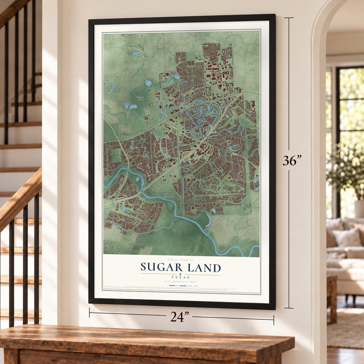
Sugar Land, Texas Map Art
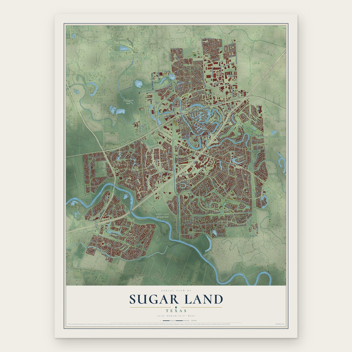
A new map of Sugar Land, Texas, made in 2026 and printed to order on thick archival matte paper.
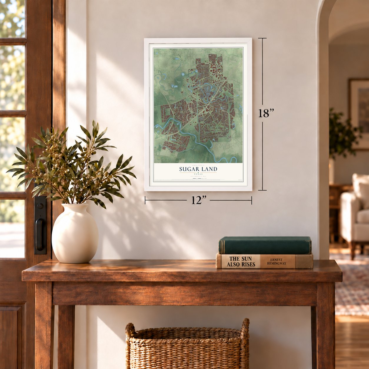
12" x 18" Archival Matte Print
A Map of Home. A Work of Art.
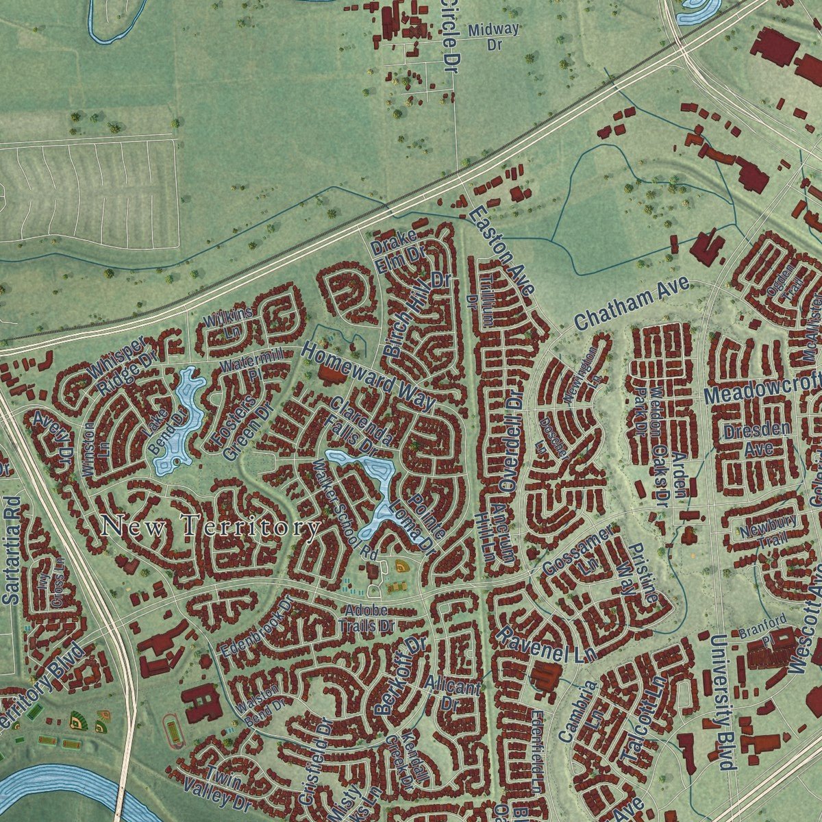
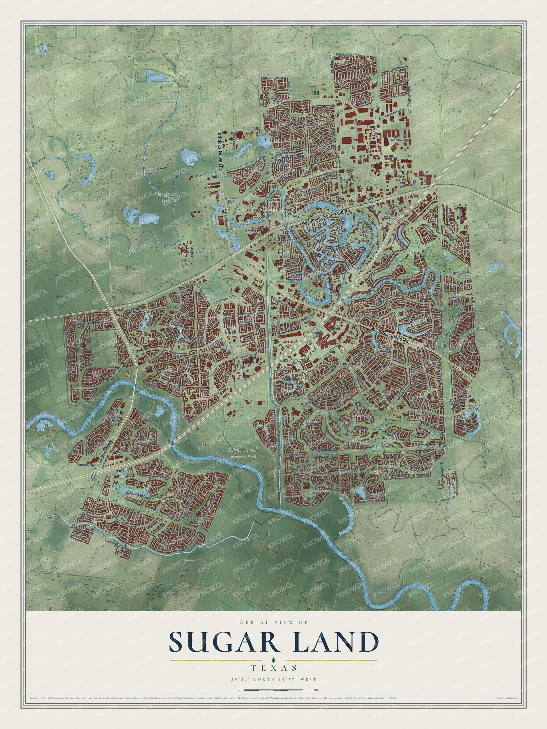
Explore Sugar Land, Texas from a whole new perspective. Created using aerial imagery and detailed geographic data, this map captures Sugar Land building by building, with labeled streets, familiar landmarks, and shaded topographical relief that highlights the natural contours of the landscape.
Combining modern data with the timeless character of a vintage atlas, this map is just as interesting up close as it is beautiful on the wall. Whether you grew up in Sugar Land, spent memorable years there, or call it home today, this unique map is a great way to celebrate a place that means something to you. Zoom in on the preview to look for your street, and then order a print to put your memories on the wall.
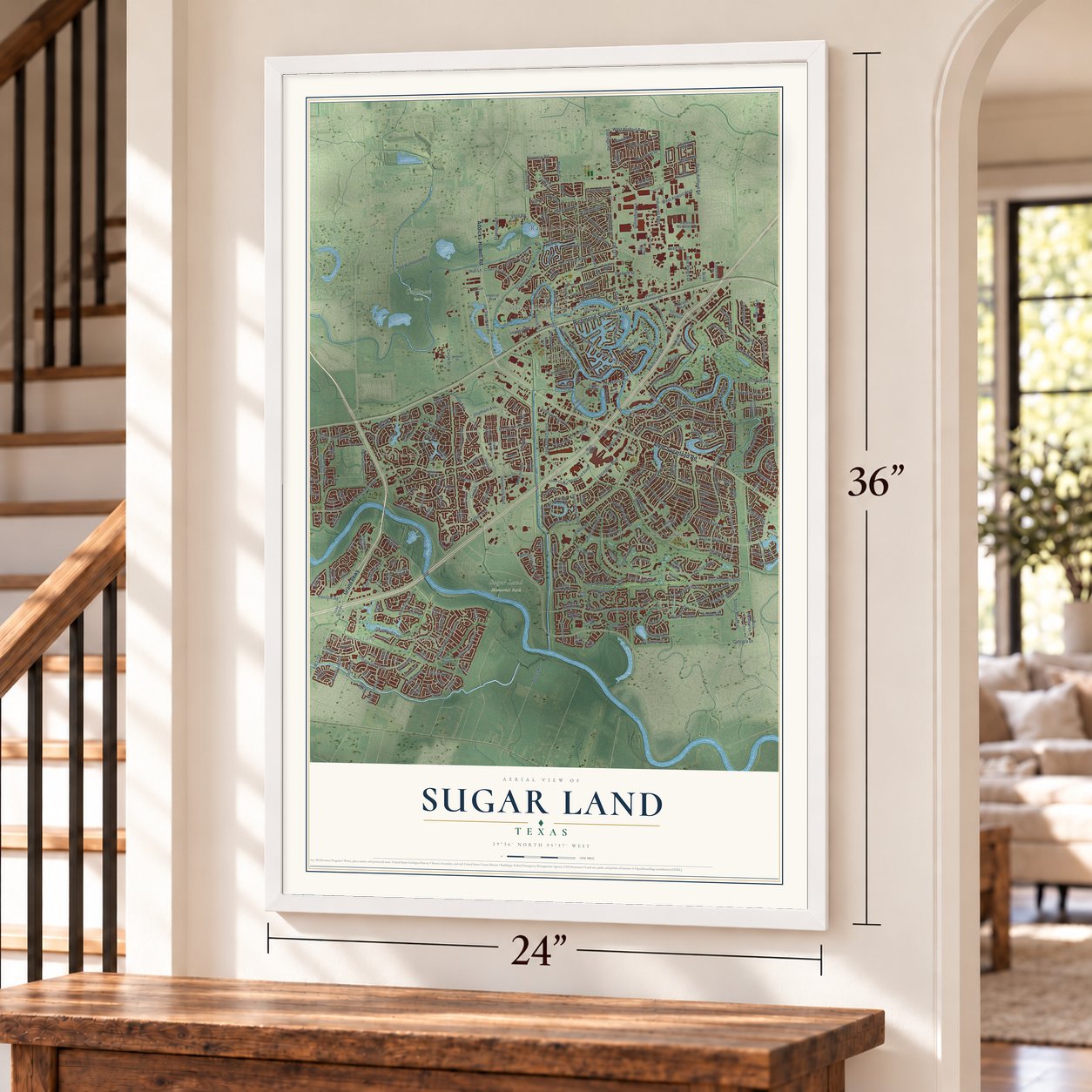
Three ways to hang it
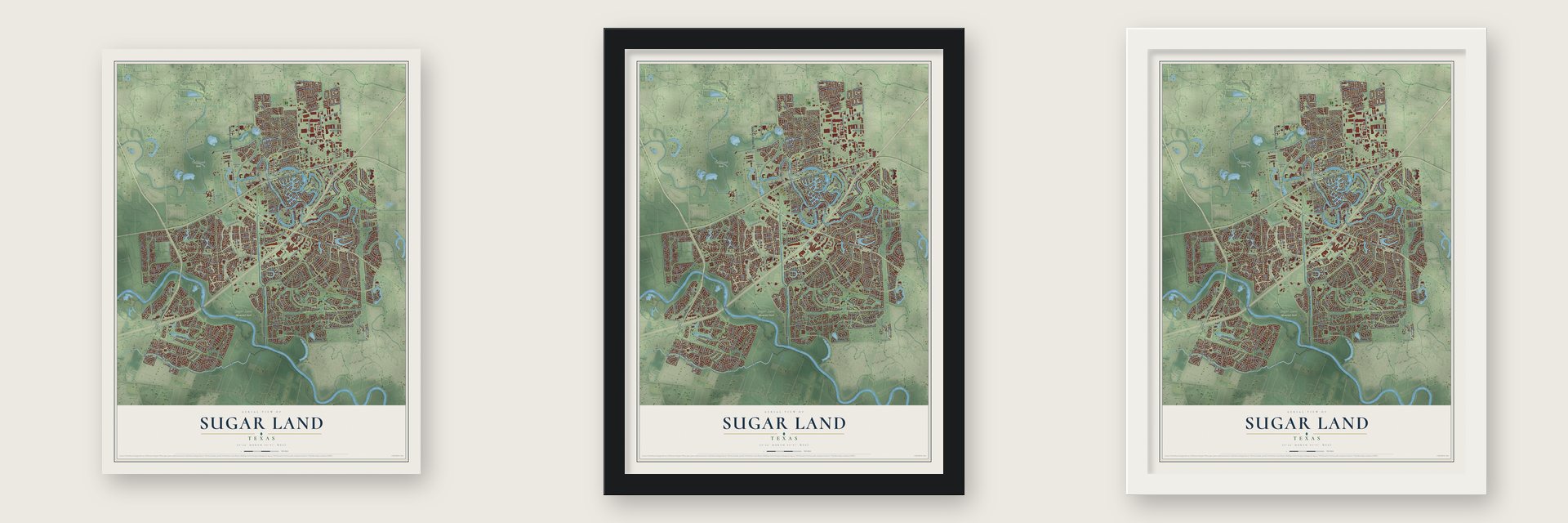
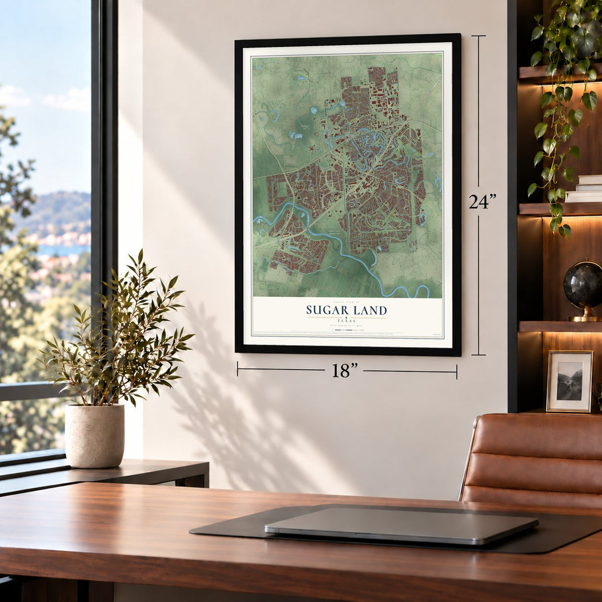
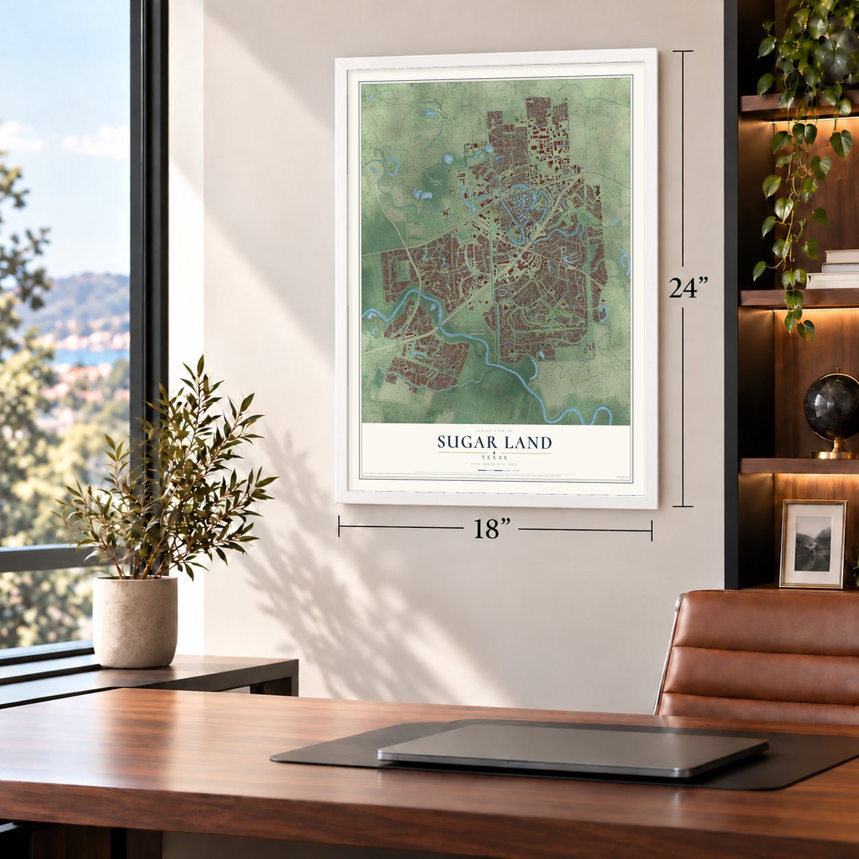
Unframed archival matte, a black wood frame or a white wood frame.
Up close
Geography Worth Displaying
This map was created using accurate cartographic data and authoritative geographic sources, including the U.S. Geological Survey and the Census Bureau. The map brings together terrain, waterways, roads, and building detail. The majority of the streets are labeled, houses are accurately depicted, and the topography is derived from government sources. Combining local data with carefully composed color and shading leads to this beautifully detailed Sugar Land artwork for your wall.
Rather than simply showing street outlines, we’ve included as many of the street names as we could reasonably fit on the map while keeping their names legible. Zoom in on the high resolution preview to see exactly what’s on the map. We truly set out to create a statement piece for anyone who loves Sugar Land. So whether it’s for you, or a gift for someone you love, we hope this map of Sugar Land brings back fond memories.
Read the story behind this map of Sugar Land, Texas from 2026.
About Sugar Land, Texas
Sugar Land is a city of 111,026 people in Fort Bend County, on Oyster Creek east of the Brazos River. Samuel M. Williams received the land in 1828 as payment for serving as Stephen F. Austin's secretary. His brother Nathaniel F. Williams bought it from him in 1838, and with a third brother, Matthew, he ran Oakland Plantation, raising cotton, corn and sugarcane. The brothers opened a raw-sugar mill in 1843.
Benjamin F. Terry and William J. Kyle bought the plantation in 1853 and helped bring the Buffalo Bayou, Brazos and Colorado Railway across it, and Terry is credited with naming the town. After Terry died in 1861 and Kyle in 1864, the place declined, and the post office that opened in 1858 shut in 1886. E. H. Cunningham of San Antonio revived it in the 1890s, gathering more than 12,000 acres and spending more than $1 million to build a refinery, a second raw-sugar mill, a paper mill and his own fourteen-mile Sugar Land Railroad.
“The inmates worked in the wet sugarcane fields, many falling victim to the periodic epidemics of fevers.”
- Imperial Sugar's company townBetween 1906 and 1908, Isaac H. Kempner, a Galveston businessman, and William T. Eldridge of Eagle Lake bought the Ellis and Cunningham plantations along with the Cunningham Sugar Company. They modernized the works and made Sugar Land a company town for Imperial Sugar. Kempner borrowed the name from a little raw-sugar mill on the Ellis Plantation, which reminded him of New York City's Imperial Hotel. The company housed its workers, encouraged new schools and built a hospital.
- Holding back the BrazosIn 1913 the sugar company raised 8½ miles of levee and dug twenty miles of drainage ditches to keep Brazos floods out of town. From 1917 to 1928, crews dredged shallow pools, lakes, creeks and Oyster Creek itself, winning back land for drainage and farming. Yet 1928 also brought the county's final sugarcane harvest. Plant disease and a steep federal tax on cane sugar ended local farming, so the refinery ran on imported raw sugar after that.
- A city since 1959The Kempner family became the town's only owners in 1946. A year before incorporation, Imperial Sugar and Sugarland Properties, another Kempner company, began selling off homes, businesses and land for development. Residents incorporated the city in 1959, and T. E. Harmon served as its first mayor. Sugar Land had 3,499 people in 1970 and 63,328 by 2000.
- The refinery closes in 2003Imperial Sugar shut its Sugar Land refinery and distribution center in 2003 but kept its headquarters in the city, and its crown logo still appears on the city seal. The old refinery grounds joined the National Register in 2017 as the Imperial Sugar Company Refinery Historic District.
Find your street
Names on the Sugar Land map
Every name below is printed on this map. Look for your street, your school, the park where you played, or the pond down the road.
Places and landmarks13
- Cullinan Park
- Sugar Land Memorial Park
- Covington West
- First Colony
- Greatwood
- Greatwood Trails
- Hall Lake
- Herbert
- New Territory
- Oxford
- Paynes
- Ragus Lake Estates
Show all 13 places
- Venetian Estates Section 2
Streets and roads370
- Richmond-Sugarland Road
- Alvin-Sugarland Road
- Grand Parkway
- Addicks-Howell Road
- Commonwealth Boulevard
- Eldridge Road
- West Bellfort Avenue
- Lombardy Drive
- Wood Street
- Savoy Street
- Creekshire Drive
- University Boulevard
- Lexington Boulevard
- Austin Parkway
- New Territory Boulevard
- Dulles Avenue
- Williams Trace Boulevard
- Palm Royale Boulevard
- Homeward Way
- West Airport Boulevard
- Sugar Creek Boulevard
- Sweetwater Boulevard
- Greatwood Parkway
- FM 1876
- Chatham Avenue
- Elkins Road
- Country Club Boulevard
- Burney Road
- Dairy Ashford Road
- Sugar Lakes Drive
Show all 370 streets
- Jess Pirtle Boulevard
- Industrial Boulevard
- Creekbend Drive
- Mesquite Drive
- Alkire Lake Drive
- Saint Michaels Court
- Brooks Street
- First Colony Boulevard
- FM 2759
- Lakeview Drive
- Gillingham Lane
- Alston Road
- Oakland Drive
- Green Fields Drive
- East Riverpark Drive
- Hull Lane
- Riverbrook Drive
- Wescott Avenue
- Sandhill Drive
- Lakefield Way
- Circle Drive
- Greenway Drive
- Winding Brook West Drive
- Jim Davidson Road
- Fairway Drive
- Oyster Creek Drive
- Telfair Avenue
- Longview Drive
- Old Richmond Road
- Greatwood Lake Drive
- Stadium Drive
- Williams Grant
- Viking Lane
- Bournewood Drive
- Julie Rivers Drive
- Pecan Point Drive
- Planters Street
- Plantation Bend Drive
- Nantucket Drive
- The Oval Street
- Sartartia Road
- Avondale Drive
- Lynnwood Lane
- Seventh Street
- Voss Road
- Edgewater Drive
- Woodstream Boulevard
- Venice Street
- Flintrock Lane
- Avenue East
- Cambridge Street
- Knoll Forest Drive
- Monarch Drive
- Greenbriar Drive
- Meadowcroft Boulevard
- Town Center Drive
- Monarch Trail
- Inverrary Lane
- Ravenel Lane
- Three Rivers Drive
- Regency Drive
- Alcorn Bayou Drive
- Soldiers Field Drive
- Old Fort Road
- Horseshoe Drive
- Imperial Road
- Drakewood Drive
- Magnolia Lane
- Ellicott Way
- Easton Avenue
- Oyster Point Drive
- Ulrich Street
- Azalea Bend
- Neal Drive
- Scenic Rivers Drive
- Ransom Road
- Stocksbridge Drive
- Cabrera Drive
- Florence Road
- Alcorn Bend Drive
- Montclair Boulevard
- Warwick Drive
- Wentworth Avenue
- Newberry Street
- Menlo Park Drive
- Deer Creek Drive
- Ashwood Drive
- Bermuda Drive
- Mason Street
- Saratoga Drive
- Agnes Road
- Jamaica Drive
- Great Oak Lane
- Arcadia Drive
- Tara Boulevard
- Flanagan Road
- Birch Hill Drive
- Talcott Lane
- Big Bend Drive
- Colonial Drive
- Reed Road
- Camellia Street
- Central
- Overdell Drive
- Berkoff Drive
- Bratton Street
- Mosby Drive
- Tyler Run
- Abbey Lane
- Forest Brk
- Bayhill Drive
- King Street
- Teal Lane
- Brookside Drive
- Settlers Way Boulevard
- Wimberly Canyon Drive
- Ralston Branch Way
- Mall Ring Road
- Commerce Green Boulevard
- Parkway Boulevard
- Imperial Boulevard
- Cunningham Creek Boulevard
- Hodges Bend Circle
- Fluor Daniel Drive
- Winding Brook East
- Crown Garden Trail
- Grants Lake Boulevard
- Parkland Boulevard
- Town Center Boulevard South
- Bendwood Drive
- Rolling Mill Drive
- Clarenda Falls Drive
- Sansbury Boulevard
- Alcorn Oaks Drive
- Jaymar Drive
- Rabbs Crossing
- Creekside Drive
- West Alkire Lake Drive
- Sam Houston Drive
- Frontier Drive
- Field Line Drive
- Coleridge Street
- Crisfield Drive
- Long Reach Drive
- Greystone Way
- Pierre Schlumberger
- Pecan Ridge Drive
- Ravenscourt Drive
- Du Pont Circle
- Imperial Canyon Lane
- Main Street
- Waters Way Drive
- Hickory Run Drive
- Kingfisher Drive
- Summit Creek
- Stephens Grant Drive
- Oyster Creek
- Great Lakes Avenue
- Chevy Chase Circle
- Bramblebury Drive
- Maple Run Drive
- Fosters Green Drive
- Ferry Landing
- Arden Oaks Drive
- Jenny Drive
- Richland Spring Lane
- Stoney Mist Drive
- Fifth Street
- Riverbend Crossing
- Austin Meadow Drive
- Archer Meadow Lane
- Old Windsor Way
- Canyon Crest Drive
- Knoll Park Drive
- Deerbrook Drive
- Stratford Gardens Drive
- Brunswick Drive
- Brannon Hill Lane
- Cardinal Meadows Drive
- Thunder Lake Lane
- Stancliff Oaks Street
- Twin Valley Drive
- Whisper Ridge Drive
- Cannons Point Drive
- Saber River
- Heathrow Lane
- Silent Forest Drive
- Frost Pass
- Alicant Drive
- Pointe Loma Drive
- Ragus Lake Drive
- Bright Trail
- Grand Manor
- Park West Drive
- Rolling Brook Court
- Heron Way
- Cambria Lane
- Russett Lane
- Summer Brook
- Lantana Drive
- South Hall Drive
- Tahoe Valley Lane
- Belle Grove Lane
- Stone Arbor Drive
- Oxbow Drive
- Executive Drive
- Gossamer Lane
- Sandy Ridge Lane
- Kettle Run
- Burkdale Drive
- Misty Oaks Lane
- Bayberry Way
- Mill Trail Drive
- Avery Drive
- Ancrum Hill Lane
- Onion Crk
- Green Belt Drive
- Oxford Mills Lane
- Pristine Way
- Dresden Avenue
- Ashford Valley Drive
- Drake Elm Drive
- Pineleaf Drive
- Quiet Trail
- West Park Street
- Brazos Drive
- Gallion Drive
- Priber Drive
- Stiles Lane
- Fenton Lane
- Black Oak Drive
- Grand Terrace
- Shadow Bend Drive
- Crabb River Road
- Walker School Road
- High Meadows Drive
- Lakeside Boulevard
- Bradford Circle
- Kempner Street
- Orchard Lane
- Matlage Way
- Dawnington Place
- Cypress Run Drive
- Creekford Circle
- Midway Drive
- Kendall Creek Drive
- Lake Bend Drive
- Presley Way
- April Meadow Way
- Colony Terrace Drive
- Stalybridge Street
- Maily Meadowlane
- McAllister Avenue
- Riviera Drive
- Edenbrook Drive
- Wagon Trail Drive
- Winston Lane
- Flintwood Drive
- Indian Summer Drive
- Adobe Trails Drive
- Edenfield Lane
- Kensington Boulevard
- Spinnaker Way
- Weldon Park Drive
- Andover Street
- River Trail
- Casey Circle
- Stone Canyon Drive
- Pebble Lake Drive
- Saint Ives Street
- High Plains Drive
- Trillium Drive
- Watermill Place
- Newbury Trail
- Ivymount Drive
- Terminal Lane
- Whitfield Street
- Burmese Lane
- River Lodge
- Dolan Lake Drive
- Fairview Drive
- Wilkins Lane
- Azalea Trail Lane
- Kings Pass
- Union Spgs
- Lissa Lane
- Creek Way Drive
- Lakefield Boulevard
- Sugar Creek Center Boulevard
- Sugar Crossing Drive
- Prudential Circle
- Cross Lakes Boulevard
- Branford Place
- Forest Bnd
- Hillswick Drive
- Walston Bend Drive
- Meadow Spring Drive
- Guinevere Drive
- Shaded Arbor Way
- Acacia Drive
- Doscher Lane
- Old Oyster Trail
- Sparrow Branch Court
- Hillside Forest Drive
- Morningside Drive
- Cordes Drive
- Newington Lane
- Steamboat Run
- Timberlake Drive
- Oak Place Drive
- Oakmont Drive
- Truslow Point Lane
- Trent Street
- North Hall Drive
- Lavender Field Drive
- Santa Maria Street
- Greenlaw Street
- Park Two Drive
- Meadow Green Drive
- Kirkwall Drive
- Technology
- Coronal Way
- Spring Trail Drive
- Ranger Run
- Shady Bend Drive
- Sunset Trail
- Kyle Hill Lane
- Schiller Park Lane
- Muirfield Way
- Huntleigh Way
- Ivy Cross Lane
- Pine Street
- Mill Place Court
- Garden Lane
- Stone River Lane
- Wood Fern Drive
- Fireside Court
- Ogden Trail
- Colony Park Drive
- Paleo Court
Names are listed as they appear on the printed map. Zoom into the product photos to find them.
The art of mapping a place
How This Map Was Made
Real places. Remarkable detail. Discover the layers that turn geographic data into a map of home.

The view from above
Aerial imagery reveals the character of the land: woodland, open fields, and the patterns of a place.

The shape of the land
Elevation data brings hills, valleys, and subtle changes in the landscape into view.

The details of home
Roads, waterways, and building footprints come together to make the map feel unmistakably local.

Geography becomes art
Considered color, shading, and typography bring the layers together in a map made for your wall.


Process illustrated with Mendon, Massachusetts. Aerial imagery: USDA NAIP. Terrain: USGS 3D Elevation Program. Map details and finished artwork: KNOWOL.
The Details
About This Print
Choose an archival matte print, or a black or white Ayous wood frame. The archival matte print is unframed.
Select your size and finish above to see the matching product image and price.
Materials & Craftsmanship
A contemporary map with the character of a classic atlas, printed on archival matte paper. Optional frames are made from Ayous wood.
Your printed map does not include the watermark shown in the full-map preview.
Shipping & Delivery
Free shipping within the United States. Every print is made to order in the USA.
Buying a gift? Add a note in your cart and we'll include it. We never put prices in the package.
Prints ship within 2 to 3 business days. Allow 7 to 10 days total from ordering for delivery. Timing may vary during holidays or periods of high order volume.
Read our shipping policy.
Returns and damaged prints
Each print is made to order. Change-of-mind refunds are not available after production.
If your print arrives damaged, misprinted or incorrect, contact support@knowol.com within 30 days of receiving it. Include your order number, photos and a description of the issue.
Read our full refund and replacement policy. For questions about your order, email support@knowol.com.
Find your town
Looking for another city?
Find a map of home in our Texas collection, or any town in the country.
Nearby
Maps of towns near Sugar Land
Know someone from one of these towns? Their map makes a great gift.
 Stafford
, Texas
From $39.99See the map
 Meadows Place
, Texas
From $39.99See the map
 Fifth Street
, Texas
From $39.99See the map
More maps nearby: Four Corners, Missouri City, Pecan Grove, Mission Bend and Richmond.