
Search for another town




Free U.S. delivery 7 to 10 days after you order
Suwanee, Georgia Map Art
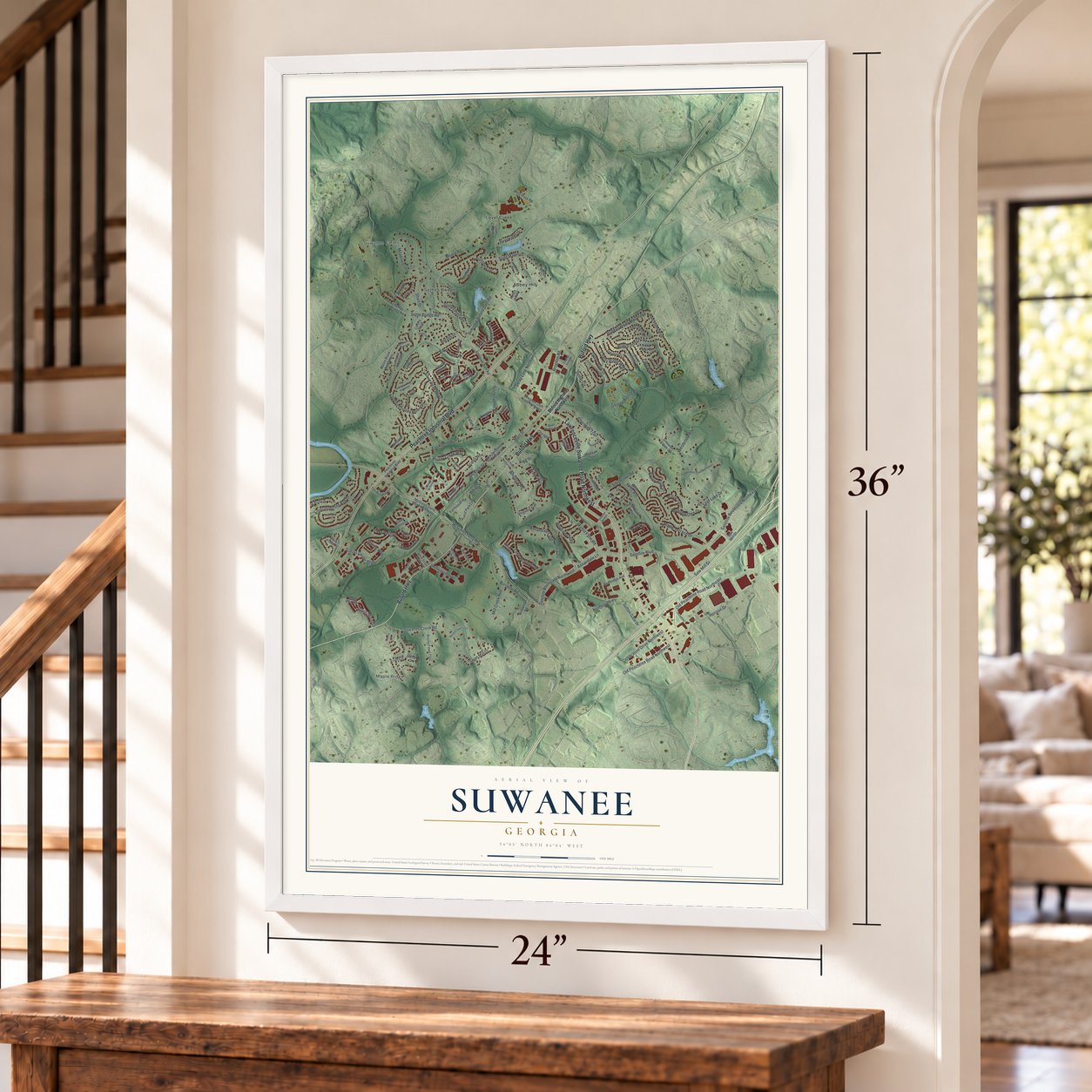
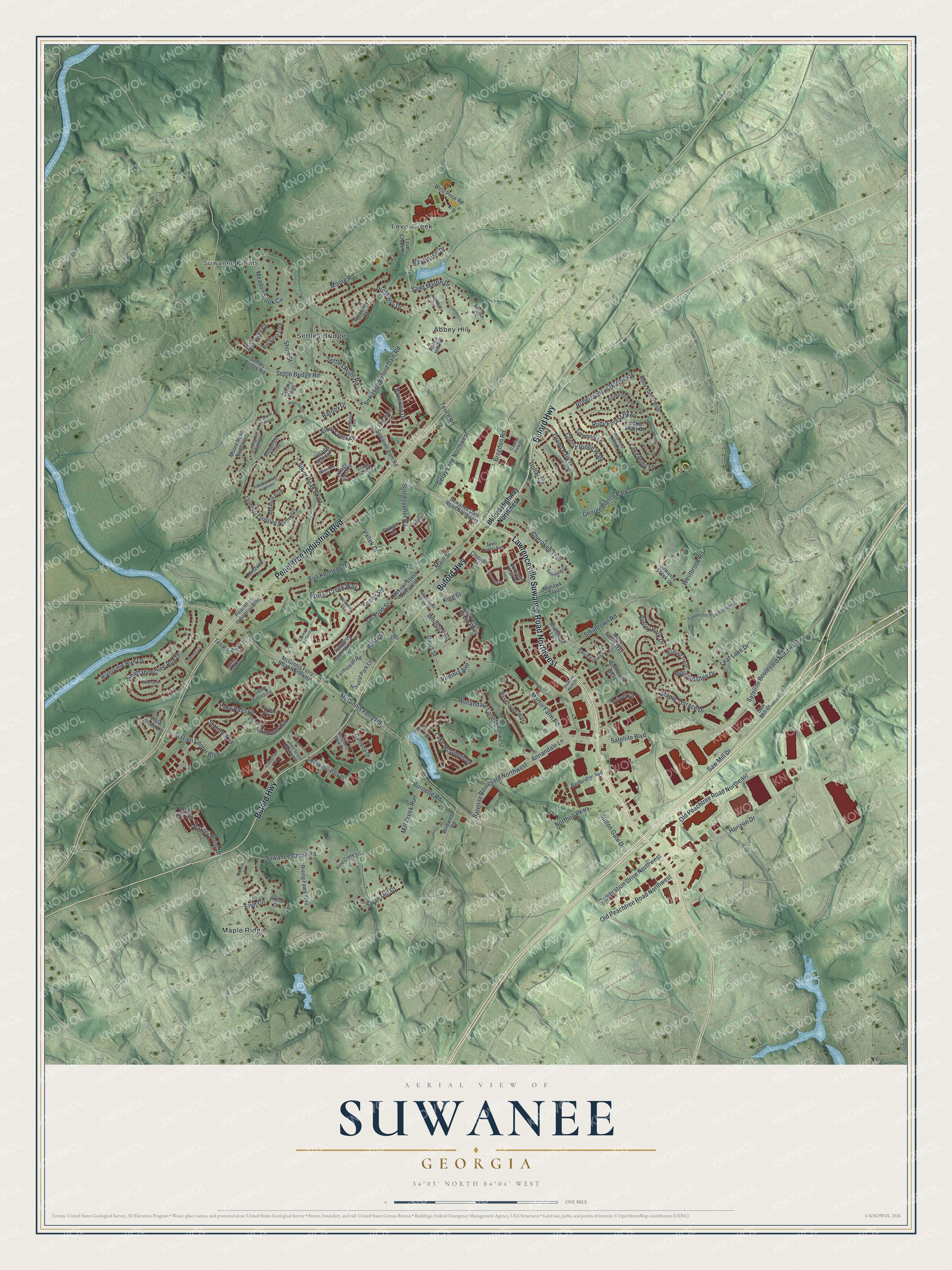
A new map of Suwanee, Georgia, made in 2026 and printed to order on thick archival matte paper.
12" x 18" Archival Matte Print
A Map of Home. A Work of Art.
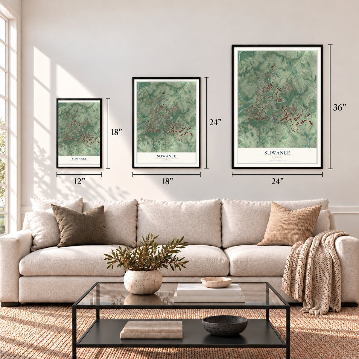
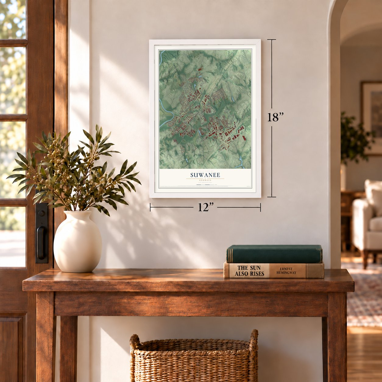
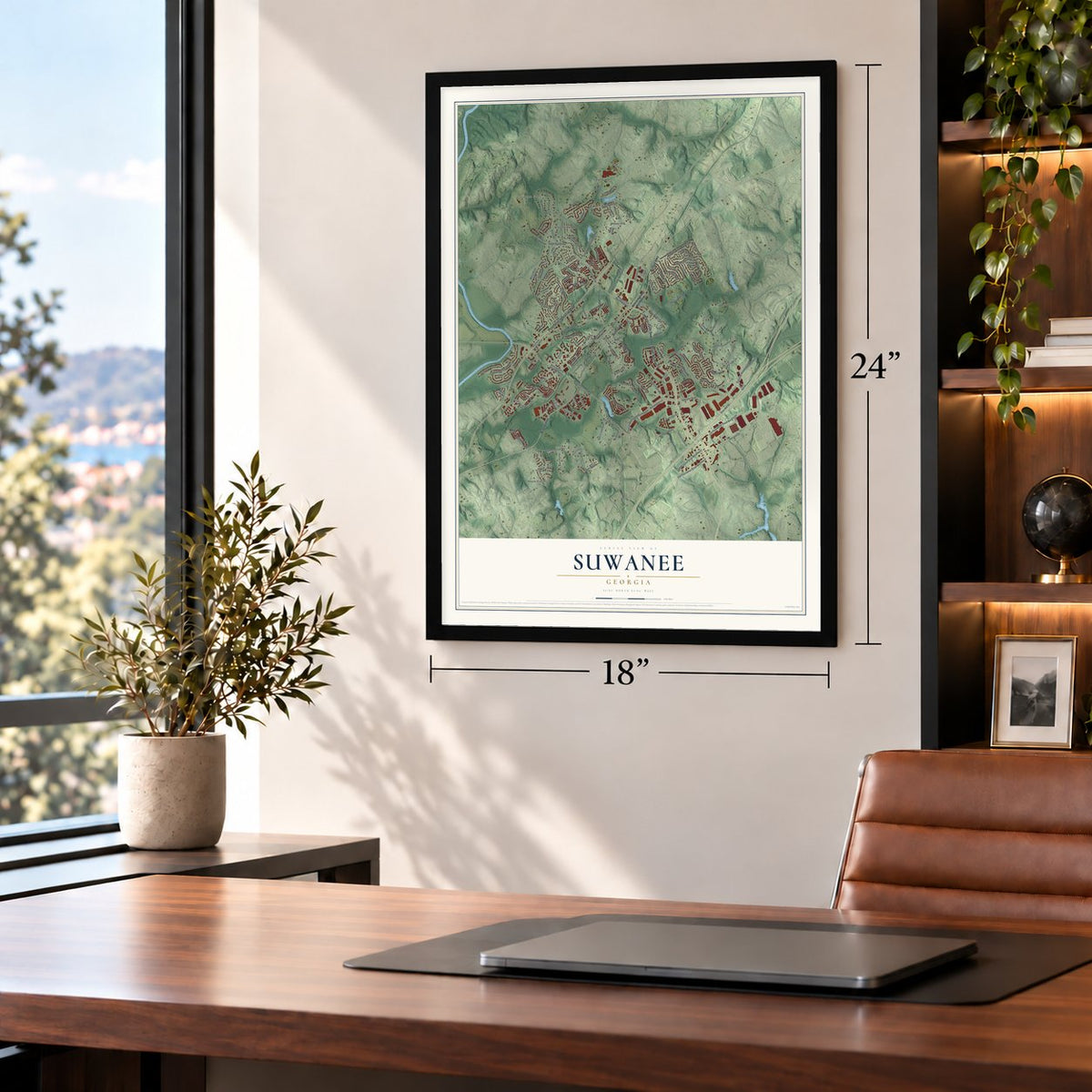
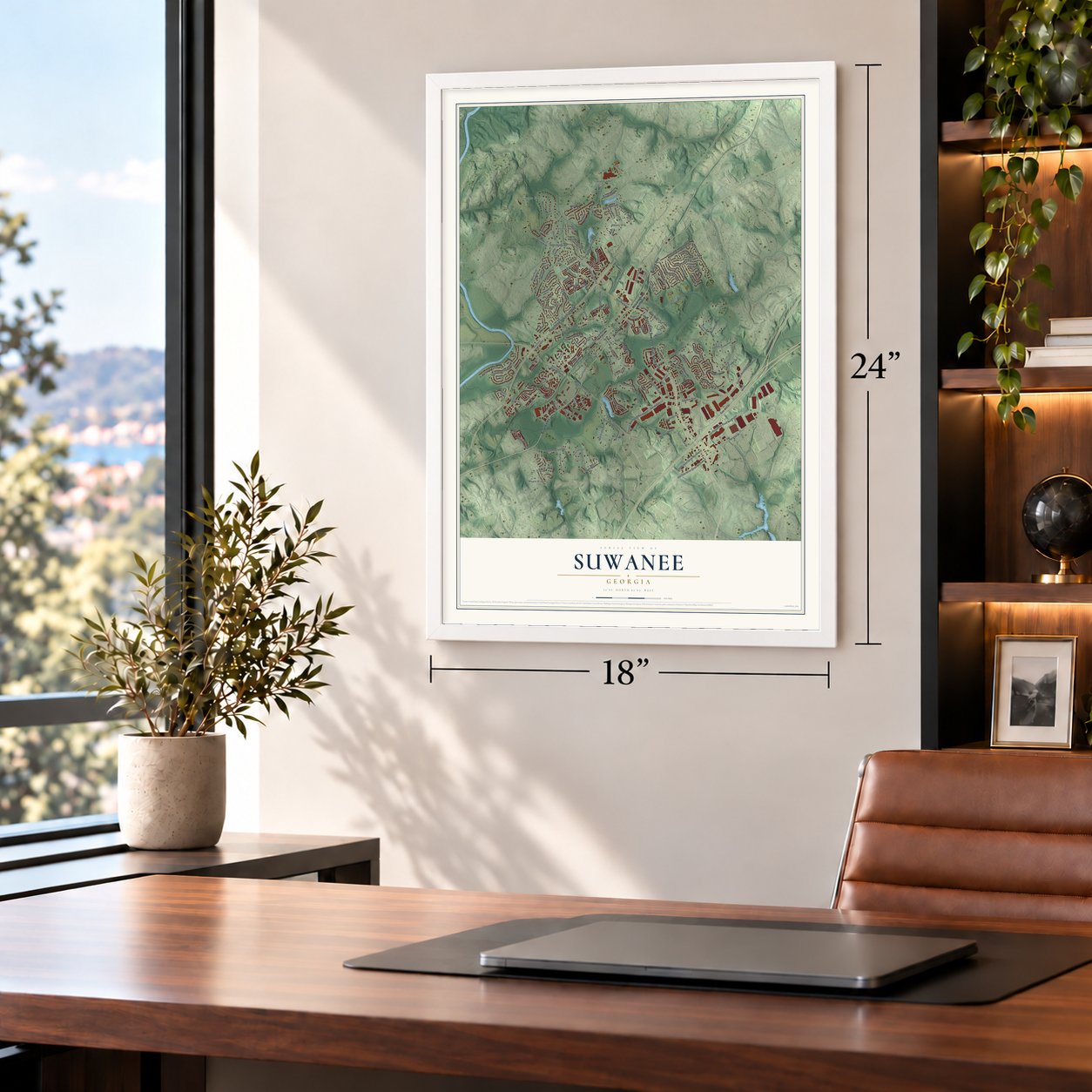
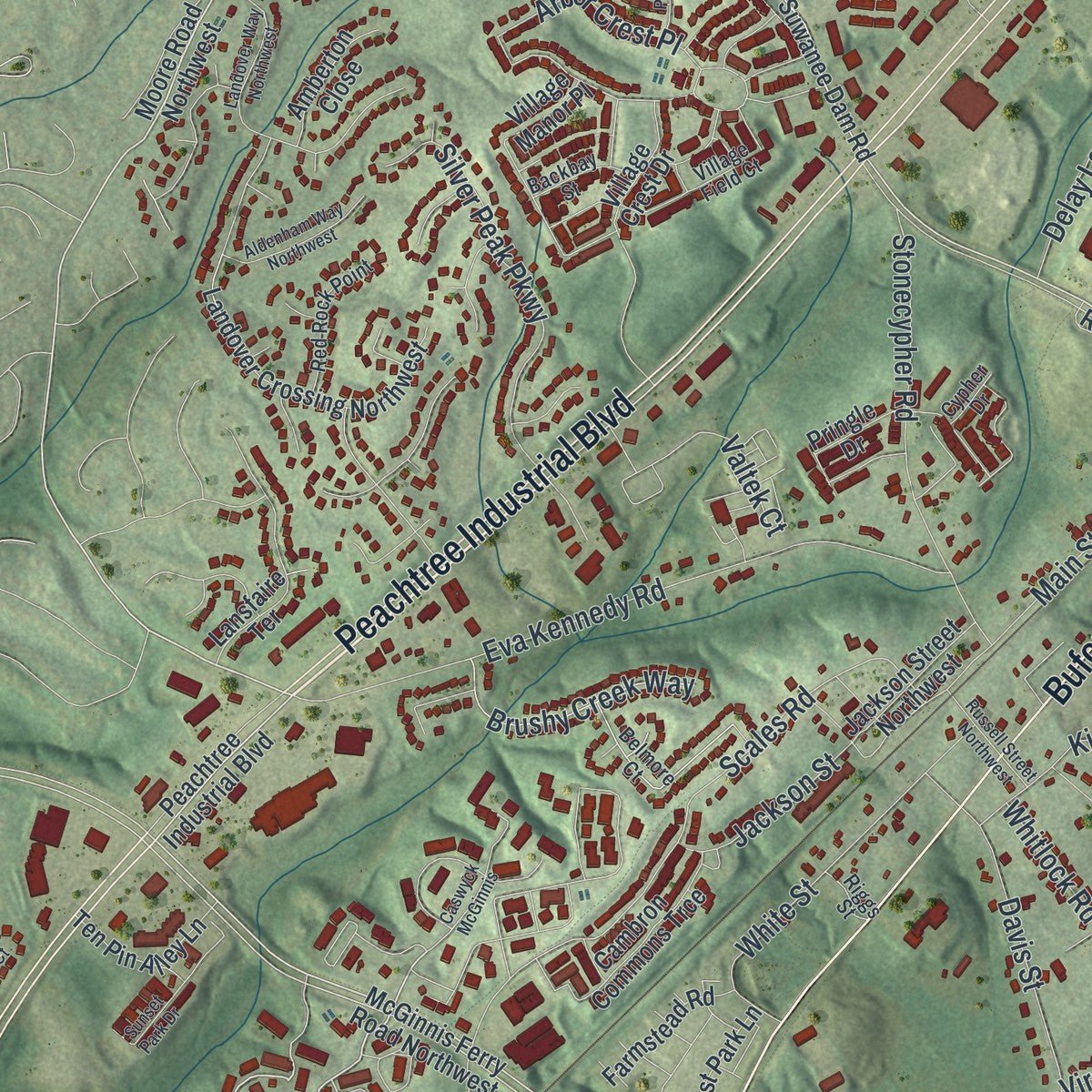
Explore Suwanee, Georgia from a whole new perspective. Created using aerial imagery and detailed geographic data, this map captures Suwanee building by building, with labeled streets, familiar landmarks, and shaded topographical relief that highlights the natural contours of the landscape.
Combining modern data with the timeless character of a vintage atlas, this map is just as interesting up close as it is beautiful on the wall. Whether you grew up in Suwanee, spent memorable years there, or call it home today, this unique map is a great way to celebrate a place that means something to you. Zoom in on the preview to look for your street, and then order a print to put your memories on the wall.
Three ways to hang it
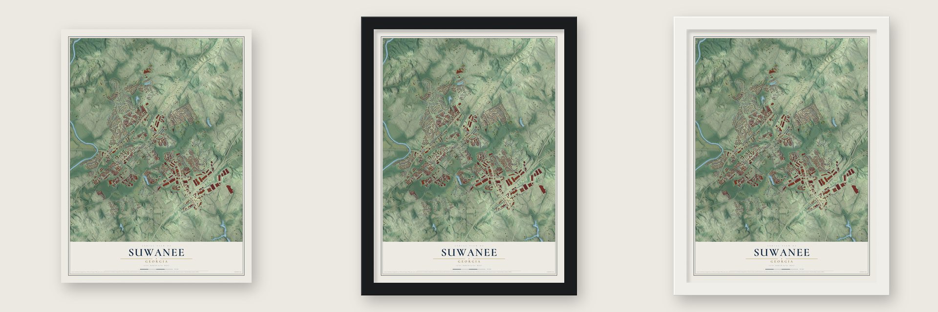
Unframed archival matte, a black wood frame or a white wood frame.
Up close
Geography Worth Displaying
This map was created using accurate cartographic data and authoritative geographic sources, including the U.S. Geological Survey (USGS) and FEMA. The map brings together terrain, waterways, roads, and building detail. The majority of the streets are labeled, houses are accurately depicted, and the topography is derived from government sources. Combining local data with carefully composed color and shading leads to this beautifully detailed Suwanee artwork for your wall.
Rather than simply showing street outlines, we’ve included as many of the street names as we could reasonably fit on the map while keeping their names legible. Zoom in on the high resolution preview to see exactly what’s on the map. We truly set out to create a statement piece for anyone who loves Suwanee. So whether it’s for you, or a gift for someone you love, we hope this map of Suwanee brings back fond memories.
Explore the full map of Suwanee, Georgia and read about the local places it shows.

About Suwanee, Georgia
Suwanee is a city of 20,786 people in the northern part of Gwinnett County, with the Chattahoochee River on its western edge. The name comes from the Shawnee, who once lived in this area. The U.S. government recognized the town in 1837, after it gained a post office.
Growth came with the Georgia Air Line Railroad, built through town in 1871. The Rhodes House hotel opened in 1880 to serve train passengers, and trade picked up as new people arrived. In 1881 a fire burned every building on Main Street but one, yet the town rebuilt and carried on. It stayed small for a long time, with 216 people in 1880 and only 241 in 1920.
- One church for two faithsSuwanee Methodist Church was founded in 1873. In its early years, both the Methodist and Baptist congregations of the town met there.
- A one-room school in 1880Suwanee High School began in 1880 as a single-room schoolhouse. Today the city is part of the Gwinnett County Public Schools district, and North Gwinnett High School and Suwanee Elementary School both opened here over the past century.
- Highways reach townCrews built Buford Highway through Suwanee from 1933 to 1936. In 1960, Interstate 85 was extended to a point just south of the city, and for a time the interstate stopped there.
- Falcons training groundThe Atlanta Falcons held their practices in Suwanee for more than two decades, from 1979 to 2001.
- Town Center, 2005 to 2009Work on Town Center started in 2005 and wrapped up in 2009, when city hall moved there. Its 13-acre park, Town Center on Main, now hosts the city's special events.
Find your street
Names on the Suwanee map
Every name below is printed on this map. Look for your street, your school, the park where you played, or the pond down the road.
Places and landmarks6
- Suwanee Farms
- Abbey Hill
- Level Creek
- Maple Ridge
- Settles Bridge
- George Pierce Park
Streets and roads155
- Lawrenceville Suwanee Road Northwest
- Peachtree Industrial Boulevard
- Buford Highway
- McGinnis Ferry Road
- Moore Road
- Suwanee Buford Dam Road
- Saw Mill Drive
- Smithtown Road
- Settle Bridge Road
- Horizon Drive
- Station Center Boulevard
- Old Peachtree Road Northeast
- Martin Farm Road
- Burnette Road
- Satellite Boulevard
- Main Street
- Chattahoochee Run Drive
- Scales Road
- Ruby Forest Parkway
- Tench Road
- Annandale Lane
- Eva Kennedy Road
- Delay Lane Northwest
- Meadowbrook Circle
- Suwanee Creek Road
- Baverton Drive
- Settles Point Road
- Lake McGinnis Drive
- Satellite Boulevard Northwest
- Silver Peak Parkway
Show all 155 streets
- Arbor Crest Place
- Stonecypher Road
- Cherokee Trail
- Northolt Parkway
- White Street
- Maple Terrace Drive
- Brogdon Road
- Annandale Lane Northwest
- Old Peachtree Road Northwest
- Lake Pass Lane
- Cherry Ridge Walk
- Ansley Park Drive
- Valtek Court
- Prestbury Drive
- Dollar Circle
- Satellite Boulevard Northeast
- Eryn Circle
- Roberts Road Northeast
- Celebration Drive Northwest
- Westbrook Road
- Davis Street
- Morning Glen Drive
- Swan Mill Court
- Brushy Creek Way
- Barony Drive
- Grand Park Drive
- Rio Vista Court
- Saint Martin Drive
- Mill Creek Run
- Riverview Run Lane
- Leaf Lake Drive
- Privet Circle
- Sutton Gate Drive
- Jackson Street
- Baxley Point Drive
- Lake Ruby Lane
- Bayswater Drive
- Whitlock Road
- Virginia Avenue
- Short Street
- Station Way
- King Street
- Buford Highway Northwest
- Suwanee Dam Road Northwest
- Moore Road Northwest
- Wildwood Road
- Chicago Street
- McGinnis Ferry Road Northwest
- Suwanee Dam Road
- Settles Bridge Road
- Landover Crossing Northwest
- White Sands Way
- Suwanee Green Parkway
- Village Crest Drive
- Treemont Lane
- Village Manor Place
- Harvest Park Lane
- Abbey Hill Road
- Cambron Commons Trce
- Tacoma Trce
- Lansfaire Terrace
- Sable Crossing
- Suwanee Creek Court
- Rising Fawn Trail
- Vista Point Lane
- Pringle Drive
- Lake Point Way
- Lake Ruby Drive
- Saw Mill Court
- Portland Trail Drive
- Smithtown Lane
- Swiftwater Park Drive
- Ruby Forest Boulevard
- Ten Pin Alley Lane
- Colony Point
- Rosehaven Way
- Mohawk Trail
- Prestbury Court
- Jackson Street Northwest
- Farmstead Road
- Redbridge Avenue
- West Price Road
- Bonneville Way
- Rio Vista Trce
- Amberton Close
- Level Creek Road
- Burnette Drive
- Floral Court
- Pierce Arrow Circle
- Azalea Chase Drive
- Timberlost Trail Northeast
- Village Field Court
- Belmore Court
- Seminole Circle
- Town Center Avenue
- Bend Creek Trail
- Morning Top Place
- Red Rock Point
- Industrial Court
- Capital View Drive
- White Street Northwest
- Lambton Circle
- Backbay Street
- McGinnis Park Drive
- Baxley Pine Trce
- Bernice Court
- Riggs Street
- Cypher Drive
- Caswyck McGinnis
- Memphis Drive
- Willow Glen Trail
- Landover Way Northwest
- Sunset Park Drive
- Amberton Crossing
- Aldenham Way Northwest
- Lake Leaf Vw
- Russell Street Northwest
- Pine Manor Bluff
- Rosewood View Drive
- Fieldcrest Court
- Idlewild Place
- Watersedge
- Lake Pass Point
- Pointview Court
- Shawnee North Drive
Names are listed as they appear on the printed map. Zoom into the product photos to find them.
The art of mapping a place
How This Map Was Made
Real places. Remarkable detail. Discover the layers that turn geographic data into a map of home.

The view from above
Aerial imagery reveals the character of the land: woodland, open fields, and the patterns of a place.

The shape of the land
Elevation data brings hills, valleys, and subtle changes in the landscape into view.

The details of home
Roads, waterways, and building footprints come together to make the map feel unmistakably local.

Geography becomes art
Considered color, shading, and typography bring the layers together in a map made for your wall.


Process illustrated with Mendon, Massachusetts. Aerial imagery: USDA NAIP. Terrain: USGS 3D Elevation Program. Map details and finished artwork: KNOWOL.
The Details
About This Print
Choose an archival matte print, or a black or white Ayous wood frame. The archival matte print is unframed.
Select your size and finish above to see the matching product image and price.
Materials & Craftsmanship
A contemporary map with the character of a classic atlas, printed on archival matte paper. Optional frames are made from Ayous wood.
Your printed map does not include the watermark shown in the full-map preview.
Shipping & Delivery
Free shipping within the United States. Every print is made to order in the USA.
Buying a gift? Add a note in your cart and we'll include it. We never put prices in the package.
Prints ship within 2 to 3 business days. Allow 7 to 10 days total from ordering for delivery. Timing may vary during holidays or periods of high order volume.
Read our shipping policy.
Returns and damaged prints
Each print is made to order. Change-of-mind refunds are not available after production.
If your print arrives damaged, misprinted or incorrect, contact support@knowol.com within 30 days of receiving it. Include your order number, photos and a description of the issue.
Read our full refund and replacement policy. For questions about your order, email support@knowol.com.
Find your town
Looking for another city?
Find a map of home in our Georgia collection, or any town in the country.
Nearby
Maps of towns near Suwanee
Know someone from one of these towns? Their map makes a great gift.
 Sugar Hill
, Georgia
From $39.99See the map
 Duluth
, Georgia
From $39.99See the map
 Buford
, Georgia
From $39.99See the map
More maps nearby: Rest Haven, Lawrenceville, Johns Creek, Berkeley Lake and Mulberry.