
Search for another town


Free U.S. delivery 7 to 10 days after you order
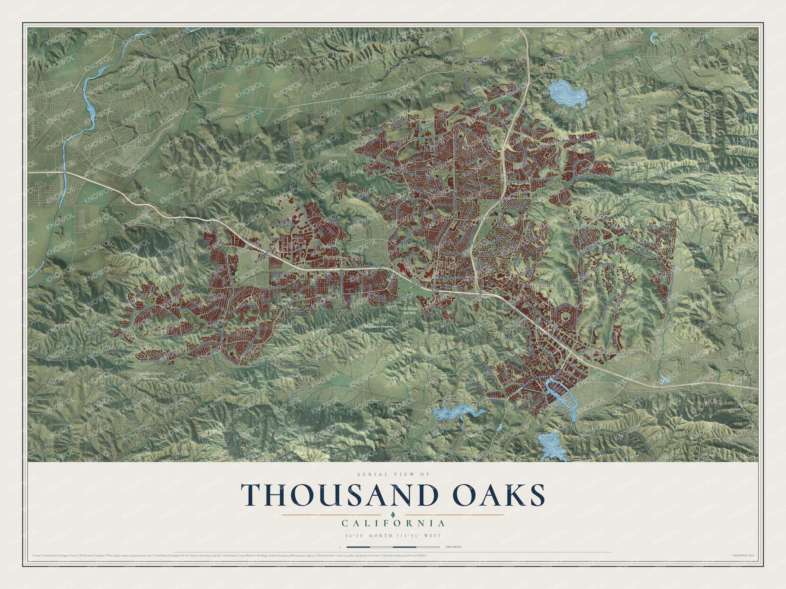
Thousand Oaks, California Map Art
Building by building, with labeled streets and shaded relief.
12" x 18" Archival Matte Print
A Map of Home. A Work of Art.
Explore Thousand Oaks, California from a whole new perspective. Created using aerial imagery and detailed geographic data, this map captures Thousand Oaks building by building, with labeled streets, familiar landmarks, and shaded topographical relief that highlights the natural contours of the landscape.
Combining modern data with the timeless character of a vintage atlas, this map is just as interesting up close as it is beautiful on the wall. Whether you grew up in Thousand Oaks, spent memorable years there, or call it home today, this unique map is a great way to celebrate a place that means something to you. Zoom in on the preview to look for your street, and then order a print to put your memories on the wall.
Three ways to hang it

Unframed archival matte, a black wood frame or a white wood frame.
Up close
Geography Worth Displaying
This map was created using accurate cartographic data and authoritative geographic sources, including the U.S. Geological Survey and the Census Bureau. The map brings together terrain, waterways, roads, and building detail. The majority of the streets are labeled, houses are accurately depicted, and the topography is derived from government sources. Combining local data with carefully composed color and shading leads to this beautifully detailed Thousand Oaks artwork for your wall.
Rather than simply showing street outlines, we’ve included as many of the street names as we could reasonably fit on the map while keeping their names legible. Zoom in on the high resolution preview to see exactly what’s on the map. We truly set out to create a statement piece for anyone who loves Thousand Oaks. So whether it’s for you, or a gift for someone you love, we hope this map of Thousand Oaks brings back fond memories.
Read the story behind this map of Thousand Oaks, California from 2026.

Find your street
Names on the Thousand Oaks map
Every name below is printed on this map. Look for your street, your school, the park where you played, or the pond down the road.
Places and landmarks13
- Thousand Oaks City Hall
- Newbury Park
- Mountclef Village
- Conejo Canyons Open Space
- Hope Nature Preserve
- Lang Ranch Open Space
- Los Robles Open Space
- Rancho Potrero Open Space
- Wildwood Park
- Woodridge Open Space
- North Ranch
- Triunfo Corner
Show all 13 places
- Greenwich Village
Streets and roads250
- South Westlake Boulevard
- North Moorpark Road
- Lakeview Canyon Road
- North Westlake Boulevard
- South Reino Road
- Old Conejo Road
- North Reino Road
- Townsgate Road
- Moorpark Road
- Potrero Road
- Agoura Road
- Lynn Road
- Hampshire Road
- West Potrero Road
- West Gainsborough Road
- West Olsen Road
- Olsen Road
- East Avenue de Las Flores
- East Olsen Road
- Lucero Street
- Holloway Street
- West Hillcrest Drive
- East Thousand Oaks Boulevard
- Erbes Road
- Borchard Road
- East Avenue de Los Arboles
- Lawrence Drive
- Rancho Conejo Boulevard
- Sunset Hills Boulevard
- East Hillcrest Drive
Show all 250 streets
- South Wendy Drive
- West Avenue de Los Arboles
- Pederson Road
- East Janss Road
- Kanan Road
- West Kimber Drive
- North Ventu Park Road
- West Janss Road
- Lindero Canyon Road
- Newbury Road
- Albertson Fire Road
- La Granada Drive
- Read Road
- Wildwood Avenue
- North Wendy Drive
- Russell Drive
- Lynnmere Drive
- Via Las Brisas
- El Monte Drive
- Rancho Road
- Falling Star Avenue
- Cll Tulipan
- Via Ricardo
- Bridgegate Street
- Rikkard Drive
- Lang Ranch Parkway
- Valley Spring Drive
- Westbend Road
- Cll Quebracho
- Warwick Avenue
- Sapra Street
- Cll Jazmin
- McCrea Road
- Sirius Street
- Willow Lane
- Adrian Street
- Michael Drive
- Los Padres Drive
- Whitecliff Road
- Cll de Oro
- Auto Mall Drive
- Via Rio
- Capitan Street
- La Jolla Drive
- Windsor Drive
- West Sidlee Street
- Dover Avenue
- Greenwood Street
- Haaland Drive
- Big Sky Drive
- Hillsbury Road
- Blackwood Street
- West Sierra Drive
- Los Vientos Drive
- Cll Almendro
- Teasdale Street
- Hood Drive
- Parkview Drive
- Mayfield Street
- Dickenson Avenue
- Felton Street
- East Kelly Road
- Cll Estepa
- Rotella Street
- Via Don Luis
- Rutland Place
- Triangle Street
- Venus Street
- Odebolt Drive
- Pauling Drive
- Marion Street
- Azalea Street
- Via Pisa
- East Potrero Road
- Hill Canyon Fire Road
- Country Valley Road
- Via Colinas
- Rancho Dos Vientos
- Los Feliz Drive
- Hendrix Avenue
- Mountclef Boulevard
- Valley High Avenue
- Teller Road
- Conejo Center Drive
- Montgomery Road
- Arroyo View Street
- Northwood Parkway
- Velarde Drive
- Grande Vista Drive
- Avenue Verano
- Campus Drive
- Via del Rancho
- Madera Road
- Foothill Drive
- Encino Vista Drive
- East Sierra Drive
- Paige Lane
- Young Avenue
- Cll Artigas
- Valecroft Avenue
- Bowfield Street
- Cll Olivo
- Campbell Avenue
- Sheffield Place
- Lone Oak Drive
- Bear Creek Drive
- Cam de Celeste
- Cll Margarita
- Oberlin Avenue
- Island Forest Place
- Cll Zocalo
- Galsworthy Street
- Crystal View Circle
- Tamarack Street
- Irving Drive
- Deep Wood Drive
- Janss Road
- Silas Avenue
- Haigh Road
- McCloud Avenue
- Wilder Street
- Brossard Drive
- Casino Drive
- Sunnyhill Street
- Rancho Lane
- Cll del Sol
- Hartglen Avenue
- Sundance Street
- Via Bonita
- Oakshore Drive
- Via Entrada
- Drayton Avenue
- Cll Nogal
- Giant Oak Avenue
- Rice Street
- Drake Drive
- Via Magnola
- Via el Toro
- Conejo Boulevard
- Bright Star Street
- Spring Wood Street
- Sweet Briar Place
- Heather Oaks Lane
- Alice Ann Road
- Via Katrina
- Maple Road
- Ruby Drive
- Denise Street
- Simi Fire
- Via Vis
- Green Oaks
- Oak Lane
- Fargo Street
- Blair Court
- Via el Cerro
- Hill Drive
- Cayo Grande Court
- Cll Castano
- La Grange Avenue
- Glastonbury Road
- Queens Way
- Burning Tree Drive
- West Kelly Road
- Berkshire Drive
- Larkfield Avenue
- Cypress Street
- Via Capote
- Darlington Drive
- Amarelle Street
- Seabreeze Street
- Cabrillo Avenue
- Windsong Street
- Westlake
- Pinecrest Drive
- Maurice Drive
- Lombard Street
- Lupe Avenue
- Pebble Beach Drive
- Lynwood Street
- Marin Street
- Carob Drive
- Lavery Court
- Clarita Court
- Hill Road
- Peak Place
- Greenmeadow Avenue
- Fairview Fire Road
- Ventu Park Road
- South Skyline Drive
- Edison Road
- West Thousand Oaks Boulevard
- South Conejo School Road
- Stonesgate Street
- Highgate Road
- Rayburn Street
- Rolling Oaks Drive
- Cll Contento
- Cll Violeta
- Rainfield Avenue
- Watergate Road
- West Lucero Street
- Shadow Lake Drive
- Mesa Avenue
- Regal Oak Court
- Meadow Brook Court
- Mayflower Street
- Faculty Street
- Oak Trail Street
- Monte Vis
- Cam de la Rosa
- Monte Sereno Drive
- North Valley Drive
- Farland Drive
- White Cedar Place
- Royal Oaks Drive
- Tamlei Avenue
- Miller Ranch
- Oxley Place
- Via Anita
- Long Court
Names are listed as they appear on the printed map. Zoom into the product photos to find them.
About Thousand Oaks, California
Thousand Oaks is a city of 126,966 people in Ventura County, at the center of the Conejo Valley. Chumash people settled here more than 10,000 years ago, in villages such as Sap'wi and Satwiwa. Spanish newcomers named the land the Valley of Rabbits. In 1803 Governor José Joaquín de Arrillaga granted El Rancho Conejo, 48,671.56 acres, to Jose Polanco and Ignacio Rodriguez.
The de la Guerra family sold off much of the rancho through the 1860s and early 1870s, and ranchers such as John Edwards, who came from Wales, bought it up. By the 1920s about 100 people lived here. They held a contest to name the place, and 14-year-old Bobby Harrington won with Thousand Oaks. When the city incorporated in 1964, the Janss Corporation proposed Conejo City instead. Residents signed a petition to put Thousand Oaks on the ballot, and 87% chose it in the vote of September 29, 1964.
- A lion farm in 1926Louis Goebel of New York worked for Universal's film studio. When the Universal Zoo closed, he started his own zoo for the movies. He opened Goebel's Lion Farm in 1926, on the site of today's Civic Arts Plaza, with five lions and seven malamute dogs. Its animals appeared in Tarzan films and helped play MGM's Leo the Lion. The 170-acre park was renamed Jungleland USA in 1956, and it went bankrupt in May 1969.
- A stagecoach stop from 1876Newbury Park sat on the stagecoach road between Los Angeles and Santa Barbara, and the Grand Union Hotel, now called the Stagecoach Inn, was built there in 1876. Roaring Ranch was filmed at the inn in 1930. Today it is a California Historical Landmark and a museum.
- The Norwegian ColonyIn the late 1890s and early 1900s, settlers from Stranda, Norway, farmed more than 650 acres around today's Moorpark and Olsen Roads. With no doctors or hospitals nearby, diphtheria killed Ole Anderson, Lars Pederson and George Hansen in 1901, and the colony did not last long. Still, its people built the Norwegian Grade by hand in 1911, a road about a mile long to Santa Rosa Valley. A settlers' son later gave his ranch to California Lutheran College.
- Ranch country for movie starsWill Rogers told actor Joel McCrea to buy land here. In the early 1930s McCrea took up a 3,000-acre ranch, where he raised his family, and Bob Hope, Dean Martin, Roy Rogers and many other stars later moved to the valley. Thousand Oaks Boulevard appears in It Happened One Night (1934), and Flaming Star Avenue is named for the 1960 Elvis Presley film shot here.
- From 3,500 to 103,000Ranching and farming led the local economy until the 1950s. In the 1960s, high-tech firms such as Packard Bell set up shop in Newbury Park's industrial park. The city grew from 3,500 people in 1957 to more than 103,000 by 1989. Amgen, the biotechnology company, was founded in Newbury Park in 1980.
Keep exploring California
Thousand Oaks is one of 1,990 California towns we've mapped. Every dot on the map is a print of its own.
The search covers every state, California first.
Near Thousand Oaks
Order 2 or more town maps and save 10%. Shown in the size and finish you picked above, so they hang as a set.
- Santa Rosa Valley 12" x 18" / Archival Matte Print $39.99
- Casa Conejo 12" x 18" / Archival Matte Print $39.99
- Lake Sherwood 12" x 18" / Archival Matte Print $39.99
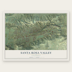
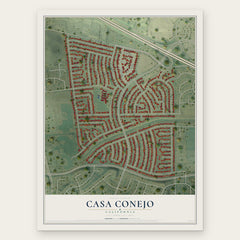

More maps nearby: Westlake Village, Oak Park, Moorpark, Agoura Hills and Somis.
The art of mapping a place
How This Map Was Made
Real places. Remarkable detail. Discover the layers that turn geographic data into a map of home.

The view from above
Aerial imagery reveals the character of the land: woodland, open fields, and the patterns of a place.

The shape of the land
Elevation data brings hills, valleys, and subtle changes in the landscape into view.

The details of home
Roads, waterways, and building footprints come together to make the map feel unmistakably local.

Geography becomes art
Considered color, shading, and typography bring the layers together in a map made for your wall.


Process illustrated with Mendon, Massachusetts. Aerial imagery: USDA NAIP. Terrain: USGS 3D Elevation Program. Map details and finished artwork: KNOWOL.
The Details
About This Print
Choose an archival matte print, or a black or white Ayous wood frame. The archival matte print is unframed.
Select your size and finish above to see the matching product image and price.
Materials & Craftsmanship
A contemporary map with the character of a classic atlas, printed on archival matte paper. Optional frames are made from Ayous wood.
Your printed map does not include the watermark shown in the full-map preview.
Shipping & Delivery
Free shipping within the United States. Every print is made to order in the USA.
Buying a gift? Add a note in your cart and we'll include it. We never put prices in the package.
Prints ship within 2 to 3 business days. Allow 7 to 10 days total from ordering for delivery. Timing may vary during holidays or periods of high order volume.
Read our shipping policy.
Returns and damaged prints
Each print is made to order. Change-of-mind refunds are not available after production.
If your print arrives damaged, misprinted or incorrect, contact support@knowol.com within 30 days of receiving it. Include your order number, photos and a description of the issue.
Read our full refund and replacement policy. For questions about your order, email support@knowol.com.