
Search for another town




Free U.S. delivery 7 to 10 days after you order
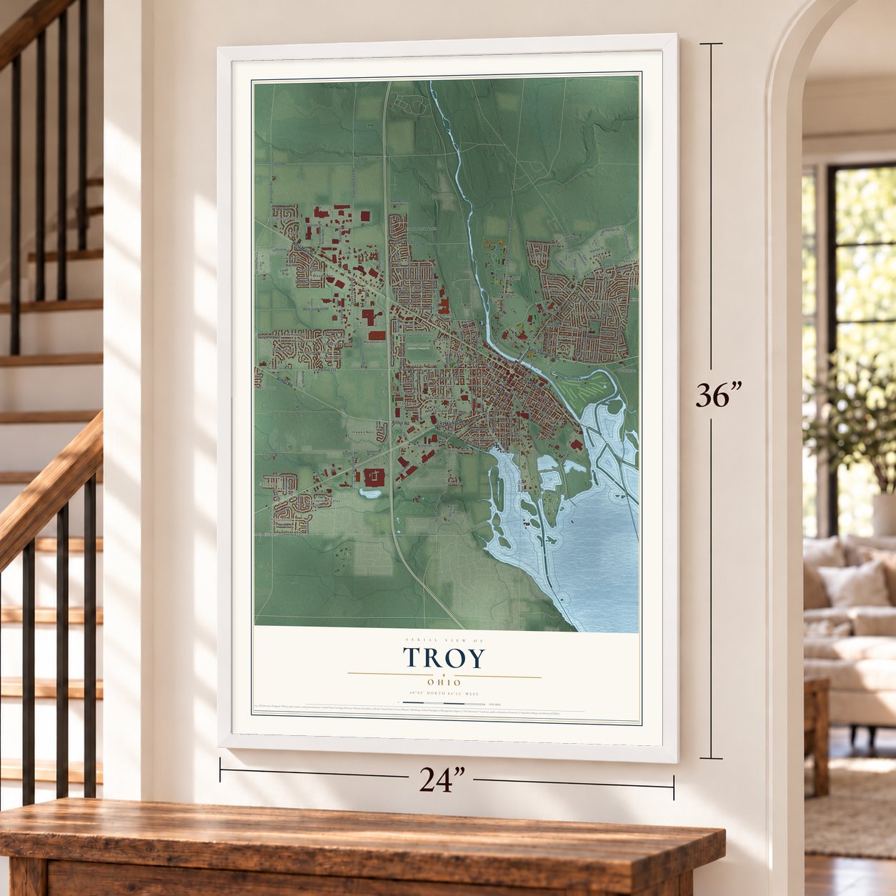
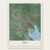
Troy, Ohio Map Art
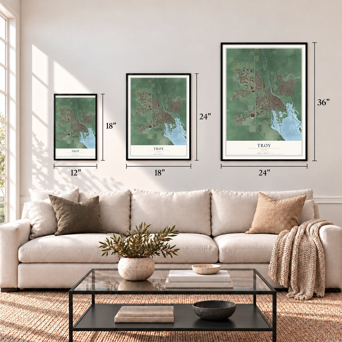
A new map of Troy, Ohio, made in 2026 and printed to order on thick archival matte paper.
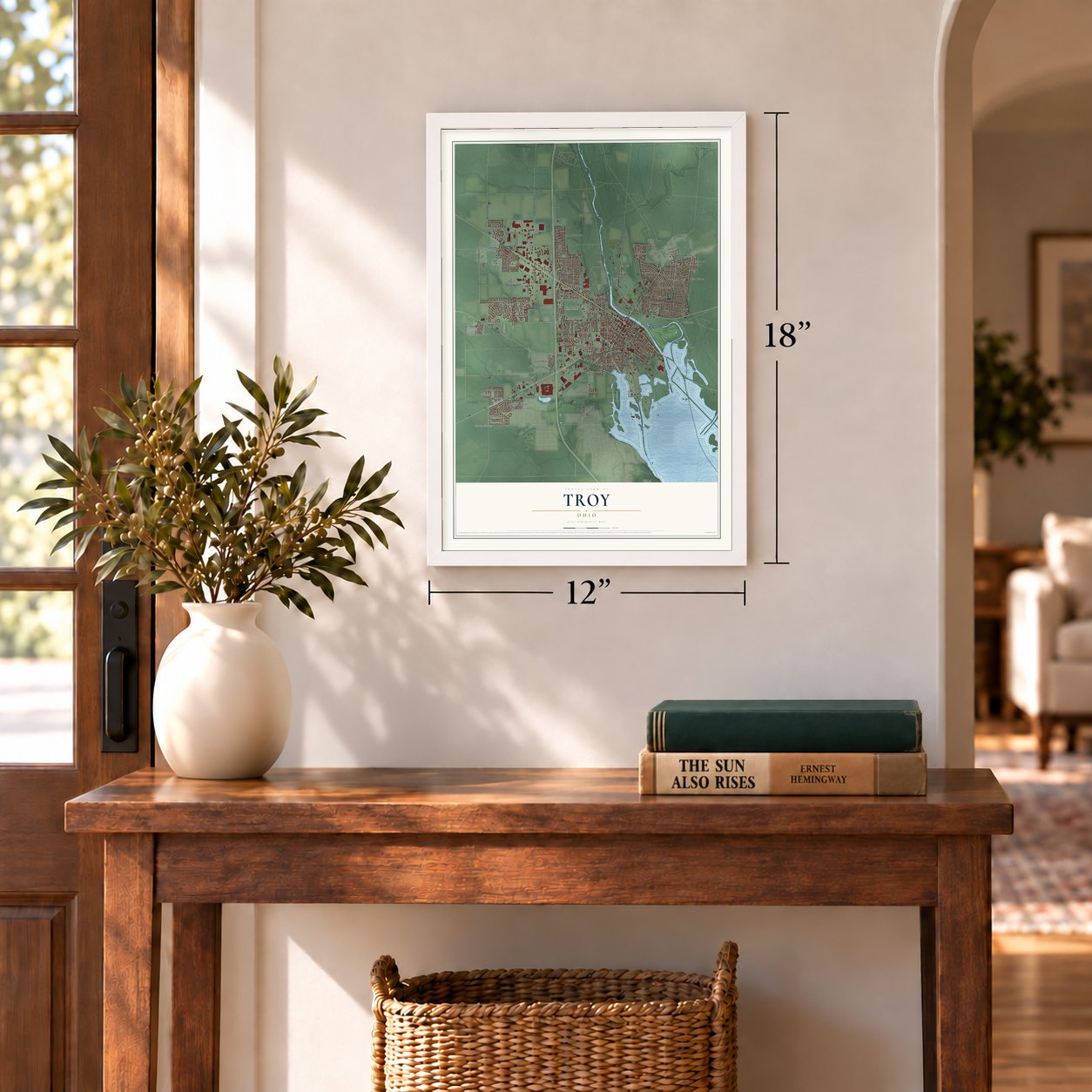
12" x 18" Archival Matte Print
A Map of Home. A Work of Art.
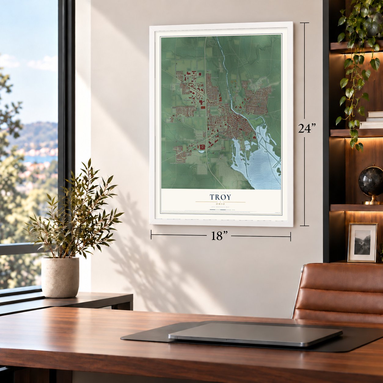
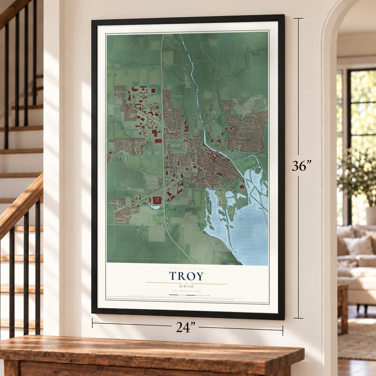
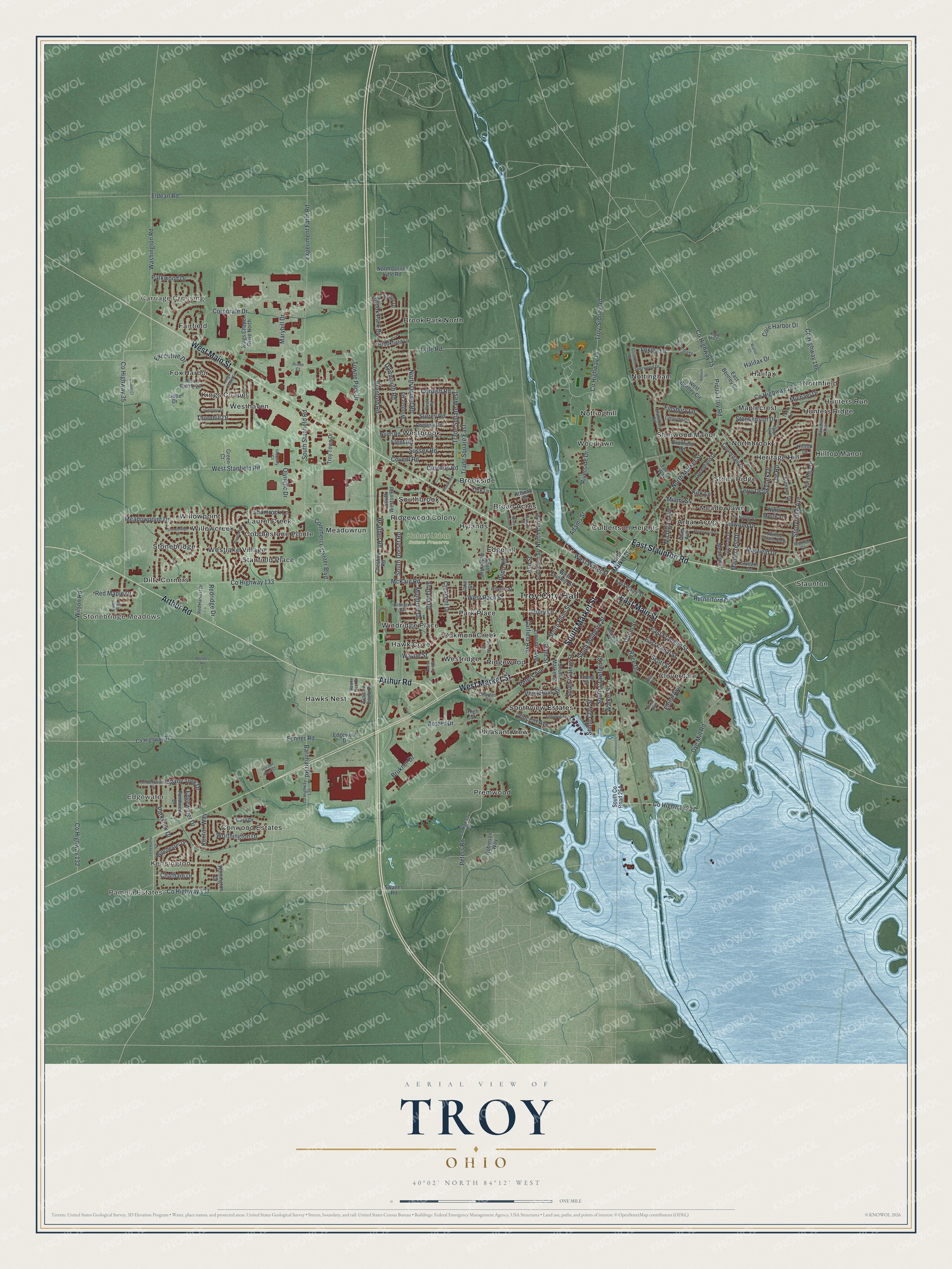
Explore Troy, Ohio from a whole new perspective. Created using aerial imagery and detailed geographic data, this map captures Troy building by building, with labeled streets, familiar landmarks, and shaded topographical relief that highlights the natural contours of the landscape.
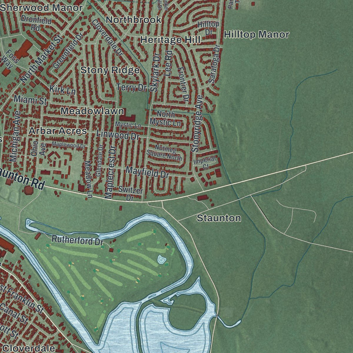
Combining modern data with the timeless character of a vintage atlas, this map is just as interesting up close as it is beautiful on the wall. Whether you grew up in Troy, spent memorable years there, or call it home today, this unique map is a great way to celebrate a place that means something to you. Zoom in on the preview to look for your street, and then order a print to put your memories on the wall.
Three ways to hang it
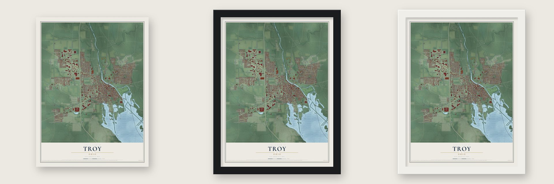
Unframed archival matte, a black wood frame or a white wood frame.
Up close
Geography Worth Displaying
This map was created using accurate cartographic data and authoritative geographic sources, including the U.S. Geological Survey and the Census Bureau. The map brings together terrain, waterways, roads, and building detail. The majority of the streets are labeled, houses are accurately depicted, and the topography is derived from government sources. Combining local data with carefully composed color and shading leads to this beautifully detailed Troy artwork for your wall.
Rather than simply showing street outlines, we’ve included as many of the street names as we could reasonably fit on the map while keeping their names legible. Zoom in on the high resolution preview to see exactly what’s on the map. We truly set out to create a statement piece for anyone who loves Troy. So whether it’s for you, or a gift for someone you love, we hope this map of Troy brings back fond memories.
About Troy, Ohio
Troy is the county seat of Miami County, situated along the Great Miami River north of Dayton. The city was platted around 1807. Its population was 26,305 at the 2020 census.
- Junior Girls CanteenFrom 1943 through 1946, 40 local teenagers and adult volunteers served food and drinks to about 600,000 soldiers stopping at Troy's railroad station.
- Barcode MilestoneOn June 26, 1974, Troy's Marsh Supermarket made the first retail UPC barcode scan when a package of Wrigley's Juicy Fruit gum was purchased.
- Steel House LegacyThe Hobart Welded Steel House Company built 22 prefabricated homes in Troy, and 16 surviving examples are listed on the National Register of Historic Places.
- Hayner Cultural CenterThe Troy-Hayner Cultural Center occupies a donated 1914 Romanesque mansion and displays local artwork and the Hayner Distillery Collection.
Find your street
Names on the Troy map
Every name below is printed on this map. Look for your street, your school, the park where you played, or the pond down the road.
Places and landmarks57
- Troy City Hall
- Pamela Estates
- Kensington
- Carriage Crossing
- Edgewater
- Stonebridge Meadows
- Hobart Urban Nature Preserve
- Arbar Acres
- Broad Acres
- Brook Park North
- Brookside
- Cloverdale
Show all 57 places
- Cobblestone Pointe
- Conwood Estates
- Culbertson Heights
- Diltz Corners
- Edgehill
- Fairfield
- Fox Harbor
- Halifax
- Hawk Cove
- Hawks Nest
- Heritage Hill
- Hilltop Manor
- Hunters Ridge
- Hunters Run
- Hylands
- Kings Chapel
- Laurel Creek
- Maplecrest
- Meadowlawn
- Meadowrun
- Northbrook
- Northfield
- Nottingham
- Nottinghill
- Oakmont Creek
- Park Place
- Pleasant View
- Premwood
- Ridgewood
- Ridgewood Colony
- Sherwood Manor
- Southbrook
- Southview Estates
- Stanfield Place
- Staunton
- Stonebridge
- Stony Ridge
- Westbrook
- Westhaven
- Westlake Village
- Westridge
- Willowcreek
- Willowpoint
- Windridge Place
- Woodlawn
Streets and roads200
- South Market Street
- East Staunton Road
- East Main Street
- West Market Street
- West Main Street
- Arthur Road
- Shady Tree Drive
- Washington Road
- West Water Street
- Dye Mill Road
- North Market Street
- Riverside Drive
- South Walnut Street
- Heather Road
- Loxley Lane
- North Elm Street
- McKaig Road
- South Dorset Road
- County Highway 35
- Experiment Farm Road
- South Stanfield Road
- Stonyridge Avenue
- Skylark Drive
- Maplecrest Drive
- County Highway 133
- Adams Street
- North Dorset Road
- Union Street
- County Highway 227
- Lytle Road
Show all 200 streets
- Meadowpoint Drive
- South Crawford Street
- South Mulberry Street
- Trade Square West
- South Clay Street
- East Canal Street
- County Highway 193
- West Race Street
- Lee Road
- Corporate Drive
- Commerce Center Boulevard
- County Highway 14
- Troy-Sidney Road
- Marybill Drive
- Peters Road
- Drury Lane
- Linwood Drive
- Towne Park Drive
- Race Drive
- Rutherford Drive
- East Franklin Street
- Wayne Street
- Branford Road
- West Stanfield Road
- Fenner Road
- Peters Avenue
- County Highway 15
- Piqua Troy Road
- County Highway 132
- Wilson Road
- Garfield Avenue
- County Highway 137
- Surrey Road
- Lincoln Avenue
- Executive Drive
- Grant Street
- Archer Drive
- South Plum Street
- Barnhart Road
- Cornish Road
- Worthington Drive
- Parkwood Drive
- Vincent Avenue
- Sussex Road
- Fleet Road
- Brook Park Drive
- Stephenson Drive
- Mayfield Drive
- Armand Drive
- Covent Road
- Scott Street
- West Ross Street
- Trade Square East
- Parkview Drive
- Cole Harbor Drive
- Brukner Drive
- Mumford Drive
- Red Maple Drive
- County Highway 186
- Crescent Drive
- Miami Street
- Shamrock Lane
- Finsbury Lane
- Thornhill Drive
- Penn Road
- Michigan Avenue
- Croydon Road
- Floral Avenue
- Michael Drive
- Dartmouth Road
- Chatham Drive
- Redridge Drive
- Eldean Road
- Kirk Lane
- Edgewater Drive
- Kenton Way
- Halifax Drive
- Olympic Drive
- Walker Street
- Terry Drive
- Ash Street
- East Water Street
- South Ridge Avenue
- North Dorset Lytle Road
- Saratoga Drive
- Meadow Lane
- Huntington Drive
- Swailes Road
- West Franklin Street
- New Castle Drive
- West Bentley Circle
- North Road
- East Bentley Circle
- Winchester Drive
- Cloverdale Drive
- Ohio Avenue
- Lake Street
- South Weston Road
- Chelsea Road
- Keller Drive
- Cheshire Road
- Frontier Drive
- Kings Chapel Drive North
- Hilltop Drive
- Young Street
- County Highway 37
- Cara Drive
- Golden Eagle Drive
- Troy Town Drive
- Greenfield Drive
- Foss Way
- Windsor Road
- Pondview Drive
- Brookfield Lane
- South Elm Street
- Dronfield Road
- Edgewood Drive
- North Mystic Lane
- Atlantic Street
- Robinson Way
- Switzer Drive
- York Lane
- Green Court
- Liette Drive
- High Street
- County Highway 149
- Sherwood Drive
- County Highway 136
- Glendale Drive
- Littlejohn Road
- Shaftsbury Road
- Ellis Street
- Paradise Trail
- Bristol Road
- Haverhill Drive
- Newton Road
- Red Harvest Drive
- Todd Lane
- Amberwood Drive
- Nutmeg Square North
- Herrlinger Way
- Arlington Avenue
- Wheeler Street
- Mystic Lane
- Knob Hill Court
- Swan Way
- Industry Court
- Imperial Court
- Hawks Nest Drive
- Prime Court
- Dixie Avenue
- Harrison Street
- Summit Avenue
- Stonebridge Drive
- Kings Chapel Drive
- Westlake Drive
- County Highway 41
- Elmwood Avenue
- North Madison Street
- Maplewood Drive
- Horizon West Court
- Auburn Street
- Inverness Court
- Laurel Tree Court
- Goveners Road
- Westbrook Lane
- Bunker Hill Drive
- Walton Court
- Chapel Court
- Peebles Road
Names are listed as they appear on the printed map. Zoom into the product photos to find them.
The art of mapping a place
How This Map Was Made
Real places. Remarkable detail. Discover the layers that turn geographic data into a map of home.

The view from above
Aerial imagery reveals the character of the land: woodland, open fields, and the patterns of a place.

The shape of the land
Elevation data brings hills, valleys, and subtle changes in the landscape into view.

The details of home
Roads, waterways, and building footprints come together to make the map feel unmistakably local.

Geography becomes art
Considered color, shading, and typography bring the layers together in a map made for your wall.


Process illustrated with Mendon, Massachusetts. Aerial imagery: USDA NAIP. Terrain: USGS 3D Elevation Program. Map details and finished artwork: KNOWOL.
The Details
About This Print
Choose an archival matte print, or a black or white Ayous wood frame. The archival matte print is unframed.
Select your size and finish above to see the matching product image and price.
Materials & Craftsmanship
A contemporary map with the character of a classic atlas, printed on archival matte paper. Optional frames are made from Ayous wood.
Your printed map does not include the watermark shown in the full-map preview.
Shipping & Delivery
Free shipping within the United States. Every print is made to order in the USA.
Buying a gift? Add a note in your cart and we'll include it. We never put prices in the package.
Prints ship within 2 to 3 business days. Allow 7 to 10 days total from ordering for delivery. Timing may vary during holidays or periods of high order volume.
Read our shipping policy.
Returns and damaged prints
Each print is made to order. Change-of-mind refunds are not available after production.
If your print arrives damaged, misprinted or incorrect, contact support@knowol.com within 30 days of receiving it. Include your order number, photos and a description of the issue.
Read our full refund and replacement policy. For questions about your order, email support@knowol.com.
Find your town
Looking for another city?
Find a map of home in our Ohio collection, or any town in the country.
Nearby
Maps of towns near Troy
Know someone from one of these towns? Their map makes a great gift.
 Casstown
, Ohio
From $39.99See the map
 Tipp City
, Ohio
From $39.99See the map
 Pleasant Hill
, Ohio
From $39.99See the map
More maps nearby: Ludlow Falls, Piqua, West Milton, Covington and Fletcher.