
Search for another town





Free U.S. delivery 7 to 10 days after you order
Tumwater, Washington Map Art
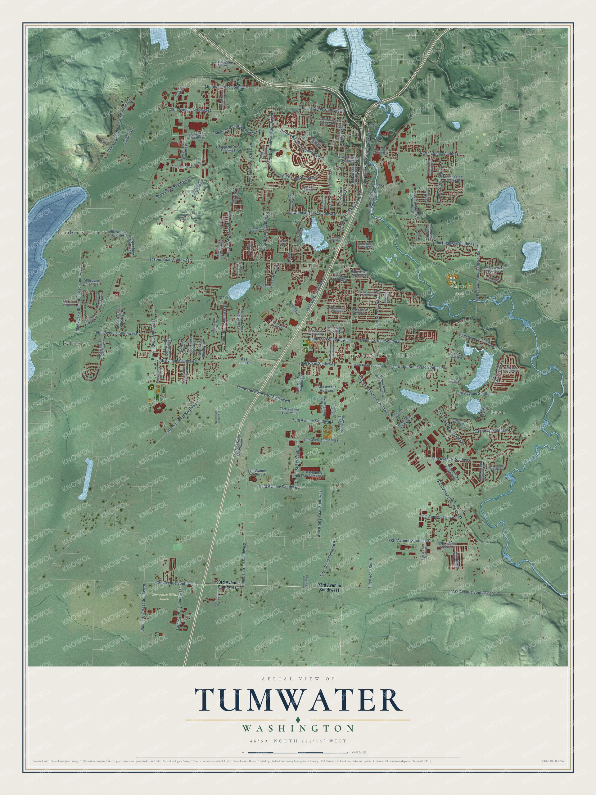
A new map of Tumwater, Washington, made in 2026 and printed to order on thick archival matte paper.
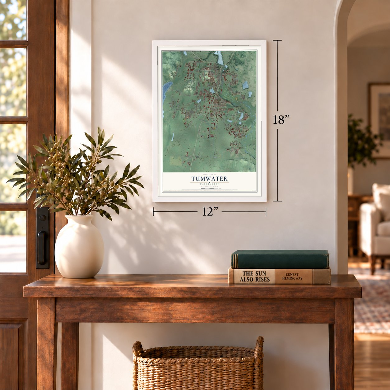
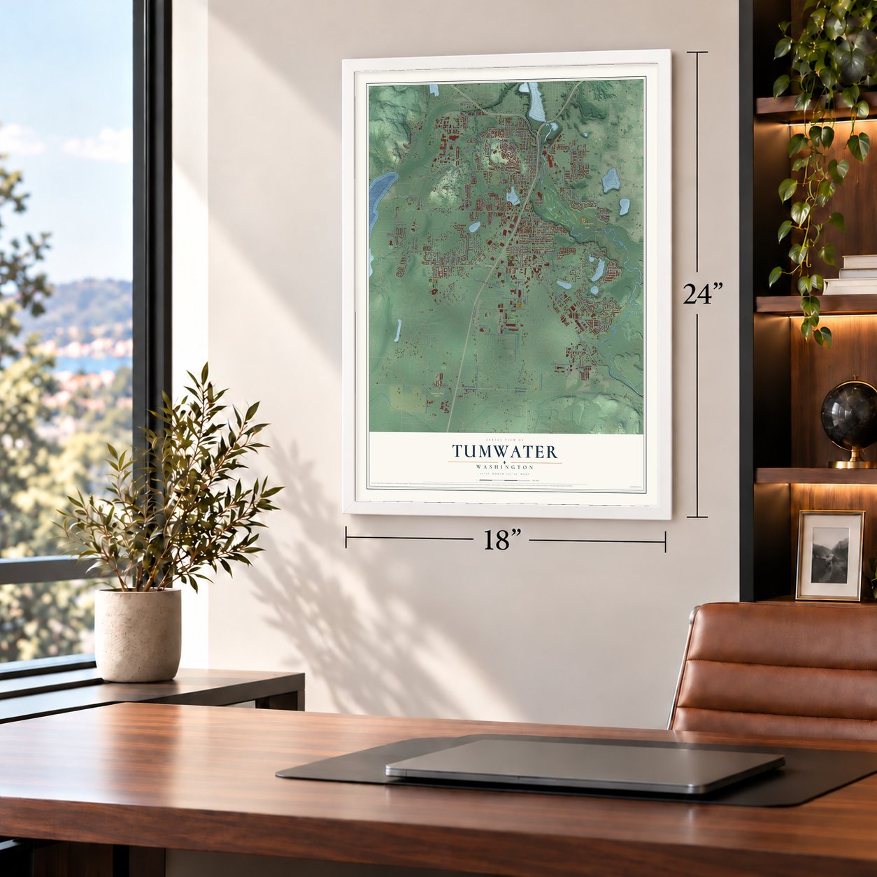
12" x 18" Archival Matte Print
A Map of Home. A Work of Art.
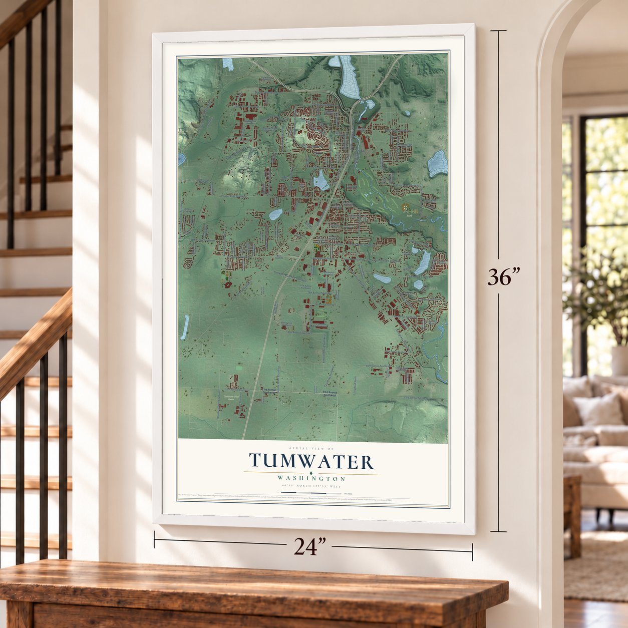
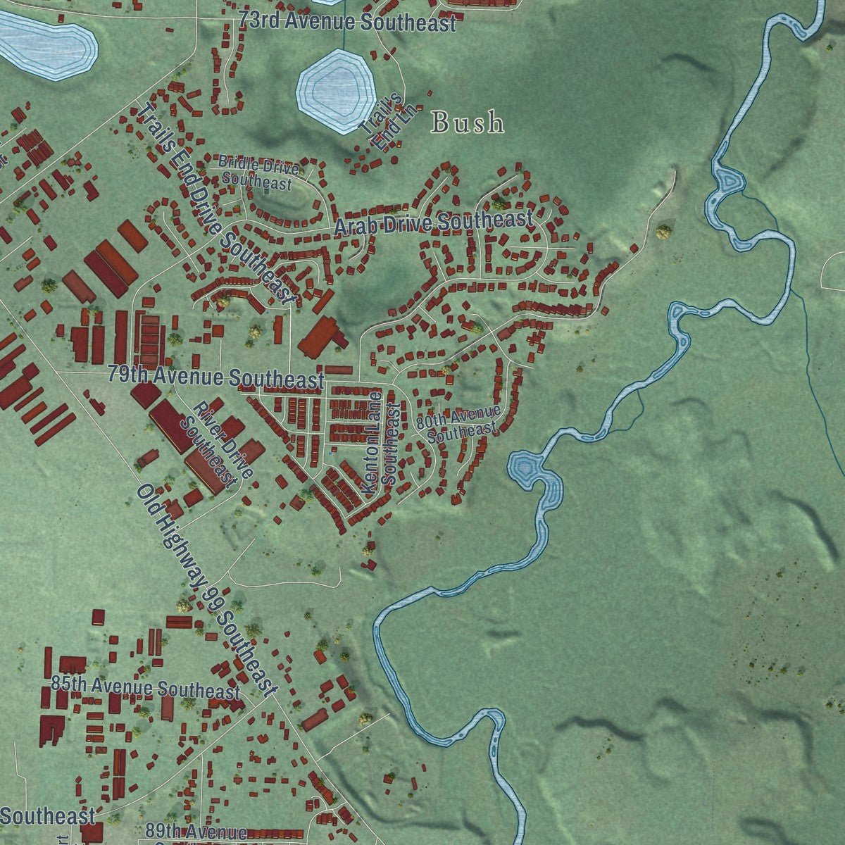
Explore Tumwater, Washington from a whole new perspective. Created using aerial imagery and detailed geographic data, this map captures Tumwater building by building, with labeled streets, familiar landmarks, and shaded topographical relief that highlights the natural contours of the landscape.
Combining modern data with the timeless character of a vintage atlas, this map is just as interesting up close as it is beautiful on the wall. Whether you grew up in Tumwater, spent memorable years there, or call it home today, this unique map is a great way to celebrate a place that means something to you. Zoom in on the preview to look for your street, and then order a print to put your memories on the wall.
Three ways to hang it
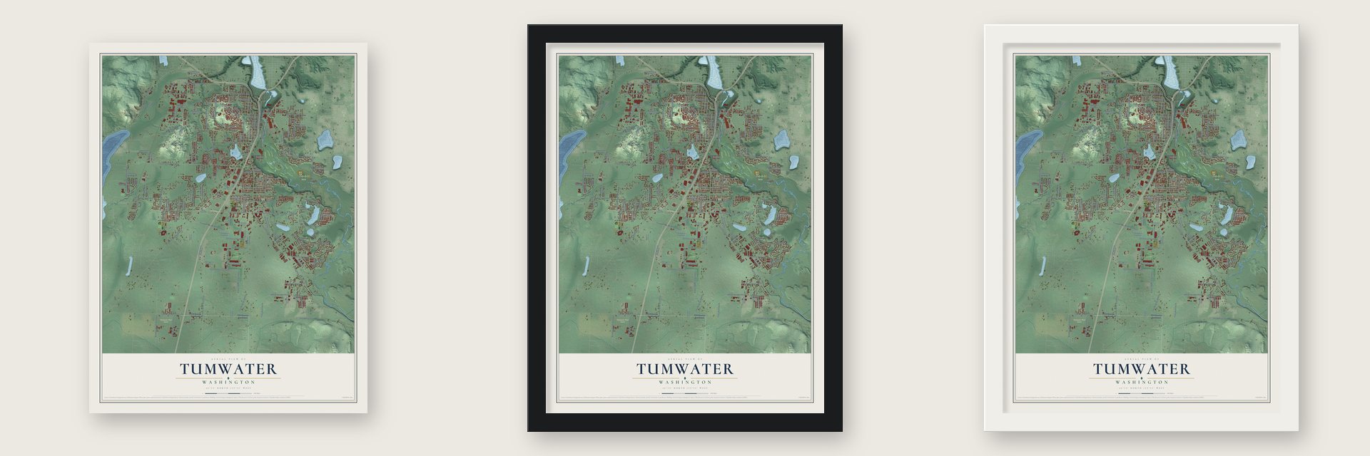
Unframed archival matte, a black wood frame or a white wood frame.
Up close
Geography Worth Displaying
This map was created using accurate cartographic data and authoritative geographic sources, including the U.S. Geological Survey and the Census Bureau. The map brings together terrain, waterways, roads, and building detail. The majority of the streets are labeled, houses are accurately depicted, and the topography is derived from government sources. Combining local data with carefully composed color and shading leads to this beautifully detailed Tumwater artwork for your wall.
Rather than simply showing street outlines, we’ve included as many of the street names as we could reasonably fit on the map while keeping their names legible. Zoom in on the high resolution preview to see exactly what’s on the map. We truly set out to create a statement piece for anyone who loves Tumwater. So whether it’s for you, or a gift for someone you love, we hope this map of Tumwater brings back fond memories.
Read the story behind this map of Tumwater, Washington from 2026.
About Tumwater, Washington
Tumwater is a city of 25,350 people in Thurston County, at the falls where the Deschutes River pours into Budd Inlet. The falls were sacred to the Steh-chass people for thousands of years, and their descendants are part of today's Squaxin Island Tribe. In May 1844 George Bush and Michael Simmons left St. Joseph, Missouri, on the Oregon Trail with 31 men, women and children in six wagons.
On the way they learned that Oregon had passed a law that June to keep out African Americans, and Bush was African American. Rather than head into California, then part of Mexico, he chose to settle north of the Columbia River, beyond the law's reach. After a winter at Fort Vancouver, the party reached Puget Sound in the fall of 1845 and founded the first American settlement there, which Simmons named New Market. A post office opened under the name Tumwater in 1863, and the city was incorporated on November 25, 1869.
“Upon this commanding site George Bush pitched his last camp and there his family have lived to the present time and the prairie of some five square miles extent has always been known as Bush Prairie”
- Washington's first millsIn the winter of 1846-1847, Bush, Simmons, David Kindred and others built a log grist mill at the falls, with millstones cut from granite, so the settlers could turn their wheat into bread. A sawmill followed in March 1848. Water power later gave way to other sources, yet heavy industry stayed in Tumwater for most of the 1900s, led by the Olympia Brewing Company.
- Named for the waterfallThe name Tumwater comes from tumwata, the Chinook Jargon word for a waterfall. It replaced New Market when the post office opened in 1863.
- Bush PrairieUnfair laws barred George Bush from claiming the land his family settled south of the landing, but a special exemption let him keep it. The prairie grew large crops of wheat, rye, oats, potatoes and hops, and its farms also sent out wool and butter.
- Concrete totems from 1937Four matching concrete totem poles stand on the Art Deco Carlyon Bridge, added in 1937 during a project on Capitol Boulevard. Each is carved in Haida style with two bears, one of them a grizzly, along with an eagle and a raven. When they went up they were thought to be the only concrete totems in the world, and no one knows who designed them.
- 100 buildings for a highwayInterstate 5, completed in 1958, ran through downtown Tumwater, and 100 buildings were torn down to make room for it. By then the larger businesses had already moved northeast to Tumwater Square, which is still a shopping center.
Find your street
Names on the Tumwater map
Every name below is printed on this map. Look for your street, your school, the park where you played, or the pond down the road.
Places and landmarks6
- Tumwater City Hall
- Belmore
- Bush
- Pioneer Park
- Tumwater West Preserve
- Lamberts Corner
Streets and roads156
- Tumwater Boulevard Southeast
- Israel Road Southwest
- Vista Loop Southwest
- Second Avenue Southwest
- 70th Avenue Southwest
- Old Highway 99 Southeast
- Capitol Boulevard Southwest
- Littlerock Road Southwest
- Trosper Road Southwest
- Henderson Boulevard Southeast
- Kimmie Street Southwest
- Tyee Drive Southwest
- Sapp Road Southwest
- Tumwater Boulevard Southwest
- Arab Drive Southeast
- Kirsop Road Southwest
- Mottman Road Southwest
- 79th Avenue Southeast
- 73rd Avenue Southeast
- Crosby Boulevard Southwest
- 76th Avenue Southwest
- Deschutes Parkway Southwest
- 93rd Avenue Southeast
- 66th Avenue Southwest
- Barnes Boulevard Southwest
- Miner Drive Southwest
- Tilley Road South
- Black Lake Belmore Road Southwest
- Black Lake Boulevard Southwest
- Linwood Avenue Southwest
Show all 156 streets
- Center Street Southwest
- 88th Avenue Southeast
- Somerset Hill Drive Southwest
- 83rd Avenue Southwest
- Hoadly Street Southeast
- North Street Southeast
- Trails End Drive Southeast
- Dennis Street Southeast
- 93rd Avenue Southwest
- Irving Street Southwest
- 29th Avenue Southwest
- Case Road Southwest
- Dennis Street Southwest
- Elm Street Southeast
- Rural Road Southwest
- 65th Avenue Southeast
- Yelm Highway Southeast
- Lambskin Street Southwest
- Blomberg Street Southwest
- Armstrong Road Southwest
- Antsen Street Southwest
- Lathrop Drive Southwest
- East Street
- Fir Avenue
- Delta Lane Southeast
- Division Street Southwest
- Israel Road Southeast
- North Sixth Avenue Southwest
- Linderson Way Southwest
- Cleveland Avenue Southeast
- Bonniewood Drive Southeast
- Seventh Avenue Southwest
- 73rd Avenue Southwest
- Munn Lake Drive Southeast
- Ferguson Street Southwest
- Tumwater Valley Drive Southeast
- Third Avenue Southwest
- 78th Avenue Southwest
- Chapparel Drive Southwest
- 49th Avenue Southwest
- Frontage Road Southwest
- Glenwood Drive Southwest
- Schoth Street Southwest
- Belmore Street Southwest
- River Drive Southeast
- 85th Avenue Southeast
- Grant Street Southwest
- Fifth Avenue Southwest
- Pat Kennedy Way Southwest
- 32nd Avenue Southwest
- 75th Avenue Southwest
- Cavalier Street Southwest
- 21st Avenue Southwest
- 89th Avenue Southeast
- Trail's End Lane
- Kenton Lane Southeast
- Shalom Drive Southwest
- Trosper Street Southwest
- Lazy Street Southwest
- Middle Street Southeast
- Joppa Street Southwest
- 53rd Avenue Southeast
- Aster Street Southeast
- Durell Road Southeast
- Lively Street Southwest
- Lee Street Southwest
- West Israel Road
- 80th Avenue Southwest
- 58th Lane Southwest
- Ruby Street Southeast
- 76th Court Southwest
- Lido Court Southwest
- 65th Way Southwest
- Oak Avenue
- Sixth Avenue Southwest
- Bush Mountain Drive Southwest
- New Market Street Southwest
- Cortez Loop Southwest
- Lorne Street Southeast
- Regal Park Lane Southwest
- 37th Avenue Southwest
- West Street Southeast
- Bridle Drive Southeast
- 80th Avenue Southeast
- Tartan Drive Southwest
- Custer Way Southwest
- Foster Drive Southwest
- Klahowya Lane Southwest
- Firland Street Southwest
- Mirasett Street Southwest
- 69th Way Southeast
- Select Court Southeast
- 61st Court Southwest
- 68th Avenue Southeast
- Lloyd Street Southeast
- West Street Southwest
- Grant Street
- Ebbets Drive Southwest
- Lake Park Drive Southwest
- Terminal Street Southwest
- Cavalier Loop Southwest
- 53rd Loop Southeast
- 48th Avenue Southwest
- Twelfth Avenue Southwest
- Bronington Drive Southwest
- Crites Street Southwest
- Joppa Lane Southwest
- Jody Court Southwest
- 71st Avenue Southeast
- Restawhile Court Southwest
- Dowcor Lane Southwest
- Woodland Drive Southwest
- Dahlia Lane Southwest
- Kings Wood Drive Southwest
- Pinehurst Drive Southeast
- Liberty Avenue Southwest
- Bald Eagle Lane Southwest
- Eighth Avenue Southwest
- Almar Lane Southeast
- Bishop Road Southwest
- Brech Street Southeast
- Louise Street Southwest
- Prine Drive Southwest
- Little Street Southwest
- Lear Street Southwest
- Bell Street Southeast
Names are listed as they appear on the printed map. Zoom into the product photos to find them.
The art of mapping a place
How This Map Was Made
Real places. Remarkable detail. Discover the layers that turn geographic data into a map of home.

The view from above
Aerial imagery reveals the character of the land: woodland, open fields, and the patterns of a place.

The shape of the land
Elevation data brings hills, valleys, and subtle changes in the landscape into view.

The details of home
Roads, waterways, and building footprints come together to make the map feel unmistakably local.

Geography becomes art
Considered color, shading, and typography bring the layers together in a map made for your wall.


Process illustrated with Mendon, Massachusetts. Aerial imagery: USDA NAIP. Terrain: USGS 3D Elevation Program. Map details and finished artwork: KNOWOL.
The Details
About This Print
Choose an archival matte print, or a black or white Ayous wood frame. The archival matte print is unframed.
Select your size and finish above to see the matching product image and price.
Materials & Craftsmanship
A contemporary map with the character of a classic atlas, printed on archival matte paper. Optional frames are made from Ayous wood.
Your printed map does not include the watermark shown in the full-map preview.
Shipping & Delivery
Free shipping within the United States. Every print is made to order in the USA.
Buying a gift? Add a note in your cart and we'll include it. We never put prices in the package.
Prints ship within 2 to 3 business days. Allow 7 to 10 days total from ordering for delivery. Timing may vary during holidays or periods of high order volume.
Read our shipping policy.
Returns and damaged prints
Each print is made to order. Change-of-mind refunds are not available after production.
If your print arrives damaged, misprinted or incorrect, contact support@knowol.com within 30 days of receiving it. Include your order number, photos and a description of the issue.
Read our full refund and replacement policy. For questions about your order, email support@knowol.com.
Find your town
Looking for another city?
Find a map of home in our Washington collection, or any town in the country.
Nearby
Maps of towns near Tumwater
Know someone from one of these towns? Their map makes a great gift.
 Olympia
, Washington
From $39.99See the map
 Lacey
Lacey, Washington
From $39.99See the map
 Tanglewilde
, Washington
From $39.99See the map
More maps nearby: Tenino, Nisqually Indian Community, Rainier, Yelm and Rochester.