
Search for another town




Free U.S. delivery 7 to 10 days after you order
Tupelo, Mississippi Map Art
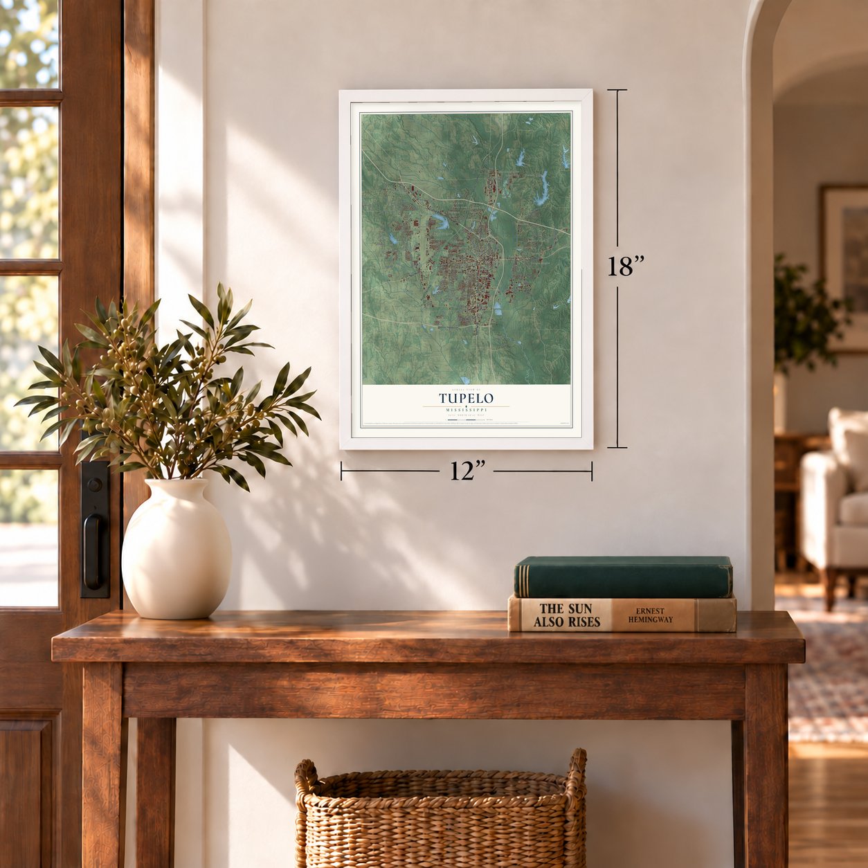
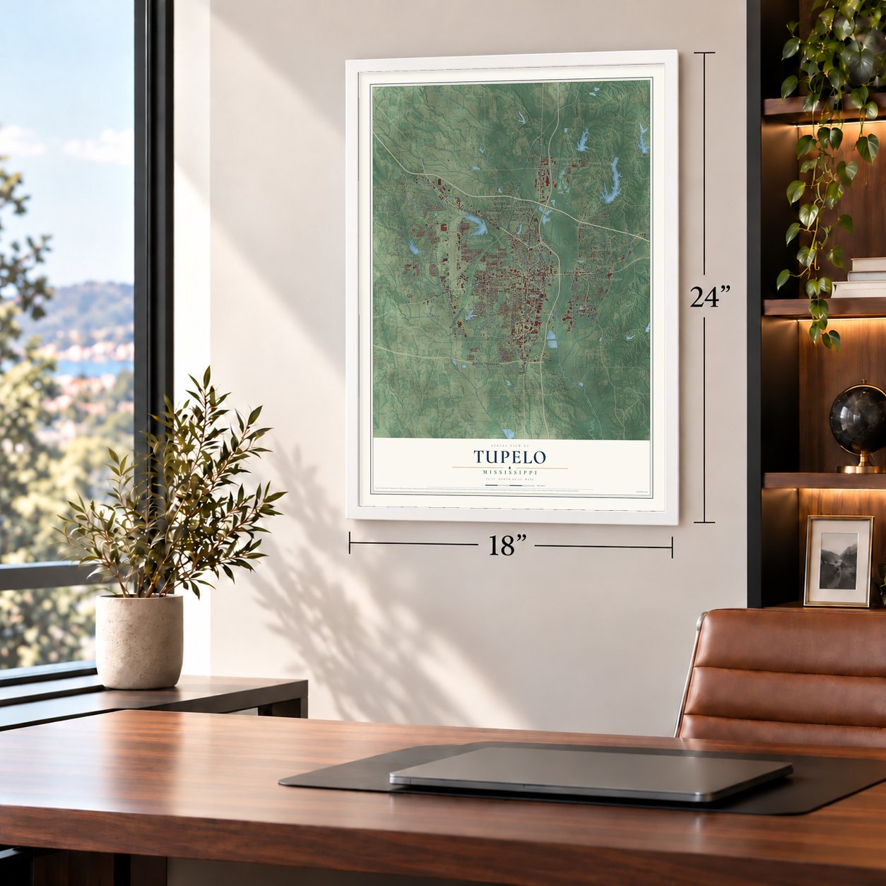
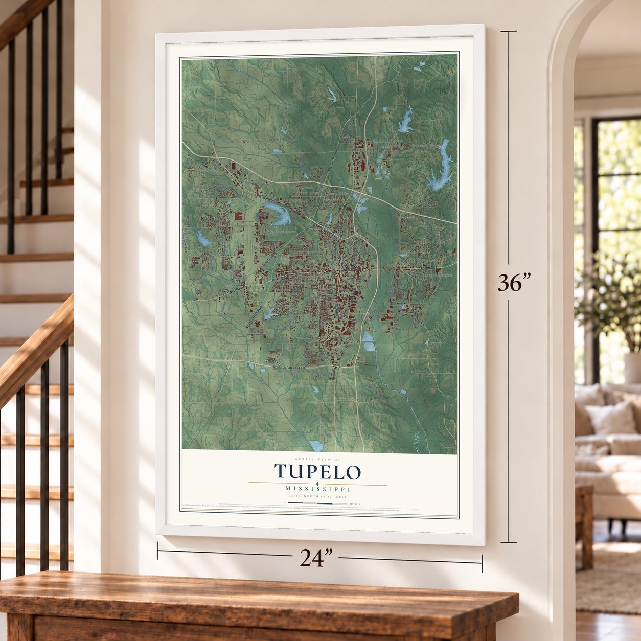
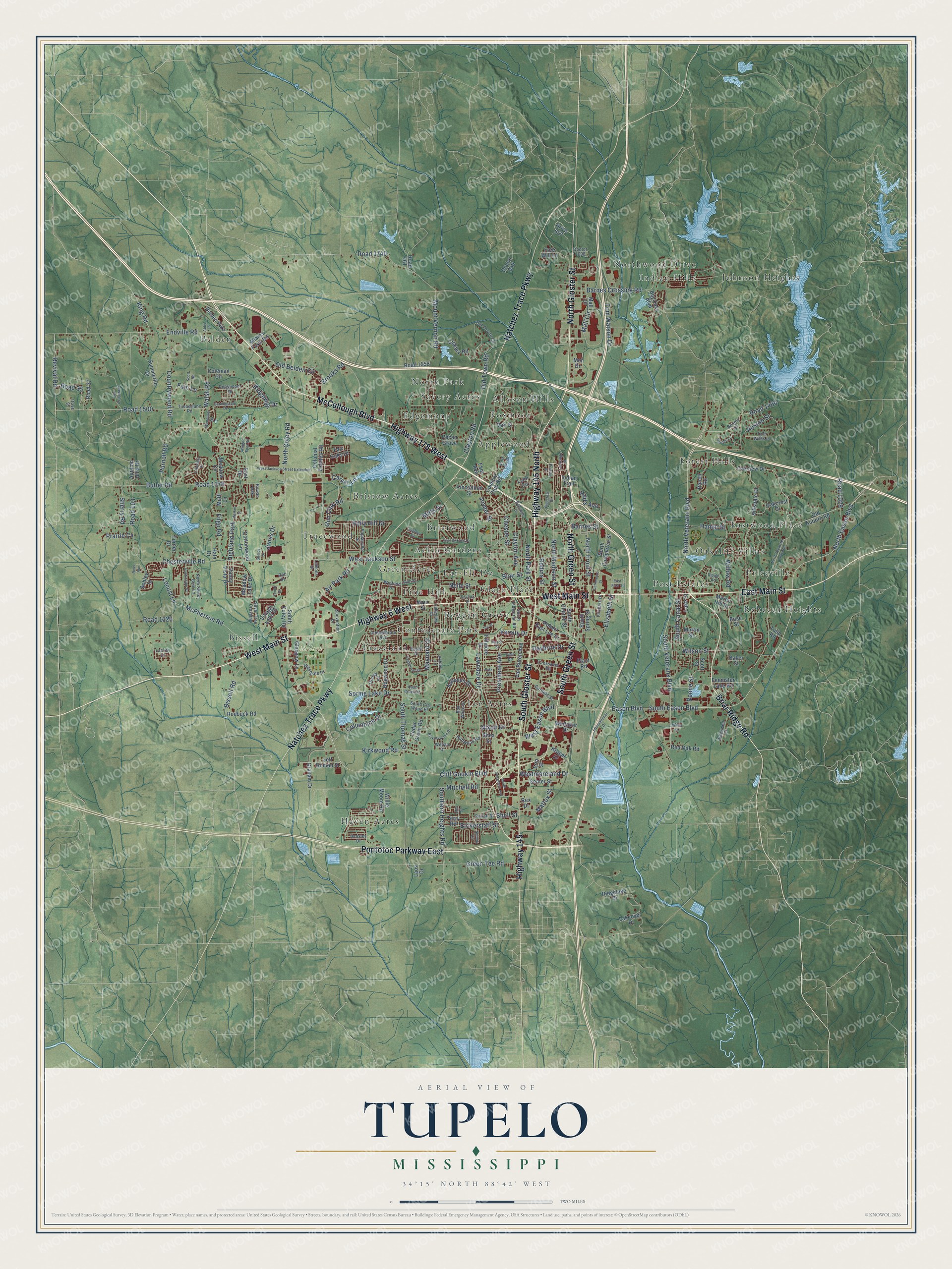
A new map of Tupelo, Mississippi, made in 2026 and printed to order on thick archival matte paper.
12" x 18" Archival Matte Print
A Map of Home. A Work of Art.
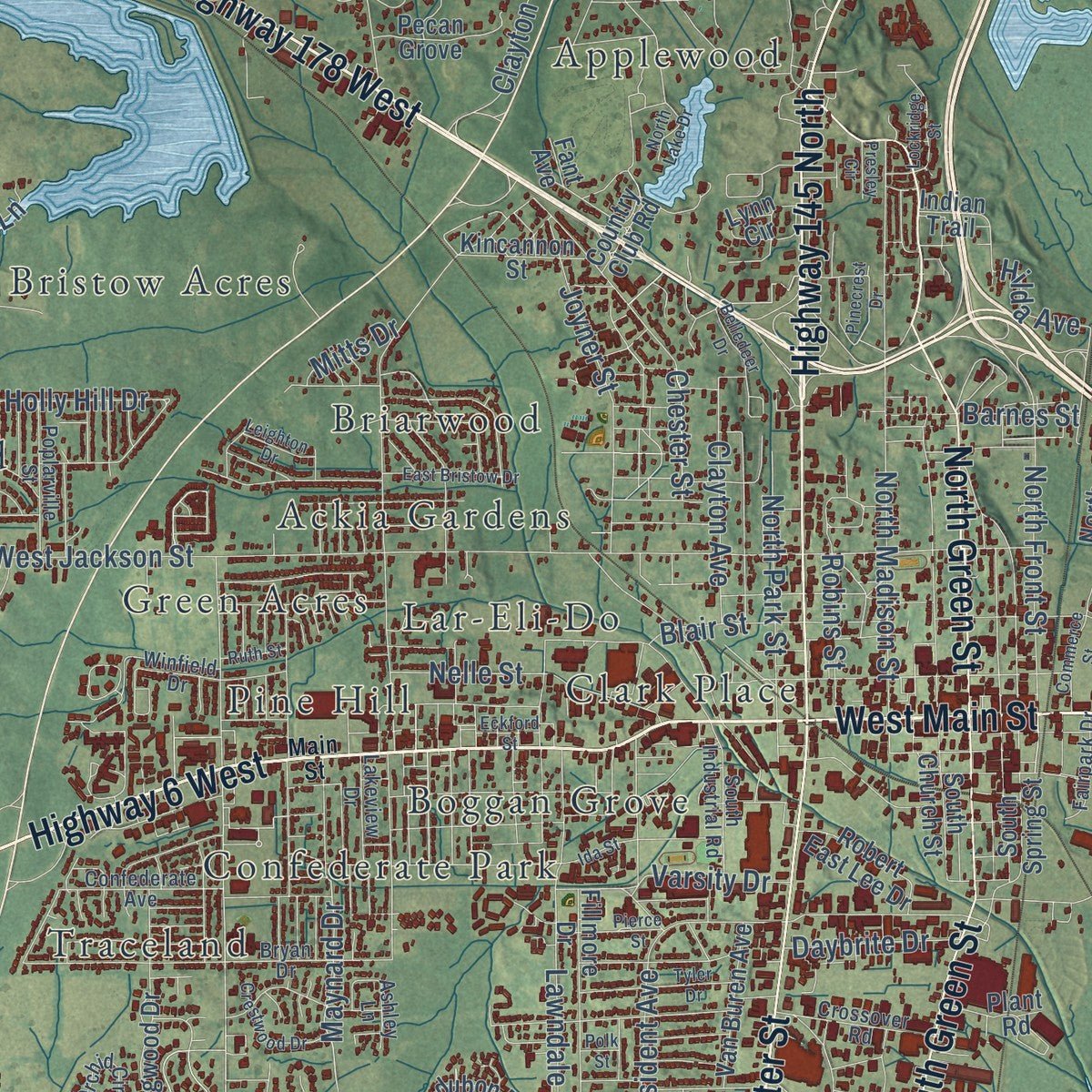
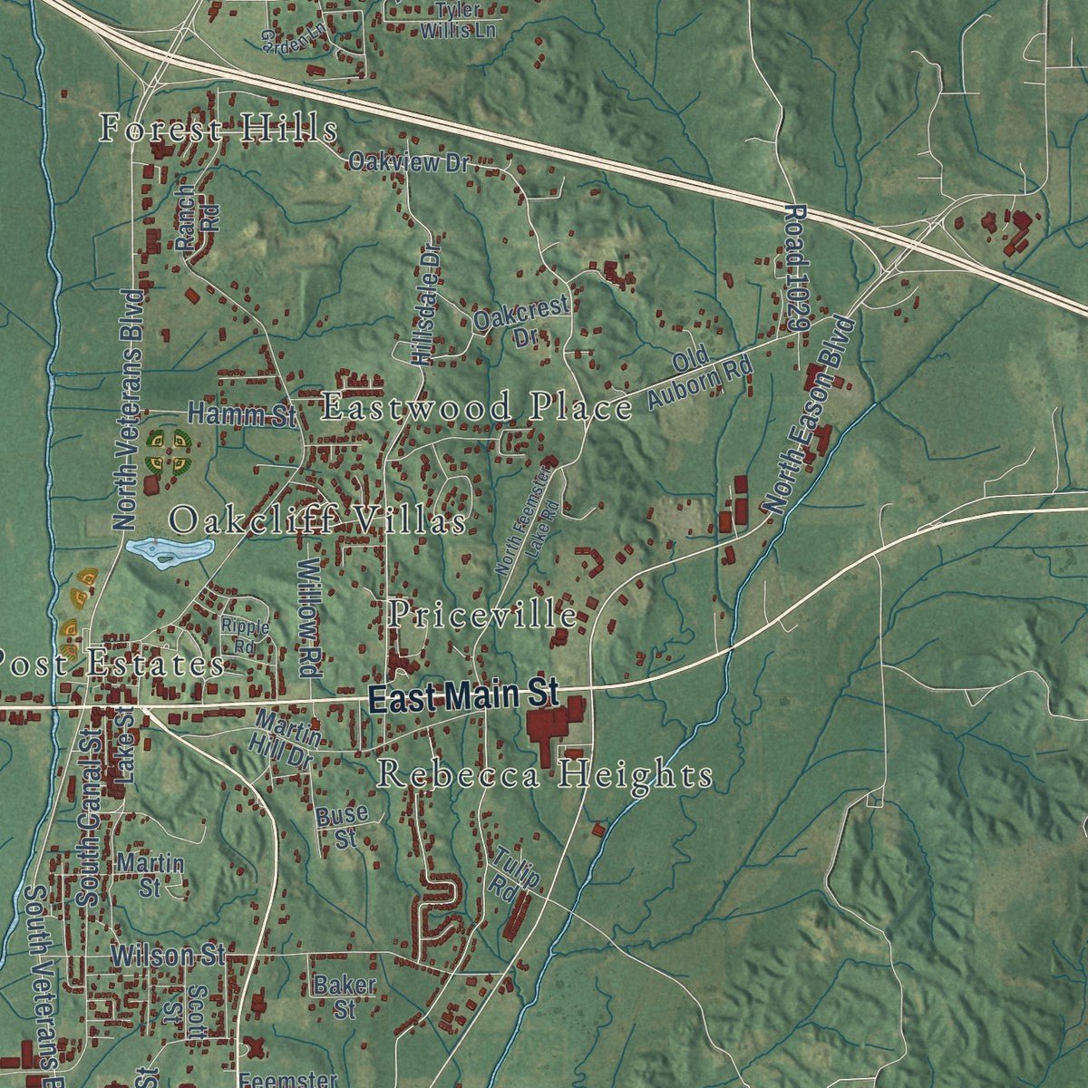
Explore Tupelo, Mississippi from a whole new perspective. Created using aerial imagery and detailed geographic data, this map captures Tupelo building by building, with labeled streets, familiar landmarks, and shaded topographical relief that highlights the natural contours of the landscape.
Combining modern data with the timeless character of a vintage atlas, this map is just as interesting up close as it is beautiful on the wall. Whether you grew up in Tupelo, spent memorable years there, or call it home today, this unique map is a great way to celebrate a place that means something to you. Zoom in on the preview to look for your street, and then order a print to put your memories on the wall.
Three ways to hang it
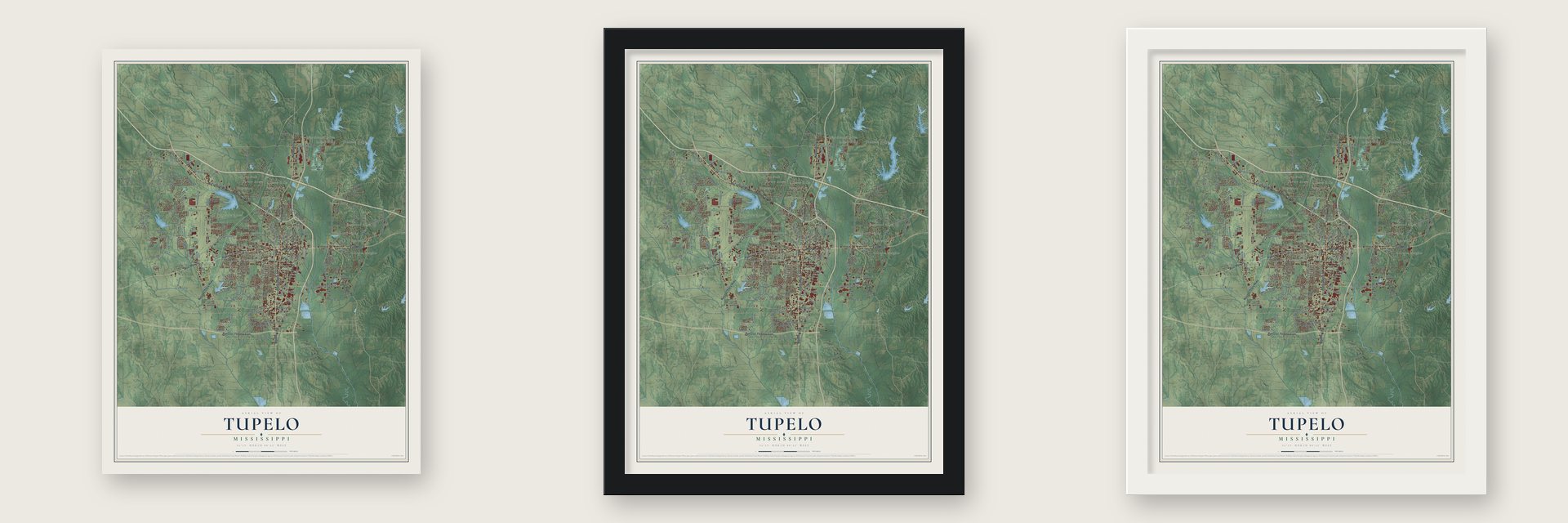
Unframed archival matte, a black wood frame or a white wood frame.
Up close
Geography Worth Displaying
This map was created using accurate cartographic data and authoritative geographic sources, including the U.S. Geological Survey and the Census Bureau. The map brings together terrain, waterways, roads, and building detail. The majority of the streets are labeled, houses are accurately depicted, and the topography is derived from government sources. Combining local data with carefully composed color and shading leads to this beautifully detailed Tupelo artwork for your wall.
Rather than simply showing street outlines, we’ve included as many of the street names as we could reasonably fit on the map while keeping their names legible. Zoom in on the high resolution preview to see exactly what’s on the map. We truly set out to create a statement piece for anyone who loves Tupelo. So whether it’s for you, or a gift for someone you love, we hope this map of Tupelo brings back fond memories.
Read the story behind this map of Tupelo, Mississippi from 2026.

About Tupelo, Mississippi
Tupelo is a city of 37,923 people and the county seat of Lee County. Early settlers called the place Gum Pond, reportedly for its tupelo trees, which locals knew as blackgum. When the Mobile and Ohio Railroad reached the settlement in 1860, it drew away the trade of Harrisburg, an older village a mile and a half to the west. The growing town later took the name Tupelo, and it was incorporated on July 20, 1870.
Electricity came during the Great Depression. Starting on February 7, 1934, Tupelo was the first city anywhere to take power from the Tennessee Valley Authority, and it became known as the First TVA City. That year Franklin and Eleanor Roosevelt came to open the Tupelo Homesteads, a planned community of twenty-five buildings for families the Depression had pushed out of their homes. During the 1930s the Tupelo Journal came under the ownership of George McLean, who pushed for better schools, well-paid industry and closer ties between town and farm, ideas at the heart of what became known as the Tupelo Miracle.
“He was the kind of guy that, if you looked at him, you would never thought he was a bank robber.”
- The Battle of Tupelo, 1864Confederate troops fell back to Tupelo after the Battle of Shiloh and camped here through the summer of 1862. On July 14, 1864, Gen. A. J. Smith led Federal troops into a bloody battle here against Confederates under Stephen D. Lee and N. B. Forrest. After his defeat at Nashville, Hood later brought his army back to Tupelo for several months. The site is now the Tupelo National Battlefield, run by the National Park Service.
- A courthouse rebuilt twiceLee County was created in 1866, and on April 15, 1867, voters picked Tupelo as its seat. Courts met in a two-story frame building until a brick courthouse opened in 1871. It burned in February 1873, and a replacement costing about $20,000, plus an $8,000 jail, stood by 1875. After that one burned in 1904, the county quickly built another for $75,000. The Lee County Courthouse joined the National Register in 1992.
- The tornado of 1936On the night of April 5 and 6, 1936, a tornado tore through the north side of Tupelo. It flattened 48 city blocks and more than 200 homes, killed 216 people and hurt more than 700, and it dropped many of the dead into Gum Pond. The state geologist later put the toll at 233, and historians believe it was higher still. The storm has since been rated F5, and among the survivors was a baby named Elvis Presley.
- Birthplace of Elvis PresleyElvis Presley was born in Tupelo in 1935, in a small shotgun house that is now a major tourist attraction. As a boy he sang in an Assemblies of God church and performed at the local fair, and in 1948 he moved with his parents to Memphis.
- Machine Gun Kelly's last jobThe Prohibition-era gangster Machine Gun Kelly pulled his last known bank robbery at the Citizen's State Bank in Tupelo on November 30, 1932. His gang got away with $38,000, and the bank's chief teller later said Kelly looked nothing like a robber.
Find your street
Names on the Tupelo map
Every name below is printed on this map. Look for your street, your school, the park where you played, or the pond down the road.
Places and landmarks32
- Ballard Park
- Ackia Gardens
- Allyson Hills
- Applewood
- Belden
- Bissell
- Boggan Grove
- Briarwood
- Bristow Acres
- Clark Place
- Confederate Park
- Eastwood Place
Show all 32 places
- Edgemont
- Forest Hills
- Foxmoor
- Green Acres
- Haven Acres
- Indian Hills
- Johnson Heights
- Lar-Eli-Do
- Lee Acres
- North Park
- Northwood Drive
- Oakcliff Villas
- Pine Hill
- Post Estates
- Priceville
- Rebecca Heights
- Savery Acres
- Traceland
- Tracewood
- Highland Park
Streets and roads243
- McCullough Boulevard
- East Main Street
- North Gloster Street
- Briar Ridge Road
- West Main Street
- Pontotoc Parkway East
- Highway 178 West
- Highway 6 West
- South Gloster Street
- Natchez Trace Parkway
- Highway 145 North
- Highway 145
- South Green Street
- North Green Street
- Cliff Gookin Boulevard
- South Eason Boulevard
- North Eason Boulevard
- West Eason Boulevard
- North Veterans Boulevard
- South Veterans Boulevard
- Kirkwood Road
- South Thomas Street
- McPherson Road
- Maynard Drive
- Road 1029
- Barnes Crossing Road
- Eason Boulevard
- North Coley Road
- Chesterville Road
- Mount Vernon Road
Show all 243 streets
- West Jackson Street
- Lawndale Drive
- Mitchell Road
- Butler Road
- Road 1378
- Purnell Road
- North Madison Street
- Locust Lane
- Clayton Avenue
- President Avenue
- Road 1500
- Green Tee Road
- Road 1740
- Wilson Street
- Countrywood Road
- Southern Heights Road
- Walsh Road
- Endville Road
- Air Park Road
- Mall Circle
- Road 1460
- South Canal Street
- Old Belden Circle
- Brooks Road
- Spring Lake Drive
- North Front Street
- Westmoreland Drive
- Holly Hill Drive
- Joyner Street
- Revival Road
- Columbine Drive
- Ridgeway Drive
- Elizabeth Street
- Nelle Street
- Tom Watson Drive
- North Park Street
- Bissell Road
- Varsity Drive
- Bickerstaff Street
- Clayton Road
- Boone Street
- Gun Club Road
- Old Town Road
- Mattox Street
- Road 35
- Jones Drive
- Prairie Cv
- King Road
- Filgo Road
- Barnes Street
- Road 103
- Daybrite Drive
- Fain Lane
- Sherry Road
- Road 1226
- Hamm Street
- Robins Street
- Blair Street
- Willow Road
- Hilda Avenue
- Auston Street
- Carver Lane
- Chester Street
- Mitts Drive
- Nixon Drive
- Shell Street
- Oakview Drive
- South Coley Road
- Graham Drive
- Old Auborn Road
- Feemster Lake Road
- Hillsdale Drive
- Fillmore Drive
- Country Club Road
- Meadow Circle
- Ridgelake Drive
- Willie Moore Road
- Village Lake Drive
- Martin Hill Drive
- Colonial Estates Road
- Roebuck Road
- Summerlin Drive
- Lake Street
- South Spring Street
- Terry Road
- Valley Vista Drive
- Drive 657
- North Commerce Street
- Dogwood Drive
- Audubon Drive
- Whitaker Drive
- Glasgow Lane
- Oakcrest Drive
- Martin Street
- Creeley Road
- Van Buren Avenue
- Big Oaks Boulevard
- Senter Street
- Jeff Homan Street
- South Church Street
- Cottonwood Lane
- Robert East Lee Drive
- Meadow Lake Drive
- Fair Oaks Drive
- Cedar Grove Road
- Van Street
- Lynn Circle
- Pecan Grove
- Belden Pike
- Road 37
- Indian Trail
- Kincannon Street
- Red Oak Road
- Muffi Lane
- Coleman Circle
- Road 1558
- Turner Drive
- Baker Street
- Plant Road
- Lakeover Drive
- Doctor 649
- Adams Farm Road
- Autumn Hills Drive
- Mall Drive
- Ranch Road
- Ashley Street
- Kruger Drive
- Scott Street
- Free Will Lane
- Hale Drive
- Buse Street
- East Drive
- Tulip Road
- Shea Street
- Road 461
- Mel Drive
- Laos Drive
- Rex Drive
- Fant Avenue
- Erin Street
- South Cla Wood Place
- Old Towne Circle
- Beasley Drive
- Garfield Street
- Westgate Drive
- Orchid Circle
- Bob White Drive
- North Sweet Gum Lane
- Bryan Drive
- South Industrial Road
- Crossover Road
- Lakeview Drive
- Confederate Avenue
- Poplarville Street
- Silver Tree Crossing
- Timberlane Road
- Tyler Willis Lane
- Blackwell Street
- Ruffwood Road
- Ashley Lane
- William Drive
- Fairpark Drive
- Ridgemoor Drive
- Convention Drive
- Parish Drive
- Jim Street
- Lackey Lane
- Winfield Drive
- Lemons Drive
- Bonnie Drive
- Doctor 1698
- Rowan Oak
- Drive 95
- Rob Drive
- Main Street
- North Feemster Lake Road
- Winged Foot Road
- West Jackson Street Extended
- Ida Street
- Greenbriar Road
- Hickorywood Drive
- International Drive
- Shelby Drive
- Shonda Circle
- Pinecrest Drive
- Tyler Drive
- Lockridge Street
- Huntington Place
- East Bristow Drive
- Garden Lane
- Abby Lane
- Lakefield Drive
- Crestwood Drive
- South President Avenue
- Belledeer Drive
- Leighton Drive
- Market Street
- Sunningdale Drive
- Pierce Street
- Wendover Drive
- Commerce Street
- River Run
- Eckford Street
- Quail Creek Road
- North Lake Drive
- Scott Road
- Ruth Street
- East First Street
- Hadley Street
- Presley Circle
- Fenco Drive
- Ripple Road
- Polk Street
Names are listed as they appear on the printed map. Zoom into the product photos to find them.
The art of mapping a place
How This Map Was Made
Real places. Remarkable detail. Discover the layers that turn geographic data into a map of home.

The view from above
Aerial imagery reveals the character of the land: woodland, open fields, and the patterns of a place.

The shape of the land
Elevation data brings hills, valleys, and subtle changes in the landscape into view.

The details of home
Roads, waterways, and building footprints come together to make the map feel unmistakably local.

Geography becomes art
Considered color, shading, and typography bring the layers together in a map made for your wall.


Process illustrated with Mendon, Massachusetts. Aerial imagery: USDA NAIP. Terrain: USGS 3D Elevation Program. Map details and finished artwork: KNOWOL.
The Details
About This Print
Choose an archival matte print, or a black or white Ayous wood frame. The archival matte print is unframed.
Select your size and finish above to see the matching product image and price.
Materials & Craftsmanship
A contemporary map with the character of a classic atlas, printed on archival matte paper. Optional frames are made from Ayous wood.
Your printed map does not include the watermark shown in the full-map preview.
Shipping & Delivery
Free shipping within the United States. Every print is made to order in the USA.
Buying a gift? Add a note in your cart and we'll include it. We never put prices in the package.
Prints ship within 2 to 3 business days. Allow 7 to 10 days total from ordering for delivery. Timing may vary during holidays or periods of high order volume.
Read our shipping policy.
Returns and damaged prints
Each print is made to order. Change-of-mind refunds are not available after production.
If your print arrives damaged, misprinted or incorrect, contact support@knowol.com within 30 days of receiving it. Include your order number, photos and a description of the issue.
Read our full refund and replacement policy. For questions about your order, email support@knowol.com.
Find your town
Looking for another city?
Find a map of home in our Mississippi collection, or any town in the country.
Nearby
Maps of towns near Tupelo
Know someone from one of these towns? Their map makes a great gift.
 Verona
, Mississippi
From $39.99See the map
 Plantersville
, Mississippi
From $39.99See the map
 Saltillo
, Mississippi
From $39.99See the map
More maps nearby: Sherman, Mooreville, Shannon, Blue Springs and Guntown.