
Search for another town



Free U.S. delivery 7 to 10 days after you order
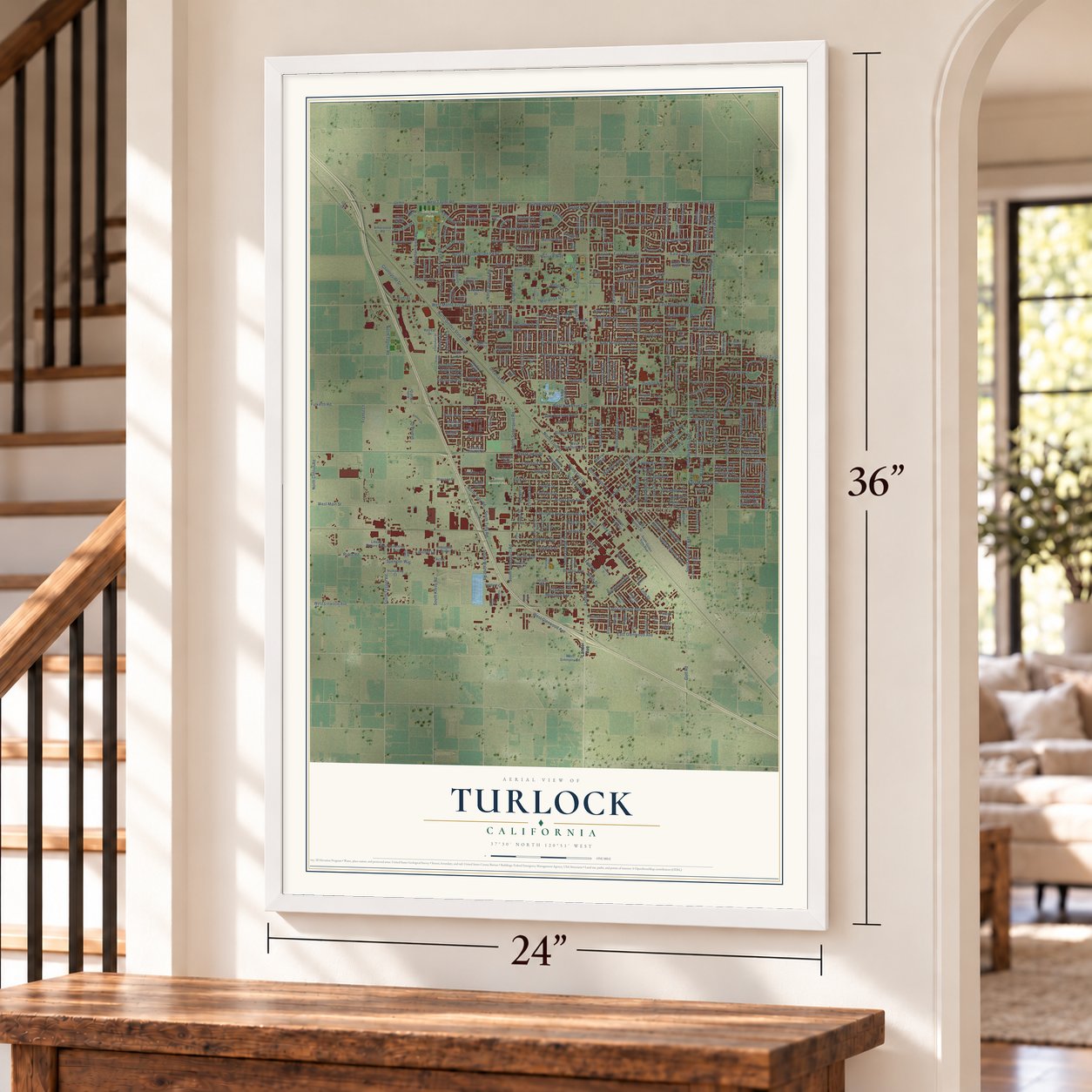
Turlock, California Map Art
Building by building, with labeled streets and shaded relief.
12" x 18" Archival Matte Print
A Map of Home. A Work of Art.
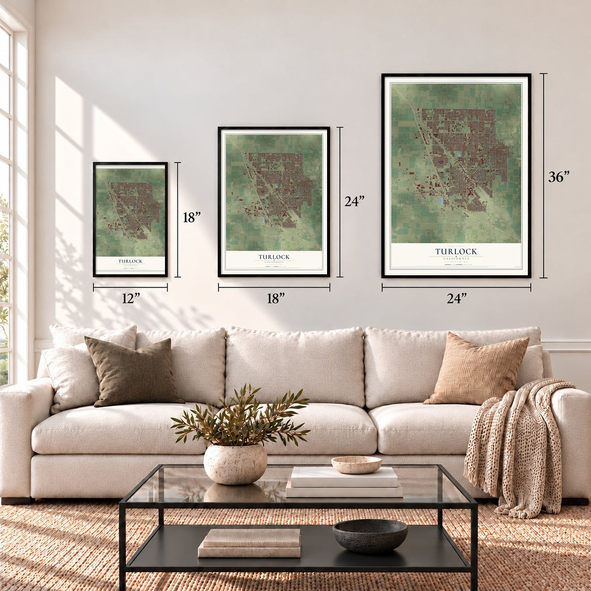
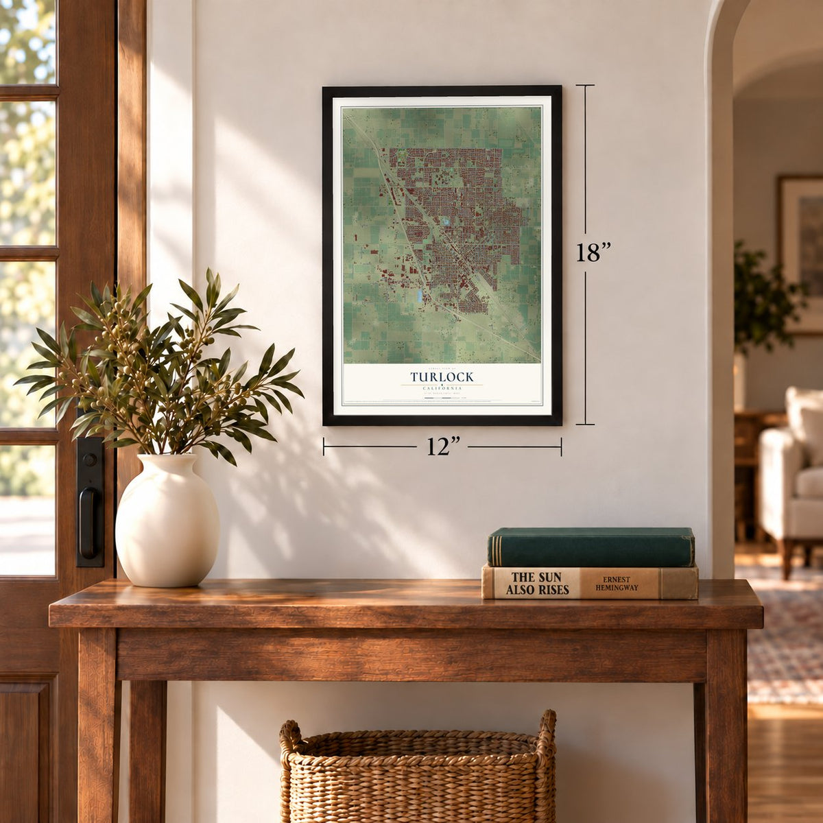
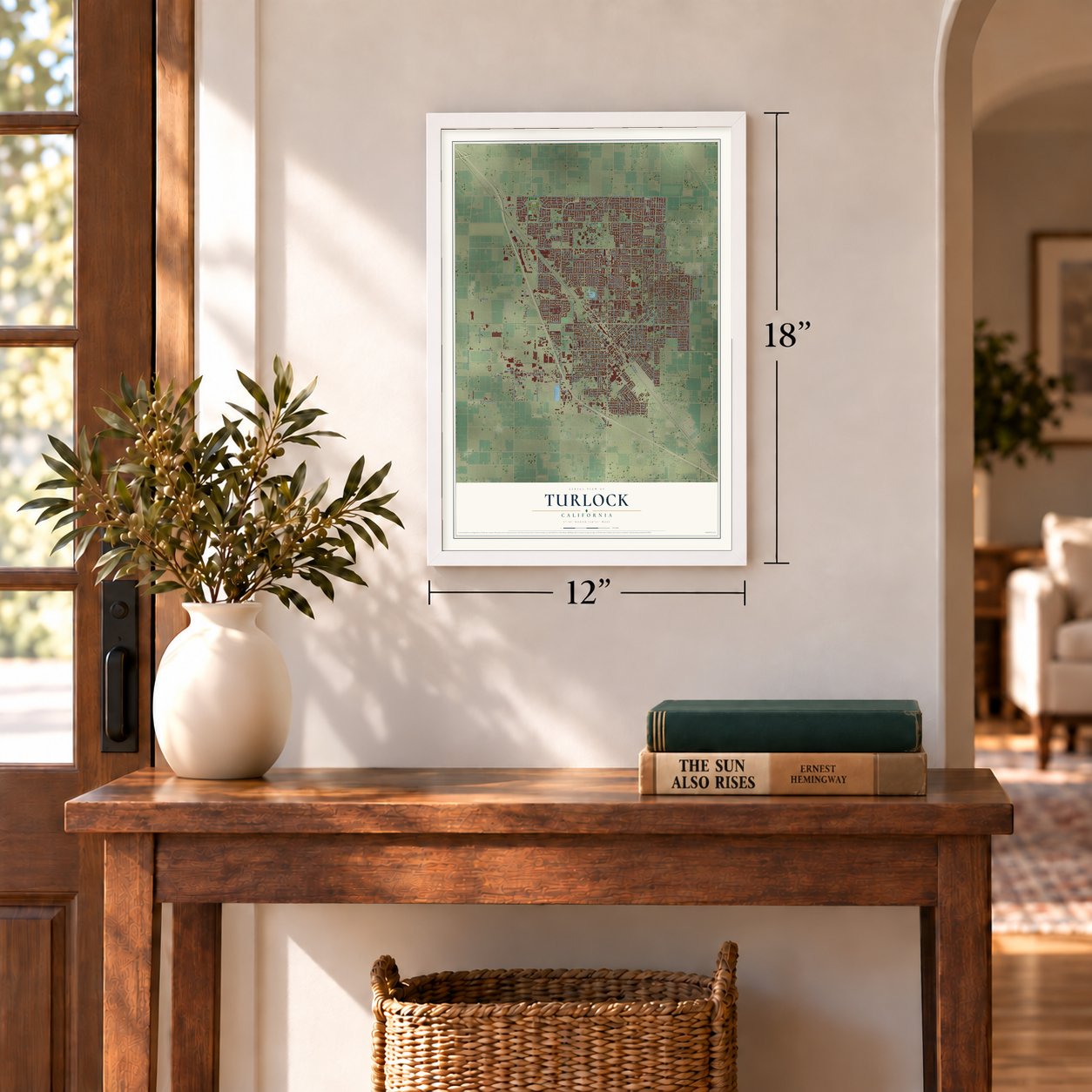
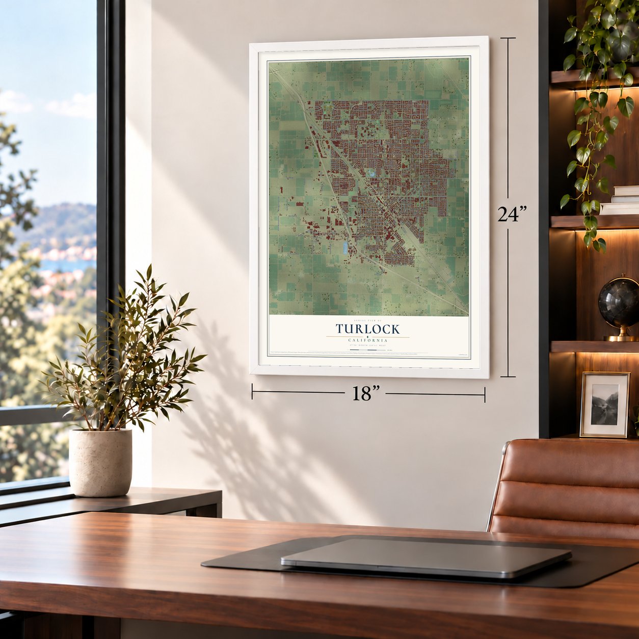
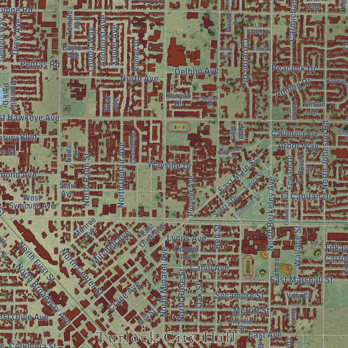
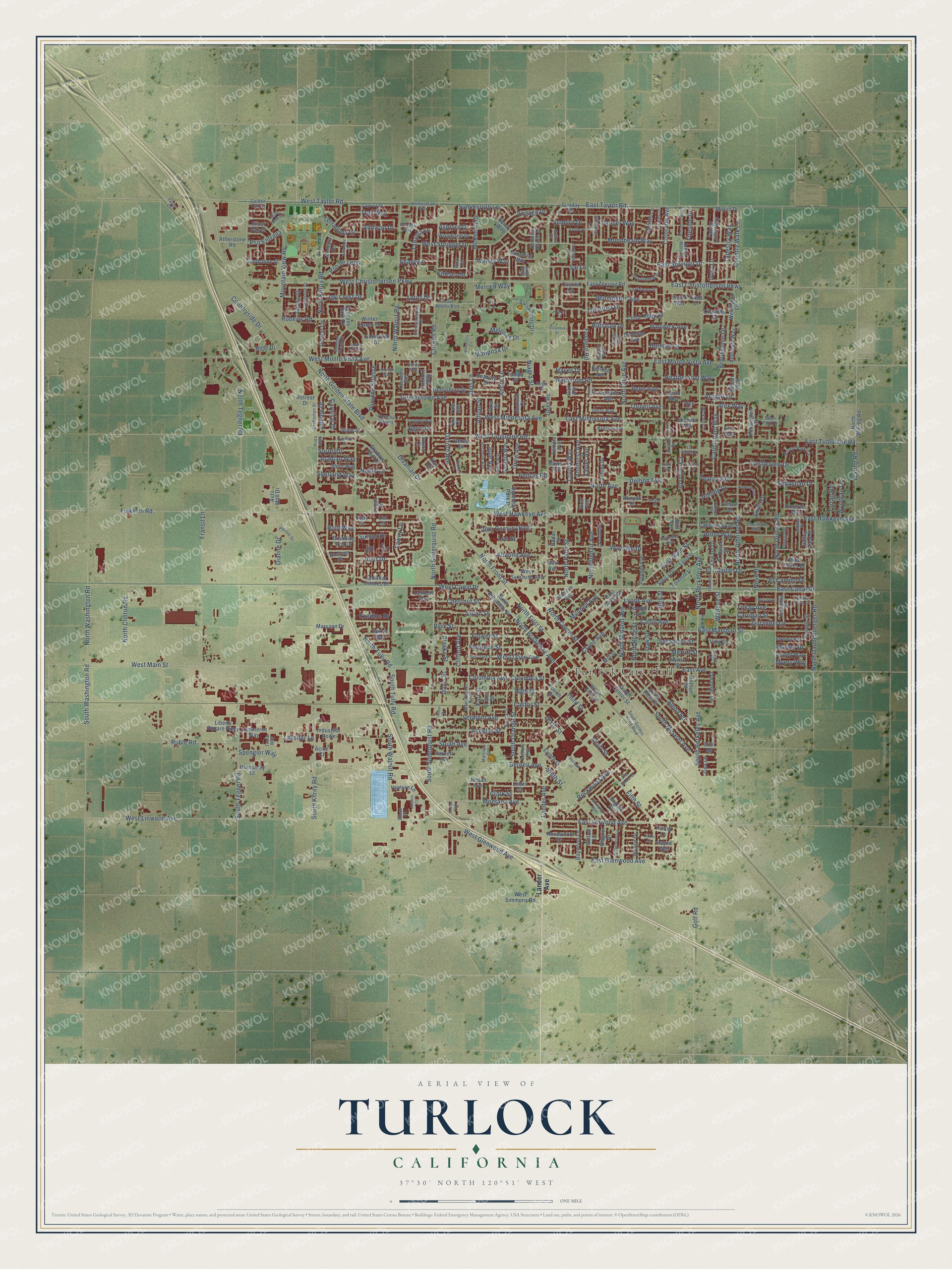
Explore Turlock, California from a whole new perspective. Created using aerial imagery and detailed geographic data, this map captures Turlock building by building, with labeled streets, familiar landmarks, and shaded topographical relief that highlights the natural contours of the landscape.
Combining modern data with the timeless character of a vintage atlas, this map is just as interesting up close as it is beautiful on the wall. Whether you grew up in Turlock, spent memorable years there, or call it home today, this unique map is a great way to celebrate a place that means something to you. Zoom in on the preview to look for your street, and then order a print to put your memories on the wall.
Three ways to hang it
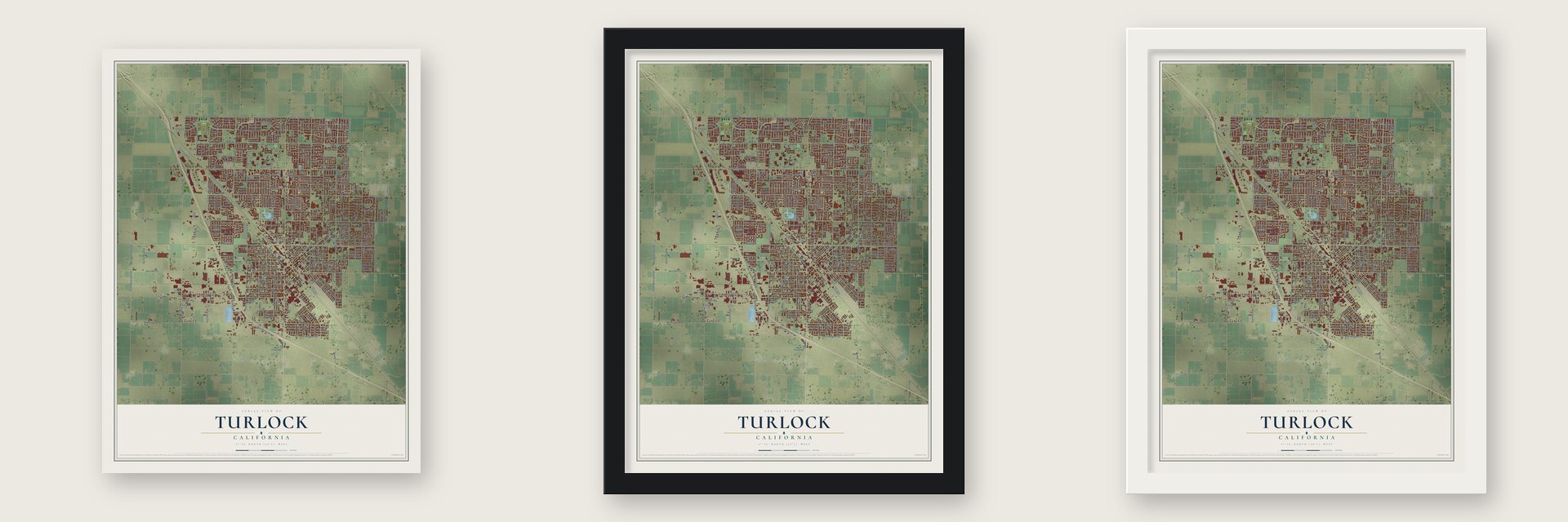
Unframed archival matte, a black wood frame or a white wood frame.
Up close
Geography Worth Displaying
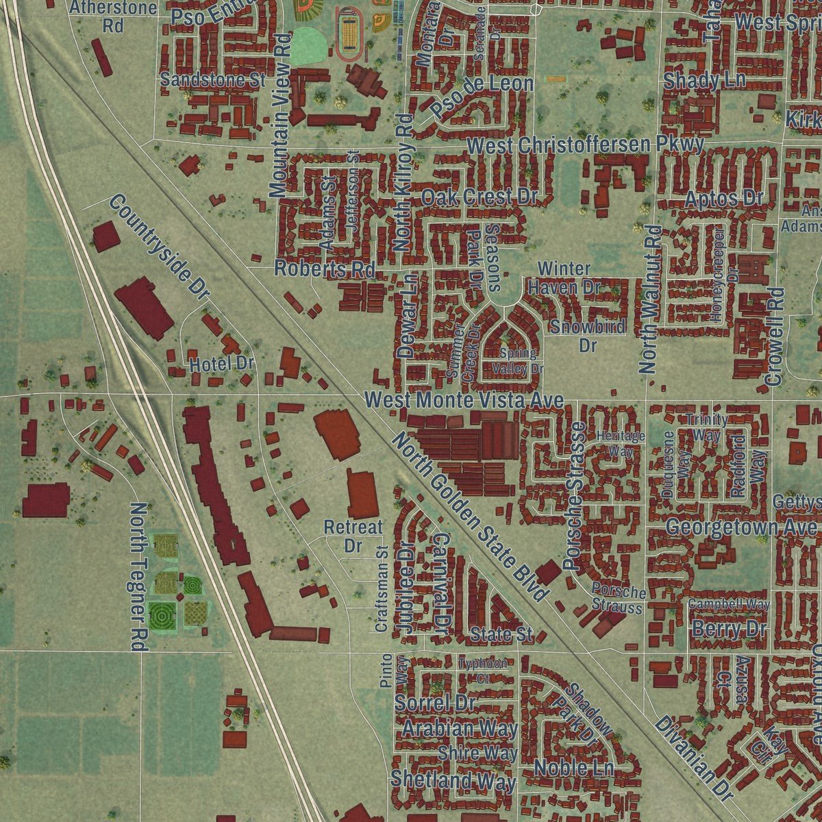
This map was created using accurate cartographic data and authoritative geographic sources, including the U.S. Geological Survey and the Census Bureau. The map brings together terrain, waterways, roads, and building detail. The majority of the streets are labeled, houses are accurately depicted, and the topography is derived from government sources. Combining local data with carefully composed color and shading leads to this beautifully detailed Turlock artwork for your wall.
Rather than simply showing street outlines, we’ve included as many of the street names as we could reasonably fit on the map while keeping their names legible. Zoom in on the high resolution preview to see exactly what’s on the map. We truly set out to create a statement piece for anyone who loves Turlock. So whether it’s for you, or a gift for someone you love, we hope this map of Turlock brings back fond memories.
Read the story behind this map of Turlock, California from 2026.
Find your street
Names on the Turlock map
Every name below is printed on this map. Look for your street, your school, the park where you played, or the pond down the road.
Places and landmarks5
- Turlock City Hall
- Donnelly Park
- Gemperle Fields
- Turlock Memorial Park
- Freitas Park
Streets and roads400
- North Berkeley Avenue
- West Christoffersen Parkway
- East Springer Drive
- East Main Street
- South Berkeley Avenue
- Merced Way
- Country Walk Lane
- Golf Road
- North Center Street
- Alex Way
- North Golden State Boulevard
- East Canal Drive
- West Main Street
- Colorado Avenue
- West Linwood Avenue
- Geer Road
- West Taylor Road
- North Olive Avenue
- West Canal Drive
- Fulkerth Road
- North Walnut Road
- West Monte Vista Avenue
- East Tuolumne Road
- East Hawkeye Avenue
- Countryside Drive
- West Tuolumne Road
- North Quincy Road
- North Tegner Road
- North Tully Road
- Crowell Road
Show all 400 streets
- North Daubenberger Road
- East Marshall Street
- North Johnson Road
- Fifth Street
- South Walnut Road
- West Springer Drive
- Lander Avenue
- East Christoffersen Parkway
- East Monte Vista Avenue
- East Taylor Road
- North Denair Avenue
- Dels Lane
- Mariposa Drive
- East Avenue
- West Glenwood Avenue
- East Glenwood Avenue
- North Washington Road
- South Kilroy Road
- North Soderquist Road
- South Washington Road
- Fransil Lane
- Dianne Drive
- South Tegner Road
- Fosberg Road
- Dancer Way
- Vermont Avenue
- North Broadway Avenue
- South Avenue
- North Kilroy Road
- East Linwood Avenue
- South Orange Street
- Moonbeam Way
- North Palm Street
- Pedras Road
- Mitchell Avenue
- Sunset Drive
- South Soderquist Road
- West Minnesota Avenue
- Merritt Street
- High Street
- East Minnesota Avenue
- Angelus Street
- Hedstrom Road
- South Minaret Avenue
- Columbia Avenue
- Columbia Street
- Joett Drive
- Flower Street
- Georgetown Avenue
- El Capitan Drive
- Castleview Drive
- West Hawkeye Avenue
- Mountain View Road
- North Front Street
- Park Street
- Wayside Drive
- West Olive Avenue
- Montana Avenue
- North First Street
- Divanian Drive
- Andre Lane
- Julian Street
- Alpha Road
- Ruble Road
- El Camino Drive
- Brookstone Drive
- Florence Street
- South Tully Road
- 20th Century Boulevard
- Spengler Way
- Bell Street
- North Rose Street
- Oak Street
- Porsche Strasse
- Fullerton Drive
- Arbor Way
- Tapestry Way
- Bennington Avenue
- Waring Road
- Sycamore Street
- Chestnut Street
- North Avenue
- McKenna Drive
- Carmichael Way
- Roberts Road
- Penn Avenue
- Trail Way
- Oxford Avenue
- Zinfandel Lane
- North Clinton Road
- Almond Avenue
- Carleton Drive
- North Minaret Avenue
- Castor Street
- Hartwick Avenue
- Crane Avenue
- Smith Drive
- Annhurst Avenue
- Bernell Avenue
- Summerton Lane
- Third Street
- Ninth Street
- Cahill Avenue
- Burman Drive
- Heathernoel Way
- Lyons Avenue
- Melones Drive
- Oak Crest Drive
- Vintage Drive
- Carnival Drive
- Tornell Avenue
- Rockwood Avenue
- Terralinda Drive
- Tahama Lane
- Clark Street
- Wendy Way
- Anning Drive
- Clifford Avenue
- Loyola Way
- Jubilee Drive
- Dewar Lane
- Shetland Way
- Pso de Leon
- Peacock Drive
- Shady Lane
- Carrigan Street
- Drew Avenue
- Tokay Avenue
- Wallace Street
- Farr Street
- Sebastian Drive
- Delbon Avenue
- Wyndfair Drive
- Adrian Street
- Sai Lane
- Addison Drive
- Hillsdale Drive
- Sorrel Drive
- Arabian Way
- Pso Entrada
- Sunbird Drive
- Ashford Drive
- Tawny Lane
- Exedine Drive
- Abigail Lane
- Noble Lane
- Tartan Road
- Aptos Drive
- Hayes Drive
- Xavier Avenue
- Lassiter Lane
- Alaska Street
- Myers Way
- Julie Avenue
- Fireside Drive
- Marlee Drive
- Kirksey Drive
- Ivory Lane
- Novo Drive
- Roth Way
- Davis Street
- Emily Street
- Niagra Street
- Berry Drive
- Sixth Street
- Lee Street
- South Center Street
- Seasons Park Drive
- Erin Way
- Kevin Way
- Field Drive
- South First Street
- Merlin Drive
- Emerald Way
- North Broadway Street
- South Rose Street
- East Olive Avenue
- Mira Flores Drive
- East Zeering Road
- Myrtle Street
- Sunday Drive
- English Avenue
- Gettysburg Street
- California Avenue
- Starr Avenue
- Venture Lane
- Sierra Drive
- Edward Drive
- El Paseo Street
- Cooper Avenue
- Sandy Way
- Pioneer Avenue
- Baywood Lane
- West Syracuse Avenue
- Corello Street
- Bothun Road
- Shadow Park Drive
- Lewis Street
- Callisto Lane
- Potomac Avenue
- Cedar Ridge Drive
- Sacramento Drive
- Winter Haven Drive
- Donnelly Park Drive
- Ferreira Ranch Drive
- Georgia Way
- North Waring Road
- Dow Street
- West Simmons Road
- Sandstone Street
- Shire Way
- Woodland Drive
- Liberty Square Parkway
- Wellington Lane
- Chakkar Estates Drive
- Rosewood Drive
- Amethyst Way
- Berea Drive
- Oleander Lane
- Kay Circle
- Villa Court
- Simon Drive
- Falcon Crest Way
- Chandler Drive
- Alex Circle
- Kensington Court
- Ashland Avenue
- Monroe Avenue
- Humphrey Court
- Michael Way
- Maryann Drive
- Camellia Street
- Valley View Drive
- Seaborg Street
- Commerce Way
- Adams Street
- Oppelt Way
- Lambert Way
- Baylor Avenue
- Industrial Rowe
- Rohrer Drive
- Tampa Street
- Mill Street
- Willert Drive
- Parnell Avenue
- Kellogg Avenue
- Ahlem Way
- Branding Iron Drive
- Silver Oak Court
- Atherstone Road
- Auto Mall Drive
- Porter Way
- Sunshine Way
- Snowbird Drive
- Glimmer Lane
- Wagner Drive
- Jeannie Court
- Chelsea Place
- Retreat Drive
- Forest Drive
- Eighth Street
- Montara Drive
- Radford Way
- Hotel Drive
- Temple Avenue
- Zina Lane
- Fourth Street
- Rice Avenue
- State Street
- Picard Lane
- Castile Lane
- Brier Road
- Payne Way
- Yale Avenue
- Jordan Avenue
- Runyan Drive
- Willow Lane
- Azusa Court
- Violet Way
- Piro Court
- Cody Court
- Gail Avenue
- Logan Lane
- Lane Street
- Lial Court
- Acme Court
- Noda Street
- Niel Avenue
- Yale Court
- Sage Way
- West Avenue South
- South Golden State Boulevard
- Bristol Park Circle
- Porsche Strauss
- Sierra Street
- Heartland Way
- Spruce Street
- Caprice Drive
- Bethany Avenue
- Rochelle Avenue
- Yosemite Street
- Arthur Mace Drive
- Craftsman Street
- Visions Drive
- Estates Drive
- Sierra Vista Drive
- Honeycreeper Drive
- Peace Way
- Barbara Way
- Pinto Way
- Summer Creek Drive
- Jefferson Street
- Stanley Avenue
- Estrella Way
- La Paloma Street
- Ansel Adams Boulevard
- Sherri Way
- Homestead Way
- Waldorf Drive
- Nicklaus Drive
- Windsor Court
- Duquesne Way
- Palmer Drive
- Trinity Way
- Polous Drive
- Trade Way
- Martinez Street
- Christine Way
- La Salle Drive
- Ryan Road
- Radcliff Way
- Blue Oak Court
- Regis Street
- Swan Park Drive
- Golden Oak Court
- Grillos Drive
- Ellerd Drive
- Taylor Court
- Elena Court
- West Olive Street
- Amberwood Lane
- Edwards Drive
- University Circle
- Hammond Drive
- Boxwood Way
- Meadowlark Drive
- Saint George Place
- Villanova Drive
- Escondido Avenue
- Seranade Drive
- Seventh Street
- Heritage Way
- Manzanita Way
- Nicole Court
- Leffler Place
- Campbell Way
- Spring Valley Drive
- Mission Street
- Country Lane
- Atlanta Court
- Cynda Street
- Villa Woods Drive
- Garden Lane
- Typhoon Court
- Case Way
- Franks Court
- Sargon Place
- Ryker Court
- Jason Drive
- Colby Avenue
Names are listed as they appear on the printed map. Zoom into the product photos to find them.
About Turlock, California
Turlock is a city of 72,740 people in Stanislaus County, second in size there only to Modesto. Soon after the Civil War, the land speculator John W. Mitchell bought 100,000 acres where the city now stands. He had already made money buying land at Paradise City at the government price and reselling it for two or three times as much. He planted grain here in 1867, and after a heavy harvest he planted even more the next year. Then he bought lumber in Stockton, hauled it out by team and put up houses for the farmers he hoped would buy his land.
Mitchell founded the town on December 22, 1871, when it was little more than a depot, a post office, a grain warehouse and a handful of other buildings. Dry years were hard on the farmers, but Mitchell helped them, because he believed water from the Sierras would one day make the land valuable. They carted their grain to the Tuolumne River to go by steamboat to Stockton, and some drove the whole forty miles to the city. Charles Light, who saw his first circus here in 1876, remembered one hotel, one saloon and one Chinese wash house, along with big warehouses full of the farmers' grain. Turlock became an incorporated city on February 15, 1908.
“you have to hand it to the Scandinavians for knowing how to run a dairy farm.”
- A name from a novelMitchell refused to let the town carry his own name. In October 1870, Harper's Weekly had printed part of Bred in the Bone, a story by the English novelist James Payn that mentions a town called Turlock. Local historians think early resident H.W. Lander read that issue and proposed the name. It is believed to trace back to Turlough, a village in Ireland.
- Hotels that moved to townAfter the railroad came through, James Allen moved his two-story house over from Westport and opened it as the Turlock Hotel. Mrs. E. H. Allen ran it in 1884, and it stood until it was torn down for the Carolyn Hotel. Around 1874 another hotel was moved in from Woods Landing and became the Fountain Hotel, on the spot where the St. Elmo later stood.
- The Melon Carnival, 1911Cantaloupes were the heart of Turlock's economy, and in 1911 the town held its first Melon Carnival downtown. The celebration grew into the Stanislaus County Fair, which is still held at the county fairgrounds in Turlock.
- Little Urmia and its churchesIn 1930, 20 percent of Turlock's people were Assyrian, most of them from the Urmia region of northwestern Iran, so the south end of town came to be called Little Urmia. In the 1930s Ripley's Believe It or Not said Turlock had more churches per person than any place in the country, partly because each immigrant group built its own.
Keep exploring California
Turlock is one of 1,968 California towns we've mapped. Every dot on the map is a print of its own.
The search covers every state, California first.
Near Turlock
Order 2 or more town maps and save 10%. Shown in the size and finish you picked above, so they hang as a set.
- Denair 12" x 18" / Archival Matte Print $39.99
- Keyes 12" x 18" / Archival Matte Print $39.99
- Hughson 12" x 18" / Archival Matte Print $39.99
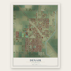


More maps nearby: Delhi, Hilmar-Irwin, Cowan, Monterey Park Tract and Ceres.
The art of mapping a place
How This Map Was Made
Real places. Remarkable detail. Discover the layers that turn geographic data into a map of home.

The view from above
Aerial imagery reveals the character of the land: woodland, open fields, and the patterns of a place.

The shape of the land
Elevation data brings hills, valleys, and subtle changes in the landscape into view.

The details of home
Roads, waterways, and building footprints come together to make the map feel unmistakably local.

Geography becomes art
Considered color, shading, and typography bring the layers together in a map made for your wall.


Process illustrated with Mendon, Massachusetts. Aerial imagery: USDA NAIP. Terrain: USGS 3D Elevation Program. Map details and finished artwork: KNOWOL.
The Details
About This Print
Choose an archival matte print, or a black or white Ayous wood frame. The archival matte print is unframed.
Select your size and finish above to see the matching product image and price.
Materials & Craftsmanship
A contemporary map with the character of a classic atlas, printed on archival matte paper. Optional frames are made from Ayous wood.
Your printed map does not include the watermark shown in the full-map preview.
Shipping & Delivery
Free shipping within the United States. Every print is made to order in the USA.
Buying a gift? Add a note in your cart and we'll include it. We never put prices in the package.
Prints ship within 2 to 3 business days. Allow 7 to 10 days total from ordering for delivery. Timing may vary during holidays or periods of high order volume.
Read our shipping policy.
Returns and damaged prints
Each print is made to order. Change-of-mind refunds are not available after production.
If your print arrives damaged, misprinted or incorrect, contact support@knowol.com within 30 days of receiving it. Include your order number, photos and a description of the issue.
Read our full refund and replacement policy. For questions about your order, email support@knowol.com.