
Search for another town





Free U.S. delivery 7 to 10 days after you order
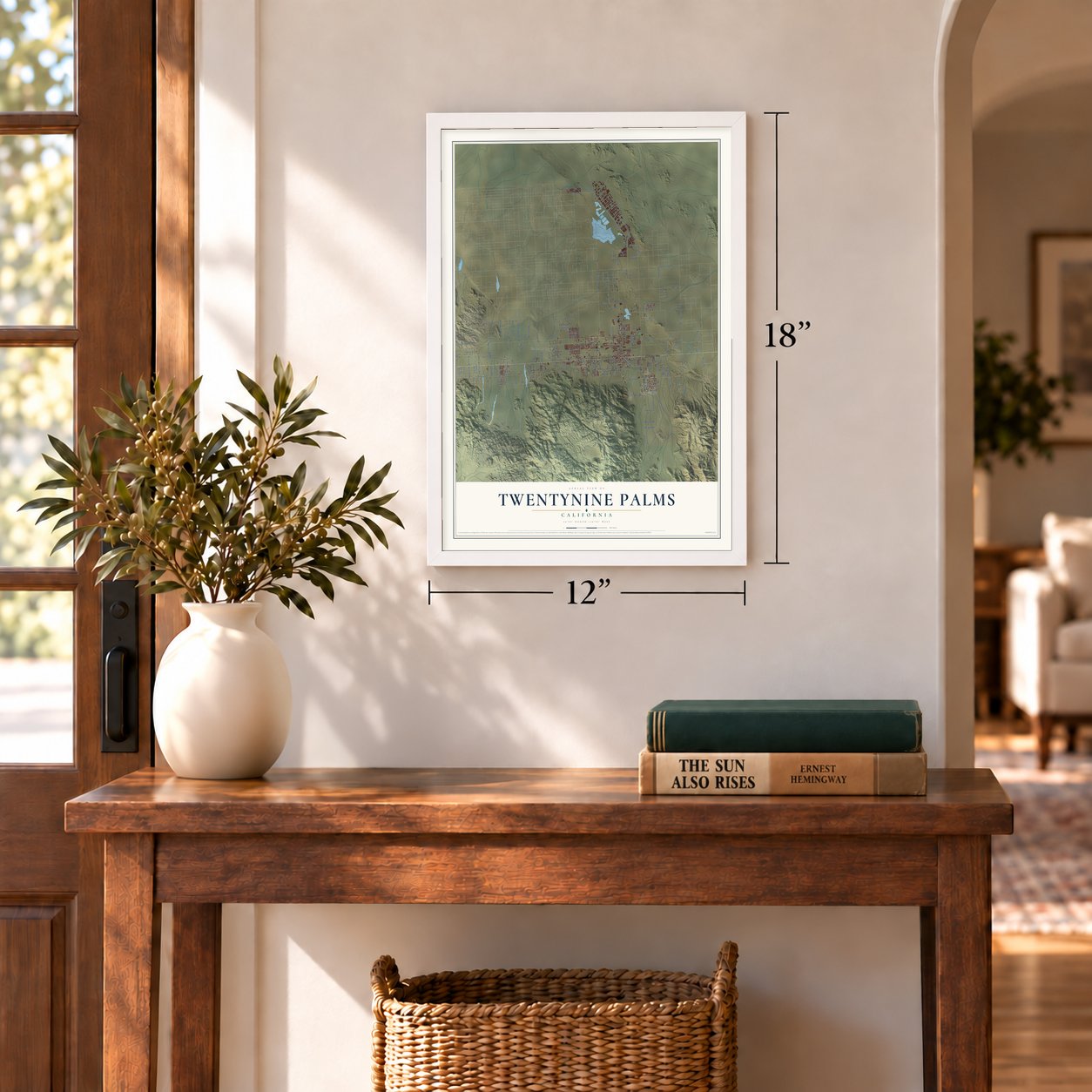
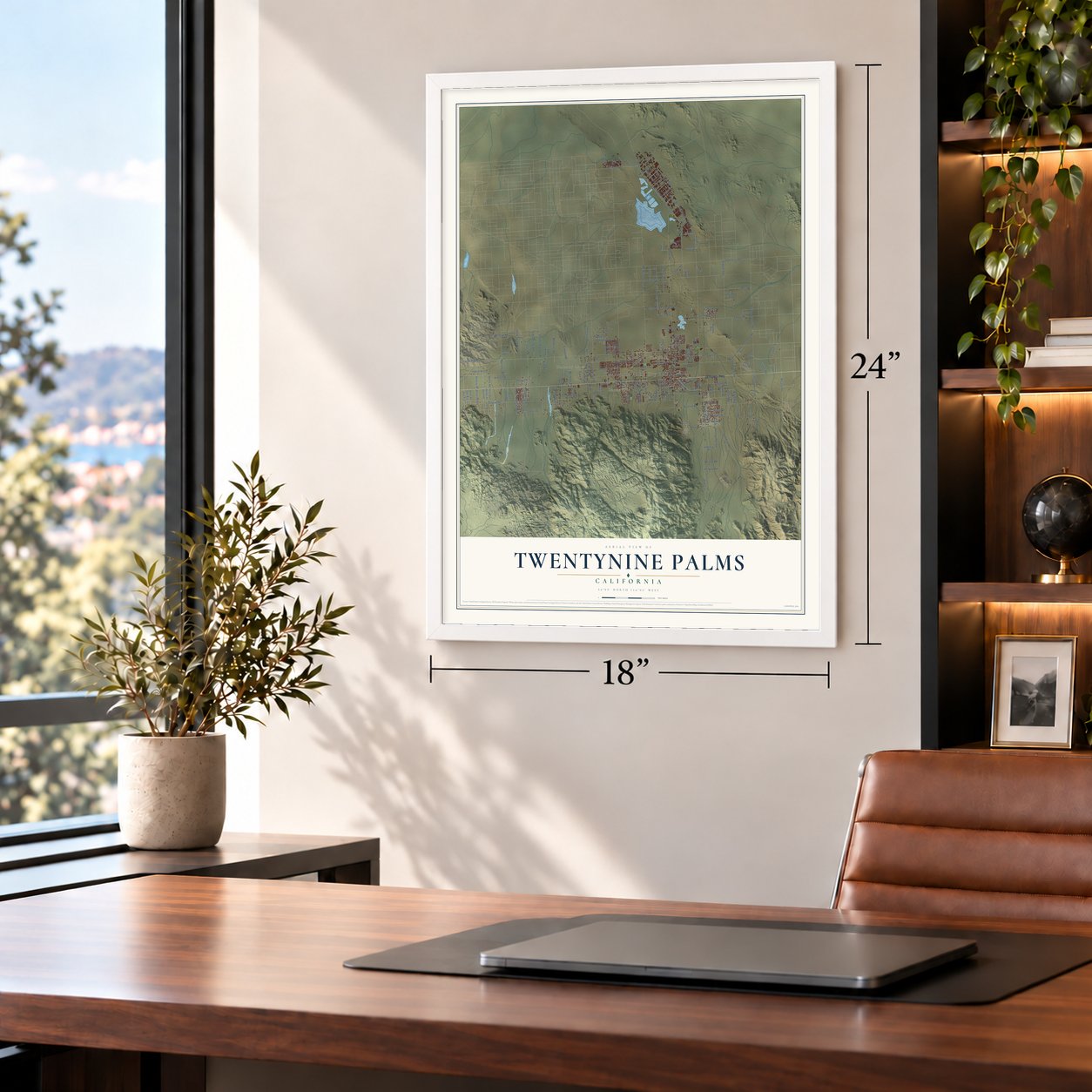
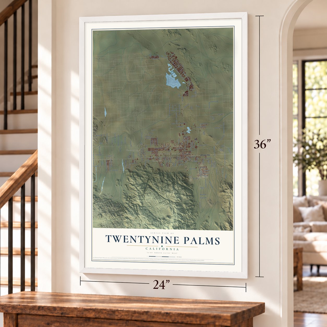
Twentynine Palms, California Map Art
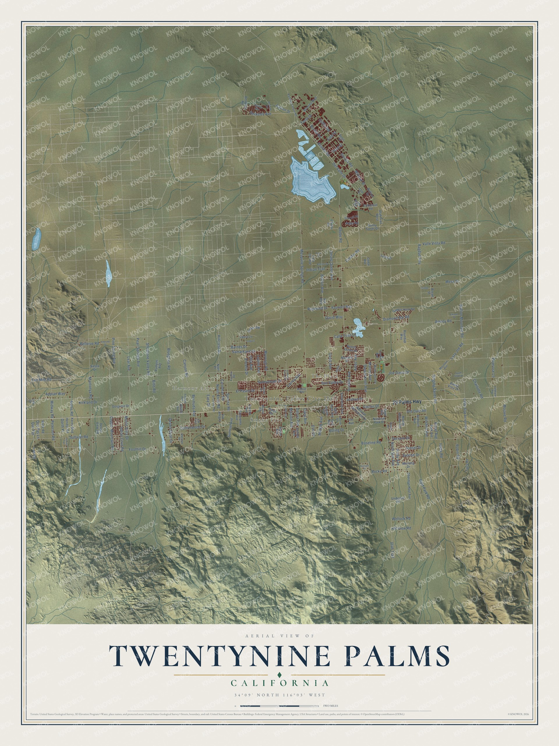
A new map of Twentynine Palms, California, made in 2026 and printed to order on thick archival matte paper.
12" x 18" Archival Matte Print
A Map of Home. A Work of Art.
Explore Twentynine Palms, California from a whole new perspective. Created using aerial imagery and detailed geographic data, this map captures Twentynine Palms building by building, with labeled streets, familiar landmarks, and shaded topographical relief that highlights the natural contours of the landscape.
Combining modern data with the timeless character of a vintage atlas, this map is just as interesting up close as it is beautiful on the wall. Whether you grew up in Twentynine Palms, spent memorable years there, or call it home today, this unique map is a great way to celebrate a place that means something to you. Zoom in on the preview to look for your street, and then order a print to put your memories on the wall.
Three ways to hang it
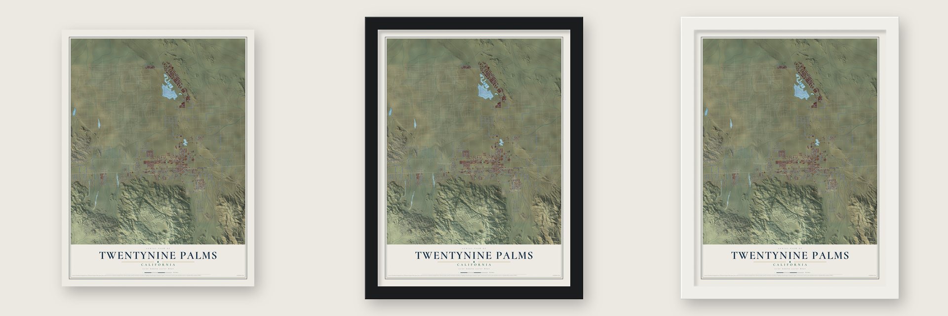
Unframed archival matte, a black wood frame or a white wood frame.
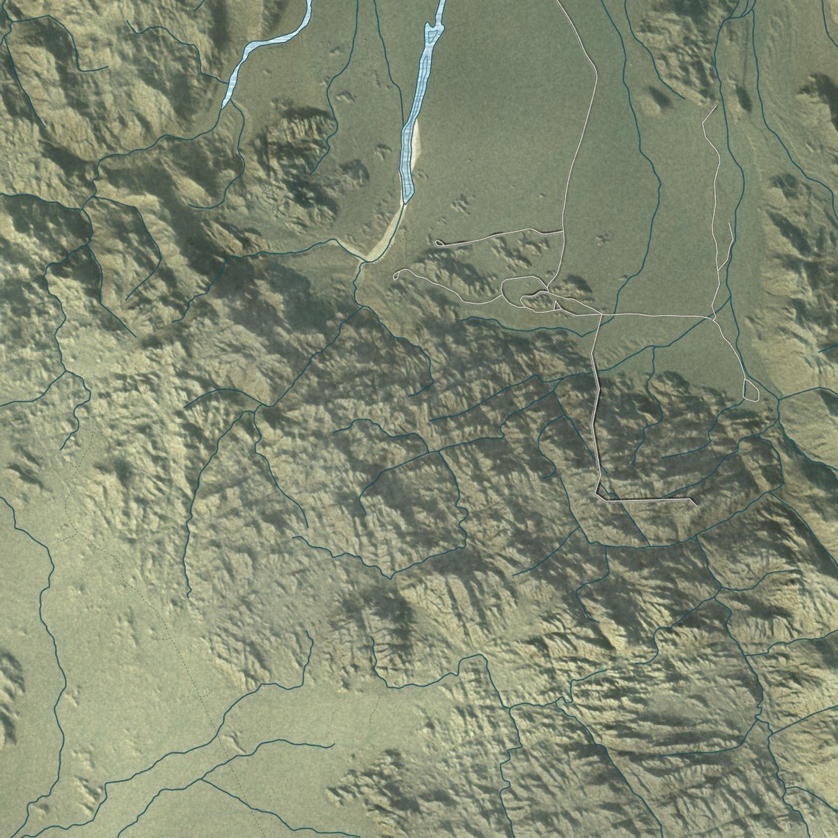
Up close
Geography Worth Displaying
This map was created using accurate cartographic data and authoritative geographic sources, including the U.S. Geological Survey and the Census Bureau. The map brings together terrain, waterways, roads, and building detail. The majority of the streets are labeled, houses are accurately depicted, and the topography is derived from government sources. Combining local data with carefully composed color and shading leads to this beautifully detailed Twentynine Palms artwork for your wall.
Rather than simply showing street outlines, we’ve included as many of the street names as we could reasonably fit on the map while keeping their names legible. Zoom in on the high resolution preview to see exactly what’s on the map. We truly set out to create a statement piece for anyone who loves Twentynine Palms. So whether it’s for you, or a gift for someone you love, we hope this map of Twentynine Palms brings back fond memories.
Read the story behind this map of Twentynine Palms, California from 2026.

About Twentynine Palms, California
Twentynine Palms is a city of 28,065 people in San Bernardino County, high in the Mojave Desert at 1,988 feet. It grew up around a spring that the Chemehuevi called Mar-rah, now known as the Oasis of Mara. The Serrano had planted 29 palms around that spring, and the town took its name from those trees.
Colonel Henry Washington was the first to record a trip to this ground. He found Chemehuevi people living by the spring and in the nearby hills. Early cattlemen later came for the oasis water while their herds grazed in the Queen Valley. Wagon trains of the late nineteenth century reached the town from St. George, Utah, and the road called Utah Trail is named for them. A post office opened here in 1927.
- Gateway to Joshua TreeJoshua Tree became a national monument in 1936 and a national park in 1994. The park lies just south of town, and the Oasis of Mara is one of its entrances. About 140,000 people a year stop at the park visitor center at the east end of the palms.
- Hollywood radio in 1945The town's Auxiliary Naval Air Station put a national radio show on the air on March 11, 1945, when Edgar Bergen, Charlie McCarthy and Joan Blondell did The Chase and Sanborn Hour from the base. On April 22 the base hosted Jack Benny, whose program joked about the dry heat. The Marine Corps Air Ground Combat Center opened nearby in 1952, and the town's economy still leans on it.
- The Lady from 29 PalmsAllie Wrubel wrote the song in 1947. Frank Sinatra and The Andrews Sisters both recorded it. Robert Plant later had a hit called "29 Palms" in 1993.
- A Weed Show every NovemberThe 29 Palms Historical Society keeps its local history museum in the town's first schoolhouse. Each November it holds a Weed Show of art made from weeds. Around town, 26 outdoor murals show scenes of desert life and history.
- Chemehuevi rootsThe Chemehuevi Cemetery is on the National Register of Historic Places. Willie Boy, a Piute-Chemehuevi man born in 29 Palms, was the subject of the film Tell Them Willie Boy Is Here.
Find your street
Names on the Twentynine Palms map
Every name below is printed on this map. Look for your street, your school, the park where you played, or the pond down the road.
Places and landmarks4
- Twentynine Palms City Hall
- Harmony Acres
- Smoke Tree
- The Plaza
Streets and roads190
- 29 Palms Highway
- Midway Road
- Peterson Road
- Foothill Drive
- Del Valle Drive
- Dorth Place
- Sullivan Road
- Berkeley Avenue
- Kerns Road
- Tenth Street
- Two Mile Road
- Utah Trail
- Adobe Road
- El Paseo Drive
- Mesquite Springs Road
- Bullion Mountain Road
- Amboy Road
- Sunnyslope Drive
- Mesa Drive
- Valle Vista Road
- Baseline Road
- Cottonwood Drive
- Desert Knoll Avenue
- Cactus Drive
- Old Dale Road
- Gold Park Road
- Indian Trail
- Mantonya Road
- Araby Avenue
- Sunrise Road
Show all 190 streets
- Bullion Avenue
- Canyon Road
- Indian Cove Road
- Joe Davis Drive
- Mojave Road
- Samarkand Drive
- Morongo Road
- Joshua Drive
- Shoshone Valley Road
- Lear Avenue
- Bagdad Highway
- Singing Sands Road
- Copper Mountain Road
- Wilshire Avenue
- Sun Valley Drive
- Diamond Bar Road
- Encelia Drive
- Lupine Avenue
- Condor Road
- Raymond Drive
- Datura Avenue
- Sturgis Road
- Robin Road
- Desert Queen Avenue
- North Star Avenue
- Lee Road
- Que Pas
- Brown Road
- Bourke Road
- Larrea Avenue
- Sunrise Drive
- Serrano Drive
- Pine Spring Avenue
- Griffin Road
- Ocotillo Avenue
- Aztec Avenue
- Appian Way
- Desert Quail Drive
- Bluegrass Road
- Rocky Road
- Isleta Road
- Bermuda Avenue
- Barnes Drive
- Clare Avenue
- Charlotte Road
- Hillcrest Drive
- Primrose Lane
- Pearl Springs Avenue
- Easy Street
- Noels Knoll Road
- Carodean Road
- Chia Avenue
- Sunset Drive
- Boling Drive
- Falcon Street
- Oasis Avenue
- Margot Avenue
- Mission Avenue
- Mineral Street
- Marine Avenue
- Kirkland Drive
- Sunrise Avenue
- Fifth Street
- Que Pas Lane
- Monte Vista Drive
- Bellerue Road
- Cove Vw
- Calle Todd Lane
- Third Street
- Elm Drive
- Lazy Joe Road
- Broad Avenue
- Hill View Road
- Wellock Road
- David Way
- Bibb Road
- National Park Drive
- Smoketree Avenue
- Encelia Avenue
- Gorgonio Drive
- Sherman Hoyt Avenue
- Buena Vista Drive
- Manana Drive
- Maude Adams Avenue
- Siesta Drive
- Split Rock Avenue
- Alpine Avenue
- Bedouin Avenue
- Raymond Way
- Foley Drive
- National Monument Drive
- Cable Stop Across Road
- Hatch Road
- Kerns Boulevard
- Tapia Road
- Juniper Avenue
- Morning Drive
- Broad Street
- Lazy Joe Avenue
- Hill Boulevard
- Saddle Horn Road
- Bullion Drive
- Hendys Road
- Desert View Road
- Agate Road
- Panorama Avenue
- Luckie Avenue
- Park Avenue
- Underhill Road
- Pine Avenue
- Boonies Boulevard
- Cottontail Road
- Utah Trail West
- Sage Avenue
- Argos Road
- Sunny Sands Drive
- Pampas Avenue
- Desert Dunes Drive
- Via Allegra
- Roundup Way
- Cedar Avenue
- Wolfe Road
- Laura Lane
- Berkeley Road
- Inn Avenue
- Cholla Road
- Alfalfa Avenue
- Noel Place
- Lee Drive
- Rainbow Canyon Road
- Timothy Avenue
- Mojave Avenue
- El Rey Avenue
- Sherman Road
- Wainwright Avenue
- Upshur Avenue
- Bemis Road
- El Comino Road
- Hillside Avenue
- Sand Hill Road
- Mountain Avenue
- Elk Trail
- Feldspar Avenue
- Gold Drive
- Wildcat Way
- Fuschia Road
- Starlight Drive
- Cahuilla Avenue
- Tamarisk Avenue
- Bagley Avenue
- Ramona Drive
- Taco Drive
- South Slope Drive
- La Buena Tierra Avenue
- Emerald Street
- Westside Road
- Elkhorn Drive
- Todd Lane
- Jackass Trail
- Roberts Avenue
Names are listed as they appear on the printed map. Zoom into the product photos to find them.
The art of mapping a place
How This Map Was Made
Real places. Remarkable detail. Discover the layers that turn geographic data into a map of home.

The view from above
Aerial imagery reveals the character of the land: woodland, open fields, and the patterns of a place.

The shape of the land
Elevation data brings hills, valleys, and subtle changes in the landscape into view.

The details of home
Roads, waterways, and building footprints come together to make the map feel unmistakably local.

Geography becomes art
Considered color, shading, and typography bring the layers together in a map made for your wall.


Process illustrated with Mendon, Massachusetts. Aerial imagery: USDA NAIP. Terrain: USGS 3D Elevation Program. Map details and finished artwork: KNOWOL.
The Details
About This Print
Choose an archival matte print, or a black or white Ayous wood frame. The archival matte print is unframed.
Select your size and finish above to see the matching product image and price.
Materials & Craftsmanship
A contemporary map with the character of a classic atlas, printed on archival matte paper. Optional frames are made from Ayous wood.
Your printed map does not include the watermark shown in the full-map preview.
Shipping & Delivery
Free shipping within the United States. Every print is made to order in the USA.
Buying a gift? Add a note in your cart and we'll include it. We never put prices in the package.
Prints ship within 2 to 3 business days. Allow 7 to 10 days total from ordering for delivery. Timing may vary during holidays or periods of high order volume.
Read our shipping policy.
Returns and damaged prints
Each print is made to order. Change-of-mind refunds are not available after production.
If your print arrives damaged, misprinted or incorrect, contact support@knowol.com within 30 days of receiving it. Include your order number, photos and a description of the issue.
Read our full refund and replacement policy. For questions about your order, email support@knowol.com.
Find your town
Looking for another city?
Find a map of home in our California collection, or any town in the country.
Nearby
Maps of towns near Twentynine Palms
Know someone from one of these towns? Their map makes a great gift.
 Joshua Tree
, California
From $39.99See the map
 Yucca Valley
, California
From $39.99See the map
 Homestead Valley
, California
From $39.99See the map
More maps nearby: Indio Hills, Sky Valley, Desert Edge, Thousand Palms and Garnet.