
Search for another town





Free U.S. delivery 7 to 10 days after you order
Vermilion, Ohio Map Art
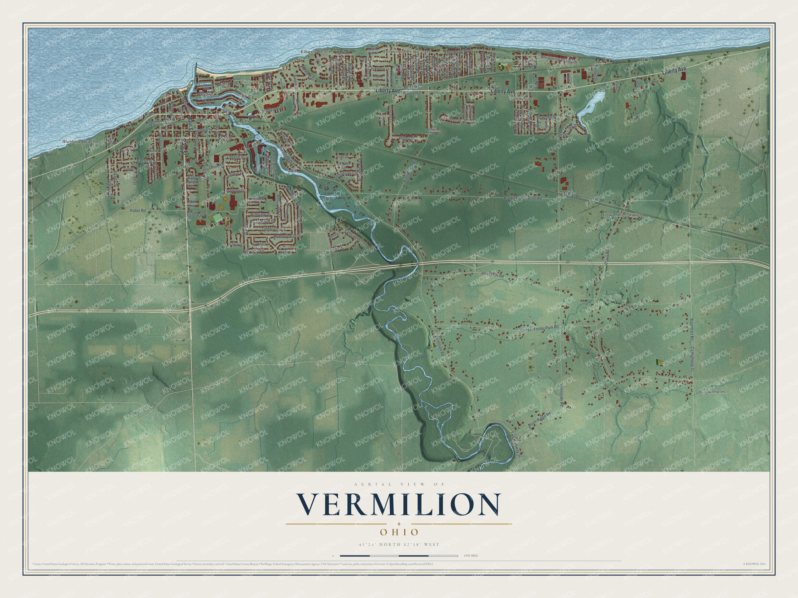
A new map of Vermilion, Ohio, made in 2026 and printed to order on thick archival matte paper.
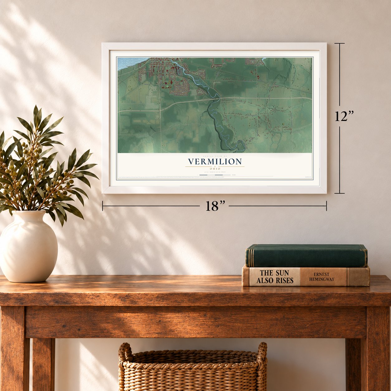
12" x 18" Archival Matte Print
A Map of Home. A Work of Art.
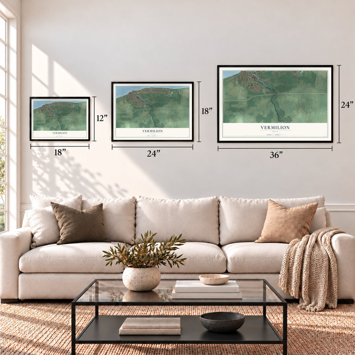
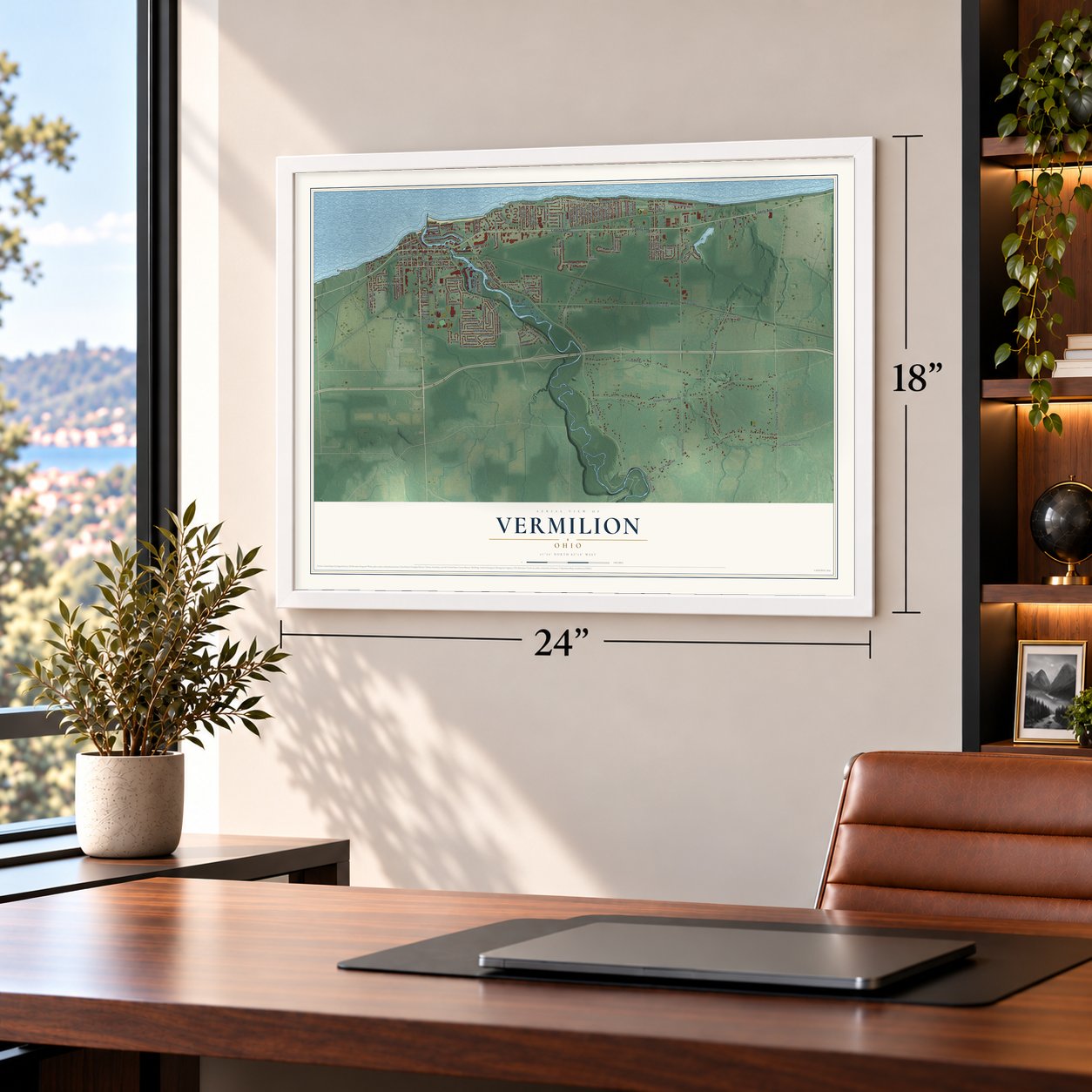
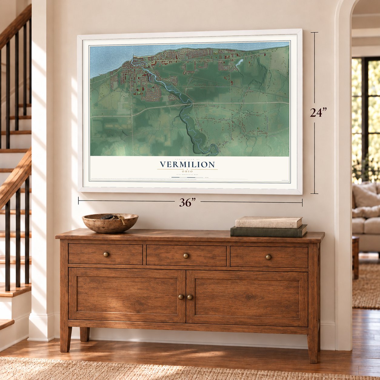
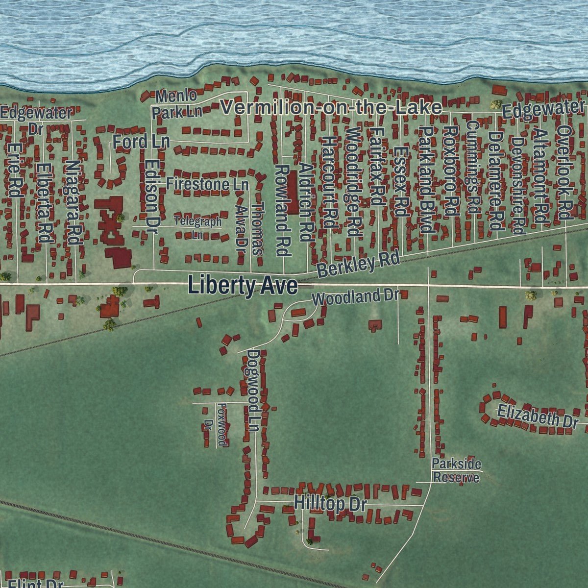
This beautifully detailed map of Vermilion, Ohio was created in 2026 using aerial imagery combined with modern topographical, census, street and landmark data. It's a modern aerial view of Vermilion in Lorain County, Ohio, that combines modern data with a vintage aesthetic. Zoom in on the preview and look for your block.
Three ways to hang it
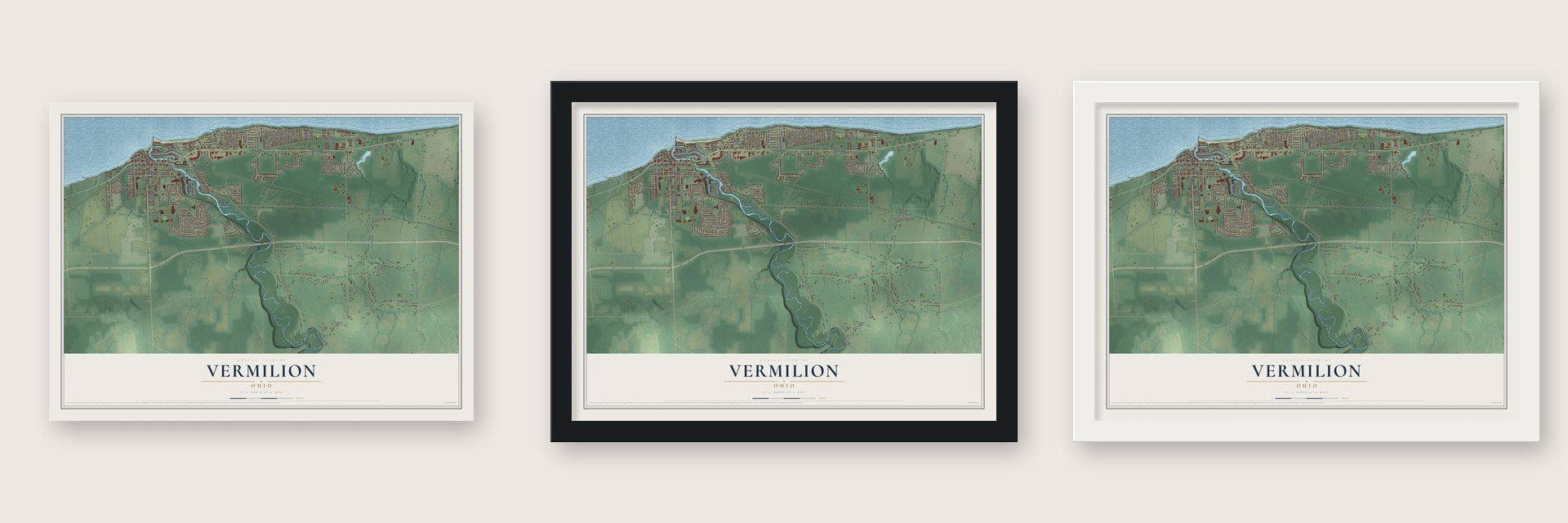
Unframed archival matte, a black wood frame or a white wood frame.
Up close
Real geography. Art worth displaying.
This map was created using accurate cartographic data and authoritative geographic sources, including the U.S. Geological Survey and the Census Bureau. The map brings together terrain, waterways, roads, and building detail. The majority of the streets are labeled, houses are accurately depicted, and the topography is derived from government sources. Combining local data with carefully composed color and shading leads to this beautifully detailed Vermilion artwork for your wall.
Rather than simply showing street outlines, we’ve included as many of the street names as we could reasonably fit on the map while keeping their names legible. Zoom in on the high resolution preview to see exactly what’s on the map. We truly set out to create a statement piece for anyone who loves Vermilion. So whether it’s for you, or a gift for someone you love, we hope this map of Vermilion brings back fond memories.
Read the story behind this map of Vermilion, Ohio from 2026.
About Vermilion, Ohio
Vermilion stands on Lake Erie and spans Erie and Lorain counties. Settled in the early 19th century, it developed around fishing, boatbuilding, and a harbor at the Vermilion River. Beaches, cottages, and recreational boating later contributed to its identity as a resort community, while the Harbor Town Historic District reflects its maritime past.
- Population CountThe 2020 census counted 10,659 people in Vermilion.
- Village to CityVermilion was incorporated as a village in 1837 and became a city after its 1960 merger with Vermilion-on-the-Lake.
- Harbor LightIn 1847, the United States Congress built the Vermilion Lighthouse to assist navigation on Lake Erie.
- Parks and RiverVermilion has more than 12 parks and facilities, including the Bacon Woods and Mill Hollow areas of the Vermilion River Reservation.
- Festival CalendarThe three-day Festival of the Fish occurs each June, while the Woollybear Festival includes Ohio's longest parade.
Find your street
Names on the Vermilion map
Every name below is printed on this map. Look for your street, your school, the park where you played, or the pond down the road.
Places and landmarks8
- Elberta Beach
- Vermilion-on-the-Lake
- Brownhelm
- Sunnyside
- Linwood Park
- Showse Park
- Bluebird Beach
- Brownhelm Station
Streets and roads140
- State Street
- Main Street
- Liberty Avenue
- Riverside Drive
- County Highway 51
- Vermilion Road
- Salem Drive
- Sunnyside Road
- Brownhelm Station Road
- Cooper Foster Park Road
- Claus Road
- North Ridge Road
- Jerusalem Road
- Baumhart Road
- West River Road
- Edgewater Boulevard
- High Bridge Road
- Berkley Road
- Hollyview Drive
- Sanford Street
- Woodside Avenue
- South Street
- Haber Road
- Ohio Street
- Douglas Street
- Portage Drive
- Decatur Street
- Station Road
- Sailorway Drive
- Howard Drive
Show all 140 streets
- Ferndale Avenue
- Hazelwood Avenue
- Guilford Road
- Mapleview Drive
- Adams Street
- Park Drive
- Jefferson Street
- Washington Street
- Timberview Drive
- Edson Street
- Rowland Road
- Beechview Drive
- Essex Road
- Whispering Shores Drive
- Perry Street
- Arrowhead Drive
- Exchange Street
- Hilltop Drive
- Aldrich Road
- Overlook Road
- Twp Highway 34
- Harcourt Road
- Jackson Street
- Bridgeport Drive
- Ford Lane
- Devon Drive
- Woodridge Road
- Edison Drive
- Morton Road
- Cliffside Drive
- Erie Road
- Niagara Road
- Elberta Road
- Altamont Road
- Anchor Point Drive
- Pineview Drive
- Fairfax Road
- Woodview Drive
- Grand Street
- Shady Lake Drive
- Portland Drive
- Parkland Boulevard
- Linda Drive
- Sandusky Street
- Roxboro Road
- Tomahawk Lane
- Nautical Drive
- Delamere Road
- Bryant Drive
- Langfitt Street
- Flint Drive
- Lorain Avenue
- Willow Lane
- Lansing Road
- Roanoke Drive
- Haley Street
- Helen Drive
- Ewa Yea Street
- Avon Avenue
- Morris Drive
- Fifth Street
- Mill Street
- Menlo Park Lane
- Edgewater Drive
- Columbus Street
- Regina Drive
- Woodland Drive
- Conneaut Light Drive
- Rolling Meadows Drive
- Sweetbriar Drive
- Birchview Drive
- Devonshire Road
- Huron Street
- Kensington Road
- Tilden Street
- Elizabeth Drive
- Cummings Road
- First Street
- Dogwood Lane
- Mornington Road
- Elyria Avenue
- South Shore Court
- Oakview Drive
- Claremont Road
- Firestone Lane
- Driftwood Drive
- Marina Drive
- Thomas Alva Drive
- Blissful Road
- Northview Court
- Concord Drive
- Nicholson
- Anchorage Way
- Idle View Drive
- Shawnee Court
- Fisher Street
- Hartford Avenue
- Martin Avenue
- Ash Street
- Oakwood Drive
- Parkside Reserve
- Kishman Avenue
- Ballast Court
- Yorktown Place
- Arlington Drive
- Minnie Wawa Street
- Telegraph Lane
- Nantucket Place
- Foxwood Drive
- Toledo Street
Names are listed as they appear on the printed map. Zoom into the product photos to find them.
The art of mapping a place
How This Map Was Made
Real places. Remarkable detail. Discover the layers that turn geographic data into a map of home.

The view from above
Aerial imagery reveals the character of the land: woodland, open fields, and the patterns of a place.

The shape of the land
Elevation data brings hills, valleys, and subtle changes in the landscape into view.

The details of home
Roads, waterways, and building footprints come together to make the map feel unmistakably local.

Geography becomes art
Considered color, shading, and typography bring the layers together in a map made for your wall.


Process illustrated with Mendon, Massachusetts. Aerial imagery: USDA NAIP. Terrain: USGS 3D Elevation Program. Map details and finished artwork: KNOWOL.
The Details
About This Print
Choose an archival matte print, or a black or white Ayous wood frame. The archival matte print is unframed.
Select your size and finish above to see the matching product image and price.
Materials & Craftsmanship
A contemporary map with the character of a classic atlas, printed on archival matte paper. Optional frames are made from Ayous wood.
Your printed map does not include the watermark shown in the full-map preview.
Shipping & Delivery
Free shipping within the United States. Every print is made to order in the USA.
Buying a gift? Add a note in your cart and we'll include it. We never put prices in the package.
Prints ship within 2 to 3 business days. Allow 7 to 10 days total from ordering for delivery. Timing may vary during holidays or periods of high order volume.
Read our shipping policy.
Returns and damaged prints
Each print is made to order. Change-of-mind refunds are not available after production.
If your print arrives damaged, misprinted or incorrect, contact support@knowol.com within 30 days of receiving it. Include your order number, photos and a description of the issue.
Read our full refund and replacement policy. For questions about your order, email support@knowol.com.
Find your town
Looking for another city?
Find a map of home in our Ohio collection.
Nearby
Maps of towns near Vermilion
Know someone from one of these towns? Their map makes a great gift.


