
Search for another town





Free U.S. delivery 7 to 10 days after you order
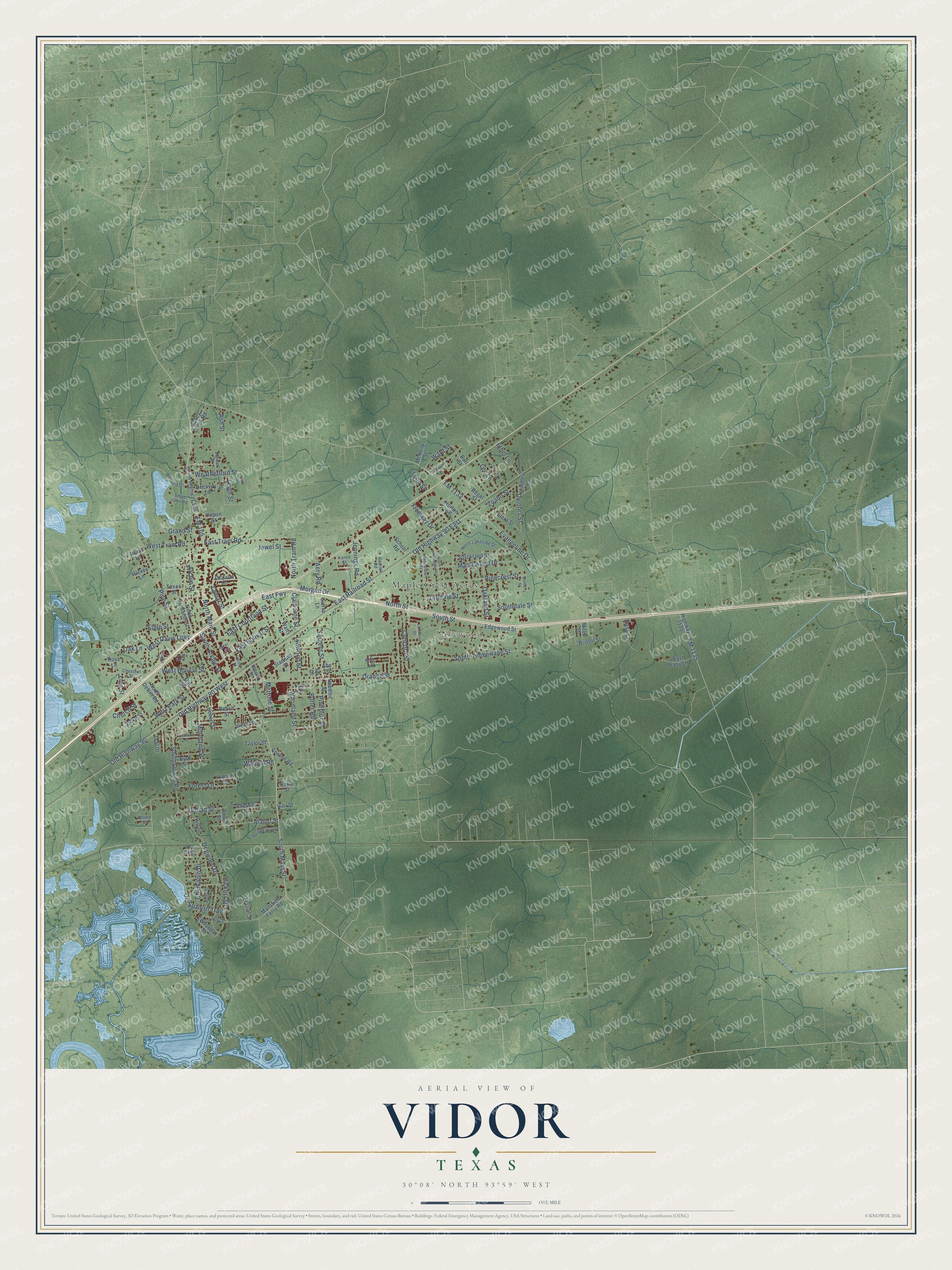
Vidor, Texas Map Art
Building by building, with labeled streets and shaded relief.
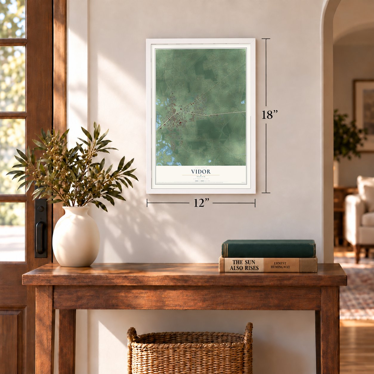
12" x 18" Archival Matte Print
A Map of Home. A Work of Art.
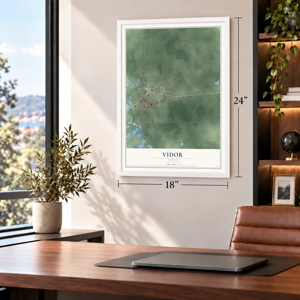
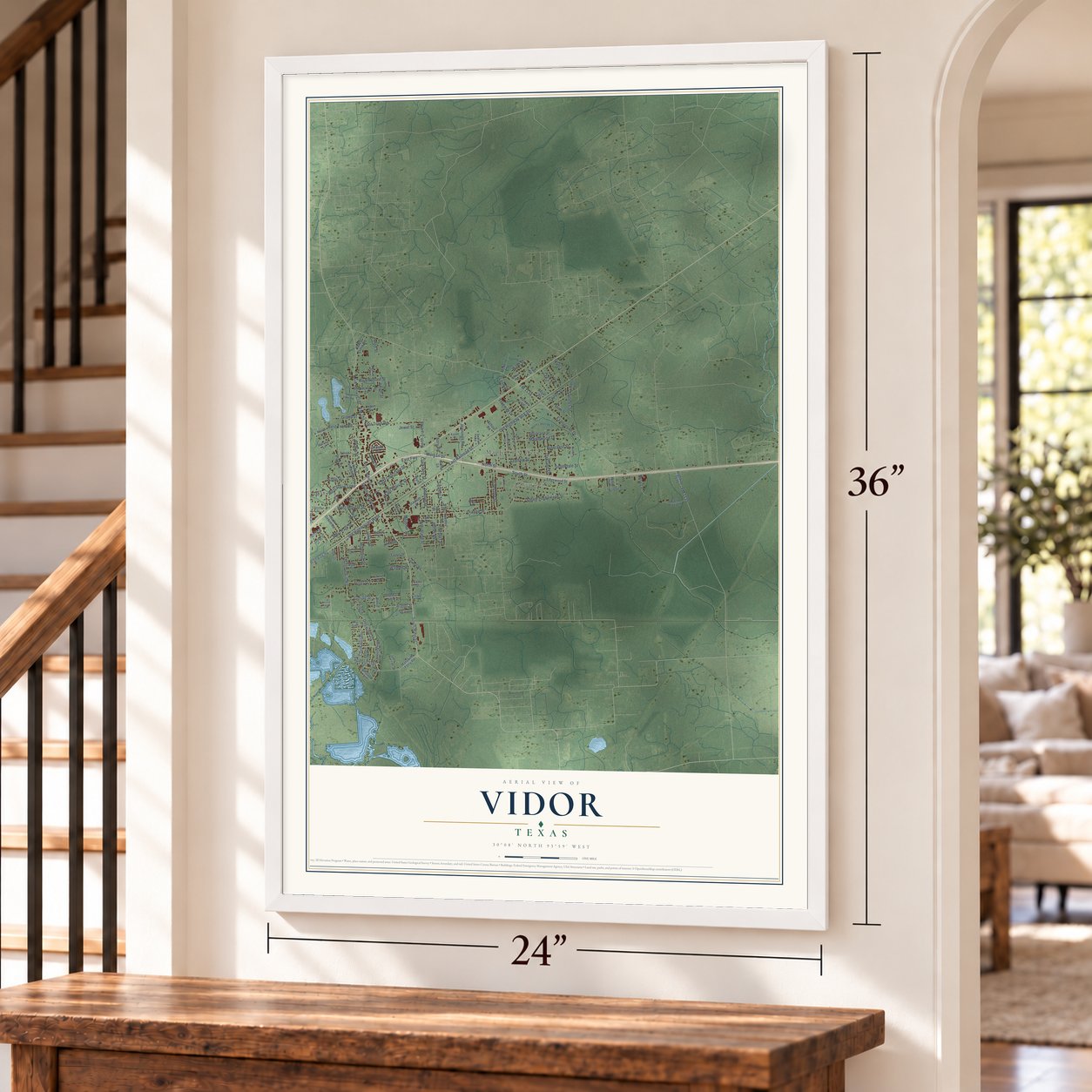
Explore Vidor, Texas from a whole new perspective. Created using aerial imagery and detailed geographic data, this map captures Vidor building by building, with labeled streets, familiar landmarks, and shaded topographical relief that highlights the natural contours of the landscape.
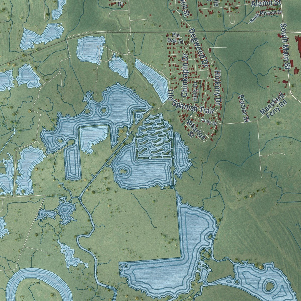
Combining modern data with the timeless character of a vintage atlas, this map is just as interesting up close as it is beautiful on the wall. Whether you grew up in Vidor, spent memorable years there, or call it home today, this unique map is a great way to celebrate a place that means something to you. Zoom in on the preview to look for your street, and then order a print to put your memories on the wall.
Three ways to hang it
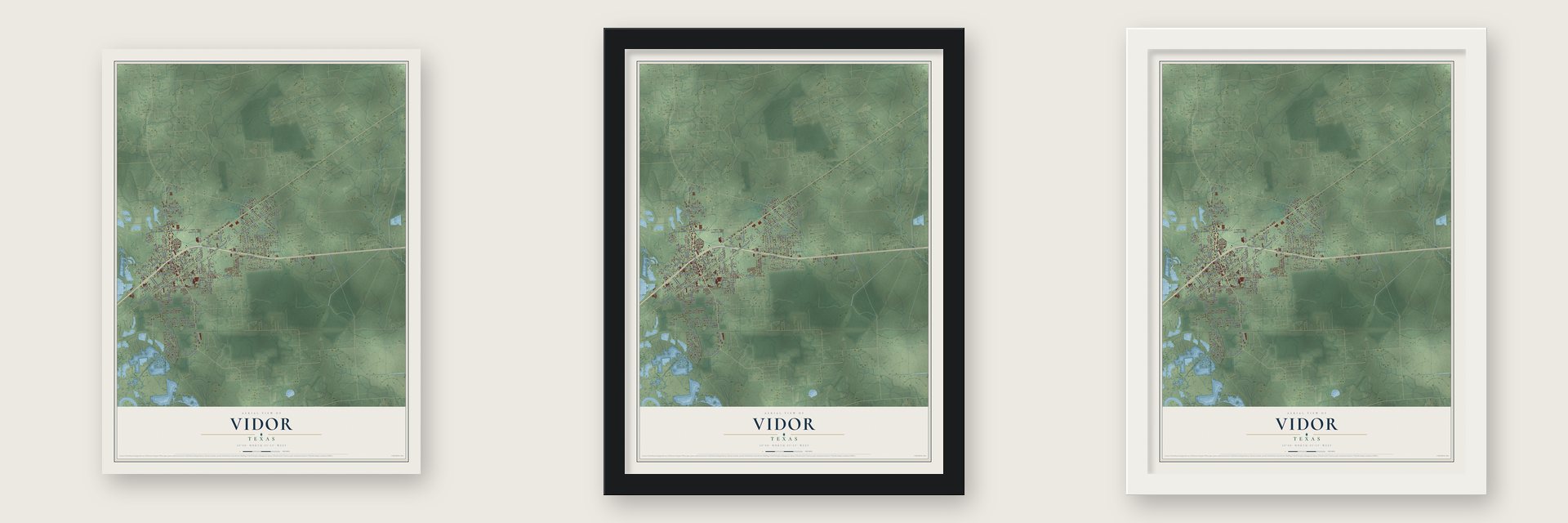
Unframed archival matte, a black wood frame or a white wood frame.
Up close
Geography Worth Displaying
This map was created using accurate cartographic data and authoritative geographic sources, including the U.S. Geological Survey and the Census Bureau. The map brings together terrain, waterways, roads, and building detail. The majority of the streets are labeled, houses are accurately depicted, and the topography is derived from government sources. Combining local data with carefully composed color and shading leads to this beautifully detailed Vidor artwork for your wall.
Rather than simply showing street outlines, we’ve included as many of the street names as we could reasonably fit on the map while keeping their names legible. Zoom in on the high resolution preview to see exactly what’s on the map. We truly set out to create a statement piece for anyone who loves Vidor. So whether it’s for you, or a gift for someone you love, we hope this map of Vidor brings back fond memories.

Find your street
Names on the Vidor map
Every name below is printed on this map. Look for your street, your school, the park where you played, or the pond down the road.
Places and landmarks2
- Lakewood
- Maple Crest Acres
Streets and roads145
- FM 105
- South Main Street
- Evangeline Drive
- North Street
- East Railroad Street
- Old Highway 90 East
- Old Highway 90 West
- Old Spanish Trail
- Zoann Street
- South Street
- Old Highway 90
- Delores Street
- North Main Street
- East Fwy
- FM 1132
- Orange Street
- South Timberlane Street
- Pinecrest Street
- Dogwood Drive
- Lyndale Street
- Pine Street
- South Dewitt Road
- East Tram Road
- Maplewood Drive
- Woodland Street
- East Bolivar Street
- Morgan Drive
- West Park Street
- East Courtland Street
- West Davis Loop
Show all 145 streets
- Oakland Street
- Butler Road
- Concord Street
- West Bolivar Street
- Lamar Street
- Forest Lane
- Alamo Street
- West Tram Road
- Sargent Street
- Southdale Street
- Chinkapin Drive
- Goliad Street
- Moreland Street
- Pineburr Street
- FM 1135
- South Archie Street
- Weatherford Street
- Jennings Road
- Lynwood Street
- North Tram Road
- Archie Street
- Elgie Street
- Oak Lane
- Grand Street
- Freeway Drive
- Lee Lane
- Ethel Lane
- Church Street
- Claiborne Street
- Easy Lane
- Hickory Drive
- Ward Street
- Jewel Street
- Melrose Street
- Aery Road
- Leigh Street
- Walden Road
- Ash Street
- Leon Street
- Lian Street
- North Highway 105
- North Tannahill Street
- Strickland Street
- North Dewitt Road
- Highway 1135
- Needles Street
- Mill Street
- Edgewood Street
- Flora Street
- Wharton Street
- Mansfield Ferry Road
- Hebert Street
- Byrd Street
- East Easy Lane
- Beach Street
- Hickory Lane
- Caney Creek Road
- Jackson Drive
- Stadium Street
- Yupon Street
- Cornell Road
- Laura Lane
- Frazier Street
- Regal Street
- Bristol Street
- McNeily Street
- Chesser Drive
- Taylor Street
- Burt Street
- Horton Street
- Texas Street
- Lynn Street
- Duke Street
- Sierra Lane
- Vidor Drive
- Hill Street
- Harvey Lane
- Teal Drive
- Millie Street
- Findley Lane
- School Road
- Watts Street
- Rene Lane
- Gail Street
- Bowie Street
- Carla Street
- Rose Lane
- Teri Drive
- Leta Street
- Abe Lane
- Ivy Lane
- North Lakeside Street
- Woodlawn Street
- Wexford Drive
- Smith Lake Road
- Berwick Street
- Holly Drive
- Chestnut Street
- Pin Oak Street
- Karen Street
- Rearick Road
- Vernon Street
- Allred Street
- North Timberlane Street
- Wilson Street
- Lakewood Drive
- Lawrence Lane
- North Mission Drive
- Polly Street
- Jeanette Street
- Vaughn Street
- Mulberry Street
- Ludlow Street
- Gulf Street
- Greer Street
Names are listed as they appear on the printed map. Zoom into the product photos to find them.
About Vidor, Texas
Vidor is a city of 9,789 people in western Orange County, six miles east of Beaumont. Logging crews moved into these woods after the Texarkana and Fort Smith Railroad was built in 1898, and the town took its name from Charles Shelton Vidor, a lumberman who bought the Beaumont Sawmill Company and went on to found the Miller-Vidor Lumber Company.
The community had its own post office by 1909. Four years later the company built a tram road known locally as the Peach Line, which let the loggers reach thousands of acres of virgin timber, so nearly everyone in Vidor worked for the company. When the nearby timber ran out in 1924, the company moved its operation to Lakeview. A few families stayed behind, the Miller-Vidor subdivision was platted in 1929, and rice, cotton and cattle became the new local trades.
- A city on the second voteThe weekly Vidorian newspaper started in 1955, a sign of a growing town. In 1959 voters turned down a plan to incorporate, but they changed their minds the next year and approved it 791 to 537, so Vidor became a city in 1960.
- From fifty people to 12,117Vidor had an estimated fifty residents in 1920. The count rose to 706 by 1940, 2,136 by 1950 and 9,738 by 1970. In 1974 Georgetown Texas Steel announced a new $50 million plant here, which drew still more families, and by 1980 the city had 12,117 people. It counted 10,935 in 1990 and 11,440 in 2000, along with 729 businesses.
- Named for King Vidor's fatherCharles Shelton Vidor, the lumberman whose company built the town and gave it its name, was the father of King Vidor, who grew up to become a film director.
- Rita, Ike and HarveyThree hurricanes did heavy damage in Vidor and the country around it: Rita in 2005, Ike in 2008 and Harvey in 2017. During one of these storms residents were under a mandatory evacuation order for about two weeks.
Keep exploring Texas
Vidor is one of 2,049 Texas towns we've mapped. Every dot on the map is a print of its own.
The search covers every state, Texas first.
Near Vidor
Order 2 or more town maps and save 10%. Shown in the size and finish you picked above, so they hang as a set.
- Rose City 12" x 18" / Archival Matte Print $39.99
- Pine Forest 12" x 18" / Archival Matte Print $39.99
- Orangefield 12" x 18" / Archival Matte Print $39.99


More maps nearby: Beaumont, Central Gardens, Mauriceville, Nederland and Bridge City.
The art of mapping a place
How This Map Was Made
Real places. Remarkable detail. Discover the layers that turn geographic data into a map of home.

The view from above
Aerial imagery reveals the character of the land: woodland, open fields, and the patterns of a place.

The shape of the land
Elevation data brings hills, valleys, and subtle changes in the landscape into view.

The details of home
Roads, waterways, and building footprints come together to make the map feel unmistakably local.

Geography becomes art
Considered color, shading, and typography bring the layers together in a map made for your wall.


Process illustrated with Mendon, Massachusetts. Aerial imagery: USDA NAIP. Terrain: USGS 3D Elevation Program. Map details and finished artwork: KNOWOL.
The Details
About This Print
Choose an archival matte print, or a black or white Ayous wood frame. The archival matte print is unframed.
Select your size and finish above to see the matching product image and price.
Materials & Craftsmanship
A contemporary map with the character of a classic atlas, printed on archival matte paper. Optional frames are made from Ayous wood.
Your printed map does not include the watermark shown in the full-map preview.
Shipping & Delivery
Free shipping within the United States. Every print is made to order in the USA.
Buying a gift? Add a note in your cart and we'll include it. We never put prices in the package.
Prints ship within 2 to 3 business days. Allow 7 to 10 days total from ordering for delivery. Timing may vary during holidays or periods of high order volume.
Read our shipping policy.
Returns and damaged prints
Each print is made to order. Change-of-mind refunds are not available after production.
If your print arrives damaged, misprinted or incorrect, contact support@knowol.com within 30 days of receiving it. Include your order number, photos and a description of the issue.
Read our full refund and replacement policy. For questions about your order, email support@knowol.com.