


Search for another town





Free U.S. delivery 7 to 10 days after you order
Wake Forest, North Carolina Map Art
Building by building, with labeled streets and shaded relief.
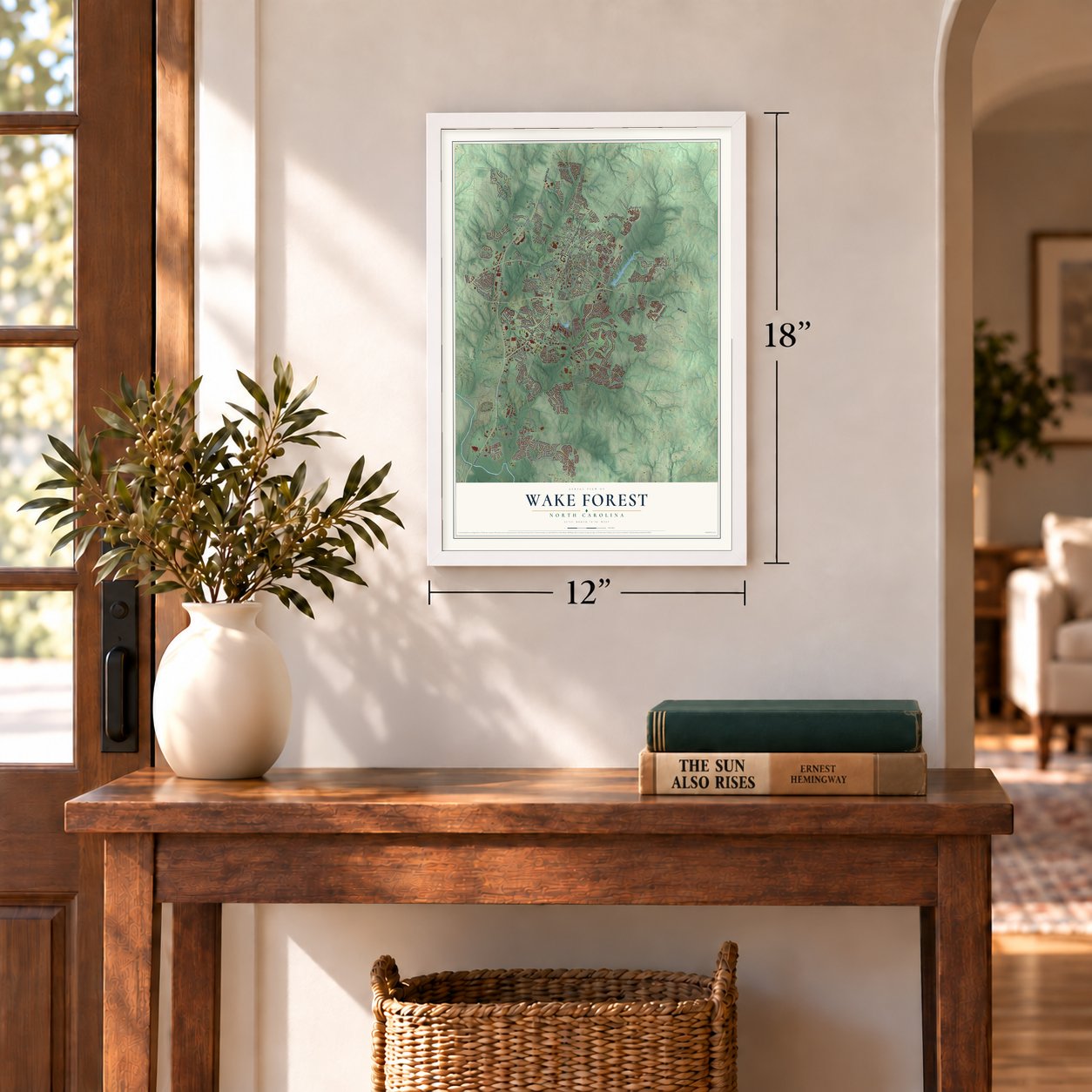
12" x 18" Archival Matte Print
A Map of Home. A Work of Art.
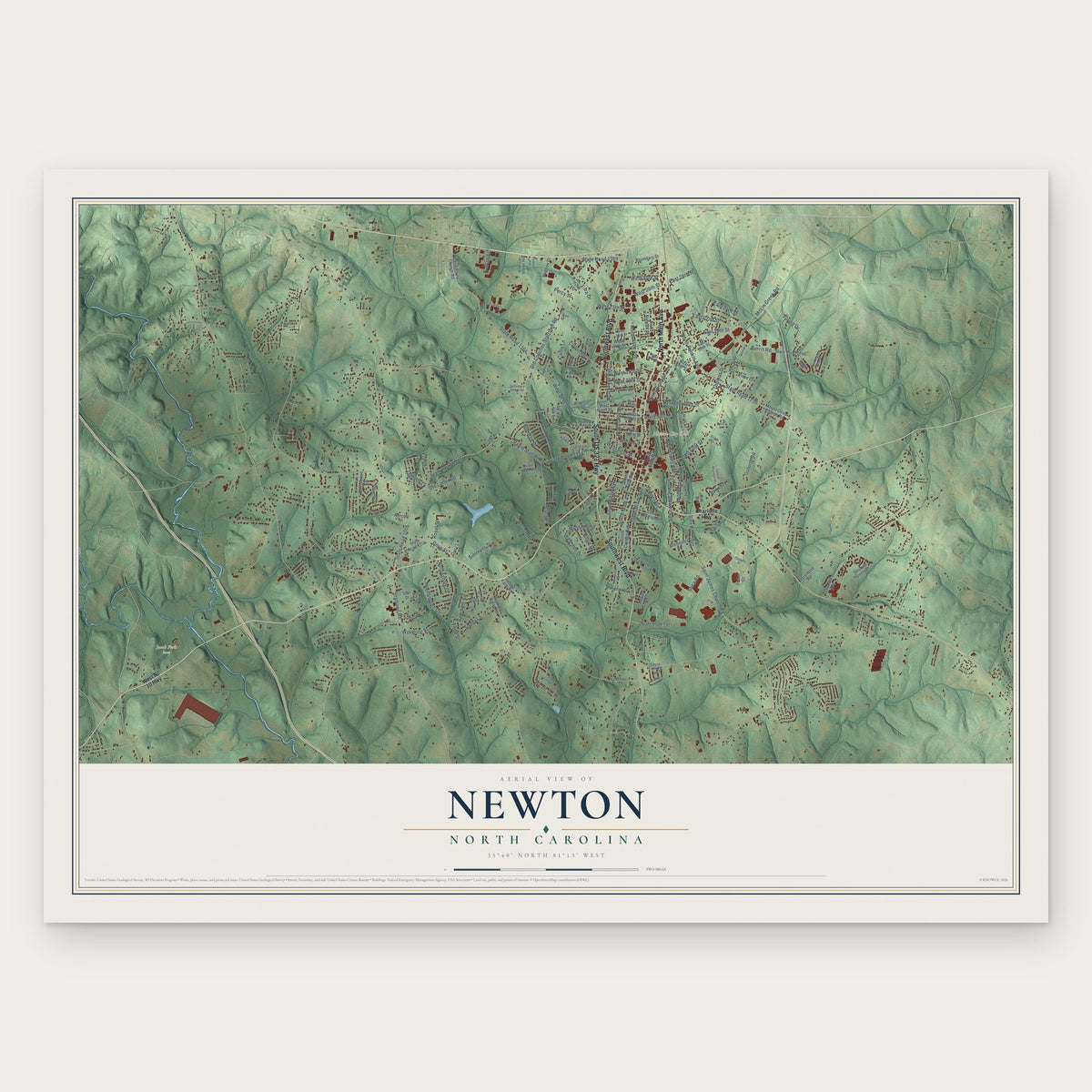
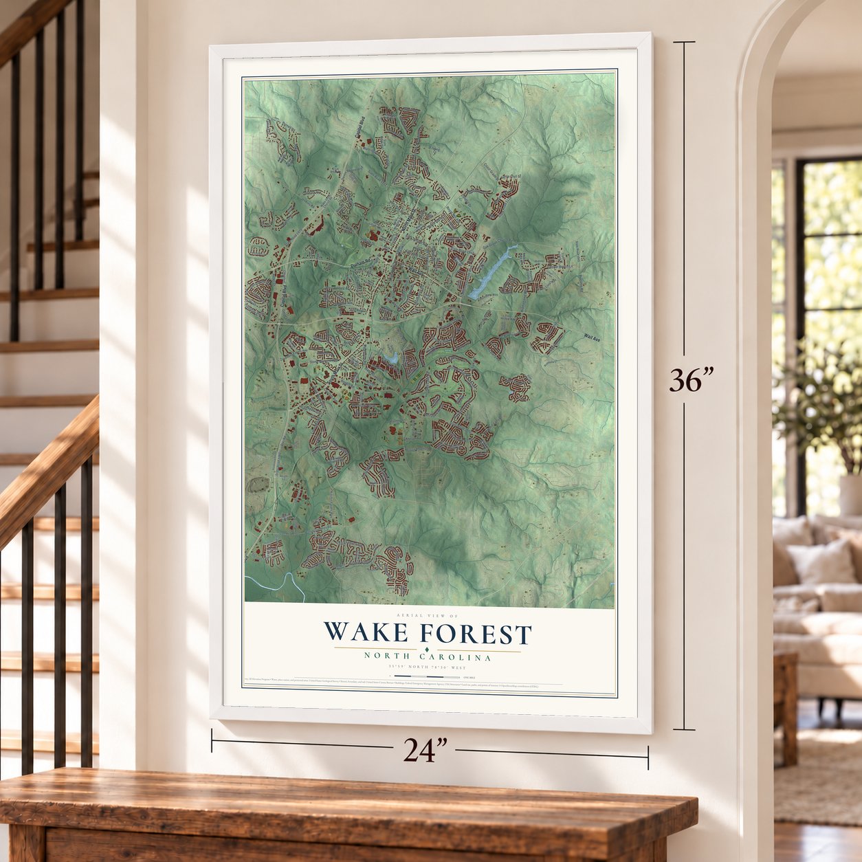
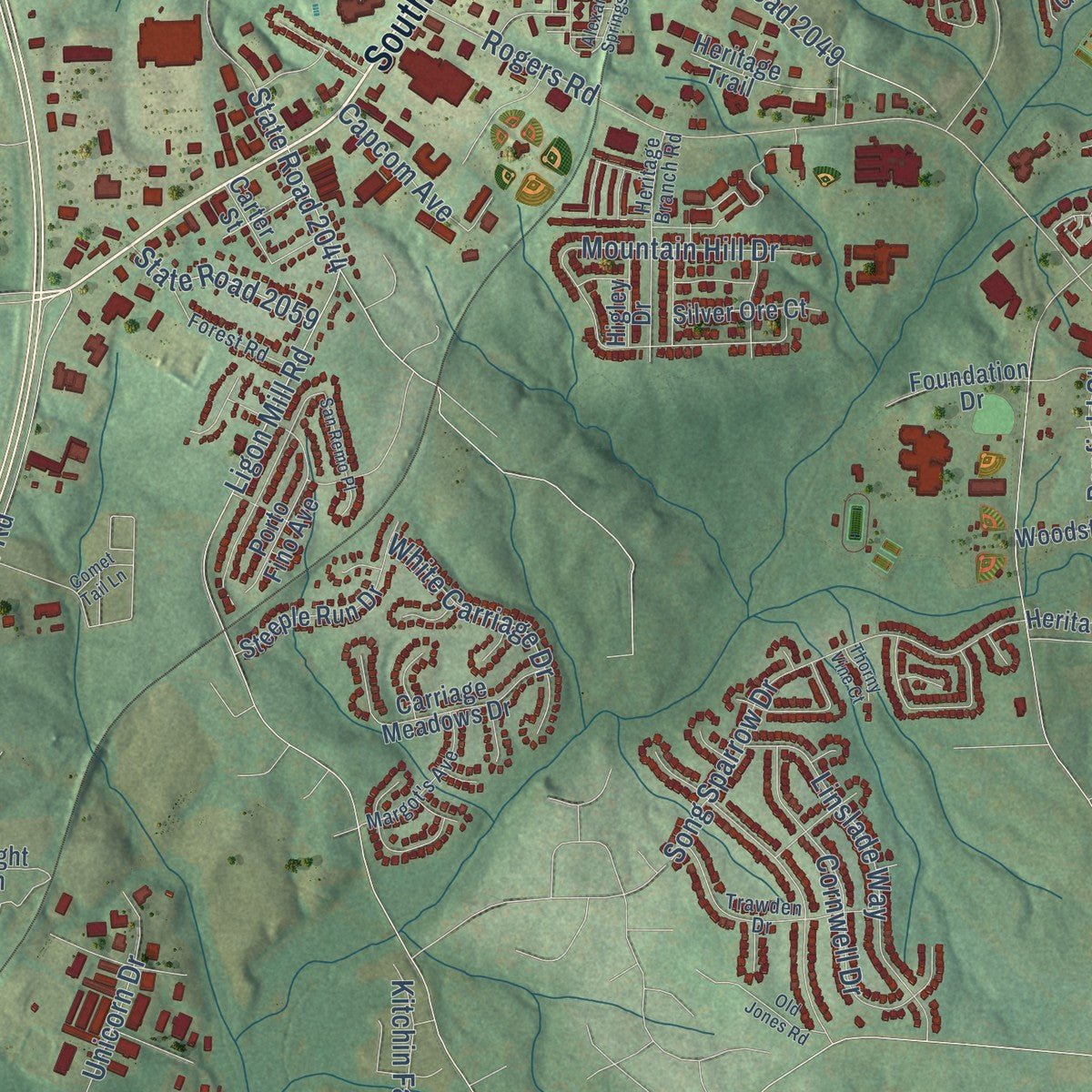
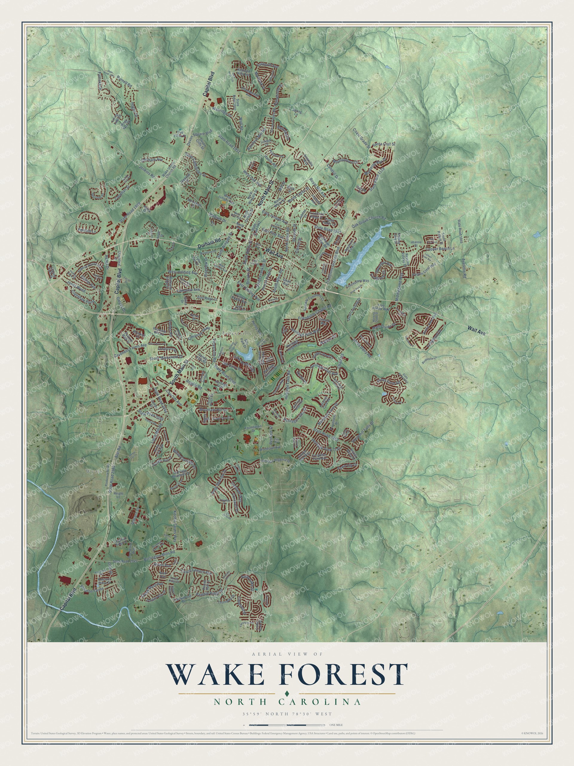
Explore Wake Forest, North Carolina from a whole new perspective. Created using aerial imagery and detailed geographic data, this map captures Wake Forest building by building, with labeled streets, familiar landmarks, and shaded topographical relief that highlights the natural contours of the landscape.
Combining modern data with the timeless character of a vintage atlas, this map is just as interesting up close as it is beautiful on the wall. Whether you grew up in Wake Forest, spent memorable years there, or call it home today, this unique map is a great way to celebrate a place that means something to you. Zoom in on the preview to look for your street, and then order a print to put your memories on the wall.
Three ways to hang it
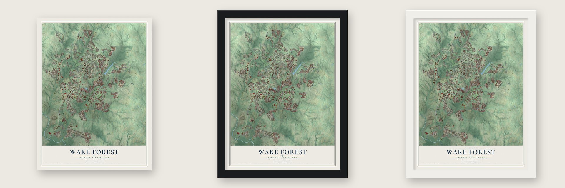
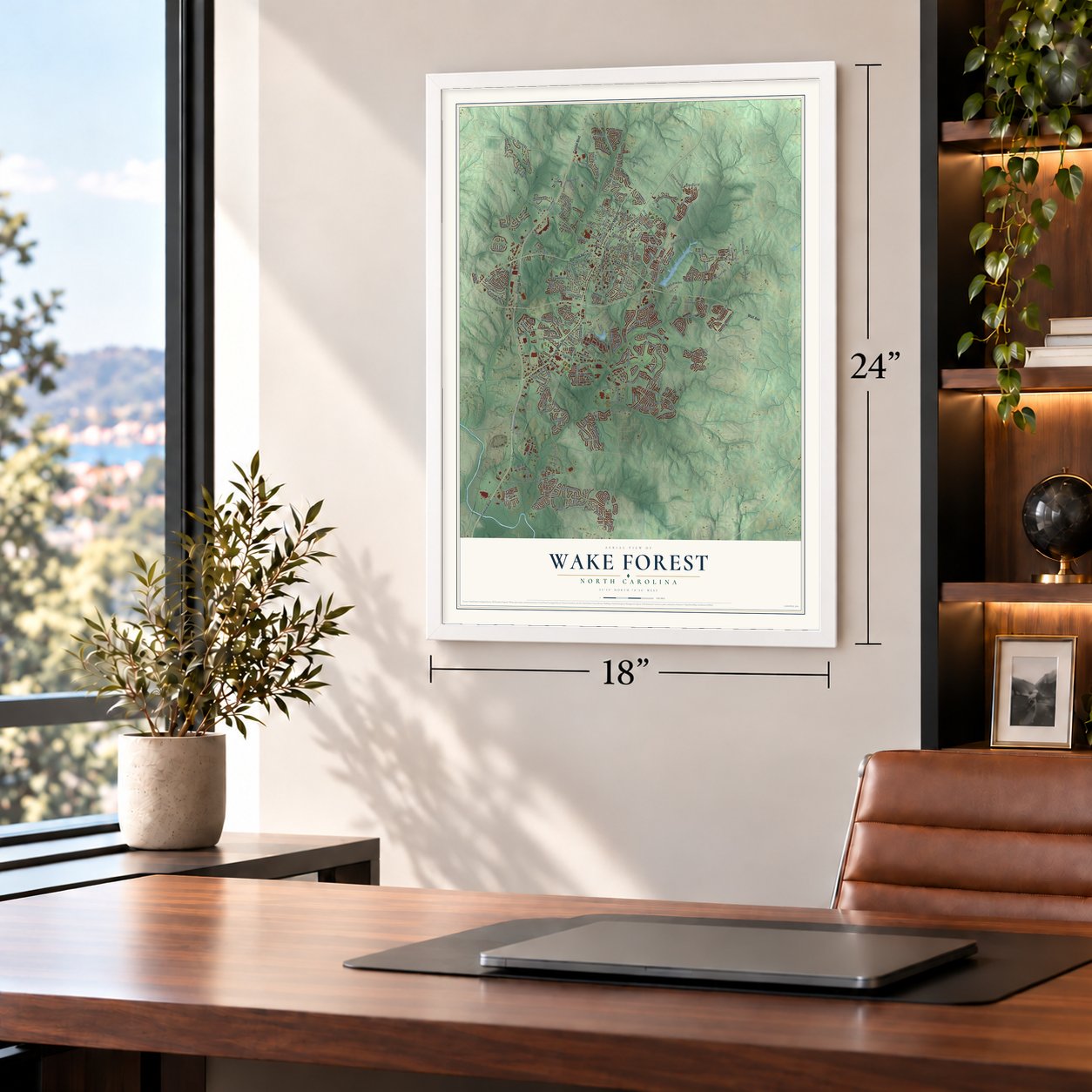
Unframed archival matte, a black wood frame or a white wood frame.
Up close
Geography Worth Displaying
This map was created using accurate cartographic data and authoritative geographic sources, including the U.S. Geological Survey and the Census Bureau. The map brings together terrain, waterways, roads, and building detail. The majority of the streets are labeled, houses are accurately depicted, and the topography is derived from government sources. Combining local data with carefully composed color and shading leads to this beautifully detailed Wake Forest artwork for your wall.
Rather than simply showing street outlines, we’ve included as many of the street names as we could reasonably fit on the map while keeping their names legible. Zoom in on the high resolution preview to see exactly what’s on the map. We truly set out to create a statement piece for anyone who loves Wake Forest. So whether it’s for you, or a gift for someone you love, we hope this map of Wake Forest brings back fond memories.
Read the story behind this map of Wake Forest, North Carolina from 2026.

Find your street
Names on the Wake Forest map
Every name below is printed on this map. Look for your street, your school, the park where you played, or the pond down the road.
Places and landmarks2
- Wyatt
- Forestville
Streets and roads272
- South Main Street
- Wait Avenue
- Durham Road
- North Main Street
- Capital Boulevard
- Stadium Drive
- North Taylor Street
- State Road 1942
- East Juniper Avenue
- Retail Drive
- Heritage Links Drive
- West Oak Avenue
- Shearon Farms
- Oak Grove Church Road
- Wall Road
- Saint Catherines Drive
- Ligon Mill Road
- State Road 2044
- Rogers Road
- South Franklin Street
- Forestville Road
- State Road 2049
- Heritage Lake Road
- Burlington Mills Road
- Marshall Farm Street
- Coach Lantern Avenue
- Longmont Drive
- Averette Road
- Star Road
- State Road 2183
Show all 272 streets
- Friendship Chapel Road
- Rainy Lake Street
- State Road 2052
- State Road 1129
- Harris Road
- Mountain Hill Drive
- State Road 1929
- Traditions Grande Boulevard
- South White Street
- Barnford Mill Road
- Main Divide Drive
- Penfold Lane
- Heritage Club Avenue
- Jones Dairy Road
- Copper Beech Lane
- Song Sparrow Drive
- South Wingate Street
- Monterey Bay Drive
- Royal Mill Avenue
- West Holding Avenue
- Heritage Hills Way
- Fairlake Drive
- North Allen Road
- South Allen Road
- Cornwell Drive
- Chalk Road
- Gross Avenue
- Linslade Way
- Jenkins Road
- Heritage View Trail
- East Holding Avenue
- Purnell Road
- Lakeview Avenue
- Coast Grade Street
- Wallridge Drive
- Brooks Street
- Clatter Avenue
- Haltwhistle Street
- Cimarron Parkway
- Forbes Road
- Kitchin Farms Way
- Jones Wynd
- Hogan Drive
- Pineview Drive
- Galaxy Drive
- Capellan Street
- Stonemill Falls Drive
- East Pine Avenue
- Stone Monument Drive
- Kemble Ridge Drive
- White Carriage Drive
- Jones Farm Road
- Old Dairy Drive
- State Road 1931
- Devon Square Boulevard
- Caveness Farms Avenue
- Crenshaw Point
- Chilmark Avenue
- Creek Moss Avenue
- Middlegame Way
- Moultonboro Drive
- Walters Drive
- Fawn Lily Drive
- Capefield Drive
- Endgame Court
- State Road 2059
- Lake Holding Street
- Fulworth Avenue
- Unicorn Drive
- Santa Cruz Street
- Landfill Drive
- Carroll Street
- Capcom Avenue
- Bellreng Drive
- Marbank Street
- Penfield Street
- Mill Street
- Seventh Street
- Urial Drive
- North Avenue
- State Road 1932
- State Road 2045
- State Road 1945
- Wake Union Church Road
- North White Street
- State Road 1941
- Reservoir View Lane
- Colonial Club Road
- North Wingate Street
- Deacon Ridge Street
- Shasta Daisy Drive
- Golden Star Way
- Gateway Commons Cr
- Wildflower Ridge Road
- Siena Drive
- Opposition Way
- McDowell Drive
- West Juniper Avenue
- Heritage Greens Drive
- Bratt Avenue
- Austin View Boulevard
- Flaherty Avenue
- Calista Drive
- Federal House Avenue
- North College Street
- Sterling Lake Drive
- Carriage Meadows Drive
- Forgotten Pond Avenue
- Heritage Garden Street
- Heritage Regency Drive
- Steeple Run Drive
- Heritage Heights Lane
- Falconhurst Drive
- Hidden Jewel Lane
- Richland Ridge Drive
- Dimock Way
- Trentini Avenue
- Coram Fields Road
- Bluebird Lane
- Reserve Estates Drive
- Tyler Run Drive
- Porto Fino Avenue
- Traditions Ridge Drive
- Club Villas Drive
- Dargan Hills Drive
- Quail Crossing Drive
- Knights Crest Way
- Tryon Palace Street
- Frog Hollow Way
- Precious Stone Drive
- Touchstone Way
- Richland Hills Avenue
- Longbourn Drive
- Chamberwell Avenue
- Lilliput Lane
- Legacy Falls Drive
- Poppy Fields Lane
- Woodstaff Avenue
- Cloverleaf Drive
- One World Way
- Pine Ridge Court
- Amaryllis Way
- Silver Ore Court
- Foundation Drive
- Thorndike Drive
- Prevenient Drive
- Spring Park Road
- Cedar Rock Drive
- Heritage Trail
- Devon Cliffs Drive
- Pasture Walk Drive
- Leighton Ridge Drive
- Reynolds Mill Road
- Canvas Drive
- Silo Park Drive
- Remey Avenue
- Height Lane
- Barrett Hall Lane
- Yellow Poplar Avenue
- Sky Hill Place
- Glencoe Drive
- Loring Lake Drive
- Agora Drive
- Jubilee Court
- Quail Avenue
- Higley Drive
- Jeanne Street
- Kings Way Court
- Carter Street
- Spring Lane
- Seina Drive
- Brick Street
- Hope Street
- State Road 2053
- Ponderosa Svc Road
- Thurman Dairy Loop
- Birdhouse Lane
- Overlook Ridge Road
- Fairstone Road
- Highpoint Street
- Trawden Drive
- Sparhawk Road
- Heritage Branch Road
- Field Oak Drive
- Woodland Drive
- Artisan Park Drive
- Melksham Road
- Morning Glade Street
- Margot's Avenue
- Forest Road
- Lariat Ridge Drive
- West Pine Avenue
- Hartsfield Forest Drive
- Otway Road
- Retreat Lane
- West Vernon Avenue
- Sugar Maple Avenue
- Prarie Aster Court
- Battery Crest Lane
- Tise Avenue
- Thompson Glenn Place
- Holding Village Way
- San Remo Place
- State Road 1909
- East Elm Avenue
- Alexander Springs Lane
- Lemongrass Lane
- Everstone Road
- Fern Hollow Trail
- East Walnut Avenue
- Boardwalk Drive
- Loghouse Street
- Trent River Avenue
- Amherst Creek Drive
- Stone Park Drive
- Latham Oaks Avenue
- Slomo Court
- Rice Circle
- Meadstone Way
- Millers Mark Avenue
- Rodney Bay Crossing
- Studbury Hall Court
- Barley Green Street
- Lowenstein Street
- Rockville Road
- Tiffield Way
- Traditions Garden Lane
- Miracle Drive
- Bishop Falls Road
- Treetop Meadow Lane
- Oakwood Drive
- Fleming House Street
- Richland Drive
- State Road 1135
- Farm Road
- Old Jones Road
- Falcate Drive
- Comet Tail Lane
- Sweet Olive Court
- Park Vista Drive
- Thorny Vine Court
- Poteat Drive
Names are listed as they appear on the printed map. Zoom into the product photos to find them.
About Wake Forest, North Carolina
Wake Forest is a town of 47,601 people, almost all of it in Wake County, just north of Raleigh. In 1832 Dr. Calvin Jones, a Massachusetts native, bought 615 acres of woods here for his plantation, and the thinly settled area came to be called the Forest of Wake. He sold the farm for $2,000 to the North Carolina Baptist Convention, which opened the Wake Forest Manual Labor Institute on the land. The school later became Wake Forest College.
The Raleigh & Gaston Railroad was finished in 1840 with a depot at nearby Forestville, and the trains helped the school and its village grow. In 1874 college leaders persuaded the railroad to move the depot closer to campus, and more business followed. The village was incorporated in 1880 as the Town of Wake Forest College, and it dropped "College" from its name in 1909. The college left for Winston-Salem in 1956, after 122 years here.
- A seminary on the old campusSoutheastern Baptist Theological Seminary, a school of the Southern Baptist Convention, began teaching on the original college grounds in 1950. When the university finished its move to Winston-Salem in 1956, the seminary took over the entire campus.
- The Calvin Jones House, 1820Built in 1820, this house was home to the first president of Wake Forest College and stood at the center of life at the school. Today it is the Wake Forest Historical Museum, holding photos, books, furniture, professors' writings and sports memorabilia from both the town and the university. It joined the National Register in 2016.
- The DuBois School, 1926In 1926 Wake Forest's African-American community gained its own school, named for W. E. B. DuBois, and it served that community until segregation ended in 1971. After the school outgrew the building and moved, the old schoolhouse stood empty for a decade. The DuBois Alumni Association then bought it and made it a community center. It joined the National Register in 1993.
- One of the fastest-growing suburbsIn 2007 Forbes magazine ranked Wake Forest the 20th fastest growing suburb in America, after its population rose 73.2 percent between 2000 and 2006. The growth kept going: the town counted 30,117 people in 2010 and 47,601 in 2020.
Keep exploring North Carolina
Wake Forest is one of 952 North Carolina towns we've mapped. Every dot on the map is a print of its own.
The search covers every state, North Carolina first.
Near Wake Forest
Order 2 or more town maps and save 10%. Shown in the size and finish you picked above, so they hang as a set.
- Rolesville 12" x 18" / Archival Matte Print $39.99
- Youngsville 12" x 18" / Archival Matte Print $39.99
- Royal 12" x 18" / Archival Matte Print $39.99


More maps nearby: Franklinton, Raleigh, Knightdale, Wilton and Zebulon.
The art of mapping a place
How This Map Was Made
Real places. Remarkable detail. Discover the layers that turn geographic data into a map of home.

The view from above
Aerial imagery reveals the character of the land: woodland, open fields, and the patterns of a place.

The shape of the land
Elevation data brings hills, valleys, and subtle changes in the landscape into view.

The details of home
Roads, waterways, and building footprints come together to make the map feel unmistakably local.

Geography becomes art
Considered color, shading, and typography bring the layers together in a map made for your wall.


Process illustrated with Mendon, Massachusetts. Aerial imagery: USDA NAIP. Terrain: USGS 3D Elevation Program. Map details and finished artwork: KNOWOL.
The Details
About This Print
Choose an archival matte print, or a black or white Ayous wood frame. The archival matte print is unframed.
Select your size and finish above to see the matching product image and price.
Materials & Craftsmanship
A contemporary map with the character of a classic atlas, printed on archival matte paper. Optional frames are made from Ayous wood.
Your printed map does not include the watermark shown in the full-map preview.
Shipping & Delivery
Free shipping within the United States. Every print is made to order in the USA.
Buying a gift? Add a note in your cart and we'll include it. We never put prices in the package.
Prints ship within 2 to 3 business days. Allow 7 to 10 days total from ordering for delivery. Timing may vary during holidays or periods of high order volume.
Read our shipping policy.
Returns and damaged prints
Each print is made to order. Change-of-mind refunds are not available after production.
If your print arrives damaged, misprinted or incorrect, contact support@knowol.com within 30 days of receiving it. Include your order number, photos and a description of the issue.
Read our full refund and replacement policy. For questions about your order, email support@knowol.com.