
Search for another town





Free U.S. delivery 7 to 10 days after you order
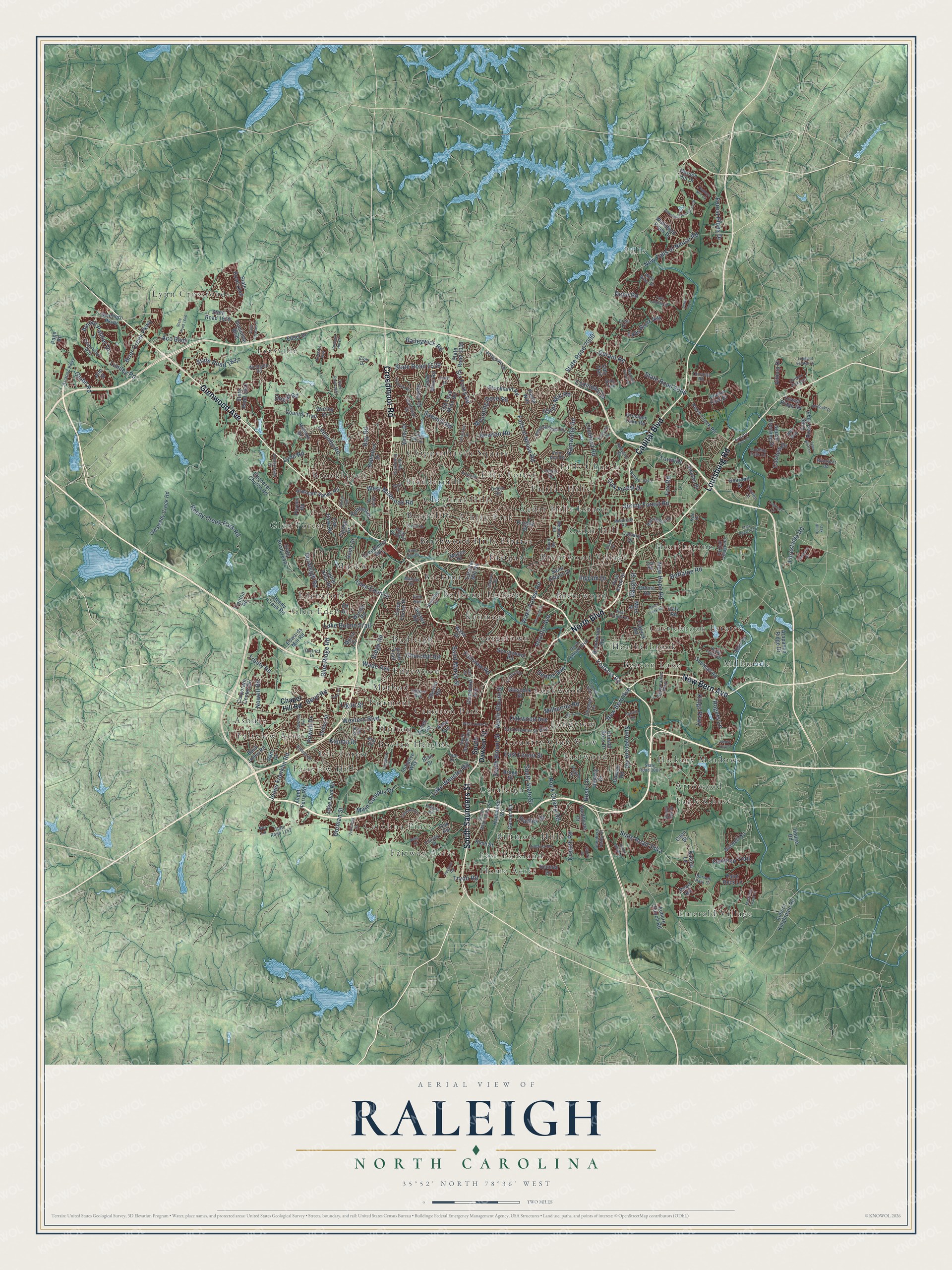
Raleigh, North Carolina Map Art
Building by building, with labeled streets and shaded relief.
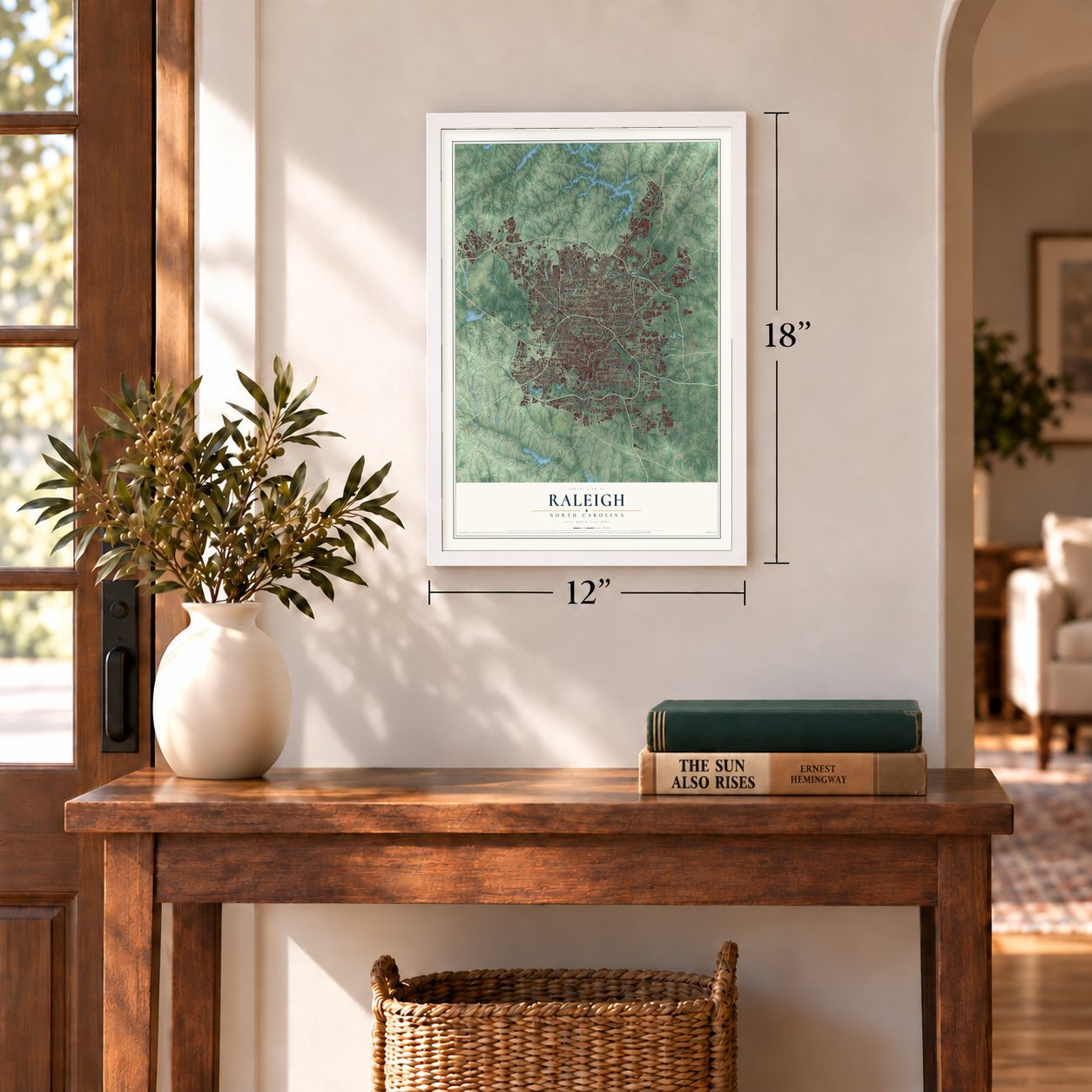
12" x 18" Archival Matte Print
A Map of Home. A Work of Art.
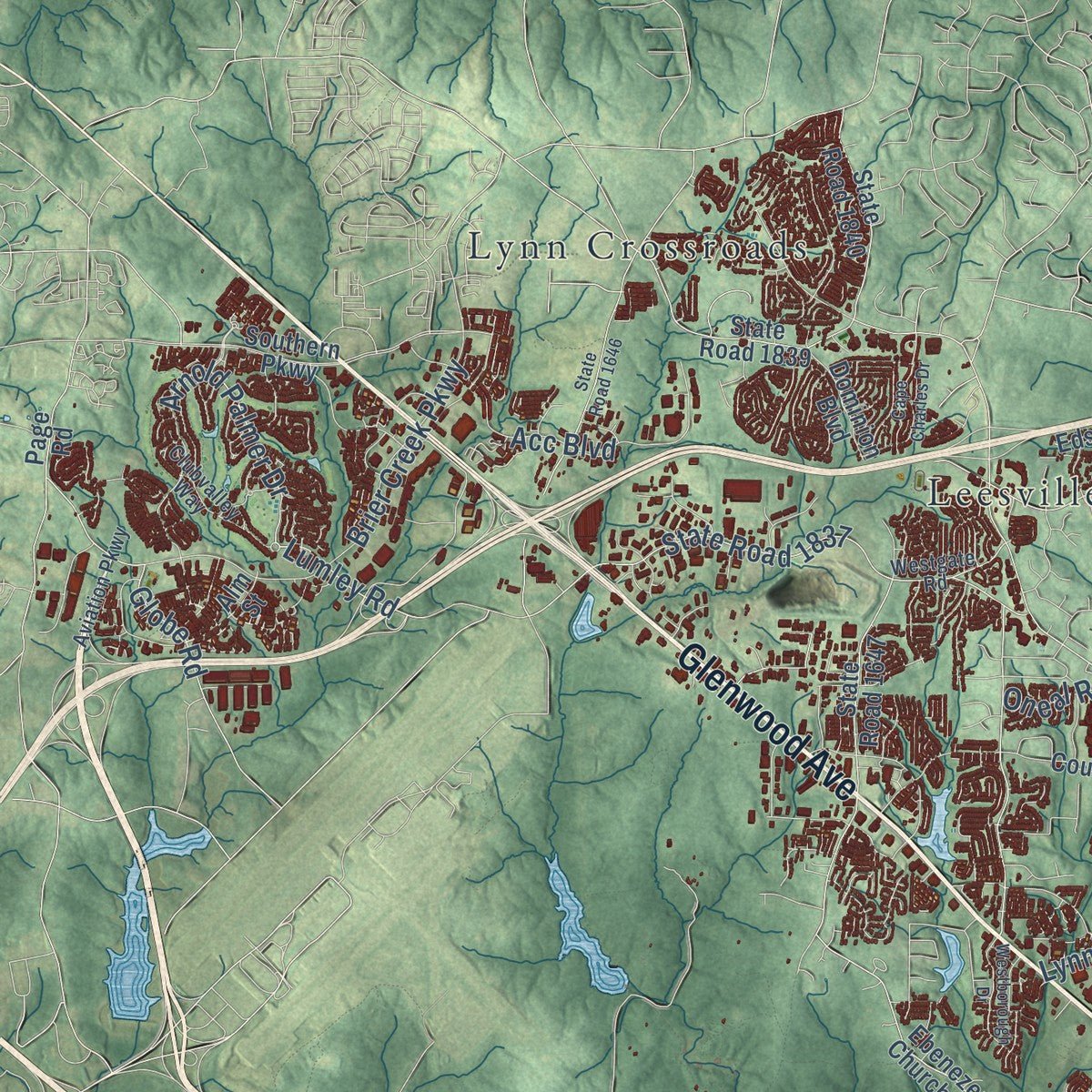
Explore Raleigh, North Carolina from a whole new perspective. Created using aerial imagery and detailed geographic data, this map captures Raleigh building by building, with labeled streets, familiar landmarks, and shaded topographical relief that highlights the natural contours of the landscape.
Combining modern data with the timeless character of a vintage atlas, this map is just as interesting up close as it is beautiful on the wall. Whether you grew up in Raleigh, spent memorable years there, or call it home today, this unique map is a great way to celebrate a place that means something to you. Zoom in on the preview to look for your street, and then order a print to put your memories on the wall.
Three ways to hang it
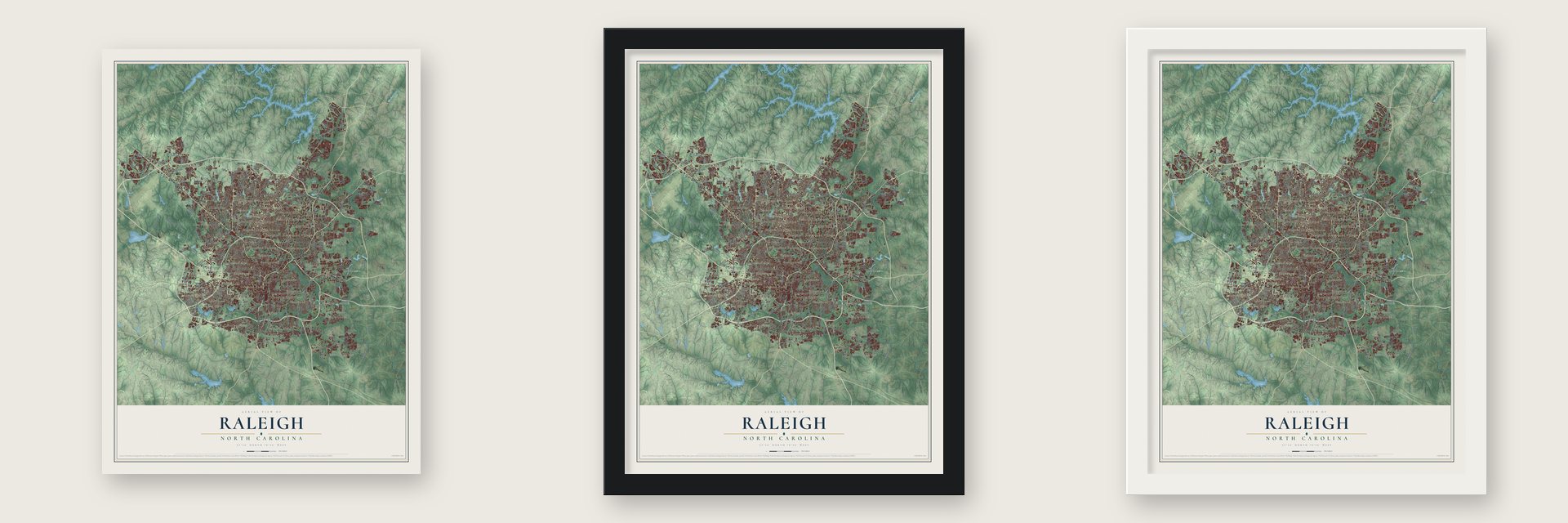
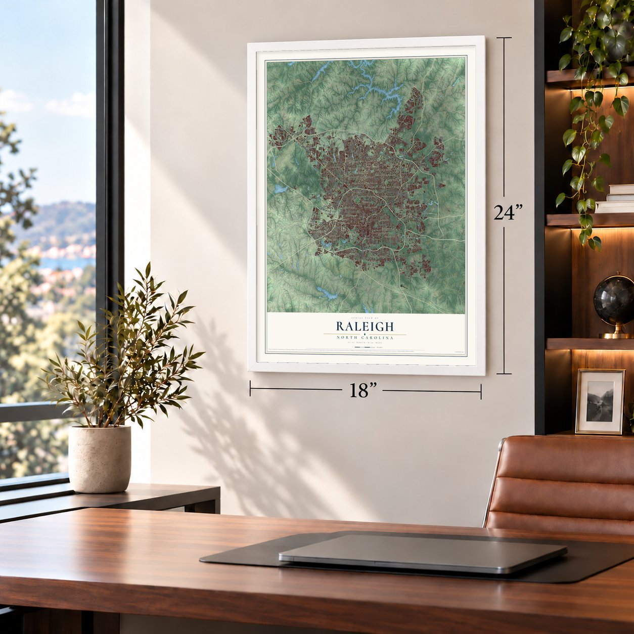
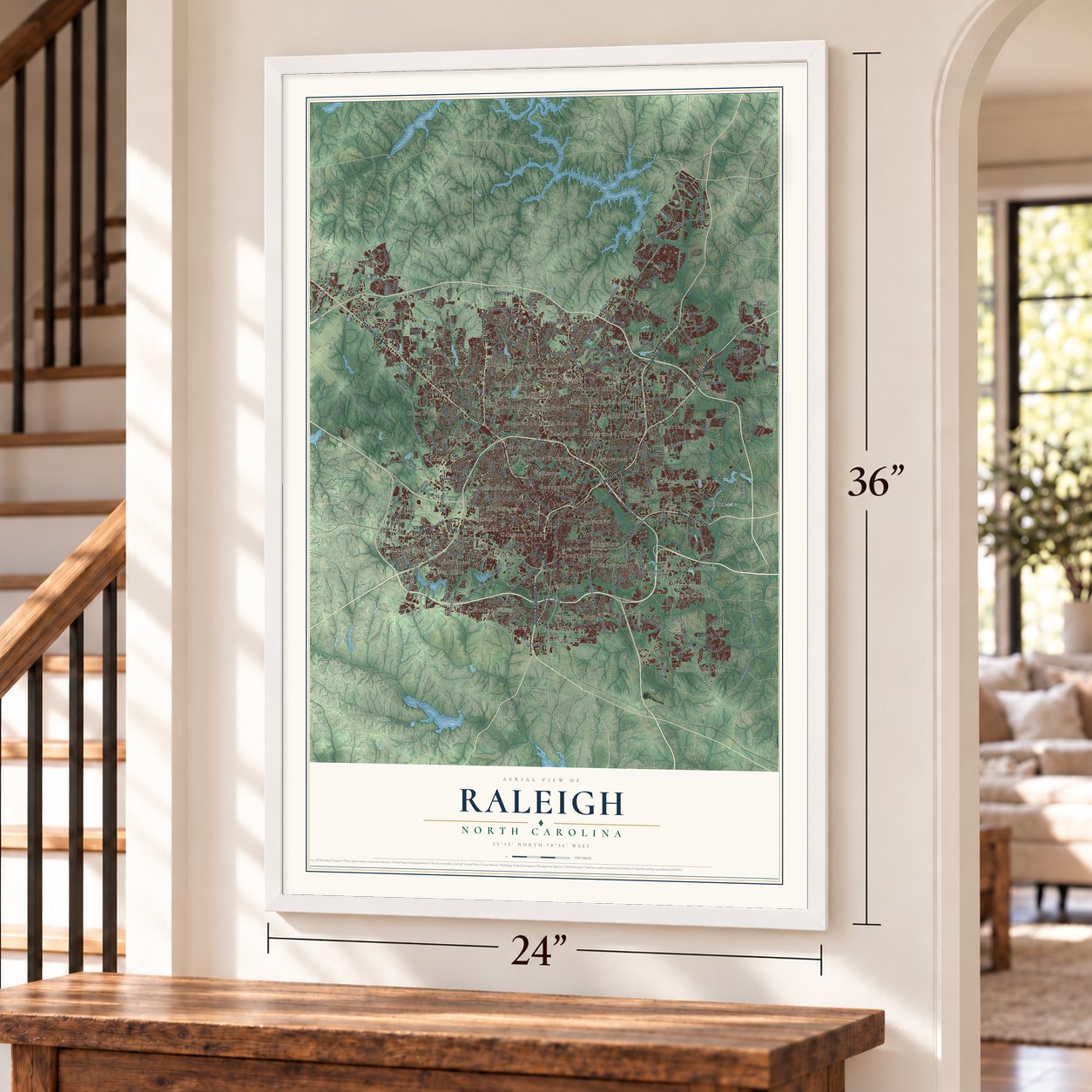
Unframed archival matte, a black wood frame or a white wood frame.
Up close
Geography Worth Displaying
This map was created using accurate cartographic data and authoritative geographic sources, including the U.S. Geological Survey and the Census Bureau. The map brings together terrain, waterways, roads, and building detail. The majority of the streets are labeled, houses are accurately depicted, and the topography is derived from government sources. Combining local data with carefully composed color and shading leads to this beautifully detailed Raleigh artwork for your wall.
Rather than simply showing street outlines, we’ve included as many of the street names as we could reasonably fit on the map while keeping their names legible. Zoom in on the high resolution preview to see exactly what’s on the map. We truly set out to create a statement piece for anyone who loves Raleigh. So whether it’s for you, or a gift for someone you love, we hope this map of Raleigh brings back fond memories.
Read the story behind this map of Raleigh, North Carolina from 2026.

Find your street
Names on the Raleigh map
Every name below is printed on this map. Look for your street, your school, the park where you played, or the pond down the road.
Places and landmarks56
- Arrowood
- Asbury
- Ashley Park
- Beacon Lake
- Beckana
- Bellevue Terrace
- Biltmore Hills
- Birchwood Hills Estates
- Boylan Heights
- Brandermill
- Brentwood
- Brentwood Village
Show all 56 places
- Briarcliff
- Brookhaven
- Budleigh
- Cameron Park
- Caraleigh
- Carolina Pines
- Castlebrook Estates
- Cedar Hill
- Cedar Hills Estates
- Chestnut Hills
- Chippenhaven Square
- Country Club View
- Eagle Chase
- East Parkland
- Eastgate
- Eastwood
- Eden Forest
- Edencroft
- Edgewood
- Emerald Village
- Fairfax Hills
- Fairmont
- Fairview Acres
- Fairview Hills
- Fairway Acres
- Falls
- Falls Church
- Georgetown
- Glen Eden
- Glen Forest
- Hearthstone
- Heatherbrook
- Hickory Meadows
- Hinton
- Home Acres
- Isle Forest
- Kenmore
- Leesville
- Lockwood
- Longview
- Lynn Crossroads
- Markwood
- Method
- Milburnie
Streets and roads294
- Glenwood Avenue
- Capital Boulevard
- Louisburg Road
- Creedmoor Road
- North Boulevard
- New Bern Avenue
- South Saunders Street
- State Road 2000
- Falls of Neuse Road
- Six Forks Road
- Western Boulevard
- New Hope Road
- Rock Quarry Road
- Lynn Road
- Spring Forest Road
- Blue Ridge Road
- State Road 2542
- Tryon Road
- Atlantic Avenue
- State Road 1529
- Falls River Avenue
- Leesville Road
- Buffaloe Road
- State Road 2006
- Forestville Road
- Wake Forest Road
- Gorman Street
- Fox Road
- New Falls of Neuse Road
- Reedy Creek Park Road
Show all 294 streets
- Duraleigh Road
- West Millbrook Road
- Saint Marys Street
- Wade Avenue
- Sunnybrook Road
- Litchford Road
- Ray Road
- Lake Boone Trail
- Harps Mill Road
- Main Campus Drive
- Brier Creek Parkway
- Lake Wheeler Road
- Durant Road
- Ridge Road
- Glen Eden Drive
- State Road 1837
- Sawmill Road
- Yonkers Road
- Jones Franklin Road
- Acc Boulevard
- Arnold Palmer Drive
- Milburnie Road
- Kaplan Drive
- Fairview Road
- Rainwater Road
- South State Street
- Rogers Lane
- Forest Pines Drive
- South Blount Street
- Globe Road
- Baileywick Road
- Churchill Road
- Beryl Road
- Oakwood Avenue
- East Lenoir Street
- Mourning Dove Road
- Dunn Road
- Coxindale Drive
- Cashew Drive
- Trinity Road
- Oak Forest Drive
- North Blount Street
- Newton Road
- Powell Drive
- Nowell Road
- Rose Lane
- Kings Parkway
- Ingram Drive
- Lumley Road
- Ligon Street
- Hadley Drive
- Quitman Trail
- Dennis Avenue
- Baugh Street
- Creech Road
- Oneal Road
- Town Drive
- Chapel Hill Road
- South Dawson Street
- State Road 1005
- Edwards Mill Road
- Lead Mine Road
- Hammond Road
- Ebenezer Church Road
- Strickland Road
- State Road 2049
- Avent Ferry Road
- Perry Creek Road
- State Road 1649
- Garner Road
- Oberlin Road
- Brentwood Road
- Reedy Creek Road
- Saint Albans Drive
- Glascock Street
- Oak Park Road
- Dixie Trail
- Gresham Lake Road
- State Road 1647
- Corporate Center Drive
- Southall Road
- State Road 1839
- Country Trail
- Lassiter Mill Road
- Buck Jones Road
- Allen Drive
- Pleasant Valley Road
- Trawick Road
- Hilburn Drive
- Laurel Hills Road
- Old Reedy Creek Road
- Lake Dam Road
- Beverly Drive
- Southgate Drive
- Auburn Church Road
- Althorp Drive
- Clarks Fork Drive
- Wakefield Pines Drive
- Barwell Road
- Rembert Drive
- Auburn Knightdale Road
- Battleford Drive
- Pearl Road
- State Road 1840
- Rush Street
- Calvary Drive
- Sinclair Drive
- Old Lead Mine Road
- Neuse Crossing Drive
- Southern Parkway
- Pullen Road
- Kasota Lane
- Page Road
- Trenton Road
- Paint Rock Lane
- Initiative Way
- Georgetown Road
- Cooper Road
- Blair Drive
- Valley Drive
- Ujamaa Drive
- Harbor Drive
- Wycliff Road
- Dominion Boulevard
- Coley Forest Place
- Ed Drive
- Poyner Road
- Myron Drive
- Donald Ross Drive
- Fairhill Drive
- Galax Drive
- Donna Road
- Pine Knoll Drive
- Caen Street
- Arapahoe Ridge Drive
- Hodge Road
- Beardall Street
- Ashe Avenue
- Fiesta Way
- Cub Trail
- Deboy Street
- Macon Place
- Lowell Ridge Road
- Dana Drive
- Sussex Road
- Garden Hill Drive
- Bragg Street
- Edsel Drive
- Worley Drive
- Mars Street
- Alm Street
- Purdue Street
- Daly Road
- Wake Drive
- Oak Road
- State Road 1007
- South Wilmington Street
- Westgate Road
- State Road 1152
- Millbrook Road
- Hunting Ridge Road
- Sumner Boulevard
- Corporation Parkway
- Athens Drive
- North Raleigh Boulevard
- Aviation Parkway
- East Edenton Street
- Thornton Road
- Hometown Drive
- Valley Estates Drive
- South Boylan Avenue
- Clubvalley Way
- Peyton Street
- Granville Drive
- Bland Road
- Volant Drive
- Wallingford Drive
- Landing Falls Lane
- Royal Troon Drive
- Fairway Drive
- Hill Street
- Kyle Drive
- Foxhall Village Road
- Chatham Lane
- Kilgore Avenue
- Shepherd Valley Street
- Bluffridge Drive
- Wide River Drive
- Ruritania Street
- Riverport Road
- Truxton Lane
- Kent Road
- Pony Run Road
- District Drive
- Sugar Bush Road
- Bolo Trail
- Memory Road
- Manuel Street
- Brown Owl Drive
- Barwell Park Drive
- Vick Avenue
- Dublin Road
- Burt Drive
- Crisp Drive
- Lee Road
- Tate Drive
- Weir Way
- Carr Street
- Club Drive
- Nur Lane
- State Road 2215
- North Hills Drive
- State Road 1826
- Wakefield Plantation Drive
- Green Road
- State Road 1646
- Cape Charles Drive
- Mackinac Island Lane
- Longstreet Drive
- Bertie Drive
- Northclift Drive
- Pawleys Mill Circle
- Trailwood Drive
- Hartham Park Avenue
- Valley Lake Drive
- Ileagnes Road
- Carolina Avenue
- Oak Hill Drive
- Crabtree Boulevard
- Westborough Drive
- Marsh Creek Road
- Hamrick Drive
- West Trawick Road
- Forum Drive
- Rowland Road
- West Jones Street
- Courtland Drive
- Braefield Drive
- Longleaf Estates Drive
- Seabrook Road
- Landover Lane
- Lawrence Drive
- Industrial Drive
- Capability Drive
- Falls Landing Drive
- Deerland Grove Drive
- Deblyn Avenue
- Bellevue Road
- Oakberry Drive
- Quarry Ridge Lane
- Averette Field Drive
- French Drive
- Breeland Way
- Holston Lane
- Tyler Bluff Lane
- Concord Hill Court
- Pylon Drive
- Kirkland Road
- Neuse View Drive
- Filbert Street
- Settle in Lane
- Calton Drive
- Basil Drive
- Betry Place
Names are listed as they appear on the printed map. Zoom into the product photos to find them.
About Raleigh, North Carolina
Raleigh is a city of 467,665 people, the capital of North Carolina and the seat of Wake County. During the Revolution the British laid siege to New Bern, the old capital, so the state looked for an inland site that would be safe from attack by sea. In 1788 it chose this spot, where no town had stood before, and the new city was incorporated on December 31, 1792. Governor Alexander Martin suggested naming it for Sir Walter Raleigh, who sent the first colonists to North Carolina.
Planners drew a grid based on Thomas Holme's 1682 plan for Philadelphia. Two main streets crossed at Union Square, where the State Capitol stands, and a smaller square sat in each corner, with North, East, West and South streets as the first city limits. The city grew over old plantations such as Mordecai, Spring Hill and Crabtree, and the General Assembly held its first session here in December 1794.
- A capitol rebuilt after 1831A fire destroyed the old State House in 1831. Work on a new building began two years later, and the state's first railroad carried gneiss in from the quarry. In 1840 the city held one celebration for both the finished State Capitol and the new Raleigh & Gaston Railroad. The Capitol joined the National Register in 1970.
- Surrendered and spared in 1865When Sherman's army neared, Governor Zebulon Vance sent former governors Graham and Swain to offer surrender on April 12, 1865. Train delays and a brief capture held them up, so Vance fled, leaving Mayor William H. Harrison in charge. Harrison rode south on April 13, and Kenneth Rayner promised General Hugh Judson Kilpatrick no resistance. Kilpatrick agreed to protect Raleigh, his cavalry raised a United States flag over the Capitol dome, and Sherman headquartered in the governor's mansion.
- Shaw University since 1865Shaw opened its classrooms in 1865 as the first college in the South for African Americans, and it received its charter in 1875. Estey Hall, on its campus, was the first building raised for the college education of Black women. Shaw's Leonard Medical Center became the nation's first medical school with a four-year course for African American students. Episcopal clergy added St. Augustine's College for freedmen in 1867.
- A president born at Casso's InnAndrew Johnson, who became the 17th President of the United States, was born at Casso's Inn in Raleigh in 1808.
- The Pullen Park CarouselBloomsbury Park opened in 1912 with a carousel that drew big crowds. The ride was later moved to Pullen Park, where it still turns today, and it is listed on the National Register.
Keep exploring North Carolina
Raleigh is one of 952 North Carolina towns we've mapped. Every dot on the map is a print of its own.
The search covers every state, North Carolina first.
Near Raleigh
Order 2 or more town maps and save 10%. Shown in the size and finish you picked above, so they hang as a set.
- Mount Vernon 12" x 18" / Archival Matte Print $39.99
- Carpenter 12" x 18" / Archival Matte Print $39.99
- Knightdale 12" x 18" / Archival Matte Print $39.99


More maps nearby: Garner, Cary, Morrisville, Rolesville and Wake Forest.
The art of mapping a place
How This Map Was Made
Real places. Remarkable detail. Discover the layers that turn geographic data into a map of home.

The view from above
Aerial imagery reveals the character of the land: woodland, open fields, and the patterns of a place.

The shape of the land
Elevation data brings hills, valleys, and subtle changes in the landscape into view.

The details of home
Roads, waterways, and building footprints come together to make the map feel unmistakably local.

Geography becomes art
Considered color, shading, and typography bring the layers together in a map made for your wall.


Process illustrated with Mendon, Massachusetts. Aerial imagery: USDA NAIP. Terrain: USGS 3D Elevation Program. Map details and finished artwork: KNOWOL.
The Details
About This Print
Choose an archival matte print, or a black or white Ayous wood frame. The archival matte print is unframed.
Select your size and finish above to see the matching product image and price.
Materials & Craftsmanship
A contemporary map with the character of a classic atlas, printed on archival matte paper. Optional frames are made from Ayous wood.
Your printed map does not include the watermark shown in the full-map preview.
Shipping & Delivery
Free shipping within the United States. Every print is made to order in the USA.
Buying a gift? Add a note in your cart and we'll include it. We never put prices in the package.
Prints ship within 2 to 3 business days. Allow 7 to 10 days total from ordering for delivery. Timing may vary during holidays or periods of high order volume.
Read our shipping policy.
Returns and damaged prints
Each print is made to order. Change-of-mind refunds are not available after production.
If your print arrives damaged, misprinted or incorrect, contact support@knowol.com within 30 days of receiving it. Include your order number, photos and a description of the issue.
Read our full refund and replacement policy. For questions about your order, email support@knowol.com.