
Search for another town





Free U.S. delivery 7 to 10 days after you order
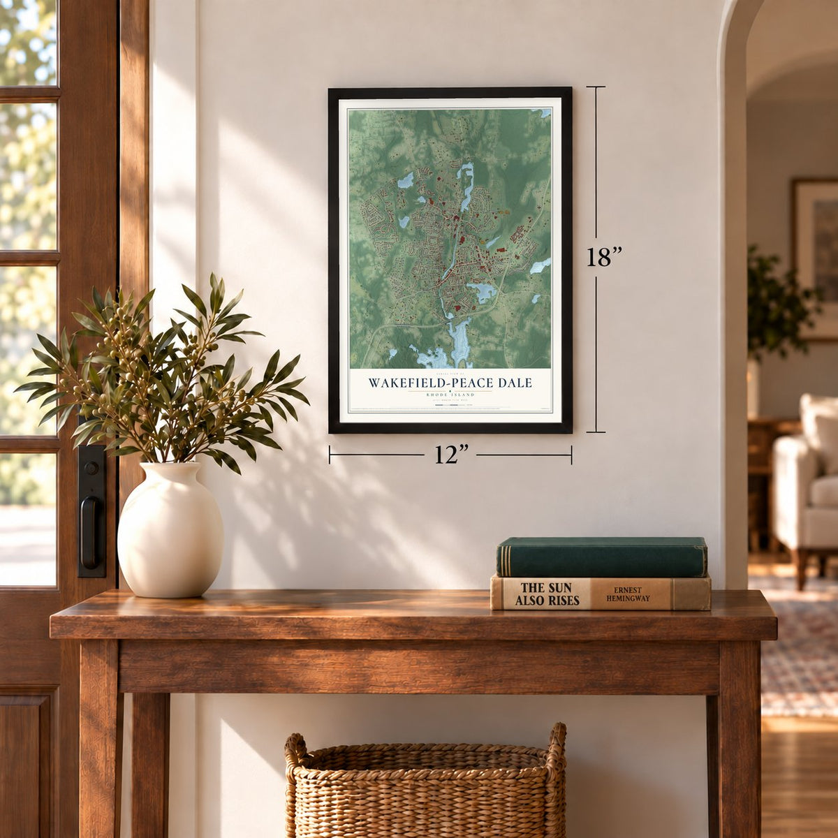
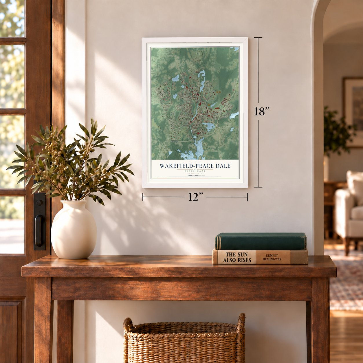
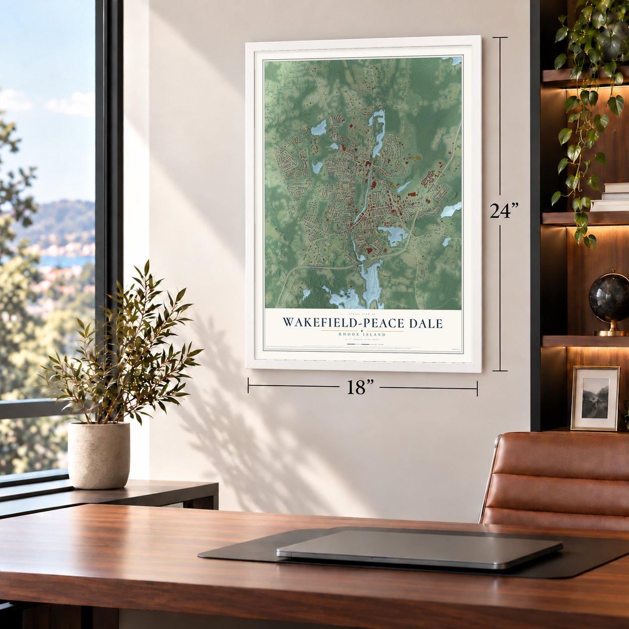
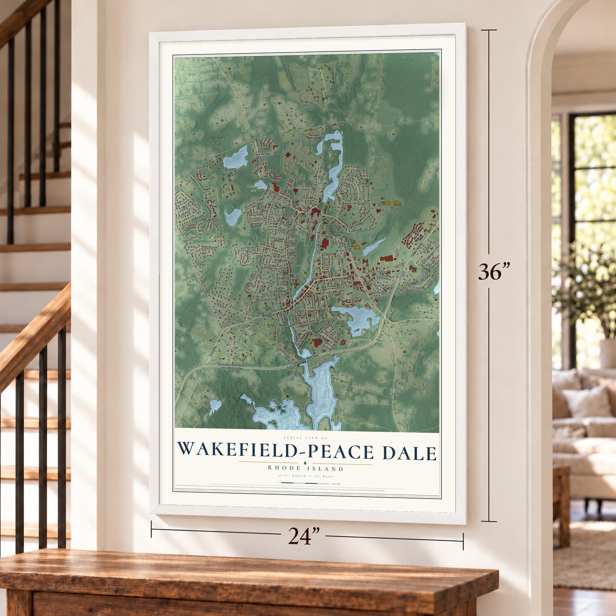
Wakefield-Peace Dale, Rhode Island Map Art
Building by building, with labeled streets and shaded relief.
12" x 18" Archival Matte Print
A Map of Home. A Work of Art.
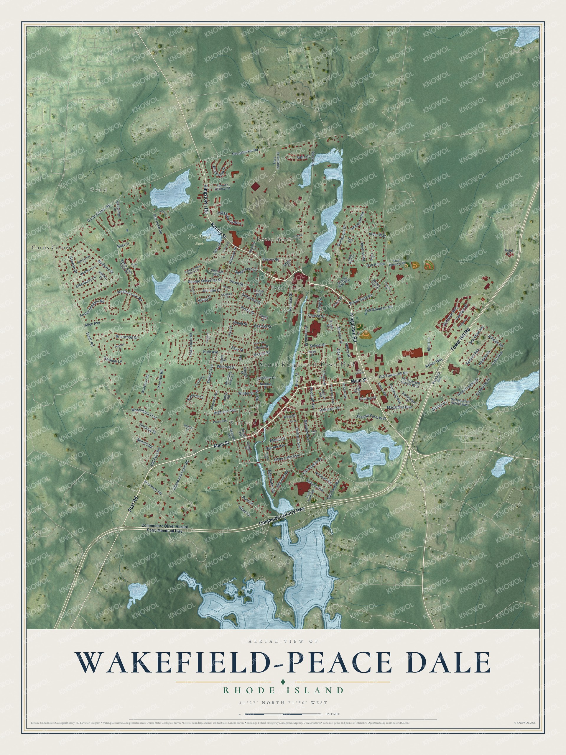
Explore Wakefield-Peace Dale, Rhode Island from a whole new perspective. Created using aerial imagery and detailed geographic data, this map captures Wakefield-Peace Dale building by building, with labeled streets, familiar landmarks, and shaded topographical relief that highlights the natural contours of the landscape.
Combining modern data with the timeless character of a vintage atlas, this map is just as interesting up close as it is beautiful on the wall. Whether you grew up in Wakefield-Peace Dale, spent memorable years there, or call it home today, this unique map is a great way to celebrate a place that means something to you. Zoom in on the preview to look for your street, and then order a print to put your memories on the wall.
Three ways to hang it
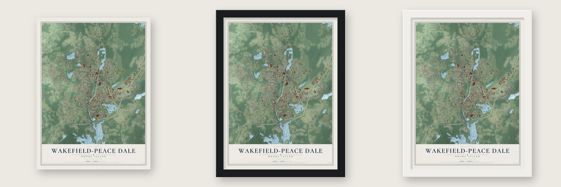
Unframed archival matte, a black wood frame or a white wood frame.
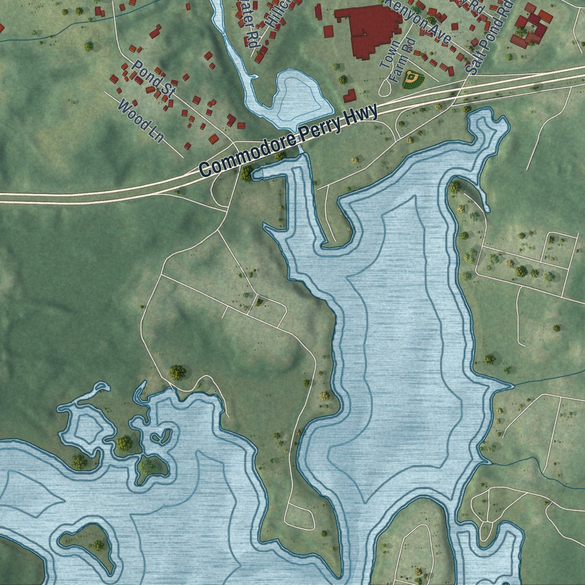
Up close
Geography Worth Displaying
This map was created using accurate cartographic data and authoritative geographic sources, including the U.S. Geological Survey and the Census Bureau. The map brings together terrain, waterways, roads, and building detail. The majority of the streets are labeled, houses are accurately depicted, and the topography is derived from government sources. Combining local data with carefully composed color and shading leads to this beautifully detailed Wakefield-Peace Dale artwork for your wall.
Rather than simply showing street outlines, we’ve included as many of the street names as we could reasonably fit on the map while keeping their names legible. Zoom in on the high resolution preview to see exactly what’s on the map. We truly set out to create a statement piece for anyone who loves Wakefield-Peace Dale. So whether it’s for you, or a gift for someone you love, we hope this map of Wakefield-Peace Dale brings back fond memories.
Read the story behind this map of Wakefield-Peace Dale, Rhode Island from 2026.

Find your street
Names on the Wakefield-Peace Dale map
Every name below is printed on this map. Look for your street, your school, the park where you played, or the pond down the road.
Places and landmarks7
- South Kingstown Town Hall
- Gould
- Rocky Brook
- Wakefield
- Tri-Pond Park
- Curtis Corner
- Peace Dale
Streets and roads169
- Kingstown Road
- Post Road
- Main Street
- Kersey Street
- Commodore Perry Highway
- Tower Hill Road
- Old Tower Hill Road
- High Street
- Gould Street
- South Road
- Saugatucket Road
- Broad Rock Road
- Curtis Corner Road
- Allen Avenue
- Oakwoods Drive
- North Road
- Willard Avenue
- Woodruff Avenue
- Mulberry Drive
- Pine Hill Road
- Columbia Street
- Kenyon Avenue
- Pond Street
- Church Street
- Hampton Way
- Rodman Street
- Edgewood Farm Road
- Silver Lake Avenue
- Weathervane Road
- Robinson Street
Show all 169 streets
- Briarwood Drive
- Dendron Road
- Hunt Avenue
- Stoneway Road
- Old Post Road
- Highland Avenue
- Macarthur Boulevard
- Asa Pond Road
- Winter Street
- School Street
- River Street
- Dockray Street
- Shadow Farm Way
- Camden Court
- Gentian Drive
- Birchwood Drive
- Orchard Avenue
- Whitford Street
- Oakdell Street
- Kersey Road
- Sea View Avenue
- Dam Street
- Meadow Avenue
- Old Mountain Road
- Holley Street
- Oak Street
- Hillside Road
- Holland Drive
- Austin Street
- River Heights Drive
- George Schaeffer Street
- Summit Avenue
- Pershing Avenue
- Rocky Brook Way
- Woodmans Trail
- Sweet Fern Lane
- Kimberley Drive
- Foster Sheldon Road
- Kelley Way
- Spring Street
- Edgewater Road
- Arbor Way
- Salt Pond Road
- Christopher Street
- Hillcrest Road
- Jennifer Drive
- Benefit Road
- Spencer Court
- Albro Lane
- Crest Avenue
- Elderberry Lane
- Wood Lane
- Oak Hill Road
- Beech Hill Road
- Sofia Court
- Railroad Street
- Victory Street
- Warner Avenue
- Schaeffer Street
- Karee Court
- Border Drive
- Cardinal Lane
- Branch Street
- Charles Street
- Dixon Street
- Eldred Court
- Pine Street
- Easy Street
- Noel Court
- Ide
- Commodore Oliver Hazard Perry Memorial Highway
- Peckham Avenue
- Narragansett Avenue East
- Hotel Drive
- Sweet Allen Farm Road
- Peaked Rock Road
- Woodbine Road
- Fiore Industrial Drive
- Cleveland Street
- Narragansett Avenue West
- Normandy Road
- Belmont Avenue
- Town Farm Road
- Wright Avenue
- Dewberry Lane
- Samuel Rodman Street
- Perry Avenue
- Kenwood Avenue
- Prospect Avenue
- Eisenhower Place
- Hopkins Lane
- Green Street
- Patton Avenue
- Inkberry Drive
- Scallop Shell Way
- Saint Dominic Road
- Mourning Dove Lane
- Beech Tree Place
- Cherry Lane
- Cemetery Lane
- Hazard Avenue
- Dinonsie Way
- Johnson Place
- Mellbridge Drive
- Liberty Street
- Pike Street
- Central Avenue
- Smith Street
- Northup Street
- Amos Street
- Fornier Ests
- George Street
- Fagan Court
- Brown Street
- Abbey Road
- Hope Court
- Emmett Lane
- Lake Street
- Bittersweet Lane
- Rockland Drive
- Sandy Bottom Shores Drive
- Roys Road
- Stedman Court
- Spruce Court
- Whittier Lane
- Eagle Nest Terrace
- Windsor Road
- Secluded Drive
- Galway Court
- Elm Street
- Chatham Road
- Tucker Avenue
- Kingswood Court
- Acorn Court
- Tri Pond Court
- Glenwood Circle
- Sentinal Drive
- Dale Carlia Street
- Mallory Lane
Names are listed as they appear on the printed map. Zoom into the product photos to find them.
About Wakefield-Peace Dale, Rhode Island
Wakefield-Peace Dale is a community of 8,925 people in Washington County, Rhode Island, made up of two villages along the Saugatucket River. Both grew up around water-powered textile mills on that river: Wakefield around a carding mill and Peace Dale around a woolen mill.
Rowland Hazard bought the old fulling mill at Peace Dale in 1804. In 1814 he bought four looms, and by 1815 they were turning out woolen cloth in a mill that handled every stage of the work, from carding the raw wool to finishing the fabric. Historians credit that mill with giving the woolen trade a complete factory system a year or two before cotton mills had one.
- Named for Mary PeaceThe village took its name from Mary Peace, who was married to the mill owner Rowland Hazard. Its first mill site sat along the Saugatucket River, where Hazard's woolen business grew out of the fulling mill he bought.
- First prize in 1893The cloth woven in the village became known as Peace Dale serge. In 1893 the judges at the World's Columbian Exposition gave Peace Dale serge their first prize.
- Wakefield's carding millJoseph Congdon opened a carding mill on the Saugatucket about 1807, and James Robinson took over the property around 1820. The textile work made the mill the new center of the village. In 1822 the village counted about 60 residents, 9 houses, one store and a blacksmith shop, along with grist, saw and carding mills.
Keep exploring Rhode Island
Wakefield-Peace Dale is one of 86 Rhode Island towns we've mapped. Every dot on the map is a print of its own.
The search covers every state, Rhode Island first.
Near Wakefield-Peace Dale
Order 2 or more town maps and save 10%. Shown in the size and finish you picked above, so they hang as a set.
- Narragansett Pier 12" x 18" / Archival Matte Print $39.99
- Kingston 12" x 18" / Archival Matte Print $39.99
- Narragansett 12" x 18" / Archival Matte Print $39.99


More maps nearby: South Kingstown, Matunuck, West Kingston, Hamilton and Carolina.
The art of mapping a place
How This Map Was Made
Real places. Remarkable detail. Discover the layers that turn geographic data into a map of home.

The view from above
Aerial imagery reveals the character of the land: woodland, open fields, and the patterns of a place.

The shape of the land
Elevation data brings hills, valleys, and subtle changes in the landscape into view.

The details of home
Roads, waterways, and building footprints come together to make the map feel unmistakably local.

Geography becomes art
Considered color, shading, and typography bring the layers together in a map made for your wall.


Process illustrated with Mendon, Massachusetts. Aerial imagery: USDA NAIP. Terrain: USGS 3D Elevation Program. Map details and finished artwork: KNOWOL.
The Details
About This Print
Choose an archival matte print, or a black or white Ayous wood frame. The archival matte print is unframed.
Select your size and finish above to see the matching product image and price.
Materials & Craftsmanship
A contemporary map with the character of a classic atlas, printed on archival matte paper. Optional frames are made from Ayous wood.
Your printed map does not include the watermark shown in the full-map preview.
Shipping & Delivery
Free shipping within the United States. Every print is made to order in the USA.
Buying a gift? Add a note in your cart and we'll include it. We never put prices in the package.
Prints ship within 2 to 3 business days. Allow 7 to 10 days total from ordering for delivery. Timing may vary during holidays or periods of high order volume.
Read our shipping policy.
Returns and damaged prints
Each print is made to order. Change-of-mind refunds are not available after production.
If your print arrives damaged, misprinted or incorrect, contact support@knowol.com within 30 days of receiving it. Include your order number, photos and a description of the issue.
Read our full refund and replacement policy. For questions about your order, email support@knowol.com.