
Search for another town





Free U.S. delivery 7 to 10 days after you order
West Orange, New Jersey Map Art
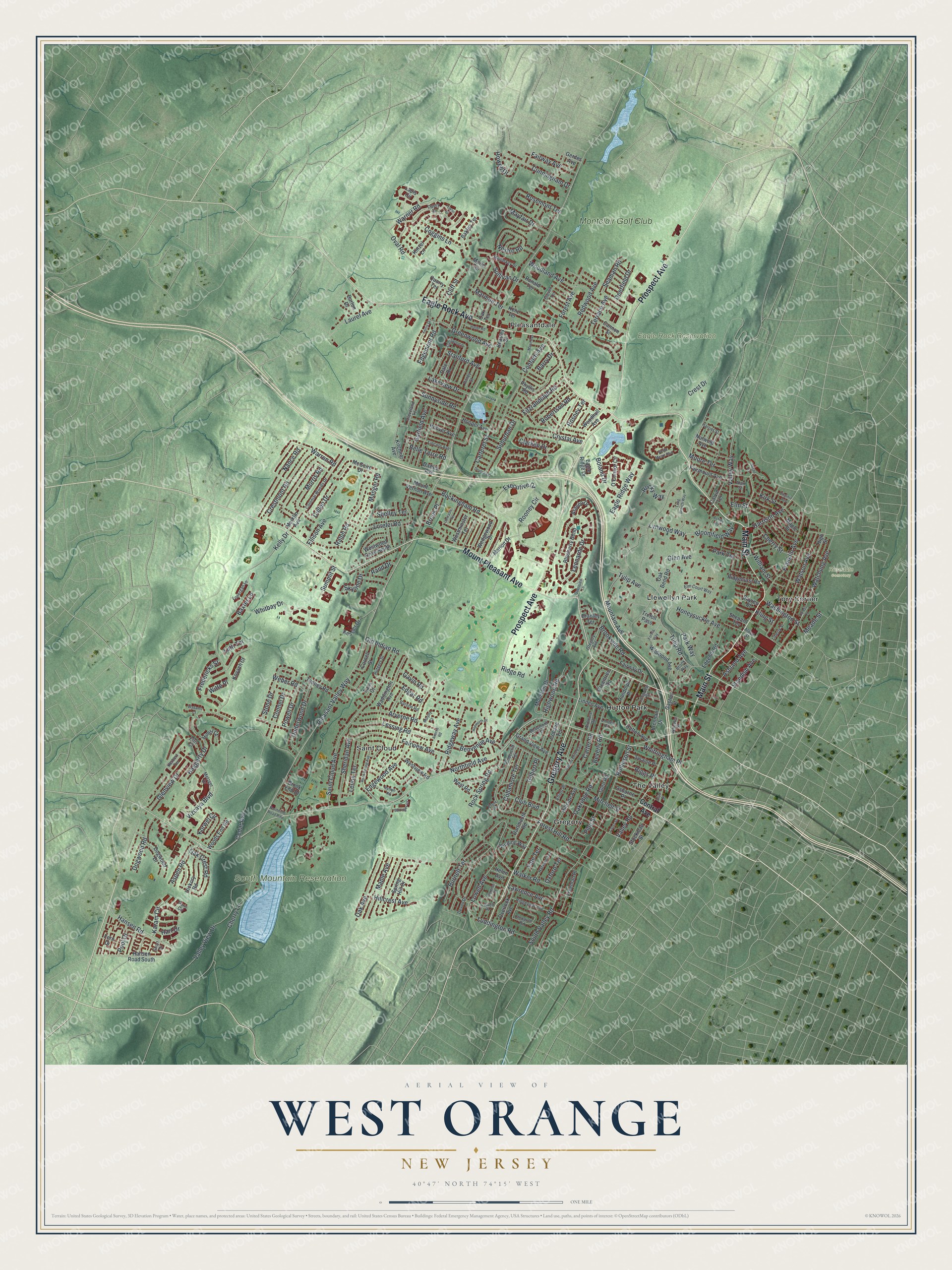
A new map of West Orange, New Jersey, made in 2026 and printed to order on thick archival matte paper.
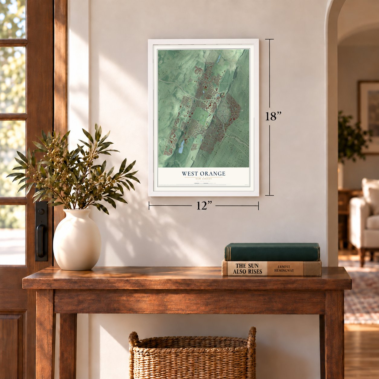
12" x 18" Archival Matte Print
A Map of Home. A Work of Art.
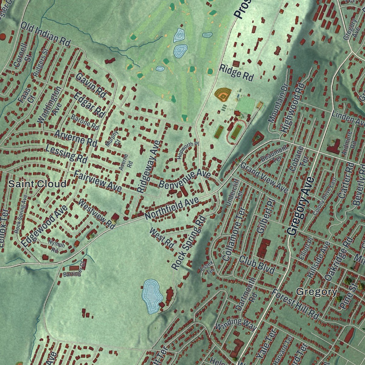
Explore West Orange, New Jersey from a whole new perspective. Created using aerial imagery and detailed geographic data, this map captures West Orange building by building, with labeled streets, familiar landmarks, and shaded topographical relief that highlights the natural contours of the landscape.
Combining modern data with the timeless character of a vintage atlas, this map is just as interesting up close as it is beautiful on the wall. Whether you grew up in West Orange, spent memorable years there, or call it home today, this unique map is a great way to celebrate a place that means something to you. Zoom in on the preview to look for your street, and then order a print to put your memories on the wall.
Three ways to hang it
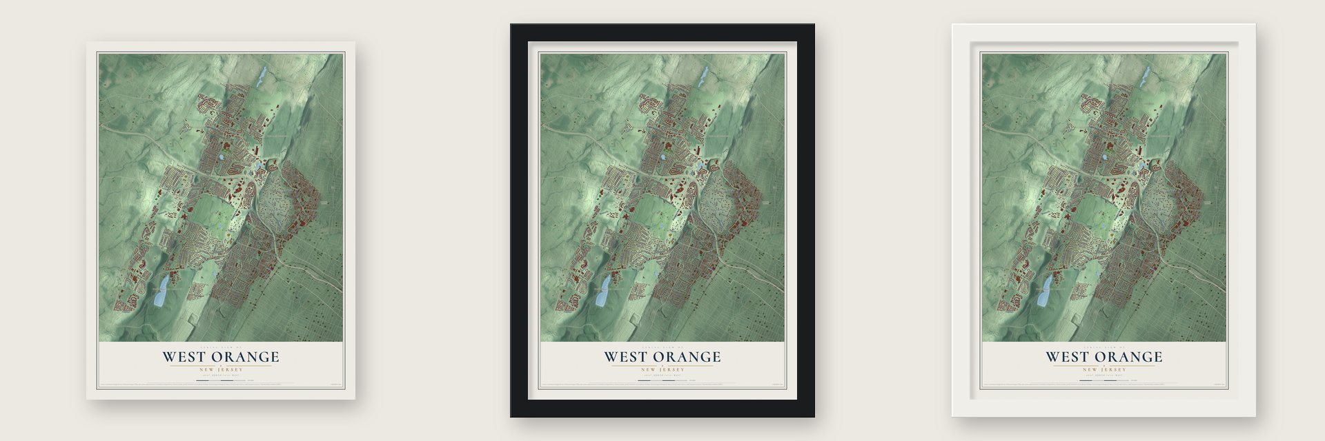
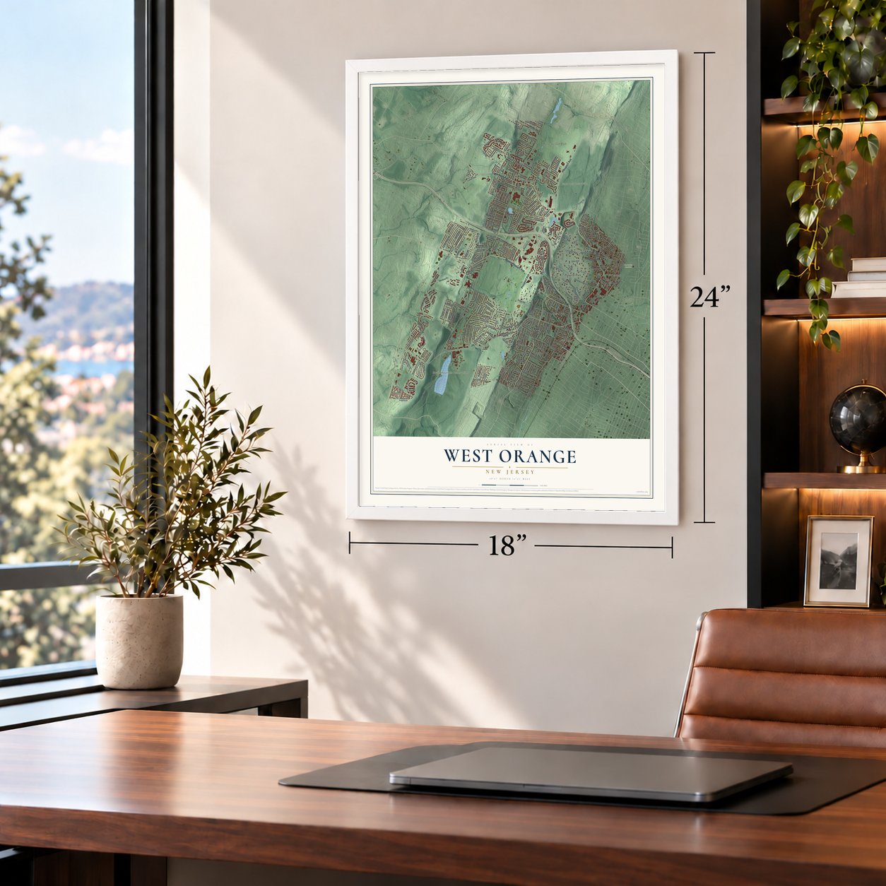
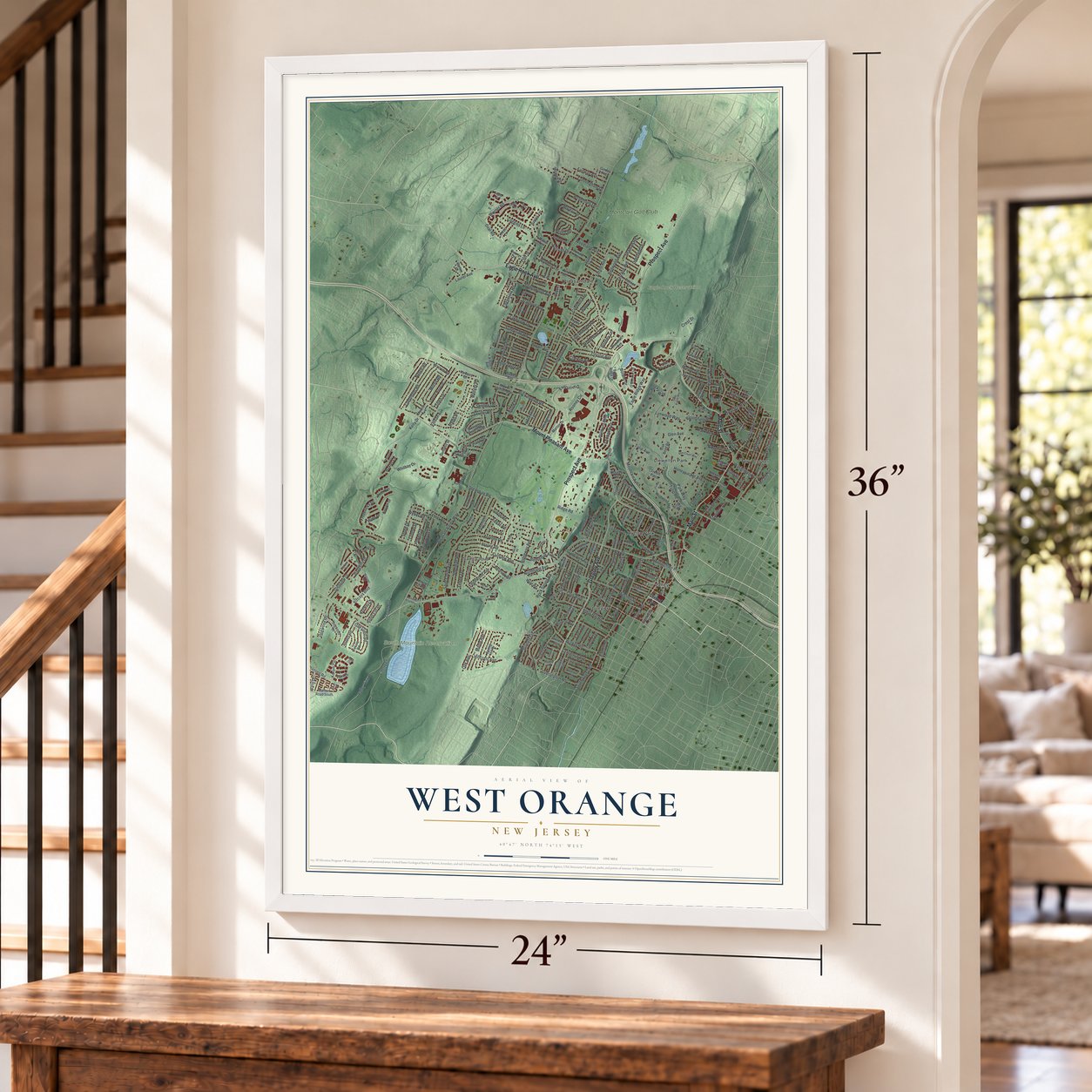
Unframed archival matte, a black wood frame or a white wood frame.
Up close
Geography Worth Displaying
This map was created using accurate cartographic data and authoritative geographic sources, including the U.S. Geological Survey (USGS) and FEMA. The map brings together terrain, waterways, roads, and building detail. The majority of the streets are labeled, houses are accurately depicted, and the topography is derived from government sources. Combining local data with carefully composed color and shading leads to this beautifully detailed West Orange artwork for your wall.
Rather than simply showing street outlines, we’ve included as many of the street names as we could reasonably fit on the map while keeping their names legible. Zoom in on the high resolution preview to see exactly what’s on the map. We truly set out to create a statement piece for anyone who loves West Orange. So whether it’s for you, or a gift for someone you love, we hope this map of West Orange brings back fond memories.
Explore the full map of West Orange, New Jersey and read about the local places it shows.

About West Orange, New Jersey
West Orange is a township of 48,843 people in Essex County, set on the Watchung Mountains about 12 miles west of Manhattan. Anthony Olive, a Dutchman, became the first European to settle here in 1678, starting a farm at the foot of the mountains on ground that is now Llewellyn Park. For more than a century the land belonged to Newark, and in the 1700s people knew it as part of the Newark Mountains.
In 1806 the Oranges broke away from Newark as Orange Township. Orange soon split apart, largely over who would pay for paid police, fire and street departments. West Orange took in the short-lived Fairmount Township, and on April 10, 1863, it became a township of its own. It became a town in 1900, then went back to being a township in 1980 to win a larger share of federal aid.
- Mary Williams at Tory CornerIn the Revolution, Main Street's Tory Corner was called Williamstown. Nathaniel Williams rallied Loyalists there, and in 1777 he and his sons James and Amos went off to serve in the British Army. His wife Mary stayed on the farm, in a house built in 1720, and aided Washington's troops. Nathaniel died of smallpox in New York and Amos never returned, though James came home decades later. The Daughters of the American Revolution gave Mary a plaque in 1922.
- Llewellyn Park, 1857Entrepreneur Llewellyn Haskell and architect Alexander Jackson Davis laid out Llewellyn Park in 1857, and it is called the first planned community in America. It is counted among the finest examples of the Romantic Landscape movement of its day.
- Edison and the Black MariaThomas Edison lived in West Orange and kept his laboratory here, where he worked on inventions that brought him more than 1,000 patents. On the lab grounds stood the Black Maria, America's first movie studio. Film making spread to Fort Lee in 1907, and independent studios later moved to Hollywood, California, to escape the Edison Trust's demands for royalties. The laboratory is now a National Historical Park.
- Hat City in the ValleyIn the late 1800s the Valley section held 34 hat factories, and West Orange was known as the country's hat making capital. Most of the industries that built the town had left by the 1960s, leaving empty warehouses behind. Today the Valley is being redeveloped as Hat City, also called the Valley Arts District.
- Uphill race in 1901By the 1800s New Yorkers came to drink from Rock Spring, at the foot of the Turtle Back Rocks, believing its water could heal. West Orange became a getaway in the country, where visitors could go boating and fishing or spend a day at the amusement park at Crystal Lake. In 1901 the town hosted the first uphill automobile test, the Eagle Rock Hill Climb.
Find your street
Names on the West Orange map
Every name below is printed on this map. Look for your street, your school, the park where you played, or the pond down the road.
Places and landmarks11
- Eagle Rock Reservation
- Rosedale Cemetery
- South Mountain Reservation
- Gregory
- Hutton Park
- Llewellyn Park
- Pleasantdale
- Saint Cloud
- The Valley
- Tory Corner
- Montclair Golf Club
Streets and roads294
- Eagle Rock Avenue
- Main Street
- Gregory Avenue
- Prospect Avenue
- Mount Pleasant Avenue
- Northfield Avenue
- Valley Road
- Harrison Avenue
- Pleasant Valley Way
- Hansen Road
- Cedar Avenue
- Mountain Avenue
- Walker Road
- Kelly Drive
- Saint Cloud Avenue
- Ridge Road
- Leonardo Drive
- Park Way
- Old Indian Road
- Cherry Lane
- South Valley Road
- Tulip Avenue
- Glen Avenue
- Rooney Circle
- Forest Hill Road
- Watchung Avenue
- Woodland Avenue
- Manger Road
- Clarken Drive
- Haggerty Drive
Show all 294 streets
- Whitbay Drive
- Mitchell Street
- Rollinson Street
- Conforti Avenue
- Valley View Drive
- Karam Circle
- Lorelei Road
- Rock Spring Road
- Arverne Road
- Oval Road
- Fairview Avenue
- Franklin Avenue
- Mayfair Drive
- Lessing Road
- Edgewood Avenue
- Crestmont Road
- Nance Road
- Watson Avenue
- Crest Drive
- Vizcaya Boulevard
- Crystal Avenue
- Nestro Road
- Valley Way
- Stanford Avenue
- Carteret Street
- Redwood Avenue
- Luddington Road
- Terrace Avenue
- Burnett Terrace
- Glenview Drive
- Forest Avenue
- Underwood Drive
- Stone Drive
- Seaman Road
- Elm Street
- Rosemont Terrace
- Sullivan Drive
- Lowell Avenue
- Boland Drive
- Ralph Road
- Brookside Road
- Lawrence Avenue
- Oak Crest Road
- Warren Road
- Ridgeway Avenue
- Garfield Avenue
- Fitzrandolph Road
- Howell Drive
- Bloomfield Way
- Edgemont Road
- Executive Drive
- Maple Avenue
- Sheridan Avenue
- Fredericks Street
- Baxter Lane
- Laurel Avenue
- Beverly Road
- Ashland Avenue
- Oakridge Road
- Buckingham Road
- Collamore Terrace
- Korwel Circle
- Dogwood Road
- Eagle Ridge Way
- Oak Avenue
- Cunningham Drive
- Suburban Drive
- Warner Road
- Benvenue Avenue
- Gilbert Place
- Lakeview Drive
- Greenwood Avenue
- Kirk Street
- Morris Road
- Hillcrest Avenue
- Highwood Road
- Washington Street
- Lenox Terrace
- Cherry Street
- Sunnyside Road
- Lynwood Way
- Honeysuckle Avenue
- Whittingham Place
- Robertson Road
- Fairway Avenue
- Aspen Road
- William Street
- Coggins Lane
- Connel Drive
- Edgar Road
- Carter Road
- Riggs Place
- Moore Terrace
- Powell Drive
- Belle Terre Road
- Park Terrace
- Club Boulevard
- Marmon Terrace
- Cliff Street
- Cullen Drive
- Weber Road
- Rocky Way
- Summit Street
- Standish Avenue
- Deerfield Drive
- Pine Street
- Gavin Road
- Skyline Drive
- Brook Place
- Pool Drive
- Rand Drive
- Ellison Avenue
- Yale Terrace
- Shelley Terrace
- Rosney Terrace
- Tulip Road
- Barry Drive
- Oxford Terrace
- Luth Terrace
- Witte Place
- Hart Drive
- Meade Street
- Kling Street
- Central Avenue
- Hansen Road South
- Oak Bend Road
- Blueberry Bend
- Wildwood Avenue
- Winding Way
- High Street
- Maple Street
- Waddington Avenue
- McGuire Drive
- O'Connor Circle
- Randolph Place
- Phyllis Road
- Edgehill Road
- Linden Avenue
- Kessler Drive
- Hutton Avenue
- Cobane Terrace
- Mountain Drive
- Eagle Ridge Drive
- Spring Hill Drive
- Dogwood Drive
- Glen Road
- Cannon Street
- Bakley Terrace
- Hillside Avenue
- Fairway Drive
- Hoover Avenue
- Overlook Avenue
- Kinzel Lane
- Nutwold Avenue
- Fairmount Avenue
- Marion Drive
- Lapis Circle
- Kitchner Avenue
- Araneo Drive
- Wedgewood Drive
- Hickory Road
- Dartmouth Road
- Cornell Street
- Hooper Avenue
- Grand View Avenue
- Tenney Road
- Marie Terrace
- Westview Road
- Woods End Road
- Westminster Terrace
- Swaine Place
- Ridgehurst Road
- Westwood Drive South
- Mount Vernon Avenue
- Freeman Place
- Woodhull Avenue
- Quarry Terrace
- Sayres Place
- Kenz Terrace
- Brennan Drive
- West Road
- Barton Drive
- Himsl Court
- Merklin Avenue
- Kovach Court
- Greentree Road
- Stockman Street
- Osborne Place
- Dale Drive
- Beasley Street
- Ronald Terrace
- Oak Terrace
- Trefoil Pass
- Calvin Terrace
- Bradley Terrace
- Fern Drive
- Helen Avenue
- Gaston Street
- Shepard Terrace
- Dawes Avenue
- Brook End Drive
- Gerdes Avenue
- Faas Court
- Herbert Terrace
- Davey Drive
- Colonial Woods Drive
- Elm Court Way
- Metzger Drive
- Lincoln Avenue
- Steven Terrace
- Longview Street
- Ridgeview Avenue
- Undercliff Terrace
- Clonavor Road
- Rutgers Street
- Devon Drive
- Harriet Street
- Harvard Terrace
- Liberty Street
- Beaumont Terrace
- Mullarkey Drive
- Ardmore Road
- Cleveland Terrace
- Lonergan Lane
- Pitney Street
- Lowell Place
- Barone Road
- Paris Circle
- Eftis Court
- Elliott Place
- Brook Way
- Wheeler Street
- Short Drive
- Alden Street
- Alan Street
- Linden Court
- Smith Manor Boulevard
- Long Branch Way
- Rock Spring Avenue
- Colony Drive East
- Ferris Drive
- Mann Avenue
- Crestwood Drive
- Ashley Road
- Hepworth Place
- Virginia Avenue
- Haller Road
- Fowler Drive
- Querques Lane
- Lancaster Terrace
- Barringer Court
- Nymph Road
- Florence Place
- Forest Way
- Northfield Road Rmp
- Devore Drive
- Cross Street
- Wadams Court
- Dean Street
- Murphy Court
- Essex Terrace
- Averne Road
- Condit Lane
- Susan Court
Names are listed as they appear on the printed map. Zoom into the product photos to find them.
The art of mapping a place
How This Map Was Made
Real places. Remarkable detail. Discover the layers that turn geographic data into a map of home.

The view from above
Aerial imagery reveals the character of the land: woodland, open fields, and the patterns of a place.

The shape of the land
Elevation data brings hills, valleys, and subtle changes in the landscape into view.

The details of home
Roads, waterways, and building footprints come together to make the map feel unmistakably local.

Geography becomes art
Considered color, shading, and typography bring the layers together in a map made for your wall.


Process illustrated with Mendon, Massachusetts. Aerial imagery: USDA NAIP. Terrain: USGS 3D Elevation Program. Map details and finished artwork: KNOWOL.
The Details
About This Print
Choose an archival matte print, or a black or white Ayous wood frame. The archival matte print is unframed.
Select your size and finish above to see the matching product image and price.
Materials & Craftsmanship
A contemporary map with the character of a classic atlas, printed on archival matte paper. Optional frames are made from Ayous wood.
Your printed map does not include the watermark shown in the full-map preview.
Shipping & Delivery
Free shipping within the United States. Every print is made to order in the USA.
Buying a gift? Add a note in your cart and we'll include it. We never put prices in the package.
Prints ship within 2 to 3 business days. Allow 7 to 10 days total from ordering for delivery. Timing may vary during holidays or periods of high order volume.
Read our shipping policy.
Returns and damaged prints
Each print is made to order. Change-of-mind refunds are not available after production.
If your print arrives damaged, misprinted or incorrect, contact support@knowol.com within 30 days of receiving it. Include your order number, photos and a description of the issue.
Read our full refund and replacement policy. For questions about your order, email support@knowol.com.
Find your town
Looking for another city?
Find a map of home in our New Jersey collection, or any town in the country.
Nearby
Maps of towns near West Orange
Know someone from one of these towns? Their map makes a great gift.
 Llewellyn Park
, New Jersey
From $39.99See the map
 Pleasantdale
, New Jersey
From $39.99See the map
 City of Orange
, New Jersey
From $39.99See the map
More maps nearby: South Orange Village, Essex Fells, East Orange, Watsessing and Livingston.