
Search for another town


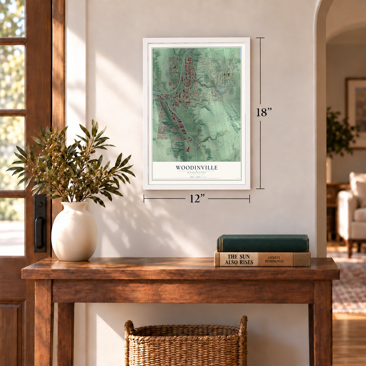
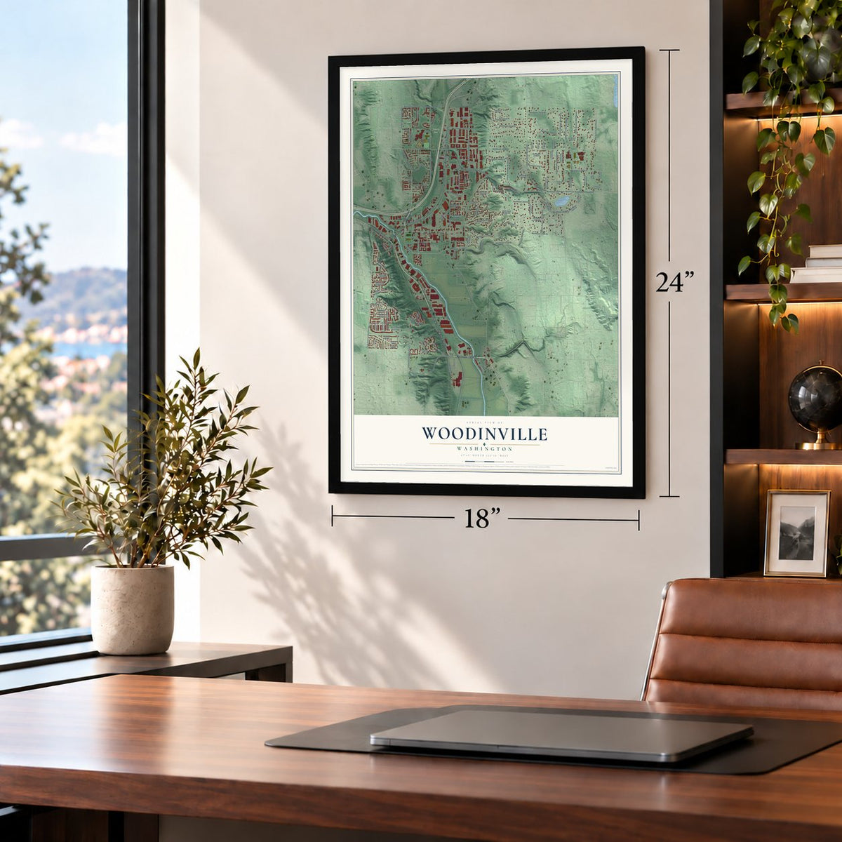
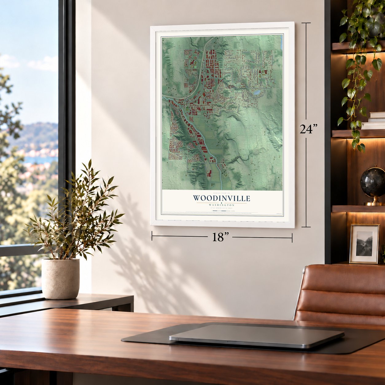

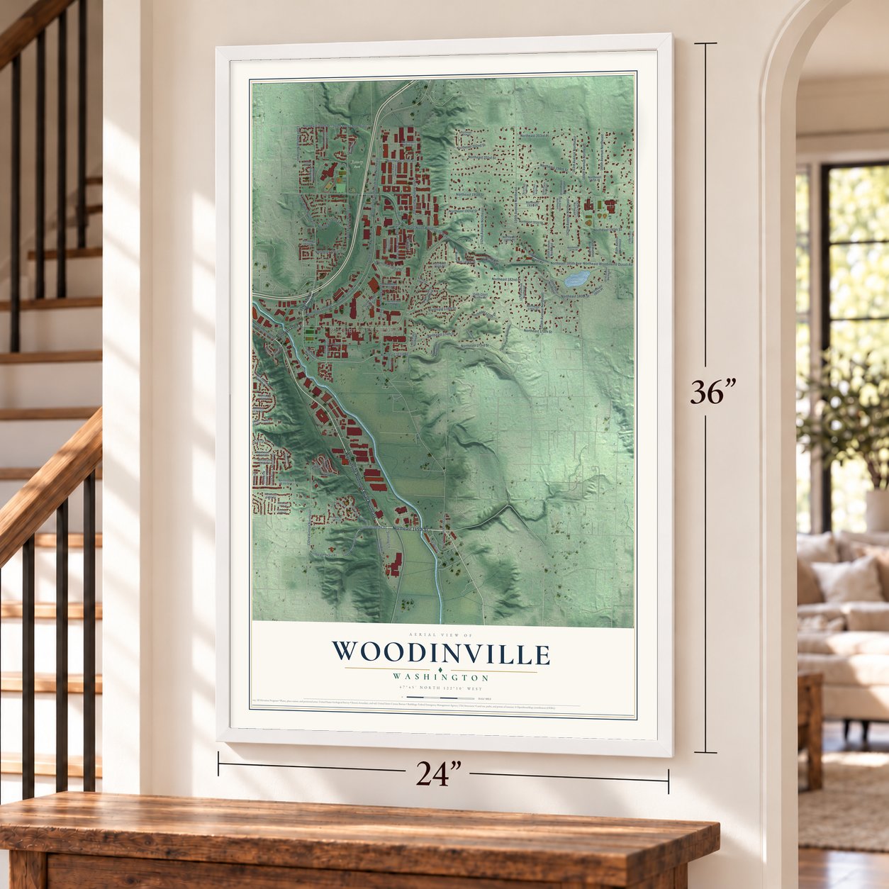
Free U.S. delivery 7 to 10 days after you order
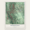
Woodinville, Washington Map Art
A new map of Woodinville, Washington, made in 2026 and printed to order on thick archival matte paper.
12" x 18" Archival Matte Print
A Map of Home. A Work of Art.
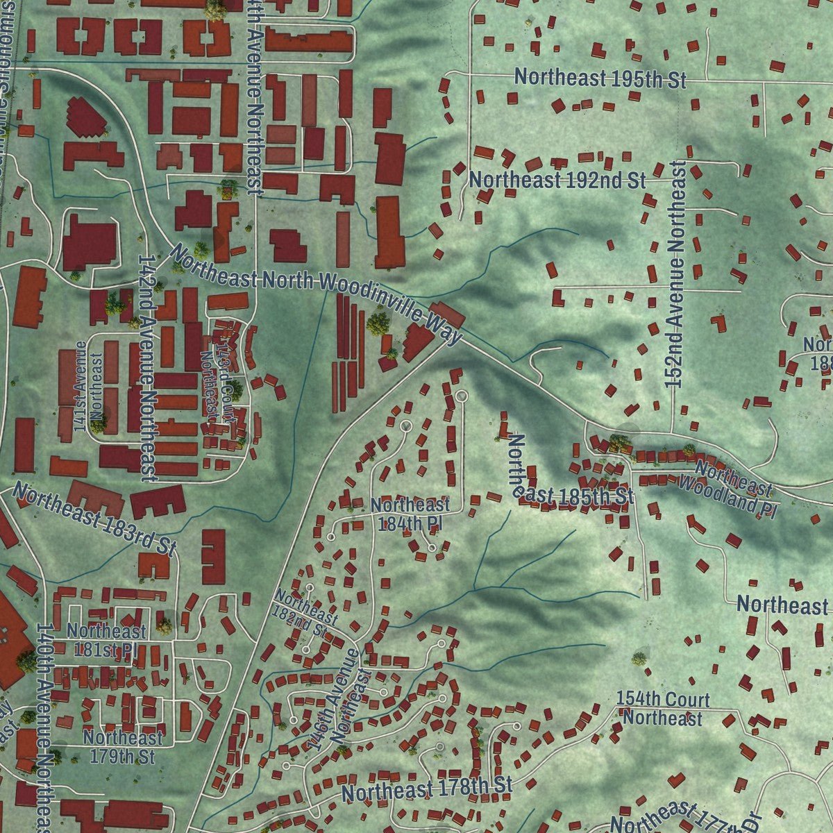
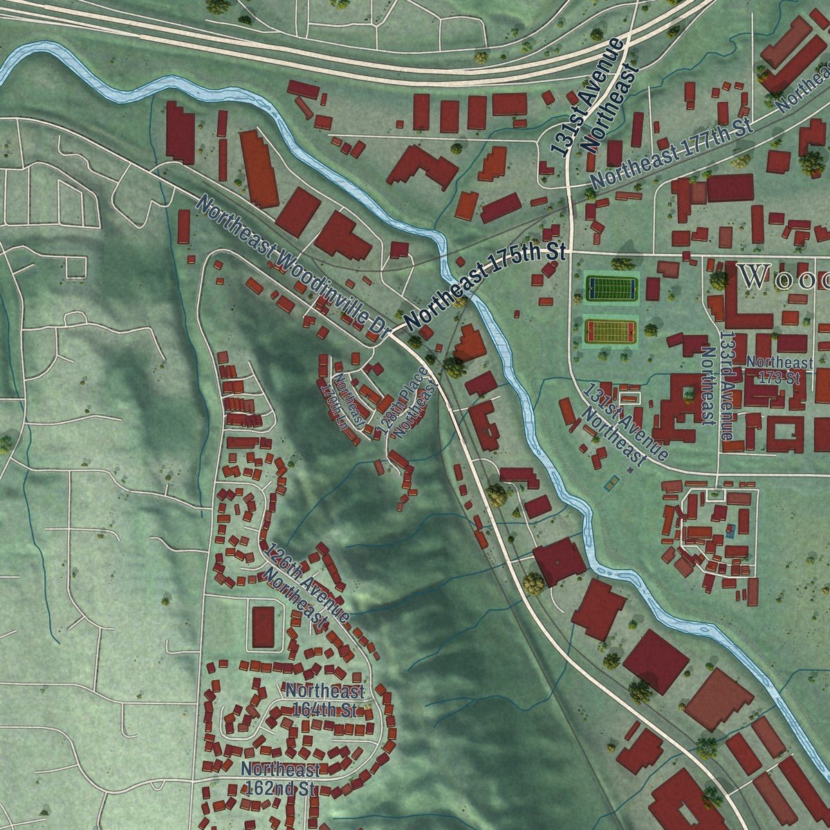
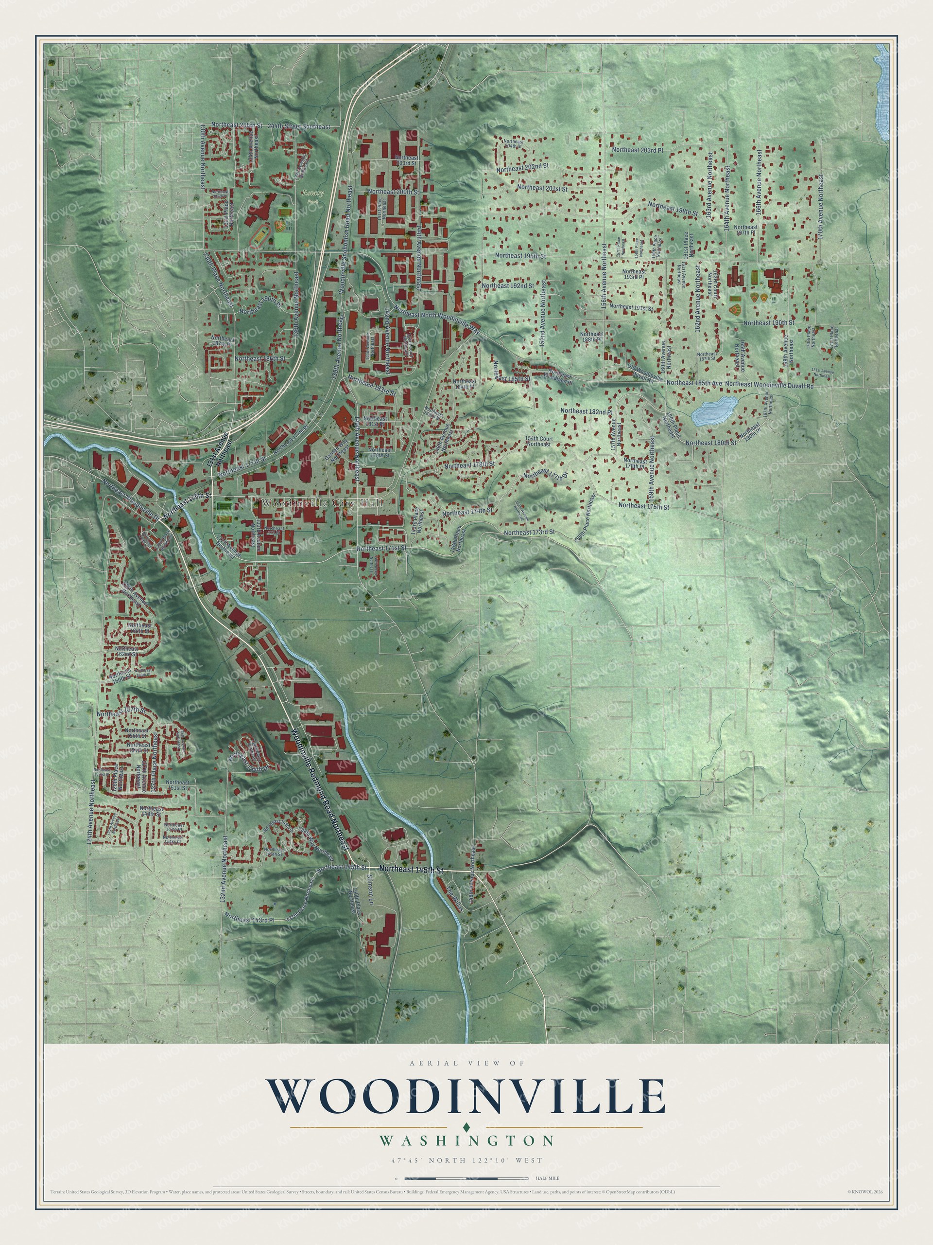
Explore Woodinville, Washington from a whole new perspective. Created using aerial imagery and detailed geographic data, this map captures Woodinville building by building, with labeled streets, familiar landmarks, and shaded topographical relief that highlights the natural contours of the landscape.
Combining modern data with the timeless character of a vintage atlas, this map is just as interesting up close as it is beautiful on the wall. Whether you grew up in Woodinville, spent memorable years there, or call it home today, this unique map is a great way to celebrate a place that means something to you. Zoom in on the preview to look for your street, and then order a print to put your memories on the wall.
Three ways to hang it
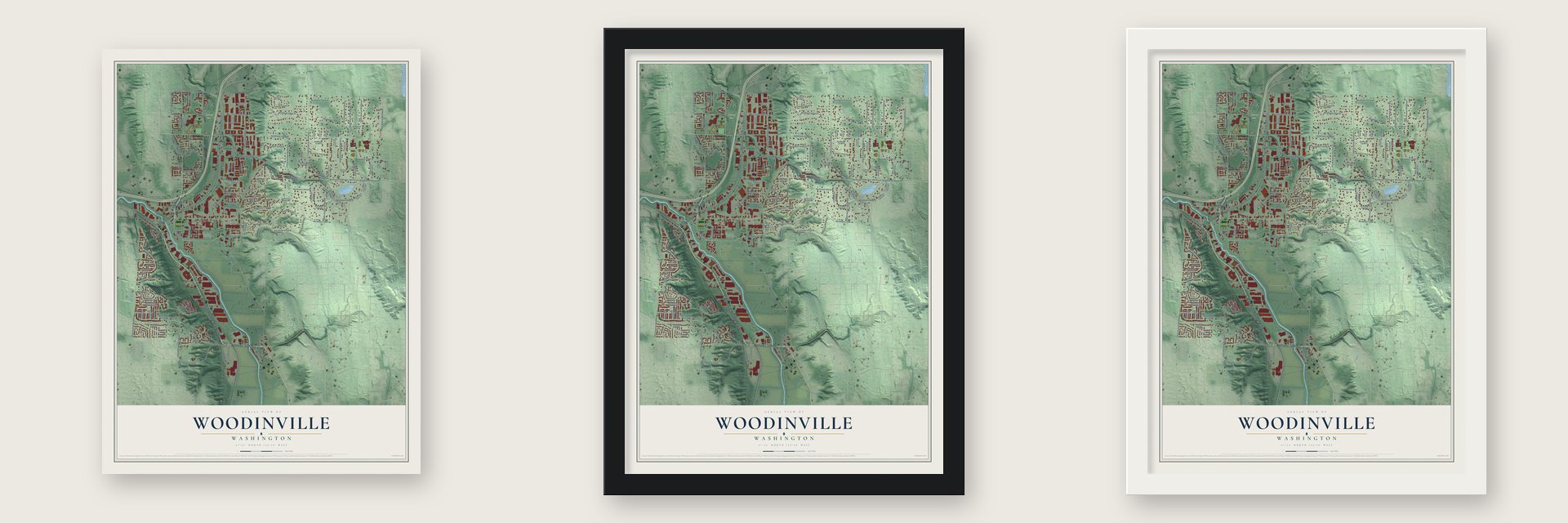
Unframed archival matte, a black wood frame or a white wood frame.
Up close
Geography Worth Displaying
This map was created using accurate cartographic data and authoritative geographic sources, including the U.S. Geological Survey and the Census Bureau. The map brings together terrain, waterways, roads, and building detail. The majority of the streets are labeled, houses are accurately depicted, and the topography is derived from government sources. Combining local data with carefully composed color and shading leads to this beautifully detailed Woodinville artwork for your wall.
Rather than simply showing street outlines, we’ve included as many of the street names as we could reasonably fit on the map while keeping their names legible. Zoom in on the high resolution preview to see exactly what’s on the map. We truly set out to create a statement piece for anyone who loves Woodinville. So whether it’s for you, or a gift for someone you love, we hope this map of Woodinville brings back fond memories.
Read the story behind this map of Woodinville, Washington from 2026.
About Woodinville, Washington
Woodinville is a city of 13,069 people in King County, on the Sammamish River about 20 miles northeast of downtown Seattle. In 1871 Ira and Susan Woodin left Seattle with their daughters, Helen and Mary, and settled on 160 acres along the river, which was then called Squak Slough. Their home became the heart of the new settlement. It held the first church until 1880 and the first school from 1878 to 1883, and from 1881 it was also the post office, with Susan as postmaster.
Growth came slowly at first, and by 1886 only 60 people lived here. That changed when the Seattle, Lake Shore & Eastern Railroad reached town in late 1887 or early 1888. By 1909 the town supported four hotels, a pair of sawmills and a pair of shingle mills, along with a brick and tile maker and a small factory that built school desks. The town stayed rural until the late 1970s. In 1985 Bothell tried to annex parts of it, and that fight started a campaign for cityhood. On the third try, voters approved incorporation on May 19, 1992, and Woodinville became a city on March 27, 1993.
“Thrills and spills were guaranteed as the boats thundered along the shallow, snaking river at speeds of up to 80 miles an hour.”
- Steamboats on Squak SloughThere were no roads into the valley at first, so the twisting river served as the main highway. The Mud Hen became the first steamboat on it in 1876. From 1884 to 1892 the Squak made two trips a week between Lake Washington and Lake Sammamish and stopped at the Woodins' place. Steamboats finally quit in 1916, when the Lake Washington Ship Canal lowered the lake nearly nine feet and left the river too shallow for them.
- Holly trees and a wineryLumber baron Frederick Stimson planted hundreds of holly trees along his driveway, and in 1911 he persuaded the logging camp of Derby to rename itself Hollywood. He finished Stimson Manor in 1912 and ran a dairy on Hollywood Farm, later adding chickens and hogs. The manor may have been a speakeasy during Prohibition. U.S. Tobacco bought the grounds in 1973 and opened Chateau Ste. Michelle, the town's first winery, in 1976. Hollywood Farm joined the National Register in 1978.
- The Sammamish Slough RaceThe Seattle Outboard Association first raced boats down the river in March 1934. Crowds were so large that a second race followed a month later, and it soon became a yearly event drawing tens of thousands to the banks from Kenmore to Redmond. It ended in 1976, after a boat ran onto the bank and broke the leg of Ron Clausen, a University of Washington pole vaulter. By then a 1965 project had halved the river's length.
- John DeYoung's storeIn February 1925 John DeYoung of Kent read a newspaper ad offering a general store for sale. He went to Woodinville that same day and bought Teegarden's Shop. He built it into the Woodinville Mercantile Company, which sold food, goods and gasoline, and he later added a lettuce packing plant, a shingle mill and a hardware store. DeYoung's Farm and Garden Center opened in 1944. His granddaughter, Lucy DeYoung, was elected the city's first mayor in 1992.
- Led Zeppelin in 1969In 1969 the Seattle Pop Festival took over Gold Creek Park in Woodinville. Led Zeppelin and The Guess Who were among the rock bands that played there.
Find your street
Names on the Woodinville map
Every name below is printed on this map. Look for your street, your school, the park where you played, or the pond down the road.
Places and landmarks2
- Woodinville City Hall
- Rotary Park
Streets and roads128
- Woodinville Redmond Road Northeast
- Northeast 145th Street
- Northeast 175th Street
- Northeast 171st Street
- Northeast 180th Street
- Northeast 183rd Street
- 132nd Avenue Northeast
- 142nd Avenue Northeast
- Northeast 195th Street
- Northeast North Woodinville Way
- Northeast 177th Drive
- Woodinville Snohomish Road Northeast
- 140th Avenue Northeast
- Northeast Woodinville Duvall Road
- 124th Avenue Northeast
- Northeast 178th Street
- Northeast 190th Street
- Northeast 185th Avenue
- Northeast 198th Street
- 144th Avenue Northeast
- 156th Avenue Northeast
- 136th Avenue Northeast
- 164th Avenue Northeast
- 130th Avenue Northeast
- Northeast 202nd Street
- 170th Avenue Northeast
- Northeast 203rd Place
- Northeast 177th Street
- Northeast 205th Street
- 139th Avenue Northeast
Show all 128 streets
- 162nd Avenue Northeast
- 244th Street Southeast
- Northeast 201st Street
- 166th Avenue Northeast
- Northeast 174th Street
- 159th Avenue Northeast
- Northeast 192nd Street
- Northeast 173rd Street
- 152nd Avenue Northeast
- Northeast 200th Street
- 163rd Avenue Northeast
- 130th Place Northeast
- Northeast 186th Street
- Northeast 185th Street
- Northeast 182nd Place
- 127th Place Northeast
- Northeast 190th Place
- Northeast Woodinville Drive
- Northeast 157th Street
- Stimson Lane
- Northeast 143rd Place
- Northeast 154th Drive
- The Willas
- 131st Avenue Northeast
- 146th Place Northeast
- 157th Avenue Northeast
- 137th Place Northeast
- 160th Place Northeast
- Northeast 179th Street
- Northeast 162nd Street
- Northeast 180th Place
- Old Woodinville Duvall Road
- Northeast 203rd Street
- 148th Avenue Northeast
- 126th Avenue Northeast
- 160th Avenue Northeast
- 146th Avenue Northeast
- Northeast 193rd Place
- 168th Avenue Northeast
- Northeast 177th Place
- 134th Avenue Northeast
- Northeast 149th Street
- Northeast 184th Place
- 155th Place Northeast
- 154th Court Northeast
- 125th Place Northeast
- Northeast 197th Place
- 127th Avenue Northeast
- Garden Way Northeast
- 131st Place Northeast
- 133rd Avenue Northeast
- Northeast 156th Street
- 140th Place Northeast
- Northeast 154th Street
- 138th Way Northeast
- Northeast 188th Place
- 165th Avenue Northeast
- Northeast 178th Place
- Northeast 191st Street
- Northeast Woodland Place
- Northeast 181st Place
- 163rd Court Northeast
- 143rd Place Northeast
- Northeast 164th Street
- Northeast 187th Place
- Northeast 151st Street
- Northeast 160th Street
- 161st Place Northeast
- Northeast 146th Place
- 134th Place Northeast
- 141st Place Northeast
- Northeast 148th Street
- Northeast 147th Place
- Northeast 182nd Street
- Northeast 204th Street
- 128th Place Northeast
- 167th Avenue Northeast
- 171st Place Northeast
- 161st Avenue Northeast
- 143rd Court Northeast
- 137th Avenue Northeast
- 141st Avenue Northeast
- Northeast 173 Street
- Northeast 146th Street
- 170th Place Northeast
- 159th Place Northeast
- Northeast 187th Street
- 151st Avenue Northeast
- Northeast 152nd Street
- 129th Avenue Northeast
- 171st Avenue Northeast
- Northeast 170th Lane
- 140th Court Northeast
- Northeast 200th Place
- 125th Avenue Northeast
- 157th Place Northeast
- 158th Place Northeast
- Northeast 160th Place
Names are listed as they appear on the printed map. Zoom into the product photos to find them.
The art of mapping a place
How This Map Was Made
Real places. Remarkable detail. Discover the layers that turn geographic data into a map of home.

The view from above
Aerial imagery reveals the character of the land: woodland, open fields, and the patterns of a place.

The shape of the land
Elevation data brings hills, valleys, and subtle changes in the landscape into view.

The details of home
Roads, waterways, and building footprints come together to make the map feel unmistakably local.

Geography becomes art
Considered color, shading, and typography bring the layers together in a map made for your wall.


Process illustrated with Mendon, Massachusetts. Aerial imagery: USDA NAIP. Terrain: USGS 3D Elevation Program. Map details and finished artwork: KNOWOL.
The Details
About This Print
Choose an archival matte print, or a black or white Ayous wood frame. The archival matte print is unframed.
Select your size and finish above to see the matching product image and price.
Materials & Craftsmanship
A contemporary map with the character of a classic atlas, printed on archival matte paper. Optional frames are made from Ayous wood.
Your printed map does not include the watermark shown in the full-map preview.
Shipping & Delivery
Free shipping within the United States. Every print is made to order in the USA.
Buying a gift? Add a note in your cart and we'll include it. We never put prices in the package.
Prints ship within 2 to 3 business days. Allow 7 to 10 days total from ordering for delivery. Timing may vary during holidays or periods of high order volume.
Read our shipping policy.
Returns and damaged prints
Each print is made to order. Change-of-mind refunds are not available after production.
If your print arrives damaged, misprinted or incorrect, contact support@knowol.com within 30 days of receiving it. Include your order number, photos and a description of the issue.
Read our full refund and replacement policy. For questions about your order, email support@knowol.com.
Find your town
Looking for another city?
Find a map of home in our Washington collection, or any town in the country.
Nearby
Maps of towns near Woodinville
Know someone from one of these towns? Their map makes a great gift.
 Bothell
, Washington
From $39.99See the map
 Cottage Lake
, Washington
From $39.99See the map
 Maltby
, Washington
From $39.99See the map
More maps nearby: Bothell East, Kenmore, Clearview, Kirkland and Bothell West.