
Search for another town





Free U.S. delivery 7 to 10 days after you order
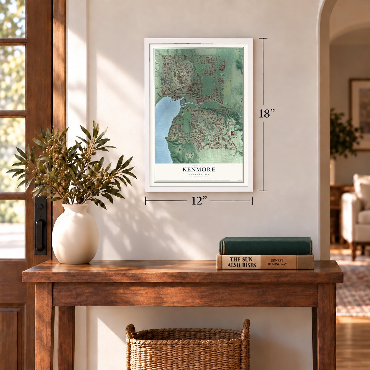
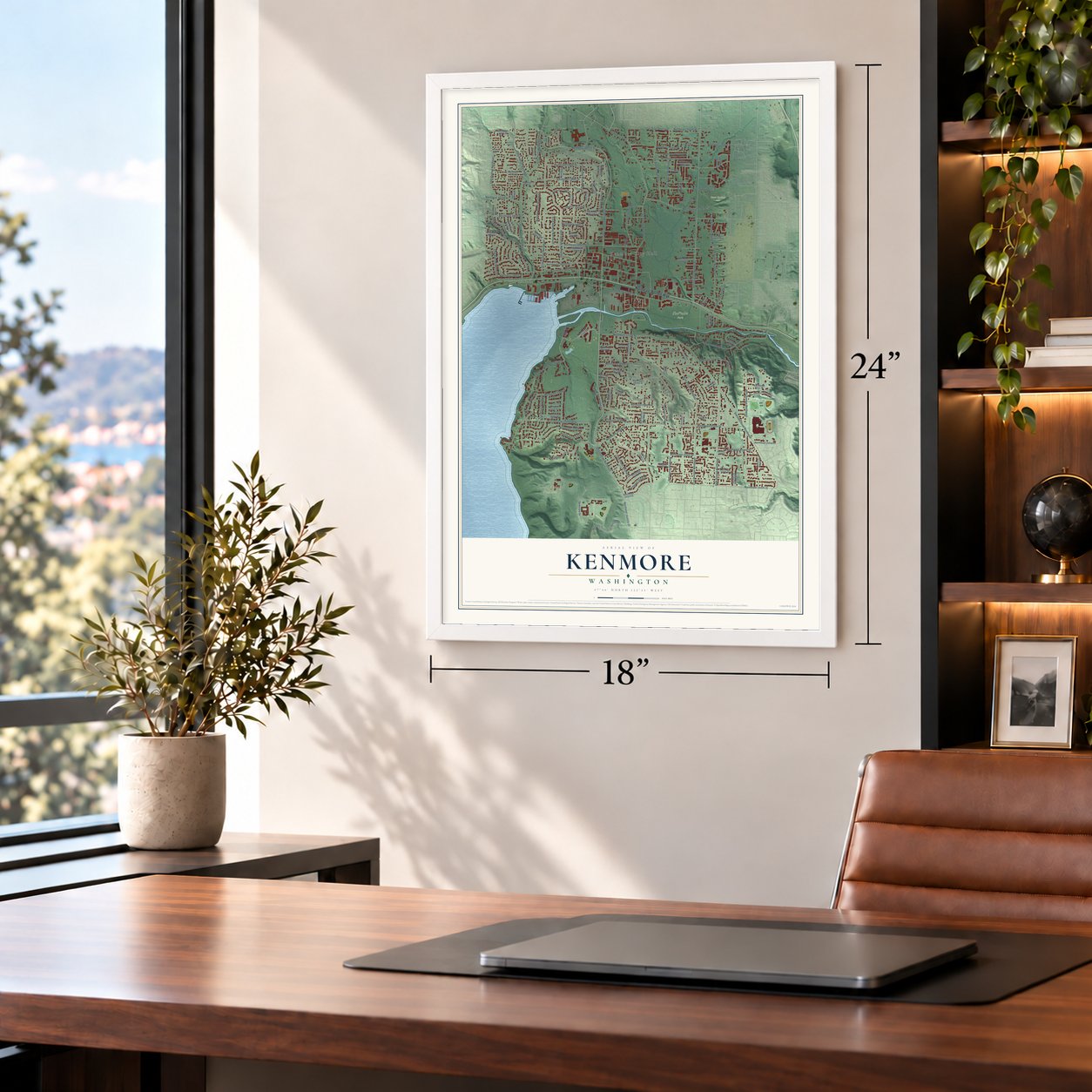
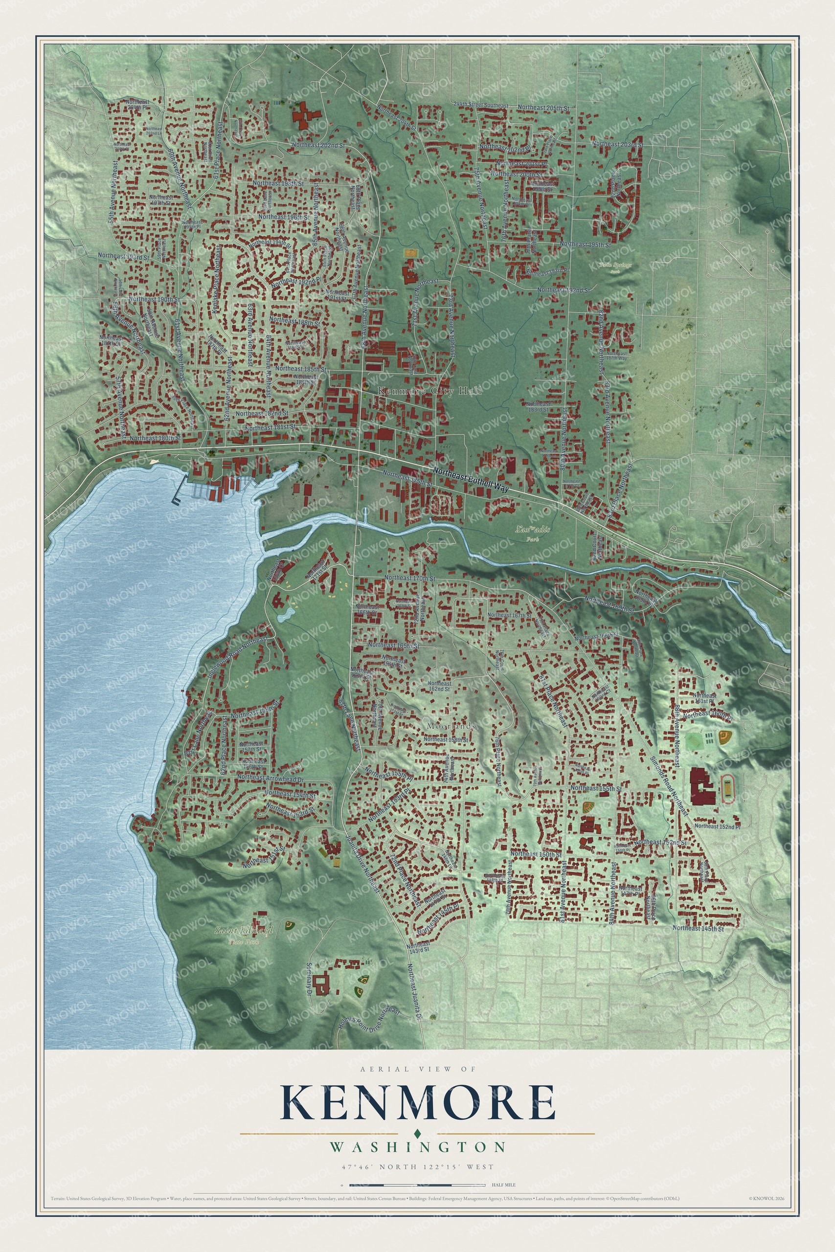
Kenmore, Washington Map Art
A new map of Kenmore, Washington, made in 2026 and printed to order on thick archival matte paper.
12" x 18" Archival Matte Print
A Map of Home. A Work of Art.
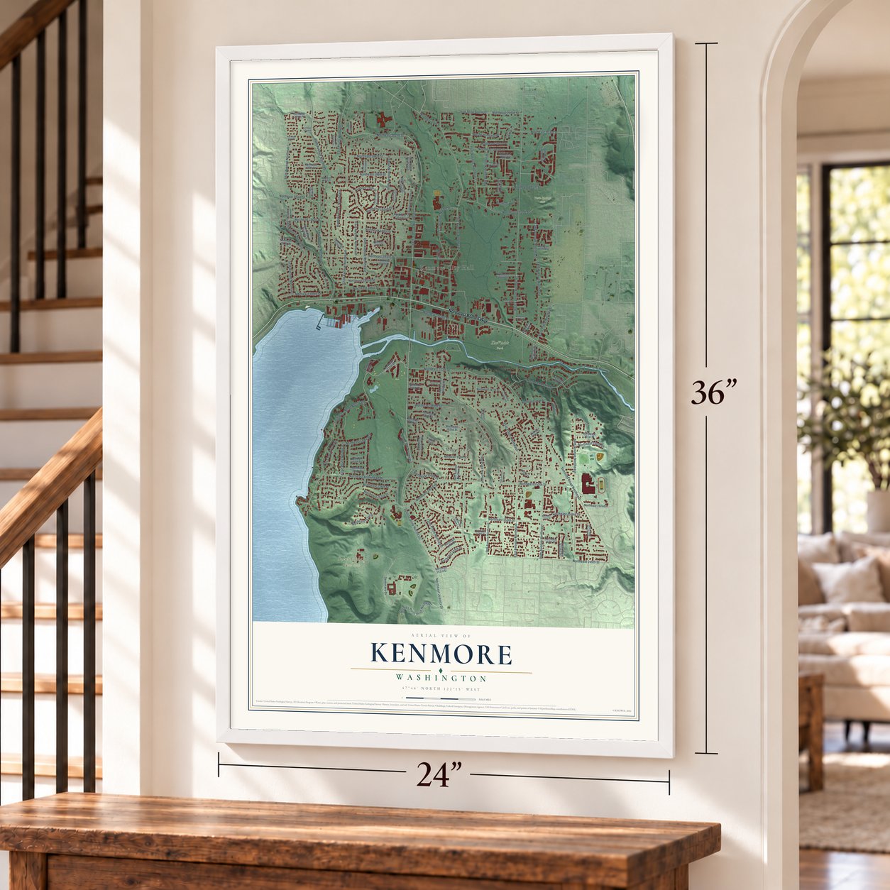
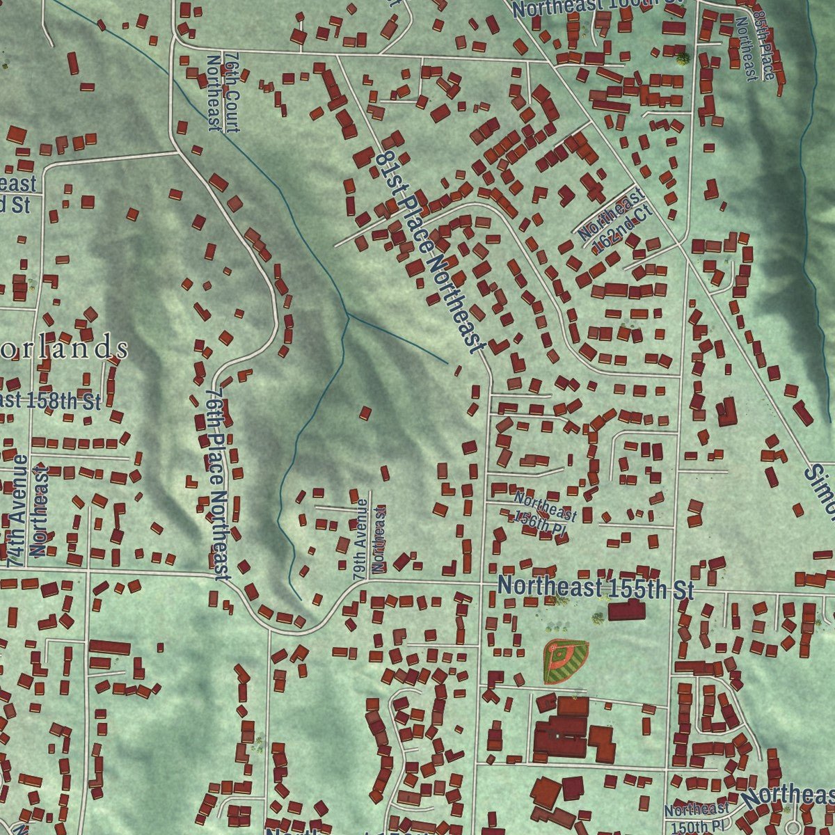
Explore Kenmore, Washington from a whole new perspective. Created using aerial imagery and detailed geographic data, this map captures Kenmore building by building, with labeled streets, familiar landmarks, and shaded topographical relief that highlights the natural contours of the landscape.
Combining modern data with the timeless character of a vintage atlas, this map is just as interesting up close as it is beautiful on the wall. Whether you grew up in Kenmore, spent memorable years there, or call it home today, this unique map is a great way to celebrate a place that means something to you. Zoom in on the preview to look for your street, and then order a print to put your memories on the wall.
Three ways to hang it
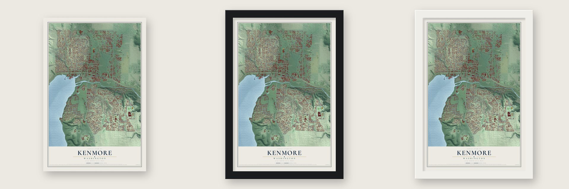
Unframed archival matte, a black wood frame or a white wood frame.
Up close
Geography Worth Displaying
This map was created using accurate cartographic data and authoritative geographic sources, including the U.S. Geological Survey and the Census Bureau. The map brings together terrain, waterways, roads, and building detail. The majority of the streets are labeled, houses are accurately depicted, and the topography is derived from government sources. Combining local data with carefully composed color and shading leads to this beautifully detailed Kenmore artwork for your wall.
Rather than simply showing street outlines, we’ve included as many of the street names as we could reasonably fit on the map while keeping their names legible. Zoom in on the high resolution preview to see exactly what’s on the map. We truly set out to create a statement piece for anyone who loves Kenmore. So whether it’s for you, or a gift for someone you love, we hope this map of Kenmore brings back fond memories.
Read the story behind this map of Kenmore, Washington from 2026.

About Kenmore, Washington
Kenmore is a city of 23,914 people in King County, on the north shore of Lake Washington where the Sammamish River flows in. In 1900 Watson Squire, a future territorial governor, leased 12 acres on the lakefront to John McMaster and Chris Kruse, who built a shingle mill on the site the following year. McMaster named the village that grew up around it after his old home, Kenmore, Ontario. McMaster's son William served as the first postmaster.
The mill's trouble began in 1917, when Lake Washington was lowered for the new ship canal. The ground under the mill shifted, and it closed for two years of repairs. Most of the big old trees had been cut by then, so the mill ran only off and on until it burned in 1928. McMaster died two years later, in 1930.
“Few people were fooled; the name itself was, in fact, a well-known slang term meaning "speakeasy".”
- The village of Tl'awh-ah-deesWhere the Sammamish River meets Lake Washington, the Sts'ahp-absh, part of the Duwamish and Sammamish tribes, kept a winter village of longhouses, likely with a ceremonial building. They traveled between the two lakes in cedar dugout canoes. After tribal leaders signed the Point Elliott Treaty in 1855, most of them left the valley, and their villages soon vanished.
- Roadhouses on Bothell WayTraffic on Bothell Way brought cafes and roadhouses to Kenmore, and during Prohibition some sold illegal liquor to Seattle's Jazz Age crowd. The Blind Pig, on Shuter's Landing, sat on the lake so its stock could be dumped in the water if needed. So many fights broke out at the Inglewood Tavern that people called it the Bucket of Blood. More than 30 restaurants, dance halls, bars and clubs crowded three blocks, shaping the town into the 1940s.
- Seaplanes since 1946Kenmore Air started flying from the Lake Washington shore in 1946, close to where the Blind Pig once stood. Its seaplanes now serve waterside towns across Cascadia. No seaplane-only passenger base in the country is bigger than Kenmore Air Harbor.
- A piece of the World's FairThe Jewel Box Building in downtown Kenmore first stood at Seattle Center during the Seattle World's Fair. After the fair closed in October 1962, it was moved to Kenmore.
- A city at last in 1998King County provided police and fire service for most of the 1900s. Voters rejected incorporation six times between 1950 and 1970, but the state's 1990 Growth Management Act left Kenmore open to annexation by neighbors. In 1997, 70 percent voted for cityhood, and Kenmore became a city on August 31, 1998. Leaders met first in an empty storefront, then an old Wells Fargo bank, and in 2010 moved into a new LEED Gold City Hall on 68th Avenue NE.
Find your street
Names on the Kenmore map
Every name below is printed on this map. Look for your street, your school, the park where you played, or the pond down the road.
Places and landmarks5
- Kenmore City Hall
- Saint Edward State Park
- Twin Springs Park
- ƛ̕ax̌ʷadis Park
- Moorlands
Streets and roads143
- Northeast Bothell Way
- Juanita Drive Northeast
- 68th Avenue Northeast
- Northeast 170th Street
- 75th Avenue Northeast
- Northeast Juanita Drive
- 63rd Avenue Northeast
- Northeast 155th Street
- Inglewood Road Northeast
- Northeast 155th Place
- 72nd Place Northeast
- Northeast 150th Street
- 76th Avenue Northeast
- 56th Avenue Northeast
- 61st Place Northeast
- Northeast 190th Street
- 88th Avenue Northeast
- Northeast 202nd Street
- Northeast 169th Street
- 62nd Place Northeast
- 62nd Avenue Northeast
- 60th Avenue Northeast
- Northeast 175th Street
- 73rd Avenue Northeast
- Simonds Road Northeast
- 80th Avenue Northeast
- 61st Avenue Northeast
- Northeast 181st Street
- 84th Avenue Northeast
- Northeast 196th Street
Show all 143 streets
- Northeast 145th Street
- Northeast 182nd Street
- 64th Avenue Northeast
- 55th Avenue Northeast
- Northeast 198th Street
- Northeast Arrowhead Drive
- 81st Avenue Northeast
- Northeast 185th Street
- Northeast 165th Street
- Northeast 195th Street
- 65th Avenue Northeast
- Northeast 152nd Street
- Northeast 203rd Street
- Northeast 153rd Street
- Northeast 192nd Street
- 83rd Avenue Northeast
- Northeast 200th Street
- 71st Avenue Northeast
- Northeast 154th Street
- Northeast 205th Street
- Northeast 145th Place
- 81st Place Northeast
- Northeast 159th Street
- 57th Avenue Northeast
- Northeast 153rd Place
- Holmes Point Drive Northeast
- 83rd Place Northeast
- Kenlake Place Northeast
- Northeast 151st Street
- Seminary Drive
- Northeast 202nd Place
- Northeast 193rd Street
- Northeast 201st Place
- Northeast 180th Street
- 82nd Avenue Northeast
- Northeast 192nd Place
- Northeast 160th Place
- 67th Lane Northeast
- 61st Lane Northeast
- Northeast 188th Street
- 66th Avenue Northeast
- 76th Place Northeast
- 66th Place Northeast
- Northeast 163rd Street
- Northeast 187th Street
- Northeast 171st Street
- Northeast 204th Place
- 82nd Place Northeast
- 58th Avenue Northeast
- 67th Avenue Northeast
- 70th Avenue Northeast
- Northeast 147th Street
- 78th Avenue Northeast
- 74th Avenue Northeast
- 72nd Avenue Northeast
- Northeast 158th Street
- Northeast 184th Street
- Northeast 156th Street
- Northeast 183rd Street
- Northeast 204th Street
- 244th Street Southeast
- Northeast 147th Place
- Northeast 161st Place
- Northeast 191st Street
- Northeast 197th Street
- Northeast 166th Street
- Northeast 157th Street
- Northeast 193rd Place
- Northeast 167th Street
- Northeast 152nd Place
- Northeast 194th Street
- 77th Place Northeast
- Northeast 187th Place
- 86th Place Northeast
- Northeast 169th Place
- Northeast 164th Street
- Northeast 162nd Street
- Northeast 166th Court
- Northeast 156th Court
- 82nd Court Northeast
- Northeast 143rd Street
- Northeast 199th Street
- Northeast 148th Place
- 60th Place Northeast
- 65th Place Northeast
- 64th Place Northeast
- Northeast 187th Way
- Northeast 198th Place
- 59th Place Northeast
- 79th Place Northeast
- Northeast 162nd Court
- Northeast 148th Lane
- 89th Place Northeast
- Northeast 195th Place
- Northeast 186th Street
- 63rd Lane Northeast
- 76th Court Northeast
- 70th Lane Northeast
- 61st Court Northeast
- 80th Court Northeast
- Northeast 150th Place
- Northeast 161st Street
- 79th Avenue Northeast
- 78th Place Northeast
- Northeast 168th Street
- 62nd Way Northeast
- Northeast 156th Place
- Northeast 179th Lane
- 56th Lane Northeast
- Northeast 200th Place
- 85th Place Northeast
- Northeast 177th Court
- Northeast 202nd Lane
Names are listed as they appear on the printed map. Zoom into the product photos to find them.
The art of mapping a place
How This Map Was Made
Real places. Remarkable detail. Discover the layers that turn geographic data into a map of home.

The view from above
Aerial imagery reveals the character of the land: woodland, open fields, and the patterns of a place.

The shape of the land
Elevation data brings hills, valleys, and subtle changes in the landscape into view.

The details of home
Roads, waterways, and building footprints come together to make the map feel unmistakably local.

Geography becomes art
Considered color, shading, and typography bring the layers together in a map made for your wall.


Process illustrated with Mendon, Massachusetts. Aerial imagery: USDA NAIP. Terrain: USGS 3D Elevation Program. Map details and finished artwork: KNOWOL.
The Details
About This Print
Choose an archival matte print, or a black or white Ayous wood frame. The archival matte print is unframed.
Select your size and finish above to see the matching product image and price.
Materials & Craftsmanship
A contemporary map with the character of a classic atlas, printed on archival matte paper. Optional frames are made from Ayous wood.
Your printed map does not include the watermark shown in the full-map preview.
Shipping & Delivery
Free shipping within the United States. Every print is made to order in the USA.
Buying a gift? Add a note in your cart and we'll include it. We never put prices in the package.
Prints ship within 2 to 3 business days. Allow 7 to 10 days total from ordering for delivery. Timing may vary during holidays or periods of high order volume.
Read our shipping policy.
Returns and damaged prints
Each print is made to order. Change-of-mind refunds are not available after production.
If your print arrives damaged, misprinted or incorrect, contact support@knowol.com within 30 days of receiving it. Include your order number, photos and a description of the issue.
Read our full refund and replacement policy. For questions about your order, email support@knowol.com.
Find your town
Looking for another city?
Find a map of home in our Washington collection, or any town in the country.
Nearby
Maps of towns near Kenmore
Know someone from one of these towns? Their map makes a great gift.
 Lake Forest Park
, Washington
From $39.99See the map
 Bothell
, Washington
From $39.99See the map
 Brier
Brier, Washington
From $39.99See the map
More maps nearby: Bothell West, Mountlake Terrace, Kirkland, Alderwood Manor and Shoreline.