
Search for another town





Free U.S. delivery 7 to 10 days after you order
Bothell, Washington Map Art
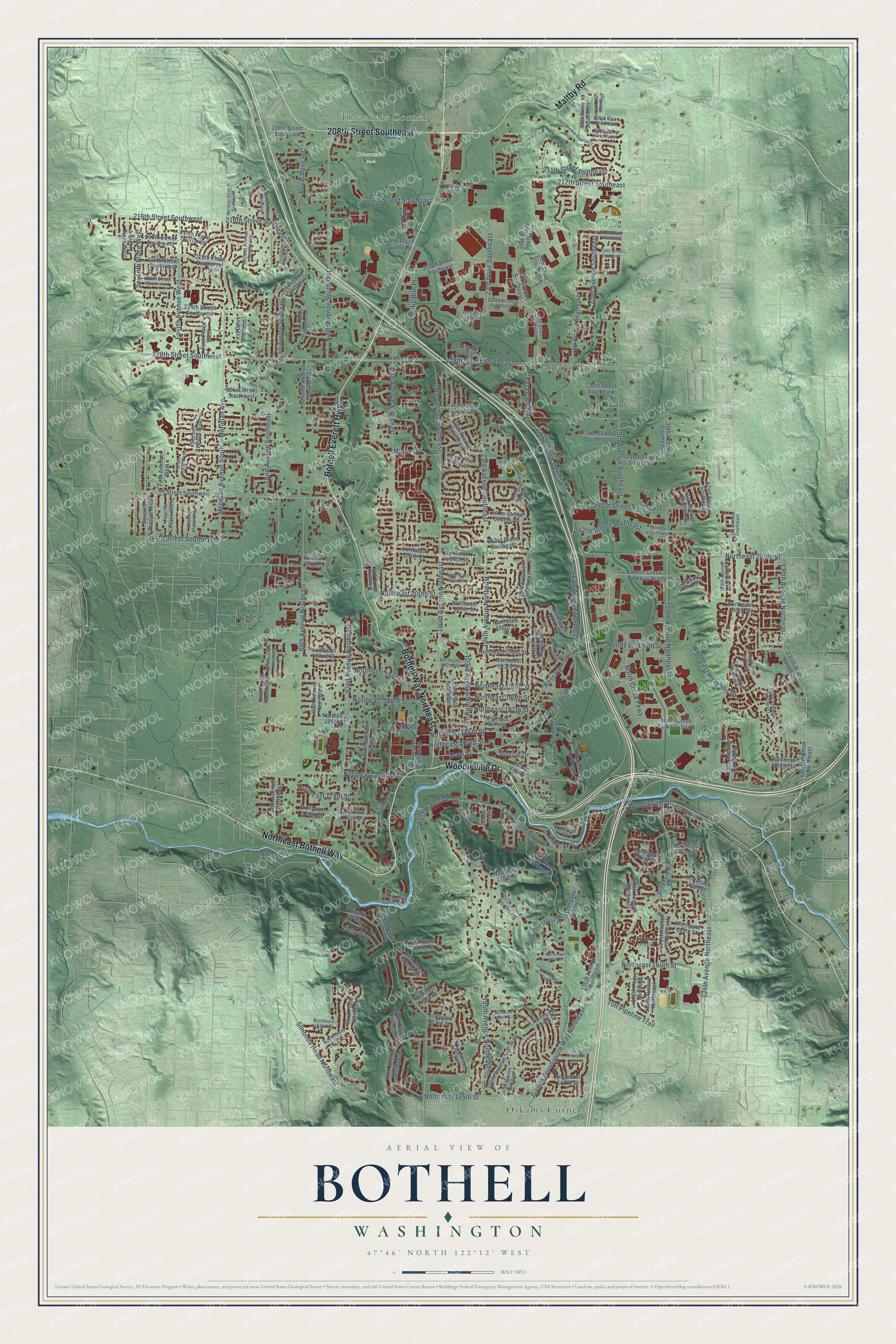
A new map of Bothell, Washington, made in 2026 and printed to order on thick archival matte paper.
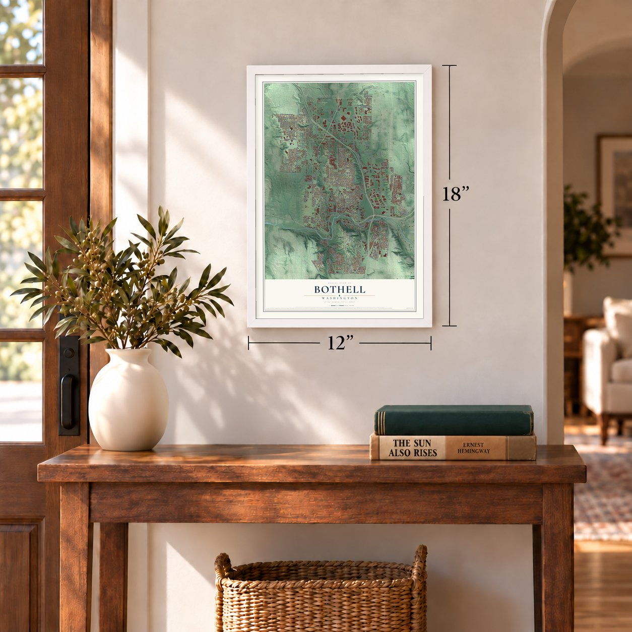
12" x 18" Archival Matte Print
A Map of Home. A Work of Art.
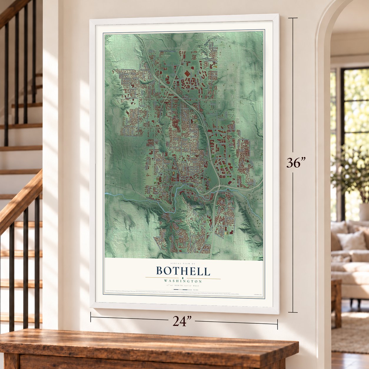
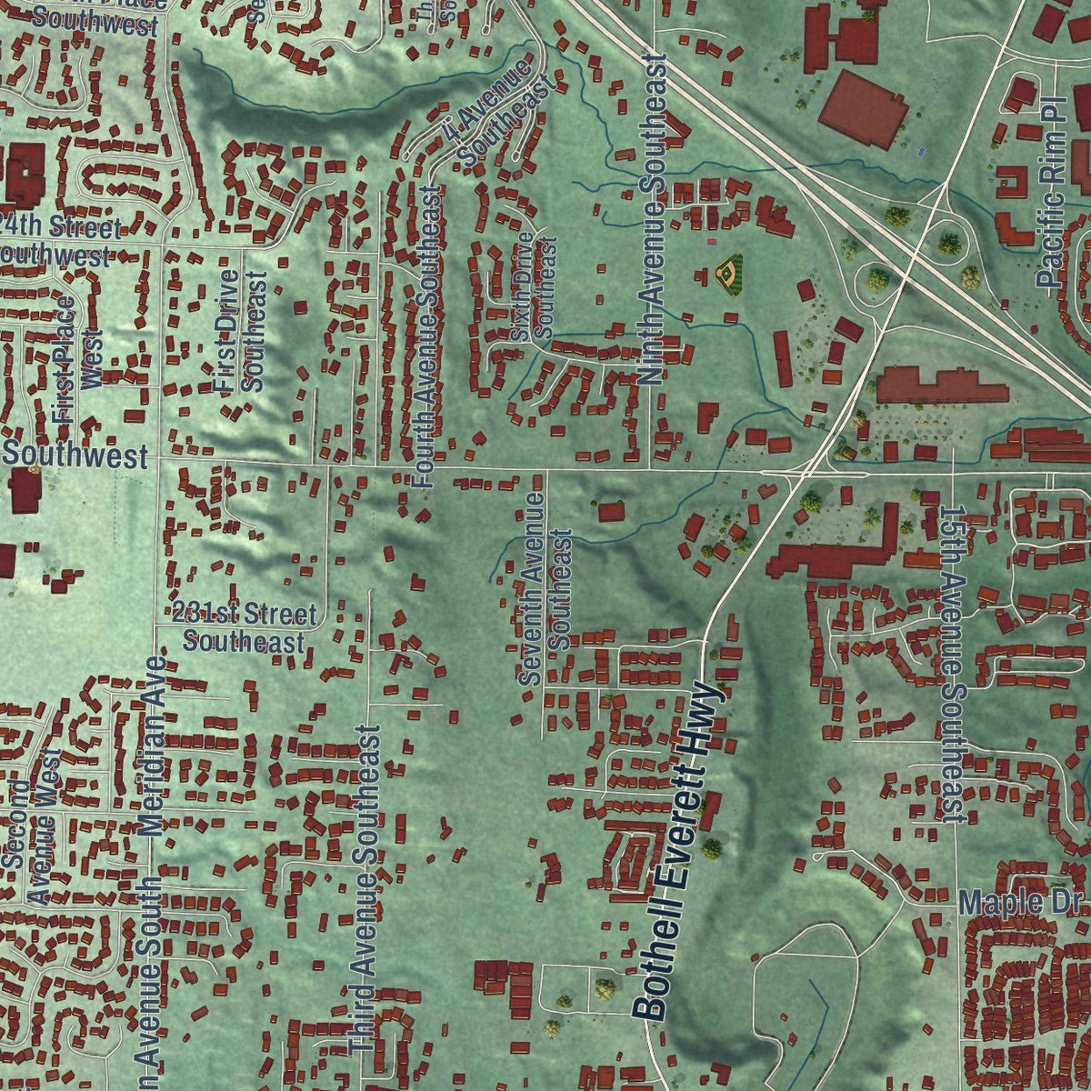
Explore Bothell, Washington from a whole new perspective. Created using aerial imagery and detailed geographic data, this map captures Bothell building by building, with labeled streets, familiar landmarks, and shaded topographical relief that highlights the natural contours of the landscape.
Combining modern data with the timeless character of a vintage atlas, this map is just as interesting up close as it is beautiful on the wall. Whether you grew up in Bothell, spent memorable years there, or call it home today, this unique map is a great way to celebrate a place that means something to you. Zoom in on the preview to look for your street, and then order a print to put your memories on the wall.
Three ways to hang it
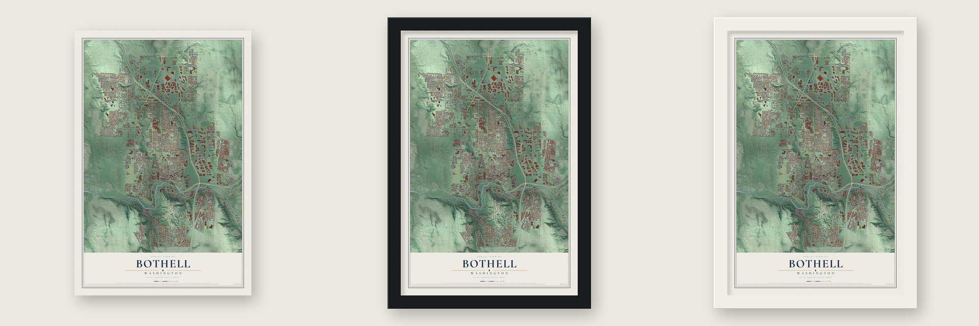
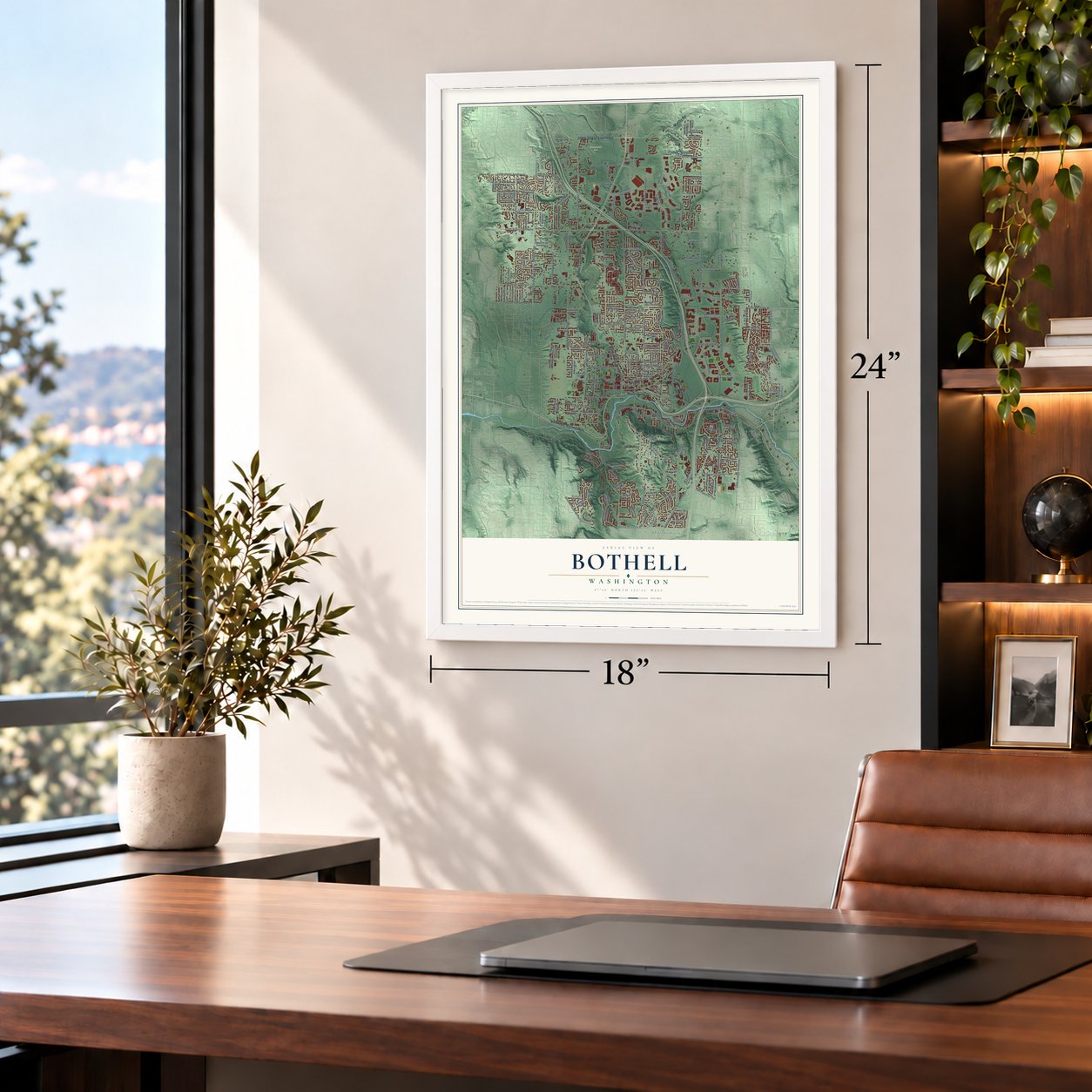
Unframed archival matte, a black wood frame or a white wood frame.
Up close
Geography Worth Displaying
This map was created using accurate cartographic data and authoritative geographic sources, including the U.S. Geological Survey and the Census Bureau. The map brings together terrain, waterways, roads, and building detail. The majority of the streets are labeled, houses are accurately depicted, and the topography is derived from government sources. Combining local data with carefully composed color and shading leads to this beautifully detailed Bothell artwork for your wall.
Rather than simply showing street outlines, we’ve included as many of the street names as we could reasonably fit on the map while keeping their names legible. Zoom in on the high resolution preview to see exactly what’s on the map. We truly set out to create a statement piece for anyone who loves Bothell. So whether it’s for you, or a gift for someone you love, we hope this map of Bothell brings back fond memories.
Read the story behind this map of Bothell, Washington from 2026.

About Bothell, Washington
Bothell is a city of 48,161 people in King County, on the Sammamish River near the north end of Lake Washington. Before settlers came, the Willow People, a band of the Duwamish, kept a village of cedar longhouses here and lived on fish, wapato bulbs, berries and waterfowl. After the Puget Sound War they were moved to Fort Kitsap and the Port Madison Reservation. In the summer of 1870 Columbus S. Greenleaf and George R. Wilson claimed land on the empty riverbank, and by 1876 eight families lived along it.
Soon after, George Brackett, a lumberman from Canada, began logging here and floated his logs into the river at a camp that became Brackett's Landing. He sold 80 acres to David Bothell, a Civil War veteran from Pennsylvania, who took in boarders and built the Bothell Hotel after his house burned. Gerhard Ericksen became postmaster on May 25, 1888, and gave the post office the family's name. The railroad from Seattle arrived that same year, and on April 14, 1909, Bothell incorporated with David's son George as its first mayor.
“There are so many Bothells in town and that's a good name, so let's call it Bothell”
- The red brick roadWith Gerhard Ericksen pushing for it in the Legislature, a highway from Seattle through Kenmore to Bothell and Everett was finished in May 1913, and four miles between Kenmore and Bothell were paved in brick. Governor Ernest Lister opened the brick section on May 29, 1913. That same month Mayor S.F. Woody was arrested for going faster than 12 m.p.h. on the river bridge, and the judge dismissed the case but warned him to slow down.
- The Easter Sunday fireOn Easter Sunday, April 11, 1911, fire swept Main Street and destroyed 10 businesses, among them Ericksen's general store, where the town kept its records. The council answered with a volunteer fire department and fire codes for new buildings, and in 1916 a motorized fire cart arrived to serve Bothell and its neighbors.
- A seven-mile flumeGerhard Ericksen's store failed in the panic of 1893. He kept working through the hard times by building a seven-mile water flume that carried cedar bolts, the short logs used for shakes, down to the river. The flume kept some logging crews running through the lean 1890s, and Ericksen later opened another store and served in the State Legislature.
- Two counties since 1992The University of Washington opened a branch campus in Bothell in 1990, in an office park building. In September 2000 it moved to a permanent campus that it shares with Cascadia Community College. In 1992 the city annexed Canyon Park to the north, adding 11,400 people and its first land in Snohomish County. By the end of the century Bothell was the third largest employment center in that county.
Find your street
Names on the Bothell map
Every name below is printed on this map. Look for your street, your school, the park where you played, or the pond down the road.
Places and landmarks5
- Thrashers Corner
- Blyth Park
- Centennial Park
- Canyon Park
- Oskams Corner
Streets and roads214
- Woodinville Drive
- Bothell Way Northeast
- Maltby Road
- Bothell Everett Highway
- Northeast Bothell Way
- 208th Street Southeast
- 228th Street Southeast
- Northeast 180th Street
- Northeast 185th Street
- 214th Street Southeast
- Main Street
- North Creek Parkway
- 103rd Avenue Northeast
- Beardslee Boulevard
- Ninth Avenue Southeast
- 120th Avenue Northeast
- Northeast 190th Street
- 105th Avenue Northeast
- Northeast 187th Street
- Third Avenue Southeast
- 104th Avenue Northeast
- Meridian Avenue South
- 240th Street Southeast
- 35th Avenue Southeast
- 112th Avenue Northeast
- Northeast 195th Street
- 88th Avenue Northeast
- 27th Avenue Southeast
- Juanita Woodinville Way Northeast
- 124th Avenue Northeast
Show all 214 streets
- 92nd Avenue Northeast
- 100th Avenue Northeast
- 242nd Street Southeast
- 19th Avenue Southeast
- East Riverside Drive
- 23rd Avenue Southeast
- 15th Avenue Southeast
- Fitzgerald Road
- Northeast 145th Street
- Northeast 205th Street
- 244th Street Southeast
- 216th Street Southeast
- Fourth Avenue West
- Northeast 189th Street
- 23rd Drive Southeast
- Northeast 183rd Street
- 130th Avenue Northeast
- Northeast 200th Street
- Simonds Road Northeast
- Ross Road
- Seventh Place West
- 216th Street Southwest
- 211th Street Southeast
- Tolt Pipeline Trail
- Meridian Avenue
- West Riverside Drive
- 228th Street Southwest
- Northeast Hollyhills Drive
- 32nd Avenue Southeast
- 212th Street Southeast
- Northeast 188th Street
- Northeast 160th Street
- Royal Anne Road
- Northeast 178th Street
- Northeast 191st Street
- Odin Way
- Pacific Rim Place
- Circle Drive
- Maple Drive
- Sunrise Drive
- Hall Road
- 20th Avenue Southeast
- Northeast 151st Street
- 93rd Place Northeast
- 98th Avenue Northeast
- Brickyard Road
- North Creek Parkway North
- 31st Drive Southeast
- 108th Avenue Northeast
- 107th Place Northeast
- Northeast 172nd Place
- Northeast 204th Place
- 112th Place Northeast
- 130th Place Northeast
- 121st Avenue Northeast
- 96th Avenue Northeast
- 220th Street Southeast
- Fourth Avenue Southeast
- Northeast 197th Street
- 31st Avenue Southeast
- Seventh Avenue Southeast
- 106th Avenue Northeast
- Northeast 198th Street
- 243rd Place Southeast
- 126th Avenue Northeast
- Northeast 203rd Street
- 236th Street Southeast
- 110th Avenue Northeast
- First Place West
- 26th Avenue Southeast
- 26th Place Southeast
- Northeast 194th Street
- Northeast 162nd Street
- Campus Way Northeast
- 94th Avenue Northeast
- 101st Place Northeast
- 231st Street Southeast
- 39th Avenue Southeast
- Seventh Avenue West
- Northeast 192nd Place
- 30th Drive Southeast
- Northeast 155th Street
- Northeast 193rd Street
- Second Avenue West
- 240th Street Southwest
- Fourth Place West
- 97th Avenue Northeast
- 119th Avenue Northeast
- 241st Street Southeast
- 42nd Avenue Southeast
- Northeast 175th Street
- 224th Street Southwest
- Northeast 186th Street
- 4 Avenue Southeast
- 89th Avenue Northeast
- Northeast 199th Street
- Northeast 176th Street
- 219th Place Southwest
- 99th Place Northeast
- 217th Place Southeast
- 234th Street Southeast
- 218th Street Southwest
- 86th Avenue Northeast
- Northeast 147th Street
- First Drive Southeast
- Northeast 170th Street
- 112th Lane Northeast
- 217th Place Southwest
- Northeast 196th Street
- 84th Place Northeast
- Northeast 164th Place
- Fifth Avenue West
- 118th Place Northeast
- Northeast 153rd Street
- Northeast 169th Street
- Valley View Street
- North Creek Parkway South
- Northeast 154th Street
- 132nd Avenue Northeast
- Northeast 164th Street
- 118th Avenue Northeast
- 220th Street Southwest
- Eighth Place West
- Northeast 186th Place
- 98th Court Northeast
- 115th Avenue Northeast
- Northeast 182nd Place
- 41st Avenue Southeast
- 230th Street Southeast
- Valhalla Way
- 109th Court Northeast
- Northeast 204th Street
- Northeast 172nd Street
- Thorsk Street
- Eason Avenue
- 102nd Avenue Northeast
- Second Avenue Southeast
- Northeast 174th Street
- 129th Avenue Northeast
- 107th Avenue Northeast
- 223rd Street Southeast
- 29th Drive Southeast
- Third Place West
- Northeast 201st Street
- 232nd Street Southeast
- Monte Villa Parkway
- 127th Avenue Northeast
- Second Place West
- Northeast 152nd Street
- 221st Street Southwest
- 125th Avenue Northeast
- 16th Drive Southeast
- Northeast 192nd Street
- 45th Avenue Southeast
- 85th Avenue Northeast
- Riverbend Drive
- 206th Place Southeast
- 227th Street Southeast
- 207th Place Southeast
- 237th Street Southeast
- Northeast 203rd Place
- Riverside Place
- Sixth Drive Southeast
- 94th Drive Northeast
- 216th Place Southeast
- 111th Avenue Northeast
- Hollyhills Drive Northeast
- 29th Avenue Southeast
- Northeast Woodinville Drive
- 224th Street Southeast
- Northeast 149th Street
- 213th Street Southeast
- 25th Drive Southeast
- Northeast 177th Street
- Northeast 201st Place
- Second Drive Southeast
- 218th Street Southeast
- Northeast 194th Drive
- Northeast 160th Place
- Third Drive Southeast
- Meridian Drive Southeast
- Northeast 154th Place
- 32nd Drive Southeast
- Northeast 162nd Lane
Names are listed as they appear on the printed map. Zoom into the product photos to find them.
The art of mapping a place
How This Map Was Made
Real places. Remarkable detail. Discover the layers that turn geographic data into a map of home.

The view from above
Aerial imagery reveals the character of the land: woodland, open fields, and the patterns of a place.

The shape of the land
Elevation data brings hills, valleys, and subtle changes in the landscape into view.

The details of home
Roads, waterways, and building footprints come together to make the map feel unmistakably local.

Geography becomes art
Considered color, shading, and typography bring the layers together in a map made for your wall.


Process illustrated with Mendon, Massachusetts. Aerial imagery: USDA NAIP. Terrain: USGS 3D Elevation Program. Map details and finished artwork: KNOWOL.
The Details
About This Print
Choose an archival matte print, or a black or white Ayous wood frame. The archival matte print is unframed.
Select your size and finish above to see the matching product image and price.
Materials & Craftsmanship
A contemporary map with the character of a classic atlas, printed on archival matte paper. Optional frames are made from Ayous wood.
Your printed map does not include the watermark shown in the full-map preview.
Shipping & Delivery
Free shipping within the United States. Every print is made to order in the USA.
Buying a gift? Add a note in your cart and we'll include it. We never put prices in the package.
Prints ship within 2 to 3 business days. Allow 7 to 10 days total from ordering for delivery. Timing may vary during holidays or periods of high order volume.
Read our shipping policy.
Returns and damaged prints
Each print is made to order. Change-of-mind refunds are not available after production.
If your print arrives damaged, misprinted or incorrect, contact support@knowol.com within 30 days of receiving it. Include your order number, photos and a description of the issue.
Read our full refund and replacement policy. For questions about your order, email support@knowol.com.
Find your town
Looking for another city?
Find a map of home in our Washington collection, or any town in the country.
Nearby
Maps of towns near Bothell
Know someone from one of these towns? Their map makes a great gift.
 Bothell East
, Washington
From $39.99See the map
 Kenmore
, Washington
From $39.99See the map
 Bothell West
, Washington
From $39.99See the map
More maps nearby: Woodinville, Brier, Alderwood Manor, Lake Forest Park and Mill Creek East.