
Search for another town



Free U.S. delivery 7 to 10 days after you order
Mountlake Terrace, Washington Map Art
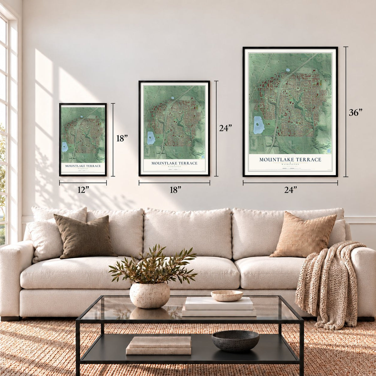
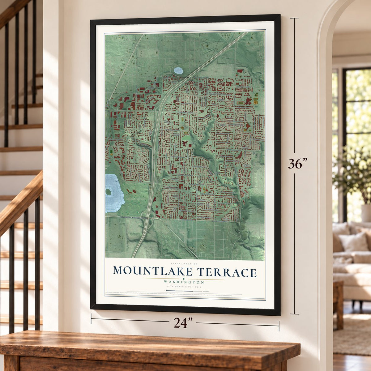
A new map of Mountlake Terrace, Washington, made in 2026 and printed to order on thick archival matte paper.
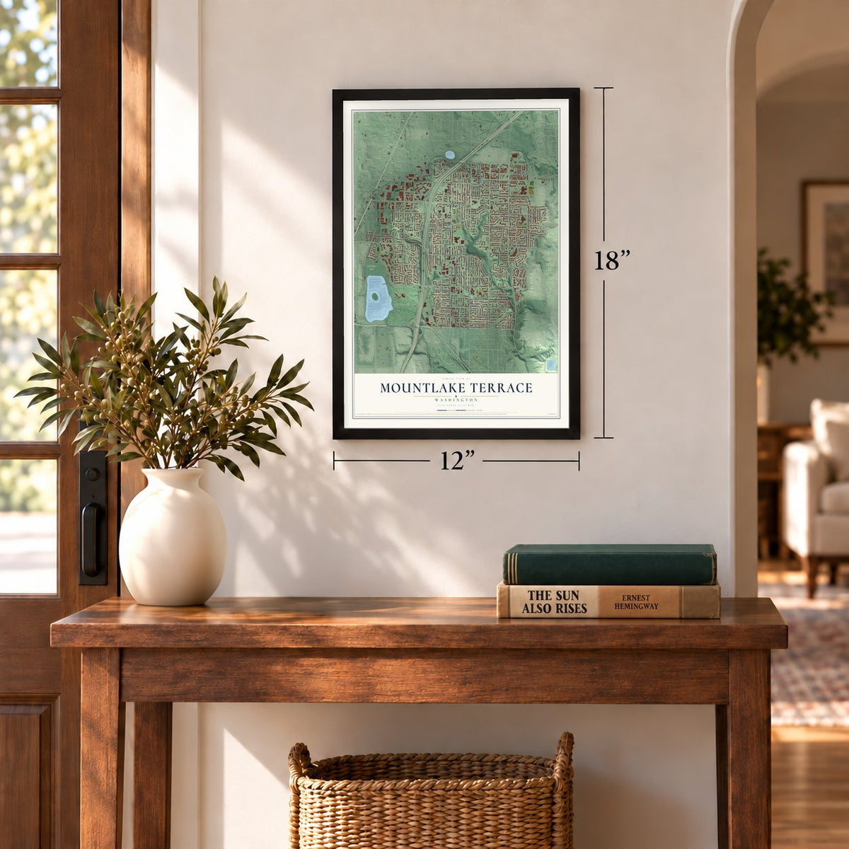
12" x 18" Archival Matte Print
A Map of Home. A Work of Art.
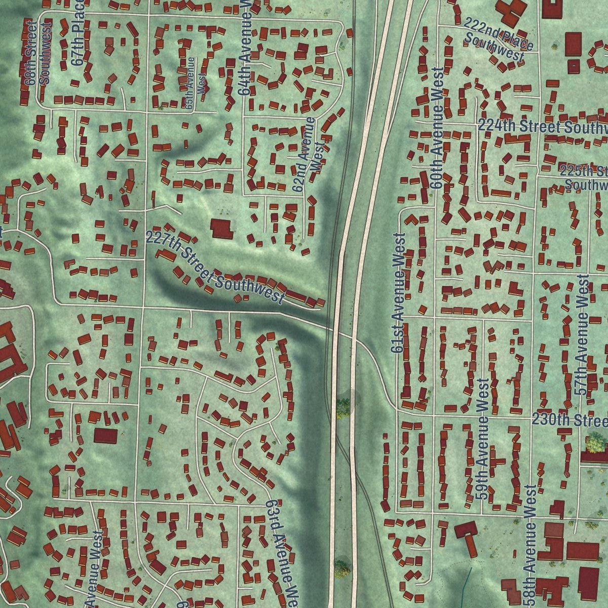
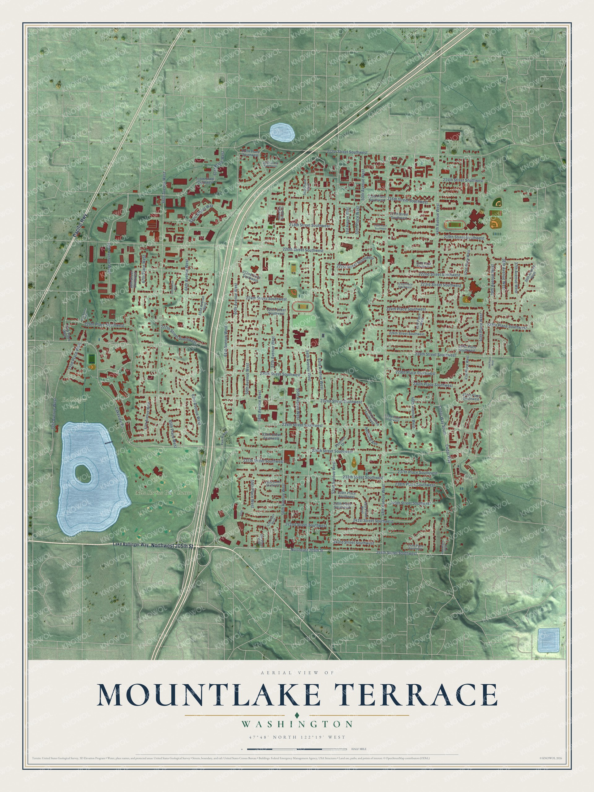
Explore Mountlake Terrace, Washington from a whole new perspective. Created using aerial imagery and detailed geographic data, this map captures Mountlake Terrace building by building, with labeled streets, familiar landmarks, and shaded topographical relief that highlights the natural contours of the landscape.
Combining modern data with the timeless character of a vintage atlas, this map is just as interesting up close as it is beautiful on the wall. Whether you grew up in Mountlake Terrace, spent memorable years there, or call it home today, this unique map is a great way to celebrate a place that means something to you. Zoom in on the preview to look for your street, and then order a print to put your memories on the wall.
Three ways to hang it
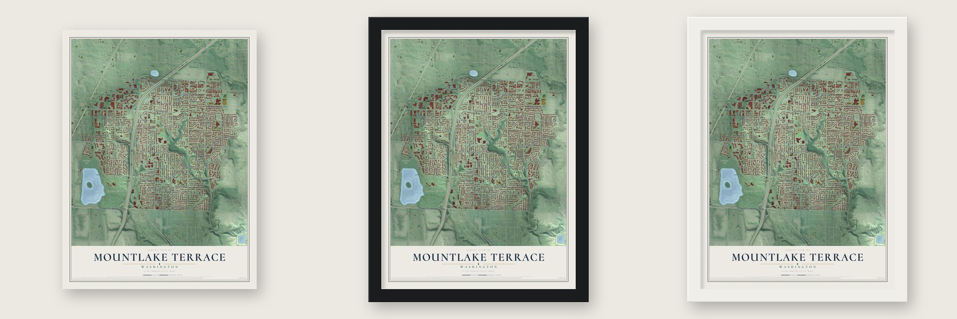
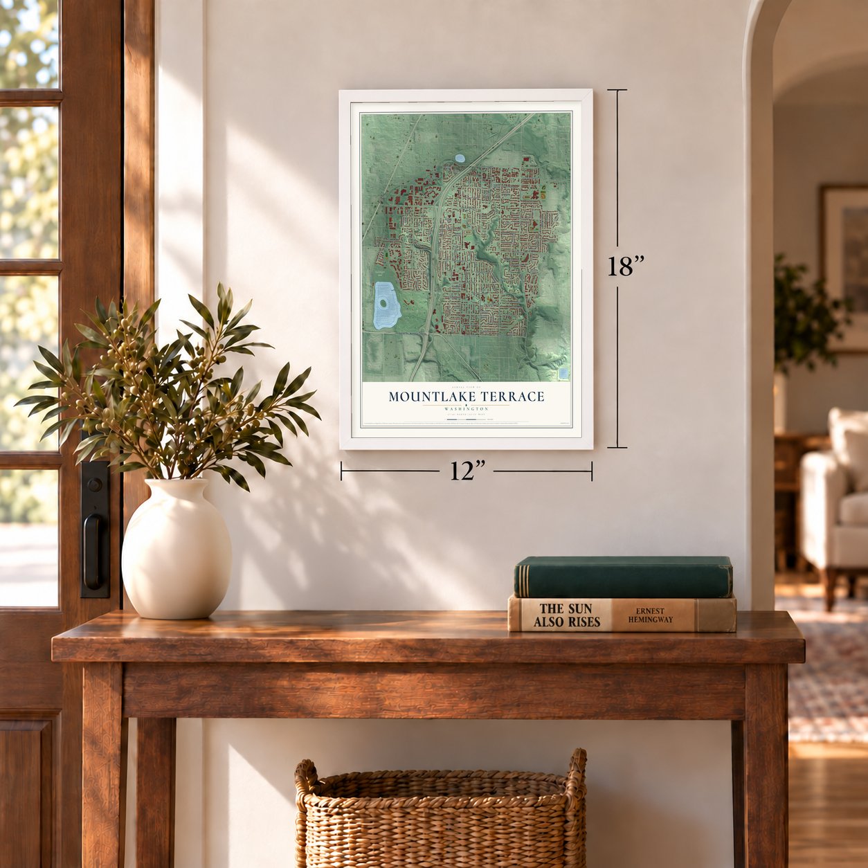
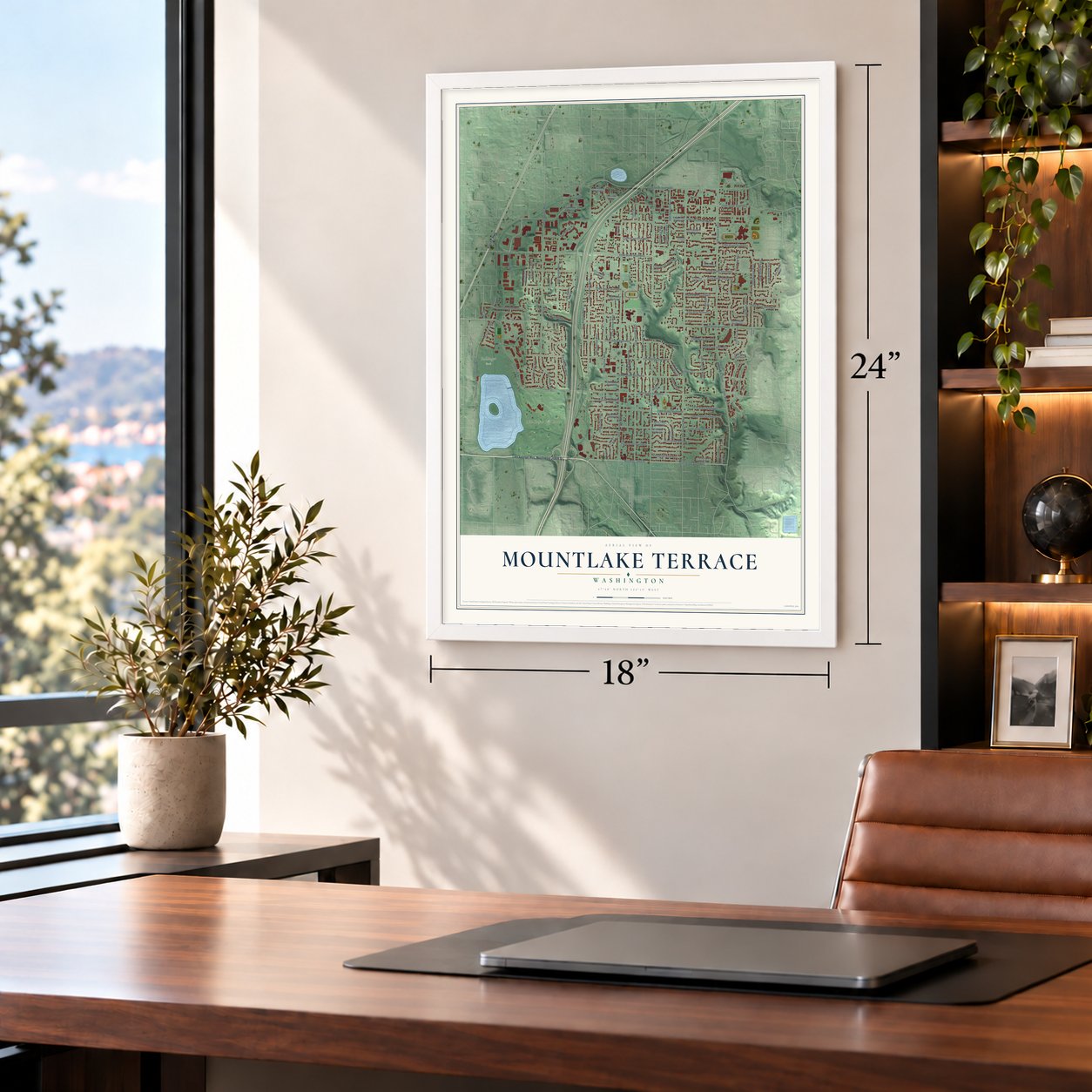
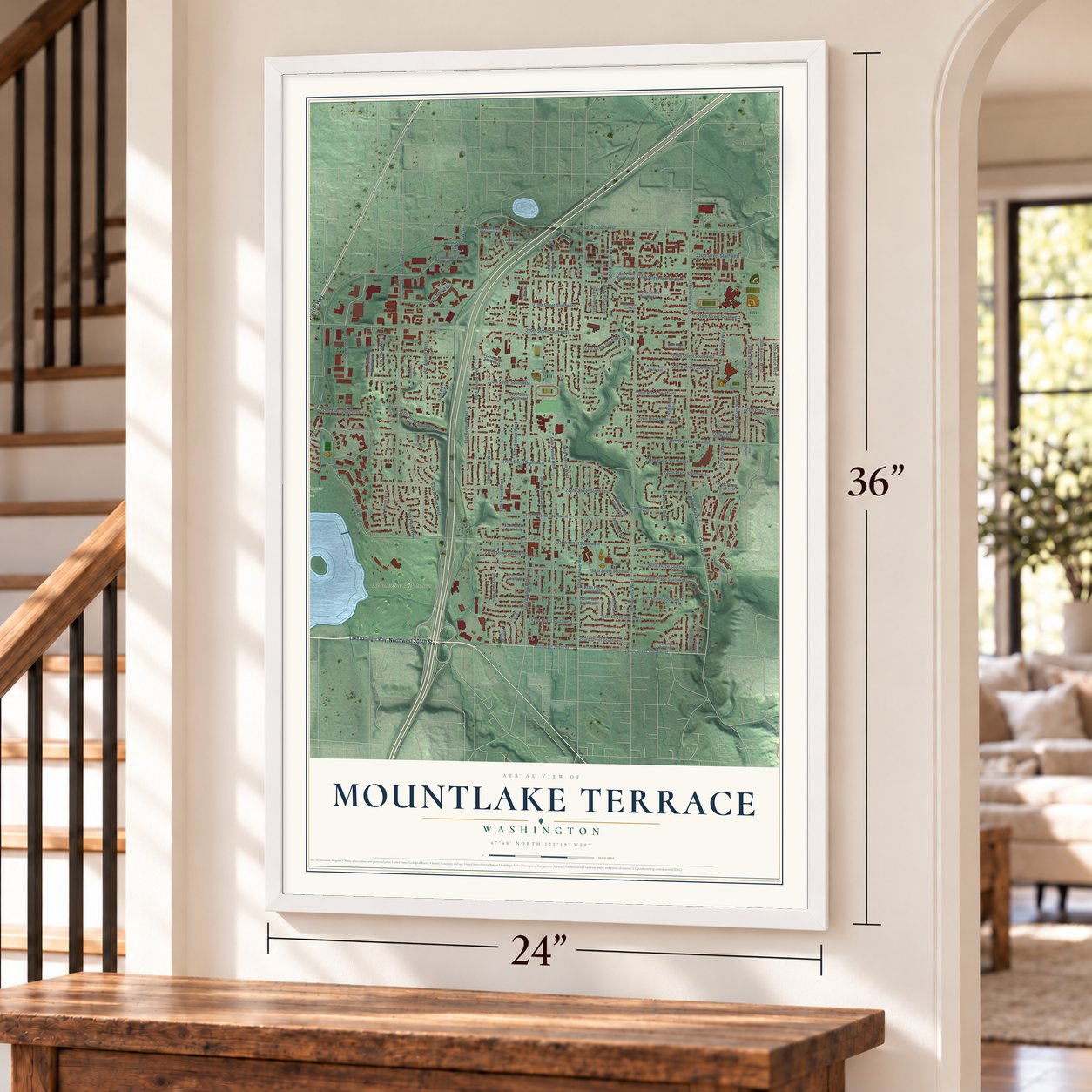
Unframed archival matte, a black wood frame or a white wood frame.
Up close
Geography Worth Displaying
This map was created using accurate cartographic data and authoritative geographic sources, including the U.S. Geological Survey and the Census Bureau. The map brings together terrain, waterways, roads, and building detail. The majority of the streets are labeled, houses are accurately depicted, and the topography is derived from government sources. Combining local data with carefully composed color and shading leads to this beautifully detailed Mountlake Terrace artwork for your wall.
Rather than simply showing street outlines, we’ve included as many of the street names as we could reasonably fit on the map while keeping their names legible. Zoom in on the high resolution preview to see exactly what’s on the map. We truly set out to create a statement piece for anyone who loves Mountlake Terrace. So whether it’s for you, or a gift for someone you love, we hope this map of Mountlake Terrace brings back fond memories.
Read the story behind this map of Mountlake Terrace, Washington from 2026.
About Mountlake Terrace, Washington
Mountlake Terrace is a city of 21,286 people in Snohomish County, just over the King County line north of Seattle. In 1949 the builders Albert LaPierre and Jack Peterson bought a wartime landing field that had been left empty on logged-off land. From parts of the site they could see Mount Rainier and Lake Washington, and the flat old runway looked a bit like a terrace, which gave them the name. Their first houses had two bedrooms, measured 20 by 30 feet and sold for $4,999 to veterans with young families.
The houses sold faster than crews could finish them. By 1954 the town had 5,104 people but no paved streets, no sewers and no police closer than Everett, 15 miles away. When someone tried to break into the home of Patrick McMahan, a Seattle firefighter, the sheriff did not come until 4 p.m. the next day. McMahan led a drive to incorporate, and on November 23, 1954, voters approved it 517 to 483. The new council chose hardware store owner Gil Geiser as mayor. He lent the city $5 to file its papers, and it became a city on November 29.
“they were warm and dry and much better than the garages and basements where so many of the veterans had lived while they hunted for something better”
- An assembly line for housesJack Peterson had built Model Ts in Detroit before he learned bricklaying, and he ran the Mountlake Terrace job like a factory. One crew readied the site, poured the slab and set the plumbing into the concrete floor. A second raised the block walls, and a third finished the inside walls and the roof. Owners painted the rooms and planted the yards themselves, and a whole row could be done in a few weeks.
- How Lake Ballinger got its nameJudge Richard A. Ballinger bought Lake McAleer in 1901 and renamed it for his father, then left the area and became mayor of Seattle. In 1927 the Nile Shrine of Seattle bought 135 acres on the lake's east side, where it built a clubhouse and later a private golf course.
- Five Sunday masses by 1955Peterson and LaPierre gave land for several churches. St. Pius X held its first mass on June 22, 1955, and so many young families were moving in that the parish was offering five masses every Sunday by the end of that year.
- City Hall in 1962Voters approved a bond issue in 1961 to pay for a permanent city hall. It opened in October 1962 with room for the city government and the police and fire departments. Senator Henry M. "Scoop" Jackson came for the dedication, which Mayor Frank Hammer remembered as a proud day for the town.
- The 1990 arson firesFires set in 1990 badly damaged both shopping centers in the middle of town. A resident, James Schmitt, later confessed to those fires and 11 others in a spree that ran from July 30, 1990, to April 25, 1991. West Plaza reopened 20 months later, but East Plaza was torn down and replaced with a gymnastics center. Among the businesses the town lost were Wilner's, a department store, and a Ben Franklin variety store.
Find your street
Names on the Mountlake Terrace map
Every name below is printed on this map. Look for your street, your school, the park where you played, or the pond down the road.
Places and landmarks2
- Ballinger Park
- Nile Shrine Golf Course
Streets and roads109
- Northwest 205th Street
- Pacific Highway
- 244th Street Southwest
- Northeast 205th Street
- Cedar Way
- Cedar Way South
- 232nd Street Southwest
- 242nd Street Southwest
- 40th Place West
- 60th Avenue West
- 228th Street Southwest
- 59th Avenue West
- 58th Avenue West
- 64th Avenue West
- Lakeview Drive
- 70th Avenue West
- 61st Avenue West
- 234th Street Southwest
- 48th Avenue West
- 56th Avenue West
- 220th Street Southwest
- 44th Avenue West
- 52nd Avenue West
- 54th Avenue West
- 236th Street Southwest
- 212th Street Southwest
- 66th Avenue West
- 230th Street Southwest
- 53rd Avenue West
- 222nd Street Southwest
Show all 109 streets
- 224th Street Southwest
- 216th Street Southwest
- 55th Avenue West
- 219th Street Southwest
- 225th Place Southwest
- 238th Street Southwest
- 227th Street Southwest
- 240th Street Southwest
- 241st Street Southwest
- 226th Place Southwest
- 223rd Street Southwest
- 237th Street Southwest
- 224th Place Southwest
- 214th Street Southwest
- 50th Avenue West
- 221st Street Southwest
- 57th Avenue West
- 218th Street Southwest
- 238th Place Southwest
- 46th Avenue West
- 63rd Avenue West
- 39th Avenue West
- 229th Place Southwest
- 59th Place West
- 237th Place Southwest
- 74th Avenue West
- 38th Avenue West
- 67th Place West
- 230th Place Southwest
- 37th Avenue West
- Saint Albion Way
- 243rd Street Southwest
- 65th Place West
- 72nd Place West
- 50th Place West
- 61st Place West
- Hedlund Avenue
- Lake Ballinger Way
- 42nd Place West
- 68th Street Southwest
- 45th Place West
- 235th Street Southwest
- 216th Place Southwest
- 226th Street Southwest
- 51st Avenue West
- 36th Avenue West
- 217th Street Southwest
- 49th Place West
- La Pierre Drive Southwest
- 239th Place Southwest
- 231st Place Southwest
- 62nd Avenue West
- 215th Street Southwest
- 225th Street Southwest
- 67th Avenue West
- 222nd Place Southwest
- 41st Place West
- 227th Place Southwest
- Peterson Drive
- 73rd Place West
- 54th Place West
- 212th Place Southwest
- 240th Place Southwest
- 223rd Place Southwest
- 233rd Street Southwest
- 221st Place Southwest
- 239th Street Southwest
- 58th Place West
- 43rd Place West
- 213th Street Southwest
- Park-N-Ride
- 243rd Place Southwest
- 56th Place Southwest
- 57th Place West
- 60th
- 72nd Avenue West
- 218th Place Southwest
- 65th Avenue West
- 39th Place West
Names are listed as they appear on the printed map. Zoom into the product photos to find them.
The art of mapping a place
How This Map Was Made
Real places. Remarkable detail. Discover the layers that turn geographic data into a map of home.

The view from above
Aerial imagery reveals the character of the land: woodland, open fields, and the patterns of a place.

The shape of the land
Elevation data brings hills, valleys, and subtle changes in the landscape into view.

The details of home
Roads, waterways, and building footprints come together to make the map feel unmistakably local.

Geography becomes art
Considered color, shading, and typography bring the layers together in a map made for your wall.


Process illustrated with Mendon, Massachusetts. Aerial imagery: USDA NAIP. Terrain: USGS 3D Elevation Program. Map details and finished artwork: KNOWOL.
The Details
About This Print
Choose an archival matte print, or a black or white Ayous wood frame. The archival matte print is unframed.
Select your size and finish above to see the matching product image and price.
Materials & Craftsmanship
A contemporary map with the character of a classic atlas, printed on archival matte paper. Optional frames are made from Ayous wood.
Your printed map does not include the watermark shown in the full-map preview.
Shipping & Delivery
Free shipping within the United States. Every print is made to order in the USA.
Buying a gift? Add a note in your cart and we'll include it. We never put prices in the package.
Prints ship within 2 to 3 business days. Allow 7 to 10 days total from ordering for delivery. Timing may vary during holidays or periods of high order volume.
Read our shipping policy.
Returns and damaged prints
Each print is made to order. Change-of-mind refunds are not available after production.
If your print arrives damaged, misprinted or incorrect, contact support@knowol.com within 30 days of receiving it. Include your order number, photos and a description of the issue.
Read our full refund and replacement policy. For questions about your order, email support@knowol.com.
Find your town
Looking for another city?
Find a map of home in our Washington collection, or any town in the country.
Nearby
Maps of towns near Mountlake Terrace
Know someone from one of these towns? Their map makes a great gift.
 Brier
Brier, Washington
From $39.99See the map
 Alderwood Manor
, Washington
From $39.99See the map
 Esperance
, Washington
From $39.99See the map
More maps nearby: Lynnwood, Lake Forest Park, Edmonds, Bothell West and Shoreline.