
Search for another town





Free U.S. delivery 7 to 10 days after you order
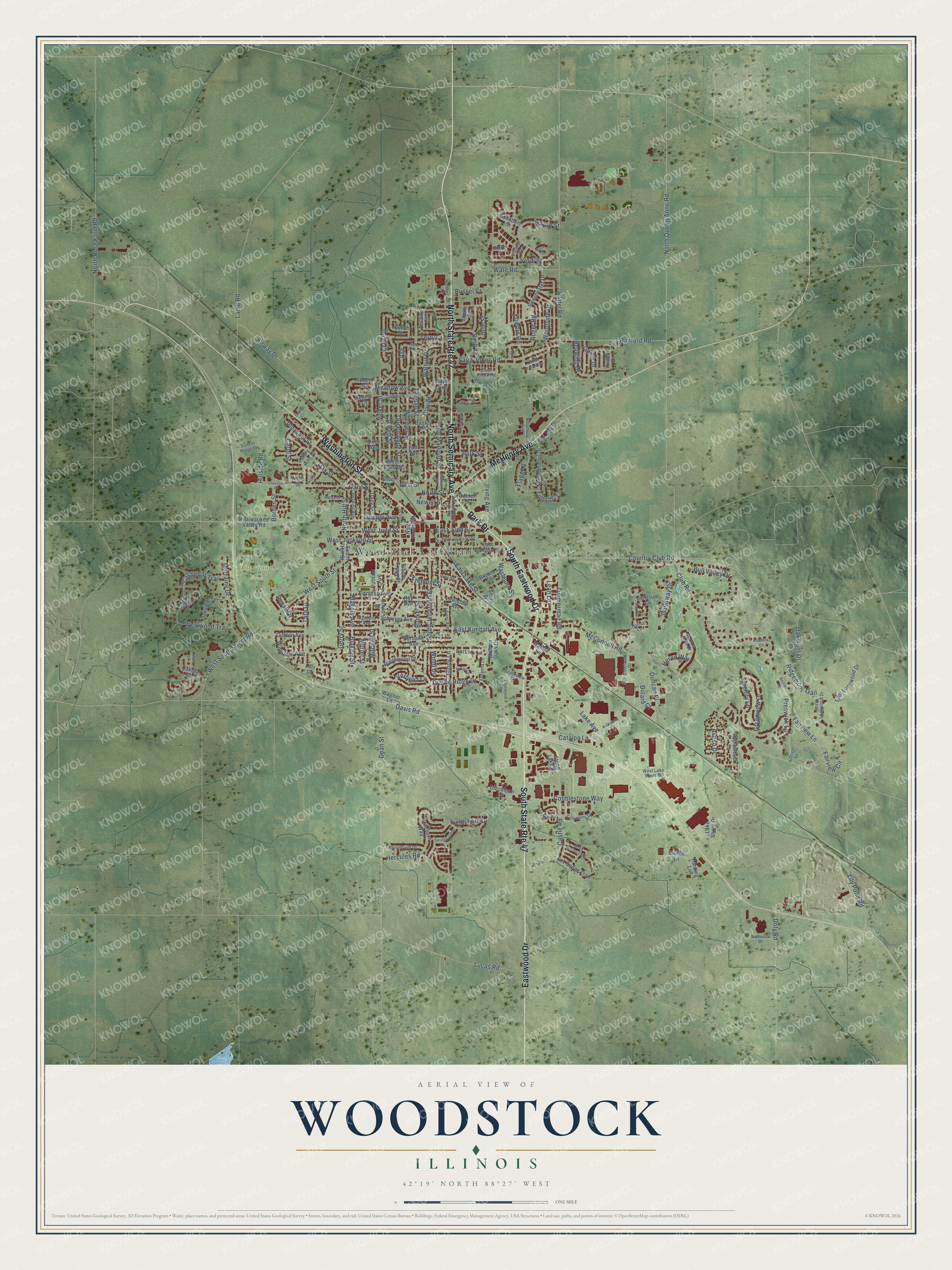
Woodstock, Illinois Map Art
A new map of Woodstock, Illinois, made in 2026 and printed to order on thick archival matte paper.
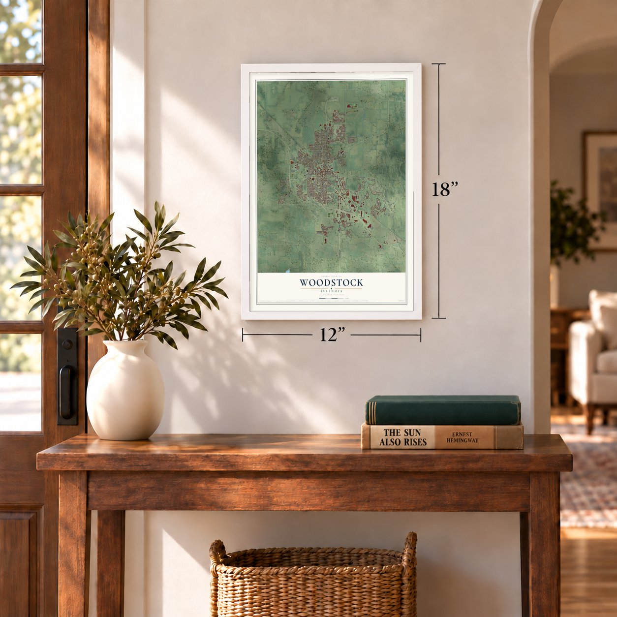
12" x 18" Archival Matte Print
A Map of Home. A Work of Art.
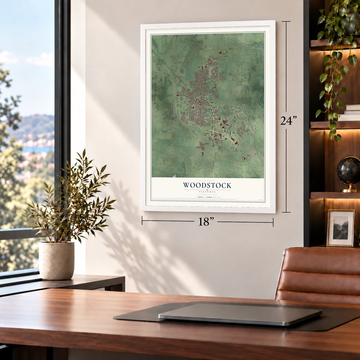
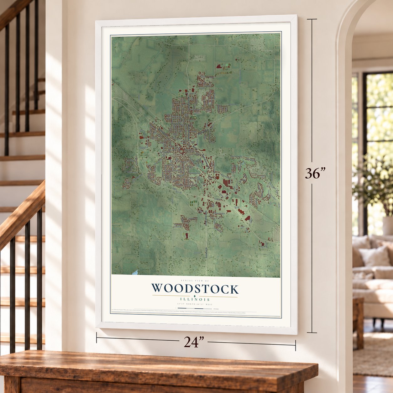
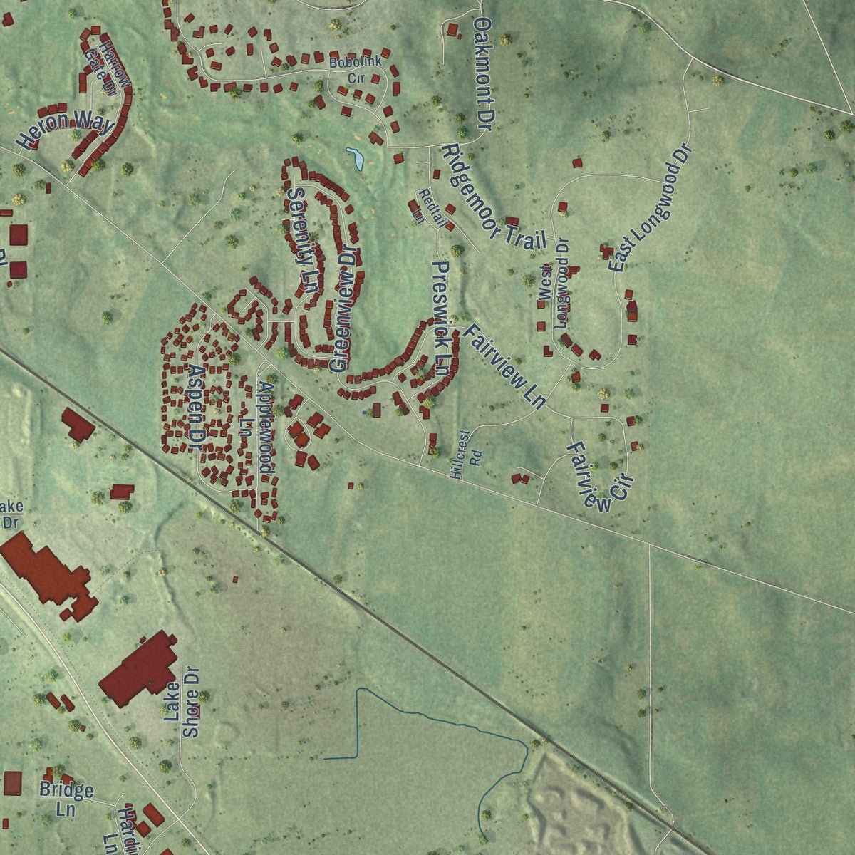
Explore Woodstock, Illinois from a whole new perspective. Created using aerial imagery and detailed geographic data, this map captures Woodstock building by building, with labeled streets, familiar landmarks, and shaded topographical relief that highlights the natural contours of the landscape.
Combining modern data with the timeless character of a vintage atlas, this map is just as interesting up close as it is beautiful on the wall. Whether you grew up in Woodstock, spent memorable years there, or call it home today, this unique map is a great way to celebrate a place that means something to you. Zoom in on the preview to look for your street, and then order a print to put your memories on the wall.
Three ways to hang it
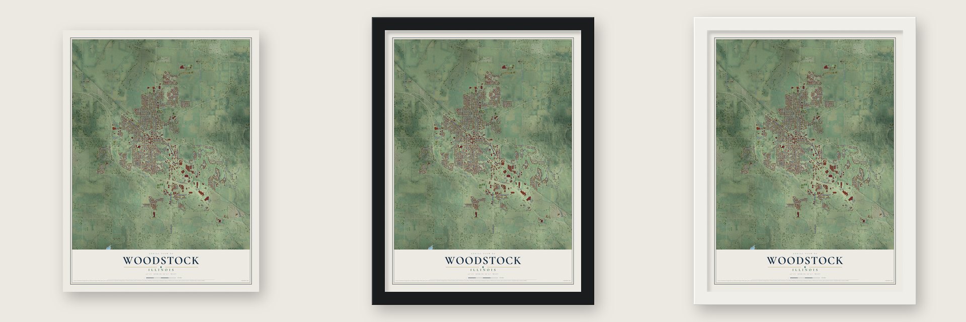
Unframed archival matte, a black wood frame or a white wood frame.
Up close
Geography Worth Displaying
This map was created using accurate cartographic data and authoritative geographic sources, including the U.S. Geological Survey and the Census Bureau. The map brings together terrain, waterways, roads, and building detail. The majority of the streets are labeled, houses are accurately depicted, and the topography is derived from government sources. Combining local data with carefully composed color and shading leads to this beautifully detailed Woodstock artwork for your wall.
Rather than simply showing street outlines, we’ve included as many of the street names as we could reasonably fit on the map while keeping their names legible. Zoom in on the high resolution preview to see exactly what’s on the map. We truly set out to create a statement piece for anyone who loves Woodstock. So whether it’s for you, or a gift for someone you love, we hope this map of Woodstock brings back fond memories.
Read the story behind this map of Woodstock, Illinois from 2026.

About Woodstock, Illinois
Woodstock is a city of 25,630 people and the seat of McHenry County, 51 miles northwest of Chicago. It began as Centerville, named for its spot at the geographic center of the county, and it was chosen as county seat on September 4, 1843. Alvin Judd drew a plat around a two-acre public square, and the next year George C. Dean and Daniel Blair built a two-story frame courthouse and jail near it.
In 1845 Joel Johnson asked for a more original name, so the town took the name of his hometown, Woodstock, Vermont. The 1850 census still called it Center. Woodstock became a village in 1852 with Judd as president, and a city in 1873 as people kept arriving after the Civil War, with John S. Wheat as its first mayor. The rail line to Chicago drew industry early, and by 1903 the town had foundry and machine shops, canning works, and pickle, cheese and butter factories.
“I suppose it's Woodstock, Illinois, if it's anywhere. I went to school there for four years. If I try to think of a home, it's that.”
- Eugene V. Debs in jailAfter the 1894 Pullman strike, Eugene V. Debs, once president of the American Railway Union, served a short federal sentence here in 1895. Officials kept him out of Chicago, where supporters might stir more unrest, and locked him in the new jail on the courthouse's lowest floor. He read Karl Marx and met socialist visitors, and crowds on the Square greeted his release that November. The Old McHenry County Courthouse joined the National Register in 1974.
- Typewriter CityEarly in the 20th century the Emerson and Oliver typewriter companies both made machines here, and by 1922 more than half of all the typewriters in the world had come from Woodstock workers. The two factories had social clubs and rival baseball teams, and Emerson's band played at public events. Emerson became the Woodstock Typewriter Company in 1919. Its factory ran until 1970 and is now lofts.
- Orson Welles at Todd SchoolOrson Welles enrolled at the Todd School for Boys in 1926, at age 10, and it was his only formal schooling. Teacher Roger Hill, later headmaster, let him follow his interests, and Welles staged his first plays there. In July 1934, at 19, he organized a six-week summer drama festival at the Woodstock Opera House with actors from Dublin's Gate Theatre. The Opera House joined the National Register in 1974, and its stage is dedicated to him.
- Groundhog Day, 1993Scenes for Planes, Trains and Automobiles were shot here in 1987, including a rental car being towed in front of the old Courthouse. That shoot led location manager Bob Hudgins to suggest Woodstock to Harold Ramis, who filmed Groundhog Day around the Square, standing in for Punxsutawney, Pennsylvania. Plaques now mark the movie's scenes on a walking tour.
Find your street
Names on the Woodstock map
Every name below is printed on this map. Look for your street, your school, the park where you played, or the pond down the road.
Places and landmarks3
- Woodstock City Hall
- Bates Park
- Emricson Park
Streets and roads208
- South State Route 47
- Park Drive
- South Eastwood Drive
- North State Route 47
- Eastwood Drive
- North Seminary Avenue
- Washington Street
- McHenry Avenue
- Country Club Road
- North Madison Street
- Washburn Street
- Wheeler Street
- Clay Street
- Davis Road
- West Jackson Street
- Aspen Drive
- West South Street
- Lake Avenue
- Gerry Street
- Oakmont Drive
- Dane Street
- Hillside Road
- Dean Street
- McConnell Road
- Raffel Road
- Bull Valley Drive
- North Queen Anne Road
- Lucas Road
- Wicker Street
- East Kimball Avenue
Show all 208 streets
- Pleasant Street
- Tappan Street
- Prairie Ridge Drive
- West South Street Road
- Castle Road
- Verdi Street
- Airway Drive
- Westwood Trail
- Saint Johns Road
- Ware Road
- Banford Road
- Blakely Avenue
- Blakely Street
- Greenview Drive
- South Jefferson Street
- Irving Avenue
- Cobblestone Way
- Roger Road
- Queen Anne Street
- North Rose Farm Road
- Haydn Street
- Morraine Drive
- Catalpa Lane
- Lamb Road
- Woodside Drive
- Fairview Circle
- Fremont Street
- Hercules Road
- Tara Drive
- West Judd Street
- Jewett Street
- Club Road
- Bunker Street
- Oak Street
- Ginny Lane
- Zimmerman Road
- Lily Pond Road
- Serenity Lane
- Timothy Lane
- East Lake Street
- Powers Road
- Fieldstone Drive
- Mitchell Street
- Fairview Lane
- Terry Court
- East Judd Street
- Walnut Drive
- Preswick Lane
- Forrest Avenue
- Leah Lane
- Muriel Street
- Duvall Drive
- Castlebar Trail
- Julie Street
- Flagg Lane
- Redwing Drive
- Ridgemoor Trail
- Duncan Place
- Galloway Drive
- Dillard Court
- Quail Court
- Meadow Avenue
- Winslow Avenue
- North Hill Street
- Doty Road
- Lincoln Avenue
- North Street
- Wood Drive
- Borden Street
- Carol Street
- Park Street
- Verbena Lane
- Ash
- Heron Way
- Russel Court
- First Street
- Newell Street
- Applewood Lane
- Dakota Drive
- East Longwood Drive
- East Calhoun Street
- Braeburn Way
- Stone Lake Road
- Walden Oaks Drive
- Lake Shore Drive
- Bagley Street
- Kishwaukee Valley Road
- Barbary Lane
- Mary Ann Street
- North Sharon Drive
- Birch Road
- Burbank Avenue
- Schryver Avenue
- Lawndale Avenue
- Fox Sedge Trail
- Wagner Lane
- South Tryon Street
- Oakview Terrace
- Sweetwater Drive
- Tanager Drive
- Berltsum Lane
- Ridgewood Drive
- Dieckman Street
- Joseph Street
- Hoy Avenue
- Putnam Avenue
- Brown Street
- Schuette Drive
- Golden Avenue
- Robert Drive
- Sheila Street
- Dacy Street
- West Third Street
- Vivaldi Street
- Todd Avenue
- Schubert Street
- Harding Lane
- Smith Street
- North Throop Street
- Bridge Lane
- Gould Street
- South Hill Street
- Center Street
- Wanda Lane
- Belaire Lane
- Kildeer Drive
- Maple Avenue
- Regina Court
- Ryan Court
- Short Street
- Anne Street
- Lorr Drive
- Olive Avenue
- East Jackson Street
- West Longwood Drive
- Harrow Gate Drive
- Commons Drive
- Cord Grass Trail
- Summit Avenue
- Bloomfield Drive
- Northwood Lane
- Highland Avenue
- Becking Avenue
- Kilkenny Court
- Southview Drive
- Broadway Avenue
- Sunset Ridge Drive
- Savanna Lane
- Laurel Avenue
- Vine Street
- West Lake Shore Drive
- Tryon Street
- Memorial Drive
- Courtauld Drive
- Halma Lane
- Silver Creek Road
- Handel Lane
- Ash Avenue
- Madison Street
- Twelve Oaks Parkway
- Boulder Lane
- Hillcrest Road
- Greenwood Circle
- Springwood Drive
- Pond Point Road
- Edgewood Drive
- Springcreek Lane
- Serene Trail
- Bobolink Circle
- Claussen Drive
- Indigo Lane
- Margaret Drive
- Arthur Drive
- Teton Drive
- Redtail Lane
- Poplar Lane
- Cairns Court
- Bach Court
Names are listed as they appear on the printed map. Zoom into the product photos to find them.
The art of mapping a place
How This Map Was Made
Real places. Remarkable detail. Discover the layers that turn geographic data into a map of home.

The view from above
Aerial imagery reveals the character of the land: woodland, open fields, and the patterns of a place.

The shape of the land
Elevation data brings hills, valleys, and subtle changes in the landscape into view.

The details of home
Roads, waterways, and building footprints come together to make the map feel unmistakably local.

Geography becomes art
Considered color, shading, and typography bring the layers together in a map made for your wall.


Process illustrated with Mendon, Massachusetts. Aerial imagery: USDA NAIP. Terrain: USGS 3D Elevation Program. Map details and finished artwork: KNOWOL.
The Details
About This Print
Choose an archival matte print, or a black or white Ayous wood frame. The archival matte print is unframed.
Select your size and finish above to see the matching product image and price.
Materials & Craftsmanship
A contemporary map with the character of a classic atlas, printed on archival matte paper. Optional frames are made from Ayous wood.
Your printed map does not include the watermark shown in the full-map preview.
Shipping & Delivery
Free shipping within the United States. Every print is made to order in the USA.
Buying a gift? Add a note in your cart and we'll include it. We never put prices in the package.
Prints ship within 2 to 3 business days. Allow 7 to 10 days total from ordering for delivery. Timing may vary during holidays or periods of high order volume.
Read our shipping policy.
Returns and damaged prints
Each print is made to order. Change-of-mind refunds are not available after production.
If your print arrives damaged, misprinted or incorrect, contact support@knowol.com within 30 days of receiving it. Include your order number, photos and a description of the issue.
Read our full refund and replacement policy. For questions about your order, email support@knowol.com.
Find your town
Looking for another city?
Find a map of home in our Illinois collection, or any town in the country.
Nearby
Maps of towns near Woodstock
Know someone from one of these towns? Their map makes a great gift.
 Bull Valley
, Illinois
From $39.99See the map
 Ridgefield
, Illinois
From $39.99See the map
 Franklinville
, Illinois
From $39.99See the map
More maps nearby: Hartland, Wonder Lake, Lakewood, Greenwood and Crystal Lake.