
Search for another town


Free U.S. delivery 7 to 10 days after you order
Zion, Illinois Map Art
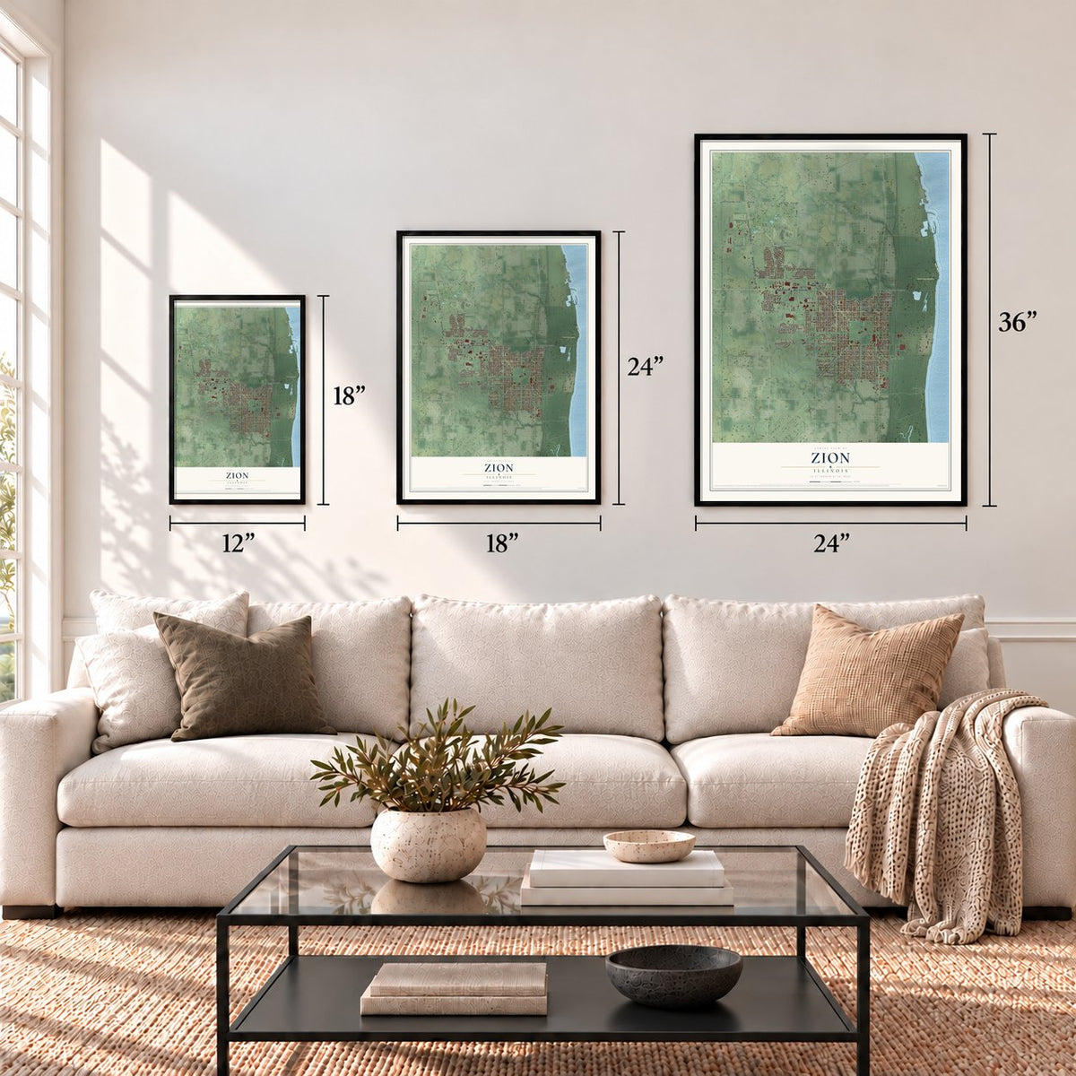
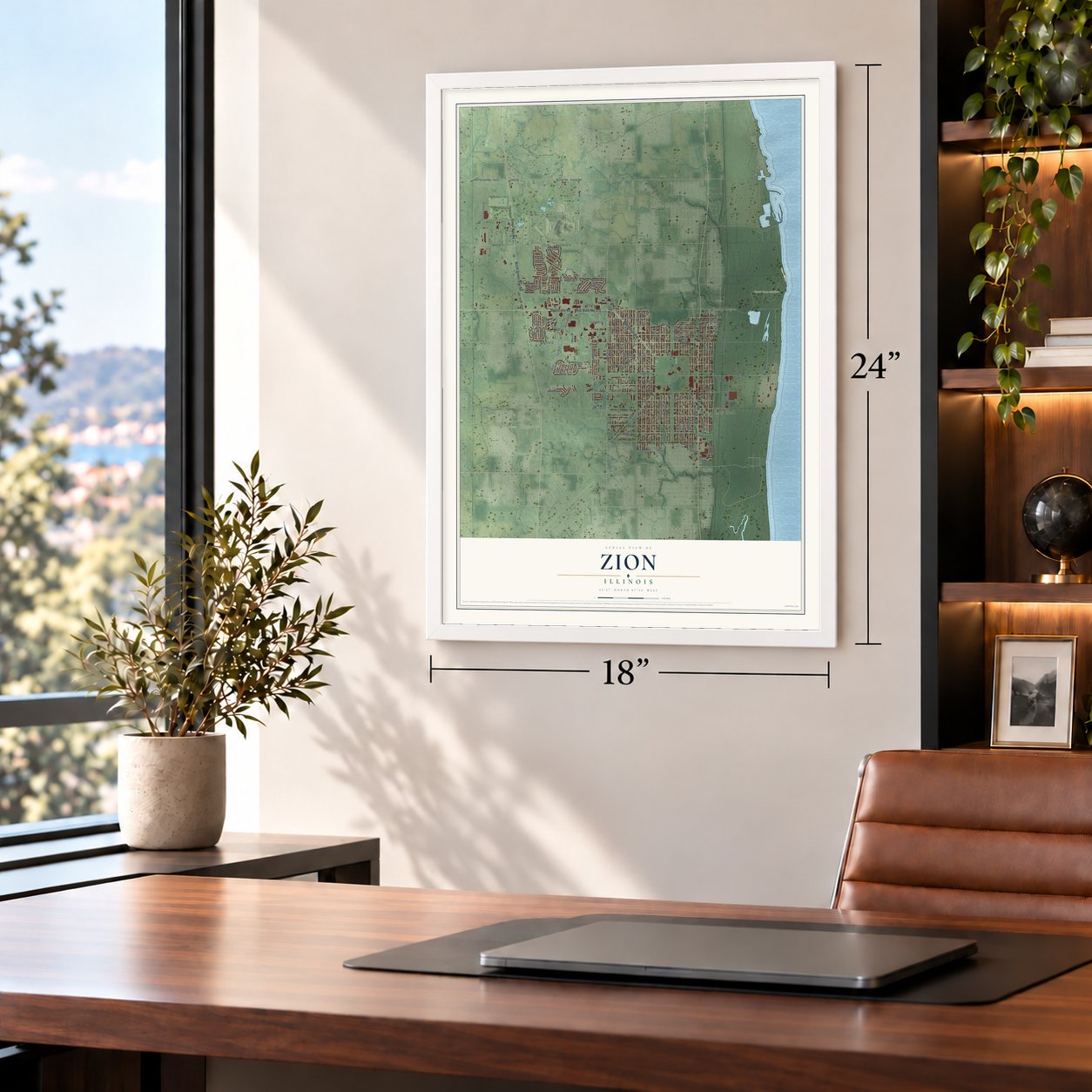
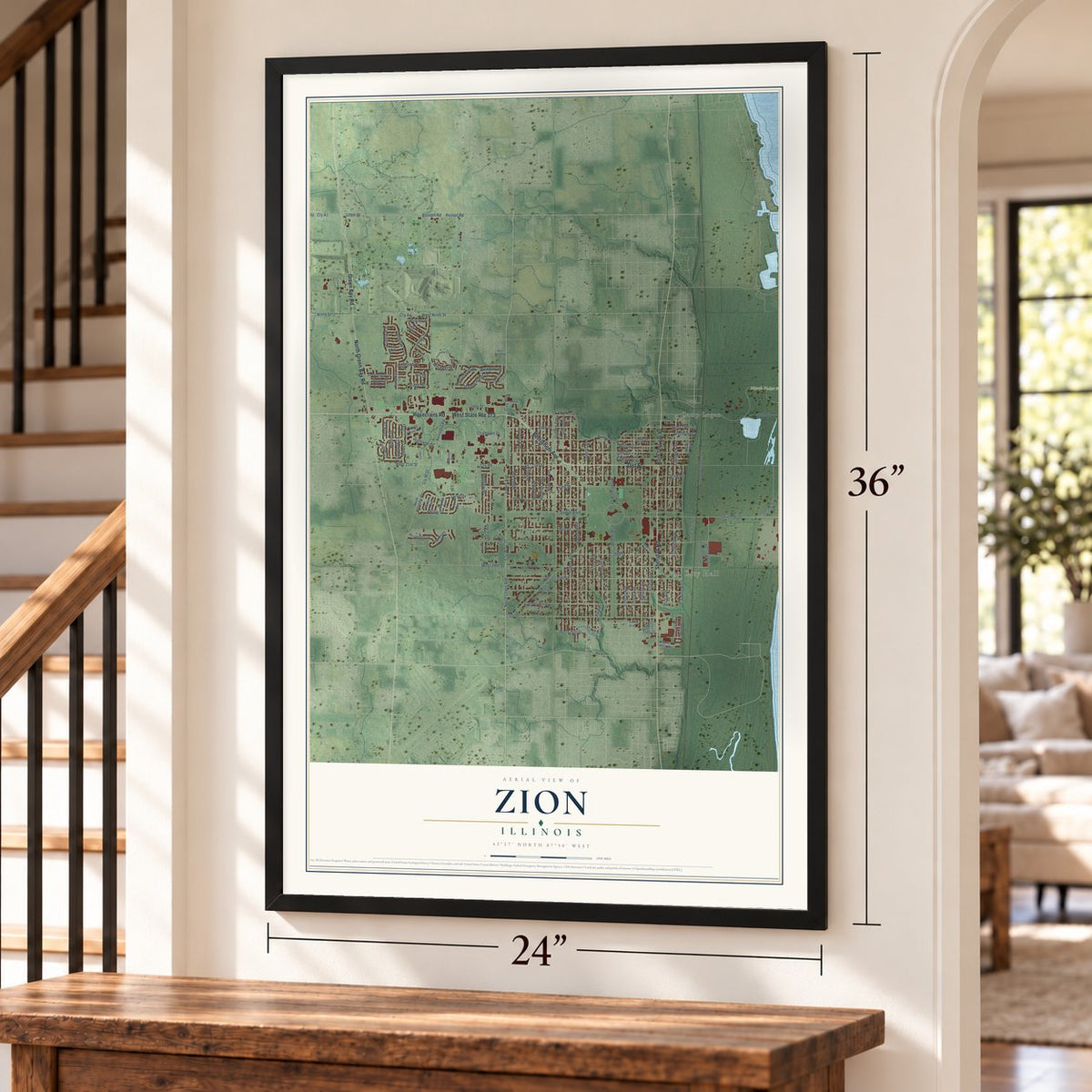
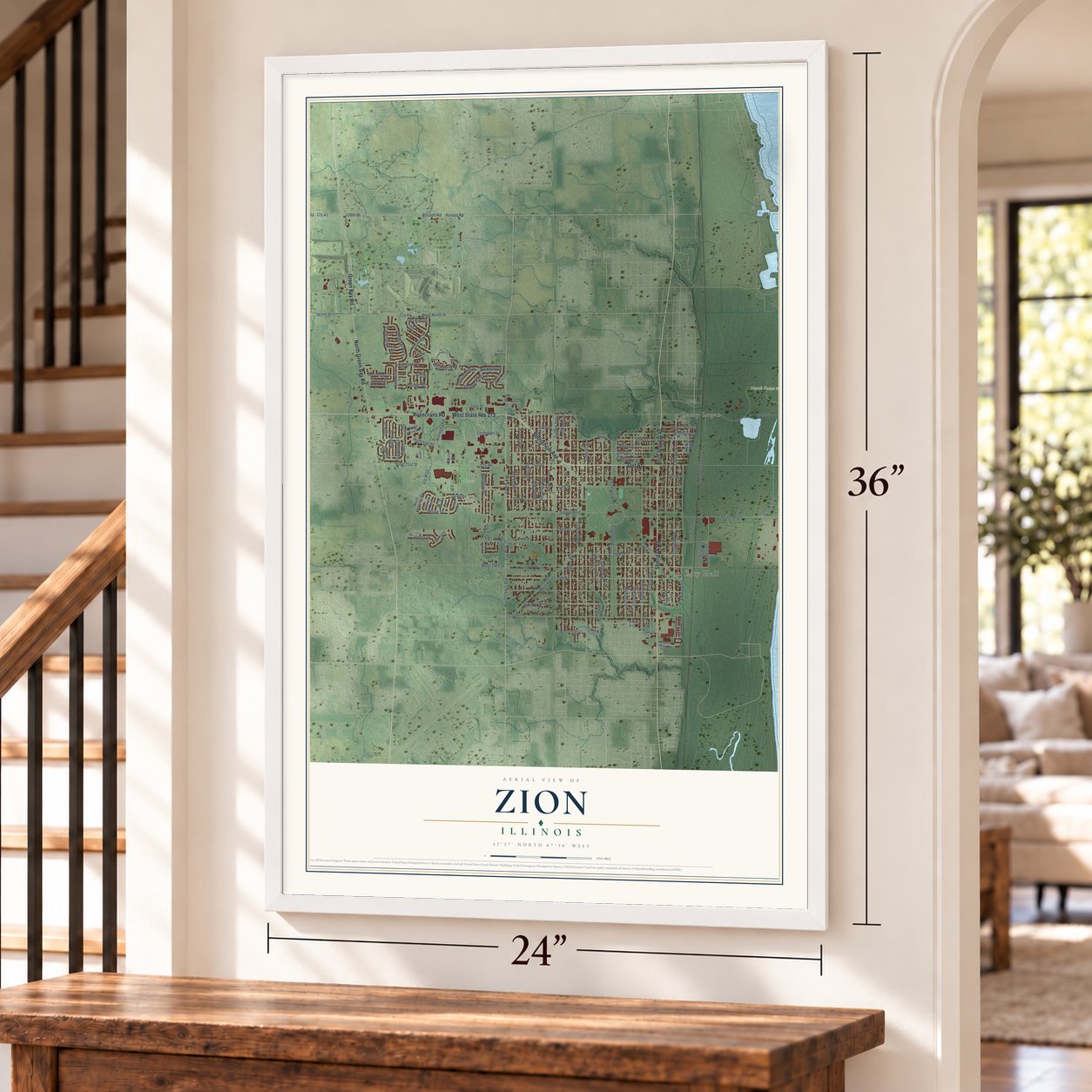
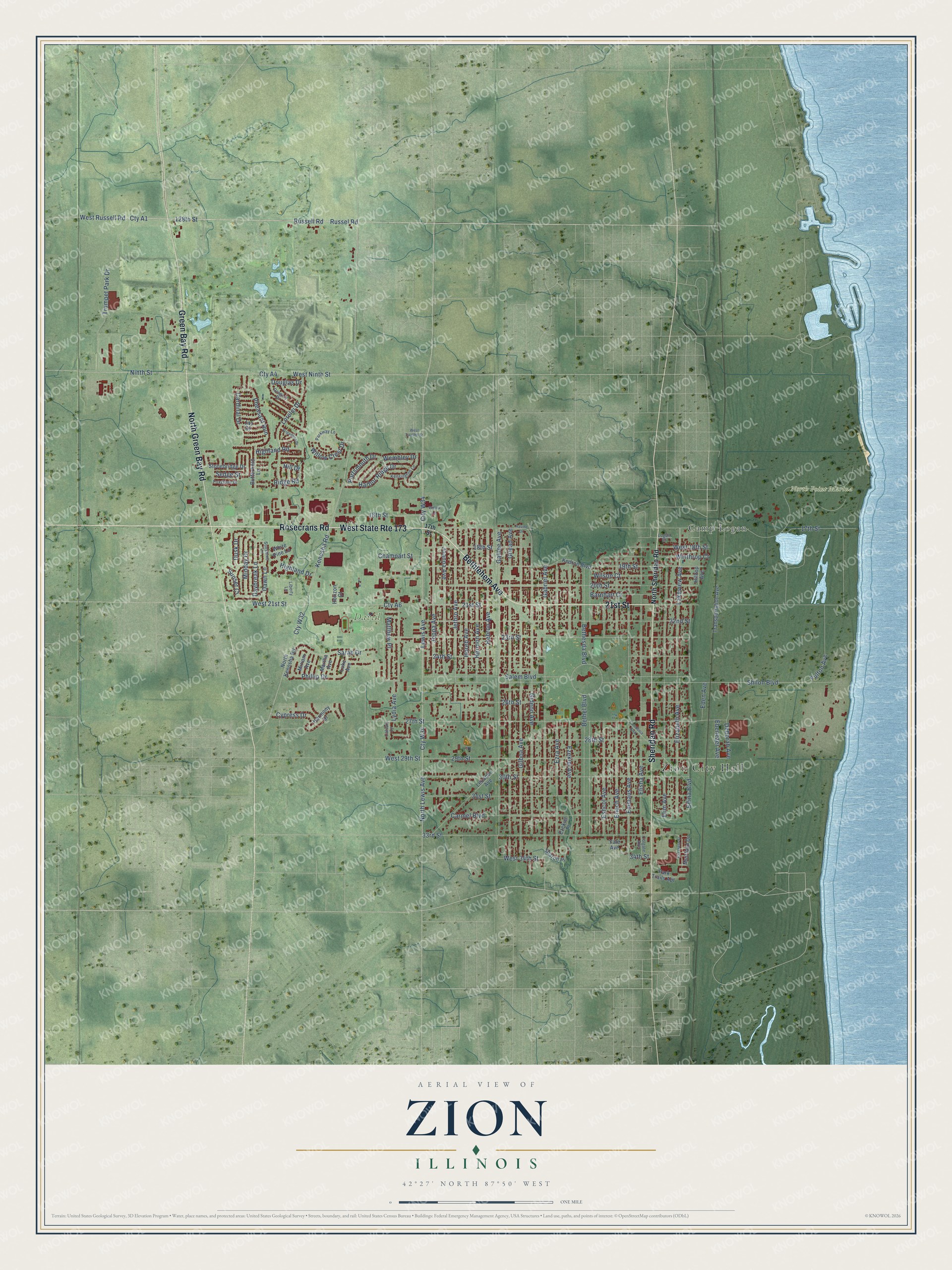
A new map of Zion, Illinois, made in 2026 and printed to order on thick archival matte paper.
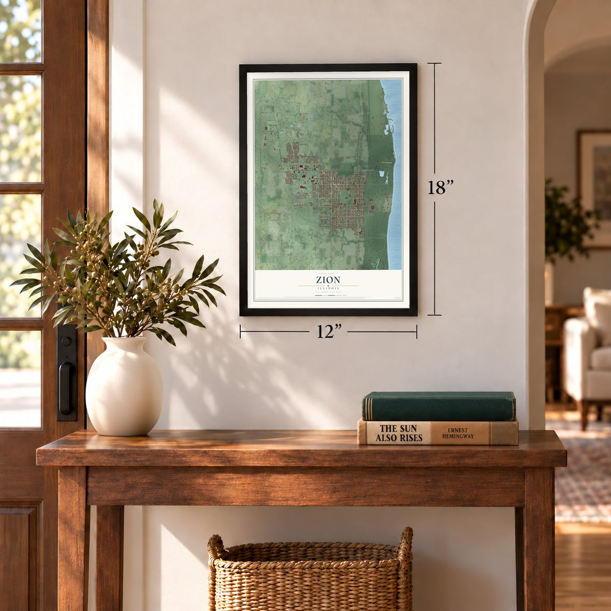
12" x 18" Archival Matte Print
A Map of Home. A Work of Art.
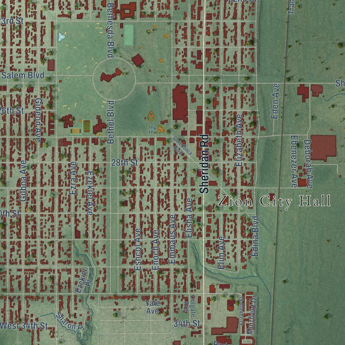
Explore Zion, Illinois from a whole new perspective. Created using aerial imagery and detailed geographic data, this map captures Zion building by building, with labeled streets, familiar landmarks, and shaded topographical relief that highlights the natural contours of the landscape.
Combining modern data with the timeless character of a vintage atlas, this map is just as interesting up close as it is beautiful on the wall. Whether you grew up in Zion, spent memorable years there, or call it home today, this unique map is a great way to celebrate a place that means something to you. Zoom in on the preview to look for your street, and then order a print to put your memories on the wall.
Three ways to hang it
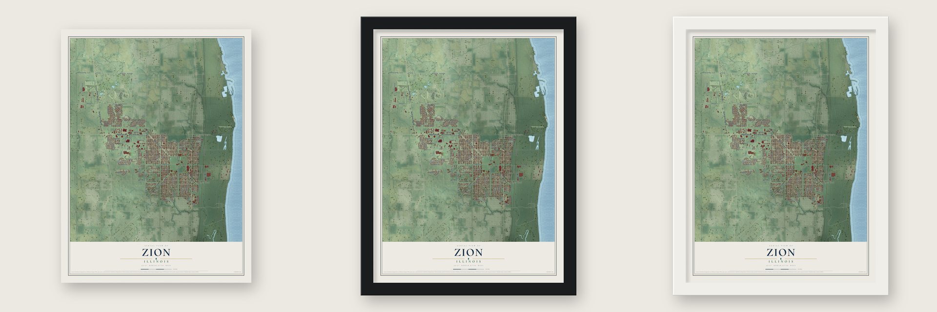
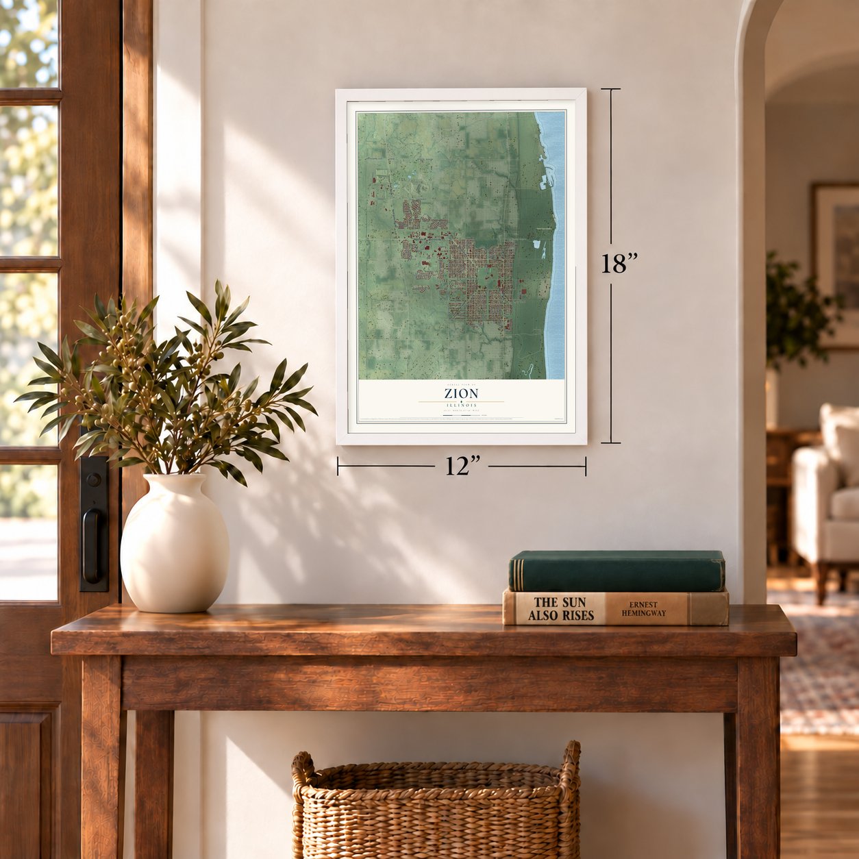
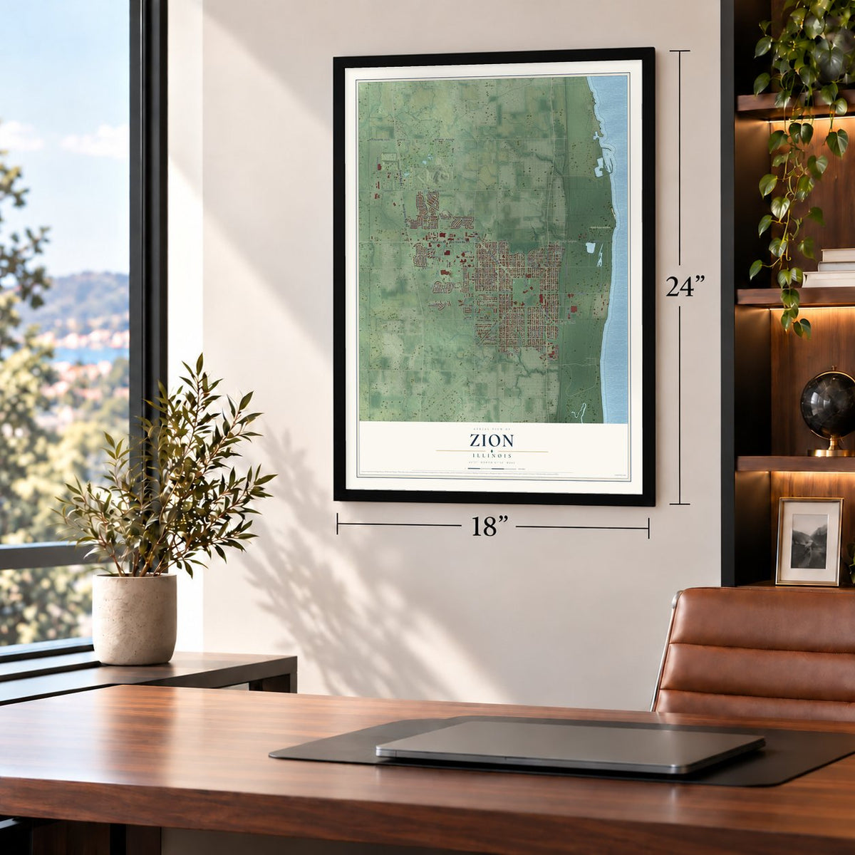
Unframed archival matte, a black wood frame or a white wood frame.
Up close
Geography Worth Displaying
This map was created using accurate cartographic data and authoritative geographic sources, including the U.S. Geological Survey and the Census Bureau. The map brings together terrain, waterways, roads, and building detail. The majority of the streets are labeled, houses are accurately depicted, and the topography is derived from government sources. Combining local data with carefully composed color and shading leads to this beautifully detailed Zion artwork for your wall.
Rather than simply showing street outlines, we’ve included as many of the street names as we could reasonably fit on the map while keeping their names legible. Zoom in on the high resolution preview to see exactly what’s on the map. We truly set out to create a statement piece for anyone who loves Zion. So whether it’s for you, or a gift for someone you love, we hope this map of Zion brings back fond memories.
About Zion, Illinois
Zion is a city of 24,655 people in Lake County, 40 miles north of Chicago. In 1888 John Alexander Dowie, a Scots-Australian preacher and faith healer, moved to the United States, and by 1890 he had made his home in Chicago. There he drew thousands of followers and ran a healing business that also worked by mail. He then bought land to the north and founded Zion in 1900, naming it for Mount Zion in Jerusalem. Dowie owned all of the land himself, along with most of the businesses.
Dowie's Zion Tabernacle of the Christian Catholic Apostolic Church was built in the early 1900s, and it was the only church in town. After Dowie, Wilbur Glenn Voliva led Zion through decades of turmoil, and the tabernacle burned down in 1937. Until the 1940s, the town's religious code taught that the earth was flat.
“Zion Home, on Elijah Avenue, a gray frame, block-long building erected in 1904, serves as a hotel and divine healing home.”
- A seal that said God ReignsDowie designed the city seal himself. It pictured a dove, a cross, a crown and a scepter, with the words "God Reigns." In 1990 a federal court ruled that the city could not use religious symbols on its seals. The Christian symbols came off, but the new seal was allowed to carry "In God We Trust."
- From rifle range to beachThe Illinois National Guard opened Camp Logan as a rifle range in 1892. In both world wars the Great Lakes Naval Training Station trained its shooters there. The range closed in 1973, and the land went to the Illinois Department of Conservation. Today it is the South Beach of Illinois Beach State Park, near North Point Marina, the largest marina in Illinois.
- A ballpark for Kevin CostnerThe actor Kevin Costner co-owned the Lake County Fielders, a North American League team named for his 1989 film Field of Dreams. Zion was to be their home, with an 8,500-seat Fielders Stadium planned to open in May 2010. The stadium's owners and the city ended up in court over a broken contract, and the ballpark was still unfinished when the team folded.
Find your street
Names on the Zion map
Every name below is printed on this map. Look for your street, your school, the park where you played, or the pond down the road.
Places and landmarks4
- Zion City Hall
- David Park
- North Point Marina
- Camp Logan
Streets and roads135
- 21st Street
- Bethlehem Avenue
- West State Route 173
- Sheridan Road
- Rosecrans Road
- Green Bay Road
- North Green Bay Road
- Cty W34
- Cty A1
- West Russell Road
- Russell Road
- North Lewis Avenue
- City W34
- Highland Drive
- Russel Road
- Lewis Avenue
- 33rd Street
- 27th Street
- Gilboa Avenue
- Gilead Avenue
- Galilee Avenue
- Gideon Avenue
- 20th Street
- 29th Street
- Gabriel Avenue
- 23rd Street
- Shiloh Boulevard
- Cty W32
- Elizabeth Avenue
- Cty A6
Show all 135 streets
- Cty A4
- Ninth Street
- West Ninth Street
- 31st Street
- 30th Street
- 22nd Street
- Bethel Boulevard
- Emmaus Avenue
- Elim Avenue
- Salem Boulevard
- Elisha Avenue
- Carmel Boulevard
- 28th Street
- 128th Street
- Edina Boulevard
- 19th Street
- 26th Street
- West 21st Street
- Ezekiel Avenue
- Ezra Avenue
- 24th Street
- Hebron Avenue
- Jethro Avenue
- Horeb Avenue
- Hermon Avenue
- Kenosha Road
- Bethesda Boulevard
- 17th Street
- 18th Street
- Trumpet Park Drive
- Lorelei Drive
- Eshcol Avenue
- Enoch Avenue
- Joppa Avenue
- Joanna Avenue
- Lydia Avenue
- Sarah Drive
- Willow Crest Drive
- Pheasant Run
- 16th Street
- Wilson Court
- Winthrop Court
- Barnhart Court
- Deborah Avenue
- Harbor Ridge Drive
- Lakeview Avenue
- Midday Drive
- Wembley Drive
- Matthew Place
- West 18th Street
- Portsmouth Drive
- Dawn Lane
- Cardinal Drive
- Daybreak Lane
- Phillip Drive
- Cypress Drive
- West 29th Street
- West 34th Street
- Highland Road
- Dusk Drive
- Champart Street
- Fulton Avenue
- Ridge Road
- Ebenezer Avenue
- Eden Avenue
- Douglas Drive
- Sedge Street
- Sunset Court
- Hill Drive
- 34th Street
- North Sheridan Road
- Muirfield Drive
- North Kenosha Road
- Lebanon Avenue
- Kedron Boulevard
- Transportation Avenue
- Sharon Place
- Stonebridge Drive
- Butterfield Lane
- Hilltop Avenue
- Luke Avenue
- Park Trails Apt
- Harmony Drive
- Miriam Avenue
- Jay Drive
- Martha Avenue
- Ezekiel Place
- Horizon Court
- White Pine Lane
- Yale Avenue
- Sunshine Lane
- Liberty Lane
- Gregory Drive
- Kensington Lane
- Parkway Lane
- Foxglove Drive
- Colgate Avenue
- Calvary Lane
- Logan Court
- Caledonia Boulevard
- Ravine Drive
- Brigadoon Drive
- Elizabeth Street
- West Twelfth Street
- Willow Lane
Names are listed as they appear on the printed map. Zoom into the product photos to find them.
The art of mapping a place
How This Map Was Made
Real places. Remarkable detail. Discover the layers that turn geographic data into a map of home.

The view from above
Aerial imagery reveals the character of the land: woodland, open fields, and the patterns of a place.

The shape of the land
Elevation data brings hills, valleys, and subtle changes in the landscape into view.

The details of home
Roads, waterways, and building footprints come together to make the map feel unmistakably local.

Geography becomes art
Considered color, shading, and typography bring the layers together in a map made for your wall.


Process illustrated with Mendon, Massachusetts. Aerial imagery: USDA NAIP. Terrain: USGS 3D Elevation Program. Map details and finished artwork: KNOWOL.
The Details
About This Print
Choose an archival matte print, or a black or white Ayous wood frame. The archival matte print is unframed.
Select your size and finish above to see the matching product image and price.
Materials & Craftsmanship
A contemporary map with the character of a classic atlas, printed on archival matte paper. Optional frames are made from Ayous wood.
Your printed map does not include the watermark shown in the full-map preview.
Shipping & Delivery
Free shipping within the United States. Every print is made to order in the USA.
Buying a gift? Add a note in your cart and we'll include it. We never put prices in the package.
Prints ship within 2 to 3 business days. Allow 7 to 10 days total from ordering for delivery. Timing may vary during holidays or periods of high order volume.
Read our shipping policy.
Returns and damaged prints
Each print is made to order. Change-of-mind refunds are not available after production.
If your print arrives damaged, misprinted or incorrect, contact support@knowol.com within 30 days of receiving it. Include your order number, photos and a description of the issue.
Read our full refund and replacement policy. For questions about your order, email support@knowol.com.
Find your town
Looking for another city?
Find a map of home in our Illinois collection, or any town in the country.
Nearby
Maps of towns near Zion
Know someone from one of these towns? Their map makes a great gift.
 Beach Park
, Illinois
From $39.99See the map
 Winthrop Harbor
, Illinois
From $39.99See the map
 Wadsworth
, Illinois
From $39.99See the map
More maps nearby: Waukegan, Old Mill Creek, Gurnee, Park City and Grandwood Park.