
Search for another town





Free U.S. delivery 7 to 10 days after you order
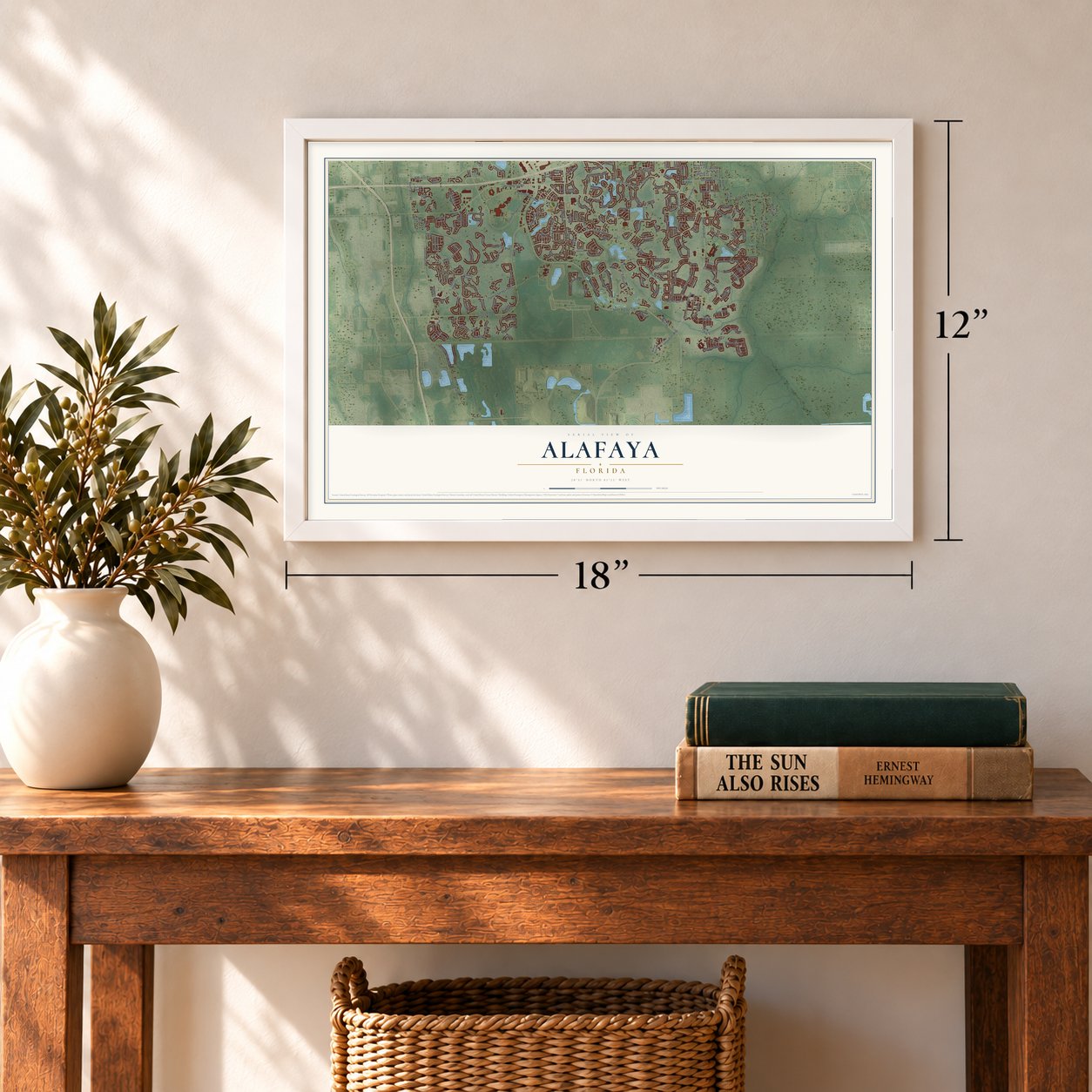
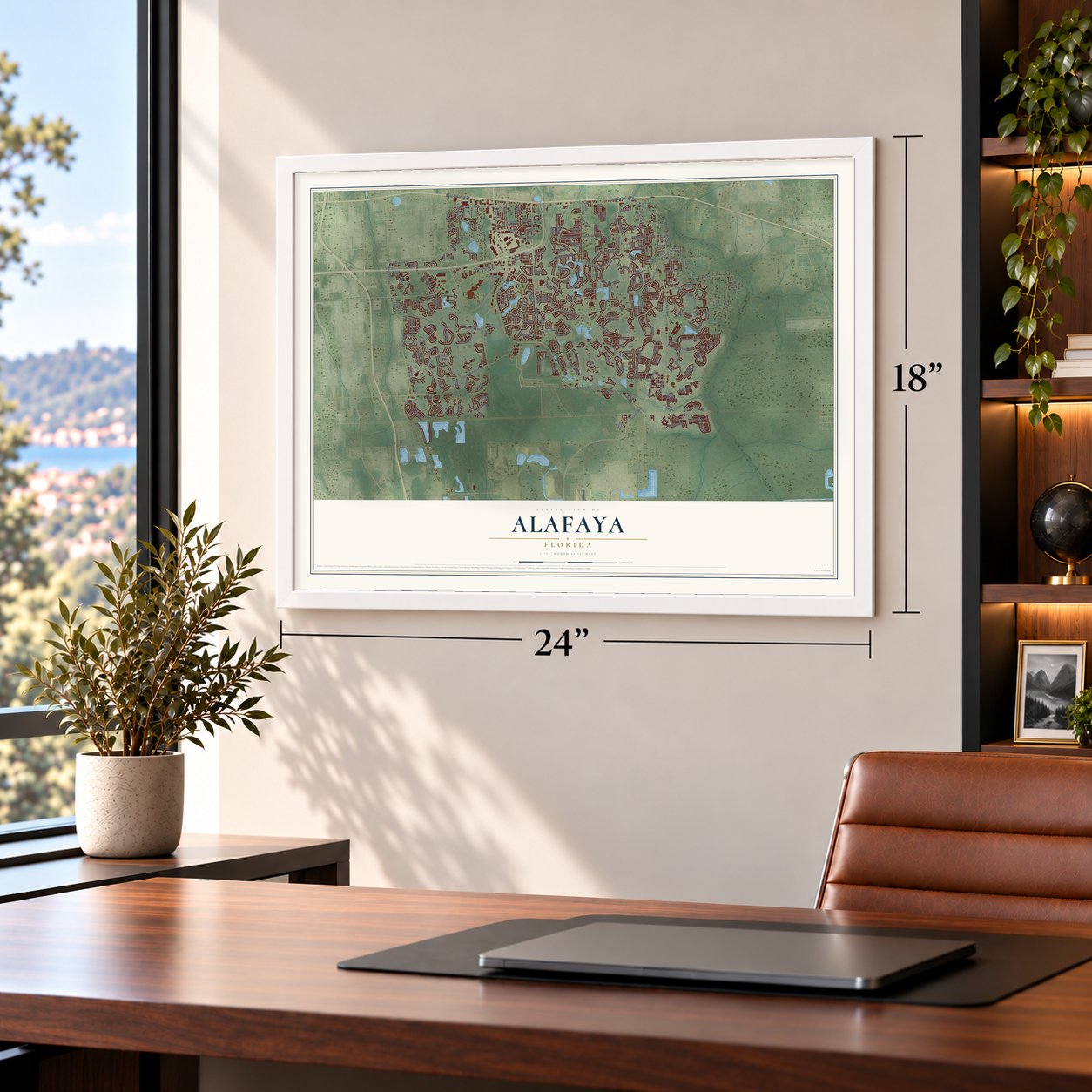
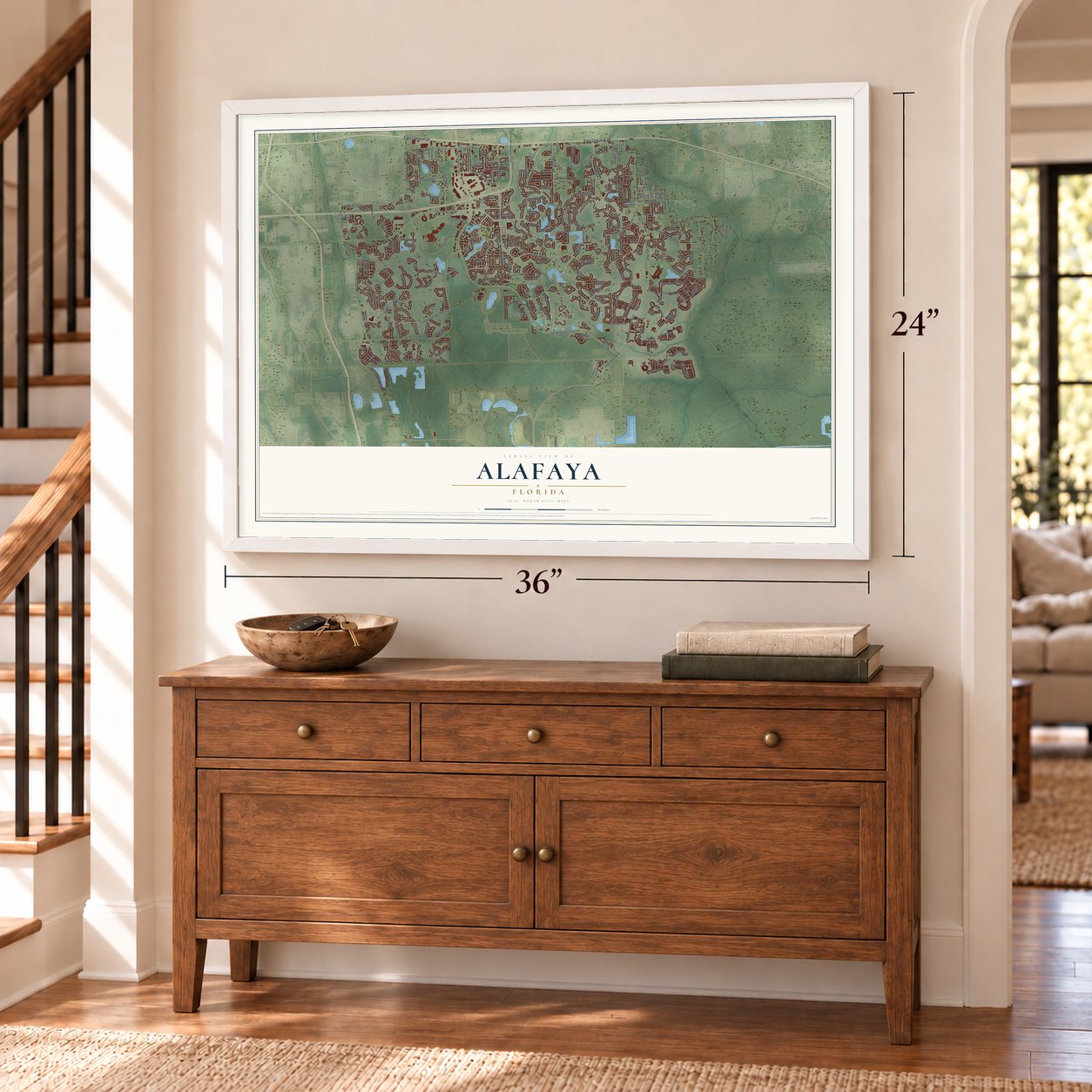
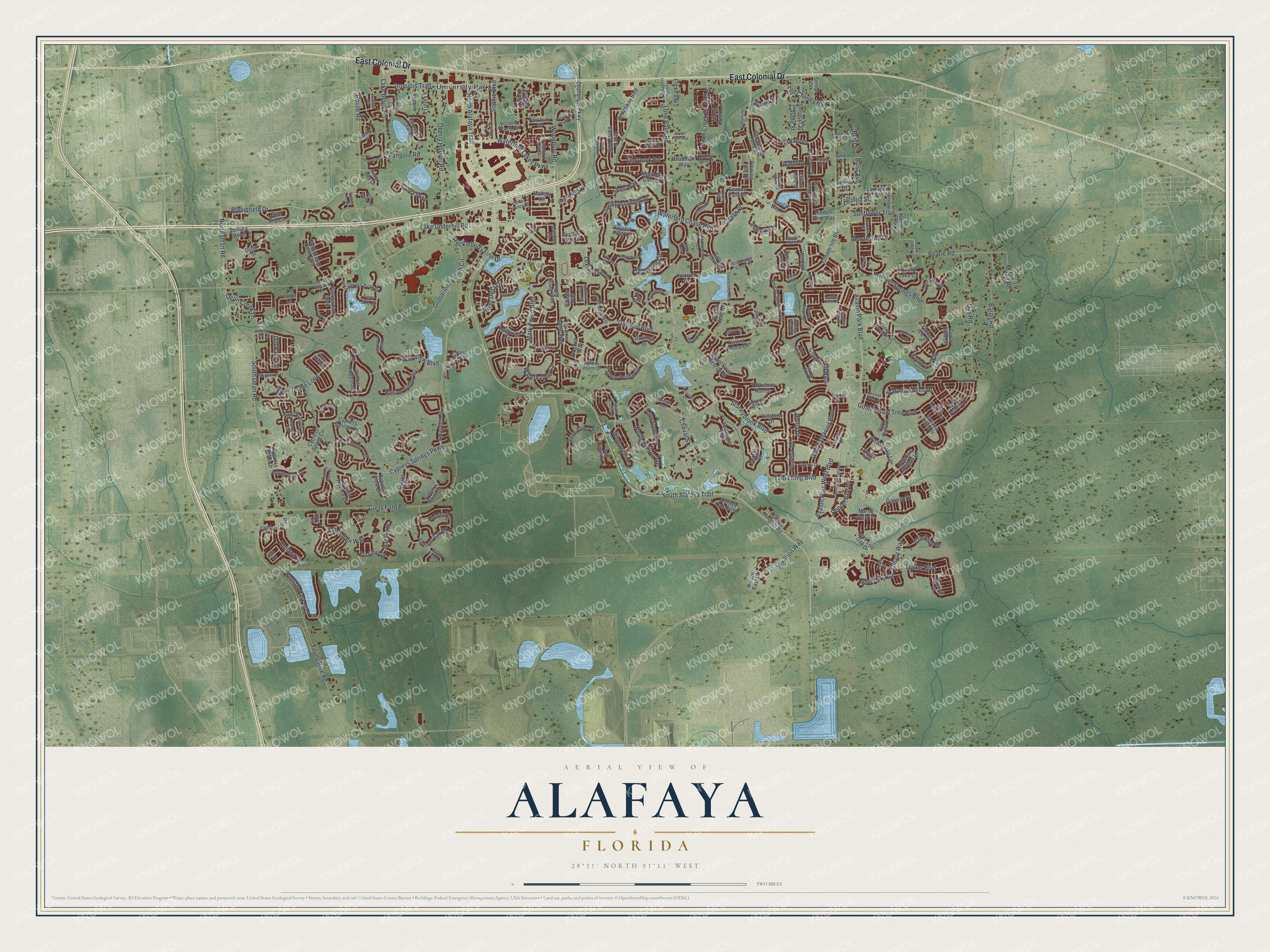
Alafaya, Florida Map Art
Building by building, with labeled streets and shaded relief.
12" x 18" Archival Matte Print
A Map of Home. A Work of Art.
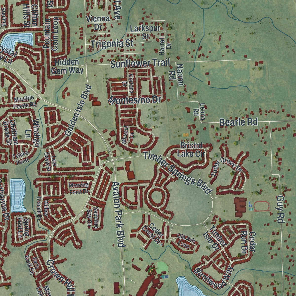
Explore Alafaya, Florida from a whole new perspective. Created using aerial imagery and detailed geographic data, this map captures Alafaya building by building, with labeled streets, familiar landmarks, and shaded topographical relief that highlights the natural contours of the landscape.
Combining modern data with the timeless character of a vintage atlas, this map is just as interesting up close as it is beautiful on the wall. Whether you grew up in Alafaya, spent memorable years there, or call it home today, this unique map is a great way to celebrate a place that means something to you. Zoom in on the preview to look for your street, and then order a print to put your memories on the wall.
Three ways to hang it
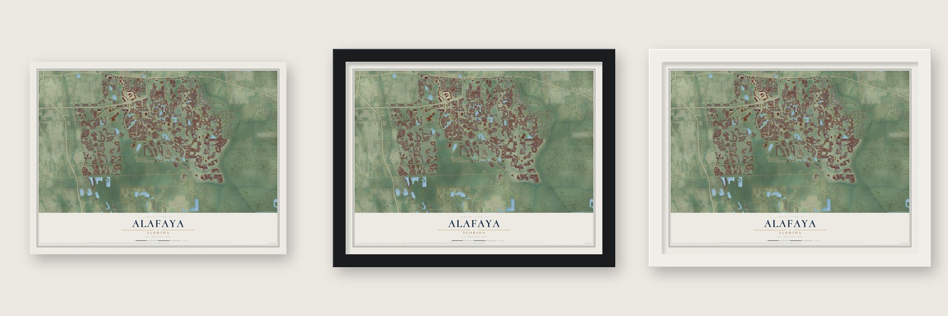
Unframed archival matte, a black wood frame or a white wood frame.
Up close
Geography Worth Displaying
This map was created using accurate cartographic data and authoritative geographic sources, including the U.S. Geological Survey and the Census Bureau. The map brings together terrain, waterways, roads, and building detail. The majority of the streets are labeled, houses are accurately depicted, and the topography is derived from government sources. Combining local data with carefully composed color and shading leads to this beautifully detailed Alafaya artwork for your wall.
Rather than simply showing street outlines, we’ve included as many of the street names as we could reasonably fit on the map while keeping their names legible. Zoom in on the high resolution preview to see exactly what’s on the map. We truly set out to create a statement piece for anyone who loves Alafaya. So whether it’s for you, or a gift for someone you love, we hope this map of Alafaya brings back fond memories.
Read the story behind this map of Alafaya, Florida from 2026.

Find your street
Names on the Alafaya map
Every name below is printed on this map. Look for your street, your school, the park where you played, or the pond down the road.
Places and landmarks1
- University Park
Streets and roads260
- East Colonial Drive
- South Alafaya Trail
- Avalon Park Boulevard
- Mark Twain Boulevard
- North Alafaya Trail
- Crown Hill Boulevard
- Bloomfield Drive
- Avalon Park West Boulevard
- North Dean Road
- Bearle Road
- Lake Underhill Road
- Curry Ford Road
- Young Pine Road
- Cypress Springs Parkway
- Global Innovation Circle
- Woodbury Road
- Golfway Boulevard
- Tanja King Boulevard
- South Dean Road
- Stoneybrook Boulevard
- Sunflower Trail
- Innovation Way
- Rouse Road
- Waterford Chase Parkway
- Timber Springs Boulevard
- Oberry Hoover Road
- Wild Tamarind Boulevard
- Mailer Boulevard
- Guy Road
- Perdido Drive
Show all 260 streets
- Lone Palm Road
- Inside Loop
- Cheval Street
- Golden Rain Tree Boulevard
- Huckleberry Finn Drive
- Old Cheney Highway
- Fairhaven Way
- Benson Park Boulevard
- Waterhaven Circle
- Baron Road
- Arbor View Boulevard
- Chase Place
- Old Dock Road
- Lake Berge Road
- Cleary Way
- Phoenix Drive
- Waterford Lakes Parkway
- Montesino Drive
- Bluewater Circle
- Northampton Avenue
- Spring Island Way
- Cassia Drive
- Carey Way
- Lexingdale Drive
- Iroquois Trail
- Paradise Tree Drive
- Sophie Boulevard
- Galbi Drive
- River Delta Drive
- Buist Street
- Fangorn Road
- Clarkson Drive
- Trigonia Street
- Holland Drive
- Erskine Drive
- Anastasia Lane
- Dean Creek Lane
- Peppervine Drive
- Malta Road
- Birch Creek Drive
- Lakes Way
- Bradbury Road
- Old Barn Road
- Antlia Drive
- Pel Street
- Buist Avenue
- Caudle Street
- Golden Isle Boulevard
- Maribou Circle
- Fawnlake Trail
- Dylan Street
- Marsh Creek Lane
- Bridgeway Boulevard
- Cypress Trail Drive
- Anna Catherine Drive
- Cypress Springs Circle
- Andover Cay Boulevard
- Lake Live Oak Drive
- Willow Ridge Loop
- Fairway Pointe Circle
- Fountain Coin Loop
- Atwood Drive
- Amaryllis Circle
- Cypress Leaf Drive
- Lower River Boulevard
- Hallowell Circle
- Balsam Willow Trail
- Crystal River Drive
- Alafaya Oak Bend
- Victoria Place Circle
- Cricket Club Circle
- Bristol Lake Circle
- Windigo Lane
- Fieldstream Boulevard
- Dornoch Drive
- Royal Saint George Drive
- Cedar Run Drive
- Mallory Circle
- Yorkshire Run Drive
- Guiana Plum Drive
- Birchwood Way
- Stone Abbey Boulevard
- Crystal Bay Lane
- Magnolia Glen Circle
- Briar Bay Circle
- Sherman Street
- Rainbow Springs Lane
- Canary Island Court
- Maumee Street
- Island Bay Drive
- Summer Swan Drive
- Cherry Valley Way
- Prairie Dune Way
- Marsh Fern Drive
- Windsorgate Lane
- Leader Lane
- Seneca Falls Drive
- Armone Street
- Fieldstream North Boulevard
- Larkspur Street
- Teton Stone Run
- Stone Glen Drive
- Belhaven Drive
- Challenger Parkway
- Blackwater Pond Drive
- Cog Hill Way
- Vienna Drive
- Lambert Boulevard
- Walton Heath Drive
- Corbyton Court
- Sweet Acacia Drive
- Portrush Drive
- Twilight Drive
- Flowing Tide Drive
- Bluejay Way
- Timber Isle Drive
- Mattson Drive
- Alafaya Heights Road
- Riviera Pointe Drive
- Parkbury Drive
- Fern Lake Drive
- Tortuga Bend
- Sunset Terrace Drive
- Kearin Lane
- Thamhall Way
- Naomi Road
- Heron Bay Drive
- Faberge Drive
- Semon Drive
- Hillshire Drive
- Fricke Avenue
- Autumn View Drive
- Cypress Spring Circle
- Hidden Gem Way
- Cypress Villas Drive
- Lacerta Drive
- Nature East Drive
- Crystal Cove Drive
- Clifton Hills Street
- Ian Street
- Guildhall Circle
- Leona Road
- Branchwater Trail
- Stone Cross Circle
- Tudor Grove Drive
- Shadowbrook Lane
- Water Hyacinth Drive
- Waterford Oak Drive
- Rockledge Grove Court
- Hartford Run Drive
- Oak Chase Drive
- Heming Way
- Cedar Crest Drive
- Mirror Lake Drive
- Saw Palmetto Lane
- Fordwell Drive
- Rockafellow Way
- Crest Pines Drive
- Cygnus Drive
- Tuten Trail
- Coliseum Street
- Three Rivers Drive
- Afton Circle
- Orchid Tree Place
- Fairway Pointe Drive
- Yeats Street
- Harrell Drive
- Estates Club Drive
- Sahara Street
- Madison Dock Road
- Wiles Way
- Carina Drive
- Grand Bank Lane
- Chatham Break Street
- Topsail Hill Street
- Earpod Drive
- Clover Walk Drive
- Spring Fest Lane
- Angler Court
- Isadore Drive
- Julip Drive
- Tree Shore Drive
- Lexi Davis Street
- Willow Branch Drive
- Winghurst Boulevard
- Hancock Lone Palm Road
- Forestedge Circle
- Windmill Grove Circle
- Cypress Trace Circle
- Auburn Park East Boulevard
- Woodbury Pines Circle
- Sylvan Pond Circle
- Satinwood Circle
- Lake Cypress Circle
- Cortona Drive
- Crane Crest Way
- Waterford Wood Circle
- Crownclover Avenue
- Early Frost Circle
- Old Ash Loop
- Deljean Circle
- Sapphire Bay Circle
- Morning Frost Drive
- Winding Creek Lane
- Flyrod Circle
- Moultrie Pointe Road
- Jade Forest Avenue
- Marguex Drive
- Emeraldview Drive
- Toluke Point
- Pondview Drive
- Silverthorn Drive
- Mahogany Drive
- Lilac Trace Lane
- Black Mangrove Drive
- Harney Drive
- Baltusrdl Drive
- Thatch Palm Way
- Cypress Tree Court
- Seaward Street
- Twinberry Road
- Baroness Court
- Sterling Spring Road
- Fern Rock Road
- Heritage Point Drive
- Squirrel Run
- Maple Tree Lane
- Mirasol Lane
- Cavan Lane
- Pied Court
Names are listed as they appear on the printed map. Zoom into the product photos to find them.
About Alafaya, Florida
Alafaya is an unincorporated community of 92,452 people in eastern Orange County, spread across the land south of State Road 50. Its center lies about 9 miles east of downtown Orlando, and it is best known for being close to Waterford Lakes, Avalon Park and the campus of the University of Central Florida.
- Avalon Park, begun in 1998Beat Kahli, an investment banker from Switzerland, started Avalon Park in 1998 as a master-planned development covering 1,860 acres on Orlando's east side. The firm Duany Plater-Zyberk & Co. drew its first master plan.
- Building without debtAvalon Park's land first covered 9,400 acres. Kahli sold 7,500 of them, with the local water management district and the county as buyers, and that sale let him start construction with no debts.
- The Clock Tower, 2000Downtown Avalon Park took shape in 2000, when the Clock Tower went up. The building soon became the place where the community's first residents came together.
Keep exploring Florida
Alafaya is one of 1,039 Florida towns we've mapped. Every dot on the map is a print of its own.
The search covers every state, Florida first.
Near Alafaya
Order 2 or more town maps and save 10%. Shown in the size and finish you picked above, so they hang as a set.
- Union Park 12" x 18" / Archival Matte Print $39.99
- University 12" x 18" / Archival Matte Print $39.99
- Rio Pinar 12" x 18" / Archival Matte Print $39.99

More maps nearby: Azalea Park, Bithlo, Wedgefield, Aloma and Goldenrod.
The art of mapping a place
How This Map Was Made
Real places. Remarkable detail. Discover the layers that turn geographic data into a map of home.

The view from above
Aerial imagery reveals the character of the land: woodland, open fields, and the patterns of a place.

The shape of the land
Elevation data brings hills, valleys, and subtle changes in the landscape into view.

The details of home
Roads, waterways, and building footprints come together to make the map feel unmistakably local.

Geography becomes art
Considered color, shading, and typography bring the layers together in a map made for your wall.


Process illustrated with Mendon, Massachusetts. Aerial imagery: USDA NAIP. Terrain: USGS 3D Elevation Program. Map details and finished artwork: KNOWOL.
The Details
About This Print
Choose an archival matte print, or a black or white Ayous wood frame. The archival matte print is unframed.
Select your size and finish above to see the matching product image and price.
Materials & Craftsmanship
A contemporary map with the character of a classic atlas, printed on archival matte paper. Optional frames are made from Ayous wood.
Your printed map does not include the watermark shown in the full-map preview.
Shipping & Delivery
Free shipping within the United States. Every print is made to order in the USA.
Buying a gift? Add a note in your cart and we'll include it. We never put prices in the package.
Prints ship within 2 to 3 business days. Allow 7 to 10 days total from ordering for delivery. Timing may vary during holidays or periods of high order volume.
Read our shipping policy.
Returns and damaged prints
Each print is made to order. Change-of-mind refunds are not available after production.
If your print arrives damaged, misprinted or incorrect, contact support@knowol.com within 30 days of receiving it. Include your order number, photos and a description of the issue.
Read our full refund and replacement policy. For questions about your order, email support@knowol.com.