
Search for another town





Free U.S. delivery 7 to 10 days after you order
Alcoa, Tennessee Map Art
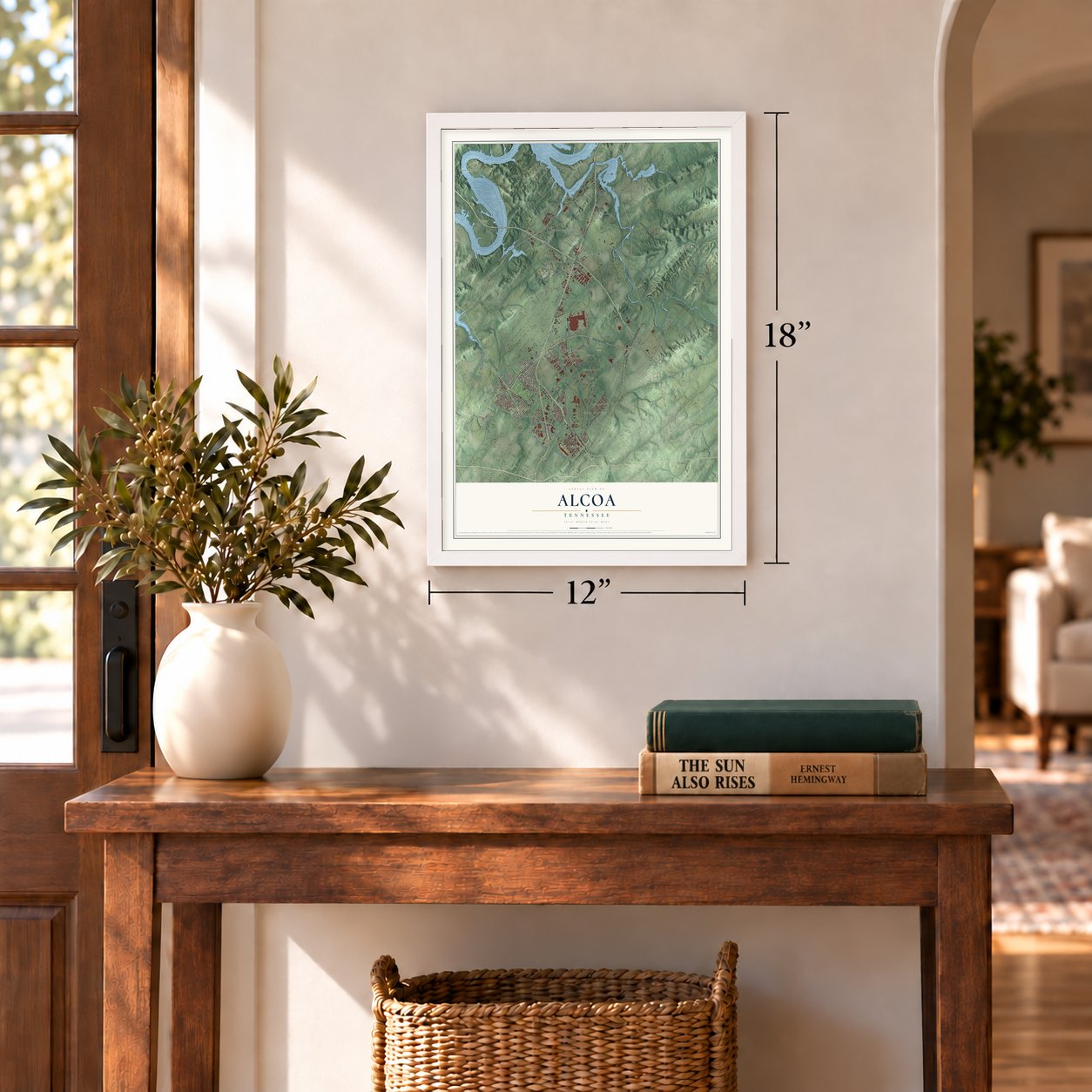
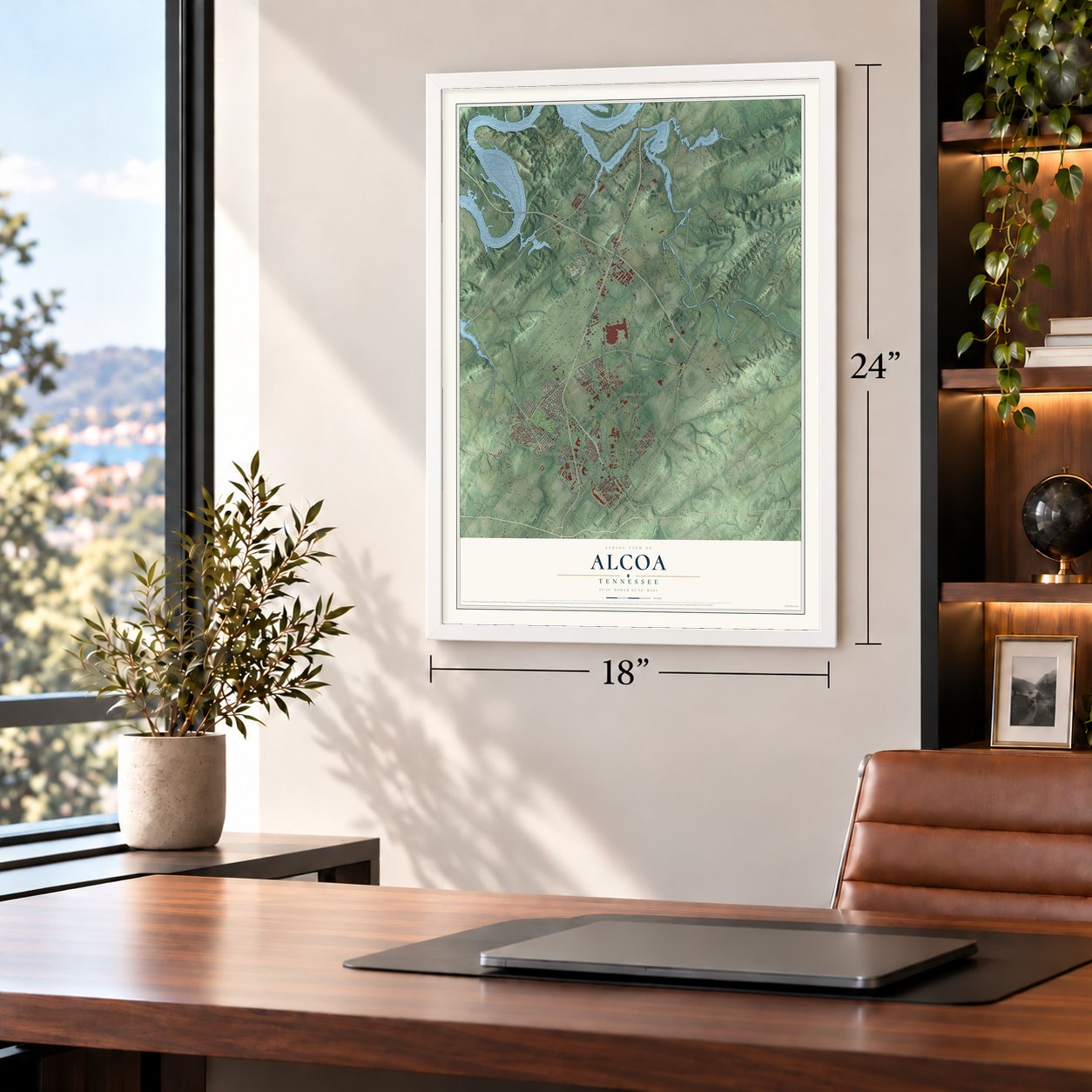
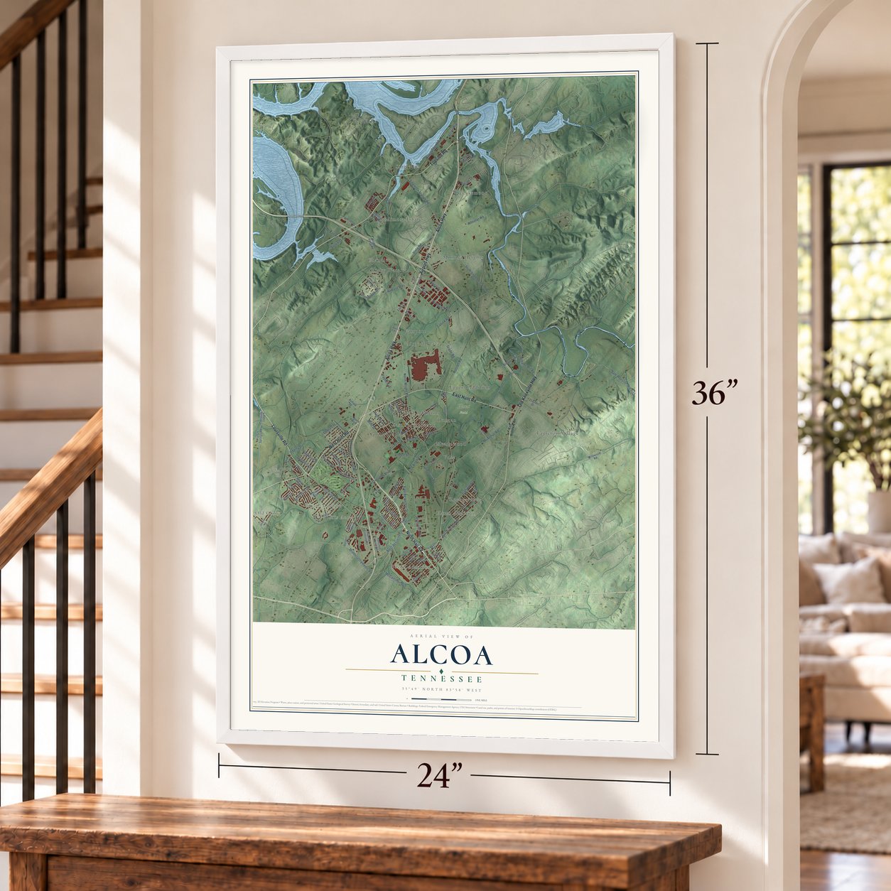
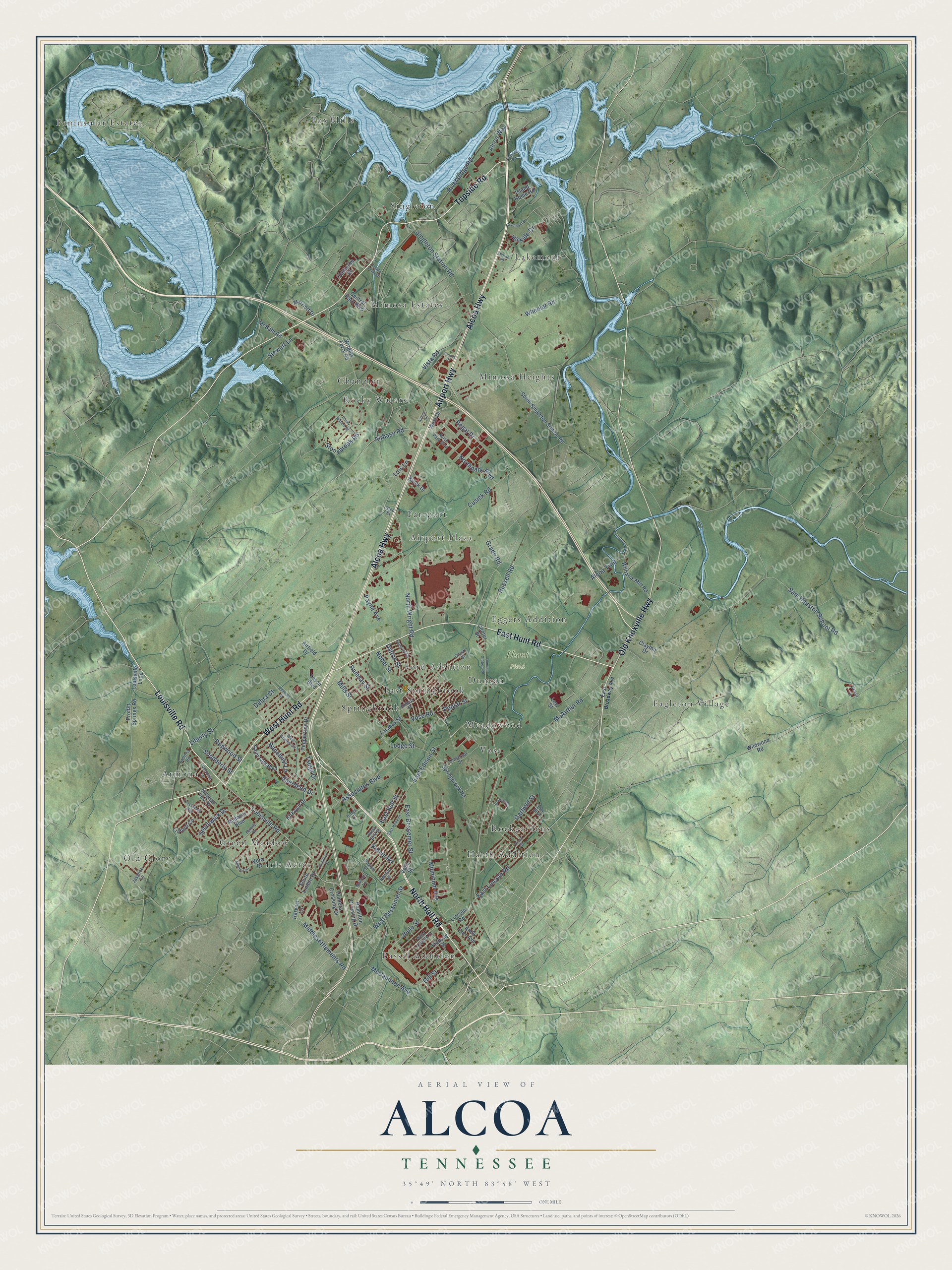
A new map of Alcoa, Tennessee, made in 2026 and printed to order on thick archival matte paper.
12" x 18" Archival Matte Print
A Map of Home. A Work of Art.
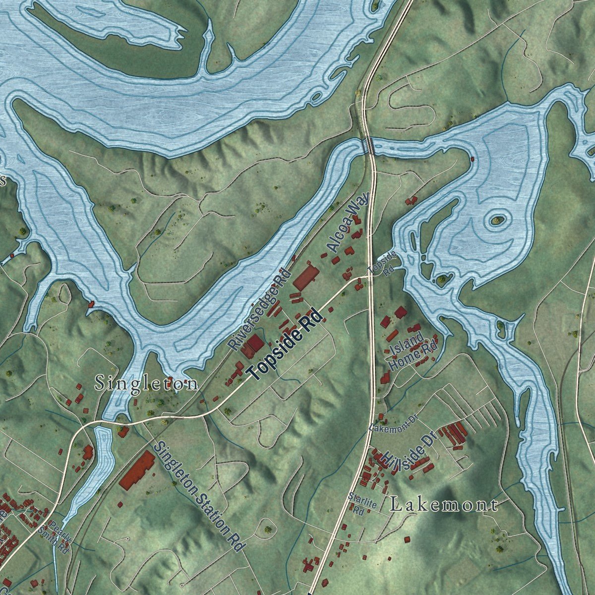
Explore Alcoa, Tennessee from a whole new perspective. Created using aerial imagery and detailed geographic data, this map captures Alcoa building by building, with labeled streets, familiar landmarks, and shaded topographical relief that highlights the natural contours of the landscape.
Combining modern data with the timeless character of a vintage atlas, this map is just as interesting up close as it is beautiful on the wall. Whether you grew up in Alcoa, spent memorable years there, or call it home today, this unique map is a great way to celebrate a place that means something to you. Zoom in on the preview to look for your street, and then order a print to put your memories on the wall.
Three ways to hang it
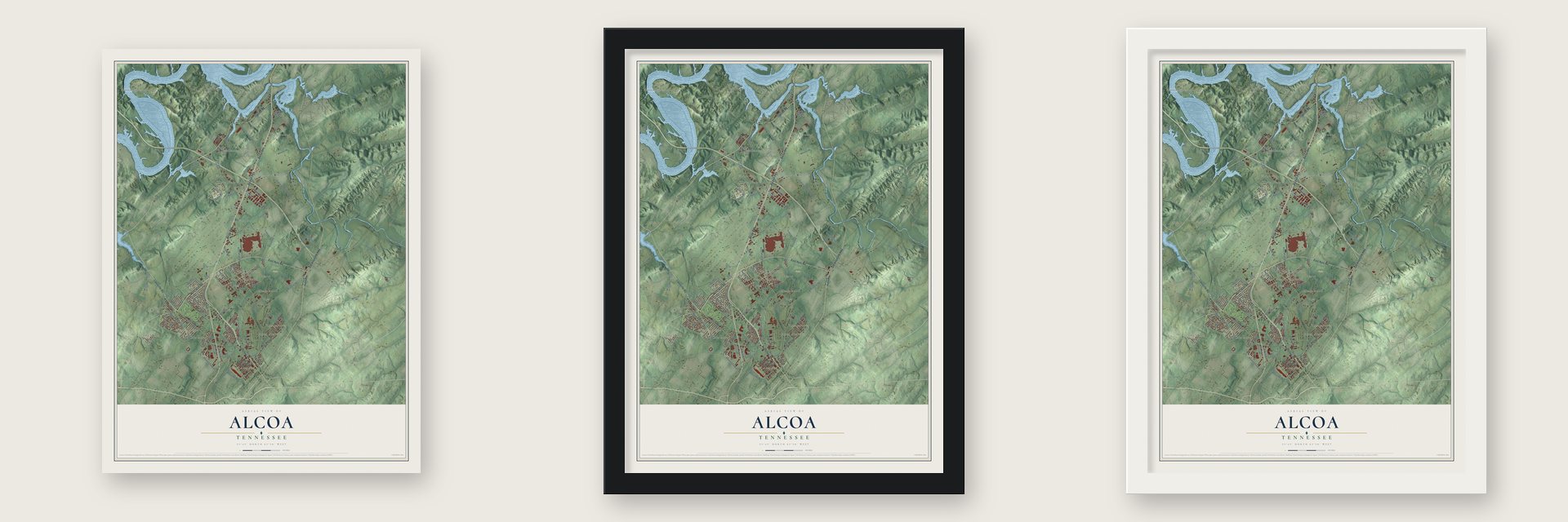
Unframed archival matte, a black wood frame or a white wood frame.
Up close
Geography Worth Displaying
This map was created using accurate cartographic data and authoritative geographic sources, including the U.S. Geological Survey and the Census Bureau. The map brings together terrain, waterways, roads, and building detail. The majority of the streets are labeled, houses are accurately depicted, and the topography is derived from government sources. Combining local data with carefully composed color and shading leads to this beautifully detailed Alcoa artwork for your wall.
Rather than simply showing street outlines, we’ve included as many of the street names as we could reasonably fit on the map while keeping their names legible. Zoom in on the high resolution preview to see exactly what’s on the map. We truly set out to create a statement piece for anyone who loves Alcoa. So whether it’s for you, or a gift for someone you love, we hope this map of Alcoa brings back fond memories.
Read the story behind this map of Alcoa, Tennessee from 2026.

About Alcoa, Tennessee
Alcoa is a city of 10,978 people in Blount County, in the foothills of the Great Smoky Mountains. In 1907 the Pittsburgh Reduction Company took a new name, the Aluminum Company of America. It soon went looking for a place in East Tennessee to smelt aluminum. Smelting takes huge amounts of electricity, and the Little Tennessee River could supply water power. In 1910 the company set up a base camp at Calderwood, which it first called Alcoa.
The company looked at Knoxville, Etowah and Monroe County, but it picked North Maryville. Maryville's mayor, Samuel Everett, helped win the deal. By 1914 the company owned 700 acres there. It was building the smelter and 150 homes for workers, and two of its engineers, Edwin Fickes and Robert Ewald, drew the town plan. World War I raised the demand for aluminum. In 1919 a rolling mill opened, and the town was incorporated as Alcoa, with C.L. Babcock as mayor. By 1920 it had 3,358 people in 700 houses.
- Steady work in the DepressionAfraid its workers would leave if the plant slowed, the company kept making aluminum through the Great Depression even with little demand. It cut hours instead of jobs, at one point to 30 a week, and by the end of the 1930s it had stored up 42,000 tons of metal. Unions grew stronger. Police broke a strike in 1934, and a second strike in 1937 ended with two strikers shot dead and the National Guard called in.
- Biggest plant under one roofAircraft builders needed aluminum in World War II. Production here rose 600%, and the local workforce grew to 12,000. The North Plant went up in the early 1940s. When it was done, no plant in the world under a single roof was larger.
- Parks built by plant workersAlcoa's planners saw parks as a must. In the 1920s the city aimed for 1 acre of park for every 100 residents. Victor Hultquist ran construction for the company and served as city manager until 1948. In the early 1930s he put idle plant workers to work building parks. In 1998 a 3-mile stretch of the Maryville-Alcoa Greenway opened. It links Springbrook Park to Maryville's Bicentennial Greenbelt Park.
- Streets named for inventorsBessemer, Joule, Edison, Darwin and Watt Streets honor scientists and inventors. Hunt, Glascock and Calderwood carry the names of company officials and engineers. The Hall neighborhood is named for the man who invented the electrolytic process for making aluminum. At first it was set apart as the place where the plant's Black workers had to live.
- A town of its ownAfter the war the company desegregated its facilities. It gave land for schools, parks and the airport. In the early 1950s it began selling company houses to the workers who lived in them. Ross Walker took over as city manager in 1956, the first one who wasn't a company employee. Before the decade ended, the company had handed over the city utilities.
Find your street
Names on the Alcoa map
Every name below is printed on this map. Look for your street, your school, the park where you played, or the pond down the road.
Places and landmarks26
- Hunt Field
- Airport Plaza
- Armona
- Bassel Addition
- Chandler
- Duncan
- Eagleton Village
- East Springbrook
- Eggers Addition
- Farrport
- Ford Addition
- Fox Hills
Show all 26 places
- Green Meadow
- Harth Addition
- Iris Acres
- Lakemont
- Meadowood
- Mimosa Estates
- Mimosa Heights
- Old Glory
- Peninsular Estates
- Rockgardens
- Rocky Waters
- Singleton
- Springbrook
- Vose
Streets and roads125
- Alcoa Highway
- Airport Highway
- North Hall Road
- Topside Road
- East Hunt Road
- West Hunt Road
- Louisville Road
- Old Knoxville Highway
- North Wright Road
- East Bell Street
- East Edison Street
- Sam Houston School Road
- Middlesettlements Road
- Cusick Road
- McArthur Road
- West Bessemer Street
- Aluminum Avenue
- East Lincoln Road
- Alcoa Trail
- Stonybrook Road
- Riversedge Road
- Wheeler Road
- Northpark Boulevard
- Singleton Station Road
- Poplar Street
- Stewart Lane
- McCammon Avenue
- Regal Drive
- East Bessemer Street
- Grade Road
Show all 125 streets
- Lodge Street
- Dalton Street
- Garfield Street
- Russell Road
- Vista Road
- Ramsay Street
- Southwick Drive
- Airbase Road
- Mills Street
- Aberdeen Drive
- Joule Street
- Nobel Street
- Associates Boulevard
- Banebury Lane
- Kelvin Road
- Snodderly Street
- Gill Street
- Dogwood Street
- Hillside Drive
- Payne Avenue
- Vose Road
- Lois Lane
- Tsuga Drive
- Liberty Street
- Alcoa Way
- Debra Court
- Airfield Drive
- Wrights Ferry Road
- Springbrook Road
- South Singleton Station Road
- Lincoln Road
- Williams Mill Road
- Peppertree Drive
- Hunters Crossing Drive
- Linford Circle
- Hamilton Crossing Drive
- Andover Boulevard
- Vera Drive
- Island Home Road
- Lindsay Street
- Saint Ives Boulevard
- South Linden Drive
- Kirkwell Drive
- Claiborne Street
- Proffitt Springs Road
- Tyson Boulevard
- McBath Road
- Wildwood Road
- West Drive
- Central Park Boulevard
- Harvest Lane
- Faraday Street
- Clayton Drive
- Louisville Loop
- Marriott Drive
- Levi Street
- Andy Carr Avenue
- Buick Drive
- Center Street
- Volta Street
- West Lincoln Street
- Davies Street
- Cherry Street
- Gilbert Street
- Armona Road
- Jasmine Lane
- Newton Street
- North Park Boulevard
- Kings Court
- Universal Street
- Victoria Lane
- Clingman View Drive
- Marlyn Lane
- West Bell Street
- Elm Boulevard
- Glco Street
- East Broadway Avenue
- Beverly Drive
- Grant Street
- Rocky Waters Drive
- Grayson Drive
- Duncan Station Road
- Kettering Road
- East Howe Street
- Mildred Circle
- Ambrose Street
- Airway Drive
- West Whitney Circle
- Crosswinds Way
- Hamilton Street
- Belfair Lane
- Lakemont Drive
- Airline Drive
- Pearly Smith Road
- Starlite Road
Names are listed as they appear on the printed map. Zoom into the product photos to find them.
The art of mapping a place
How This Map Was Made
Real places. Remarkable detail. Discover the layers that turn geographic data into a map of home.

The view from above
Aerial imagery reveals the character of the land: woodland, open fields, and the patterns of a place.

The shape of the land
Elevation data brings hills, valleys, and subtle changes in the landscape into view.

The details of home
Roads, waterways, and building footprints come together to make the map feel unmistakably local.

Geography becomes art
Considered color, shading, and typography bring the layers together in a map made for your wall.


Process illustrated with Mendon, Massachusetts. Aerial imagery: USDA NAIP. Terrain: USGS 3D Elevation Program. Map details and finished artwork: KNOWOL.
The Details
About This Print
Choose an archival matte print, or a black or white Ayous wood frame. The archival matte print is unframed.
Select your size and finish above to see the matching product image and price.
Materials & Craftsmanship
A contemporary map with the character of a classic atlas, printed on archival matte paper. Optional frames are made from Ayous wood.
Your printed map does not include the watermark shown in the full-map preview.
Shipping & Delivery
Free shipping within the United States. Every print is made to order in the USA.
Buying a gift? Add a note in your cart and we'll include it. We never put prices in the package.
Prints ship within 2 to 3 business days. Allow 7 to 10 days total from ordering for delivery. Timing may vary during holidays or periods of high order volume.
Read our shipping policy.
Returns and damaged prints
Each print is made to order. Change-of-mind refunds are not available after production.
If your print arrives damaged, misprinted or incorrect, contact support@knowol.com within 30 days of receiving it. Include your order number, photos and a description of the issue.
Read our full refund and replacement policy. For questions about your order, email support@knowol.com.
Find your town
Looking for another city?
Find a map of home in our Tennessee collection, or any town in the country.
Nearby
Maps of towns near Alcoa
Know someone from one of these towns? Their map makes a great gift.
 Rockford
, Tennessee
From $39.99See the map
 Eagleton Village
, Tennessee
From $39.99See the map
 Maryville
, Tennessee
From $39.99See the map
More maps nearby: Louisville, Wildwood, Friendsville, Walland and Knoxville.