
Search for another town





Free U.S. delivery 7 to 10 days after you order
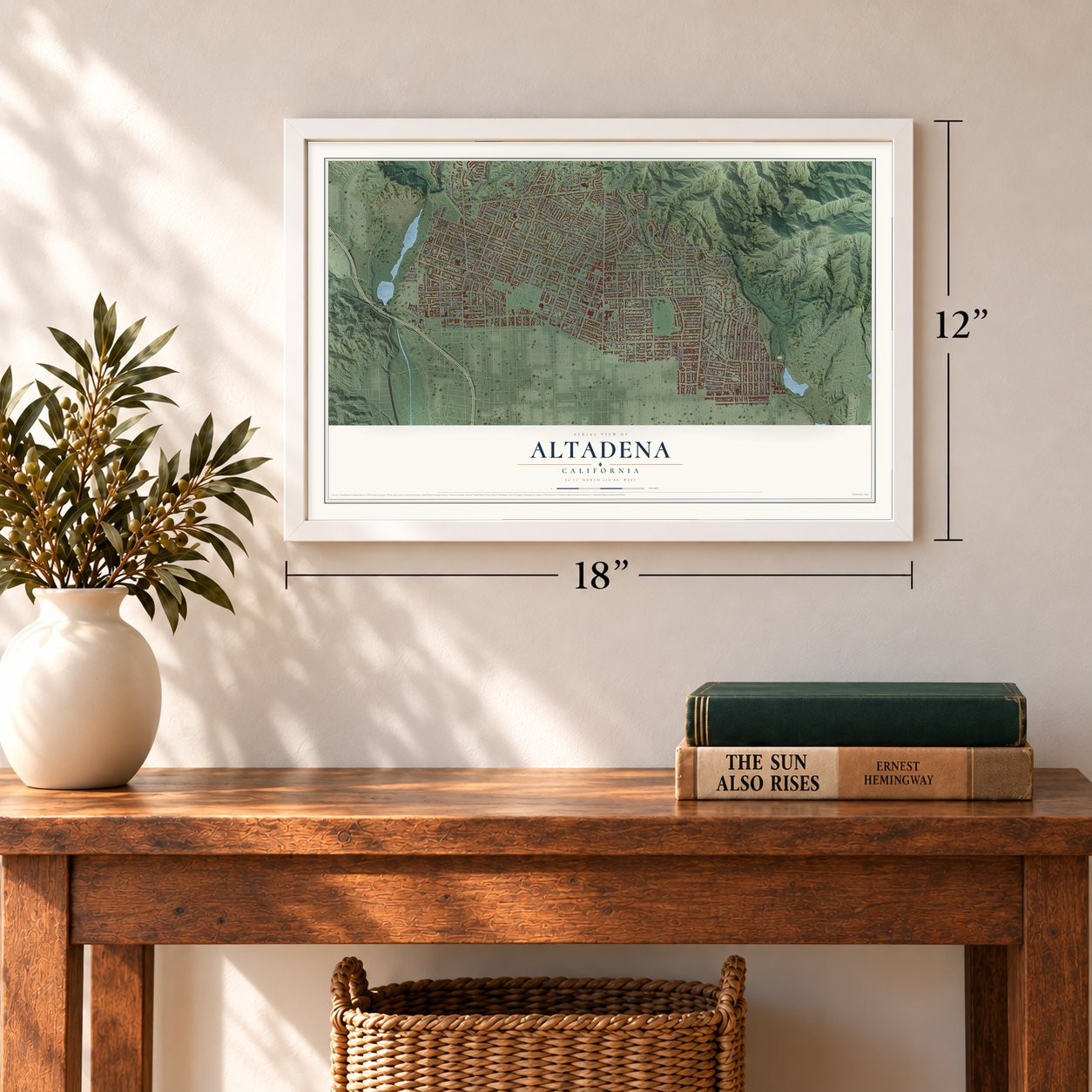
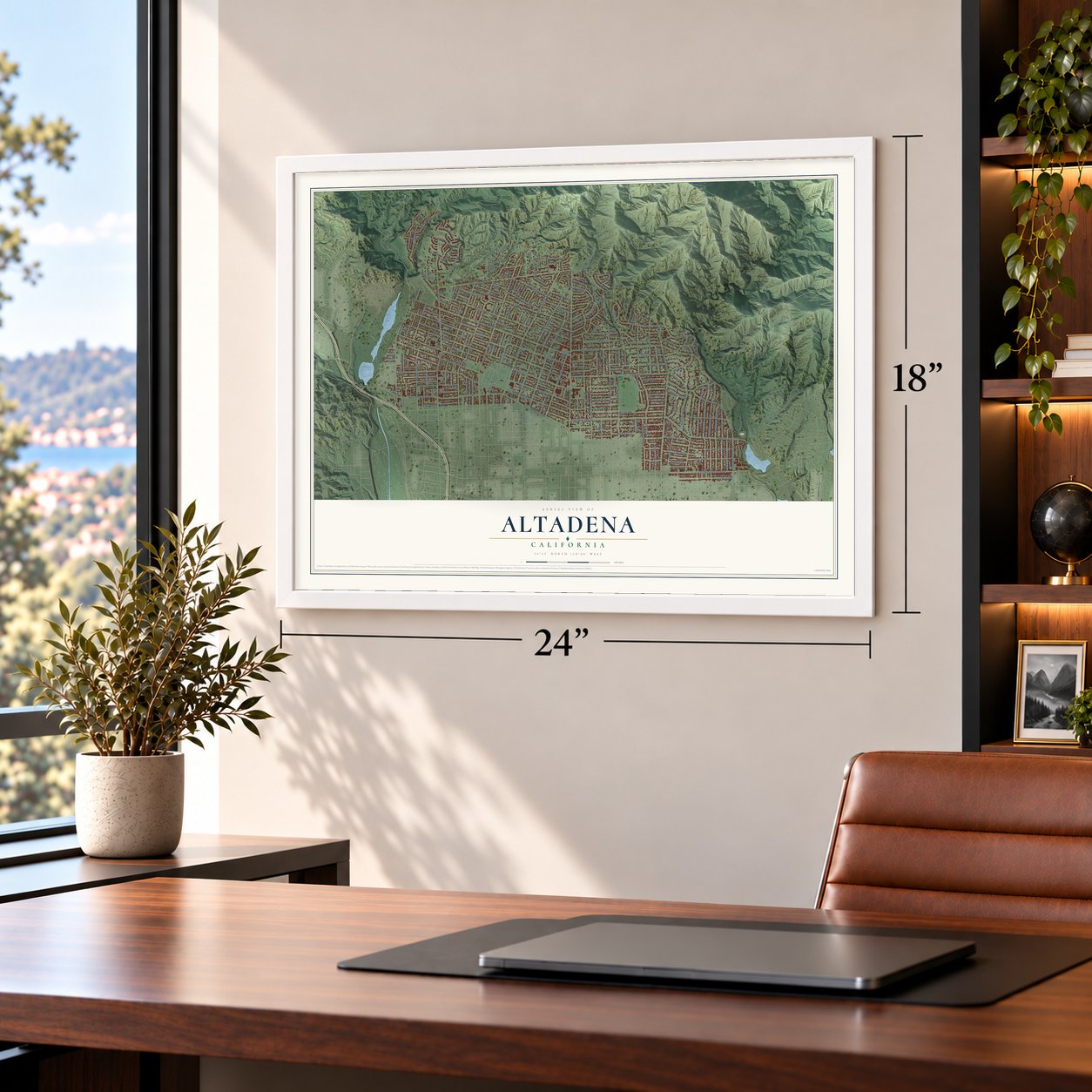
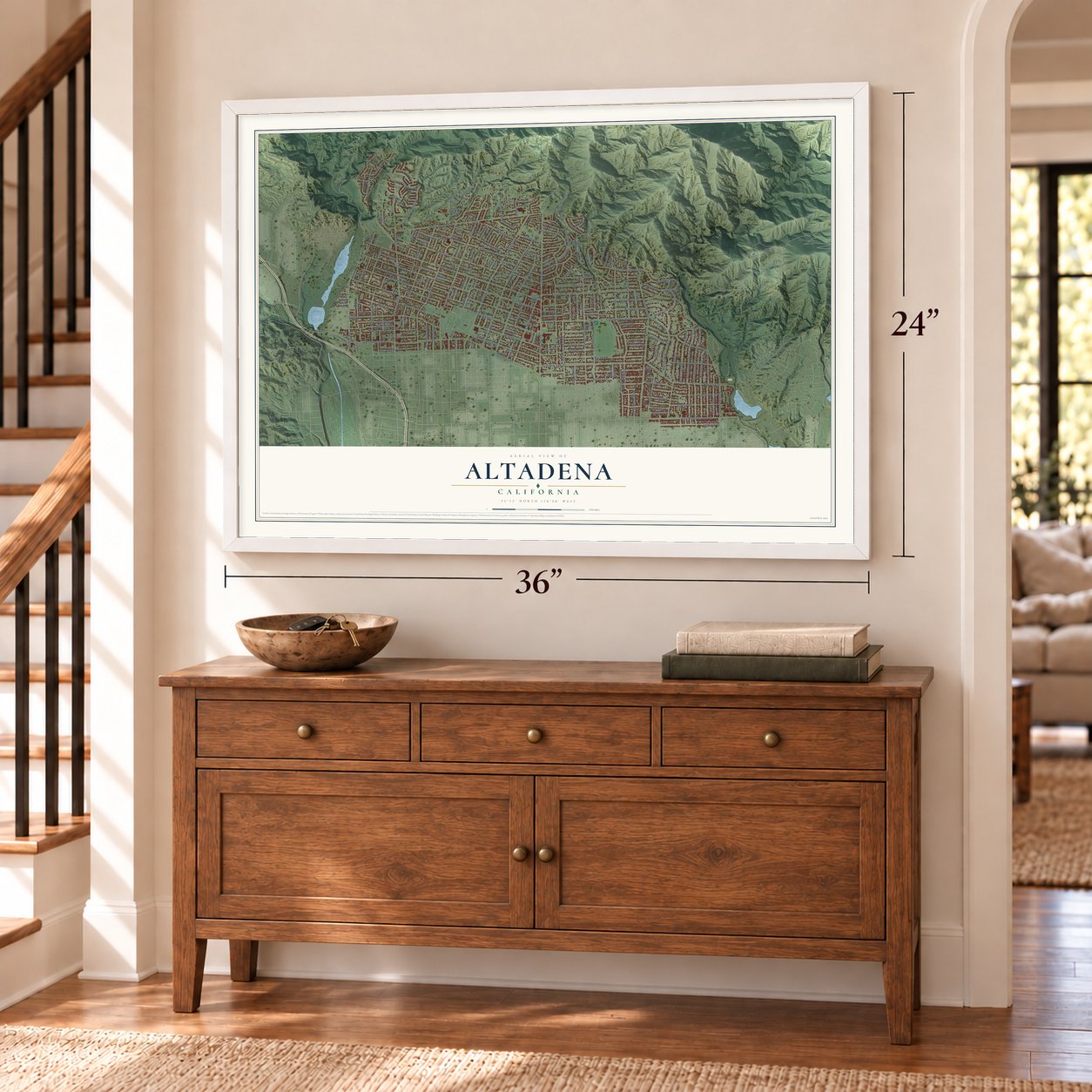
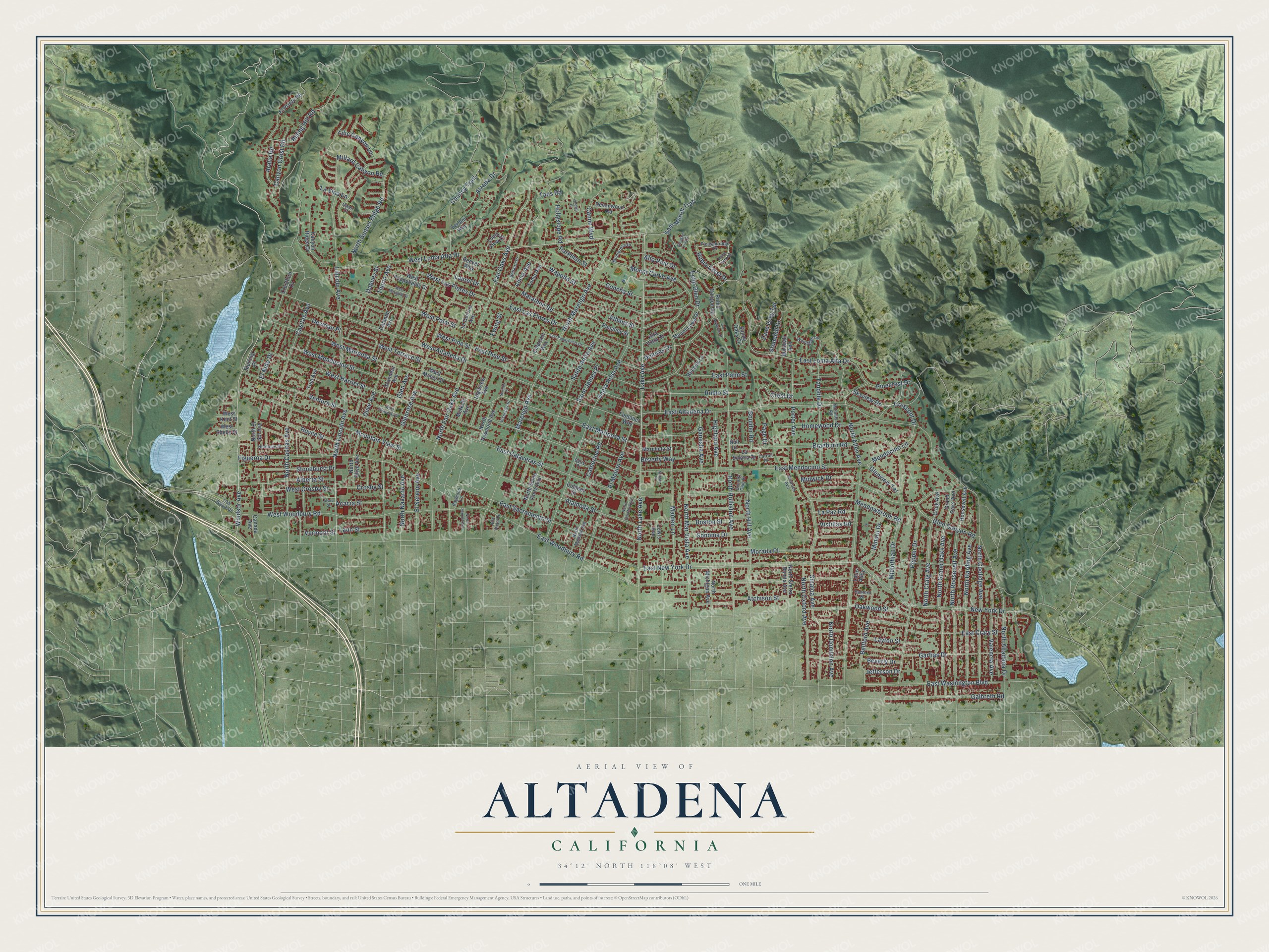
Altadena, California Map Art
Building by building, with labeled streets and shaded relief.
12" x 18" Archival Matte Print
A Map of Home. A Work of Art.
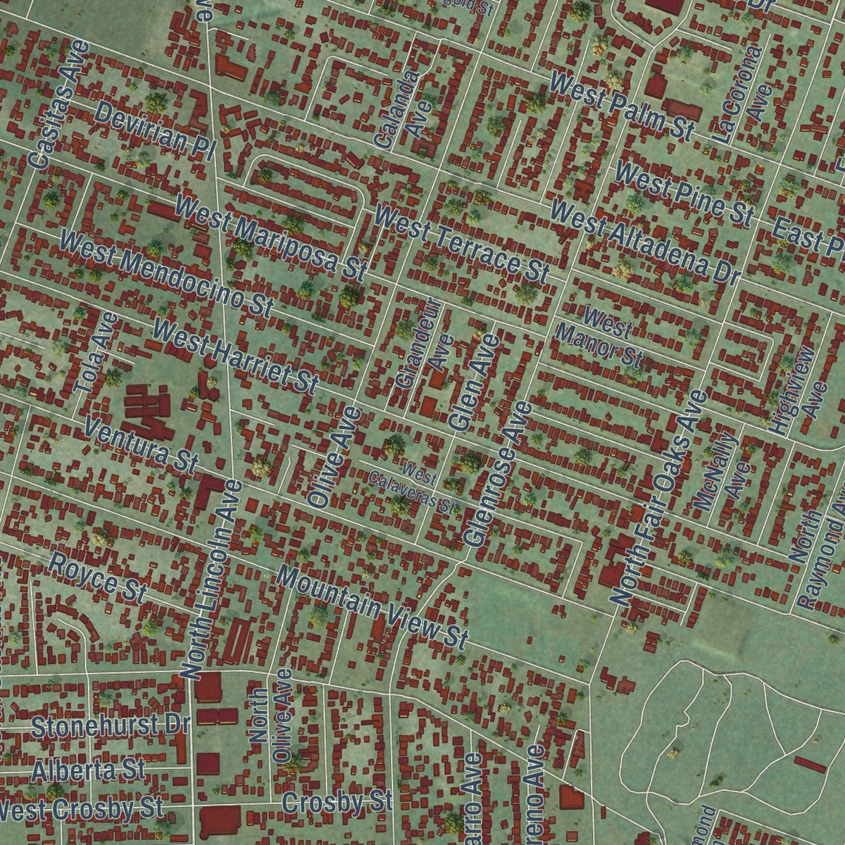
Explore Altadena, California from a whole new perspective. Created using aerial imagery and detailed geographic data, this map captures Altadena building by building, with labeled streets, familiar landmarks, and shaded topographical relief that highlights the natural contours of the landscape.
Combining modern data with the timeless character of a vintage atlas, this map is just as interesting up close as it is beautiful on the wall. Whether you grew up in Altadena, spent memorable years there, or call it home today, this unique map is a great way to celebrate a place that means something to you. Zoom in on the preview to look for your street, and then order a print to put your memories on the wall.
Three ways to hang it
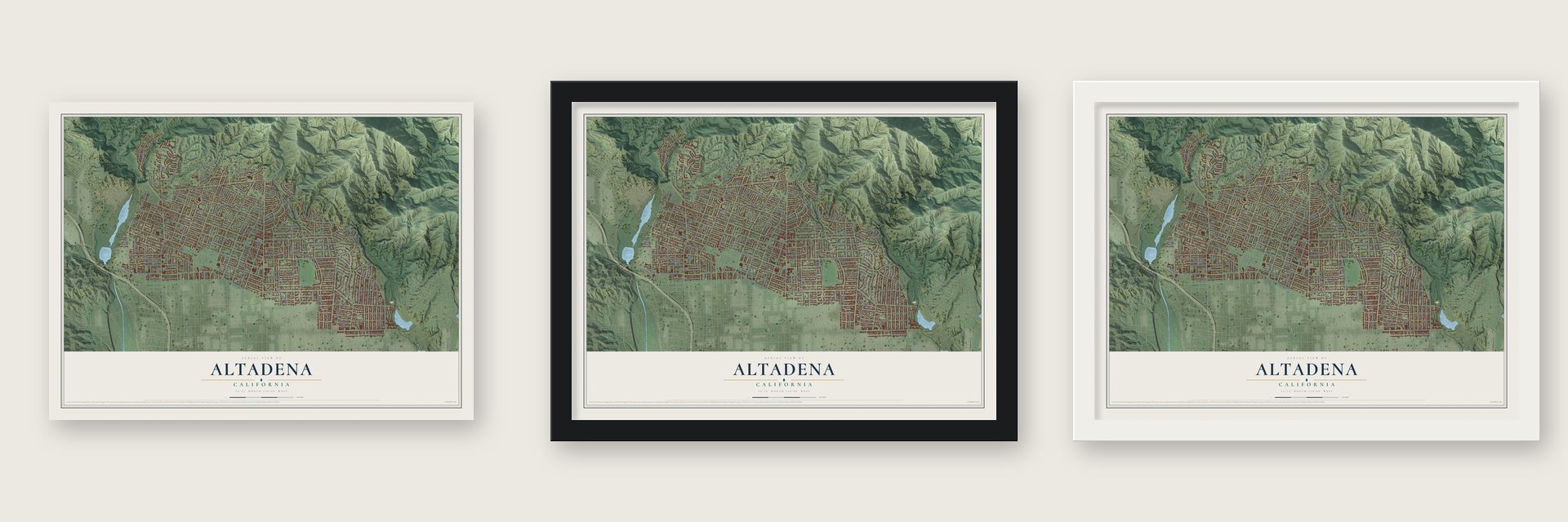
Unframed archival matte, a black wood frame or a white wood frame.
Up close
Geography Worth Displaying
This map was created using accurate cartographic data and authoritative geographic sources, including the U.S. Geological Survey and the Census Bureau. The map brings together terrain, waterways, roads, and building detail. The majority of the streets are labeled, houses are accurately depicted, and the topography is derived from government sources. Combining local data with carefully composed color and shading leads to this beautifully detailed Altadena artwork for your wall.
Rather than simply showing street outlines, we’ve included as many of the street names as we could reasonably fit on the map while keeping their names legible. Zoom in on the high resolution preview to see exactly what’s on the map. We truly set out to create a statement piece for anyone who loves Altadena. So whether it’s for you, or a gift for someone you love, we hope this map of Altadena brings back fond memories.
Read the story behind this map of Altadena, California from 2026.

Find your street
Names on the Altadena map
Every name below is printed on this map. Look for your street, your school, the park where you played, or the pond down the road.
Streets and roads212
- East Loma Alta Drive
- Windsor Avenue
- Vermont Street
- Lake Avenue
- Fair Oaks Avenue
- North Lincoln Avenue
- East New York Drive
- Casitas Avenue
- East Altadena Drive
- East Woodbury Road
- East Mendocino Street
- New York Drive
- Glenrose Avenue
- East Calaveras Street
- North Marengo Avenue
- North Allen Avenue
- North Altadena Drive
- Maiden Lane
- East Mariposa Street
- Lincoln Avenue
- North Holliston Avenue
- Morada Place
- East Palm Street
- North Fair Oaks Avenue
- Santa Rosa Avenue
- Canyon Crest Road
- Sinaloa Avenue
- Chaney Trail
- West Woodbury Road
- Ventura Street
Show all 212 streets
- Mountain View Street
- West Altadena Drive
- West Mariposa Street
- Figueroa Drive
- Wapello Street
- East Sacramento Street
- Mount Curve Avenue
- West Harriet Street
- Midwick Drive
- Pepper Drive
- Meadowbrook Road
- West Loma Alta Drive
- East Washington Boulevard
- Olive Avenue
- East Las Flores Drive
- Braeburn Road
- North Mar Vista Avenue
- North Grand Oaks Avenue
- North Roosevelt Avenue
- Midlothian Drive
- East Crary Street
- Alameda Street
- North Harding Avenue
- West Palm Street
- North Lake Avenue
- North Coolidge Avenue
- El Molino Avenue
- North Casitas Avenue
- Garfias Drive
- Santa Anita Avenue
- Oakwood Street
- West Terrace Street
- West Mendocino Street
- Tanoble Drive
- Pinecrest Drive
- Galbreth Road
- North Oxford Avenue
- North Hill Avenue
- Bellford Avenue
- Porter Avenue
- Atchison Street
- North Craig Avenue
- North Sunset Ridge Road
- Rising Hill Road
- Sonoma Drive
- El Sereno Avenue
- East Pine Street
- Concha Street
- Homewood Drive
- Athens Street
- Boston Street
- Alberta Street
- Glen Avenue
- Alzada Drive
- Marathon Road
- Sam Merrill Trail
- Alta Pine Drive
- Stonehurst Drive
- West Las Flores Drive
- Beverly Drive
- Parkman Street
- Devirian Place
- Glen Canyon Road
- Taos Road
- Skyview Drive
- Layton Street
- Rubio Street
- Mendocino Lane
- Valencia Avenue
- Zane Grey Terrace
- Royce Street
- Catherine Road
- West Crosby Street
- Millard Canyon Road
- Laurel Drive
- Beverly Way
- Dolores Drive
- North Navarro Avenue
- Saint James Place
- Minoru Drive
- Ganesha Avenue
- Highland Avenue
- North Dominion Avenue
- Crest Drive
- Crescent Drive
- Canon Boulevard
- El Nido Drive
- Thurin Avenue
- Lilic Canyon Lane
- Rubio Crest Drive
- Aralia Road
- Laun Street
- Acacia Street
- Crosby Street
- Boulder Road
- Hollyslope Road
- Marengo Avenue
- Glenview Terrace
- La Paz Road
- Stonehill Drive
- Echo Glen Drive
- Page Drive
- Vistillas Road
- West Pine Street
- Jefferson Drive
- La Vina Lane
- Alicia Avenue
- Dabney Street
- Ewing Street
- Roosevelt Avenue
- North Raymond Avenue
- North Santa Anita Avenue
- El Prieto Road
- West Poppyfields Drive
- McNally Avenue
- North El Sol Avenue
- Mount Lowe Drive
- Grandeur Avenue
- Grand Oaks Avenue
- Rubio Canyon Road
- Marcheta Street
- Highview Avenue
- Punahou Street
- Devonwood Road
- Colman Street
- North Olive Avenue
- Calanda Avenue
- Sunny Oaks Circle
- North Michigan Avenue
- Crestford Drive
- Canyon Ridge Drive
- West Manor Street
- La Corona Avenue
- Tonia Avenue
- Reposa Lane
- North Sierra Bonita Avenue
- Craig Avenue
- La Solana Drive
- Alta Vista Drive
- Windfall Avenue
- Reever Way
- West Shelly Street
- Tola Avenue
- Loma View Drive
- Fontanet Way
- Sterling Place
- Emerson Way
- Lewis Avenue
- Hull Lane
- Leilani Way
- Canada Avenue
- West Kent Street
- Lotus Alley
- Pleasantridge Drive
- Monterosa Drive
- Morslay Road
- Oak Grove Drive
- Neldome Street
- Winrock Avenue
- North Madison Avenue
- Woodglen Lane
- Bellaire Drive
- Country Club Drive
- Visscher Place
- Raymond Lane
- Hanford Drive
- Barry Place
- Alta Pasa Drive
- Carroll Drive
- Owen Court
- East Poppyfields Drive
- West Calaveras Street
- Ellington Villa Drive
- Rubio Vista Road
- West Marigold Street
- Vinehill Drive
- North Crawford Avenue
- Via Maderas Street
- North Summit Avenue
- Scripps Place
- Norwic Place
- Alvey Street
Names are listed as they appear on the printed map. Zoom into the product photos to find them.
About Altadena, California
Altadena is an unincorporated community of 42,846 people in Los Angeles County, on higher ground just north of Pasadena. In the mid-1860s Benjamin S. Eaton dug ditches to carry water from the Arroyo Seco and Eaton Canyon to his vineyard, and that water made Altadena, Pasadena and South Pasadena possible. The landowners, B. D. Wilson and Dr. John Griffin, still gave up their plan to sell the land by 1870. It was hard to reach, and few people believed crops would grow so close to the mountains.
Investors from Indiana bought 4,000 acres in late 1873, but they built Pasadena farther south. In 1875 Byron O. Clark opened a nursery in the foothills and called it Altadena, joining the Spanish alta, meaning upper, to the end of Pasadena. Frederick and John Woodbury of Marshalltown, Iowa, bought 937 acres here in 1880 or 1881. In 1887 John Woodbury formed the Pasadena Improvement Company to lay out a subdivision. Clark had moved away by then, but he let Woodbury use the name Altadena.
- Millionaire's Row in 1887Andrew McNally, the Chicago printing magnate, and his friend George Gill Green built mansions in 1887 on Mariposa Street near Santa Rosa Avenue, the start of Millionaire's Row. Newspaper owners William Armiger Scripps and William Kellogg built side by side east of Fair Oaks Avenue. Zane Grey bought a house nearby and added a second-floor study. The Eaton Fire of January 2025 damaged or destroyed both the McNally house and Scripps Hall.
- Christmas lights since 1920Since 1920, Santa Rosa Avenue between Woodbury Road and Altadena Drive has drawn holiday crowds. It is the oldest large-scale outdoor Christmas light display in the world. Every December the Christmas Tree Lane Association strings thousands of lights on the 110 giant deodars that still line the 0.7-mile street.
- 160 houses by a con manFrom 1924 to 1926, Elisha Paul Janes, a con man on the run, built 160 houses in Altadena with steep roofs and clusters of gables. He had no qualifications as a builder, but buyers liked his homes. In 2002 his neighborhood was named a heritage area.
- Annexation stopped in 1956Pasadena took small Altadena neighborhoods along its edges through the 1940s. When it tried for a larger annexation, residents campaigned against it and stopped it in 1956. Pasadena has tried again several times since and failed each time, so Altadena is still unincorporated.
Keep exploring California
Altadena is one of 1,990 California towns we've mapped. Every dot on the map is a print of its own.
The search covers every state, California first.
Near Altadena
Order 2 or more town maps and save 10%. Shown in the size and finish you picked above, so they hang as a set.
- Bungalow Heaven 12" x 18" / Archival Matte Print $39.99
- Pasadena 12" x 18" / Archival Matte Print $39.99
- La Cañada Flintridge 12" x 18" / Archival Matte Print $39.99


More maps nearby: San Pasqual, Madison Heights, Oak Knoll, San Marino and East Pasadena.
The art of mapping a place
How This Map Was Made
Real places. Remarkable detail. Discover the layers that turn geographic data into a map of home.

The view from above
Aerial imagery reveals the character of the land: woodland, open fields, and the patterns of a place.

The shape of the land
Elevation data brings hills, valleys, and subtle changes in the landscape into view.

The details of home
Roads, waterways, and building footprints come together to make the map feel unmistakably local.

Geography becomes art
Considered color, shading, and typography bring the layers together in a map made for your wall.


Process illustrated with Mendon, Massachusetts. Aerial imagery: USDA NAIP. Terrain: USGS 3D Elevation Program. Map details and finished artwork: KNOWOL.
The Details
About This Print
Choose an archival matte print, or a black or white Ayous wood frame. The archival matte print is unframed.
Select your size and finish above to see the matching product image and price.
Materials & Craftsmanship
A contemporary map with the character of a classic atlas, printed on archival matte paper. Optional frames are made from Ayous wood.
Your printed map does not include the watermark shown in the full-map preview.
Shipping & Delivery
Free shipping within the United States. Every print is made to order in the USA.
Buying a gift? Add a note in your cart and we'll include it. We never put prices in the package.
Prints ship within 2 to 3 business days. Allow 7 to 10 days total from ordering for delivery. Timing may vary during holidays or periods of high order volume.
Read our shipping policy.
Returns and damaged prints
Each print is made to order. Change-of-mind refunds are not available after production.
If your print arrives damaged, misprinted or incorrect, contact support@knowol.com within 30 days of receiving it. Include your order number, photos and a description of the issue.
Read our full refund and replacement policy. For questions about your order, email support@knowol.com.