
Search for another town


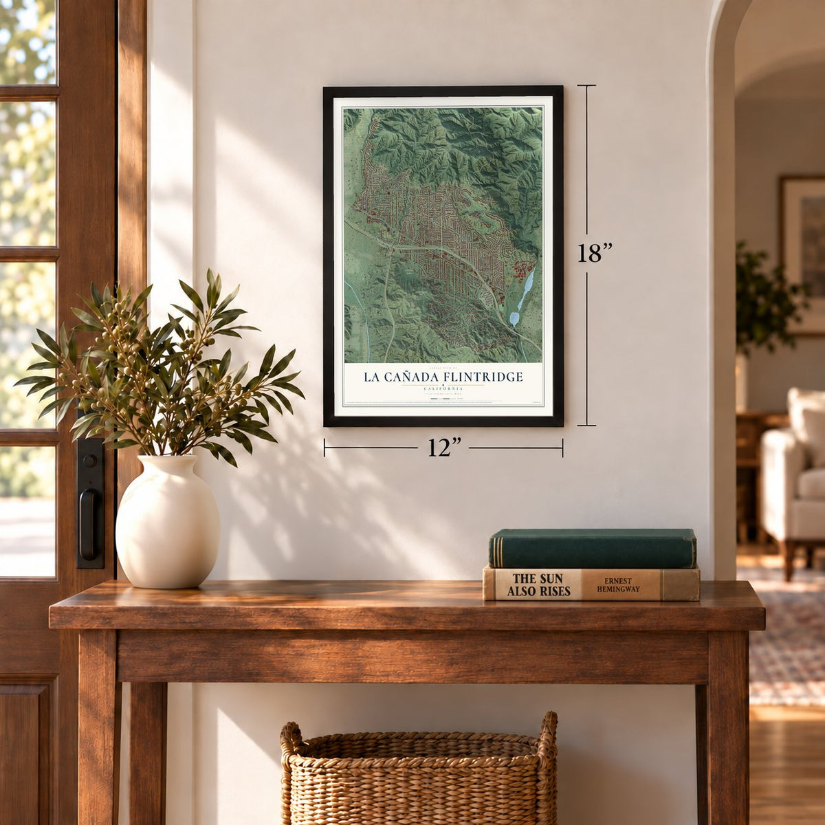
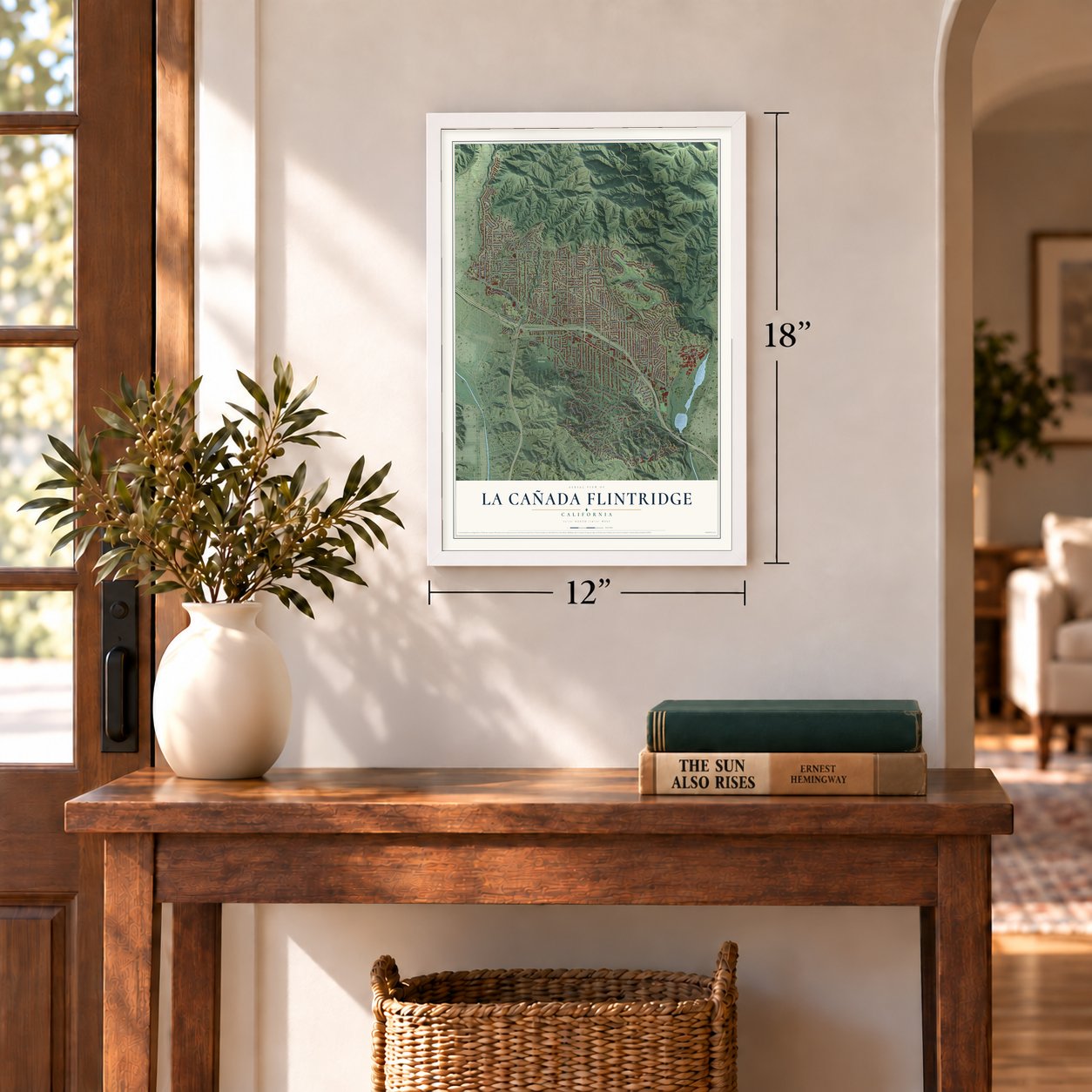
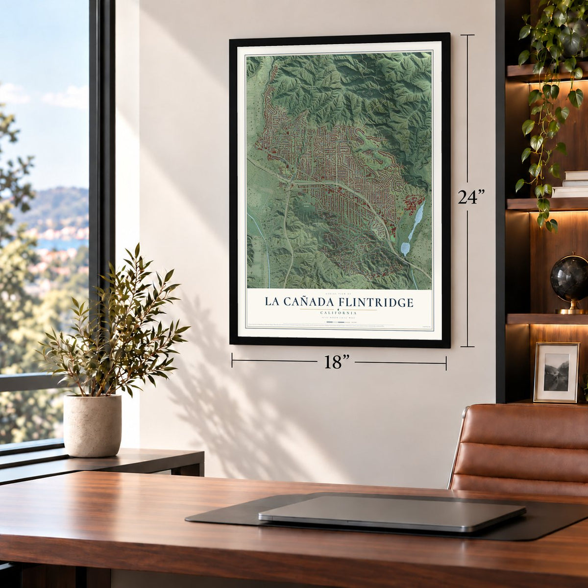
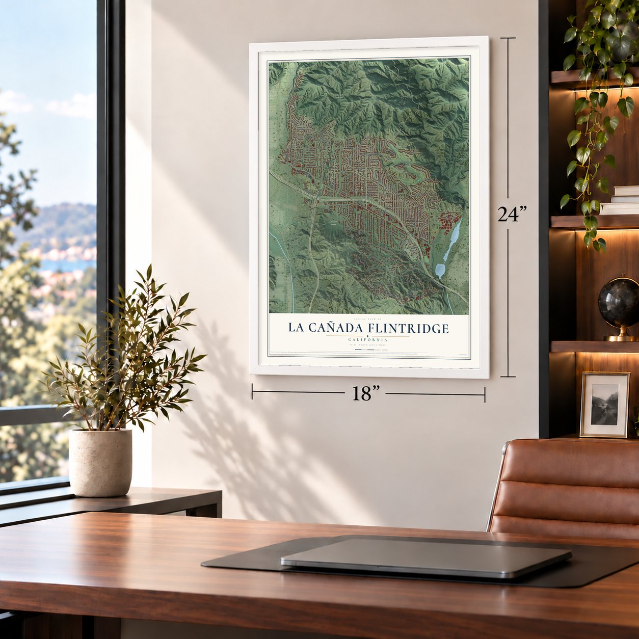

Free U.S. delivery 7 to 10 days after you order
La Cañada Flintridge, California Map Art
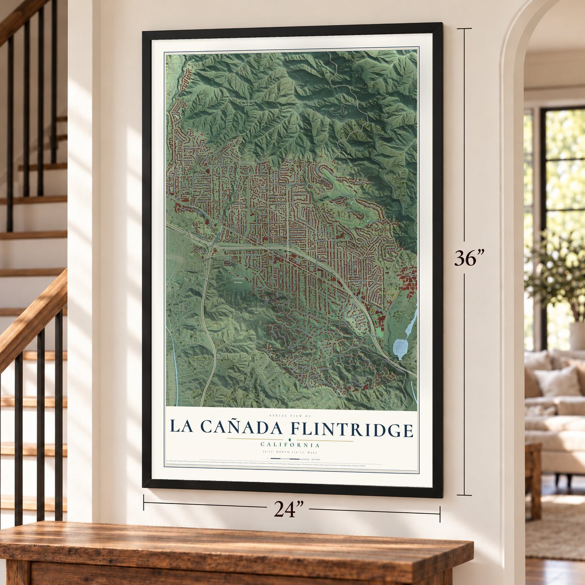
A new map of La Cañada Flintridge, California, made in 2026 and printed to order on thick archival matte paper.
12" x 18" Archival Matte Print
A Map of Home. A Work of Art.
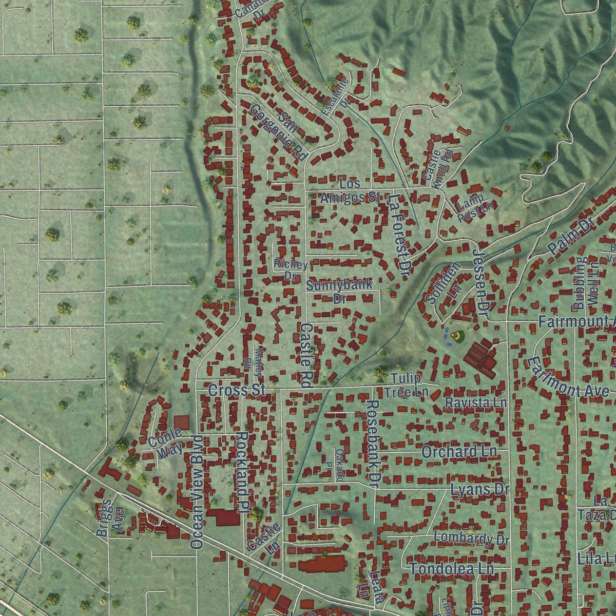
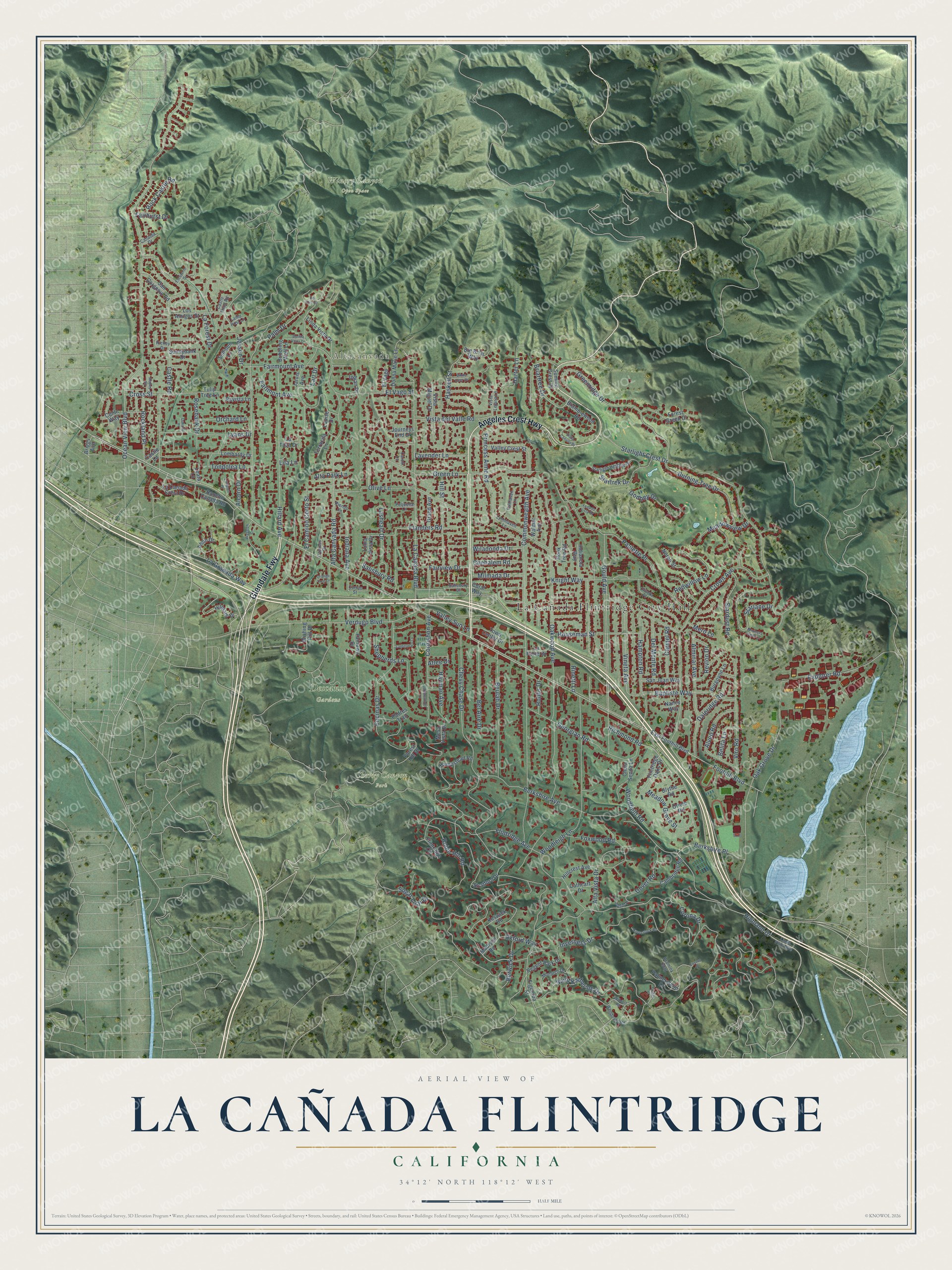
Explore La Cañada Flintridge, California from a whole new perspective. Created using aerial imagery and detailed geographic data, this map captures La Cañada Flintridge building by building, with labeled streets, familiar landmarks, and shaded topographical relief that highlights the natural contours of the landscape.
Combining modern data with the timeless character of a vintage atlas, this map is just as interesting up close as it is beautiful on the wall. Whether you grew up in La Cañada Flintridge, spent memorable years there, or call it home today, this unique map is a great way to celebrate a place that means something to you. Zoom in on the preview to look for your street, and then order a print to put your memories on the wall.
Three ways to hang it
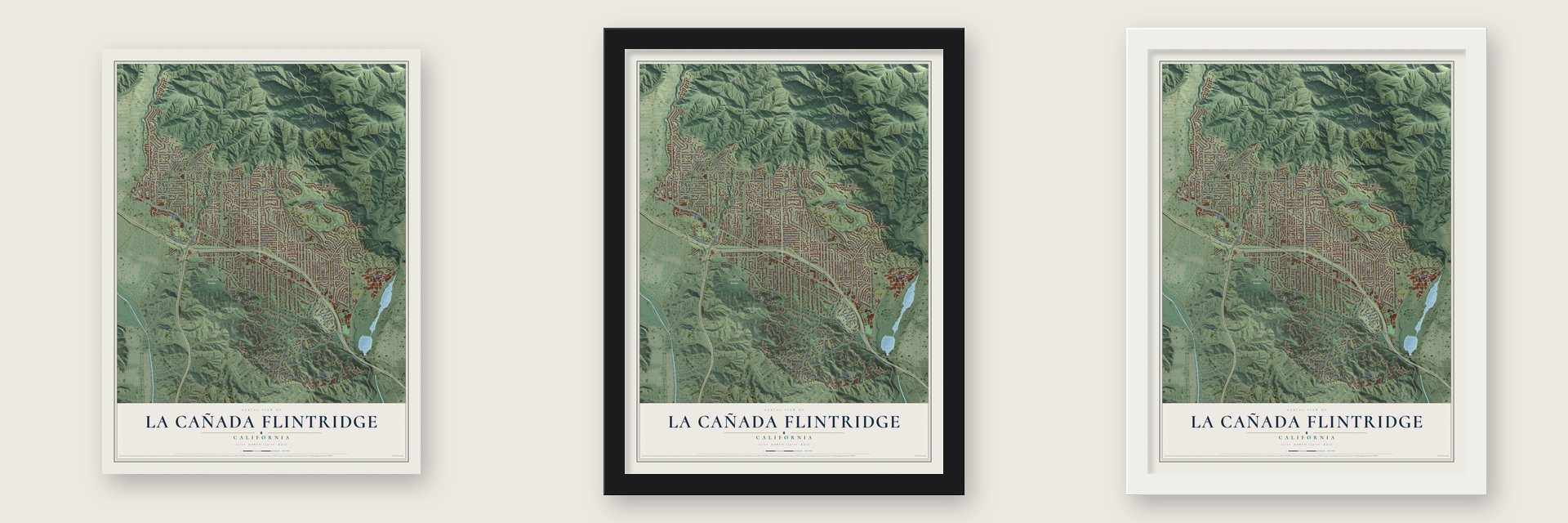
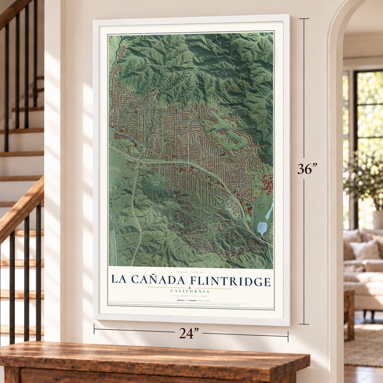
Unframed archival matte, a black wood frame or a white wood frame.
Up close
Geography Worth Displaying
This map was created using accurate cartographic data and authoritative geographic sources, including the U.S. Geological Survey and the Census Bureau. The map brings together terrain, waterways, roads, and building detail. The majority of the streets are labeled, houses are accurately depicted, and the topography is derived from government sources. Combining local data with carefully composed color and shading leads to this beautifully detailed La Cañada Flintridge artwork for your wall.
Rather than simply showing street outlines, we’ve included as many of the street names as we could reasonably fit on the map while keeping their names legible. Zoom in on the high resolution preview to see exactly what’s on the map. We truly set out to create a statement piece for anyone who loves La Cañada Flintridge. So whether it’s for you, or a gift for someone you love, we hope this map of La Cañada Flintridge brings back fond memories.
Read the story behind this map of La Cañada Flintridge, California from 2026.

About La Cañada Flintridge, California
La Cañada Flintridge is a city of 20,573 people in Los Angeles County, set in the Crescenta Valley below the San Gabriel Mountains. The Tongva lived here first. Trails between their villages of Tejungna and Hahamongna crossed this land, and the live oaks gave them food and shelter. In 1771 missionaries at Mission San Gabriel Arcángel enslaved them, which is why they are also called Gabrielinos.
Under Spain and Mexico the land was Rancho La Cañada, named for the Spanish word for a canyon or ravine. Jacob Lanterman and Adolphus Williams bought the rancho in 1875. Water was scarce, so growth came slowly, with a few orchards of oranges and stone fruit. The clear air drew people with tuberculosis, who came with their families to recover. To the south, Senator Frank P. Flint developed Flintridge. On December 8, 1976, the two communities joined as one city, and they left the hyphen out of its name to show their unity.
- Lanterman House, 1915Built in 1915, Lanterman House is one of the area's early homes. It is on the National Register, and today it is a museum that keeps the town's historical archives.
- North America's top camelliasDescanso Gardens grows more kinds of camellias than any other collection in North America.
- Home of JPLNASA's Jet Propulsion Laboratory stands at the east end of the city, though its mail goes to Pasadena. It is the country's main center for the robots that explore the Solar System.
- Rose Parade floats since 1979Every year since 1979, local volunteers have built a float of flowers and plant materials for the city's entry in Pasadena's Rose Parade.
- 23 miles of trailsHikers and horseback riders share 23 miles of trails across the city. A local Trails Council has looked after them since 1974.
Find your street
Names on the La Cañada Flintridge map
Every name below is printed on this map. Look for your street, your school, the park where you played, or the pond down the road.
Places and landmarks5
- La Cañada Flintridge City Hall
- Altacanyada
- Cherry Canyon Park
- Descanso Gardens
- Winery Canyon Open Space
Streets and roads208
- Angeles Crest Highway
- Glendale Fwy
- Inverness Drive
- Foothill Boulevard
- Gould Avenue
- Briartree Drive
- Greenridge Drive
- Flanders Road
- Chevy Chase Drive
- Alta Canyada Road
- Ocean View Boulevard
- Commonwealth Avenue
- Saint Katherine Drive
- Oakwood Avenue
- Starlight Crest Drive
- Berkshire Avenue
- Highland Drive
- Palm Drive
- La Canada Boulevard
- Castle Road
- Crown Avenue
- Flintridge Avenue
- Oak Grove Drive
- Green Lane
- Woodleigh Lane
- Hillard Avenue
- La Granada Way
- Encinas Drive
- Meadow Grove Street
- Knight Way
Show all 208 streets
- Georgian Road
- Olive Lane
- Stardust Road
- Godbey Drive
- Verdugo Boulevard
- Earlmont Avenue
- Beulah Drive
- Haskell Street
- Viro Road
- Hampton Road
- Vineta Avenue
- Hayman Avenue
- Baptiste Way
- Robin Hill Road
- Lyans Drive
- Burning Tree Drive
- Cornishon Avenue
- Houseman Street
- Lasheart Drive
- El Vago Street
- Explorer Road
- Rockland Place
- Dover Road
- Harter Lane
- Princess Anne Road
- Shepherds Lane
- Bel Aire Drive
- Redwillow Lane
- Salisbury Road
- Alminar Avenue
- Sugar Loaf Drive
- Daleridge Road
- Wiladonda Drive
- La Forest Drive
- Paulette Place
- Richmond Road
- Alta Vista Drive
- Vista del Valle Road
- Jessen Drive
- El Camino Corto Street
- Fairmount Avenue
- Indiana Avenue
- Berkshire Place
- Cross Street
- Tondolea Lane
- Hill Street
- Del Monte Road
- Meadowview Drive
- Foxwood Road
- Fairview Drive
- Revlon Drive
- Rock Castle Road
- Starlane Drive
- Alveo Road
- Orchard Lane
- Lavender Lane
- Carmel Road
- Milmada Drive
- Rosebank Drive
- Valley Sun Lane
- Woodfield Road
- Corona Drive
- Chehalem Road
- Berwick Drive
- Earl Drive
- Alcorn Drive
- Belita Lane
- Hobbs Drive
- Oxford Way
- Startrek Drive
- Alta Park Lane
- Fairhurst Drive
- Mero Lane
- Atlee Drive
- Rinetti Lane
- Lila Lane
- Hilldale Drive
- Hampstead Road
- Forest Hill Drive
- Indianola Way
- Madison Road
- Palmerstone Drive
- Journeys End Drive
- Flintridge Oaks Drive
- Rancho Canada Road
- Hillcrest Avenue
- Los Amigos Street
- Mesa Vista Drive
- Noren Street
- Forest Green Drive
- Fairlawn Drive
- Grand Avenue
- Vista Miguel Drive
- Solliden Lane
- Jarvis Avenue
- Linda Vista Drive
- Cambridge Road
- Bramblewood Road
- Chula Senda Lane
- Wishing Hill Drive
- East Foothill Boulevard
- Regent Park Drive
- Loma Vista Drive
- Lombardy Drive
- Summit Crest Drive
- Donna Marie Lane
- La Porte Drive
- Valley Crest Street
- San Gorgonio Road
- San Juan Way
- Hook Tree Road
- Ahlin Drive
- Town Center Drive
- Padres Trail
- Burgoyne Lane
- La Canada Crest Drive
- Louise Drive
- Blythe Road
- Flintridge Circle
- Stratford Drive
- Walmar Avenue
- Sunnybank Drive
- Big Briar Way
- Cathcart Drive
- Figueroa Street
- Bubbling Well Lane
- Terracita Lane
- Tulip Tree Lane
- Oriole Road
- Keswick Road
- Ravista Lane
- Indian Drive
- Conle Way
- El Vago
- La Taza Drive
- Briggs Avenue
- Coral Way
- Nancy Way
- Castle Lane
- Leata Lane
- Vista Lejana Lane
- Lynnhaven Lane
- Starlight Heights Drive
- Monarch Drive
- Bramley Way
- Wendover Road
- Oliveta Place
- Linda Vista Avenue
- Richey Drive
- Castle Knoll Road
- Lamp Post Lane
- Salisbury Court
- Fallhaven Lane
- Pequena Lane
- Canalda Drive
- Cypress Drive
- Riendo Lane
- Curran Street
- Caroli Lane
- Waldorf Road
- Lanterman Lane
- Vista Canada Place
- Wasatch Drive
- Haverstock Road
- Cobblestone Lane
- White Deer Drive
- Escalante Drive
- Venado Vista Drive
- Littleton Place
- Antrim Place
- Matley Road
- Orange Tree Lane
- Bonita Vista Drive
- Mariners View Lane
- Oakado Place
- Yarden Place
- Del Oro Drive
- Euston Place
Names are listed as they appear on the printed map. Zoom into the product photos to find them.
The art of mapping a place
How This Map Was Made
Real places. Remarkable detail. Discover the layers that turn geographic data into a map of home.

The view from above
Aerial imagery reveals the character of the land: woodland, open fields, and the patterns of a place.

The shape of the land
Elevation data brings hills, valleys, and subtle changes in the landscape into view.

The details of home
Roads, waterways, and building footprints come together to make the map feel unmistakably local.

Geography becomes art
Considered color, shading, and typography bring the layers together in a map made for your wall.


Process illustrated with Mendon, Massachusetts. Aerial imagery: USDA NAIP. Terrain: USGS 3D Elevation Program. Map details and finished artwork: KNOWOL.
The Details
About This Print
Choose an archival matte print, or a black or white Ayous wood frame. The archival matte print is unframed.
Select your size and finish above to see the matching product image and price.
Materials & Craftsmanship
A contemporary map with the character of a classic atlas, printed on archival matte paper. Optional frames are made from Ayous wood.
Your printed map does not include the watermark shown in the full-map preview.
Shipping & Delivery
Free shipping within the United States. Every print is made to order in the USA.
Buying a gift? Add a note in your cart and we'll include it. We never put prices in the package.
Prints ship within 2 to 3 business days. Allow 7 to 10 days total from ordering for delivery. Timing may vary during holidays or periods of high order volume.
Read our shipping policy.
Returns and damaged prints
Each print is made to order. Change-of-mind refunds are not available after production.
If your print arrives damaged, misprinted or incorrect, contact support@knowol.com within 30 days of receiving it. Include your order number, photos and a description of the issue.
Read our full refund and replacement policy. For questions about your order, email support@knowol.com.
Find your town
Looking for another city?
Find a map of home in our California collection, or any town in the country.
Nearby
Maps of towns near La Cañada Flintridge
Know someone from one of these towns? Their map makes a great gift.
 La Crescenta-Montrose
, California
From $39.99See the map
 Glendale
, California
From $39.99See the map
 Altadena
, California
From $39.99See the map
More maps nearby: Pasadena, Eagle Rock, Glassell Park, Burbank and South Pasadena.