
Search for another town






Free U.S. delivery 7 to 10 days after you order
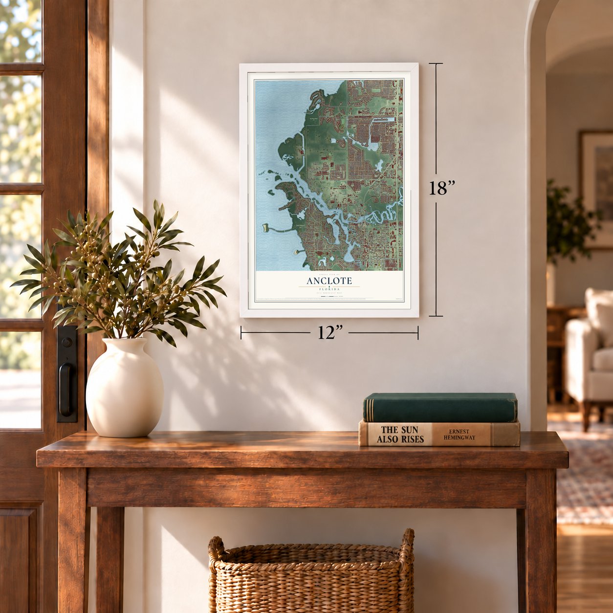
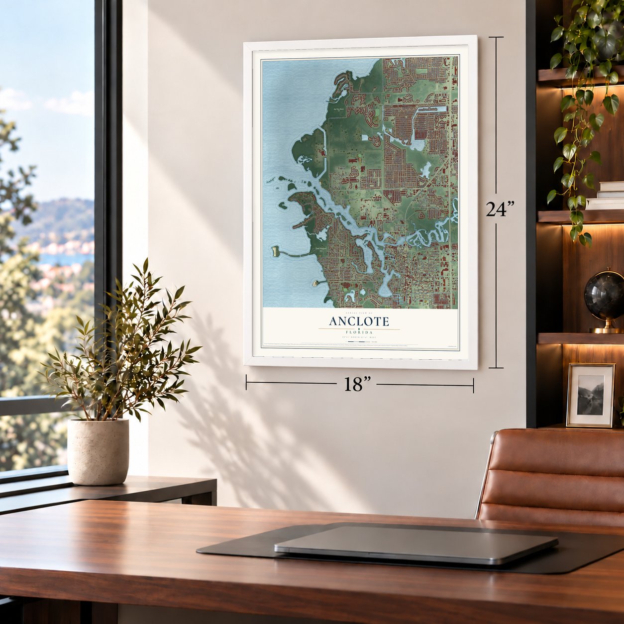
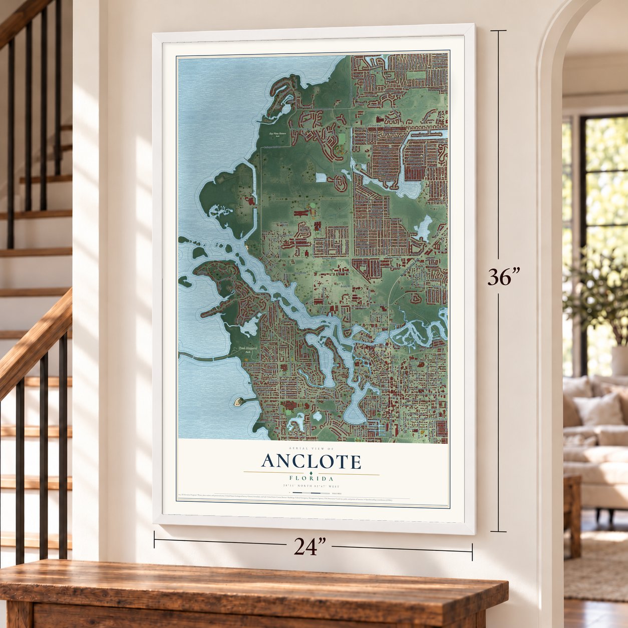
Anclote, Florida Map Art
Building by building, with labeled streets and shaded relief.
12" x 18" Archival Matte Print
A Map of Home. A Work of Art.
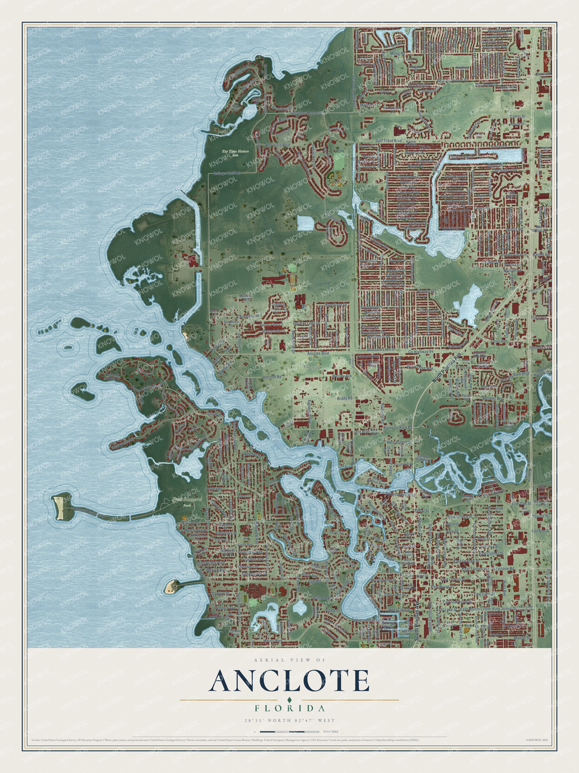
Explore Anclote, Florida from a whole new perspective. Created using aerial imagery and detailed geographic data, this map captures Anclote building by building, with labeled streets, familiar landmarks, and shaded topographical relief that highlights the natural contours of the landscape.
Combining modern data with the timeless character of a vintage atlas, this map is just as interesting up close as it is beautiful on the wall. Whether you grew up in Anclote, spent memorable years there, or call it home today, this unique map is a great way to celebrate a place that means something to you. Zoom in on the preview to look for your street, and then order a print to put your memories on the wall.
Three ways to hang it
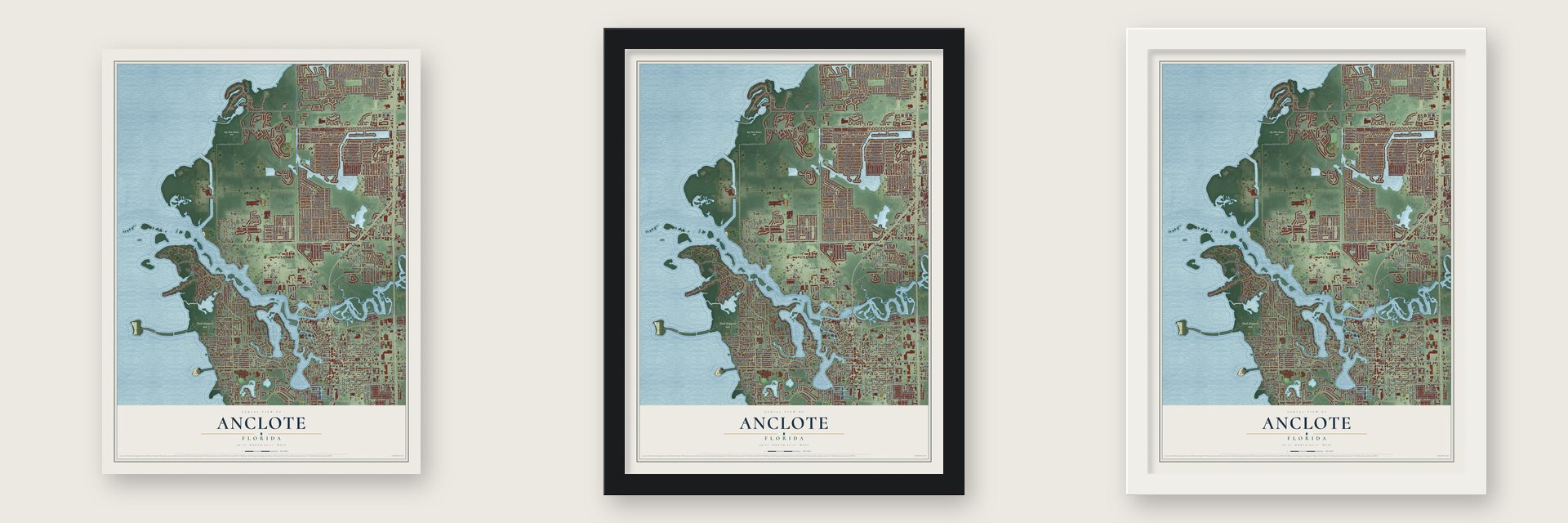
Unframed archival matte, a black wood frame or a white wood frame.
Up close
Geography Worth Displaying
This map was created using accurate cartographic data and authoritative geographic sources, including the U.S. Geological Survey and the Census Bureau. The map brings together terrain, waterways, roads, and building detail. The majority of the streets are labeled, houses are accurately depicted, and the topography is derived from government sources. Combining local data with carefully composed color and shading leads to this beautifully detailed Anclote artwork for your wall.
Rather than simply showing street outlines, we’ve included as many of the street names as we could reasonably fit on the map while keeping their names legible. Zoom in on the high resolution preview to see exactly what’s on the map. We truly set out to create a statement piece for anyone who loves Anclote. So whether it’s for you, or a gift for someone you love, we hope this map of Anclote brings back fond memories.
Read the story behind this map: Detailed Map of Anclote, Florida.

Find your street
Names on the Anclote map
Every name below is printed on this map. Look for your street, your school, the park where you played, or the pond down the road.
Places and landmarks4
- Holiday
- Victor
- Fred Howard Park
- Key Vista Nature Park
Streets and roads485
- North Pinellas Avenue
- South Pinellas Avenue
- Riverside Drive
- Baileys Bluff Road
- Anclote Boulevard
- Dixie Highway
- South Spring Boulevard
- Strauber Memorial
- North Spring Boulevard
- Rainville Park Road
- Rainville Road
- Calvary Road
- Anclote Road
- Whitcomb Boulevard
- Banana Street
- East Lake Street
- East Martin Luther King Junior Drive
- Pineview Drive
- Jern Boulevard
- Sunset Drive
- Bonita Road
- West Lake Street
- Savannah Avenue
- East Spruce Street
- North Grosse Avenue
- Richboro Drive
- Tarpon Drive
- Gulf Trace Boulevard
- Meres Boulevard
- Moog Road
Show all 485 streets
- Darlington Road
- Gulf Road
- Holiday Lake Drive
- County Highway 84
- North Florida Avenue
- Beacon Square Drive
- Blossom Lake Drive
- Bayshore Drive
- East Lime Street
- Howard Park Causeway
- Dartmouth Drive
- East Tarpon Avenue
- South Pointe Alexis Drive
- North Pointe Alexis Drive
- Cypress Street
- Pine Street
- Keystone Road
- Sunray Drive
- Solar Drive
- Holiday Drive
- Live Oak Street
- Society Drive
- Cemetery Road
- Normandy Boulevard
- Wood Pointe Drive
- Seabreeze Drive
- East Orange Street
- Chesapeake Drive
- Bigelow Drive
- Pleasure Drive
- Strauber Mem Highway
- Wideview Avenue
- East Oakwood Street
- Baden Drive
- Wellington Drive
- North Disston Avenue
- East Lemon Street
- Brompton Drive
- East Boyer Street
- Key Vista Boulevard
- Atlantis Drive
- Tallahassee Drive
- Peninsula Avenue
- South Levis Avenue
- Jackson Drive
- North Walton Avenue
- Anclote Drive
- South Safford Avenue
- East Center Street
- Buena Vista Lane
- Oswego Drive
- Indian Key Drive
- Village Drive
- South Florida Avenue
- Tiki Drive
- Classic Drive
- Brittany Park Boulevard
- Bluff Boulevard
- Hillside Drive
- Sweetbriar Drive
- Flora Avenue
- Roselawn Drive
- Rock Royal Drive
- Wesley Avenue
- Dodecanese Boulevard
- Elkridge Drive
- Pinehurst Drive
- Brady Road
- Hibiscus Street
- Orange Drive
- Pent Street
- Chelsea Lane
- Maybury Drive
- Beckett Way
- Wiltshire Drive
- Roosevelt Boulevard
- Lange Road
- Westwood Drive
- Mango Street
- Eunice Drive
- Viking Drive
- Yale Drive
- Poinsettia Avenue
- Louis Avenue
- Fairmount Drive
- Devonshire Drive
- Winder Drive
- Kimberly Oaks Drive
- Coldwell Drive
- Salisbury Drive
- Roxbury Drive
- Pinon Drive
- Chatlin Road
- Seminole Boulevard
- Summervale Drive
- Charlotte Avenue
- Shady Cove Drive
- Hoyle Drive
- Pleasant Hill Lane
- Speck Drive
- Mela Court
- West Lime Street
- Mandarin Drive
- Lullaby Drive
- Hess Drive
- Kepner Drive
- Kibler Lane
- Melody Drive
- Ashland Avenue
- Gulfview Drive
- Palm Avenue
- West Lemon Street
- Merrilon Drive
- Truman Drive
- Grand Boulevard
- Safford Avenue
- Athens Street
- Big Pine Drive
- Wood Dove Avenue
- Fuchsia Drive
- Hillcrest Lane
- Hickory Lane
- Barracuda Court
- Oleander Drive
- Star Island Drive
- Eisenhower Drive
- Cary Lane
- Hoover Drive
- Seffner Drive
- Allandale Drive
- Chauncy Road
- Trask Drive
- Cincinnati Drive
- Umber Road
- Hunter Lane
- North Street
- Nixon Road
- Lincoln Avenue
- Garfield Drive
- Springfield Drive
- Garden Avenue
- Brightwell Drive
- North Ring Avenue
- Plaza Drive
- Mexico Avenue
- Kreamer Avenue
- Sand Bay Drive
- Gulf Beach Boulevard
- Melody Lane
- Wilmar Avenue
- San Luis Road
- Merlins Court
- Bywater Drive
- Sailmaker Lane
- Primrose Drive
- Huntington Road
- Merita Drive
- Kilburn Road
- Windridge Drive
- South Japonica Avenue
- Tahitian Drive
- Grand Central Drive
- Seaside Drive
- Narcissus Drive
- Read Street
- Persimmon Drive
- Lomi Lomi Drive
- Carioca Road
- Columbus Drive
- Brookfield Drive
- Drury Lane
- Bainbridge Drive
- Landale Drive
- Brookston Drive
- Woodfield Avenue
- Crestfield Avenue
- Bridgewater Drive
- Wilson Drive
- Kenneth Way
- Belcher Drive
- Suwannee
- Coburn Drive
- Beechwood Drive
- Explorers Drive
- Oakfield Avenue
- Springdale Drive
- Huey Avenue
- Avoca Drive
- Island Avenue
- Ravendale Lane
- Gina Court
- Inness Drive
- Chris Drive
- Parrot Fish Court
- Sablewood Drive
- Wood Haven Street
- Redwood Drive
- Wood Trail Street
- Wood Bend Street
- Circle Drive
- Ridgefield Avenue
- Briar Cliff Drive
- Clydesdale Drive
- Ventnor Avenue
- Domino Drive
- West Fulton Street
- Hamilton Avenue
- Rosefield Drive
- Sheryl Hill Drive
- Cheswick Drive
- Bradford Drive
- Begonia Drive
- Ochatilla Road
- Silver Hill Drive
- Manton Lane
- Covington Drive
- De Soto Way
- Camry Drive
- Dickens Drive
- Cable Drive
- Connon Drive
- Almond Drive
- Aloha Place
- Precision Street
- Bayou Avenue
- Phoenix Avenue
- Lucas Street
- Barbara Way
- Berg Road
- Ardsley Lane
- Calusa Trail
- Bay View Street
- Cleveland Place
- Shore Drive
- Valve Drive
- Doric Court
- Muir Street
- Dole Street
- Spruce Street
- Staysail Lane
- Cheval Drive
- Bartelt Road
- High Street
- Marisa Place
- Ada Street
- Cedar Street
- Ohio Place
- Anclote Road East
- Hidden Lake Drive
- Athenian Way
- Cypress Park Avenue
- Oakview Lane
- River Oaks Drive
- South Disston Avenue
- Kauna Point Drive
- North Levis Avenue
- Oakmont Avenue
- Hope Street
- Tarpon Point
- Jambalana Drive
- Windrush Bay Drive
- Boston Street
- Windy Bay Shl
- Haven Place
- Harbour Watch Circle
- Pineapple Street
- Triggerfish Court
- Marina Drive
- Windrush Loop
- Weston Oaks Drive
- Shell Pointe Drive
- East Court Street
- Honeymoon Lane
- Plantain Drive
- Blue River Road
- Citrine Trail
- Elmwood Drive
- Norfolk Drive
- Jeru Boulevard
- North Avenue
- Forde Avenue
- Star Light Cv
- Oak Circle
- Pampas Avenue
- Thorny Ridge Drive
- River Village Drive
- Island Avenue North
- Pondview Court
- Cavemill Way
- Sunkissed Drive
- Maitland Drive
- South Walton Avenue
- Bayou Drive
- Englewood Avenue
- River Watch Boulevard
- Supreme Drive
- Bay Street
- Oscar Hill Road
- Ridge Shore Drive
- Grove Avenue
- Riverview Lane
- Canterberry Drive
- Northgate Drive
- Timacqua Drive
- Bath Street
- Carillon Street
- Wayfarer Drive
- Locust Street
- North Safford Avenue
- Mile Stretch Drive
- Salton Street
- Sandy Hills Avenue
- East Pine Street
- Tricon Lane
- Stonecrab Drive
- Virginia Avenue
- Island Drive
- Pasaje Avenue
- Carolina Avenue
- Hearthstone Court
- Lecanto Street
- Desoto Avenue
- Treasure Drive
- Meyers Cove Drive
- Glades Avenue
- Lake Avoca Drive
- Dixie Lane
- Harrison Drive
- Foxhall Drive
- Sunset Road
- Eastwood Lane
- Windy Bay Shoal
- Moorings Cove Drive
- Kona Drive
- East Live Oak Street
- Manoa Drive
- Hilo Drive
- Central Court
- Nanny Goat Alley
- Hillcrest Avenue
- Lloyd Drive
- Cross Street
- Brixton Lane
- Russel Lane
- Wickham Lane
- Arfaras Boulevard
- Cluster Drive
- Morlock Lane
- Margate Drive
- Bay Vista Drive
- Banyan Lane
- Geronimo Drive
- Poulos Lane
- West Orange Street
- Pokole Drive
- Apricot Court
- Alexis Court
- Bernice Boulevard
- Wallace Boulevard
- Fern Glen Street
- River Court
- Park Avenue
- Rattan Drive
- Lord Street
- Orca Court
- Lucille Drive
- Midway Avenue
- Rivo Place
- Oceola Street
- Craig Drive
- Pert Lane
- Cove Court
- Dove Lane
- Rumar Lane
- Mill Street
- East Harrison Street
- Greenlea Drive
- Harbour Watch Drive
- Cedarwood Drive
- Biarritz Circle
- Club Drive
- Ottway Drive
- Westchester Drive
- Universal Plaza
- Woodmuse Court
- Berkley Avenue
- Featherstone Drive
- Panorama Avenue
- West Boyer Street
- Harmony Way
- Lighthouse Drive
- Punta Palma Court
- Eagles Crest Court
- Cajeput Way
- Springtime Drive
- Palamore Drive
- South Beach Drive
- Ember Lane
- Marsh View Lane
- Bluebell Lane
- Walton Way
- West Center Street
- Highland Avenue
- Aegean Avenue
- Pinetta Court
- Delta Place
- East Locust Street
- Deal Lane
- Emory Drive
- Apache Place
- Taray Lane
- Croydon Lane
- Caravel Court
- Flaherty Road
- Albion Street
- Julie Lane
- Oakview Road
- South Park Avenue
- Watermill Circle
- Cherrywood Drive
- Mac Chesney Drive
- Harvard Drive
- Oxford Drive
- Windham Drive
- Kingsbury Drive
- West Park Street
- Latimer Street
- Calamondin Drive
- Wailua Drive
- Druid Circle
- Dalwood Drive
- Gerard Lane
- L&r Industrial Boulevard
- Swordfish Avenue
- Manatee Lane
- West Court Street
- Sommarie Way
- Farham Drive
- Arthurs Court
- Fentress Place
- Prescott Lane
- Teal Pointe
- Ashley Court
- Waxberry Circle
- Swan Lane
- Mango Circle
- Norland Court
- Lutea Place
- Verona Place
- Schultz Drive
- Library Lane
- Willow Street
- Diane Lane
- Sandy Hill Court
- Topp Drive
Names are listed as they appear on the printed map. Zoom into the product photos to find them.
About Anclote, Florida
Anclote was first settled in 1880. Within three years it had a hotel, two stores, a sawmill and two churches. It also had its own school. Settlers shipped out oranges, lemons, limes and vegetables. Travelers from Tampa rode a stage to Tarpon Springs and finished the trip to Anclote by boat.
Native people lived around Anclote long before settlers came. They left burial mounds and shell heaps on the mainland and on Anclote Keys, across from the river mouth. Anclote also kept an old mill dating from Spanish times.
Keep exploring Florida
Anclote is one of 1,067 Florida towns we've mapped. Every dot on the map is a print of its own.
The search covers every state, Florida first.
Near Anclote
Order 2 or more town maps and save 10%. Shown in the size and finish you picked above, so they hang as a set.
- Key Vista 12" x 18" / Archival Matte Print $39.99
- Tarpon Springs 12" x 18" / Archival Matte Print $39.99
- Holiday 12" x 18" / Archival Matte Print $39.99


More maps nearby: Beacon Square, Elfers, New Port Richey, Palm Harbor and East Lake.
The art of mapping a place
How This Map Was Made
Real places. Remarkable detail. Discover the layers that turn geographic data into a map of home.

The view from above
Aerial imagery reveals the character of the land: woodland, open fields, and the patterns of a place.

The shape of the land
Elevation data brings hills, valleys, and subtle changes in the landscape into view.

The details of home
Roads, waterways, and building footprints come together to make the map feel unmistakably local.

Geography becomes art
Considered color, shading, and typography bring the layers together in a map made for your wall.


Process illustrated with Mendon, Massachusetts. Aerial imagery: USDA NAIP. Terrain: USGS 3D Elevation Program. Map details and finished artwork: KNOWOL.
The Details
About This Print
Choose an archival matte print, or a black or white Ayous wood frame. The archival matte print is unframed.
Select your size and finish above to see the matching product image and price.
Materials & Craftsmanship
A contemporary map with the character of a classic atlas, printed on archival matte paper. Optional frames are made from Ayous wood.
Your printed map does not include the watermark shown in the full-map preview.
Shipping & Delivery
Free shipping within the United States. Every print is made to order in the USA.
Buying a gift? Add a note in your cart and we'll include it. We never put prices in the package.
Prints ship within 2 to 3 business days. Allow 7 to 10 days total from ordering for delivery. Timing may vary during holidays or periods of high order volume.
Read our shipping policy.
Returns and damaged prints
Each print is made to order. Change-of-mind refunds are not available after production.
If your print arrives damaged, misprinted or incorrect, contact support@knowol.com within 30 days of receiving it. Include your order number, photos and a description of the issue.
Read our full refund and replacement policy. For questions about your order, email support@knowol.com.