
Search for another town



Free U.S. delivery 7 to 10 days after you order
Palm Harbor, Florida Map Art
A new map of Palm Harbor, Florida, made in 2026 and printed to order on thick archival matte paper.
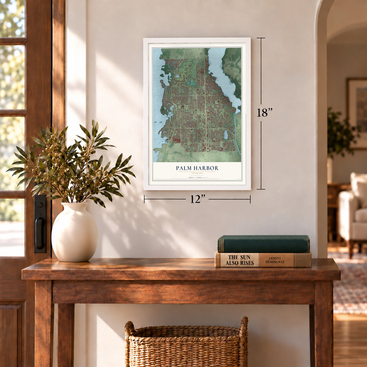
12" x 18" Archival Matte Print
A Map of Home. A Work of Art.
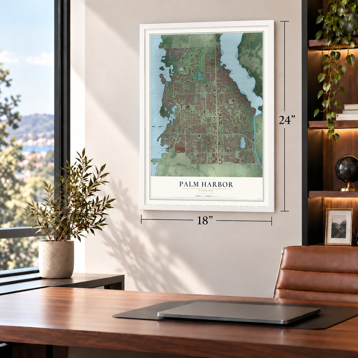
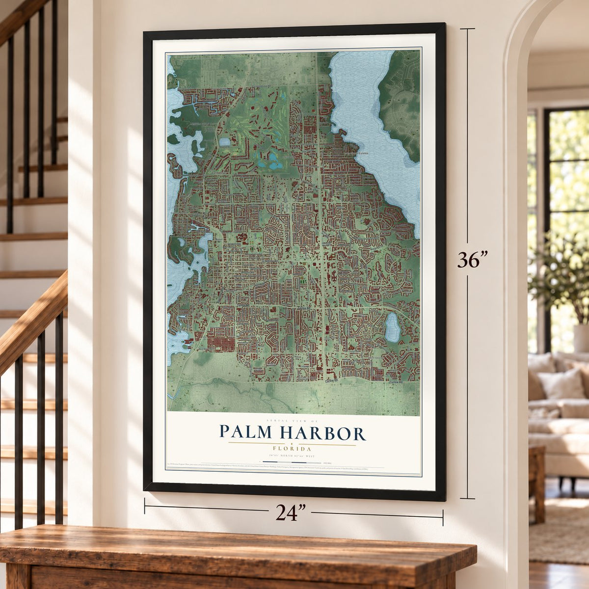
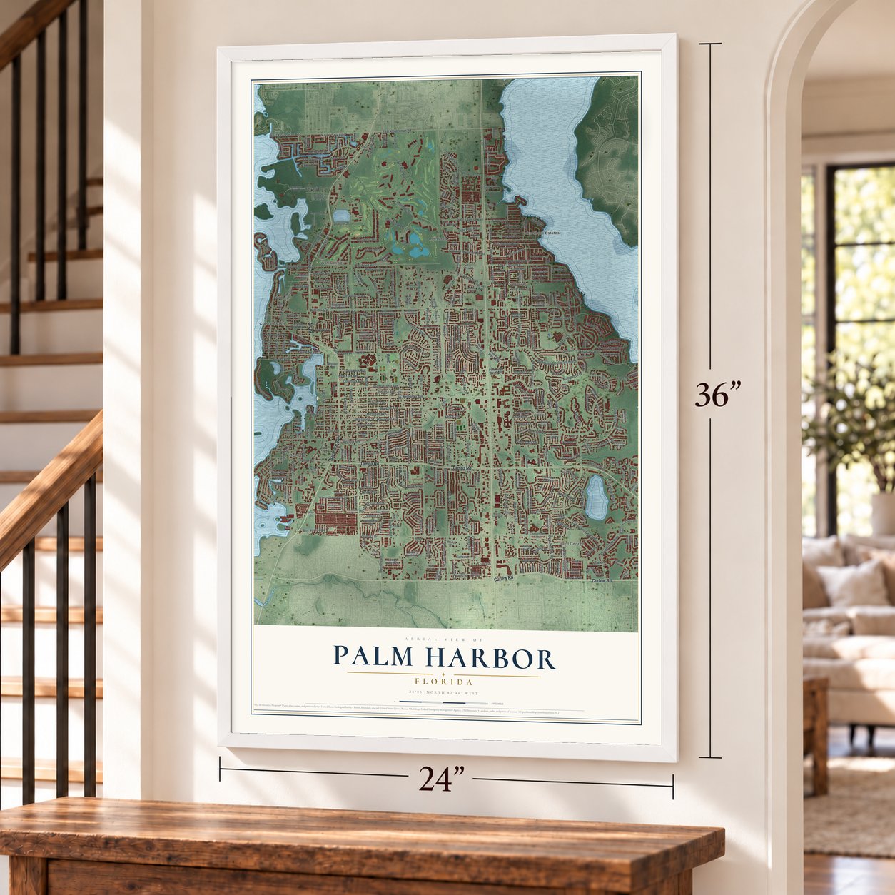
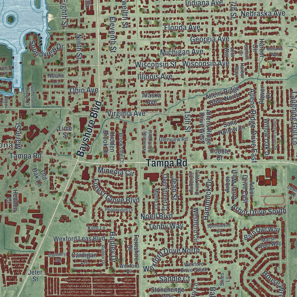
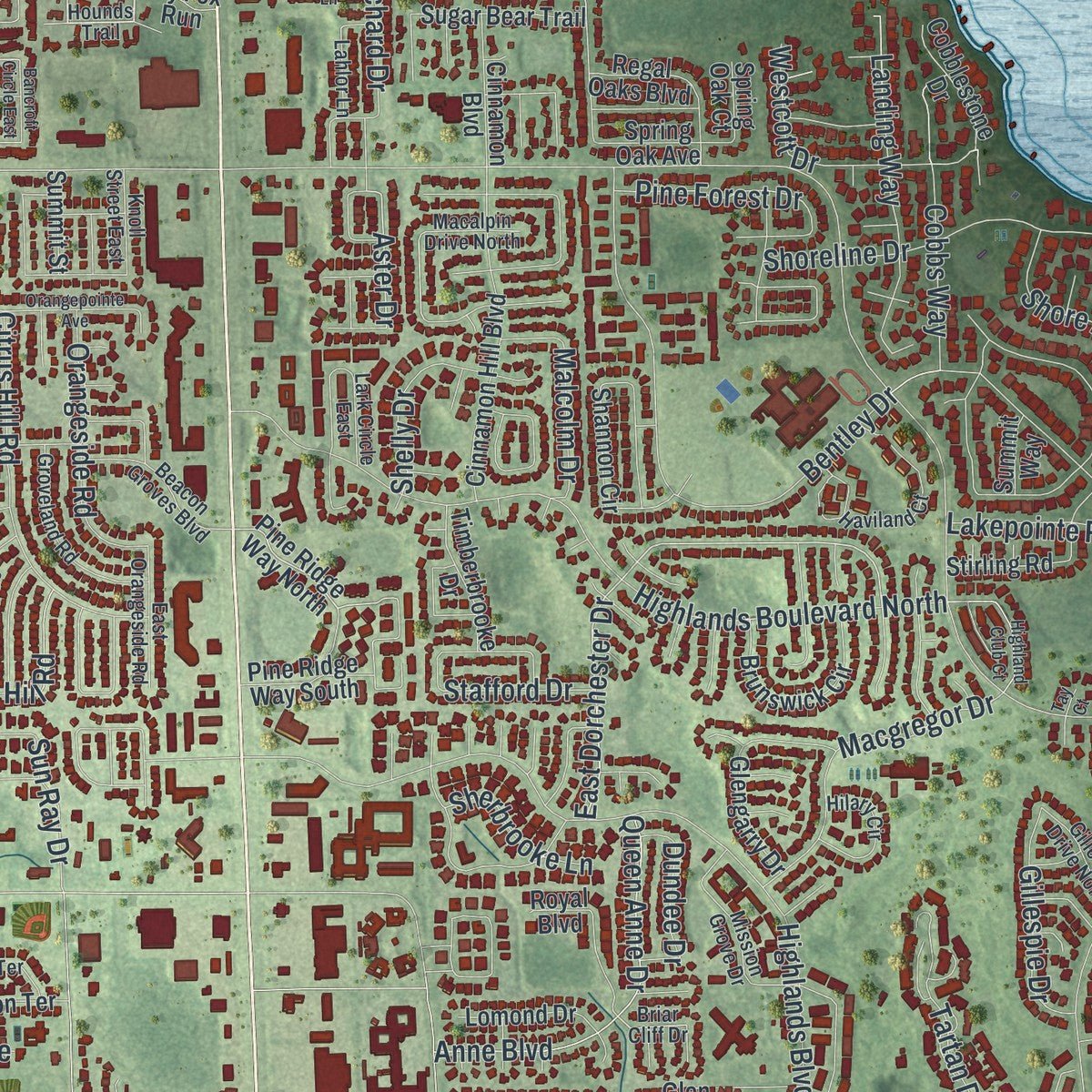
Explore Palm Harbor, Florida from a whole new perspective. Created using aerial imagery and detailed geographic data, this map captures Palm Harbor building by building, with labeled streets, familiar landmarks, and shaded topographical relief that highlights the natural contours of the landscape.
Combining modern data with the timeless character of a vintage atlas, this map is just as interesting up close as it is beautiful on the wall. Whether you grew up in Palm Harbor, spent memorable years there, or call it home today, this unique map is a great way to celebrate a place that means something to you. Zoom in on the preview to look for your street, and then order a print to put your memories on the wall.

Three ways to hang it
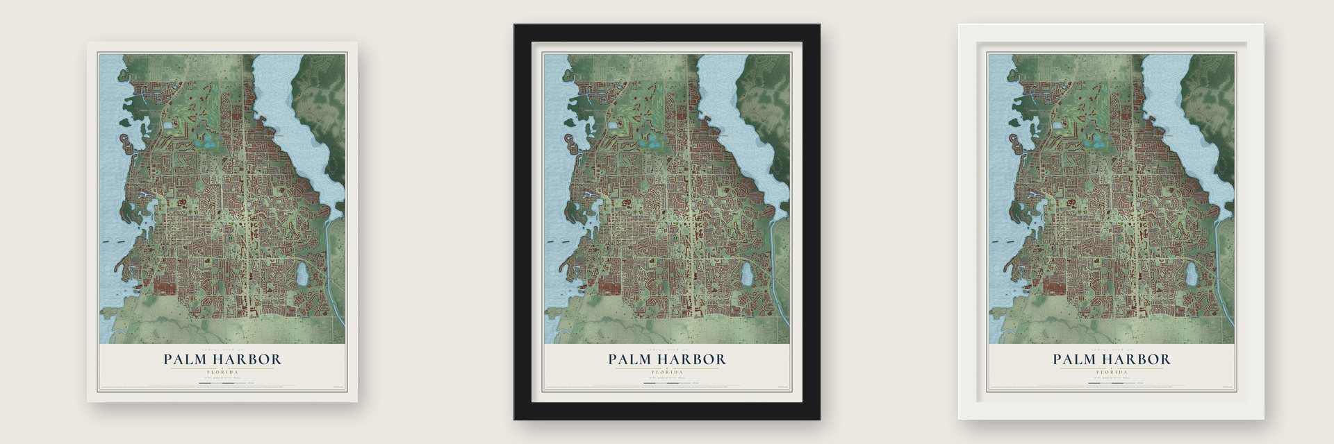
Unframed archival matte, a black wood frame or a white wood frame.
Up close
Geography Worth Displaying
This map was created using accurate cartographic data and authoritative geographic sources, including the U.S. Geological Survey (USGS) and FEMA. The map brings together terrain, waterways, roads, and building detail. The majority of the streets are labeled, houses are accurately depicted, and the topography is derived from government sources. Combining local data with carefully composed color and shading leads to this beautifully detailed Palm Harbor artwork for your wall.
Rather than simply showing street outlines, we’ve included as many of the street names as we could reasonably fit on the map while keeping their names legible. Zoom in on the high resolution preview to see exactly what’s on the map. We truly set out to create a statement piece for anyone who loves Palm Harbor. So whether it’s for you, or a gift for someone you love, we hope this map of Palm Harbor brings back fond memories.
Explore the full map of Palm Harbor, Florida and read about the local places it shows.
About Palm Harbor, Florida
Palm Harbor is an unincorporated community of 61,366 people in Pinellas County, on the Gulf coast 22 miles north of downtown St. Petersburg. Few people lived here until settlers came in the 1860s and called the area Curlew. They opened a pioneer cemetery in 1869 and built a Methodist church, and a post office named Bay St. Joseph followed in 1878.
The Sutherland Improvement Company then bought land around Curlew and Bay St. Joseph and laid out a new town, Sutherland, which opened a post office of its own in 1888. Orange Belt Railway trains arrived in 1890. The larger of Sutherland's two hotels became Southern College in 1902, set on a high bluff above Sutherland Bayou and the Gulf, and in 1925 the town took the name Palm Harbor.
- Where Sutherland got its nameOne story credits the Duke of Sutherland, who came ashore at Tarpon Springs in 1887 and toured the area. Local pioneers rejected that idea. They said the name was cut down from Southern Land and Development Company, the firm that platted the community in 1888.
- A teacher starts a libraryOzona Elementary teacher Jeanette Malouf saw that her students had no library nearby, since Dunedin and Tarpon Springs charged anyone from outside their cities. The Palm Harbor Civic Club gave $400, Bill Honey offered a floor of his house at 1205 Omaha Avenue, and volunteers opened the library on April 1, 1978. With 10,000 volumes it moved into the old Palm Harbor Methodist Church in December 1980, and by 1982 it held 20,000.
- Ten years to a new buildingA $200,000 state grant for a new library died when Governor Graham vetoed it on June 30, 1983, so Malouf and the Friends of the Library kept raising money. In 1985 a bill from Senator Curt Kiser let Palm Harbor tax itself for services such as a library, and bonds paid for a site on Nebraska Avenue. The new library opened there on July 5, 1988, the only one in Florida paid for by a Municipal Service Taxing Unit.
- Neighbors against the KlanWhen part of his 13-acre property north of Tampa Road was rezoned from commercial to residential, Donald Kersey, who wasn't a Klansman, punished the zoning board by letting the Ku Klux Klan put its Florida headquarters there in 1977. Residents burned the Klan building four times and the Chamber of Commerce condemned the group. Bank president Frank S. Weaner fought it for years and debated David Duke. The Klan faded in the 1990s, and the land sold in 2006.
- Golf, First Fridays and foodInnisbrook's Copperhead Course opened in 1974 and hosts the PGA Tour's Valspar Championship. The historic downtown, where Florida Avenue meets Alternate 19, throws a party each month on the first Friday. On the first Sunday of October, the Palm Harbor Junior Women's Club holds the Taste of Palm Harbor, with dishes from over 20 local restaurants, to pay for its grants and scholarships.
Find your street
Names on the Palm Harbor map
Every name below is printed on this map. Look for your street, your school, the park where you played, or the pond down the road.
Places and landmarks8
- Saint George
- Curlew
- Cove Springs
- Lake Shore Estates
- Crystal Beach
- Innisbrook
- Ozona
- Wall Springs
Streets and roads492
- Alt 19
- Bayshore Boulevard
- Tampa Road
- Curlew Road
- Belcher Road
- Pennsylvania Avenue
- Virginia Avenue
- 14th Street
- Delaware Avenue
- Columbia Avenue
- Wexford Drive North
- North Belcher Road
- Laughing Gull Lane
- Talley Drive
- Fox Hunt Drive
- Florida Avenue
- 21st Street
- Florida Boulevard
- Rustic Oaks Drive
- Fox Chase Boulevard
- Hadley Drive
- Osprey Lane
- Omaha Street
- Cypress Pond Road
- East Dorchester Drive
- Boyd Fitchlic Road
- Hermosa Drive
- 18th Street
- Carriage Drive
- Aster Drive
Show all 492 streets
- Alderman Road
- Highlands Boulevard
- Nebraska Avenue
- McMullen Booth Road
- 19th Street
- Georgia Avenue
- West Lake Road
- Millridge Road
- Lake Saint George Drive
- Bee Pond Road
- Orange Street
- Lake Shore Drive
- Westlake Boulevard
- Indiana Avenue
- Village Way
- Highlands Boulevard North
- East Klosterman Road
- Ohio Avenue
- Mayo Street
- Innisbrook Drive
- West Klosterman Road
- Countryside Boulevard
- Old Oak Circle
- Skye Lane
- Westwinds Drive
- Bentley Drive
- Wisconsin Avenue
- Wisconsin Street
- Eniswood Parkway
- Shore Drive
- 15th Street
- 16th Street
- Lakeview Drive
- Colonial Boulevard
- Desoto Boulevard
- Eighth Street
- Ridge Boulevard
- Eleventh Street
- Riviere Road
- Douglas Street
- Winding Willow Drive
- Michigan Avenue
- Lakepointe Road
- Via Verdi Drive
- Lake Tarpon Drive
- Hidden Lake Drive
- Illinois Avenue
- Twelfth Street
- Shore Line Circle
- Woodridge Parkway
- Harvest Moon Drive
- Seaview Circle
- Hammock Drive
- Garland Circle
- Independence Avenue
- Kavalier Drive
- De Soto Boulevard
- Carlyle Drive
- Playmoor Drive
- Wai Lani Road
- Anne Boulevard
- Queen Anne Drive
- Noell Boulevard
- Citrus Hill Road
- Olde Post Road
- Landing Way
- Maple Avenue
- Autumn Drive
- Philadelphia Boulevard
- Point Seaside Drive
- Grove Valley Avenue
- Fisher Road
- Shoreline Drive
- Bonnie Boulevard
- Winding Oaks Drive
- Macgregor Drive
- Lagoon Drive
- Sandy Hook Road
- Orchard Hill Circle
- Crosswinds Drive
- Colonial Boulevard West
- Avery Avenue
- New York Avenue
- Orchard Drive
- Yawl Lane
- Leprechaun Lane
- Severs Landing
- Rolling Trail
- Manning Road
- Tartan Drive
- Bay Street
- Ninth Street
- Maryland Avenue
- Swan Lane
- Pine Burr Road
- Pine Hill Road
- Cobbs Way
- Citrus Drive
- Country Place Lane
- Edgehill Drive
- Dunbridge Drive
- Cypress Drive
- Longleaf Lane
- Vincent Street
- Douglas Place
- County Road
- Langstaff Drive
- Oak Avenue
- Orangeside Road
- Oceanview Avenue
- Allens Ridge Drive East
- Westcott Drive
- Cloverplace Drive
- Pine Forest Drive
- Oak Creek Lane
- Courtyard
- Forest Grove Boulevard
- Glen Eagles Parkway
- Countrybrook Drive
- House Wren Circle
- Talah Drive
- Ridge Road
- Indian Trail East
- Saddle Court
- Broadus Street
- Cardinal Avenue
- Malcolm Drive
- Woodridge Place
- Mineola Circle
- Manor Boulevard
- South Gulf Drive
- Oak Lake Drive
- Tomoka Drive
- Sanctuary Drive
- Arbor Drive South
- Highview Drive
- Rolling Oaks Drive
- Northcote Drive
- Arbor Chase Drive
- Sun Ray Drive
- Wicks Drive
- Shelly Drive
- Harbor Drive
- Sutton Place
- Marie Street
- Dundee Drive
- Enisglen Drive
- Blue Heron Boulevard
- Crystal Drive
- Soundview Drive
- Roberts Road
- Robin Avenue
- Sherbrooke Lane
- Gillespie Drive
- Rolando Drive
- Loch Road
- Grace Street
- Wicklow Drive
- Sparrow Avenue
- Liberty Way
- Jean Street
- Hickory Lane
- Harry Street
- Baywood Drive
- Jodi Lane
- Stafford Drive
- Cyprus Drive
- Ulelah Avenue
- Timber Lane
- Sean Way
- Cara Court
- 17th Street
- Baldwin Road
- Tenby Way
- Vance Avenue
- Mildred Drive
- Rita Lane
- Erne Street
- Hill Road
- 66th Street
- Cheltenham Drive
- Wynford Drive
- Sandpiper Drive
- Kestrel Street
- Diane Avenue
- Mountain Laurel Drive
- Red Oak Drive
- Sage Road
- Lennox Road East
- Paddock Drive
- Pine Ridge Way North
- Wexford Leas Boulevard
- Katherine Boulevard
- Valencia Lane East
- Lake Valencia Boulevard West
- Spanish Oaks Boulevard
- Crystal Beach Avenue
- Rolling Woods Drive
- Tarpon Pointe Circle
- Orange Grove Way
- Canopy Oaks Boulevard
- Landmark Boulevard
- Cinnamon Hill Boulevard
- Shannon Circle
- Valley View Circle
- Harbor Ridge Drive
- Citrus Hill Lane
- Willow Oak Drive
- Stonehenge Way
- Valencia Lane West
- Harbor Woods Drive
- Marinella Drive
- Hillside Drive
- Wesleyan Drive
- South Canal Drive
- Strathmore Gate Drive
- Seaview Drive
- Daneman Point Drive
- Sugar Bear Trail
- Willow Brook Drive
- Glengarry Drive
- Brunswick Circle
- Westford Circle
- Allens Ridge Drive West
- East Orangehill Avenue
- Seton Circle
- Painted Bunting Circle
- Samantha Drive
- Pine Ridge Way South
- Pinewood Terrace West
- Catalina Drive
- Park Court
- Grove Wood Boulevard
- Driftwood Drive West
- Sand Hollow Lane
- Arbor Drive East
- Banana Street
- Missouri Avenue
- McMath Drive
- West Canal Drive
- Blue Jay Circle
- Allens Ridge Drive North
- Barn Owl Way
- Glenwood Close
- Cobblestone Drive
- Lomond Drive
- Whitehall Drive
- Sage Circle
- Royal Boulevard
- Phlox Drive
- Meadow View Lane
- Portofino Place
- Casa Vista Drive
- Grand Preserve Place
- Regal Oaks Boulevard
- Stirling Road
- Tamarron Terrace
- Sutton Place Drive
- Overstreet Court
- Green Valley Road
- Hidden Brook Drive
- Arbor Drive West
- Timberbrooke Drive
- Cinnamon Boulevard
- Glengary Lane
- Ridgegrove Drive South
- Cardinal Trail
- Shady Lane
- Grovepark Road
- Rolling Wood Drive
- North Street
- North Carolina Avenue
- Hollow Ridge Road
- Still Meadows Circle East
- Harbor Circle
- Amelia Way
- Ermine Path
- Sheffield Circle West
- Sunshine Drive
- Sunward Avenue
- Salem Avenue
- Phillips Way
- Sumner Way
- Lillian Avenue
- Hollow Trail Court
- Campbell Street
- Lifestyle Boulevard
- Henry Lane
- Ridge Drive
- Fernshire Drive
- Cathedral Drive
- Rebstock Boulevard
- Woods Court
- Treetop Drive
- Rolling Ridge Road
- Gulfwinds Drive
- Egret Drive
- Cardigan Lane
- First Court
- North Gulf Drive
- Clover Hill Road
- Spring Oak Court
- Old Oak Lane
- Eagles Nest Drive
- Leafwing Court
- Oak View Drive
- Timber Run Drive
- Spring Oak Avenue
- Barbara Street
- Summit Street
- Cactus Hill Place
- Hillpoint Drive
- Sante Fe Trail
- Cascade Circle
- Grove Ridge Drive
- Somerset Lane
- Key Lane
- Glen Haven Drive
- Highland Street
- Limetta Street
- Surrey Drive
- Hedden Court
- Alaska Avenue
- Berkley Court
- Michelle Lane
- Ribolla Drive
- Brier Court
- Sly Fox Run
- Plover Place
- Carlyle Street
- Robin Trail
- Summit Way
- Cedar Drive
- Cobble Court
- Trent Road
- Bonnie Avenue
- Jeter Street
- Moore Street
- Scott Court
- Lime Street
- Wexford Drive
- Hounds Trail
- Franklin Circle
- Moss Rose Avenue
- Mayfair Circle East
- Lemon Street
- Briar Cliff Drive
- Haviland Court
- Rolling Hills Drive
- Freshwater Drive
- Fox Chase Circle
- Orchard Highlands Drive
- North Canal Drive
- Landmark Trail
- Tarian Court
- Mission Grove Drive
- Groveland Road
- Wexford Drive South
- Harbor Way
- Ontario Avenue
- Gillespie Drive North
- Beacon Groves Boulevard
- Enisgrove Drive East
- Steeplechase Lane
- Channing Drive
- Camelot Court
- Cimarron Terrace
- Foxcroft Drive West
- Hilary Circle
- 16th Way
- East Orangeside Road
- Carlyle Circle
- Ketch Circle
- Myrtle Court
- Latana Drive
- Brookside Court
- Kent Lane
- Lahlor Lane
- Northridge Drive
- Willard Street
- Deer Run North
- Landmark Way
- Spanish Moss Lane
- Parkway Place
- Pinewood Terrace East
- Marsh Wren Way
- Oakbend Drive
- Glenview Road
- Lake Shore Drive North
- Knoll Street East
- Sunflower Drive
- Lark Circle East
- Macalpin Drive North
- Hunter Court
- Hamilton Avenue
- Birkdale Lane
- Gorse Court
- Rodney Court
- Second Court
- Blue Tern Drive
- Indian Oak Court
- Orchid Lane
- Natalie Lane
- Holly
- Ozona Drive
- Birch Lane
- Stiles Lane
- Gary Court
- Prior Place
- Lakeview Terrace
- Longford Drive
- Orangepointe Avenue
- Kentucky Avenue
- Dolly Bay Drive
- Daventry Square
- Bent Oak Road
- Highland Club Court
- Catalina Point Road
- Calibre Downs Lane
- Spottswood Circle
- Chianti Place
- Bilgore Grove Boulevard
- West Groveleaf Avenue
- Arboretum Drive
- New England Avenue
- Klosterman Oaks Boulevard
- Wild Oak Lane
- Winding Way
- Glossy Ibis Court
- Glenbrook Lane
- Indian Trail North
- Cherry Laurel Drive
- Nighthawk Drive
- Pepperidge Drive
- Meadow Brook Drive
- Enisgrove Drive
- Downing Place
- Radnor Drive
- Bellingham Place
- Riverside Drive
- Morningside Drive
- Trailwood Drive
- Peterson Lane
- Blooming Hill Lane
- Forest View Drive
- Delaney Court
- Ridge Lane
- Country Lane
- Sunrise Circle
- Normandy Circle West
- Sutherland Bayou Court
- Bancroft Circle East
- Briarwood Lane
- Valley Road
- Mineola Place
- Nuthatch Way
- Melanie Way
- Citrus Court
- Bayou Lane
- Jeffrey Drive
- Bridge
- Tay Court
Names are listed as they appear on the printed map. Zoom into the product photos to find them.
The art of mapping a place
How This Map Was Made
Real places. Remarkable detail. Discover the layers that turn geographic data into a map of home.

The view from above
Aerial imagery reveals the character of the land: woodland, open fields, and the patterns of a place.

The shape of the land
Elevation data brings hills, valleys, and subtle changes in the landscape into view.

The details of home
Roads, waterways, and building footprints come together to make the map feel unmistakably local.

Geography becomes art
Considered color, shading, and typography bring the layers together in a map made for your wall.


Process illustrated with Mendon, Massachusetts. Aerial imagery: USDA NAIP. Terrain: USGS 3D Elevation Program. Map details and finished artwork: KNOWOL.
The Details
About This Print
Choose an archival matte print, or a black or white Ayous wood frame. The archival matte print is unframed.
Select your size and finish above to see the matching product image and price.
Materials & Craftsmanship
A contemporary map with the character of a classic atlas, printed on archival matte paper. Optional frames are made from Ayous wood.
Your printed map does not include the watermark shown in the full-map preview.
Shipping & Delivery
Free shipping within the United States. Every print is made to order in the USA.
Buying a gift? Add a note in your cart and we'll include it. We never put prices in the package.
Prints ship within 2 to 3 business days. Allow 7 to 10 days total from ordering for delivery. Timing may vary during holidays or periods of high order volume.
Read our shipping policy.
Returns and damaged prints
Each print is made to order. Change-of-mind refunds are not available after production.
If your print arrives damaged, misprinted or incorrect, contact support@knowol.com within 30 days of receiving it. Include your order number, photos and a description of the issue.
Read our full refund and replacement policy. For questions about your order, email support@knowol.com.
Find your town
Looking for another city?
Find a map of home in our Florida collection, or any town in the country.
Nearby
Maps of towns near Palm Harbor
Know someone from one of these towns? Their map makes a great gift.
 Dunedin
, Florida
From $39.99See the map
 Tarpon Springs
, Florida
From $39.99See the map
 Greenbriar
, Florida
From $39.99See the map
More maps nearby: East Lake, Oldsmar, Anclote, Safety Harbor and Holiday.