
Search for another town

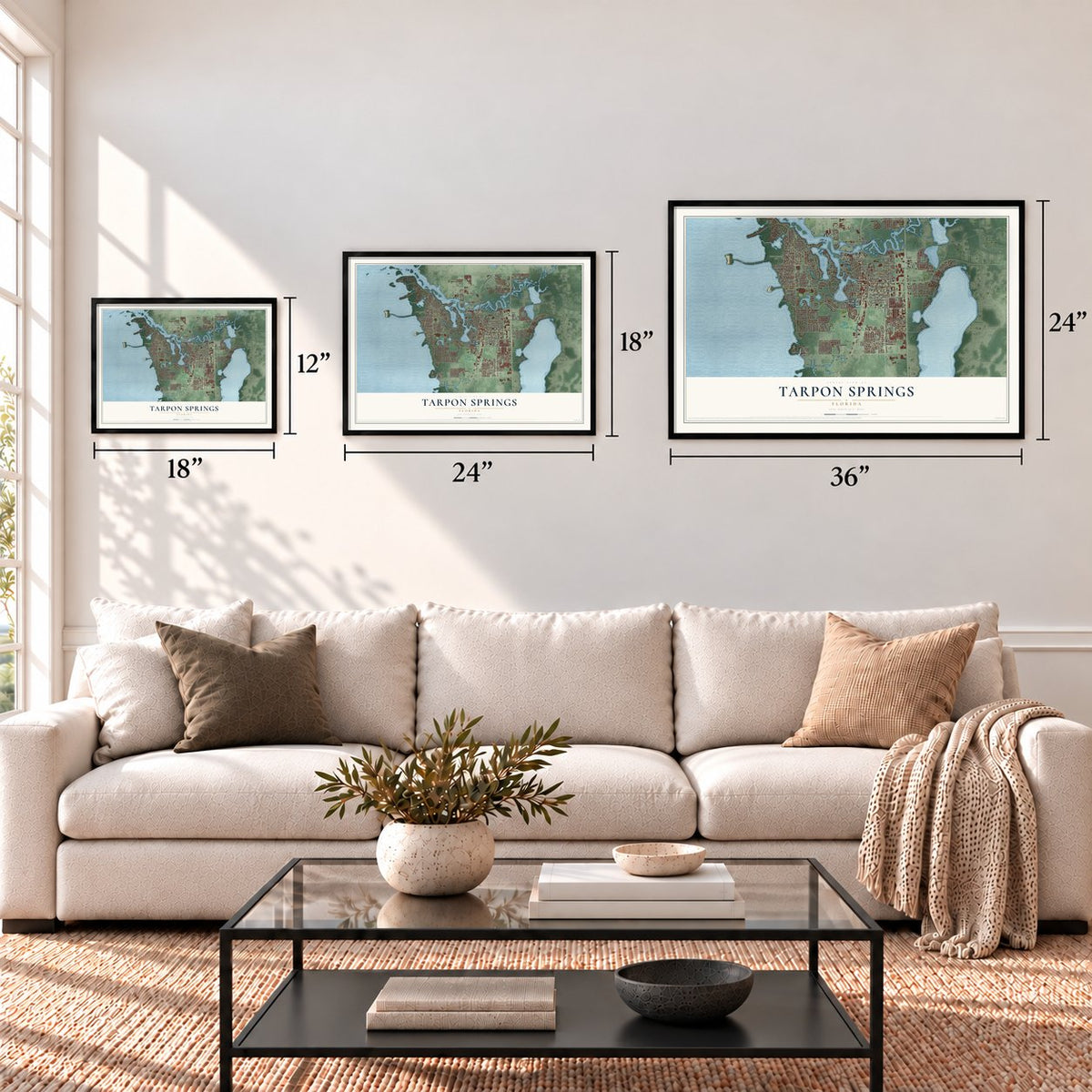

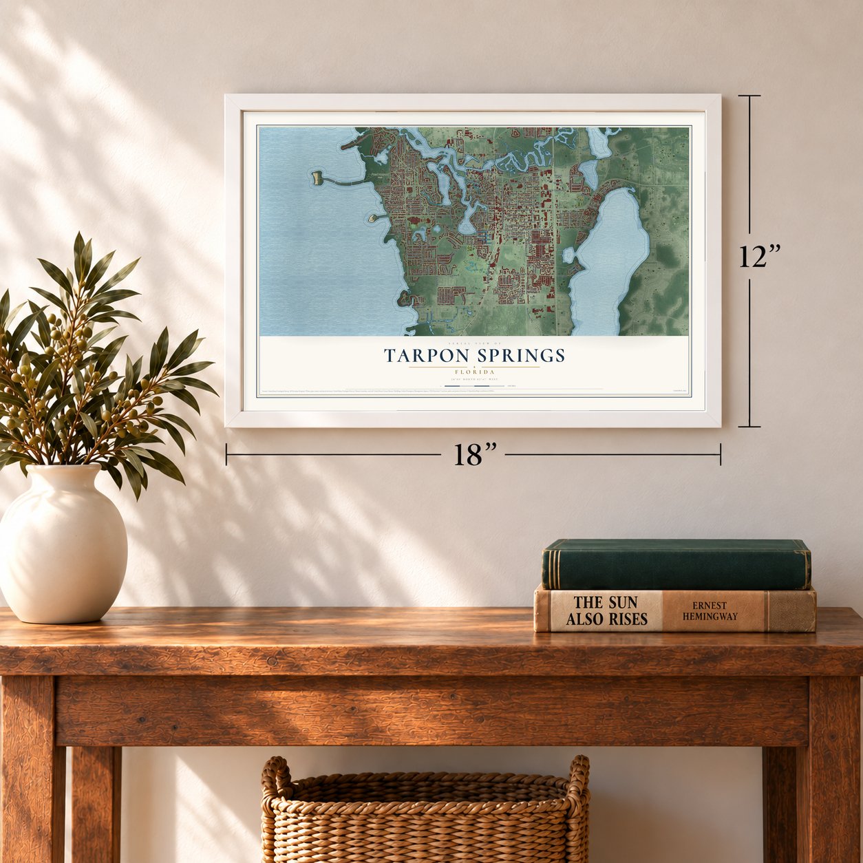
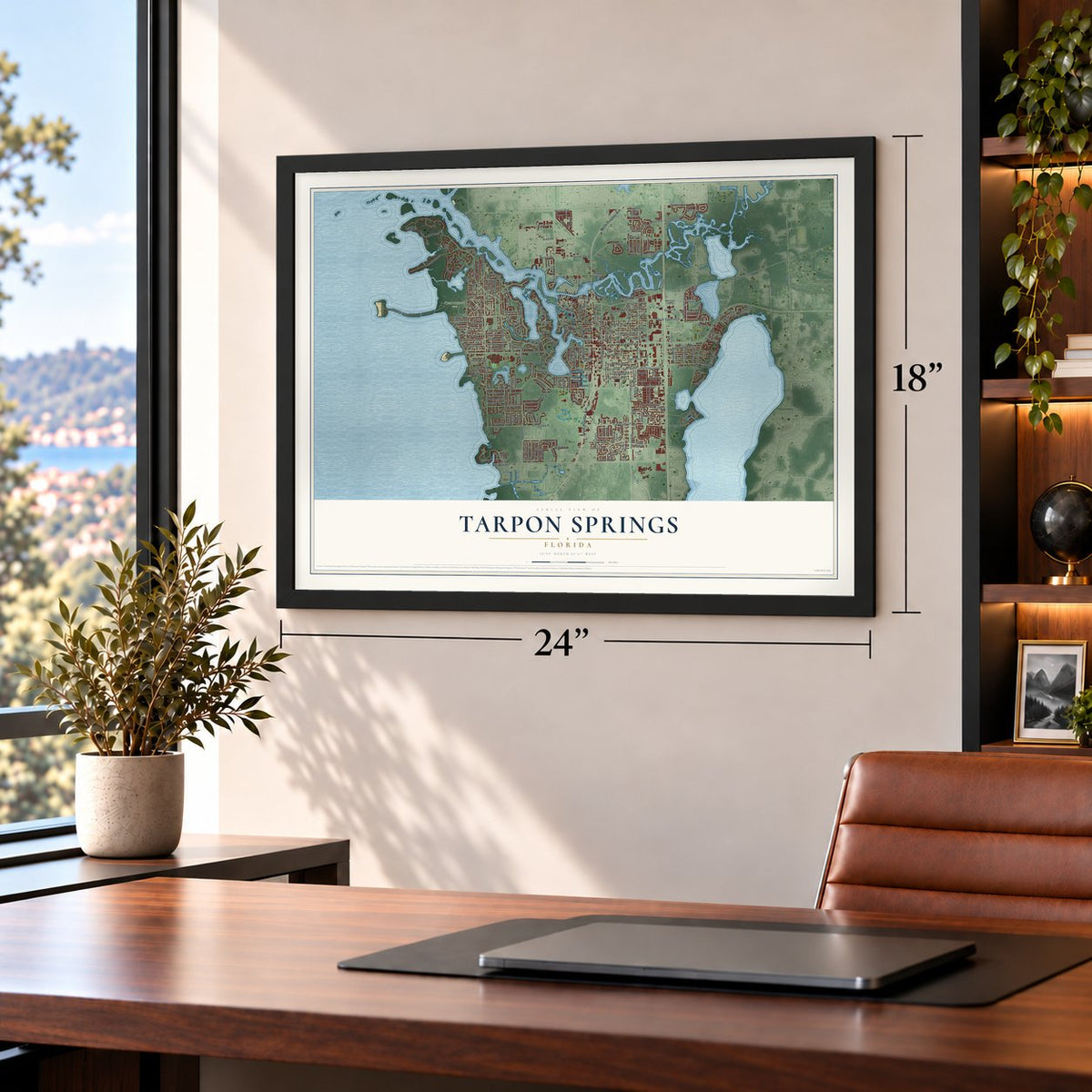
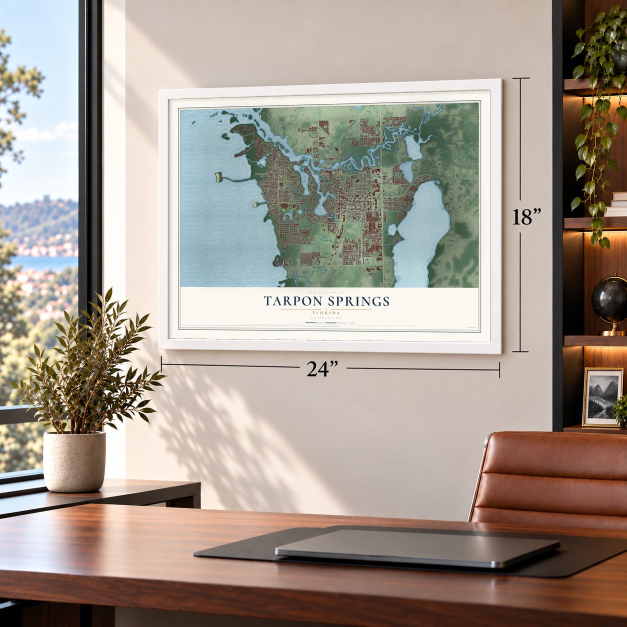

Free U.S. delivery 7 to 10 days after you order
Tarpon Springs, Florida Map Art
A new map of Tarpon Springs, Florida, made in 2026 and printed to order on thick archival matte paper.
12" x 18" Archival Matte Print
A Map of Home. A Work of Art.
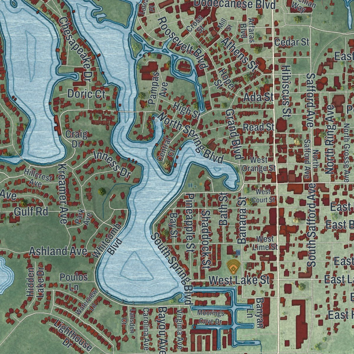
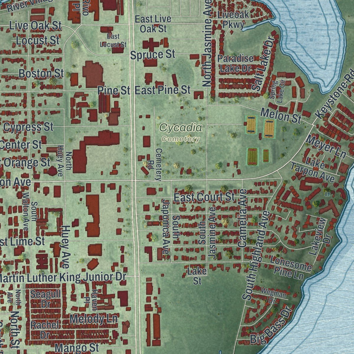
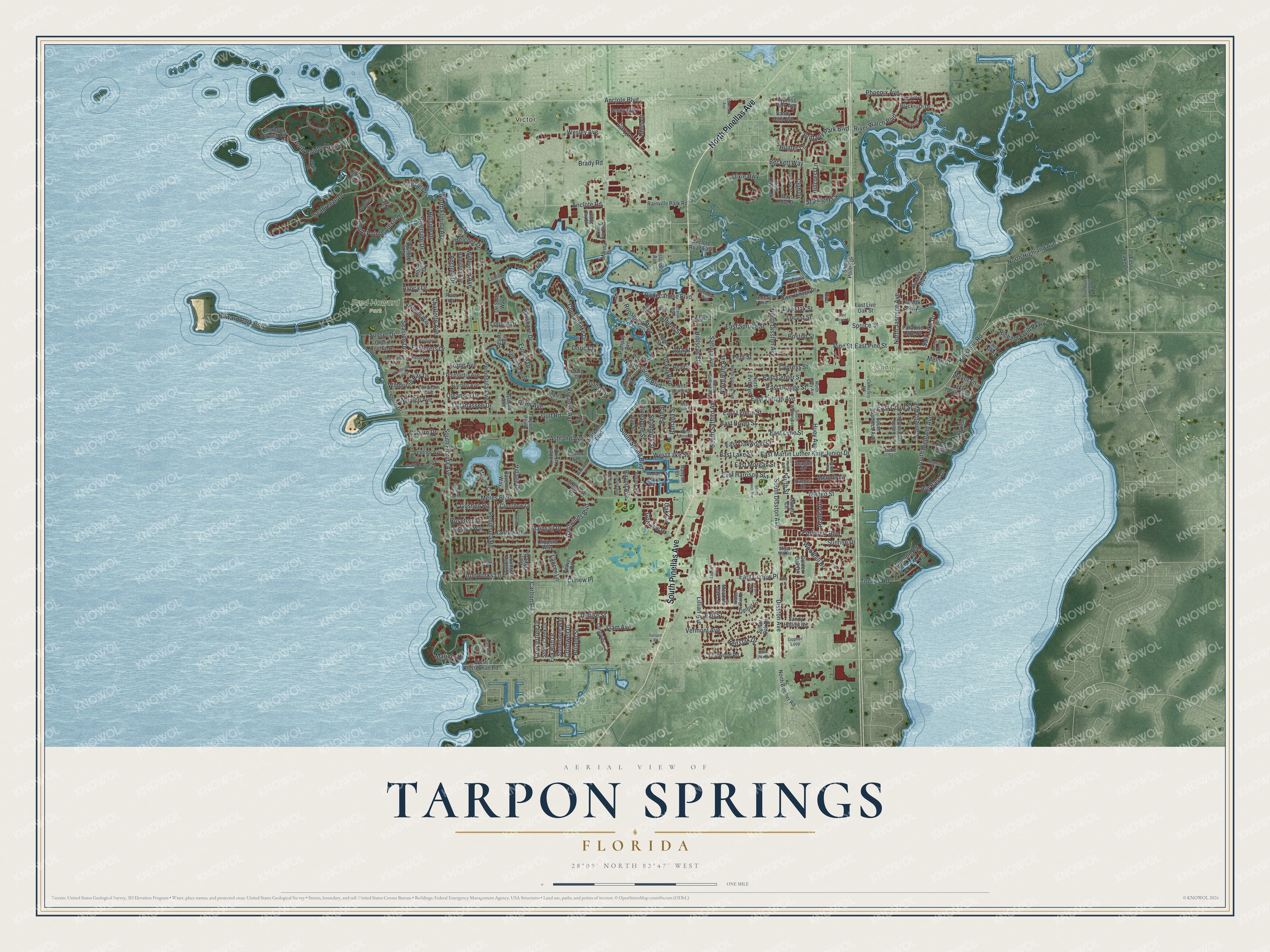
Explore Tarpon Springs, Florida from a whole new perspective. Created using aerial imagery and detailed geographic data, this map captures Tarpon Springs building by building, with labeled streets, familiar landmarks, and shaded topographical relief that highlights the natural contours of the landscape.
Combining modern data with the timeless character of a vintage atlas, this map is just as interesting up close as it is beautiful on the wall. Whether you grew up in Tarpon Springs, spent memorable years there, or call it home today, this unique map is a great way to celebrate a place that means something to you. Zoom in on the preview to look for your street, and then order a print to put your memories on the wall.
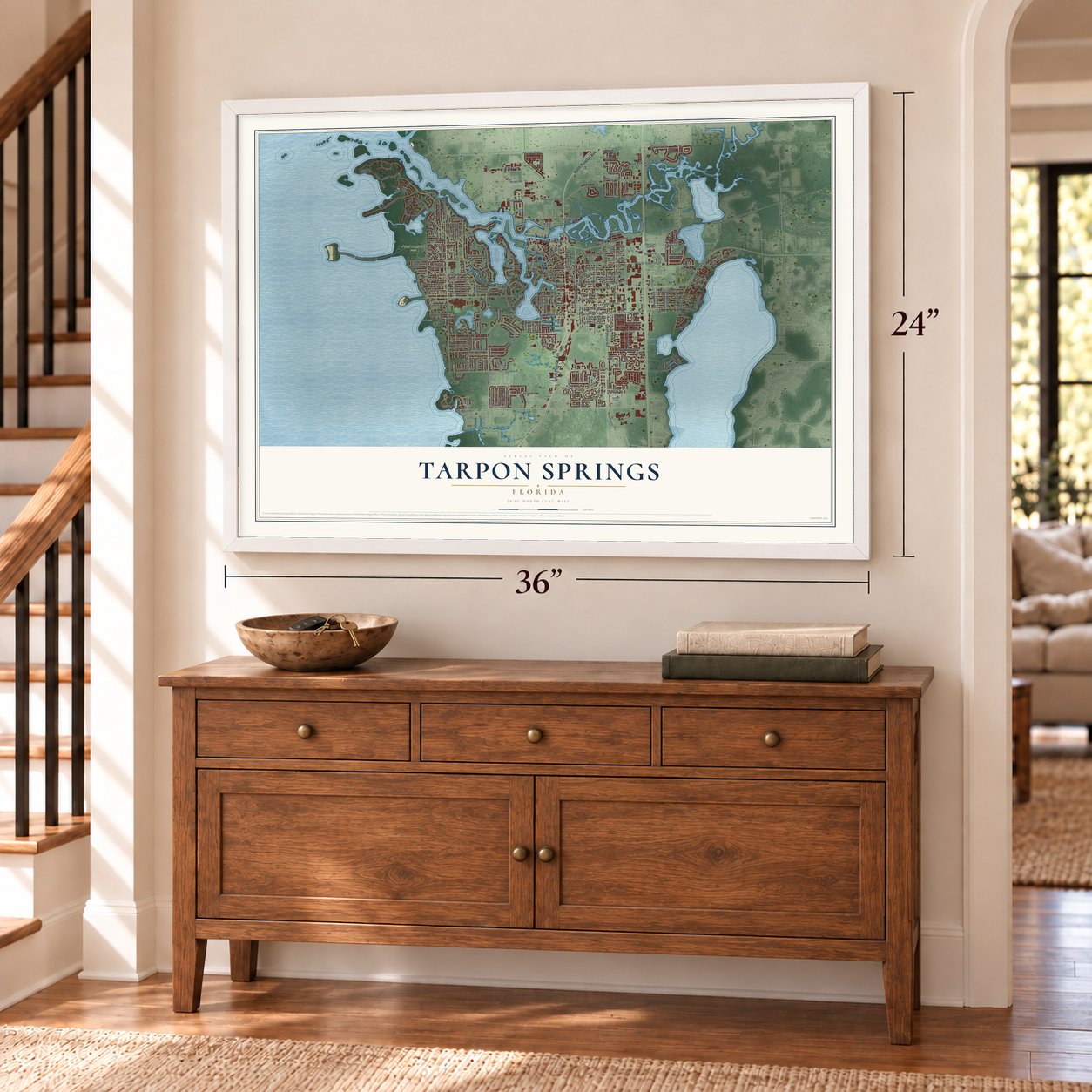
Three ways to hang it
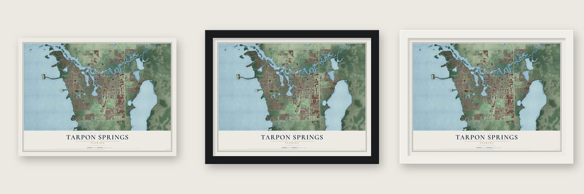
Unframed archival matte, a black wood frame or a white wood frame.
Up close
Geography Worth Displaying
This map was created using accurate cartographic data and authoritative geographic sources, including the U.S. Geological Survey (USGS) and FEMA. The map brings together terrain, waterways, roads, and building detail. The majority of the streets are labeled, houses are accurately depicted, and the topography is derived from government sources. Combining local data with carefully composed color and shading leads to this beautifully detailed Tarpon Springs artwork for your wall.
Rather than simply showing street outlines, we’ve included as many of the street names as we could reasonably fit on the map while keeping their names legible. Zoom in on the high resolution preview to see exactly what’s on the map. We truly set out to create a statement piece for anyone who loves Tarpon Springs. So whether it’s for you, or a gift for someone you love, we hope this map of Tarpon Springs brings back fond memories.
Explore the full map of Tarpon Springs, Florida and read about the local places it shows.

About Tarpon Springs, Florida
Tarpon Springs is a city of 25,117 people in Pinellas County, set on a string of bayous that drain into the Gulf of Mexico. Farmers and fishermen settled here around 1876, and newcomers named the place for the tarpon they saw leaping from the water, though most of the splashing fish were really mullet. Hamilton Disston, who had bought the land the year before, ordered a town plan drawn up in 1882.
The town incorporated on February 12, 1887, ahead of every other community in present-day Pinellas County. The Orange Belt Railway, the county's first railroad, reached it on January 13, 1888, and the town grew as a place where wealthy northerners came to spend the winter.
- Greek sponge divers in 1905John K. Cheyney started the first local sponge business in the 1880s, and settlers from Key West and the Bahamas came in the 1890s to hook sponges and process them. In 1905 John Cocoris brought divers and crews over from Greece, first from Aegina and Hydra, then mostly from Kalymnos, Symi and Halki. Sponges soon became the town's most important business, worth millions of dollars a year, and the 1953 film Beneath the 12-Mile Reef was shot here.
- The red tide of 1947In 1947 a red tide killed off the Gulf's sponge beds. Many divers and their boats turned to shrimping, and others gave up the trade. The sponges slowly grew back, and in the 1980s a disease that killed Mediterranean sponges brought a new boom to Tarpon Springs, where a small sponge industry still works today.
- The cross in Spring BayouEvery January 6, St. Nicholas Greek Orthodox Cathedral leads the Epiphany celebration, usually with the Metropolitan of Atlanta giving the blessings. At the end a wooden cross is tossed into Spring Bayou, and teenage boys from 16 to 18 jump in after it. The one who brings it up is said to be blessed for the whole year. In 2007 and 2008 the city made sister cities of Kalymnos, Halki, Symi, Hydra and Larnaca, Cyprus.
- A library begun in 1916Julia Roswell Smith Inness and other community leaders started the public library in 1916 on the second floor of City Hall, paid for by the Library Association and dues. It moved five times as its books and the town grew. John and Mabel Cheyney gave land for a new building in 1937, a library opened in Coburn Park in 1964, and the present building on East Lemon Street, with two life size tarpon in its fountain, opened in 1997.
Find your street
Names on the Tarpon Springs map
Every name below is printed on this map. Look for your street, your school, the park where you played, or the pond down the road.
Places and landmarks4
- Victor
- Cycadia Cemetery
- Fred Howard Park
- Twin Lake
Streets and roads274
- North Pinellas Avenue
- South Pinellas Avenue
- Riverside Drive
- East Tarpon Avenue
- South Spring Boulevard
- North Spring Boulevard
- Anclote Boulevard
- Banana Street
- Safford Avenue
- Live Oak Street
- Anclote Road
- South Pointe Alexis Drive
- East Lake Street
- East Martin Luther King Junior Drive
- South Disston Avenue
- Keystone Road
- Disston Avenue
- North Disston Avenue
- Huey Avenue
- West Lake Street
- East Spruce Street
- Mariner Drive
- Cromwell Drive
- Meres Boulevard
- Gulf Road
- East Lime Street
- North Florida Avenue
- Bayshore Drive
- Howard Park Causeway
- Cypress Street
Show all 274 streets
- North Pointe Alexis Drive
- South Florida Avenue
- Pine Street
- Sunset Drive
- Curlew Place
- East Oakwood Street
- East Lemon Street
- East Boyer Street
- Dixie Highway
- North Jasmine Avenue
- Carlton Road
- Seabreeze Drive
- East Orange Street
- Chesapeake Drive
- South Highland Avenue
- Wideview Avenue
- Vermont Avenue
- Tallahassee Drive
- Peninsula Avenue
- Woodhill Drive
- East Court Street
- Anclote Drive
- South Safford Avenue
- East Center Street
- Village Drive
- Brittany Park Boulevard
- Hillside Drive
- North Highland Avenue
- Wesley Avenue
- Dodecanese Boulevard
- Peninsula Road
- Hibiscus Street
- Pent Street
- Beckett Way
- Roosevelt Boulevard
- Parkview Boulevard
- Mango Street
- Eunice Drive
- East Curlew Place
- Red Oak Drive
- East Harrison Street
- River Watch Boulevard
- Charlotte Avenue
- Lagoon Road
- Oak Circle
- Ashland Avenue
- Tookes Road
- Lillian Avenue
- Melon Street
- Richard Ervin Parkway
- Palm Avenue
- Windrush Bay Drive
- Grand Boulevard
- Athens Street
- East Morgan Street
- Boston Street
- Hillcrest Lane
- Oleander Drive
- Westwinds Boulevard
- Hunter Lane
- North Street
- Liam Avenue
- Salt Lake Drive
- North Ring Avenue
- Pineapple Street
- Mexico Avenue
- Kreamer Avenue
- Earl Street
- Phoenix Avenue
- Melody Lane
- Fox Run Drive
- Cary Lane
- Camelia Avenue
- Seaside Drive
- Spruce Street
- Shaddock Street
- East Pine Street
- Belcher Drive
- Coburn Drive
- Denise Street
- Coppertree Drive
- Explorers Drive
- Brady Road
- Avoca Drive
- Rosetree Lane
- Forde Avenue
- Inness Drive
- Chris Drive
- Big Bass Drive
- Star Light Cv
- Azalea Drive
- Circle Drive
- Club Drive
- Mainsail Drive
- Sunrise Drive
- Ironworks Lane
- Golfview Drive
- Briland Street
- Goshen Road
- Bayou Avenue
- Meyer Lane
- Loquat Drive
- Bath Street
- Doric Court
- Locust Street
- Lancer Lane
- Ada Street
- West Klosterman Road
- Whitcomb Boulevard
- Anclote Road East
- River Village Drive
- East Live Oak Street
- North Belcher Road
- Lake Avoca Drive
- Liveoak Parkway
- Cypress Park Avenue
- Lake Tarpon Avenue
- Bay Cove Drive
- Hidden Lake Drive
- River Oaks Drive
- Castleworks Lane
- Blackrush Drive
- Meadow Oak Lane
- North Levis Avenue
- Seminole Boulevard
- Hope Street
- Tarpon Point
- Poinsettia Avenue
- Lakeview Drive
- Garden Avenue
- Holiday Drive
- Harbour Watch Circle
- Rachel Drive
- Timber Lane
- Merlins Court
- Marina Drive
- Beaver Drive
- South Japonica Avenue
- Grand Central Drive
- South Jasmine Avenue
- Paradise Lake Drive
- Read Street
- Shell Pointe Drive
- Paradise Boulevard
- Kenneth Way
- Citrine Trail
- Stone Creek Drive
- Stonehaven Way
- Rainville Park Road
- Jamaica Way
- Longview Lane
- Pampas Avenue
- Ventnor Avenue
- Hamilton Avenue
- Gulf Oaks Drive
- Silver Oak Drive
- Sandy Hollow Road
- Mango Circle
- Cavemill Way
- Island Avenue
- De Soto Way
- Leafwood Road
- Lonesome Pine Lane
- Crossbow Lane
- Bay Street
- Becky Way
- Shore Drive
- Lighthouse Drive
- Sandy Hills Avenue
- Sunset Ridge Lane
- Desoto Avenue
- High Street
- Glades Avenue
- Clippers Way
- Golden Oak Drive
- Cedar Street
- Banyan Lane
- Poulos Lane
- East Lake Drive
- River Court
- Seagull Drive
- Lucille Drive
- Rivo Place
- Craig Drive
- Lake Street
- North Safford Avenue
- North Huey Avenue
- South Walton Avenue
- Treasure Drive
- North Grosse Avenue
- West Lime Street
- Windy Bay Shl
- Gopher Loop
- Haven Place
- Riveredge Drive
- Athenian Way
- Gulf Beach Boulevard
- Windrush Loop
- Manatee Circle
- Cemetery Road
- Pondview Court
- Water Oak Drive
- Bay View Street
- Riverview Lane
- Virginia Avenue
- Carolina Avenue
- Sunset Road
- Windy Bay Shoal
- Central Court
- Hillcrest Avenue
- Cross Street
- Arfaras Boulevard
- Mandalay Drive
- Sugar Mill Road
- West Orange Street
- Alexis Court
- Park Avenue
- Midway Avenue
- Tiara Lane
- South Levis Avenue
- Spring Lake Circle
- Sawgrass Drive
- Harbour Watch Drive
- North Avenue
- Lauren Lane
- Wayfarer Drive
- Oakmont Avenue
- Ivey Lane
- Moorings Cove Drive
- Wegman Drive
- South Beach Drive
- George Street North
- Lynnlea Lane
- West Court Street
- Harbor Oaks Court
- Waterview Lane
- Terrace Road
- East Locust Street
- Lansden Court
- Colony South Drive
- Caravel Court
- White Oak Drive
- Lutea Place
- Mill Street
Names are listed as they appear on the printed map. Zoom into the product photos to find them.
The art of mapping a place
How This Map Was Made
Real places. Remarkable detail. Discover the layers that turn geographic data into a map of home.

The view from above
Aerial imagery reveals the character of the land: woodland, open fields, and the patterns of a place.

The shape of the land
Elevation data brings hills, valleys, and subtle changes in the landscape into view.

The details of home
Roads, waterways, and building footprints come together to make the map feel unmistakably local.

Geography becomes art
Considered color, shading, and typography bring the layers together in a map made for your wall.


Process illustrated with Mendon, Massachusetts. Aerial imagery: USDA NAIP. Terrain: USGS 3D Elevation Program. Map details and finished artwork: KNOWOL.
The Details
About This Print
Choose an archival matte print, or a black or white Ayous wood frame. The archival matte print is unframed.
Select your size and finish above to see the matching product image and price.
Materials & Craftsmanship
A contemporary map with the character of a classic atlas, printed on archival matte paper. Optional frames are made from Ayous wood.
Your printed map does not include the watermark shown in the full-map preview.
Shipping & Delivery
Free shipping within the United States. Every print is made to order in the USA.
Buying a gift? Add a note in your cart and we'll include it. We never put prices in the package.
Prints ship within 2 to 3 business days. Allow 7 to 10 days total from ordering for delivery. Timing may vary during holidays or periods of high order volume.
Read our shipping policy.
Returns and damaged prints
Each print is made to order. Change-of-mind refunds are not available after production.
If your print arrives damaged, misprinted or incorrect, contact support@knowol.com within 30 days of receiving it. Include your order number, photos and a description of the issue.
Read our full refund and replacement policy. For questions about your order, email support@knowol.com.
Find your town
Looking for another city?
Find a map of home in our Florida collection, or any town in the country.
Nearby
Maps of towns near Tarpon Springs
Know someone from one of these towns? Their map makes a great gift.
 Anclote
, Florida
From $39.99See the map
 Key Vista
, Florida
From $39.99See the map
 Holiday
, Florida
From $39.99See the map
More maps nearby: Beacon Square, Palm Harbor, Elfers, East Lake and New Port Richey.