
Search for another town

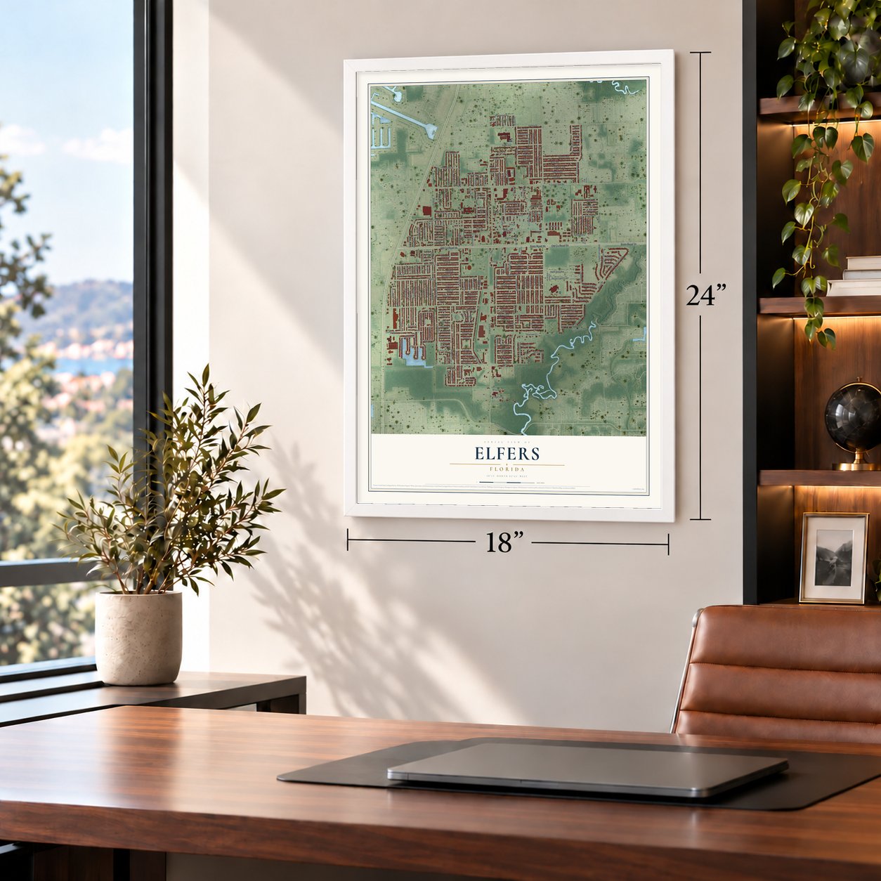

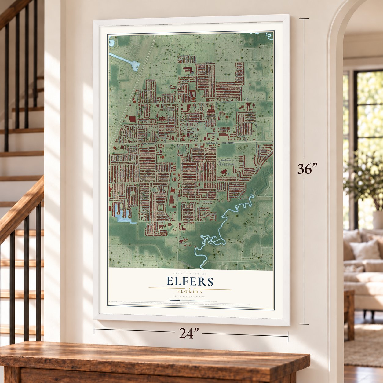
Free U.S. delivery 7 to 10 days after you order
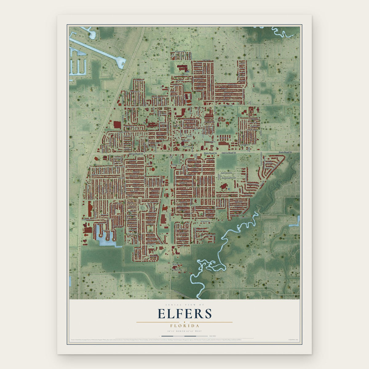
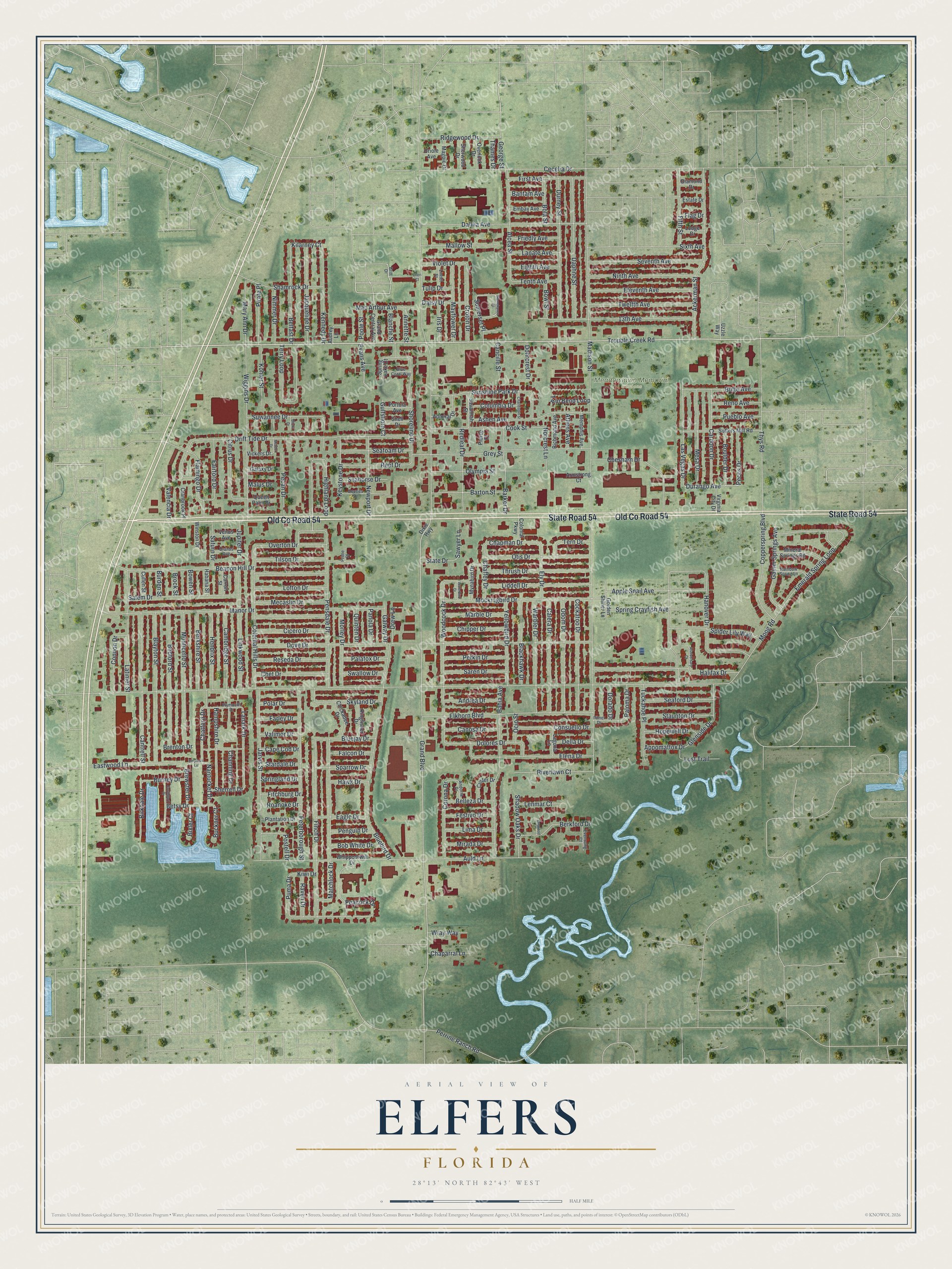
Elfers, Florida Map Art
Building by building, with labeled streets and shaded relief.
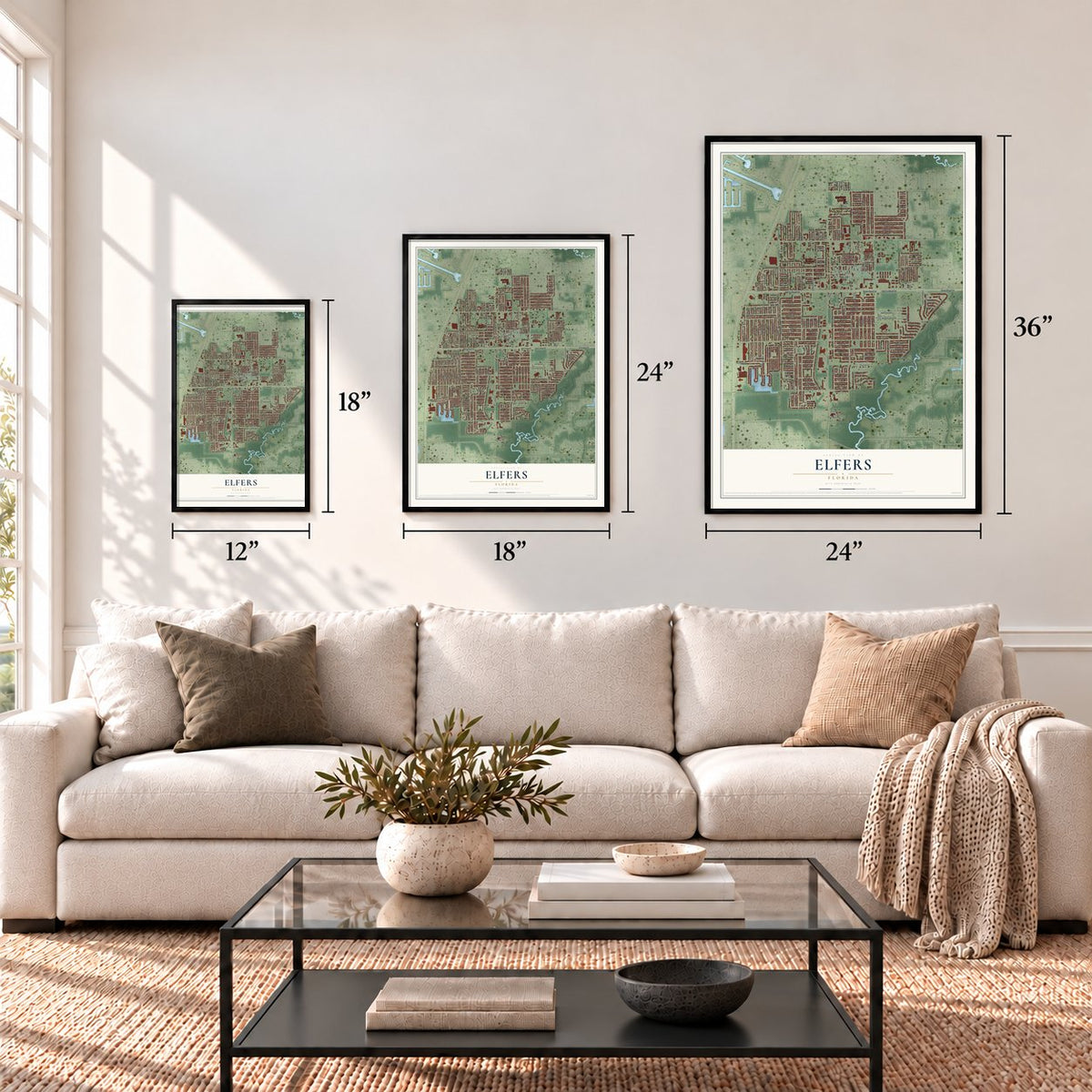
12" x 18" Archival Matte Print
A Map of Home. A Work of Art.
Explore Elfers, Florida from a whole new perspective. Created using aerial imagery and detailed geographic data, this map captures Elfers building by building, with labeled streets, familiar landmarks, and shaded topographical relief that highlights the natural contours of the landscape.
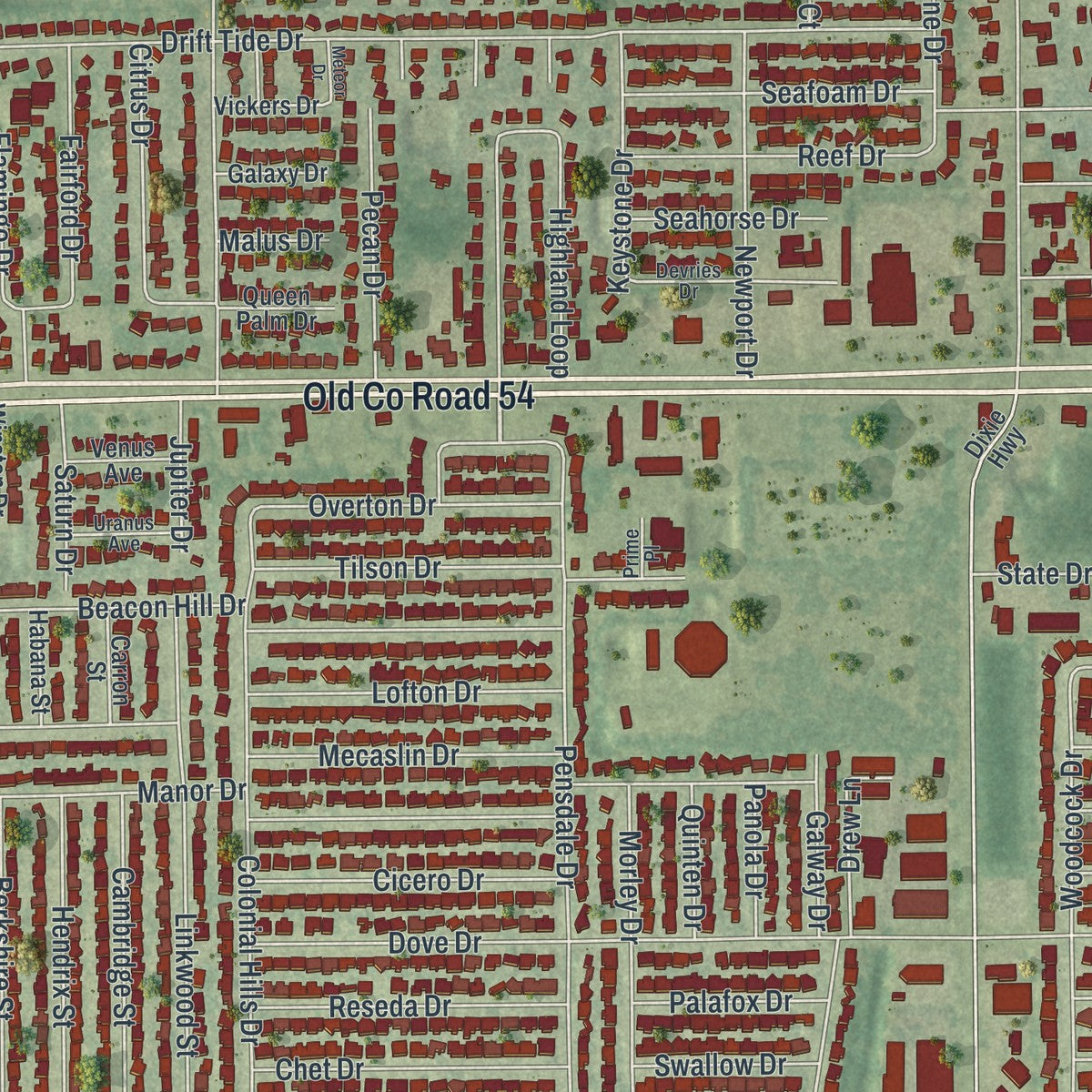
Combining modern data with the timeless character of a vintage atlas, this map is just as interesting up close as it is beautiful on the wall. Whether you grew up in Elfers, spent memorable years there, or call it home today, this unique map is a great way to celebrate a place that means something to you. Zoom in on the preview to look for your street, and then order a print to put your memories on the wall.
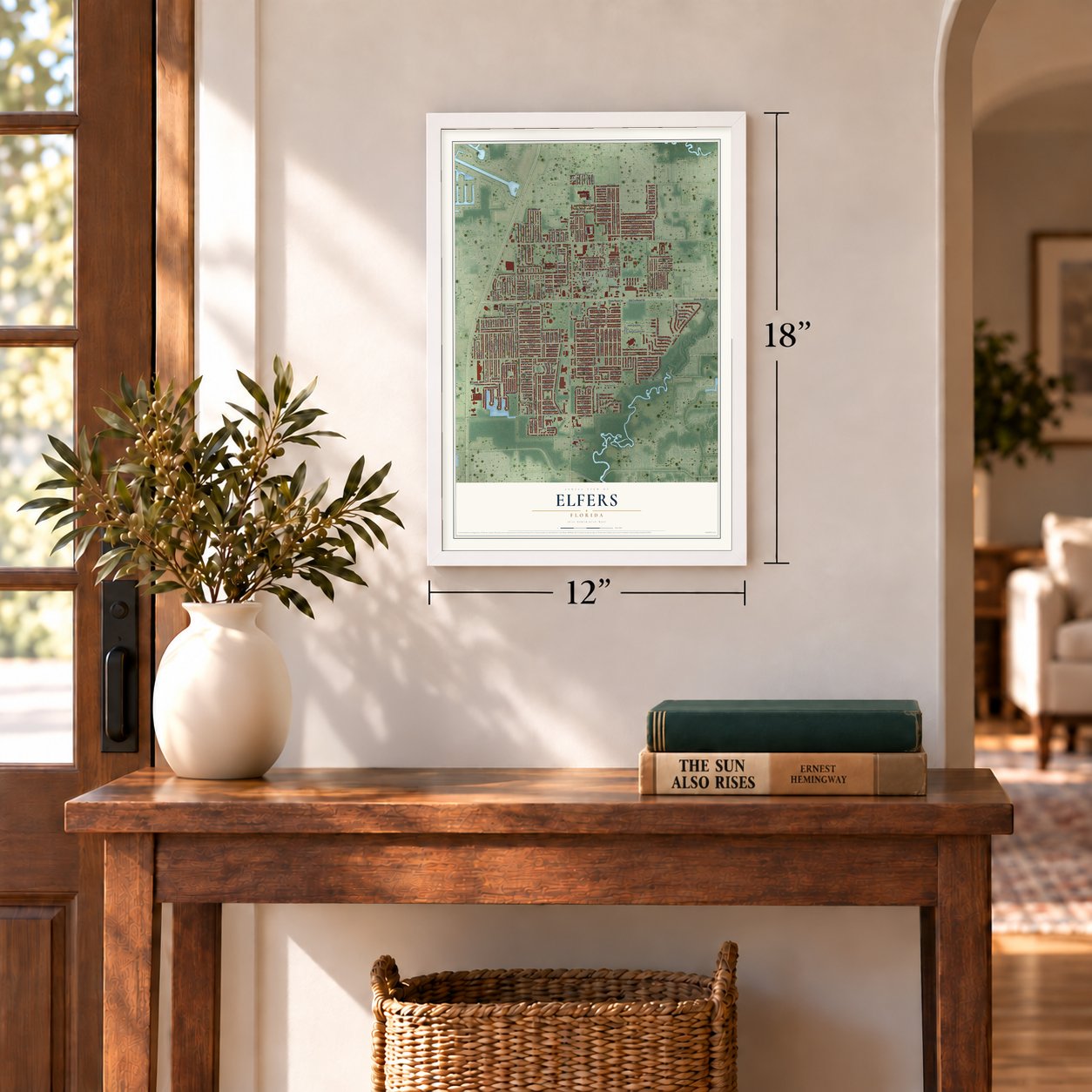
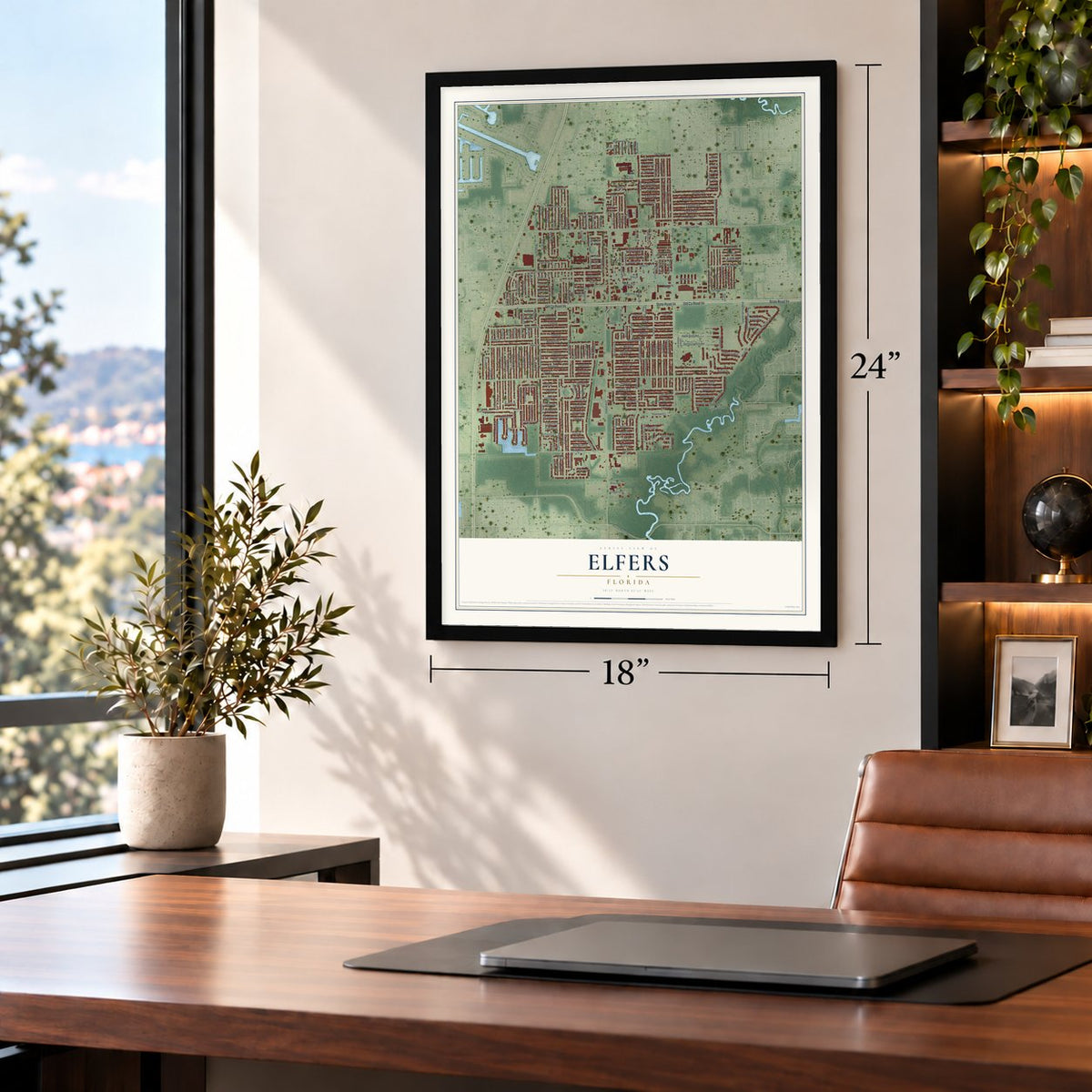
Three ways to hang it
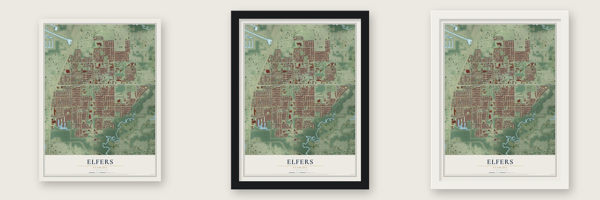
Unframed archival matte, a black wood frame or a white wood frame.
Up close
Geography Worth Displaying
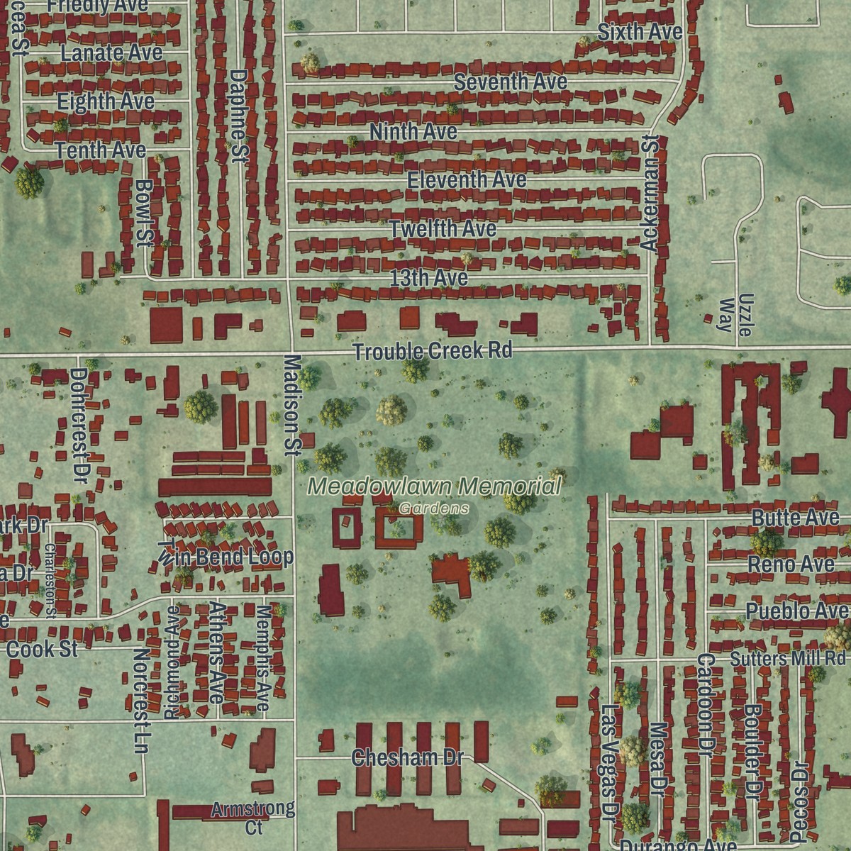
This map was created using accurate cartographic data and authoritative geographic sources, including the U.S. Geological Survey and the Census Bureau. The map brings together terrain, waterways, roads, and building detail. The majority of the streets are labeled, houses are accurately depicted, and the topography is derived from government sources. Combining local data with carefully composed color and shading leads to this beautifully detailed Elfers artwork for your wall.
Rather than simply showing street outlines, we’ve included as many of the street names as we could reasonably fit on the map while keeping their names legible. Zoom in on the high resolution preview to see exactly what’s on the map. We truly set out to create a statement piece for anyone who loves Elfers. So whether it’s for you, or a gift for someone you love, we hope this map of Elfers brings back fond memories.
Read the story behind this map of Elfers, Florida from 2026.

Find your street
Names on the Elfers map
Every name below is printed on this map. Look for your street, your school, the park where you played, or the pond down the road.
Places and landmarks1
- Meadowlawn Memorial Gardens
Streets and roads294
- Old County Road 54
- State Road 54
- Trouble Creek Road
- Evans Avenue
- Kilarney Court
- Pensdale Drive
- Durango Avenue
- Grand Boulevard
- Moog Road
- Madison Street
- Dove Drive
- Manor Drive
- Drift Tide Drive
- Hanover Drive
- Bluebird Drive
- Beacon Hill Drive
- Cecelia Drive
- Peacock Drive
- Woodcock Drive
- Finch Drive
- Emerald Spring Loop
- Grey Street
- Wiggins Drive
- Thys Road
- Ackerman Street
- Matchlock Drive
- Bahia Avenue
- Peterborough Street
- Jarvis Street
- Elkhorn Boulevard
Show all 294 streets
- Dahlia Avenue
- 13th Avenue
- Cantrell Street
- Blayton Street
- Halifax Drive
- Mockingbird Drive
- Colonial Hills Drive
- Daphne Street
- Durney Street
- Shoreline Drive
- Elena Drive
- Bedford Street
- Monticello Street
- Highland Loop
- Sunshine Park Drive
- Terry Loop
- Ashen Avenue
- Latimer Street
- Linkwood Street
- Auld Lane
- Seventh Avenue
- Olympia Street
- Chesham Drive
- Cook Street
- Cockatoo Drive
- Calera Drive
- Odom Drive
- Warbler Drive
- Alcea Street
- Copperspring Boulevard
- Salem Drive
- Perrine Ranch Road
- Ninth Avenue
- Otis Drive
- Twelfth Avenue
- Eleventh Avenue
- Thrush Drive
- Liddell Drive
- Las Vegas Drive
- Flamingo Drive
- Spring Crayfish Avenue
- Apple Snail Avenue
- Jacqueline Drive
- Kennedy Drive
- Tilson Drive
- Belfast Drive
- Mesa Drive
- Cardoon Drive
- Spider Lily Way
- Eastwood Lane
- Dolores Drive
- Suwannee Drive
- Twin Bend Loop
- Gainer Springs Avenue
- Barker Drive
- Yellowbird Drive
- Blackhawk Drive
- Redleaf Drive
- Lanark Drive
- Shamrock Drive
- Ridgewood Drive
- Corona Drive
- Hampshire Drive
- Cape Cod Drive
- Skyland Drive
- Newport Drive
- Mayflower Drive
- Riverlawn Court
- Cambridge Street
- Butte Avenue
- Morley Drive
- Berkshire Street
- First Avenue
- Croton Drive
- Hendrix Street
- Fifth Street
- Tuckahoe Place
- Consuello Drive
- Mallow Street
- Berkford Drive
- Chatford Drive
- Glenside Drive
- Citrus Drive
- Barton Street
- Mecaslin Drive
- Cicero Drive
- Lofton Drive
- Reseda Drive
- Chet Drive
- Seafoam Drive
- Overton Drive
- Reef Drive
- Fairford Drive
- Seaford Drive
- Connon Drive
- Staunton Drive
- Mary Ann Drive
- Perkin Drive
- Saren Drive
- Chipper Drive
- Marble Drive
- Shadow Oaks Drive
- Pecan Drive
- Kohler Street
- Pirate Place
- Keystone Drive
- Bluejay Drive
- Mac Arthur Avenue
- Ely Drive
- Nimmer Drive
- Andrea Drive
- Chaffey Drive
- Birkdale Drive
- Sparrow Drive
- Hopewell Drive
- Canosa Drive
- Boulder Drive
- Pecos Drive
- Chapman Drive
- Eagle Drive
- Bob White Drive
- Somerset Place
- Postell Drive
- Lost Trail
- Columbia Drive
- Reno Avenue
- Pueblo Avenue
- Mirada Drive
- Betsy Drive
- Friedly Avenue
- Eighth Avenue
- Lanate Avenue
- Lima Drive
- Festivo Drive
- Belleza Drive
- Tenth Avenue
- Tern Drive
- Seahorse Drive
- Drew Lane
- Daisy Drive
- Bola Street
- Palafox Drive
- Violet Drive
- Lenmar Court
- Burney Drive
- Chaparral Lane
- Falcon Drive
- Norcrest Lane
- Saturn Drive
- Swallow Drive
- Raven Drive
- Penguin Drive
- Galway Drive
- Sawyer Lane
- Brewster Drive
- Appomattox Drive
- Della Drive
- Puma Drive
- Nantucket Drive
- Channing Drive
- Valimor Drive
- Fitchburg Drive
- Polar Drive
- Farley Drive
- Roanoke Drive
- Springland Drive
- Stardale Drive
- Iris Drive
- Wray Way
- Hawk Drive
- Dohrcrest Drive
- Bowl Street
- State Drive
- Brenton Drive
- Gulfshore Court
- Athens Avenue
- Poole Street
- Quinten Drive
- Blanche Street
- Annette Street
- Panola Drive
- Dorado Drive
- Jupiter Drive
- Bantam Avenue
- Paloma Drive
- Cancille Street
- Buckner Court
- Sherrell Drive
- Thames Drive
- Sixth Avenue
- George Street
- Bixler Court
- Valencia Drive
- Tulip Drive
- Ocio Street
- Kiwi Drive
- Brock Street
- Bowen Street
- Burden Street
- Malus Drive
- Flag Drive
- Whippoorwill Drive
- Sutters Mill Road
- Chickadee Drive
- Mineral Springs Road
- Mynabird Drive
- Admiral Drive
- Plantation Drive
- Golden Shiner Lane
- Kingfisher Drive
- Memphis Avenue
- Richmond Avenue
- Grand Central Avenue
- Savannah Street
- Embay Avenue
- Custer Drive
- Spring Lake Court
- Cranbrook Place
- Sherwood Drive
- Overlook Drive
- Magpie Drive
- Audrey Lane
- Laguna Lane
- Colonial Parkway
- Virginia City Drive
- Shell Drive
- Portola Avenue
- Vickers Drive
- Habana Street
- Queen Palm Drive
- Armstrong Court
- Carron Street
- Cullen Street
- Venus Avenue
- Winston Drive
- Galaxy Drive
- Oriole Avenue
- Lodge Drive
- Diamond Drive
- Estate Drive
- Dixie Highway
- Pierce Court
- Uzzle Way
- Britt Drive
- Devries Drive
- Rainbow Spring Lane
- Plymouth Drive
- Pitner Drive
- Andorra Drive
- Blue Coral Way
- Evensong Court
- Uranus Avenue
- Linnet Street
- Prime Place
- Stonehaven Place
- Southport Drive
- Charleston Street
- Anniversary Court
- Empress Lane
- Waterbird Drive
- Evewood Court
- Meteor Drive
- Biloxi Drive
- Cheri Court
Names are listed as they appear on the printed map. Zoom into the product photos to find them.
About Elfers, Florida
Elfers is a community of 14,573 people in Pasco County, Florida. Native Americans once hunted on this ground, which they called Alafia. Samuel Hope surveyed the land in the 1840s, and over time the place went by Alfiers, The Neck and Sapling Woods before it became Elfers.
Settlers also knew it as the Baillie settlement until a post office opened on Dec. 14, 1909. Trains came in 1913 to haul away the area's citrus, and Elfers was an incorporated town from 1925 until 1933.
- Samuel Baker's house, about 1882Pioneer businessman Samuel Baker brought his family to Elfers in 1882. He built a house and planted an orange grove that eventually covered 70 acres. The Samuel Baker House is among the oldest buildings still standing in Pasco County.
- Blackboards for Baillie SchoolThe year the Bakers arrived, a school went up: Baillie School, in District 22. Samuel Baker sat as one of its trustees from 1887 to 1892, and he did business with it too, selling the school a cistern beside its building and blackboards he made himself.
- First brick school, 1915The Elfers School opened in 1915 as the first brick schoolhouse in western Pasco County. A newer building took over its classes in 1966. The old red brick school became the Elfers CARES Center, which reopened in 2013 with a cafe, an auditorium and New Port Richey's Avery Branch library.
Keep exploring Florida
Elfers is one of 1,049 Florida towns we've mapped. Every dot on the map is a print of its own.
The search covers every state, Florida first.
Near Elfers
Order 2 or more town maps and save 10%. Shown in the size and finish you picked above, so they hang as a set.
- Beacon Square 12" x 18" / Archival Matte Print $39.99
- New Port Richey 12" x 18" / Archival Matte Print $39.99
- Holiday 12" x 18" / Archival Matte Print $39.99


More maps nearby: Key Vista, Seven Springs, New Port Richey East, Port Richey and Anclote.
The art of mapping a place
How This Map Was Made
Real places. Remarkable detail. Discover the layers that turn geographic data into a map of home.

The view from above
Aerial imagery reveals the character of the land: woodland, open fields, and the patterns of a place.

The shape of the land
Elevation data brings hills, valleys, and subtle changes in the landscape into view.

The details of home
Roads, waterways, and building footprints come together to make the map feel unmistakably local.

Geography becomes art
Considered color, shading, and typography bring the layers together in a map made for your wall.


Process illustrated with Mendon, Massachusetts. Aerial imagery: USDA NAIP. Terrain: USGS 3D Elevation Program. Map details and finished artwork: KNOWOL.
The Details
About This Print
Choose an archival matte print, or a black or white Ayous wood frame. The archival matte print is unframed.
Select your size and finish above to see the matching product image and price.
Materials & Craftsmanship
A contemporary map with the character of a classic atlas, printed on archival matte paper. Optional frames are made from Ayous wood.
Your printed map does not include the watermark shown in the full-map preview.
Shipping & Delivery
Free shipping within the United States. Every print is made to order in the USA.
Buying a gift? Add a note in your cart and we'll include it. We never put prices in the package.
Prints ship within 2 to 3 business days. Allow 7 to 10 days total from ordering for delivery. Timing may vary during holidays or periods of high order volume.
Read our shipping policy.
Returns and damaged prints
Each print is made to order. Change-of-mind refunds are not available after production.
If your print arrives damaged, misprinted or incorrect, contact support@knowol.com within 30 days of receiving it. Include your order number, photos and a description of the issue.
Read our full refund and replacement policy. For questions about your order, email support@knowol.com.