
Search for another town





Free U.S. delivery 7 to 10 days after you order
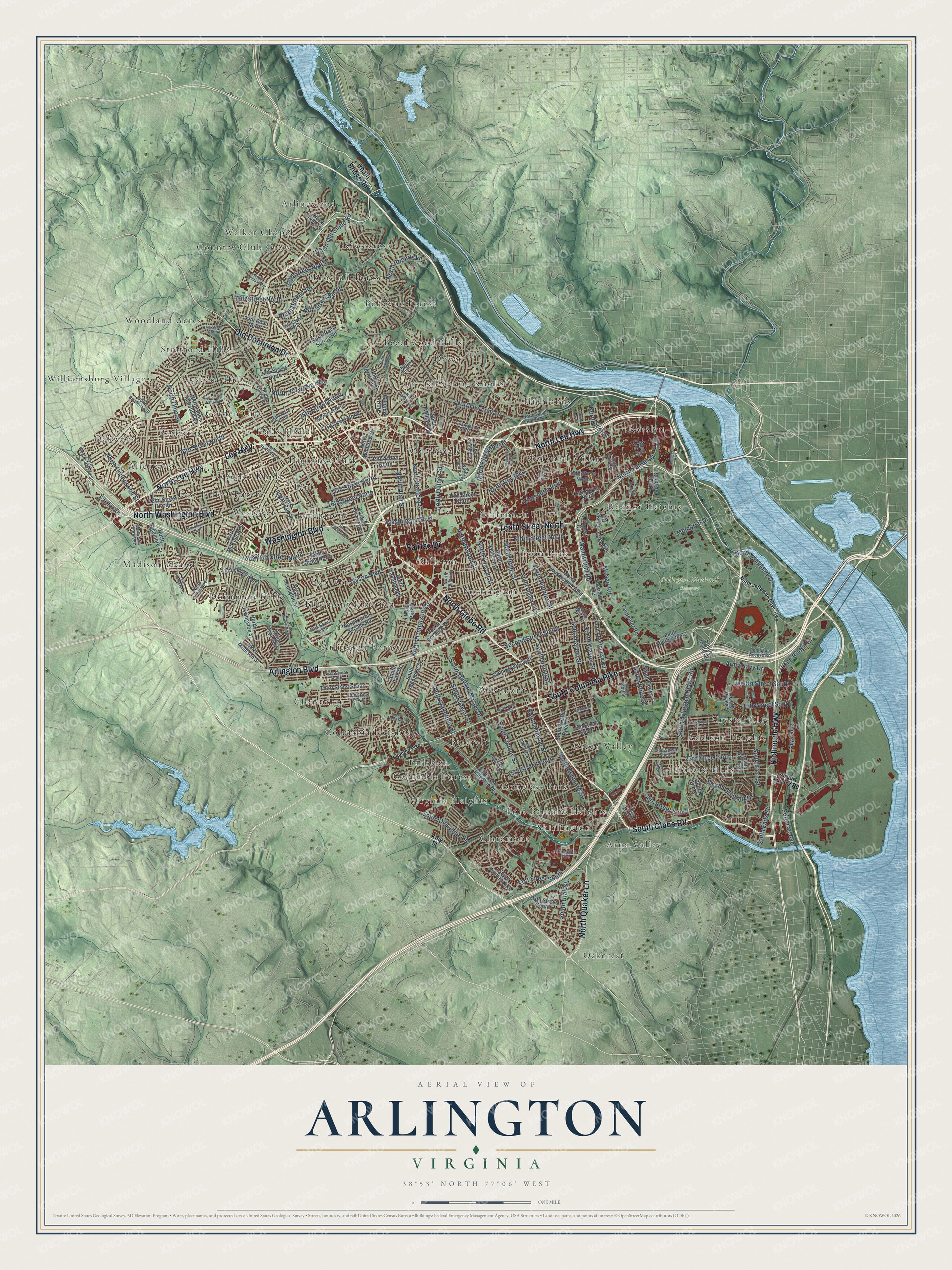
Arlington, Virginia Map Art
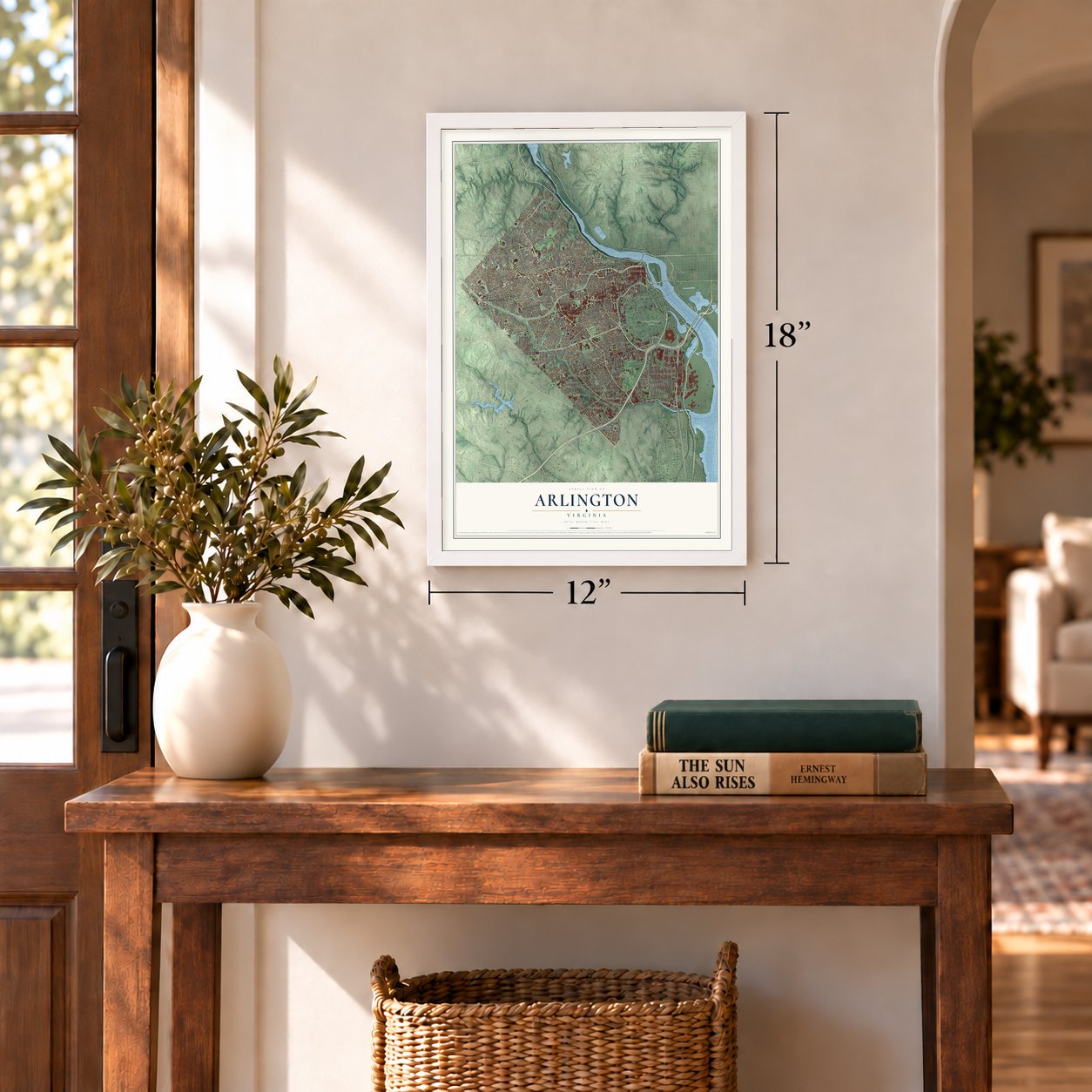
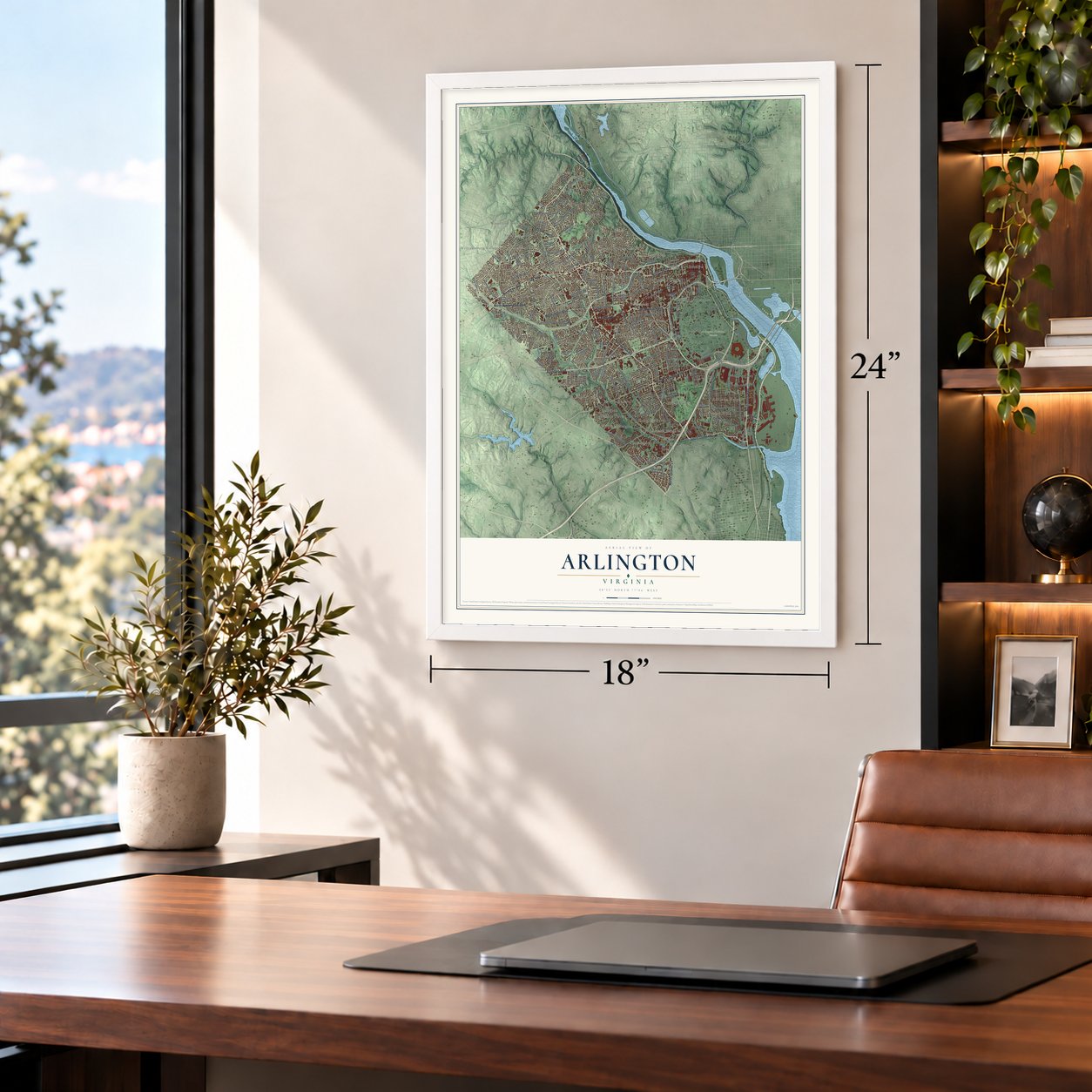
A new map of Arlington, Virginia, made in 2026 and printed to order on thick archival matte paper.
12" x 18" Archival Matte Print
A Map of Home. A Work of Art.
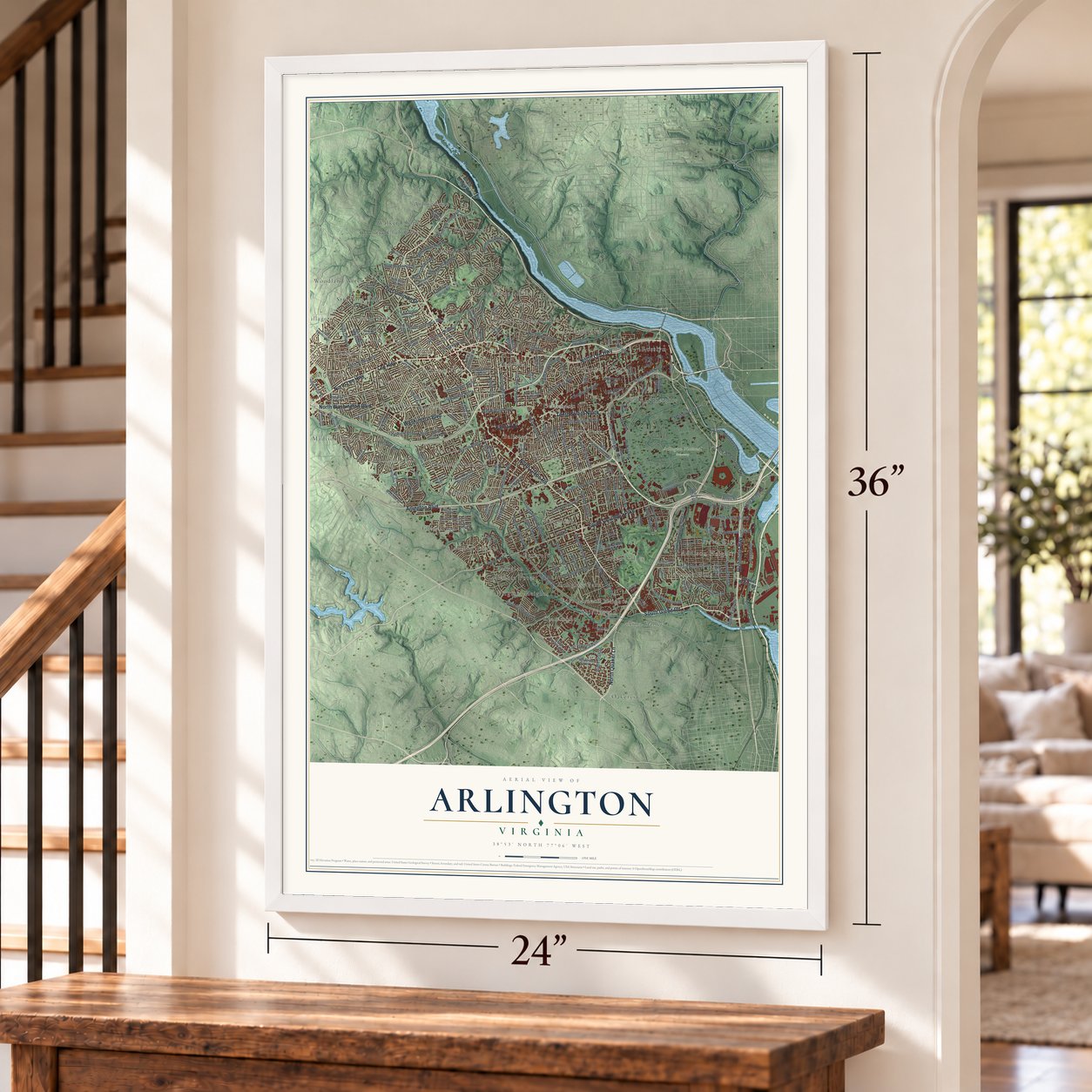
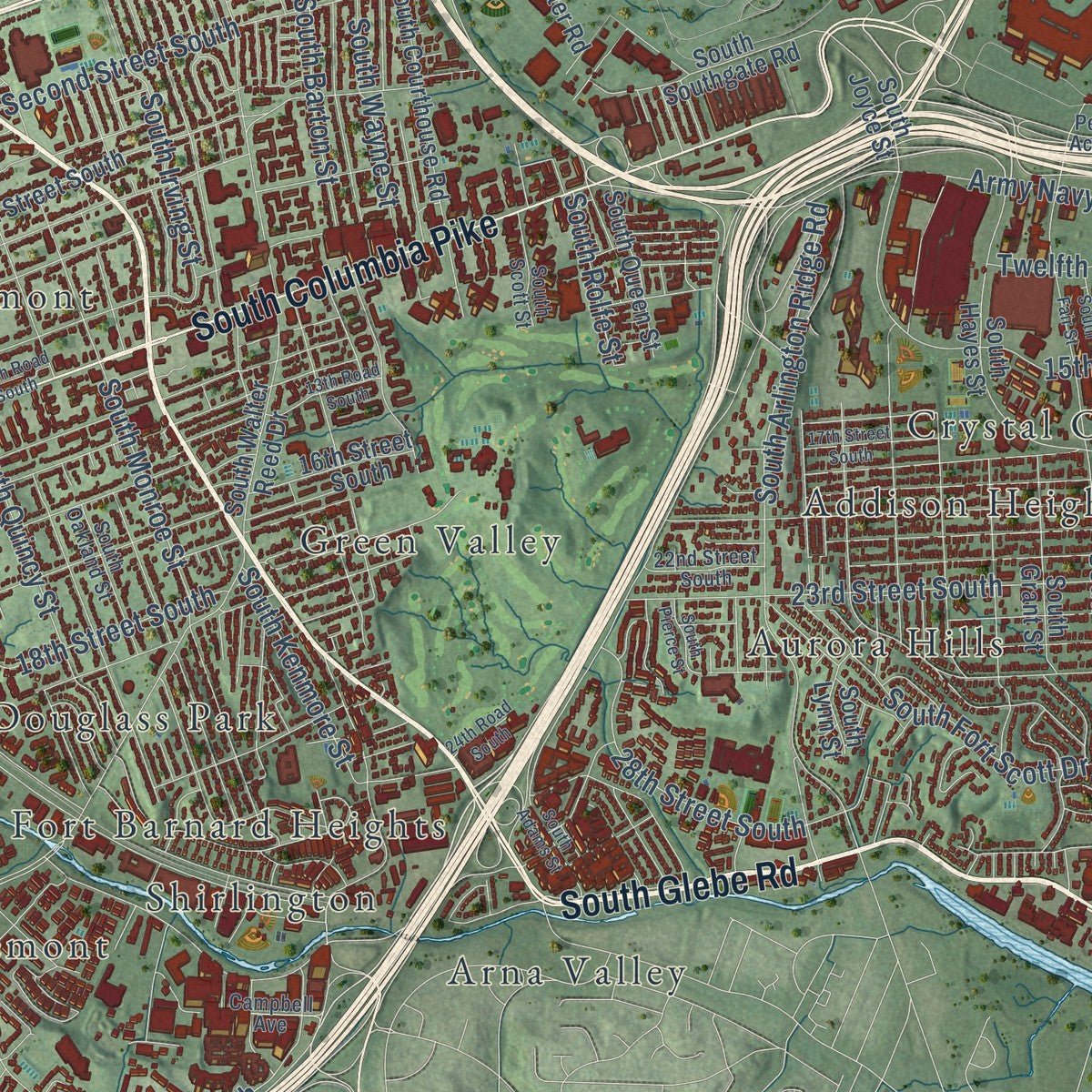
Explore Arlington, Virginia from a whole new perspective. Created using aerial imagery and detailed geographic data, this map captures Arlington building by building, with labeled streets, familiar landmarks, and shaded topographical relief that highlights the natural contours of the landscape.
Combining modern data with the timeless character of a vintage atlas, this map is just as interesting up close as it is beautiful on the wall. Whether you grew up in Arlington, spent memorable years there, or call it home today, this unique map is a great way to celebrate a place that means something to you. Zoom in on the preview to look for your street, and then order a print to put your memories on the wall.
Three ways to hang it
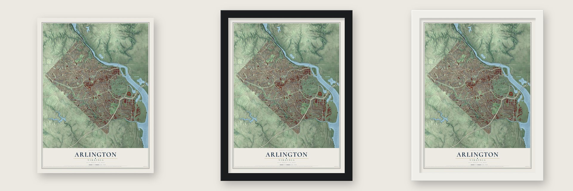
Unframed archival matte, a black wood frame or a white wood frame.
Up close
Geography Worth Displaying
This map was created using accurate cartographic data and authoritative geographic sources, including the U.S. Geological Survey and the Census Bureau. The map brings together terrain, waterways, roads, and building detail. The majority of the streets are labeled, houses are accurately depicted, and the topography is derived from government sources. Combining local data with carefully composed color and shading leads to this beautifully detailed Arlington artwork for your wall.
Rather than simply showing street outlines, we’ve included as many of the street names as we could reasonably fit on the map while keeping their names legible. Zoom in on the high resolution preview to see exactly what’s on the map. We truly set out to create a statement piece for anyone who loves Arlington. So whether it’s for you, or a gift for someone you love, we hope this map of Arlington brings back fond memories.
Read the story behind this map of Arlington, Virginia from 2026.

About Arlington, Virginia
Arlington, in Arlington County, is home to 238,643 people on the southwestern bank of the Potomac River, facing Washington, D.C. When John Smith arrived in 1608, the Nacotchtank people lived here, and he noted a town called Nameroughquena close to where the 14th Street bridges now stand. Trade, disease and war wore the Nacotchtank down, and by 1679 they had left and joined the Piscataway.
English settlers had arrived by the 1670s, and the land became part of Fairfax County in 1742. After independence, Virginia gave this ground to help create the nation's capital, and crews began setting boundary stones on April 15, 1791. From 1801 it was called Alexandria County, until pressure from the city of Alexandria returned it to Virginia in 1847. Clarendon became the county seat in 1898, and in 1920 the county took the name Arlington.
- The first mansion by 1746On November 13, 1669, John Alexander purchased the Howson Patent, which had belonged to Captain Robert Howson, and by 1677 tenants were living on the land. By 1746 his grandson Gerard had established Abingdon Plantation, whose house was the first mansion in the Arlington area.
- Arlington Plantation, 1802George Washington Parke Custis started Arlington Plantation in 1802 with land and enslaved people he inherited from John Parke Custis, the stepson of George Washington. Of the 200 enslaved people in that inheritance, 63 built and kept up the plantation.
- A national cemetery since 1864Arlington National Cemetery was established in 1864, and it now holds the graves of more than 400,000 people who served in the U.S. Armed Forces. The Tomb of the Unknown Soldier draws thousands of visitors every year, and the Marine Corps War Memorial and the Air Force Memorial also stand in Arlington.
- Virginia's first to desegregateVirginia's massive resistance campaign fought school integration, but Arlington became the first county in the state to desegregate its schools, in 1959. A series of sit-in protests followed, and its businesses desegregated in 1960.
Find your street
Names on the Arlington map
Every name below is printed on this map. Look for your street, your school, the park where you played, or the pond down the road.
Places and landmarks56
- Arlington National Cemetery
- Addison Heights
- Allencrest
- Arlington Forest
- Arlingwood
- Arna Valley
- Aurora Hills
- Ballston
- Barcroft
- Beechwood Hills
- Bellevue Forest
- Berkshire
Show all 56 places
- Bluemont Junction
- Bon Air
- Broyhill Forest
- Buckingham
- Cherrydale
- Claremont
- Clarendon
- Colonial Village
- Columbia Forest
- Columbia Heights
- Country Club Grove
- Crescent Hills
- Crystal City
- Crystal Spring Knolls
- Dominion Hills
- Douglass Park
- Dover
- East Falls Church
- Fort Barnard Heights
- Garden City
- Glencarlyn
- Green Valley
- Halls Hill
- Highlands
- Highview Park
- Larchmont
- Lyon Park
- Madison Manor
- Oakcrest
- Oakwood
- Overlee Knolls
- Parkglen
- Radnor Heights
- Rivercrest
- Rosslyn
- Shirlington
- Stratford Hills
- Tara
- Virginia Heights
- Walker Chapel
- Westmont
- Westover
- Williamsburg Village
- Woodland Acres
Streets and roads180
- North Glebe Road
- Arlington Boulevard
- South Glebe Road
- North Lee Highway
- Lee Highway
- Old Dominion Drive
- North Washington Boulevard
- Washington Boulevard
- Fairfax Drive
- Richmond Highway
- Tenth Street North
- North Quaker Lane
- South Columbia Pike
- Lee Avenue
- North Quincy Street
- Wainwright Road
- North Boundary Drive
- North Irving Street
- South George Mason Drive
- South Irving Street
- Long Bridge Drive
- Wilson Boulevard
- 26th Street North
- 25th Street North
- 16th Street North
- North Nelson Street
- Army Navy Drive
- 17th Street North
- Eleventh Street North
- Twelfth Street South
Show all 180 streets
- Ninth Street North
- 18th Street South
- North Fillmore Street
- 23rd Street South
- North Stafford Street
- 35th Street North
- South Eads Street
- Second Street South
- North Ohio Street
- 36th Street North
- North Utah Street
- North Lincoln Street
- South Quincy Street
- South Monroe Street
- North Lorcom Lane
- South Arlington Ridge Road
- Clarendon Boulevard
- South Fern Street
- South Wakefield Street
- North Key Boulevard
- 28th Street South
- Crystal Drive
- North Fairfax Drive
- North Yorktown Boulevard
- 31st Street South
- South Taylor Street
- 38th Street North
- South Barton Street
- 15th Street South
- Potomac Avenue
- South Dinwiddie Street
- North Dittmar Road
- McNair Road
- North Kirkwood Road
- South Fort Scott Drive
- North Underwood Street
- South Wayne Street
- North Henderson Road
- North Scott Street
- South Utah Street
- North Old Glebe Road
- South Rolfe Street
- North Roberts Lane
- South Kenmore Street
- Memorial Drive
- Chain Bridge Road
- North Meade Street
- North Sycamore Street
- Custer Road
- North Park Drive
- South Four Mile Run Drive
- South Walter Reed Drive
- 22nd Street North
- 19th Street North
- North Vermont Street
- 15th Street North
- North Military Road
- North Wakefield Street
- 14th Street North
- 23rd Street North
- Sixth Street South
- North Pershing Drive
- 13th Street North
- South Buchanan Street
- North Lexington Street
- South Joyce Street
- North Highland Street
- North Jackson Street
- North Madison Street
- 16th Street South
- South Hayes Street
- North Carlin Springs Road
- North John Marshall Drive
- 30th Street North
- South Abingdon Street
- Third Street South
- North Inglewood Street
- South Lynn Street
- North Woodrow Street
- South Grant Street
- North Rock Spring Road
- South Courthouse Road
- North McKinley Road
- Sheridan Avenue
- North Livingston Street
- Tenth Road North
- North Upton Street
- South Queen Street
- North Oak Street
- 34th Road North
- Carpenter Road
- South Southgate Road
- 34th Street South
- Forrest Circle
- South Park Drive
- North River Street
- King Street
- Airport Access Road
- 24th Street North
- North Powhatan Street
- North Harrison Street
- North Edison Street
- North Monroe Street
- 22nd Street South
- North Pollard Street
- North Buchanan Street
- Fifth Street North
- North Spout Run Parkway
- North Kenmore Street
- South Oakland Street
- Fifth Street South
- North Potomac Street
- Pentagon Access Road
- First Street South
- North Stuart Street
- 34th Street North
- North Quinn Street
- North Westmoreland Street
- North Montague Street
- South Scott Street
- 25th Place North
- Campbell Avenue
- North Van Buren Street
- 21st Avenue North
- South Wise Street
- North Jefferson Davis Highway
- Columbia Pike
- North Fort Myer Drive
- North Little Falls Road
- 18th Street North
- 37th Street North
- South Stafford Street
- North Vacation Lane
- North Albemarle Street
- North Manchester Street
- 13th Road South
- South Adams Street
- Seventh Road South
- 17th Street South
- North Troy Street
- North Rochester Street
- North Bryan Street
- 24th Road South
- North Lynn Street
- North Upshur Street
- South Pierce Street
- North Evergreen Street
- Ninth Road South
- North Harvard Street
- South Fair Street
Names are listed as they appear on the printed map. Zoom into the product photos to find them.
The art of mapping a place
How This Map Was Made
Real places. Remarkable detail. Discover the layers that turn geographic data into a map of home.

The view from above
Aerial imagery reveals the character of the land: woodland, open fields, and the patterns of a place.

The shape of the land
Elevation data brings hills, valleys, and subtle changes in the landscape into view.

The details of home
Roads, waterways, and building footprints come together to make the map feel unmistakably local.

Geography becomes art
Considered color, shading, and typography bring the layers together in a map made for your wall.


Process illustrated with Mendon, Massachusetts. Aerial imagery: USDA NAIP. Terrain: USGS 3D Elevation Program. Map details and finished artwork: KNOWOL.
The Details
About This Print
Choose an archival matte print, or a black or white Ayous wood frame. The archival matte print is unframed.
Select your size and finish above to see the matching product image and price.
Materials & Craftsmanship
A contemporary map with the character of a classic atlas, printed on archival matte paper. Optional frames are made from Ayous wood.
Your printed map does not include the watermark shown in the full-map preview.
Shipping & Delivery
Free shipping within the United States. Every print is made to order in the USA.
Buying a gift? Add a note in your cart and we'll include it. We never put prices in the package.
Prints ship within 2 to 3 business days. Allow 7 to 10 days total from ordering for delivery. Timing may vary during holidays or periods of high order volume.
Read our shipping policy.
Returns and damaged prints
Each print is made to order. Change-of-mind refunds are not available after production.
If your print arrives damaged, misprinted or incorrect, contact support@knowol.com within 30 days of receiving it. Include your order number, photos and a description of the issue.
Read our full refund and replacement policy. For questions about your order, email support@knowol.com.
Find your town
Looking for another city?
Find a map of home in our Virginia collection, or any town in the country.
Nearby
Maps of towns near Arlington
Know someone from one of these towns? Their map makes a great gift.
 Seven Corners
, Virginia
From $39.99See the map
 Bailey's Crossroads
, Virginia
From $39.99See the map
 Lake Barcroft
, Virginia
From $39.99See the map
More maps nearby: Falls Church, Alexandria, West Falls Church, Lincolnia and Idylwood.