
Search for another town




Free U.S. delivery 7 to 10 days after you order
Arvada, Colorado Map Art
A new map of Arvada, Colorado, made in 2026 and printed to order on thick archival matte paper.
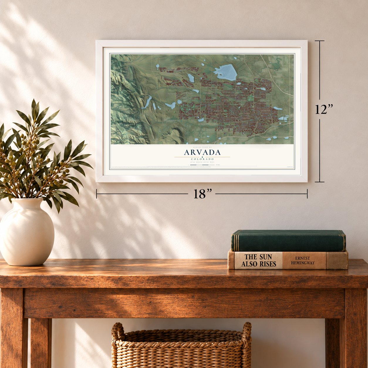
12" x 18" Archival Matte Print
A Map of Home. A Work of Art.
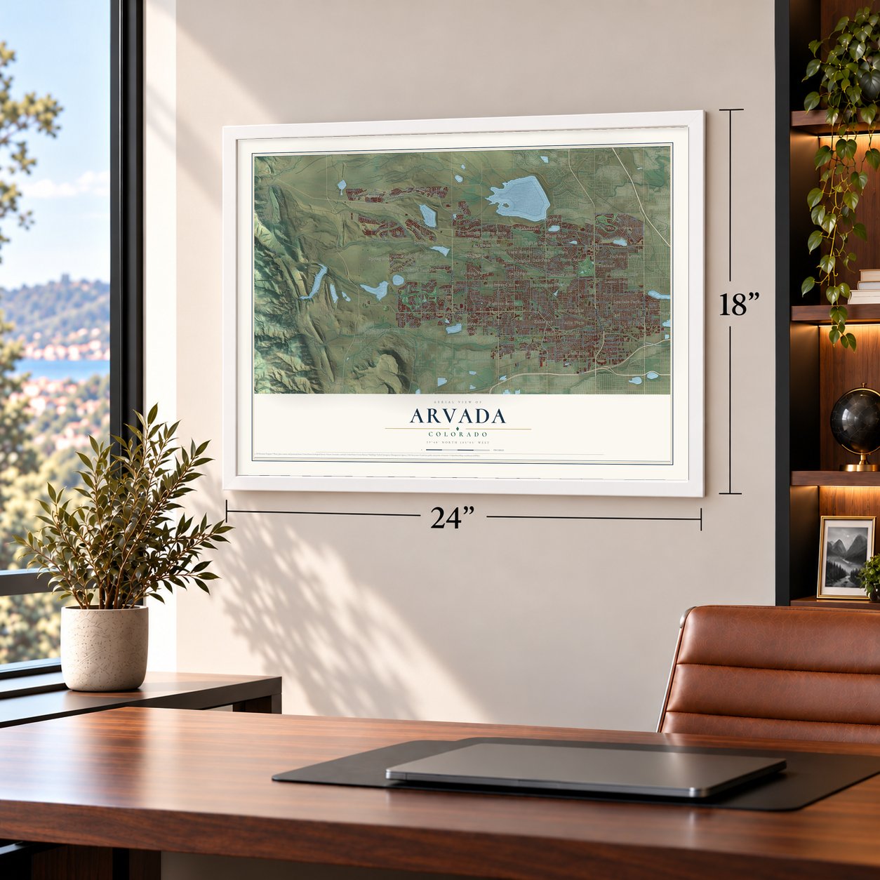
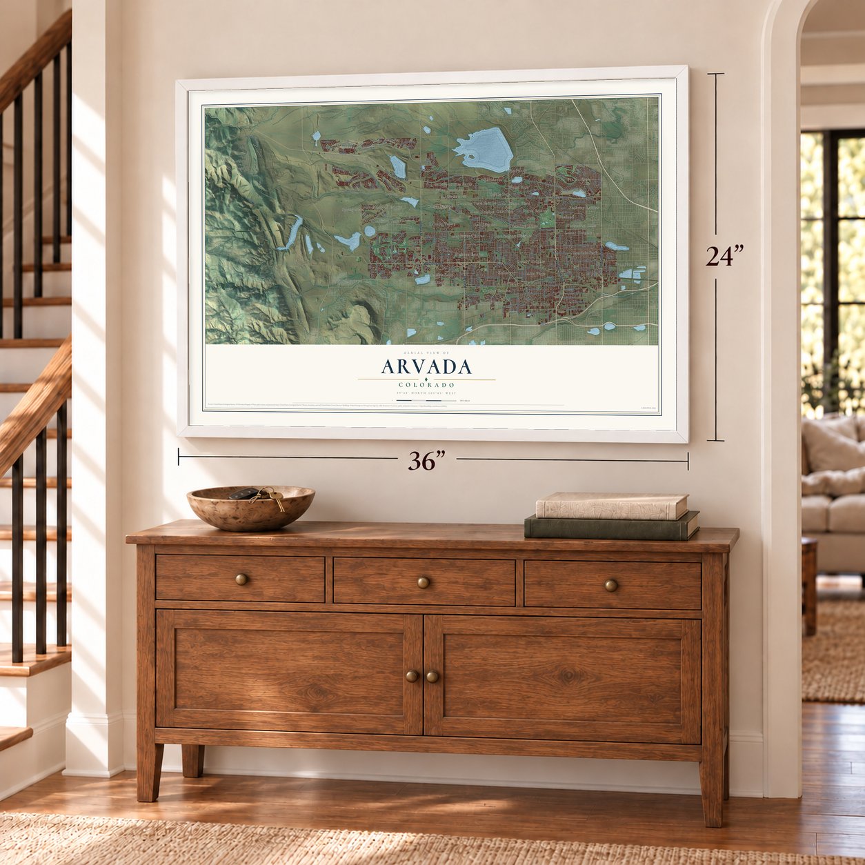
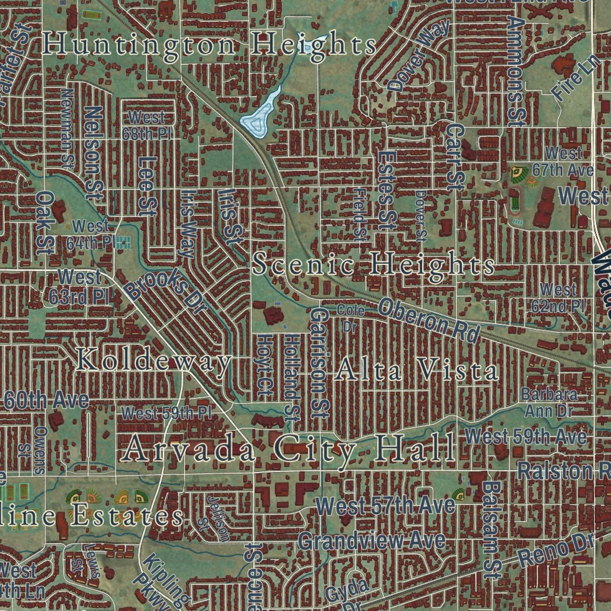
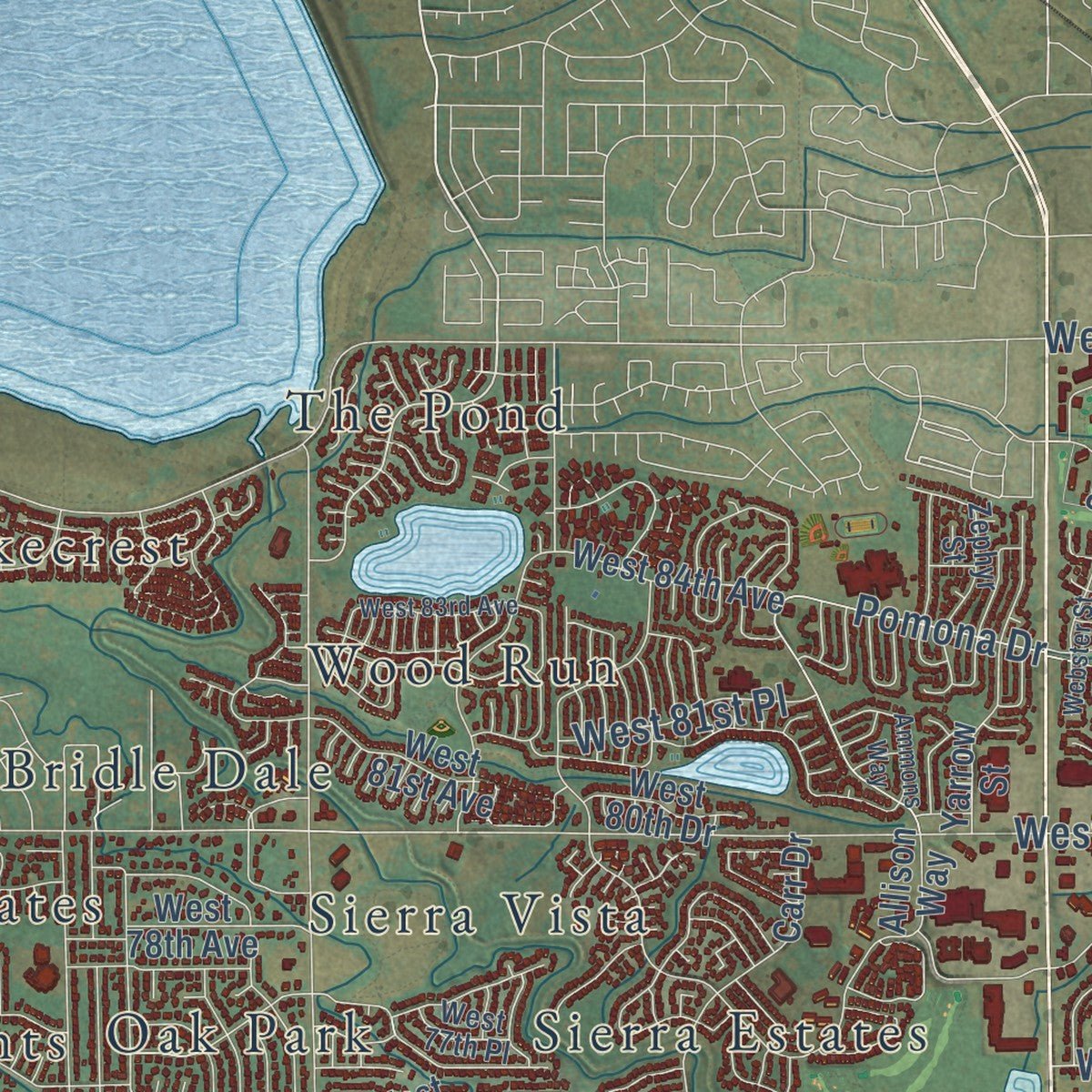
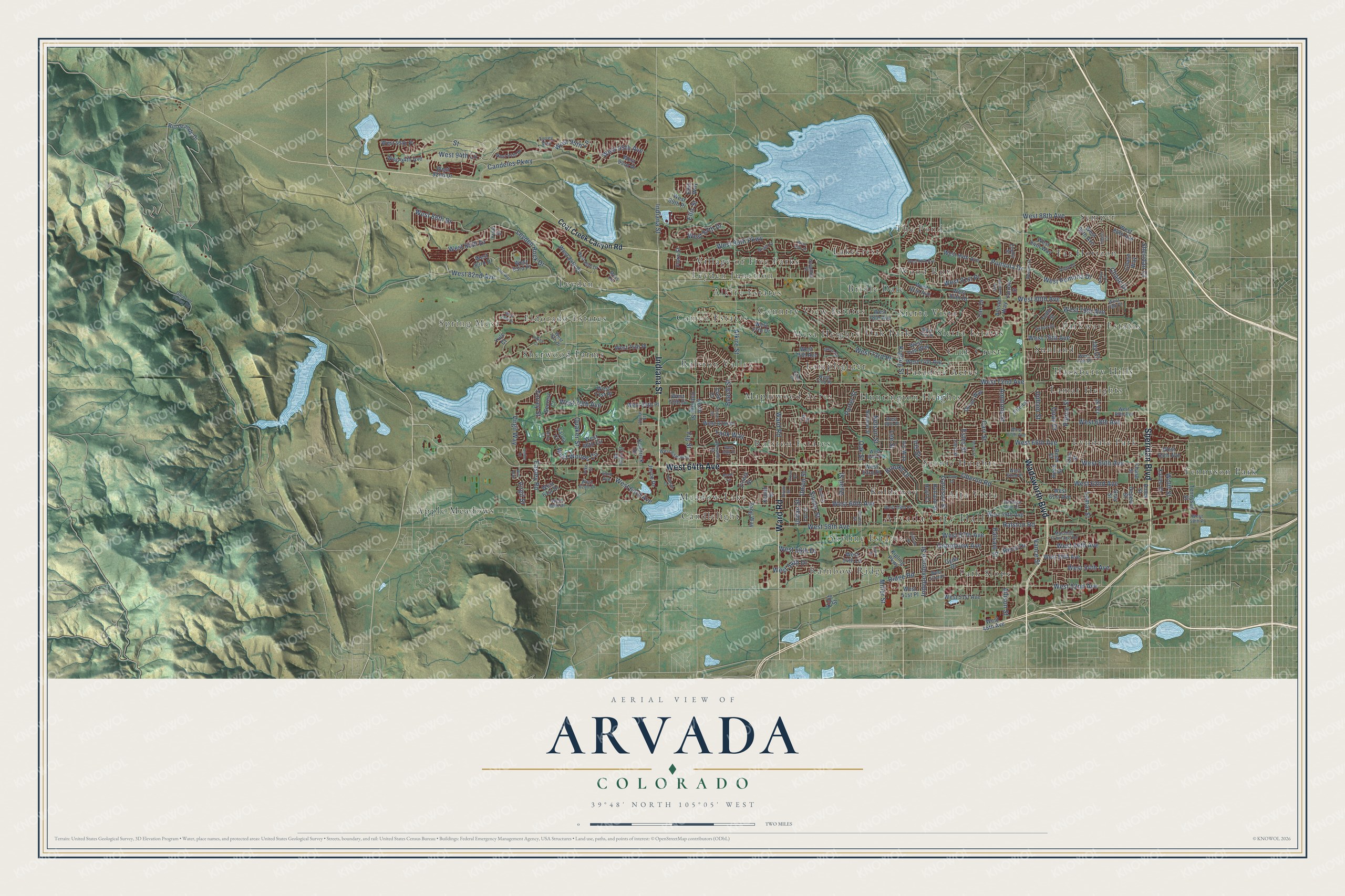
Explore Arvada, Colorado from a whole new perspective. Created using aerial imagery and detailed geographic data, this map captures Arvada building by building, with labeled streets, familiar landmarks, and shaded topographical relief that highlights the natural contours of the landscape.
Combining modern data with the timeless character of a vintage atlas, this map is just as interesting up close as it is beautiful on the wall. Whether you grew up in Arvada, spent memorable years there, or call it home today, this unique map is a great way to celebrate a place that means something to you. Zoom in on the preview to look for your street, and then order a print to put your memories on the wall.
Three ways to hang it
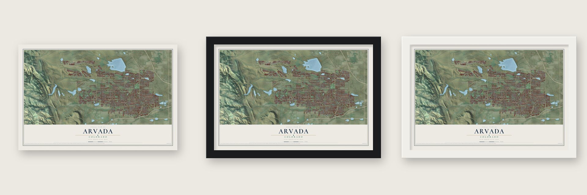
Unframed archival matte, a black wood frame or a white wood frame.
Up close
Geography Worth Displaying
This map was created using accurate cartographic data and authoritative geographic sources, including the U.S. Geological Survey and the Census Bureau. The map brings together terrain, waterways, roads, and building detail. The majority of the streets are labeled, houses are accurately depicted, and the topography is derived from government sources. Combining local data with carefully composed color and shading leads to this beautifully detailed Arvada artwork for your wall.
Rather than simply showing street outlines, we’ve included as many of the street names as we could reasonably fit on the map while keeping their names legible. Zoom in on the high resolution preview to see exactly what’s on the map. We truly set out to create a statement piece for anyone who loves Arvada. So whether it’s for you, or a gift for someone you love, we hope this map of Arvada brings back fond memories.
Read the story behind this map of Arvada, Colorado from 2026.

About Arvada, Colorado
Arvada is a city of 124,402 people, most of them in Jefferson County and the rest in Adams County. On June 22, 1850, Lewis Ralston, a prospector from Georgia bound for California, dipped his pan into a little stream close to Clear Creek and found gold worth about five dollars. His companions weren't impressed and moved on the next morning, and after a few more days of panning Ralston followed them. He returned in 1858 with a new party, and some of its members soon found gold farther up the South Platte River.
The loose gold soon gave out, and some miners turned to farming the bottom land along Ralston Creek and Clear Creek, selling their crops to other gold seekers. Benjamin F. Wadsworth claimed a 160-acre homestead on Clear Creek in 1860 and began digging an irrigation ditch the next year. After the Colorado Central Railroad laid track through in the summer of 1870, Wadsworth teamed up with Louis A. Reno, and on December 1, 1870, the two men laid out a townsite they called Ralston Point. Because other places along Ralston Creek shared that name, it soon became Arvada, for Hiram Arvada Haskin, Mary Wadsworth's brother-in-law. The town incorporated on August 14, 1904.
- Celery Capital of the WorldFarms spread across the valley to feed the growing region, and in time 42 irrigation ditches watered them. Arvada became a major source of produce and dairy goods, and in the first half of the twentieth century its Pascal celery grew so famous that special shipments went to the White House. The town called itself the Celery Capital of the World until labor shortages during World War II cut the harvest.
- Colorado's first supermarketAfter World War II, Arvada grew quickly as a suburb of Denver. Lloyd J. King opened Colorado's first supermarket here in 1947, at West 57th Avenue and Webster Street downtown. The city took statutory status on October 31, 1951, then adopted home rule on July 23, 1963, and by the end of the millennium it had passed 100,000 people.
- Where Ralston found goldLewis Ralston's find was the first documented gold discovery in the Rocky Mountain region, and the creek that carries his name gave the settlement its first name. The spot where he panned now lies along Ralston Creek in the city's Gold Strike Park, and a nearby G line rail stop is called 60th & Sheridan/Arvada Gold Strike.
- First postmaster in 1871The Arvada post office opened on February 16, 1871, five years before Colorado became a state. Its first postmaster was Benjamin Wadsworth, the homesteader who had helped plat the townsite.
Find your street
Names on the Arvada map
Every name below is printed on this map. Look for your street, your school, the park where you played, or the pond down the road.
Places and landmarks42
- Arvada City Hall
- Spring Mesa
- Alkire Estates
- Alta Vista
- Apple Meadows
- Bridle Dale
- Cameo Estates
- Candlelight
- Club Crest
- Country View Estates
- Eldorado Estates
- Far Horizon
Show all 42 places
- Hackberry Hills
- Huntington Heights
- Koldeway
- Lakecrest
- Lamar Heights
- Lamplighter
- Leyden
- Leyden Junction
- Lyndale Park
- Maplewood Acres
- Meadow Lake
- Mesa Heights
- Oak Park
- Paradise Acres
- Park Slope
- Parkway Estates
- Rainbow Ridge
- Ralston Estates
- Ralston Valley
- Scenic Heights
- Semper
- Sherwood Farms
- Sierra Estates
- Sierra Vista
- Skyline Estates
- Sunland
- Tennyson Park
- The Pond
- Village of Five Parks
- Wood Run
Streets and roads218
- West 64th Avenue
- Sheridan Boulevard
- Indiana Street
- Ward Road
- Wadsworth Boulevard
- West 68th Avenue
- Ralston Road
- Kipling Street
- Independence Street
- Miller Street
- West 52nd Avenue
- West 95th Avenue
- West 87th Drive
- West 88th Drive
- West 94th Lane
- West 85th Drive
- West 82nd Avenue
- West 79th Avenue
- West 95th Lane
- Street
- West 63rd Avenue
- West 72nd Avenue
- Candeles Parkway
- West 80th Avenue
- West 58th Avenue
- West 60th Avenue
- West 66th Avenue
- West 62nd Avenue
- Simms Street
- West 70th Avenue
Show all 218 streets
- Pierce Street
- West 86th Parkway
- Carr Street
- Lamar Street
- Garrison Street
- Quail Street
- Oak Street
- Pomona Drive
- Grandview Avenue
- West 73rd Place
- Allison Street
- Oberon Road
- Parfet Street
- West Woods Circle
- Balsam Street
- Brooks Drive
- Alkire Street
- Quaker Street
- West 57th Avenue
- Estes Street
- Ridge Road
- West 76th Avenue
- West 54th Avenue
- Chase Drive
- Nelson Street
- Upham Street
- Vance Street
- Iris Street
- West Pomona Drive
- West 56th Avenue
- West 88th Avenue
- Urban Street
- Ammons Street
- Union Street
- West 81st Place
- Lee Street
- Yank Way
- Leyden Rock Drive
- Virgil Way
- Quay Court
- Fig Street
- Beech Street
- Reno Drive
- Torrey Street
- Wolff Street
- Ellis Street
- Jay Court
- Easley Road
- West 54th Drive
- West 56th Drive
- Sheridan Court
- Virgil Street
- Coal Creek Canyon Road
- West 77th Drive
- West 95th Place
- Kipling Parkway
- West 92nd Drive
- Yule Street
- West 86th Avenue
- West 75th Place
- Tennyson Street
- West 65th Avenue
- West 84th Avenue
- West 84th Place
- West 61st Avenue
- West 63rd Place
- West 69th Place
- West 59th Avenue
- West 74th Avenue
- West 71st Place
- West 67th Place
- West 75th Avenue
- Yarrow Street
- Reed Street
- West 81st Avenue
- Teller Street
- West 94th Avenue
- West 78th Avenue
- Otis Street
- Gray Street
- West 83rd Place
- Jay Street
- West 70th Drive
- West 55th Avenue
- Zinnia Street
- Depew Street
- West 75th Way
- West 51st Avenue
- West 85th Avenue
- Robb Street
- Carr Drive
- West 84th Way
- Iris Way
- Reed Court
- Chase Street
- West 83rd Drive
- Xenon Street
- West 93rd Place
- Dover Way
- West 66th Circle
- Cole Court
- Holland Street
- Rio Grande Drive
- West 61st Drive
- Allison Way
- West 80th Drive
- Xavier Court
- North Eldridge Street
- Hoyt Court
- Flora Street
- West 89th Place
- West 48th Avenue
- Zang Way
- Kendrick Drive
- Ames Street
- West 54th Lane
- Salvia Court
- Secrest Court
- Chase Way
- Fire Lane
- Ellis Way
- West 51st Place
- Joyce Drive
- Gyda Drive
- Yule Court
- West 69th Avenue
- West 67th Avenue
- West 62nd Place
- West 74th Place
- West 64th Place
- West 68th Place
- West 84th Drive
- West 72nd Place
- Field Street
- West 76th Drive
- West 77th Place
- Zephyr Street
- West 59th Place
- Owens Street
- West 58th Place
- Deframe Street
- Vance Drive
- West 94th Drive
- Newman Street
- West 53rd Place
- West 65th Way
- Taft Court
- Quay Drive
- West 62nd Drive
- West 79th Place
- Swadley Street
- Marshall Frontage Road
- Torrey Way
- Moss Circle
- Terry Court
- Barbara Ann Drive
- Glencoe Valley Road
- West 60th Drive
- Mc Intyre Street
- 63rd Avenue
- Pike Street
- Joyce Street
- Dover Street
- West 65th Place
- West 83rd Avenue
- West 85th Place
- West 78th Drive
- Urban Court
- Jellison Street
- Webster Street
- Vivian Street
- Lewis Street
- Routt Street
- Wright Street
- Coors Street
- Queen Circle
- Ingalls Circle
- Torrey Court
- Yule Way
- Braun Circle
- Ammons Way
- Umber Drive
- Holman Court
- Cole Drive
- Urban Drive
- Harlan Court
- Wier Way
- Taft Circle
Names are listed as they appear on the printed map. Zoom into the product photos to find them.
The art of mapping a place
How This Map Was Made
Real places. Remarkable detail. Discover the layers that turn geographic data into a map of home.

The view from above
Aerial imagery reveals the character of the land: woodland, open fields, and the patterns of a place.

The shape of the land
Elevation data brings hills, valleys, and subtle changes in the landscape into view.

The details of home
Roads, waterways, and building footprints come together to make the map feel unmistakably local.

Geography becomes art
Considered color, shading, and typography bring the layers together in a map made for your wall.


Process illustrated with Mendon, Massachusetts. Aerial imagery: USDA NAIP. Terrain: USGS 3D Elevation Program. Map details and finished artwork: KNOWOL.
The Details
About This Print
Choose an archival matte print, or a black or white Ayous wood frame. The archival matte print is unframed.
Select your size and finish above to see the matching product image and price.
Materials & Craftsmanship
A contemporary map with the character of a classic atlas, printed on archival matte paper. Optional frames are made from Ayous wood.
Your printed map does not include the watermark shown in the full-map preview.
Shipping & Delivery
Free shipping within the United States. Every print is made to order in the USA.
Buying a gift? Add a note in your cart and we'll include it. We never put prices in the package.
Prints ship within 2 to 3 business days. Allow 7 to 10 days total from ordering for delivery. Timing may vary during holidays or periods of high order volume.
Read our shipping policy.
Returns and damaged prints
Each print is made to order. Change-of-mind refunds are not available after production.
If your print arrives damaged, misprinted or incorrect, contact support@knowol.com within 30 days of receiving it. Include your order number, photos and a description of the issue.
Read our full refund and replacement policy. For questions about your order, email support@knowol.com.
Find your town
Looking for another city?
Find a map of home in our Colorado collection, or any town in the country.
Nearby
Maps of towns near Arvada
Know someone from one of these towns? Their map makes a great gift.
 Fairmount
, Colorado
From $39.99See the map
 Wheat Ridge
, Colorado
From $39.99See the map
 Westminster
, Colorado
From $39.99See the map
More maps nearby: Applewood, Shaw Heights, Lakeside, Mountain View and Berkley.