
Search for another town



Free U.S. delivery 7 to 10 days after you order
Westminster, Colorado Map Art
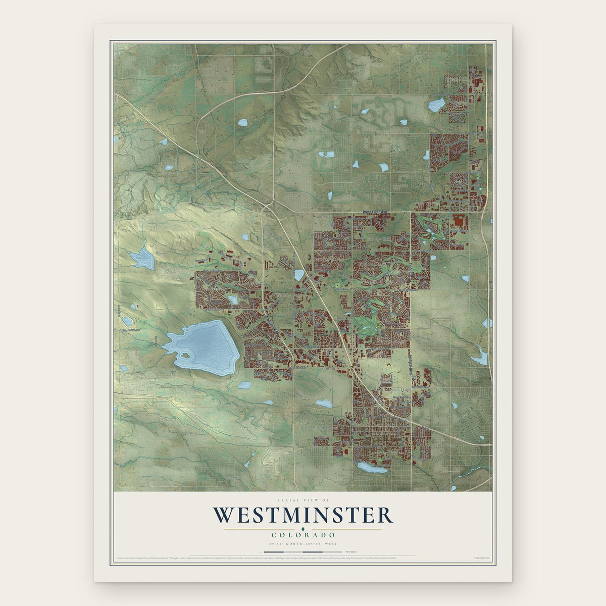
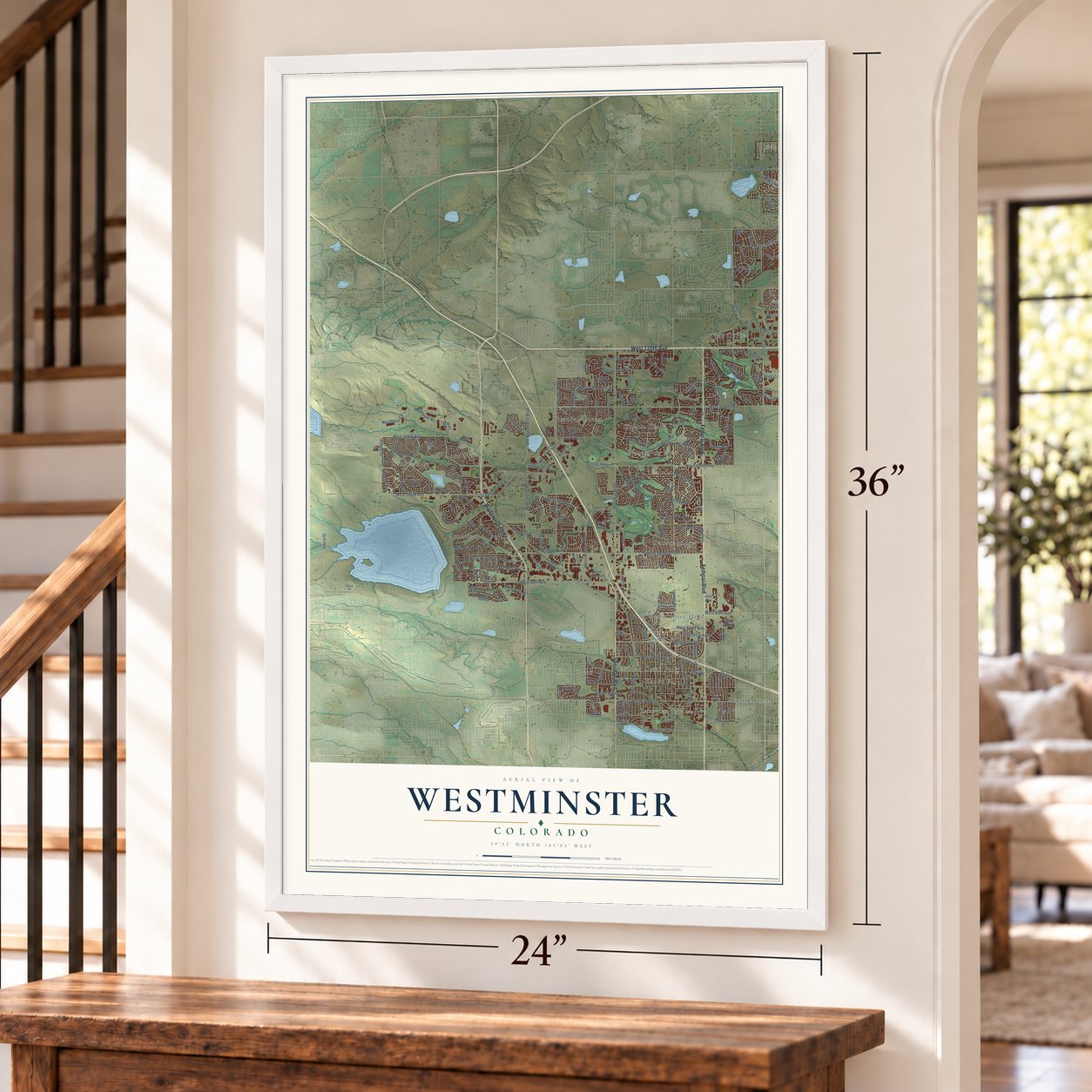
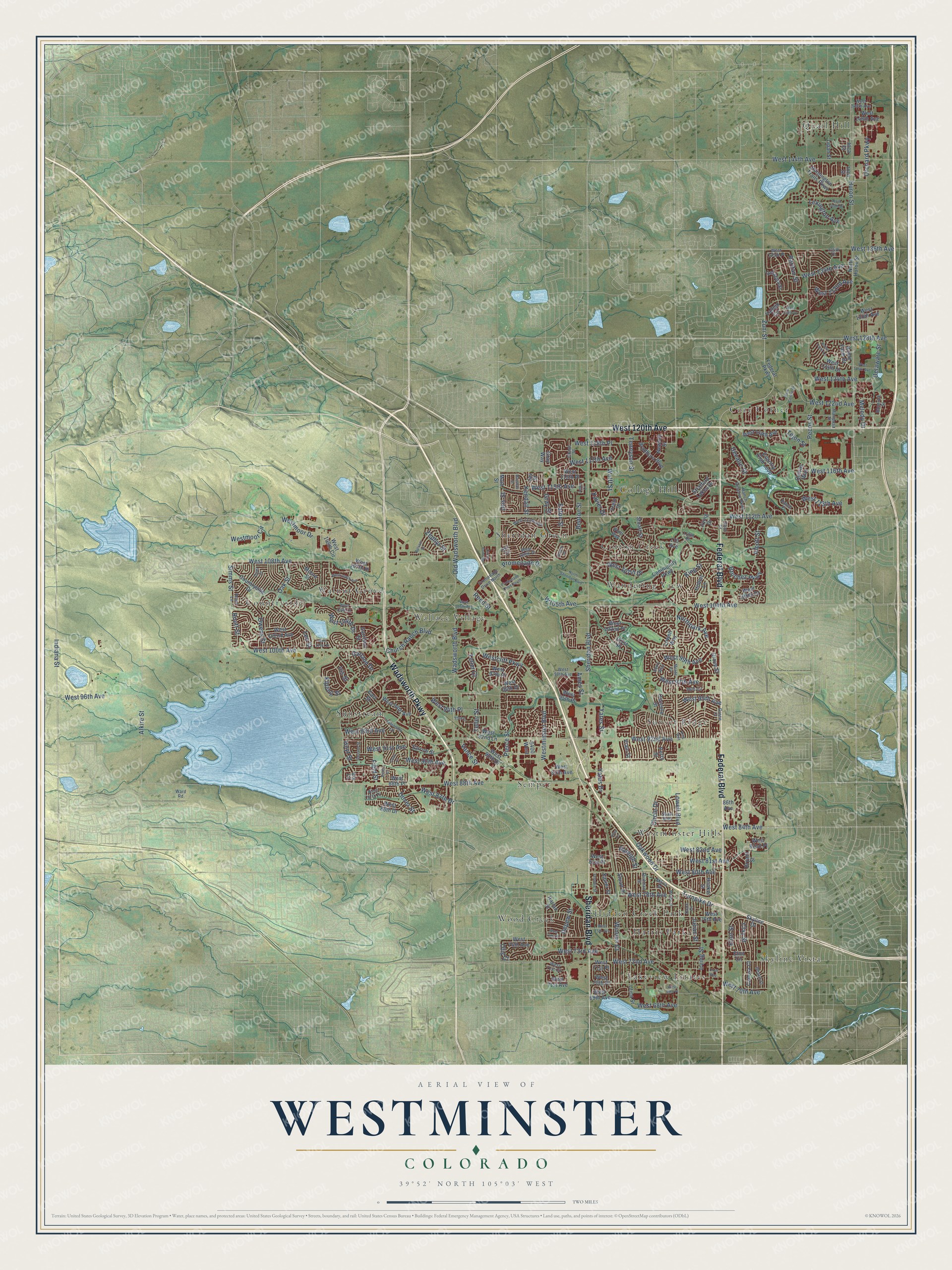
A new map of Westminster, Colorado, made in 2026 and printed to order on thick archival matte paper.
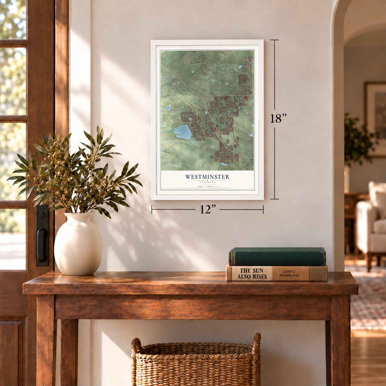
12" x 18" Archival Matte Print
A Map of Home. A Work of Art.
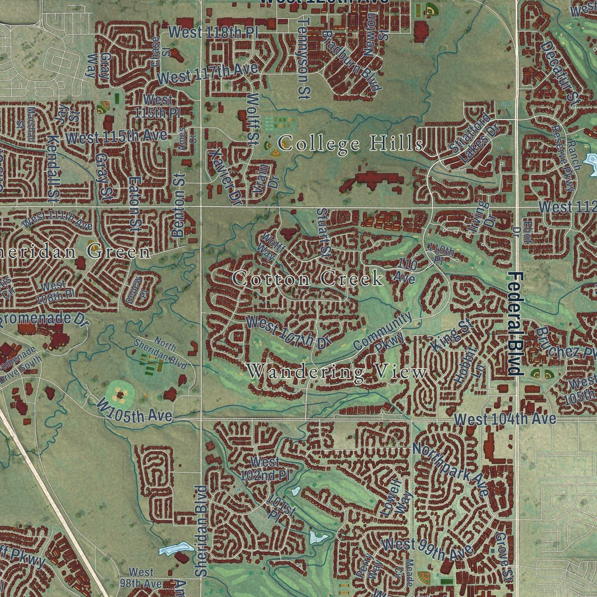
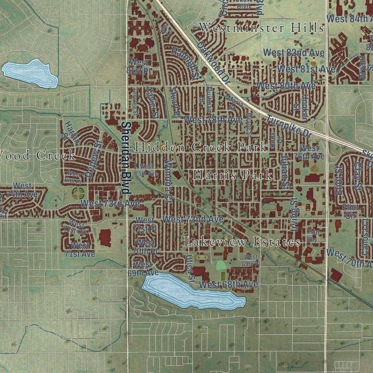
Explore Westminster, Colorado from a whole new perspective. Created using aerial imagery and detailed geographic data, this map captures Westminster building by building, with labeled streets, familiar landmarks, and shaded topographical relief that highlights the natural contours of the landscape.
Combining modern data with the timeless character of a vintage atlas, this map is just as interesting up close as it is beautiful on the wall. Whether you grew up in Westminster, spent memorable years there, or call it home today, this unique map is a great way to celebrate a place that means something to you. Zoom in on the preview to look for your street, and then order a print to put your memories on the wall.
Three ways to hang it
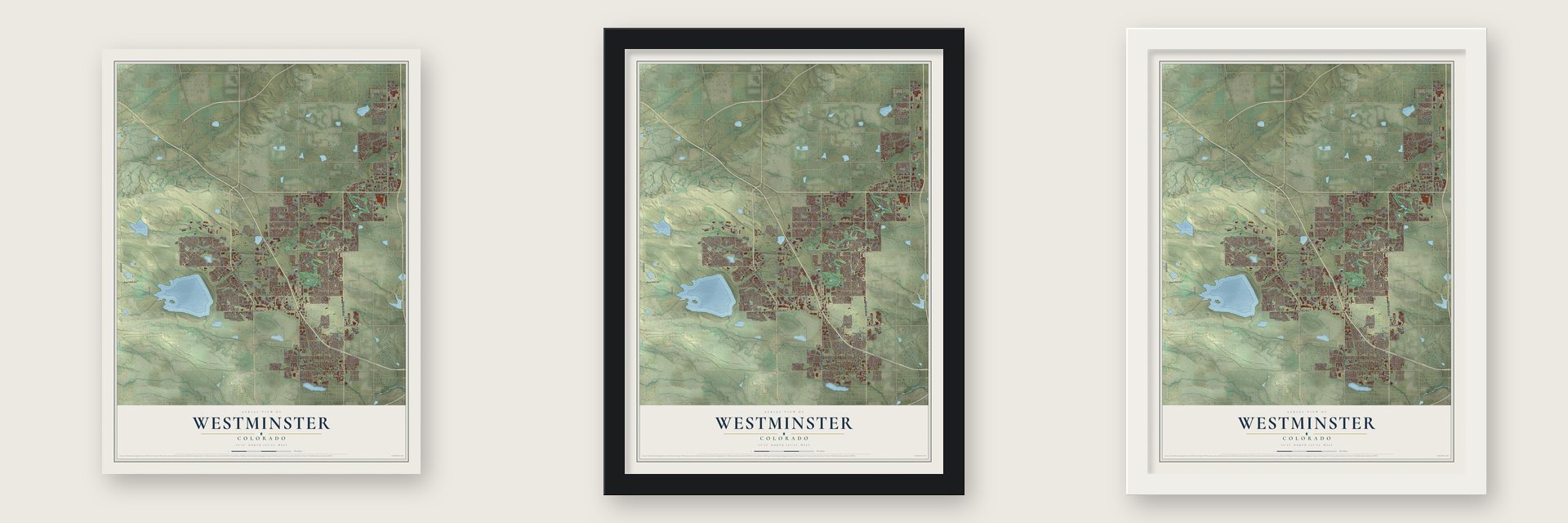
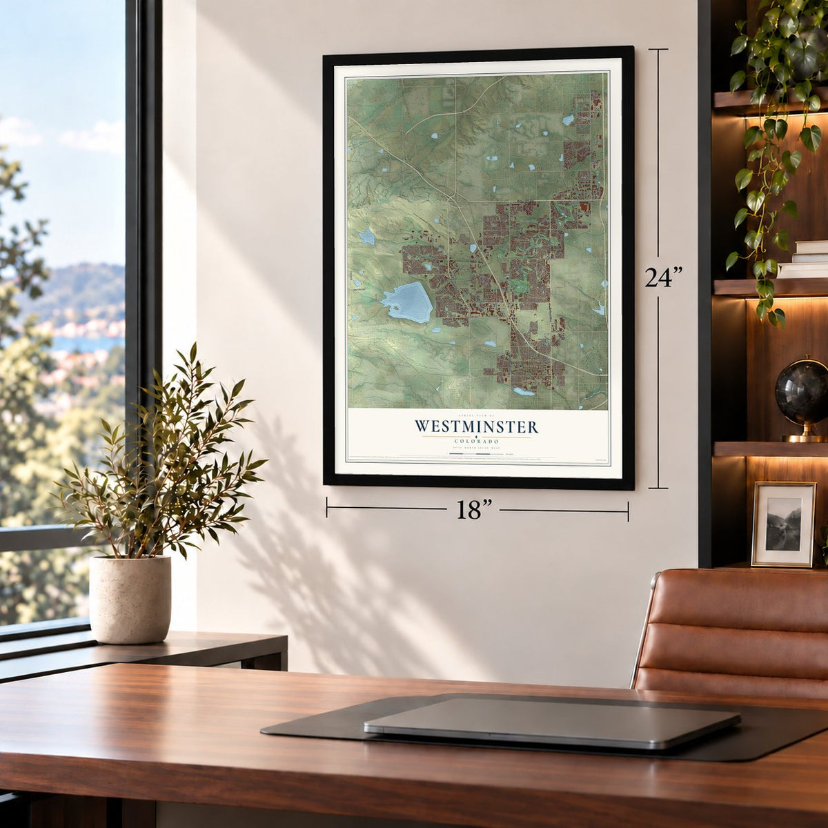
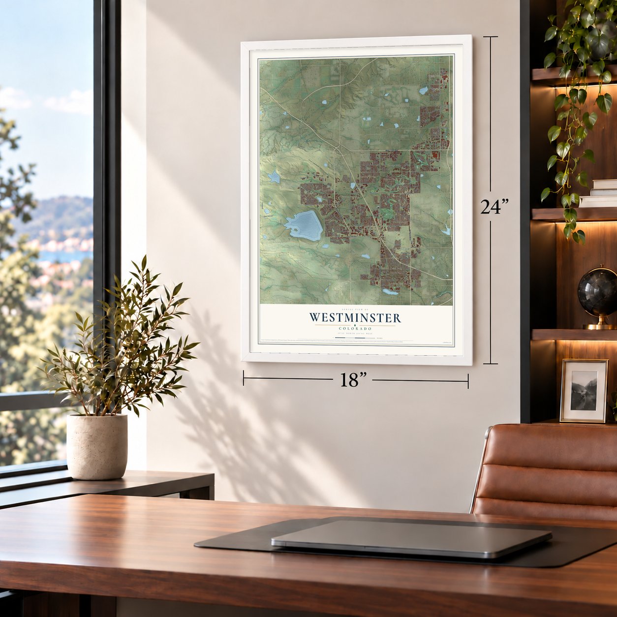
Unframed archival matte, a black wood frame or a white wood frame.
Up close
Geography Worth Displaying
This map was created using accurate cartographic data and authoritative geographic sources, including the U.S. Geological Survey and the Census Bureau. The map brings together terrain, waterways, roads, and building detail. The majority of the streets are labeled, houses are accurately depicted, and the topography is derived from government sources. Combining local data with carefully composed color and shading leads to this beautifully detailed Westminster artwork for your wall.
Rather than simply showing street outlines, we’ve included as many of the street names as we could reasonably fit on the map while keeping their names legible. Zoom in on the high resolution preview to see exactly what’s on the map. We truly set out to create a statement piece for anyone who loves Westminster. So whether it’s for you, or a gift for someone you love, we hope this map of Westminster brings back fond memories.
Read the story behind this map of Westminster, Colorado from 2026.

About Westminster, Colorado
Westminster is a city of 116,317 people in Adams and Jefferson counties, north-northwest of Denver. Gold found in the South Platte River Valley in 1858 drew the nation's attention to the area, and the Homestead Act of 1862 persuaded many eastern pioneers to stop in Colorado instead of pushing on to California. In 1870 Pleasant DeSpain, a farmer from Kentucky, became the first to settle here for good, on 160 acres near today's 76th Avenue and Lowell Boulevard.
DeSpain and his five sons grew grain and planted apple and cherry orchards, and the farms around them became known as DeSpain Junction. In 1885 C.J. Harris, a real estate developer from Connecticut, bought the DeSpain farm and others, joined the homesteads together, then cut them into smaller tracts for fruit growers, and the place took his name. A Presbyterian school later gave the town the name it has today: the Harris post office became Westminster on June 5, 1908, and the town incorporated on May 24, 1911.
- The Princeton of the WestIn 1890 New Yorker Henry T. Mayham talked the Denver Presbytery into putting a university on his own land in Harris. The depression of 1893 stalled construction, but the building was eventually finished in red sandstone from Colorado's Red Rocks region, and its courses followed Princeton's.
- Classes from 1908 to 1917The university's first classes began in 1908, when a year there cost $50. In 1917 every student left to fight in World War I, so the school closed, and through the next decade the building served as a church and school.
- A brick house from 1881Edward Bruce Bowles was among the settlers who followed DeSpain to the junction. In 1881 he built a brick house in the Italianate style, and the Bowles House joined the National Register in 1988.
- A bell tower for Big BenCity Hall's 14-story bell tower rises to a 130-foot spire capped by a steel mesh pyramid, planned as a tribute to Big Ben, the clock tower of Westminster Palace in England. The mayor of Westminster, England, came for the unveiling in 1986, and an English Oak on the City Hall grounds was a gift from that city.
- Open space since 1985In 1985 Westminster voters first approved a sales tax set aside to buy and protect open space. Today the city holds over 3,000 acres, among them land at Standley Lake Regional Park and in the Westminster Hills. The Big Dry Creek Trail runs about 12 miles from the city's eastern edge to Standley Lake.
Find your street
Names on the Westminster map
Every name below is printed on this map. Look for your street, your school, the park where you played, or the pond down the road.
Places and landmarks18
- College Hills
- Cotton Creek
- Countryside
- Cozy Corner
- Harris Park
- Hidden Creek Park
- Lakeview Estates
- Quail Hill
- Semper
- Sheridan Green
- Skyline Vista
- Sunset Ridge
Show all 18 places
- Sunstream
- Wallace Village
- Walnut Grove
- Wandering View
- Westminster Hills
- Wood Creek
Streets and roads238
- Federal Boulevard
- West 120th Avenue
- Wadsworth Parkway
- Sheridan Boulevard
- Lowell Boulevard
- West 112th Avenue
- West 96th Avenue
- Zuni Street
- West 99th Avenue
- West 97th Avenue
- Indiana Street
- Otis Street
- Northpark Avenue
- King Street
- West 100th Avenue
- Irving Street
- West 92nd Avenue
- Wolff Street
- Clay Street
- West 94th Place
- West 116th Avenue
- West 144th Avenue
- Routt Street
- Huron Street
- West 104th Avenue
- West 88th Avenue
- West 108th Avenue
- Westminster Boulevard
- West 72nd Avenue
- Pecos Street
Show all 238 streets
- Pierce Street
- Raleigh Street
- Wadsworth Boulevard
- Eaton Street
- Yates Street
- West 73rd Avenue
- Old Wadsworth Boulevard
- Turnpike Drive
- Decatur Street
- West 80th Avenue
- Orchard Parkway
- West 84th Avenue
- West 95th Avenue
- Dover Street
- Simms Street
- West 90th Avenue
- West 113th Avenue
- Alcott Street
- Julian Street
- Tennyson Street
- West 93rd Avenue
- Church Ranch Boulevard
- Benton Street
- West 118th Place
- West 115th Avenue
- West 128th Avenue
- West 136th Avenue
- Winona Court
- West 132nd Avenue
- Depew Street
- West 122nd Avenue
- Alkire Street
- Westmoor Drive
- West 124th Avenue
- West 104th Drive
- West 70th Avenue
- Oak Street
- Delaware Street
- Westcliff Parkway
- Tejon Street
- Owens Street
- West 81st Avenue
- West 78th Avenue
- Yates Drive
- Kendall Street
- West 91st Avenue
- West 117th Avenue
- West 107th Drive
- Gray Street
- West 134th Avenue
- Lexington Avenue
- West 82nd Avenue
- Ames Street
- West 68th Avenue
- Reed Street
- Bruchez Parkway
- Raritan Street
- Hoyt Street
- Circle Drive
- Xavier Drive
- Oakwood Drive
- Zephyr Street
- Promenade Drive
- West 87th Drive
- Garland Drive
- Westmoor Circle
- Eliot Street
- Teller Street
- Field Street
- Teller Court
- Kipling Street
- Vance Street
- Melody Drive
- Lee Street
- Otis Court
- Iris Street
- Federal Parkway
- Stratford Lakes Drive
- West 95th Place
- 101st Place
- West 102nd Avenue
- Umatilla Street
- Newton Street
- Osceola Street
- West 94th Avenue
- Stuart Street
- West 76th Avenue
- West 74th Avenue
- Grove Street
- Harlan Street
- Hooker Street
- West 107th Place
- Bradburn Boulevard
- Bryant Street
- Vrain Street
- Community Parkway
- Perry Street
- West 108th Circle
- Countryside Drive
- Utica Street
- Garrison Street
- West 105th Drive
- Quivas Way
- West 102nd Place
- Yarrow Street
- West 97th Place
- Xavier Street
- Jay Street
- West 148th Avenue
- Canosa Court
- Moore Street
- West 89th Avenue
- Main Street
- Country Club Loop
- West 96th Drive
- West 69th Avenue
- Huntington Trails Parkway
- Home Farm Drive
- West 71st Avenue
- West 88th Place
- Carr Street
- West 90th Drive
- Vallejo Circle
- West 119th Avenue
- West 115th Place
- North Huron Street
- Skyline Drive
- Hobbit Lane
- West 71st Place
- Stuart Place
- Gray Way
- Eliot Circle
- Lipan Street
- 110 Avenue
- West 81st Place
- West 124th Drive
- West 70th Place
- West 86th Drive
- West 130th Avenue
- West 92nd Lane
- West 82nd Place
- Vrain Drive
- Irving Drive
- Lowell Way
- Inca Court
- Inca Street
- 6400 West
- 86th Avenue
- Iris Court
- Perry Way
- West 98th Avenue
- West 87th Place
- Ranch Reserve Parkway
- West 111th Avenue
- Quitman Street
- Knox Court
- Green Court
- Chase Street
- West 108th Place
- Mariposa Street
- Garrison Drive
- Shaw Boulevard
- Beach Street
- West 135th Place
- Promenade Drive North
- Wolff Way
- 96th Circle
- Bannock Street
- West 149th Avenue
- Ranch Place
- Routt Lane
- Maria Street
- Ward Road
- Otis Circle
- West 71st Circle
- 110th Place
- 135th Court
- Eliot Drive
- King Way
- Meade Street
- West 106th Avenue
- West 75th Avenue
- West 105th Avenue
- West 130th Drive
- Marshall Street
- Balsam Street
- Zenobia Street
- Garland Street
- North Sheridan Boulevard
- Park Centre Drive
- Circle Point Road
- West 140th Drive
- Promenade Drive South
- West 101st Drive
- West 104th Court
- West 125th Avenue
- Estes Street
- Home Farm Lane
- Ames Court
- Cody Court
- Quail Court
- West 69th Place
- 93rd Place
- Meade Circle
- West 74th Place
- Depew Place
- Craft Way
- Apex Lane
Names are listed as they appear on the printed map. Zoom into the product photos to find them.
The art of mapping a place
How This Map Was Made
Real places. Remarkable detail. Discover the layers that turn geographic data into a map of home.

The view from above
Aerial imagery reveals the character of the land: woodland, open fields, and the patterns of a place.

The shape of the land
Elevation data brings hills, valleys, and subtle changes in the landscape into view.

The details of home
Roads, waterways, and building footprints come together to make the map feel unmistakably local.

Geography becomes art
Considered color, shading, and typography bring the layers together in a map made for your wall.


Process illustrated with Mendon, Massachusetts. Aerial imagery: USDA NAIP. Terrain: USGS 3D Elevation Program. Map details and finished artwork: KNOWOL.
The Details
About This Print
Choose an archival matte print, or a black or white Ayous wood frame. The archival matte print is unframed.
Select your size and finish above to see the matching product image and price.
Materials & Craftsmanship
A contemporary map with the character of a classic atlas, printed on archival matte paper. Optional frames are made from Ayous wood.
Your printed map does not include the watermark shown in the full-map preview.
Shipping & Delivery
Free shipping within the United States. Every print is made to order in the USA.
Buying a gift? Add a note in your cart and we'll include it. We never put prices in the package.
Prints ship within 2 to 3 business days. Allow 7 to 10 days total from ordering for delivery. Timing may vary during holidays or periods of high order volume.
Read our shipping policy.
Returns and damaged prints
Each print is made to order. Change-of-mind refunds are not available after production.
If your print arrives damaged, misprinted or incorrect, contact support@knowol.com within 30 days of receiving it. Include your order number, photos and a description of the issue.
Read our full refund and replacement policy. For questions about your order, email support@knowol.com.
Find your town
Looking for another city?
Find a map of home in our Colorado collection, or any town in the country.
Nearby
Maps of towns near Westminster
Know someone from one of these towns? Their map makes a great gift.
 Shaw Heights
, Colorado
From $39.99See the map
 Federal Heights
, Colorado
From $39.99See the map
 Sherrelwood
, Colorado
From $39.99See the map
More maps nearby: Northglenn, Twin Lakes, Broomfield, Berkley and Arvada.