
Search for another town

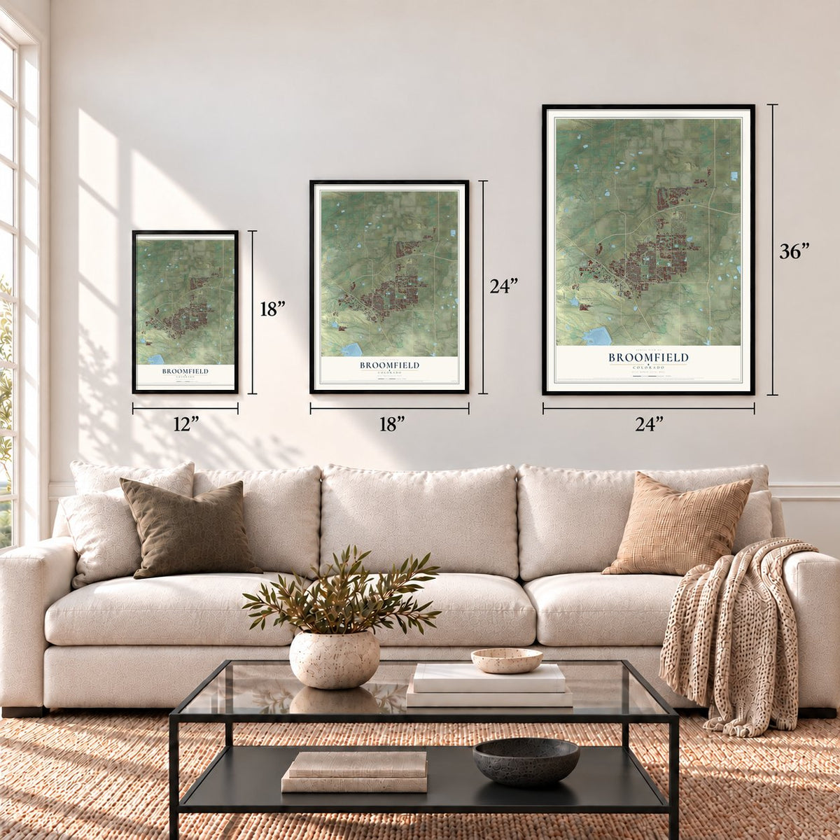
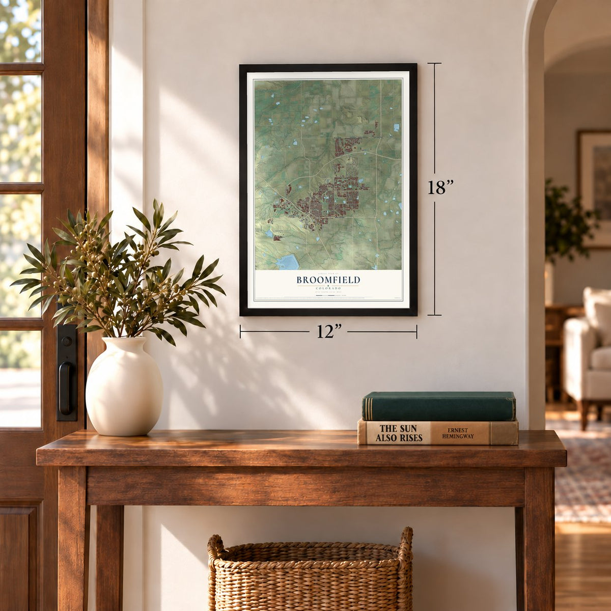
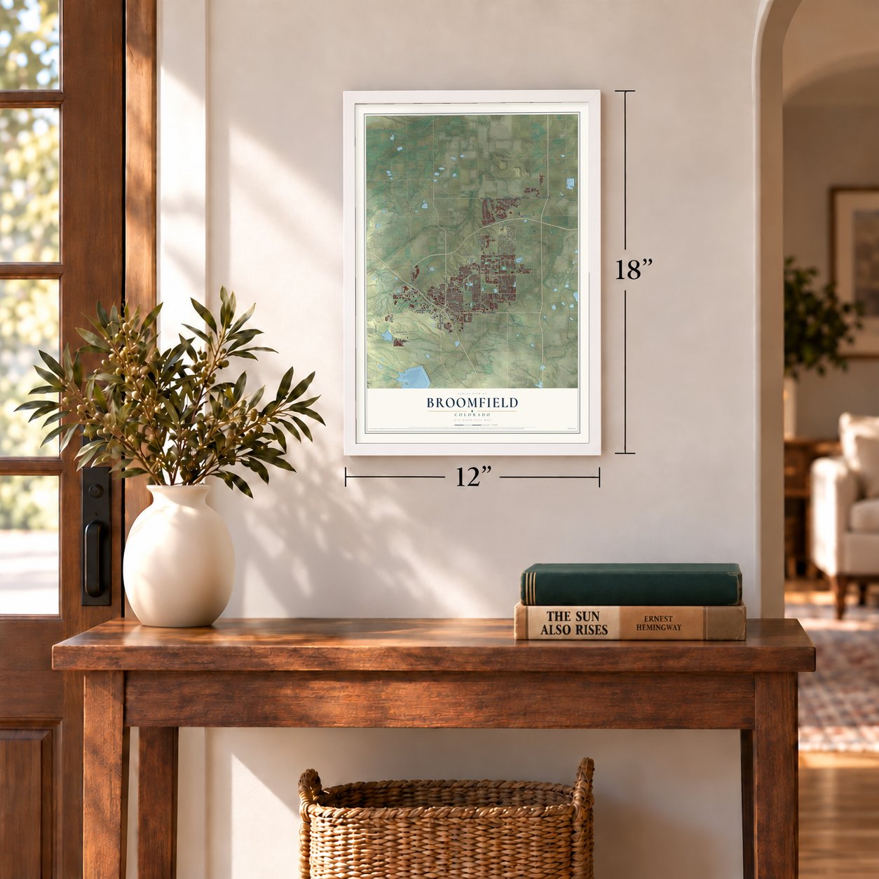

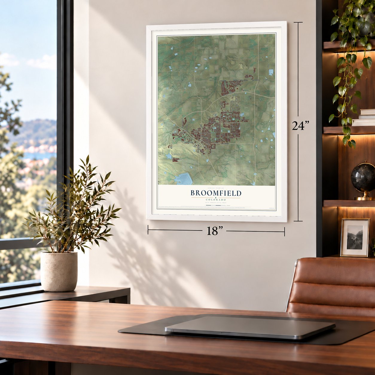

Free U.S. delivery 7 to 10 days after you order
Broomfield, Colorado Map Art
A new map of Broomfield, Colorado, made in 2026 and printed to order on thick archival matte paper.
12" x 18" Archival Matte Print
A Map of Home. A Work of Art.
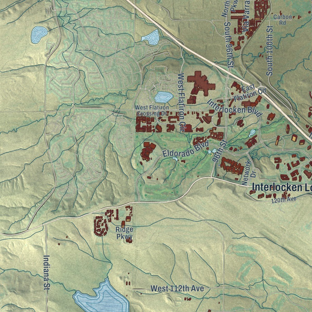
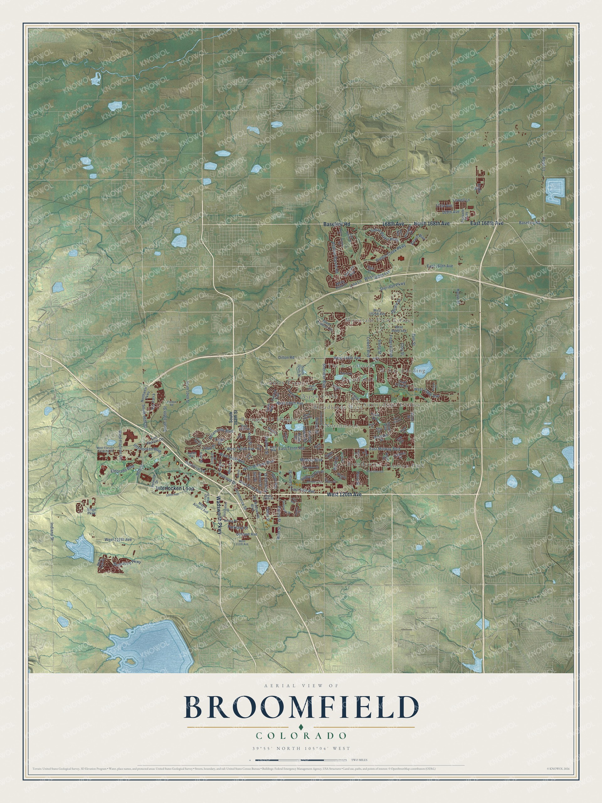
Explore Broomfield, Colorado from a whole new perspective. Created using aerial imagery and detailed geographic data, this map captures Broomfield building by building, with labeled streets, familiar landmarks, and shaded topographical relief that highlights the natural contours of the landscape.
Combining modern data with the timeless character of a vintage atlas, this map is just as interesting up close as it is beautiful on the wall. Whether you grew up in Broomfield, spent memorable years there, or call it home today, this unique map is a great way to celebrate a place that means something to you. Zoom in on the preview to look for your street, and then order a print to put your memories on the wall.
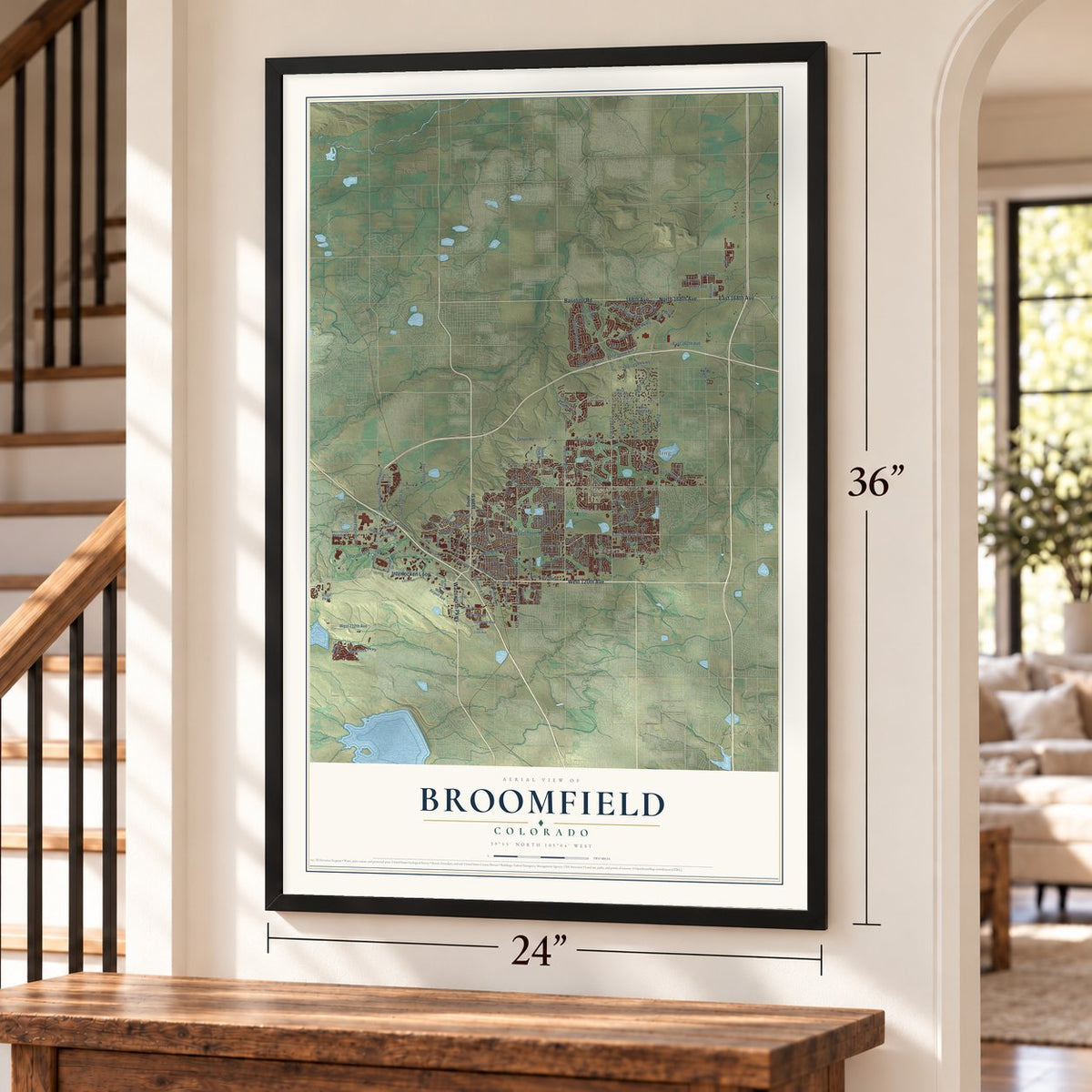
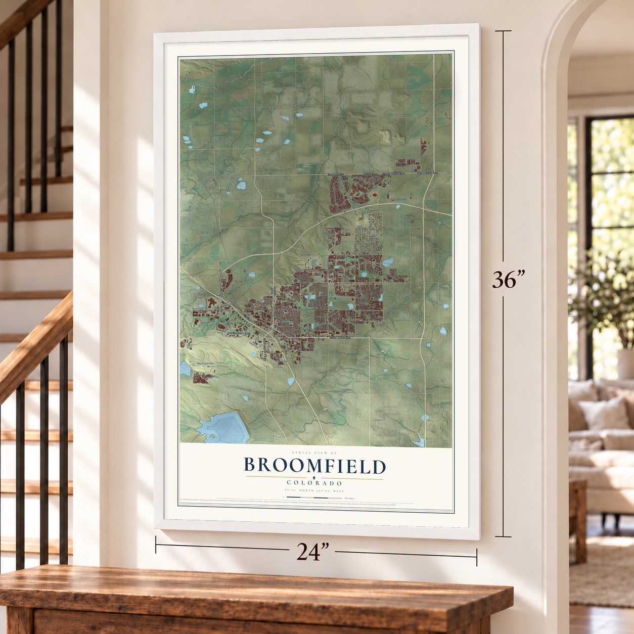
Three ways to hang it
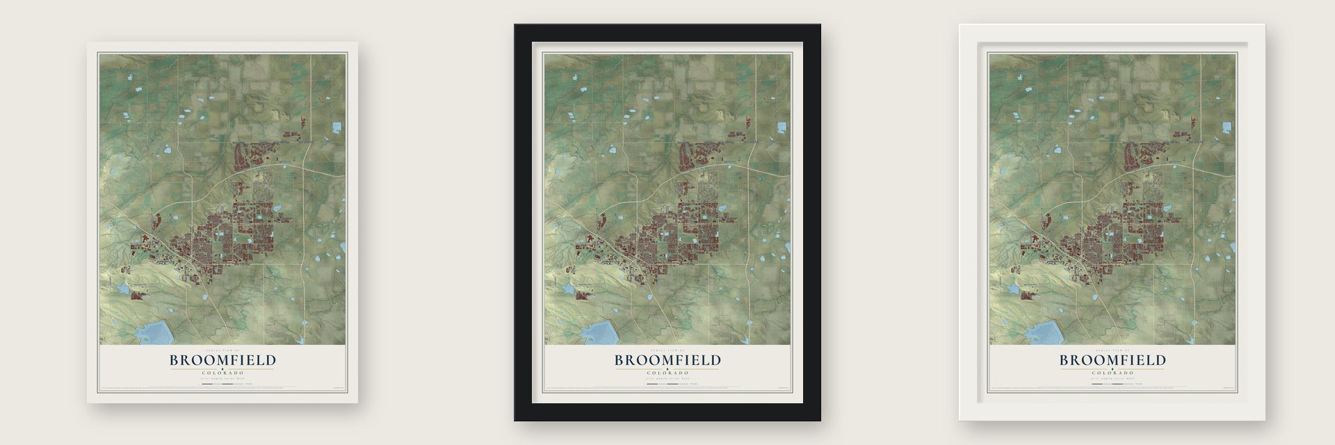
Unframed archival matte, a black wood frame or a white wood frame.
Up close
Geography Worth Displaying
This map was created using accurate cartographic data and authoritative geographic sources, including the U.S. Geological Survey and the Census Bureau. The map brings together terrain, waterways, roads, and building detail. The majority of the streets are labeled, houses are accurately depicted, and the topography is derived from government sources. Combining local data with carefully composed color and shading leads to this beautifully detailed Broomfield artwork for your wall.
Rather than simply showing street outlines, we’ve included as many of the street names as we could reasonably fit on the map while keeping their names legible. Zoom in on the high resolution preview to see exactly what’s on the map. We truly set out to create a statement piece for anyone who loves Broomfield. So whether it’s for you, or a gift for someone you love, we hope this map of Broomfield brings back fond memories.
Read the story behind this map of Broomfield, Colorado from 2026.

About Broomfield, Colorado
Broomfield is a consolidated city and county of 74,112 people, set midway between Denver and Boulder. Farmers in the area grew sorghum, also called broomcorn, and its stalks were sold to make brooms and whisk brooms. When the U.S. Post Office opened a station here on September 26, 1884, it named the town Broomfield after that crop. One early name for the area was Zang's Spur, for the railroad spur that served Adolph Zang's grain fields.
On June 6, 1961, Broomfield became an incorporated city in Boulder County's southeastern corner, and the new Denver-Boulder Turnpike made it a popular home for commuters. Three decades of annexation pushed the city into Adams, Jefferson and Weld counties, so by the 1990s its leaders dealt with four county governments, four sales tax bases and four court districts. Voters approved a state constitutional amendment in 1998, and after a three-year transition Broomfield became Colorado's 64th county on November 15, 2001.
- A depot from 1909The Broomfield Depot went up in 1909 for two lines, the Colorado & Southern and the Denver & Interurban. It handled both passengers and freight, and both steam trains and electric interurban cars, which makes it a rare survivor. The Colorado Encyclopedia calls it the only Denver & Interurban depot still holding its historical integrity.
- A toll road set freeWork on the Denver-Boulder Turnpike began in 1950, and it opened on January 19, 1952, with its only toll plaza at Broomfield. Drivers paid 10 cents from Federal Boulevard to Broomfield and 15 cents on to Boulder. Once the road had paid for itself, it became free on September 14, 1967, as part of U.S. Route 36, the first public toll road in the country to drop its toll.
- Rails from Golden in 1873The first rails came in 1873, when the Colorado Central Railroad ran a narrow-gauge line out of Golden. The Denver, Utah and Pacific followed in 1881 and was widened to standard gauge in 1889, and the Denver, Marshall and Boulder Railway built through the future town in 1886.
- Colorado's smallest countyBroomfield covers 21,471 acres, 371 of them water. No county in Colorado is smaller, it ranks 5th smallest among counties nationwide, and it is the newest county in the nation when county equivalents are left out.
Find your street
Names on the Broomfield map
Every name below is printed on this map. Look for your street, your school, the park where you played, or the pond down the road.
Places and landmarks12
- Aspen Creek
- Brandywine
- Broadlands
- Broadlands West
- Broomfield Heights
- Country Estates
- Crofton Park
- McKay Landing
- Mountain View Estates
- Northmoor
- Sunnyslope Estates
- The Broadlands
Streets and roads156
- Interlocken Loop
- West 120th Avenue
- Baseline Road
- North 168th Avenue
- 168th Avenue
- East 168th Avenue
- Wadsworth Parkway
- Sheridan Boulevard
- Lowell Boulevard
- Midway Boulevard
- Zuni Street
- West 112th Avenue
- Indiana Street
- Sheridan Parkway
- Lamar Street
- Industrial Lane
- Railroad Drive
- West Midway Boulevard
- Alcott Way
- South 100th Street
- West Flatiron Circle
- West 136th Avenue
- East Midway Boulevard
- Interlocken Boulevard
- Eldorado Boulevard
- 96th Street
- West 144th Avenue
- Main Street
- Preble Creek Parkway
- Huron Street
Show all 156 streets
- Anthem Ranch Road
- Kohl Street
- Dillon Road
- Miramonte Boulevard
- East 160th Avenue
- South 96th Street
- West Sixth Avenue
- Uptown Avenue
- Daphne Street
- Aspen Street
- Indian Peaks Parkway
- Emerald Street
- East Tenth Avenue
- Irving Street
- West 138th Avenue
- East First Avenue
- West Tenth Avenue
- West 160th Avenue
- Pierce Street
- 169th Avenue
- West First Avenue
- Perry Street
- Federal Boulevard
- Lilac Street
- Iris Street
- Dexter Street
- Parkland Street
- Skyestone Parkway
- Via Varra
- Clay Street
- Teller Street
- Wolff Street
- Commerce Street
- Road 11
- Lowell Lane
- 171st Avenue
- Spruce Street
- Lina Lane
- South 112th Street
- West 152nd Avenue
- East Flatiron Circle
- Ridge Drive
- Northwest Parkway
- Westlake Drive
- Birch Street
- Ridge Parkway
- Silver Feather Circle
- South 124th Street
- Alter Street
- Network Drive
- Alcott Street
- Old Wadsworth Boulevard
- Grove Way
- West 149th Avenue
- Prospect Lane
- Garnet Street
- Yale Drive
- Metro Airport Avenue
- Arista Place
- Outlook Trail
- Highland Park Drive
- Agate Way
- South 104th Street
- Quail Creek Drive
- White Rock Drive
- Hoyt Street
- San Luis Way
- Carla Way
- Creek Drive
- Yates Circle
- Hazel Street
- Palisade Parkway
- Drake Street
- Yates Court
- Trails Avenue
- Calkins Place
- Bear Cub Drive
- Birdie Road
- Elm Circle
- Greenway Drive
- West Flatiron Crossing Drive
- Carbon Road
- Opal Street
- Destination Drive
- Nickel Street
- West 119th Place
- Antero Circle
- King Circle
- Burbank Street
- 120th Avenue
- Longs Peak Drive
- Longs Court
- Aberdeen Drive
- Duette Way
- Compton Street
- Vrain Street
- Eagle Way
- Molly Lane
- Las Brisas Drive
- West 111th Avenue
- West 13th Avenue
- Ninth Avenue
- Winona Place
- East 15th Street
- Dyer Way
- West 124th Avenue
- Aspen Creek Drive
- Laurel Street
- West 134th Place
- Augusta Drive
- Flint Way
- Elmwood Street
- South Oak Circle
- McIntosh Avenue
- Columbine Avenue
- Beacon Street
- Misty Street
- Bryant Drive
- Monterey Drive
- Cypress Street
- Oakhurst Drive
- Lotus Way
- Antero Street
- Patton Street
- Meade Street
- Pine Way
Names are listed as they appear on the printed map. Zoom into the product photos to find them.
The art of mapping a place
How This Map Was Made
Real places. Remarkable detail. Discover the layers that turn geographic data into a map of home.

The view from above
Aerial imagery reveals the character of the land: woodland, open fields, and the patterns of a place.

The shape of the land
Elevation data brings hills, valleys, and subtle changes in the landscape into view.

The details of home
Roads, waterways, and building footprints come together to make the map feel unmistakably local.

Geography becomes art
Considered color, shading, and typography bring the layers together in a map made for your wall.


Process illustrated with Mendon, Massachusetts. Aerial imagery: USDA NAIP. Terrain: USGS 3D Elevation Program. Map details and finished artwork: KNOWOL.
The Details
About This Print
Choose an archival matte print, or a black or white Ayous wood frame. The archival matte print is unframed.
Select your size and finish above to see the matching product image and price.
Materials & Craftsmanship
A contemporary map with the character of a classic atlas, printed on archival matte paper. Optional frames are made from Ayous wood.
Your printed map does not include the watermark shown in the full-map preview.
Shipping & Delivery
Free shipping within the United States. Every print is made to order in the USA.
Buying a gift? Add a note in your cart and we'll include it. We never put prices in the package.
Prints ship within 2 to 3 business days. Allow 7 to 10 days total from ordering for delivery. Timing may vary during holidays or periods of high order volume.
Read our shipping policy.
Returns and damaged prints
Each print is made to order. Change-of-mind refunds are not available after production.
If your print arrives damaged, misprinted or incorrect, contact support@knowol.com within 30 days of receiving it. Include your order number, photos and a description of the issue.
Read our full refund and replacement policy. For questions about your order, email support@knowol.com.
Find your town
Looking for another city?
Find a map of home in our Colorado collection, or any town in the country.
Nearby
Maps of towns near Broomfield
Know someone from one of these towns? Their map makes a great gift.
 Lafayette
, Colorado
From $39.99See the map
 Northglenn
, Colorado
From $39.99See the map
 Louisville
, Colorado
From $39.99See the map
More maps nearby: Westminster, Superior, Erie, Thornton and Federal Heights.