
Search for another town


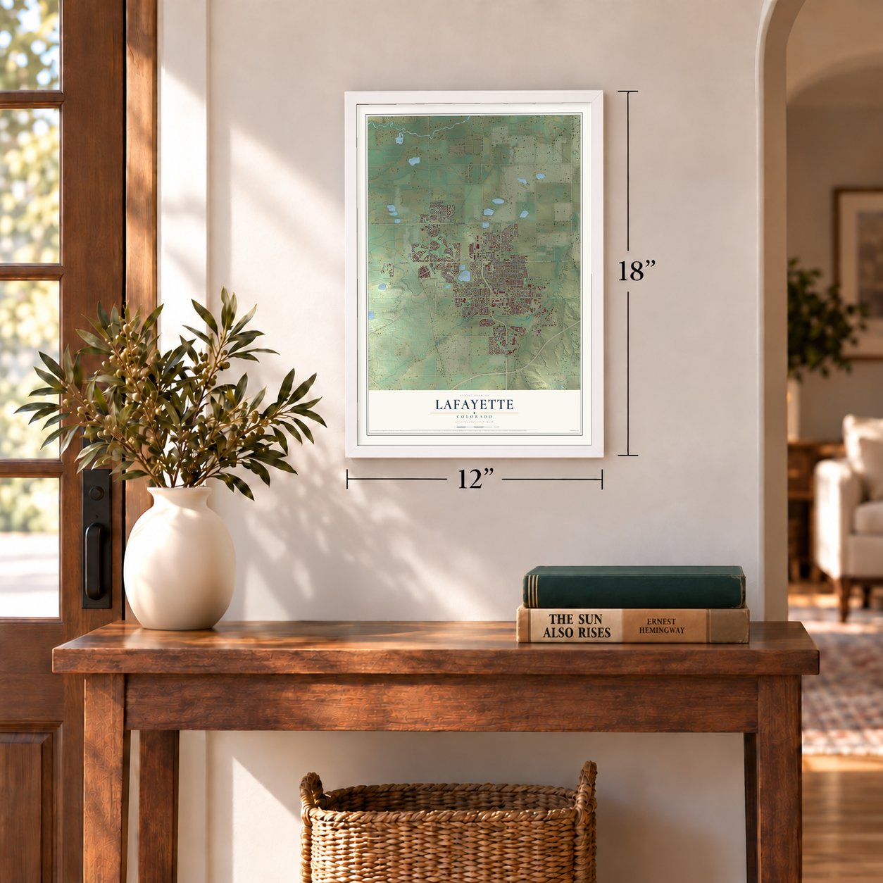

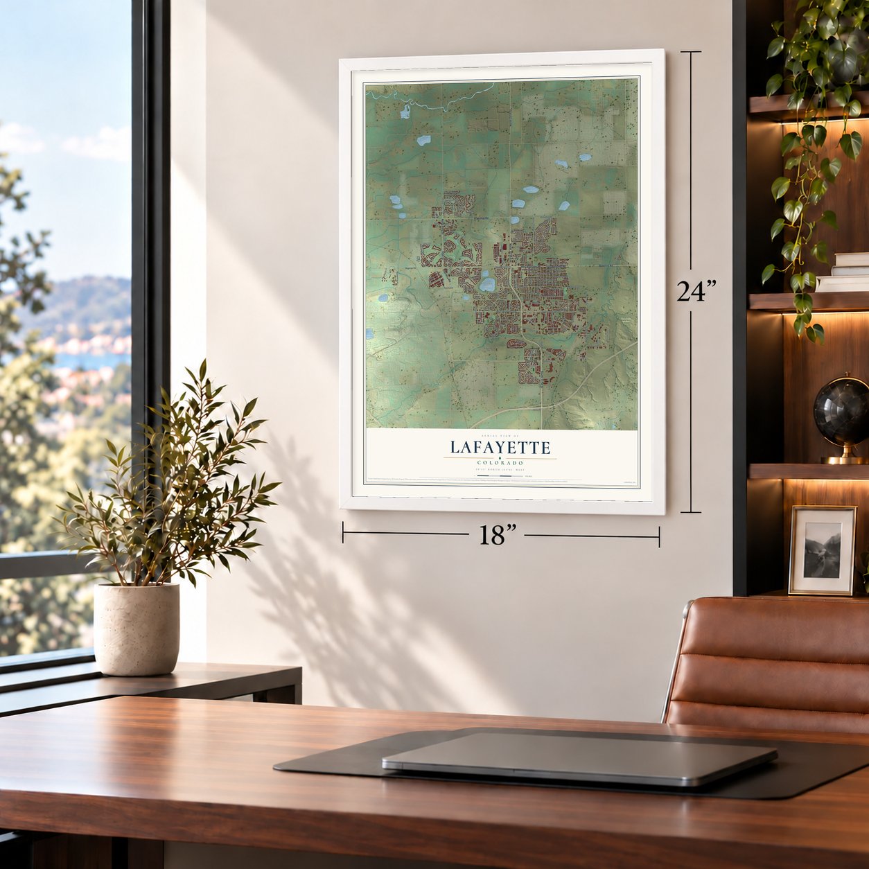

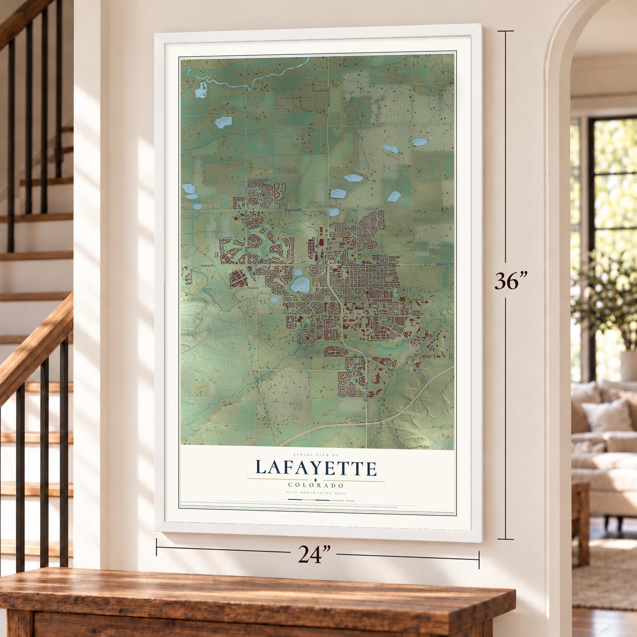

Free U.S. delivery 7 to 10 days after you order
Lafayette, Colorado Map Art
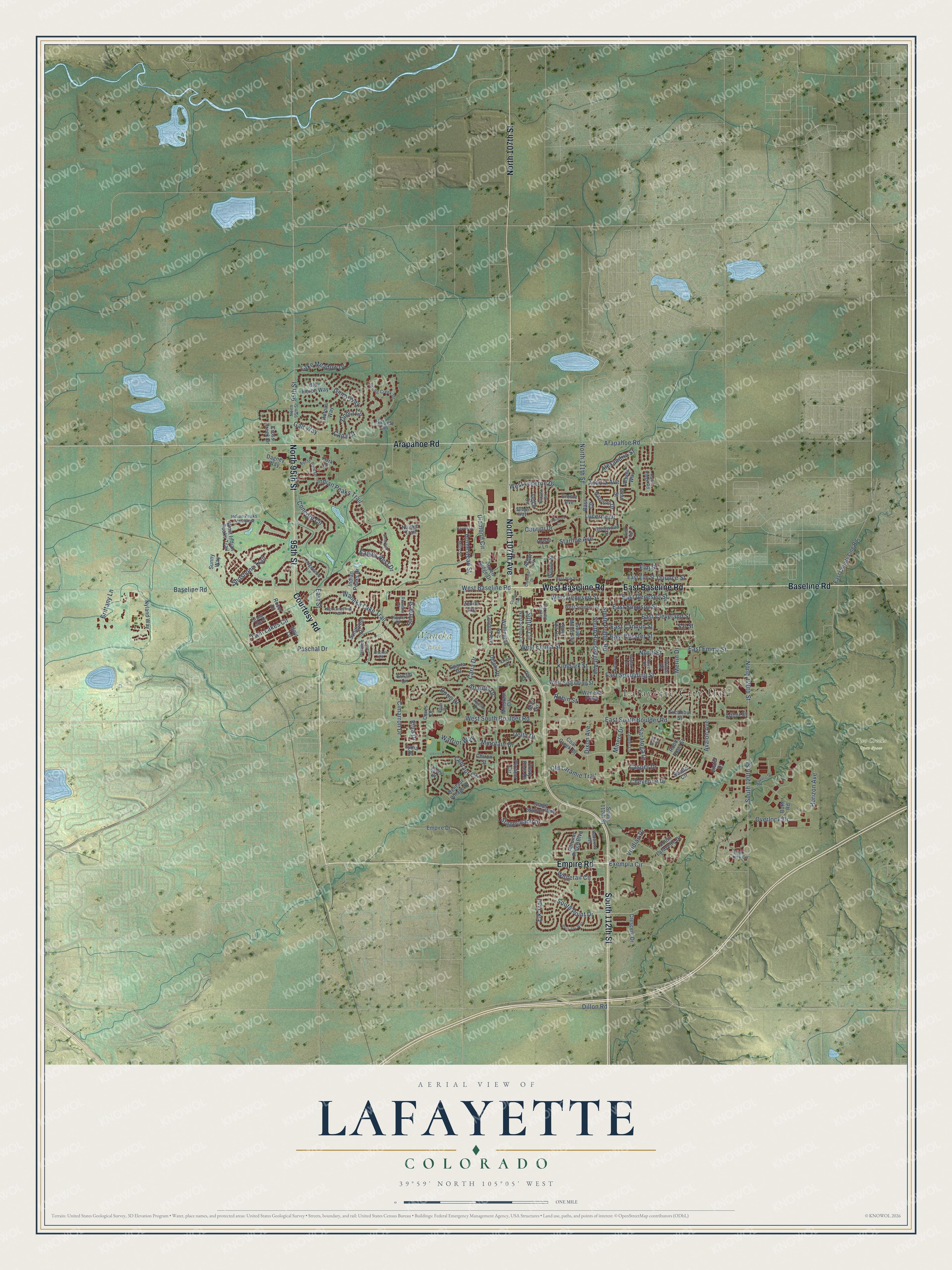
A new map of Lafayette, Colorado, made in 2026 and printed to order on thick archival matte paper.
12" x 18" Archival Matte Print
A Map of Home. A Work of Art.
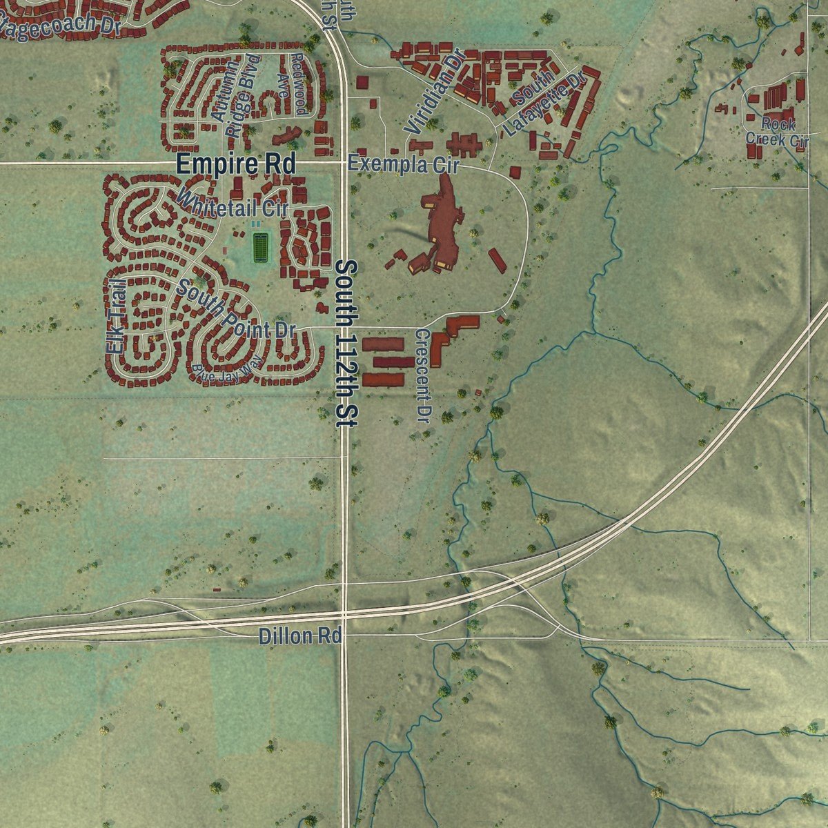
Explore Lafayette, Colorado from a whole new perspective. Created using aerial imagery and detailed geographic data, this map captures Lafayette building by building, with labeled streets, familiar landmarks, and shaded topographical relief that highlights the natural contours of the landscape.
Combining modern data with the timeless character of a vintage atlas, this map is just as interesting up close as it is beautiful on the wall. Whether you grew up in Lafayette, spent memorable years there, or call it home today, this unique map is a great way to celebrate a place that means something to you. Zoom in on the preview to look for your street, and then order a print to put your memories on the wall.
Three ways to hang it
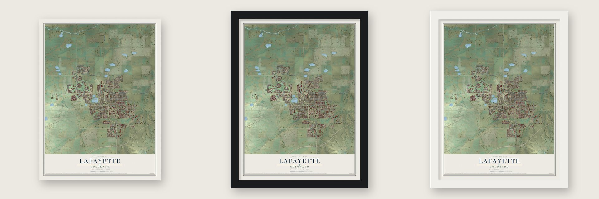
Unframed archival matte, a black wood frame or a white wood frame.
Up close
Geography Worth Displaying
This map was created using accurate cartographic data and authoritative geographic sources, including the U.S. Geological Survey and the Census Bureau. The map brings together terrain, waterways, roads, and building detail. The majority of the streets are labeled, houses are accurately depicted, and the topography is derived from government sources. Combining local data with carefully composed color and shading leads to this beautifully detailed Lafayette artwork for your wall.
Rather than simply showing street outlines, we’ve included as many of the street names as we could reasonably fit on the map while keeping their names legible. Zoom in on the high resolution preview to see exactly what’s on the map. We truly set out to create a statement piece for anyone who loves Lafayette. So whether it’s for you, or a gift for someone you love, we hope this map of Lafayette brings back fond memories.
Read the story behind this map of Lafayette, Colorado from 2026.

About Lafayette, Colorado
Lafayette is a city of 30,411 people in southeastern Boulder County. It began as a farm. Lafayette and Mary Miller bought the land from two Denver coal speculators in March 1868 and moved to Boulder in 1874. After Lafayette died there in 1878, Mary returned to the farm with their six young children. Coal turned up on the property in 1884, and in 1887 John H. Simpson leased ground from her brother, James B. Foote, and sank the first mine shaft.
In 1888 Mary Miller set aside 37 acres of the farm for a town and named it for her late husband. She sold the first lot to Hugh Hughes that March, the Cannon mine opened in July, and the first houses went up. Lafayette was incorporated on April 2, 1889. That same year a 3-mile railroad spur from Louisville, paid for by the Spencer-Simpson Coal Company, tied its mines to Denver's market. Her deeds banned the sale of alcohol east of what is now Public Road.
“In the NE 1/4 of the NE 1/4 of Sec. 1 is an outcrop of coal 1 chain long (66 feet) and 4 ft. thick, extent unknown.”
- A woman bank presidentMary Miller kept leading the town after the business district burned in January 1900. That year she founded the Lafayette Bank and was elected its president, a job a 1902 Denver Post story said no other American woman was known to hold. A temperance believer, she ran for the U.S. Senate on the Prohibition ticket in 1913. The bank failed in 1914 after about $90,000 in bad loans to striking union miners. She died in 1921.
- The Long StrikeNorthern Coal Field miners in the United Mine Workers walked out in April 1910, and in 1913 the union spread the strike across Colorado. To keep the mines running, the operators brought in strikebreakers from Eastern Europe and Mexico. The union locals, which had shut Latinos out, saw they needed them as allies, and on September 25, 1913, a group of Latino miners paid their $10 dues to Lafayette Local 1388. The strike lasted until 1914.
- The Columbine Mine, 1927Lafayette's miners struck again in 1927, in a walkout led by the Industrial Workers of the World. On November 27, 1927, five miners from Lafayette were killed at the Columbine Mine, northeast of town at Serene. That same year Josephine Roche used shares left by her late father to take control of the Rocky Mountain Fuel Company, which owned many local mines, and she ran it with the most labor-friendly management in the nation.
- The last mine closed in 1956As natural gas took the place of coal from the 1930s on, the mines shut one by one. The Black Diamond, at today's U.S. 287 and Baseline Road, was the last to close, in 1956. Lafayette went back to farming until the growth of Denver and Boulder brought new homes, shops and small factories.
Find your street
Names on the Lafayette map
Every name below is printed on this map. Look for your street, your school, the park where you played, or the pond down the road.
Places and landmarks3
- Lafayette City Hall
- Two Creeks Open Space
- Waneka Park
Streets and roads179
- South 112th Street
- Baseline Road
- North 107th Avenue
- East Baseline Road
- West Baseline Road
- Empire Road
- 95th Street
- Courtesy Road
- Arapahoe Road
- North 95th Street
- North 107th Street
- South Public Road
- Exempla Circle
- East Simpson Street
- East Geneseo Street
- West Geneseo Street
- South Point Drive
- Elk Trail
- Elm Street
- Dillon Road
- Galt Way
- South 120th Street
- Cabrini Drive
- North 120th Street
- Lucerne Drive
- West South Boulder Road
- Indian Peaks Trail
- East South Boulder Road
- Caria Drive
- Waneka Lake Trail
Show all 179 streets
- Horizon Avenue
- Whitetail Circle
- Centaur Circle
- North 111th Street
- East Emma Street
- Ginny Way
- West Emma Street
- Avalon Avenue
- Shoshone Trail
- Paschal Drive
- Twin Lakes Circle
- Merlin Drive
- East Chester Street
- Stagecoach Drive
- Kimbark Street
- West Lucerne Drive
- Diamond Circle
- East Cleveland Street
- Concord Circle
- Casper Drive
- South Roosevelt Avenue
- Viridian Drive
- Eagles Nest Drive
- East Spaulding Street
- Minotaur Drive
- Old Laramie Trail
- Acadia Avenue
- Doric Drive
- Saratoga Drive
- Zinnia Circle
- Homestead Street
- Atlantis Drive
- Lake Meadow Drive
- Alexandria Street
- Starline Avenue
- Overlook Drive
- Cheyenne Drive
- East Cannon Street
- Miners Drive
- Sutton Circle
- Delta Drive
- North Street
- Brittany Lane
- Salina Street
- Warrior Way
- Dixon Avenue
- Cimarron Drive
- Dounce Street
- Robin Street
- East Street
- Cana Court
- Etna Drive
- Sal Street
- West Indian Peaks Trail
- Dagney Way
- Cross Creek Drive
- Wilson Street
- Lydia Drive
- East Elm Street
- Rufous Way
- Centaur Village Drive
- Delphi Drive
- South Miller Avenue
- Autumn Ridge Boulevard
- Minotaur Circle
- Glenwood Drive
- Pioneer Circle
- Vetch Circle
- Roser Drive
- Zenith Avenue
- Sparta Drive
- Coal Creek Drive
- Indian Peaks Drive
- East County Line Road
- Arbor Drive
- West Spaulding Street
- Nyland Way
- Waneka Parkway
- Harrison Drive
- Sandpiper Drive
- Bass Circle
- Shallot Circle
- Stein Street
- Arthur Street
- Excalibur Street
- Euclid Circle
- Ceres Drive
- Aspen Ridge Drive
- London Avenue
- Stage Station Way
- Robin Hood Street
- Blue Heron Way
- Wellington Avenue
- Hillside Terrace
- Distel Drive
- South Lafayette Drive
- Milo Circle
- Hoyt Lane
- Crescent Drive
- Alsace Way
- Oriole Drive
- Saint Ida Circle
- Zeus Drive
- Empire Drive
- Navajo Trail
- Butte Road
- Chiron Street
- Cristo Lane
- Dusty Boot Drive
- Brome Avenue
- Pan Court
- Sunny Way
- Park Lane
- Indian Peaks Trail West
- West Simpson Street
- Spring Creek Drive
- Hawk Ridge Road
- South Carr Avenue
- Rock Creek Circle
- Lander Lane
- Skylark Circle
- Clover Circle
- Grand Lake Drive
- North Park Drive
- West Sutton Circle
- Lodgewood Lane
- Sedge Way
- Mills Street
- Clipper Drive
- Ilium Drive
- Dove Drive
- Redwood Avenue
- Portside Court
- Rowena Place
- Orion Drive
- Apollo Drive
- Anchor Place
- Park Street
- High Lonesome Trail
- Blue Jay Way
- West Oak Street
- Crossing Drive
- Majestic Drive
- Snowbird Lane
- Banneks
- Harvest Drive
- Wild Ridge Lane
- Conoco Plaza
- Cordova Court
Names are listed as they appear on the printed map. Zoom into the product photos to find them.
The art of mapping a place
How This Map Was Made
Real places. Remarkable detail. Discover the layers that turn geographic data into a map of home.

The view from above
Aerial imagery reveals the character of the land: woodland, open fields, and the patterns of a place.

The shape of the land
Elevation data brings hills, valleys, and subtle changes in the landscape into view.

The details of home
Roads, waterways, and building footprints come together to make the map feel unmistakably local.

Geography becomes art
Considered color, shading, and typography bring the layers together in a map made for your wall.


Process illustrated with Mendon, Massachusetts. Aerial imagery: USDA NAIP. Terrain: USGS 3D Elevation Program. Map details and finished artwork: KNOWOL.
The Details
About This Print
Choose an archival matte print, or a black or white Ayous wood frame. The archival matte print is unframed.
Select your size and finish above to see the matching product image and price.
Materials & Craftsmanship
A contemporary map with the character of a classic atlas, printed on archival matte paper. Optional frames are made from Ayous wood.
Your printed map does not include the watermark shown in the full-map preview.
Shipping & Delivery
Free shipping within the United States. Every print is made to order in the USA.
Buying a gift? Add a note in your cart and we'll include it. We never put prices in the package.
Prints ship within 2 to 3 business days. Allow 7 to 10 days total from ordering for delivery. Timing may vary during holidays or periods of high order volume.
Read our shipping policy.
Returns and damaged prints
Each print is made to order. Change-of-mind refunds are not available after production.
If your print arrives damaged, misprinted or incorrect, contact support@knowol.com within 30 days of receiving it. Include your order number, photos and a description of the issue.
Read our full refund and replacement policy. For questions about your order, email support@knowol.com.
Find your town
Looking for another city?
Find a map of home in our Colorado collection, or any town in the country.
Nearby
Maps of towns near Lafayette
Know someone from one of these towns? Their map makes a great gift.
 Louisville
, Colorado
From $39.99See the map
 Broomfield
, Colorado
From $39.99See the map
 Leyner
, Colorado
From $39.99See the map
More maps nearby: Erie, Paragon Estates, Superior, Gunbarrel and Valmont.