
Search for another town




Free U.S. delivery 7 to 10 days after you order
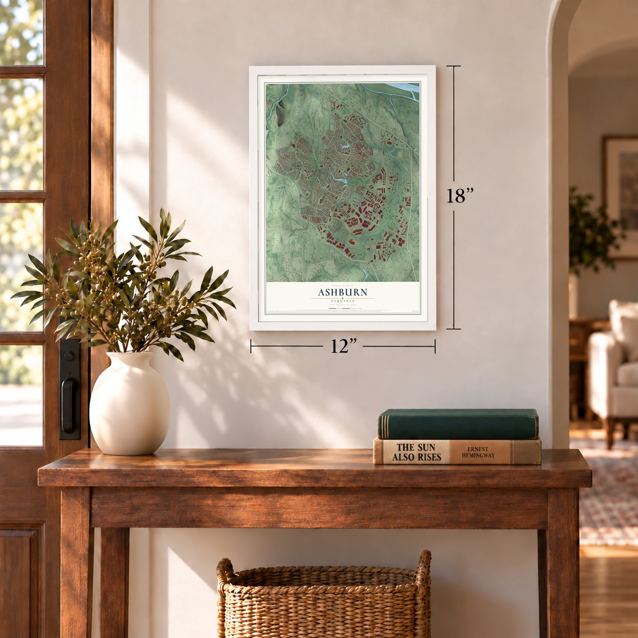
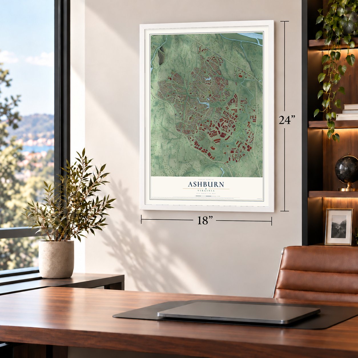
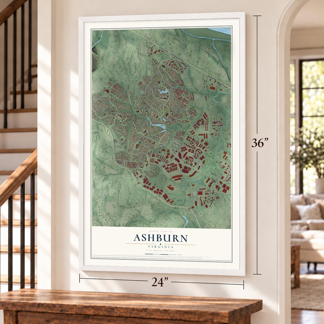
Ashburn, Virginia Map Art
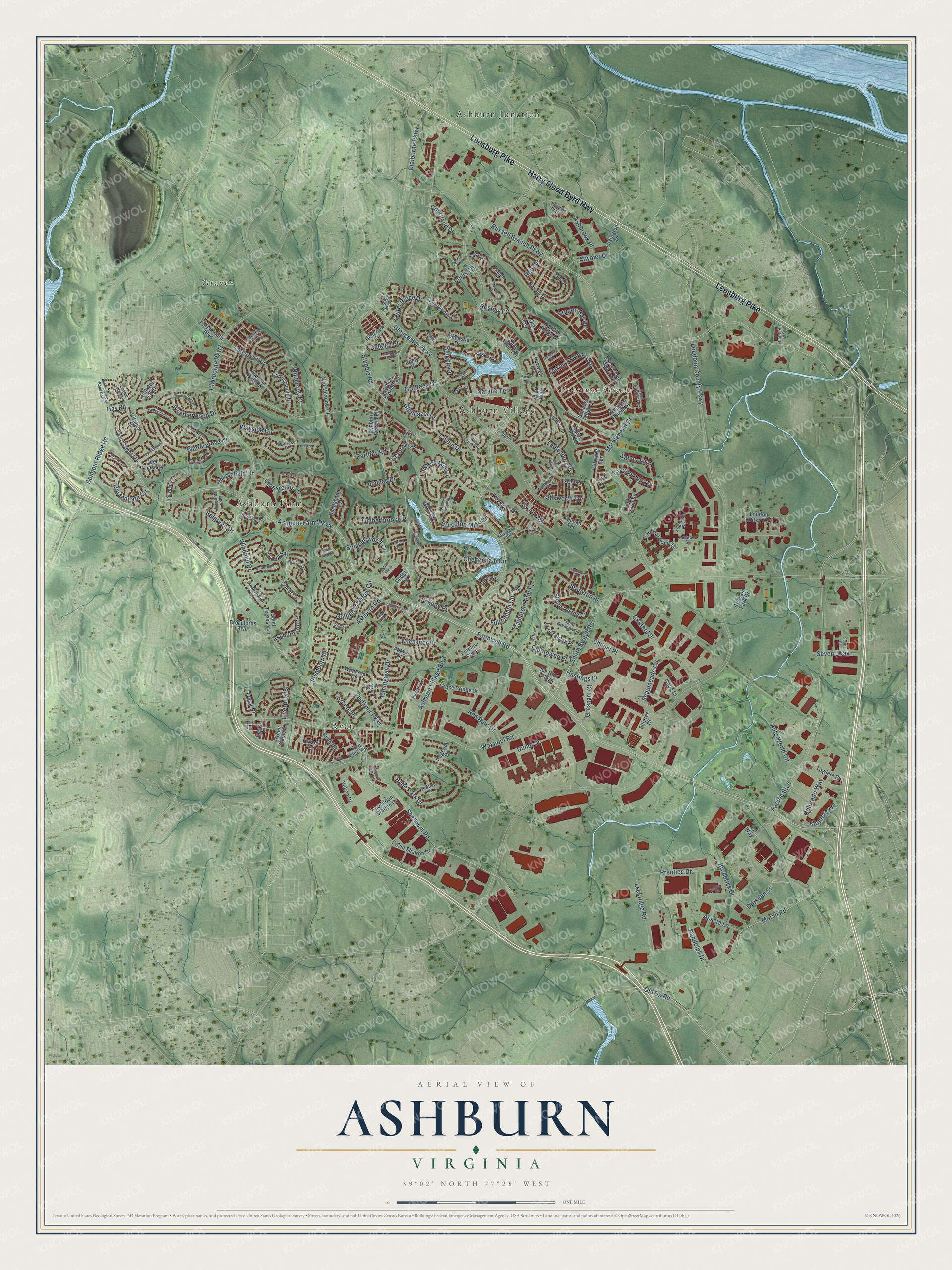
A new map of Ashburn, Virginia, made in 2026 and printed to order on thick archival matte paper.
12" x 18" Archival Matte Print
A Map of Home. A Work of Art.
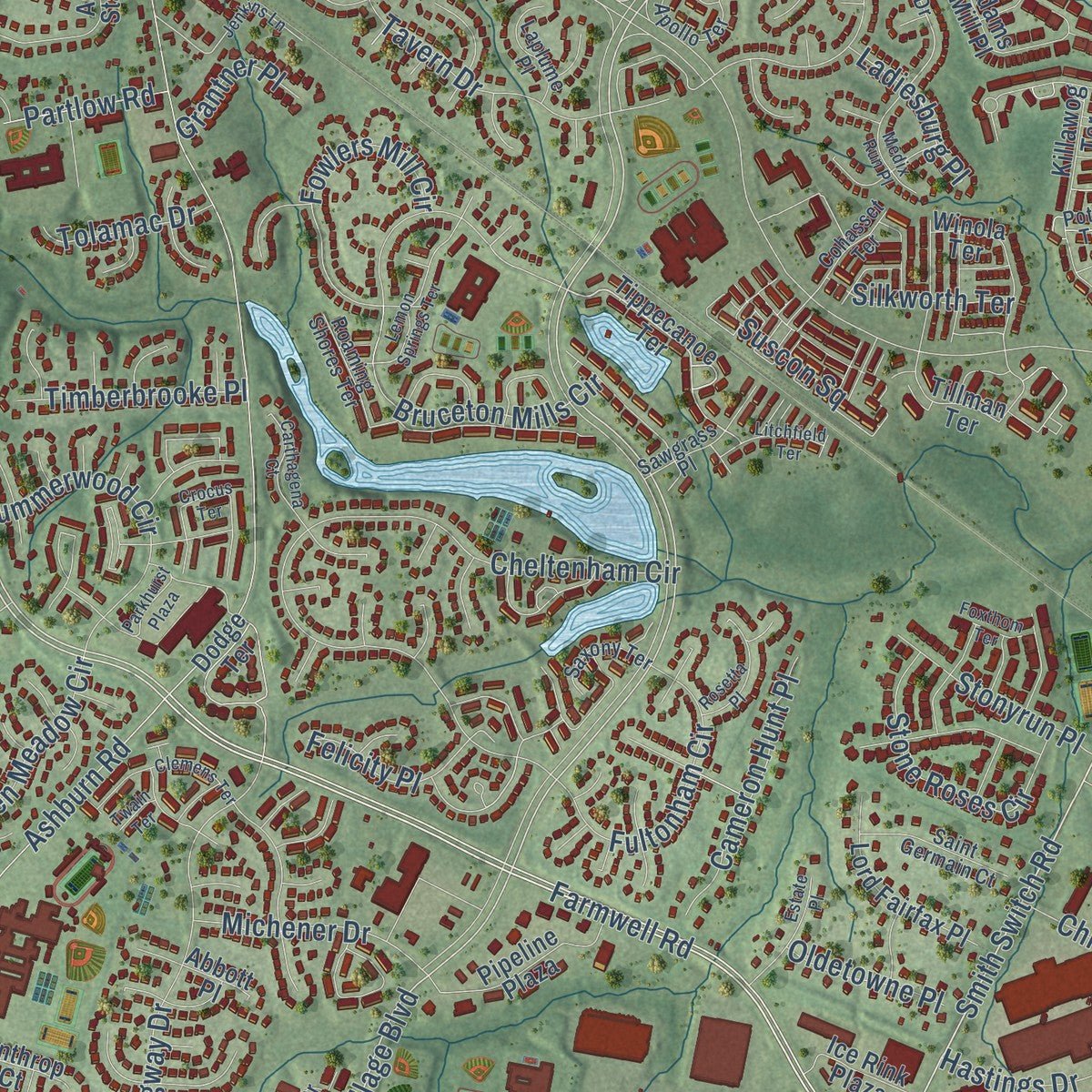
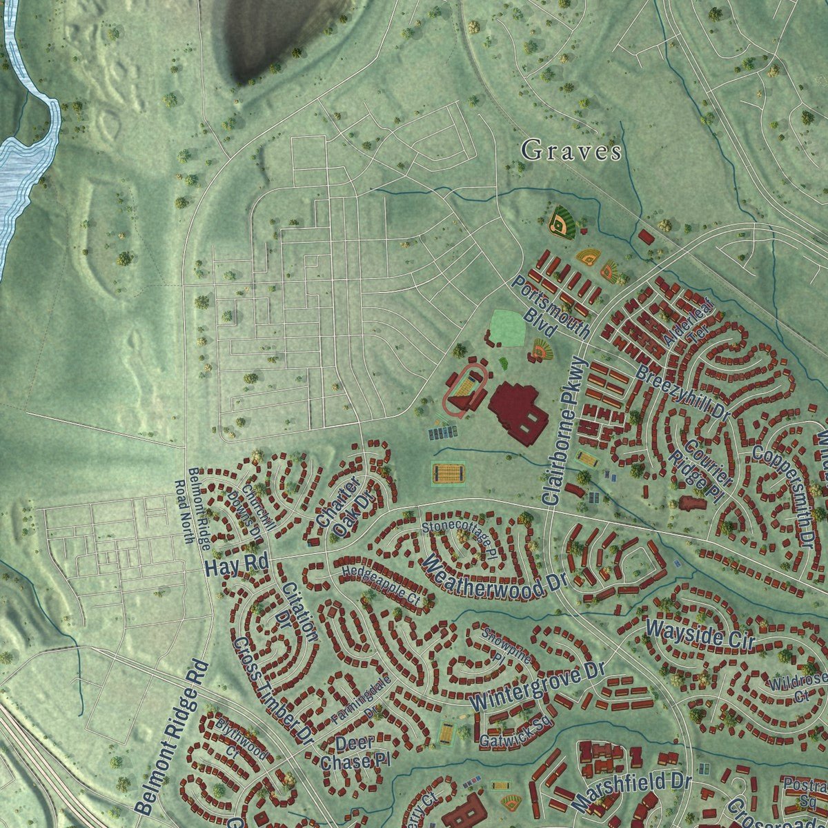
Explore Ashburn, Virginia from a whole new perspective. Created using aerial imagery and detailed geographic data, this map captures Ashburn building by building, with labeled streets, familiar landmarks, and shaded topographical relief that highlights the natural contours of the landscape.
Combining modern data with the timeless character of a vintage atlas, this map is just as interesting up close as it is beautiful on the wall. Whether you grew up in Ashburn, spent memorable years there, or call it home today, this unique map is a great way to celebrate a place that means something to you. Zoom in on the preview to look for your street, and then order a print to put your memories on the wall.
Three ways to hang it
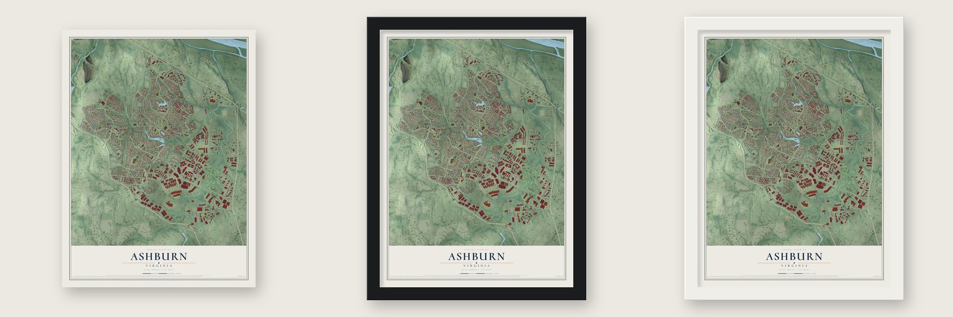
Unframed archival matte, a black wood frame or a white wood frame.
Up close
Geography Worth Displaying
This map was created using accurate cartographic data and authoritative geographic sources, including the U.S. Geological Survey and the Census Bureau. The map brings together terrain, waterways, roads, and building detail. The majority of the streets are labeled, houses are accurately depicted, and the topography is derived from government sources. Combining local data with carefully composed color and shading leads to this beautifully detailed Ashburn artwork for your wall.
Rather than simply showing street outlines, we’ve included as many of the street names as we could reasonably fit on the map while keeping their names legible. Zoom in on the high resolution preview to see exactly what’s on the map. We truly set out to create a statement piece for anyone who loves Ashburn. So whether it’s for you, or a gift for someone you love, we hope this map of Ashburn brings back fond memories.
Read the story behind this map of Ashburn, Virginia from 2026.

About Ashburn, Virginia
Ashburn is a community of 46,349 people in Loudoun County, about 30 miles northwest of Washington, D.C. It began as a farming area called Farmwell, split among several estates, and later grew into a small stop on the Washington and Old Dominion Railroad. Its name comes from Ashburn Farm, a 1,236-acre estate once owned by John Janney, the Quaker lawyer who led Virginia's Secession Convention in 1861.
George Lee III bought the estate in the 1870s and is thought to have named it Ashburn, perhaps for its ash trees, its ash-colored soil or earlier barn fires. The area stayed mostly farmland until Washington Dulles International Airport opened nearby in 1962 and pulled growth west. Big neighborhoods such as Ashburn Village and Ashburn Farm went up in the 1980s and 1990s, and the population climbed from 3,393 in 1990 to 46,349 in 2020.
- Data Center AlleyBy the early 2000s, steady electric power and access to fiber-optic lines had drawn major technology firms to Ashburn. The area now has the world's densest cluster of data centers. Digital Realty, Equinix and NTT run several sites here, and Amazon Web Services and the Wikimedia Foundation keep data centers here too.
- End of the Silver LineThe Washington Metro's Silver Line runs past Dulles Airport and into Ashburn down the middle of the Dulles Greenway. It stops at Loudoun Gateway and ends at Ashburn station. The stations were supposed to open in 2016, but after a string of delays they opened on November 15, 2022.
- A Tuskegee AirmanCarl C. Johnson, a retired Army officer who was the last cadet pilot to graduate with the Tuskegee Airmen, has lived in Ashburn.
Find your street
Names on the Ashburn map
Every name below is printed on this map. Look for your street, your school, the park where you played, or the pond down the road.
Places and landmarks6
- Ashburn Farm
- Ashburn Junction
- Ashburn Village
- Graves
- Potomac Green
- Ryan
Streets and roads217
- Harry Flood Byrd Highway
- Leesburg Pike
- Russell Branch Parkway
- Pacific Boulevard
- Farmwell Road
- Smith Switch Road
- Ashburn Farm Parkway
- Ashburn Village Boulevard
- Waxpool Road
- Ringold Drive
- Clairborne Parkway
- Hopi Drive
- Claiborne Parkway
- Wintergrove Drive
- Gardengate Circle
- Colorado Way
- Loudoun County Parkway
- Gloucester Parkway
- Ashburn Road
- Shellhorn Road
- Hay Road
- Beaumeade Circle
- Moran Road
- Cheltenham Circle
- Uunet Drive
- Broderick Drive
- Windmill Drive
- Bruceton Mills Circle
- Wayside Circle
- Lockridge Road
Show all 217 streets
- Marblehead Drive
- Golden Meadow Circle
- Hyde Park Drive
- Hemingway Drive
- Prentice Drive
- Auto World Circle
- Old Ox Road
- Tavern Drive
- Randolph Drive
- Guilford Drive
- Red Rum Drive
- Belmont Ridge Road
- Oakmont Manor Square
- Bristow Circle
- Fowlers Mill Circle
- Crossroads Drive
- Summerwood Circle
- Fultonham Circle
- Ashbrook Place
- Stone Roses Circle
- Belgreen Drive
- Faulkner Parkway
- Natalie Terrace
- Cameron Hunt Place
- Hastings Drive
- Plymouth Place
- Monterey Place
- Weatherwood Drive
- Stubble Road
- Laurel Ridge Drive
- Wildbrook Court
- Atwater Drive
- Saber Jet Place
- Michener Drive
- Suscon Square
- Stonyrun Place
- Timberbrooke Place
- Courtland Drive
- Glenhazel Drive
- Cruden Bay Drive
- Louisa Drive
- Gresham Court
- Granite Run Terrace
- Severn Way
- Chilum Place
- Ashburn Run Place
- Marshfield Drive
- Silkworth Terrace
- Felicity Place
- Ladiesburg Place
- Tolamac Drive
- Acacia Lane
- Dresden Street
- Oldetowne Place
- Liverpool Street
- Partlow Road
- Grantner Place
- Grottoes Drive
- Raleigh Place
- Bronte Place
- Trask Place
- Cardinal Pond Terrace
- Tippecanoe Terrace
- Charter Oak Drive
- Loudon Water Way
- Navajo Drive
- Crescent Pointe Place
- Breezyhill Drive
- Killawog Terrace
- Adams Mill Place
- Tillman Terrace
- Fincastle Drive
- Green Stable Square
- Cross Timber Drive
- Gala Circle
- Yukon Drive
- Shady Glen Terrace
- Coppersmith Drive
- Pipeline Plaza
- Wild Meadow Court
- Ashburn Station Place
- Lord Fairfax Place
- Citation Drive
- Grace Bridge Drive
- Devin Shafron Drive
- Rocky Knoll Square
- Saint Theresa Lane
- Dodge Terrace
- Broadlords Boulevard
- Towlern Place
- Winola Terrace
- Paget Terrace
- Ryan Road
- Rosewood Manor Square
- High Rock Terrace
- Redskin Park Drive
- Deerview Drive
- Nightshade Place
- Panther Ridge Drive
- Livery Square
- Loudoun Station Drive
- Ice Rink Plaza
- Hillary Way
- Portsmouth Boulevard
- Lexington Drive
- Summer Ridge Drive
- Filigree Court
- Huxley Terrace
- Courier Ridge Place
- Old Grey Place
- Winthrop Court
- Stubble Corner Square
- Amity Place
- Deer Chase Place
- Regency Drive
- Colter Court
- Norwich Place
- Cape Court
- Frost Court
- Abbott Place
- Mears Terrace
- Aol Way
- Fenwick Drive
- Gatwick Square
- Hope Spring Terrace
- Romans Drive
- Apollo Terrace
- Postrail Square
- Apache Circle
- Hartley Place
- Saint Germain Court
- Potter Terrace
- Roaming Shores Terrace
- Championship Place
- Audubon Square
- Chloe Terrace
- Alderleaf Terrace
- Premier Plaza
- Deer Run Way
- Laplume Place
- Susan Leslie Drive
- Hollyberry Court
- Railstop Terrace
- Saxony Terrace
- Smokehouse Court
- Cohasset Terrace
- Wildrose Court
- Sawgrass Place
- Richfield Way
- Audobon Square
- Catlett Place
- Novi Terrace
- Litchfield Terrace
- Parkhurst Plaza
- Blossom Hill Terrace
- Ferncliff Terrace
- Jenkins Lane
- Clemens Terrace
- Farmingdale Drive
- Churchill Downs Drive
- Belmont Ridge Road North
- Choptank Terrace
- Carthagena Court
- Rosetta Place
- Medix Run Place
- Hedgeapple Court
- Estate Place
- Stonecottage Place
- Crocus Terrace
- Whetstone Court
- Lemon Springs Terrace
- Pandora Court
- Butterfield Court
- Rock Bar Terrace
- Snowpine Place
- Blythwood Court
- Cross Breeze Place
- Keyser Court
- Pavilion Parkway
- Carrleigh Court
- Osage Court
- Foxthom Terrace
- McHenry Square
- Mustoe Place
- Squire Court
- Coal Bed Court
- Twain Terrace
Names are listed as they appear on the printed map. Zoom into the product photos to find them.
The art of mapping a place
How This Map Was Made
Real places. Remarkable detail. Discover the layers that turn geographic data into a map of home.

The view from above
Aerial imagery reveals the character of the land: woodland, open fields, and the patterns of a place.

The shape of the land
Elevation data brings hills, valleys, and subtle changes in the landscape into view.

The details of home
Roads, waterways, and building footprints come together to make the map feel unmistakably local.

Geography becomes art
Considered color, shading, and typography bring the layers together in a map made for your wall.


Process illustrated with Mendon, Massachusetts. Aerial imagery: USDA NAIP. Terrain: USGS 3D Elevation Program. Map details and finished artwork: KNOWOL.
The Details
About This Print
Choose an archival matte print, or a black or white Ayous wood frame. The archival matte print is unframed.
Select your size and finish above to see the matching product image and price.
Materials & Craftsmanship
A contemporary map with the character of a classic atlas, printed on archival matte paper. Optional frames are made from Ayous wood.
Your printed map does not include the watermark shown in the full-map preview.
Shipping & Delivery
Free shipping within the United States. Every print is made to order in the USA.
Buying a gift? Add a note in your cart and we'll include it. We never put prices in the package.
Prints ship within 2 to 3 business days. Allow 7 to 10 days total from ordering for delivery. Timing may vary during holidays or periods of high order volume.
Read our shipping policy.
Returns and damaged prints
Each print is made to order. Change-of-mind refunds are not available after production.
If your print arrives damaged, misprinted or incorrect, contact support@knowol.com within 30 days of receiving it. Include your order number, photos and a description of the issue.
Read our full refund and replacement policy. For questions about your order, email support@knowol.com.
Find your town
Looking for another city?
Find a map of home in our Virginia collection, or any town in the country.
Nearby
Maps of towns near Ashburn
Know someone from one of these towns? Their map makes a great gift.
 One Loudoun
, Virginia
From $39.99See the map
 Broadlands
, Virginia
From $39.99See the map
 Kincora
, Virginia
From $39.99See the map
More maps nearby: Moorefield, Belmont, Goose Creek Village, University Center and Dulles Town Center.