
Search for another town



Free U.S. delivery 7 to 10 days after you order
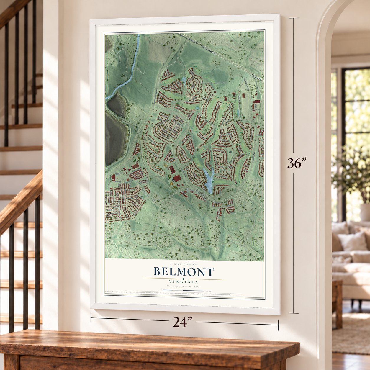
Belmont, Virginia Map Art
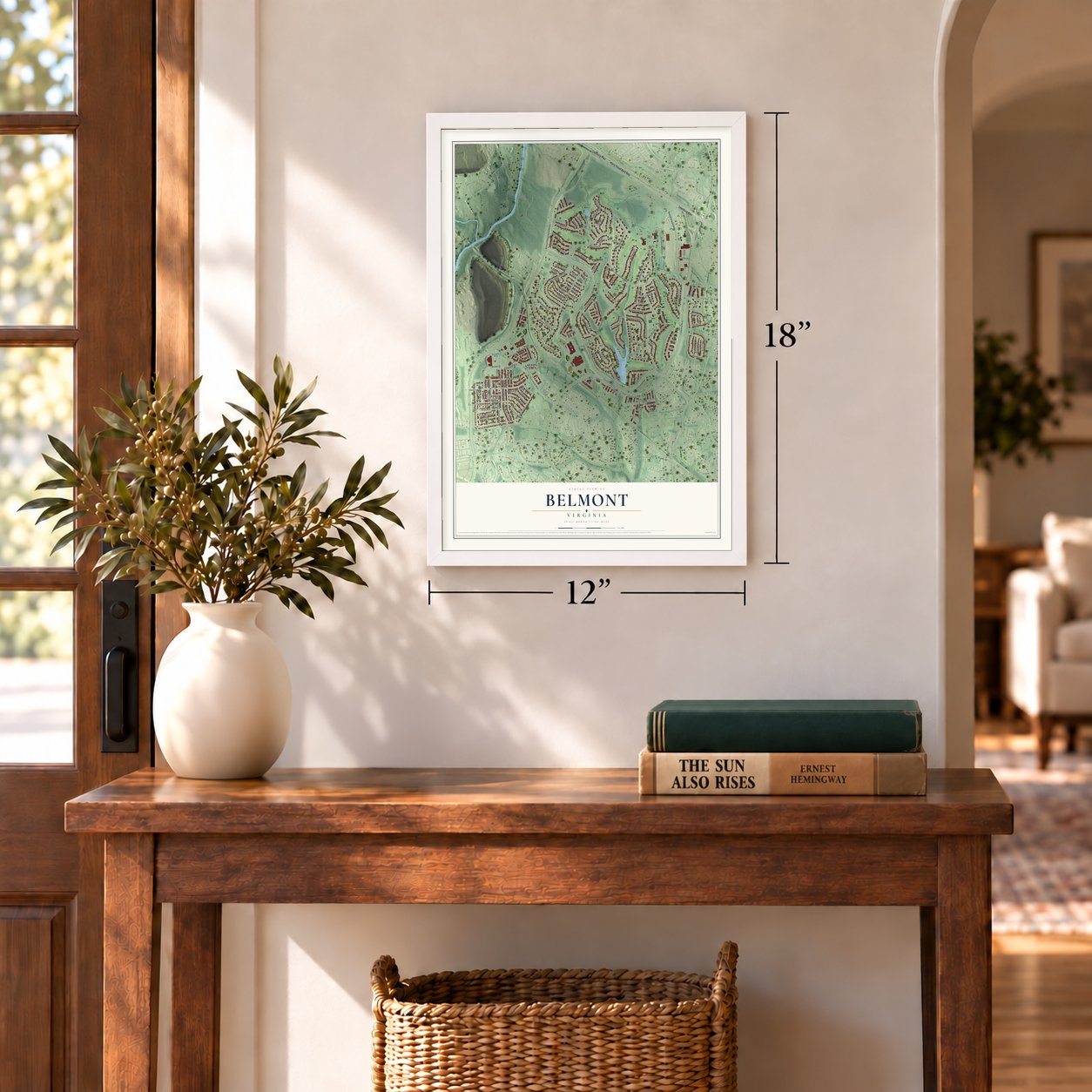
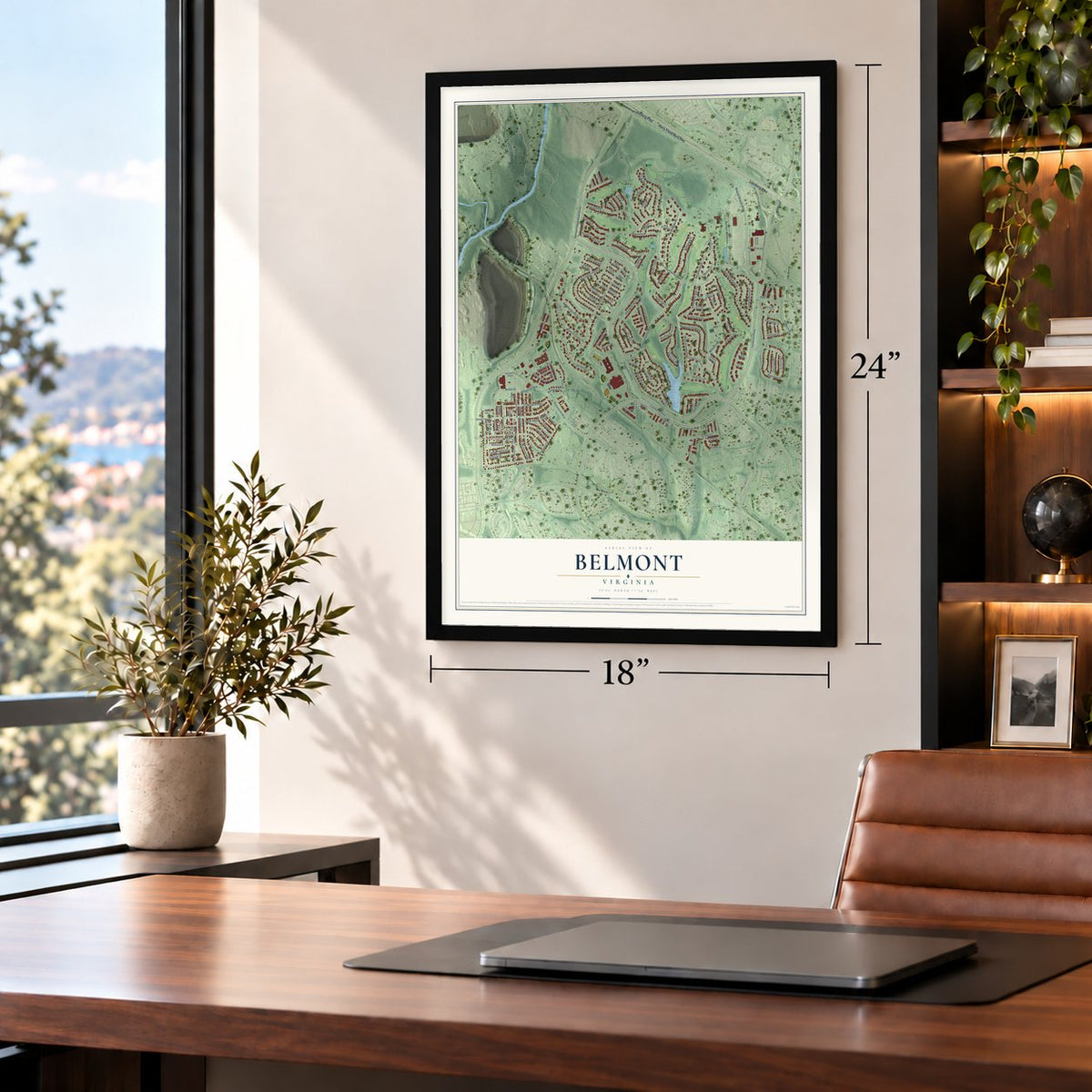
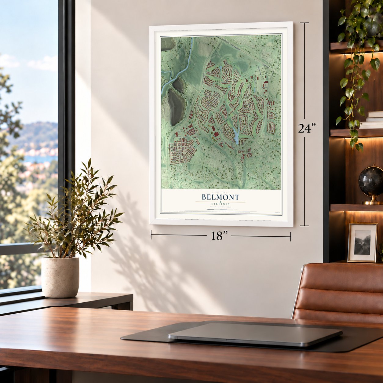
A new map of Belmont, Virginia, made in 2026 and printed to order on thick archival matte paper.
12" x 18" Archival Matte Print
A Map of Home. A Work of Art.
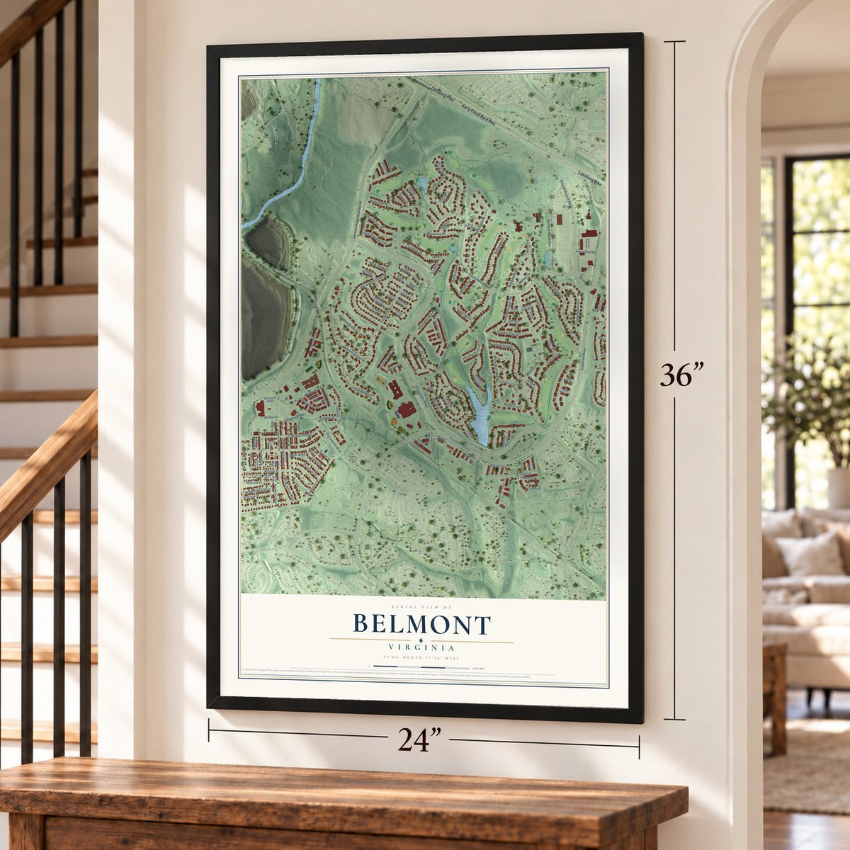
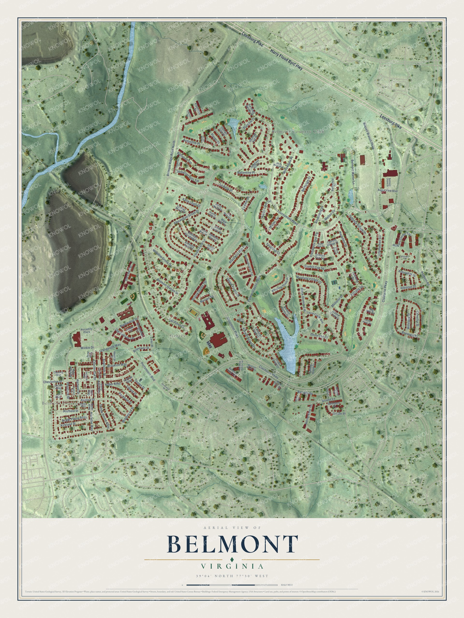
Explore Belmont, Virginia from a whole new perspective. Created using aerial imagery and detailed geographic data, this map captures Belmont building by building, with labeled streets, familiar landmarks, and shaded topographical relief that highlights the natural contours of the landscape.
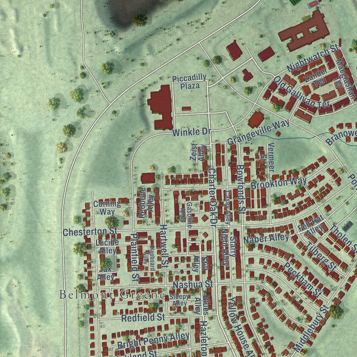
Combining modern data with the timeless character of a vintage atlas, this map is just as interesting up close as it is beautiful on the wall. Whether you grew up in Belmont, spent memorable years there, or call it home today, this unique map is a great way to celebrate a place that means something to you. Zoom in on the preview to look for your street, and then order a print to put your memories on the wall.
Three ways to hang it
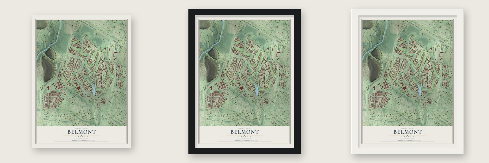
Unframed archival matte, a black wood frame or a white wood frame.
Up close
Geography Worth Displaying
This map was created using accurate cartographic data and authoritative geographic sources, including the U.S. Geological Survey and the Census Bureau. The map brings together terrain, waterways, roads, and building detail. The majority of the streets are labeled, houses are accurately depicted, and the topography is derived from government sources. Combining local data with carefully composed color and shading leads to this beautifully detailed Belmont artwork for your wall.
Rather than simply showing street outlines, we’ve included as many of the street names as we could reasonably fit on the map while keeping their names legible. Zoom in on the high resolution preview to see exactly what’s on the map. We truly set out to create a statement piece for anyone who loves Belmont. So whether it’s for you, or a gift for someone you love, we hope this map of Belmont brings back fond memories.
Read the story behind this map of Belmont, Virginia from 2026.

About Belmont, Virginia
Belmont is a community of 10,268 people in Loudoun County, about 5 miles southeast of Leesburg, the county seat, and 31 miles northwest of Washington, D.C. Its oldest landmark is a brick manor house that a son of Richard Henry Lee built between 1799 and 1802, and the place still carries that estate's name.
The old house stands in the northeast part of the community. Today it serves as the clubhouse of Belmont Country Club, a gated golf neighborhood that grew up around the historic estate.
“Best known for advocating the liberation of enslaved African Americans and promoting their resettlement in Liberia, Mercer also gained recognition for her book Popular Lectures on Ethics (1841).”
- A Lee family manorBelmont Manor House went up between 1799 and 1802, built by a son of Richard Henry Lee. More than two centuries later the house remains in use as the clubhouse at the center of a private golf community.
- Two neighborhoodsBelmont is made up of two large subdivisions. Belmont Country Club, to the east around the old manor, is the bigger one, and Belmont Greene lies to the west.
- Waters bound for the PotomacMost of Belmont's streams run east toward Broad Run, which flows north into the Potomac River. The western edge drains the other way, to Goose Creek, which also ends up in the Potomac.
Find your street
Names on the Belmont map
Every name below is printed on this map. Look for your street, your school, the park where you played, or the pond down the road.
Places and landmarks3
- Belmont Greene
- Belmont Country Club
- Graves
Streets and roads148
- Harry Flood Byrd Highway
- Leesburg Pike
- Charter Oak Drive
- Hazleton Way
- Tournament Parkway
- Hazeltine Place
- Bowfonds Street
- Graves Lane
- Claiborne Parkway
- Belmont Ridge Road North
- Gloucester Parkway
- Russell Branch Parkway
- Medalist Drive
- Middlebury Street
- Forest Farm Lane
- Kiawah Island Drive
- Palmer Classic Parkway
- Alexandras Grove Drive
- Ashburn Road
- Chesterton Street
- Portsmouth Boulevard
- Boxwood Place
- Baltusrol Terrace
- Valhalla Square
- Nashua Street
- Belmont Station Drive
- Belmont Manor Lane
- Blackwolf Run Place
- Clairborne Parkway
- Augusta Village Place
Show all 148 streets
- Augustine Place
- Willowdale Place
- Camellia Street
- Leier Place
- Brookton Way
- Winkle Drive
- Muirfield Village Court
- Interlachen Circle
- Tall Pines Court
- Kirkland Street
- Old Gallivan Terrace
- La Belle Place
- Bethpage Court
- Hartwell Street
- Hickory Corner Terrace
- Meadow Grove Drive
- Presidents Cup Terrace
- Tilberg Street
- Annenberg Drive
- Desert Forest Drive
- Redfield Street
- Mellon Circle
- Dunhill Cup Square
- Nightwatch Street
- Somerset Hills Terrace
- Black Diamond Place
- Ballantine Place
- Millstead Drive
- Peckham Street
- Plainfield Street
- Barretts Square
- Bright Penny Alley
- Yellow House Alley
- Old Line Terrace
- Hibiscus Drive
- Grangeville Way
- Arborvitae Drive
- Corder Place
- Prairie Dunes Terrace
- Morven Square
- Katie Leigh Court
- Blantyre Court
- Branower Street
- Naber Alley
- Mizner Terrace
- Tholen Street
- Foxgrove Court
- Player Court
- La Bete Court
- Piccadilly Plaza
- Blues Alley
- Felt Hat Alley
- Stilt Alley
- Laurel Creek Way
- Saratoga Springs Place
- Whistling Straits Place
- Northville Hills Terrace
- Naples Lakes Terrace
- Bandon Dunes Court
- Blair Park Square
- Kathleen Elizabeth Drive
- Zeist Alley
- Inverness Square
- Stanford Hall Place
- Vermeer Street
- Kentucky Oaks Court
- Rolling Water Terrace
- Kimberly Anne Court
- Hidden Creek Court
- Aspen View Boulevard
- Olympic Club Court
- Macglashan Terrace
- Spyglass Hill Court
- Starry Night Alley
- Edison Club Court
- Lucille Alley
- Ocean Forest Court
- Lindsay Marie Court
- Rothschild Court
- Solheim Cup Terrace
- Belmont Park Terrace
- Zander Terrace
- Cypress Village Drive
- Fishers Island Court
- Jax Alley
- Redbone Alley
- Aspendale Square
- Sandi Louise Court
- Helen Marie Court
- Corning Way
- Rachelle Ann Court
- Alicent Terrace
- Belvedere Court
- Mary Rita Terrace
- Cog Hill Terrace
- Gasoline Alley
- Estancia Terrace
- Meadow Valley Terrace
- Madison Renee Terrace
- White Birch Way
- Amanda Kay Court
- Casey Alley
- Ryder Cup Square
- Belmont Chase Drive
- Sleepy Alley
- Heather Leigh Court
- Scioto Terrace
- Kristin Marie Court
- Julie Martin Court
- Castle Pines Terrace
- Homeland Terrace
- Shadow Creek Court
- Gardenpost Square
- Edgemont Square
- Clapboard Alley
- Pelican Hill Court
- Carys Brook Court
- Ashlawn Court
Names are listed as they appear on the printed map. Zoom into the product photos to find them.
The art of mapping a place
How This Map Was Made
Real places. Remarkable detail. Discover the layers that turn geographic data into a map of home.

The view from above
Aerial imagery reveals the character of the land: woodland, open fields, and the patterns of a place.

The shape of the land
Elevation data brings hills, valleys, and subtle changes in the landscape into view.

The details of home
Roads, waterways, and building footprints come together to make the map feel unmistakably local.

Geography becomes art
Considered color, shading, and typography bring the layers together in a map made for your wall.


Process illustrated with Mendon, Massachusetts. Aerial imagery: USDA NAIP. Terrain: USGS 3D Elevation Program. Map details and finished artwork: KNOWOL.
The Details
About This Print
Choose an archival matte print, or a black or white Ayous wood frame. The archival matte print is unframed.
Select your size and finish above to see the matching product image and price.
Materials & Craftsmanship
A contemporary map with the character of a classic atlas, printed on archival matte paper. Optional frames are made from Ayous wood.
Your printed map does not include the watermark shown in the full-map preview.
Shipping & Delivery
Free shipping within the United States. Every print is made to order in the USA.
Buying a gift? Add a note in your cart and we'll include it. We never put prices in the package.
Prints ship within 2 to 3 business days. Allow 7 to 10 days total from ordering for delivery. Timing may vary during holidays or periods of high order volume.
Read our shipping policy.
Returns and damaged prints
Each print is made to order. Change-of-mind refunds are not available after production.
If your print arrives damaged, misprinted or incorrect, contact support@knowol.com within 30 days of receiving it. Include your order number, photos and a description of the issue.
Read our full refund and replacement policy. For questions about your order, email support@knowol.com.
Find your town
Looking for another city?
Find a map of home in our Virginia collection, or any town in the country.
Nearby
Maps of towns near Belmont
Know someone from one of these towns? Their map makes a great gift.
 Lansdowne
, Virginia
From $39.99See the map
 Goose Creek Village
, Virginia
From $39.99See the map
 One Loudoun
, Virginia
From $39.99See the map
More maps nearby: Ashburn, University Center, Broadlands, Kincora and Leesburg.