
Search for another town




Free U.S. delivery 7 to 10 days after you order
Auburn, Washington Map Art
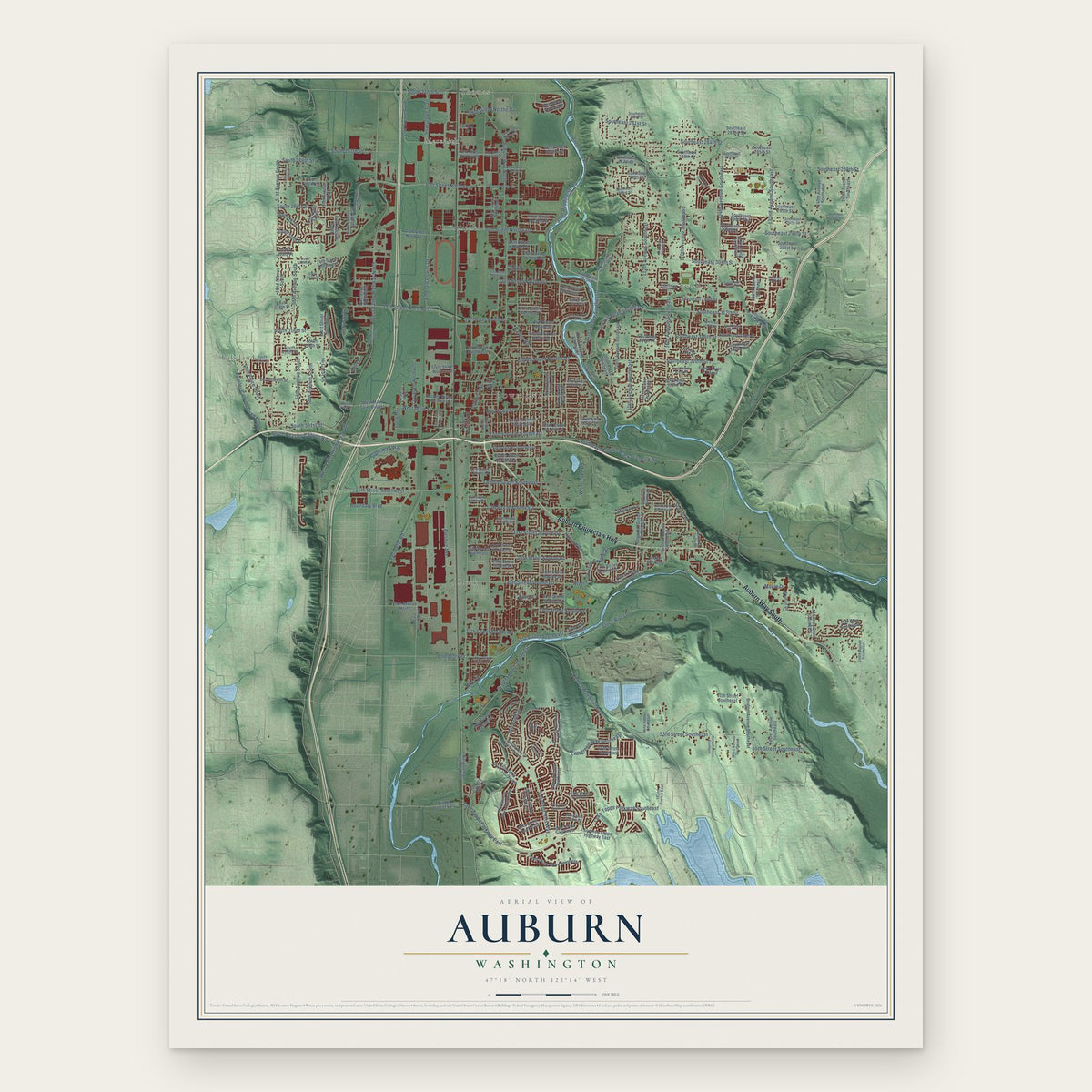
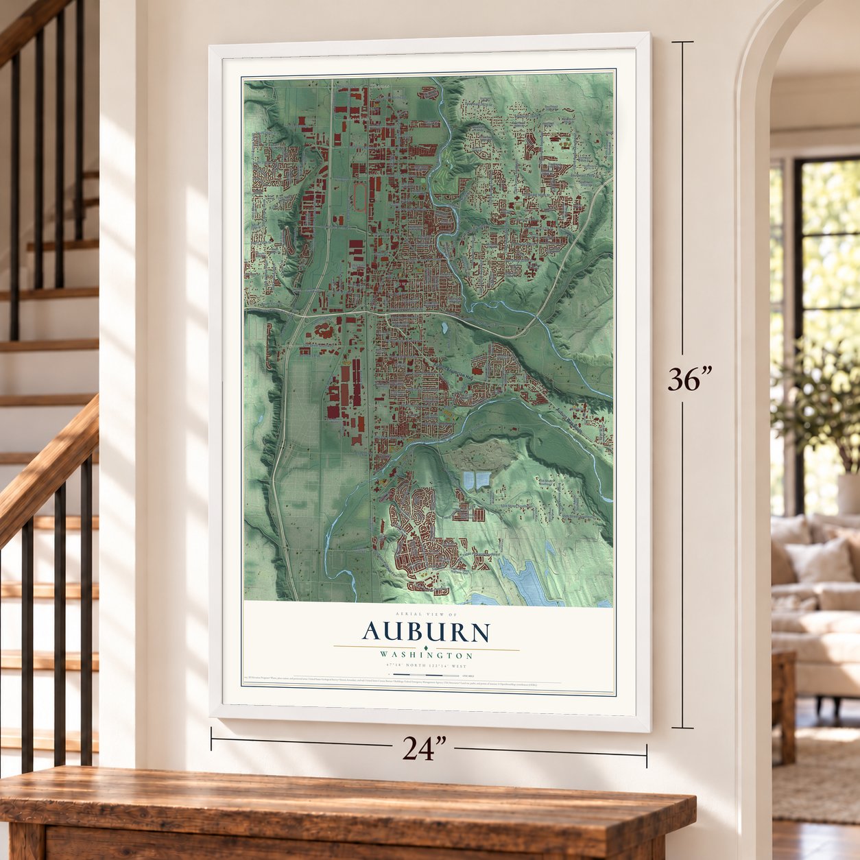
A new map of Auburn, Washington, made in 2026 and printed to order on thick archival matte paper.
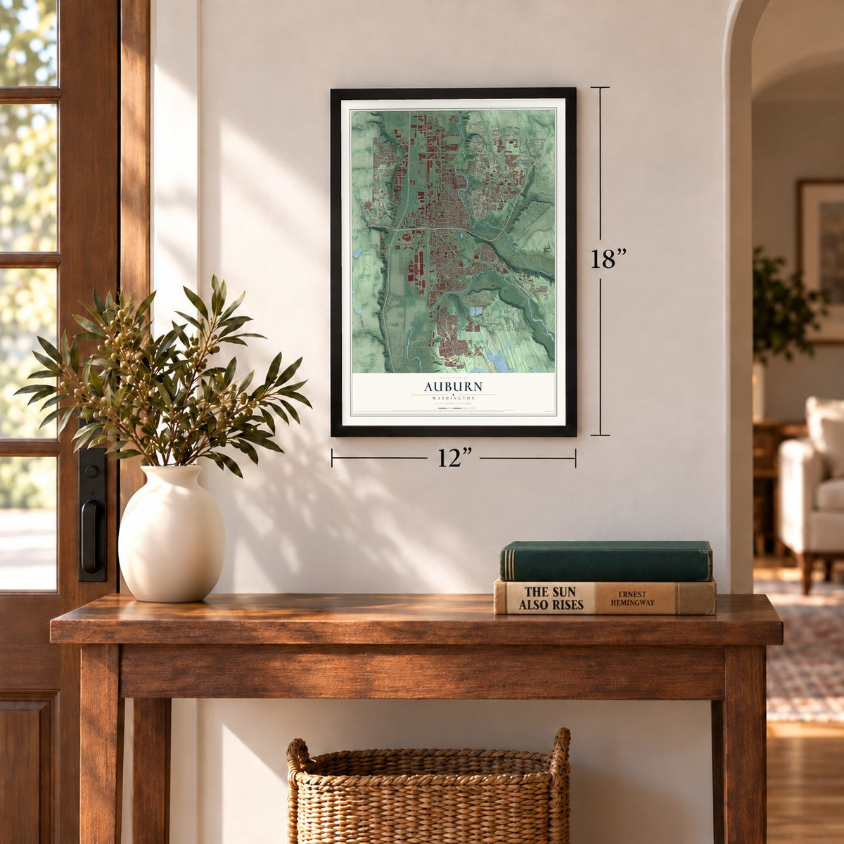
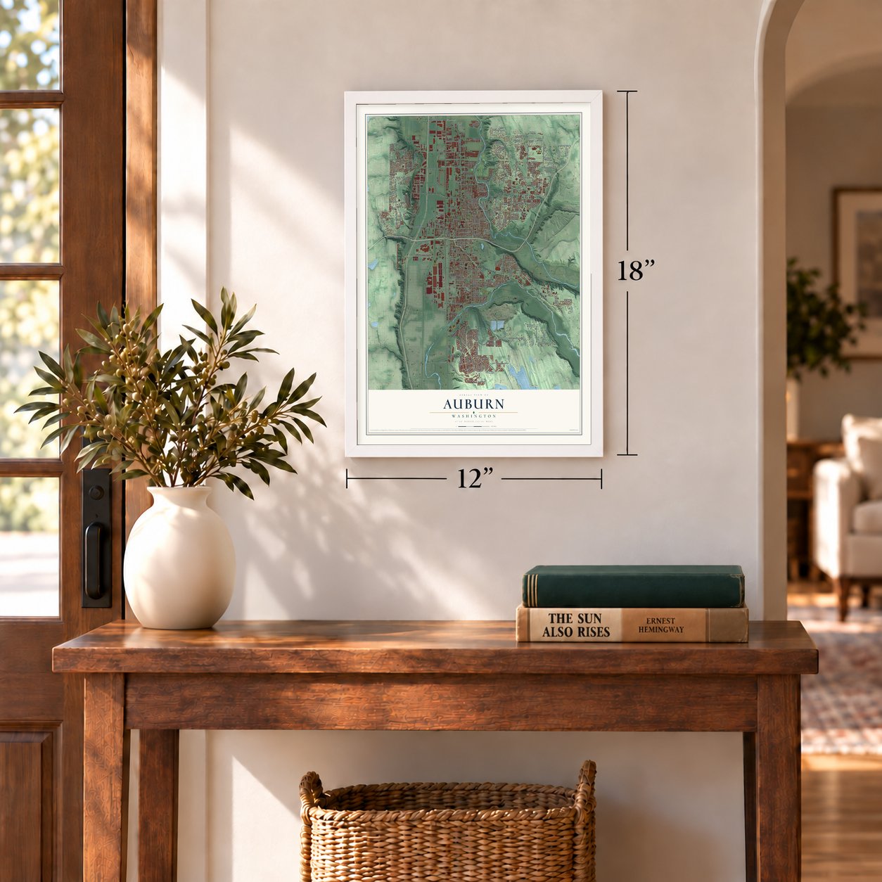
12" x 18" Archival Matte Print
A Map of Home. A Work of Art.
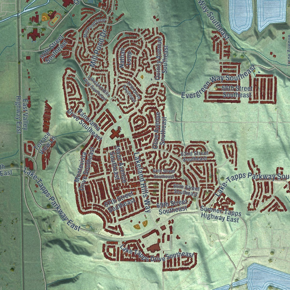
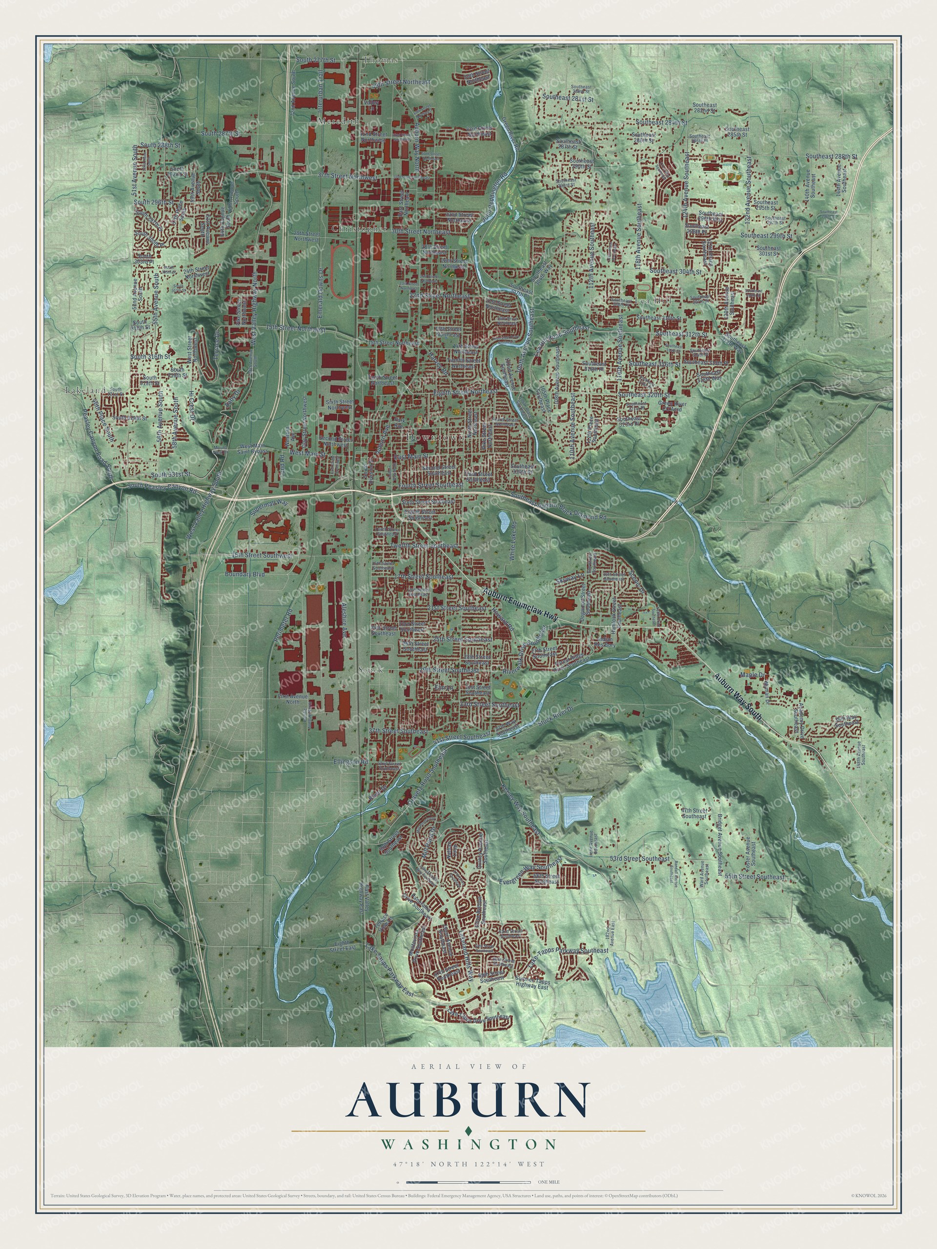
Explore Auburn, Washington from a whole new perspective. Created using aerial imagery and detailed geographic data, this map captures Auburn building by building, with labeled streets, familiar landmarks, and shaded topographical relief that highlights the natural contours of the landscape.
Combining modern data with the timeless character of a vintage atlas, this map is just as interesting up close as it is beautiful on the wall. Whether you grew up in Auburn, spent memorable years there, or call it home today, this unique map is a great way to celebrate a place that means something to you. Zoom in on the preview to look for your street, and then order a print to put your memories on the wall.
Three ways to hang it
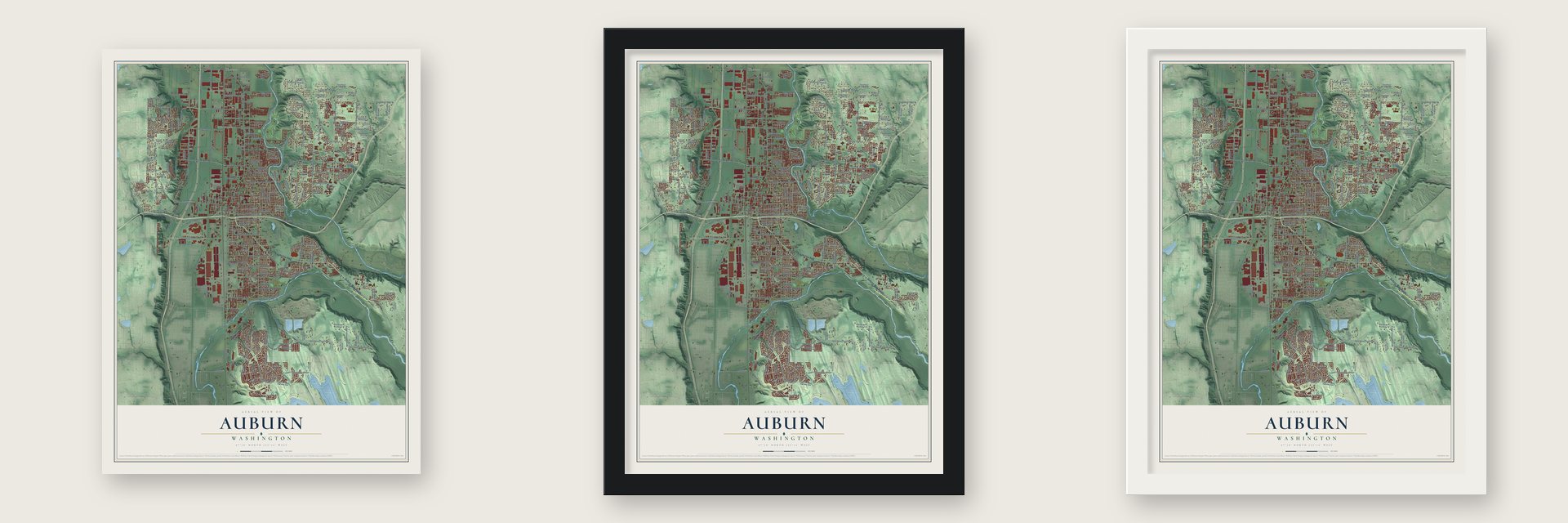
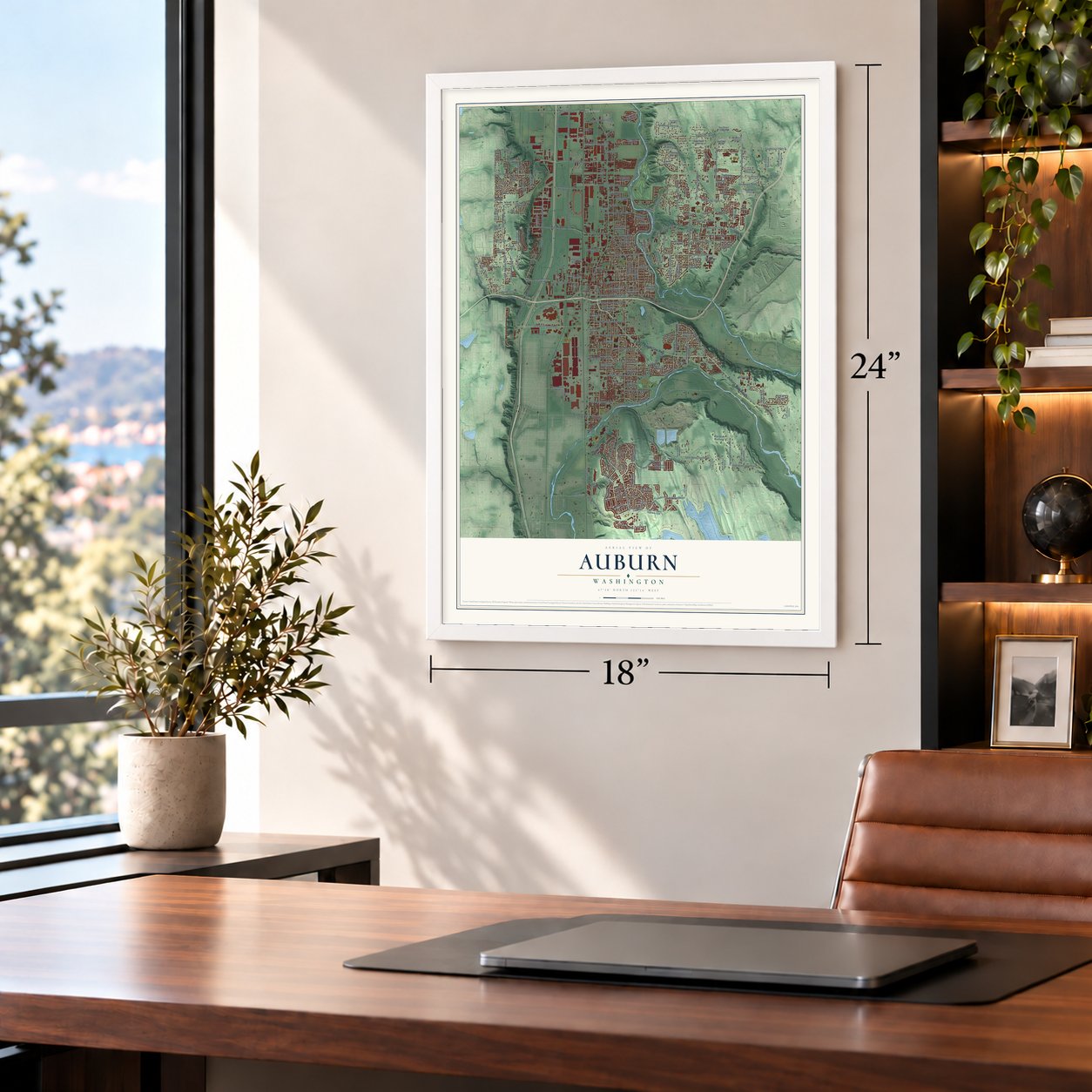
Unframed archival matte, a black wood frame or a white wood frame.
Up close
Geography Worth Displaying
This map was created using accurate cartographic data and authoritative geographic sources, including the U.S. Geological Survey and the Census Bureau. The map brings together terrain, waterways, roads, and building detail. The majority of the streets are labeled, houses are accurately depicted, and the topography is derived from government sources. Combining local data with carefully composed color and shading leads to this beautifully detailed Auburn artwork for your wall.
Rather than simply showing street outlines, we’ve included as many of the street names as we could reasonably fit on the map while keeping their names legible. Zoom in on the high resolution preview to see exactly what’s on the map. We truly set out to create a statement piece for anyone who loves Auburn. So whether it’s for you, or a gift for someone you love, we hope this map of Auburn brings back fond memories.
Read the story behind this map of Auburn, Washington from 2026.

About Auburn, Washington
Auburn is a city of 87,256 people in King County, 20 miles south of Seattle, near the spot where the Green and White rivers once joined. The Skopamish, Smalhkamish and Stkamish peoples lived in this valley first, and settlers came in the 1850s. When war broke out in 1855, Lieutenant William Slaughter led troops from Fort Steilacoom and camped nearby. On December 4, 1855, Native fighters attacked his camp and killed him and two others. The war ended within months, and a new treaty set up the Muckleshoot reservation.
Settlers slowly came back, and in 1866 Dr. Levi Ballard opened a medical practice and later a general store. In February 1886 the Ballards laid out the first town plat and named the place Slaughter, after the fallen officer, and it was incorporated on June 13, 1891. Older settlers saw the name as a memorial, but newcomers found it grim. On February 21, 1893, the state legislature renamed the town Auburn, after Oliver Goldsmith's poem The Deserted Village.
“It’s not very inviting when your town hotel is referred to as the Slaughter House.”
- Dynamite in the nightAuburn grew hops until aphids wiped out nearly the whole crop in 1890, and dairy and berry farms took over. Logjams flooded the valley each year, so some farmers secretly blew them up at night, flooding their neighbors instead. The feud between White River and Stuck River farmers ended in 1906, when a huge flood sent most of the water down the Stuck. A diversion dam followed, and the Howard Hanson Dam of 1962 left the valley nearly flood-free.
- Rails to the marketThe Northern Pacific Railroad ran its line through town in 1883, and the Seattle-Tacoma Interurban began service in 1902. Farmers could now get fresh crops to both cities within hours of picking them. Better rail and roads drew the Borden Condensery and the Northern Clay Company, and the railroad kept a steam locomotive roundhouse in Auburn until 1987.
- About 300 families, 25 returnedIn 1917 the city gave part of Pioneer Cemetery to the White River Buddhist Church, which served a growing Japanese community. Between the world wars the White River All-Stars baseball team won four July 4th tournaments. After Executive Order 9066 in 1942, Auburn's Japanese families were sent to camps, and only around 25 of about 300 came back. In 1980 a federal commission called the detainment unjust.
- Boeing since 1963Boeing built a plant here in 1963 to mill the sheet metal skin of jet airliners. It is now called the largest airplane parts plant in the world, turning out 1.265 million parts each year, as farmland in the valley gave way to industry.
Find your street
Names on the Auburn map
Every name below is printed on this map. Look for your street, your school, the park where you played, or the pond down the road.
Places and landmarks7
- Downtown
- Thomas
- Christopher
- Lakeland
- Lea Hill
- Meredith
- Stuck
Streets and roads242
- Auburn Way South
- Auburn Enumclaw Highway
- Southeast 304th Street
- 132nd Avenue Southeast
- Southeast 312th Street
- Southeast 320th Street
- Eighth Street Northeast
- South 331st Street
- Hi Crest Drive
- 104th Avenue Southeast
- Lea Hill Road Southeast
- Aaby Drive
- Supermall Way
- 15th Street Northwest
- 37th Street Northwest
- Fourth Street Southeast
- 46th Place South
- Terrace Drive
- Auburn Way North
- West Valley Highway North
- 51st Avenue South
- Stuck River Drive
- 124th Avenue Southeast
- 15th Street Southwest
- 112th Avenue Southeast
- Evergreen Way Southeast
- 116th Avenue Southeast
- 56th Avenue South
- Kersey Way Southeast
- 53rd Street Southeast
Show all 242 streets
- 118th Avenue Southeast
- 17th Street Southeast
- Peasley Canyon Road South
- South Peasley Canyon Road
- 55th Avenue South
- South 277th Street
- Emerald Downs Drive
- Oravetz Road Southeast
- East Main Street
- Southeast Auburn-Black Diamond Road
- Southeast 288th Street
- 37th Street Southeast
- Lakeland Hills Way
- Perimeter Road
- Lake-Tapps Parkway Southeast
- John Reddington Road
- 21st Street Southeast
- Lake Tapps Parkway East
- West Valley Highway South
- 110th Avenue Southeast
- West Main Street
- 41st Street Southeast
- 25th Street Southeast
- Southeast 284th Street
- 29th Street Southeast
- South 296th Street
- 22nd Street Northeast
- 55th Street Southeast
- Riverwalk Drive Southeast
- White Lake Road
- Aleshire Avenue
- 33rd Street Southeast
- Twelfth Street Southeast
- Scenic Drive
- South 287th Street
- Mill Pond Drive
- Southeast 299th Street
- 49th Street Northeast
- Howard Road
- Southeast 316th Street
- 30th Street Northeast
- Boundary Boulevard
- 58th Avenue South
- Harvey Road
- Interurban Trail
- South 316th Street
- Southeast 281st Street
- Maple Drive
- River Drive
- Ellingson Road
- South 288th Street
- Auburn Avenue
- Skyway Lane
- Lund Road
- Elm Lane
- Southeast 307th Place
- Southeast 304th Way
- 59th Avenue South
- South 292nd Street
- 16th Street Northeast
- Wyman Drive
- 61st Avenue South
- 130th Avenue Southeast
- 108th Avenue Southeast
- Pike Street Northeast
- 24th Street Southeast
- 28th Street Southeast
- East Street Northeast
- Southeast 295th Street
- 23rd Street Southeast
- Montevista Drive Southeast
- Quincy Avenue Southeast
- 52nd Avenue South
- Dogwood Street Southeast
- Second Street Southeast
- East Valley Highway East
- Southeast 282nd Street
- Tenth Street Northeast
- 69th Street Southeast
- Academy Drive Southeast
- 26th Street Southeast
- 14th Street Northeast
- 29th Street Northwest
- Southeast 315th Place
- Southeast 316th Place
- 127th Place Southeast
- Twelfth Street Northeast
- Southeast 290th Street
- Green River Road
- Olive Avenue Southeast
- Southeast 301st Street
- Forest Ridge Drive Southeast
- Sixth Street Southeast
- North Street Northeast
- 50th Street Southeast
- Eighth Street Southeast
- 27th Street Southeast
- 112th Place Southeast
- 72nd Avenue South
- Lake Tapps Drive Southeast
- Southeast 298th Place
- Bridget Avenue Southeast
- 26th Street Northeast
- West Street Northwest
- 15th Street Northeast
- South 300th Place
- 47th Street Southeast
- 67th Street Southeast
- Sumner-Tapps Highway East
- Clay Street Northwest
- Foster Avenue Southeast
- South 324th Street
- 65th Avenue South
- 57th Place South
- 144th Avenue Southeast
- 31st Street Southeast
- Southeast 296th Way
- Pike Street Northwest
- 21st Street Northeast
- 35th Way Southeast
- Southeast 286th Street
- 140th Avenue Southeast
- 105th Place Southeast
- South 318th Street
- Second Street Northwest
- Southeast 318th Way
- Hemlock Street Southeast
- 32nd Street Northeast
- Panorama Drive Southeast
- Southeast 310th Street
- 43rd Street Northeast
- Nathan Loop
- 56th Street Southeast
- First Avenue North
- Green River CC Acrd
- 28th Street Northeast
- Southeast 323rd Place
- South 297th Place
- Southeast 287th Street
- Sixth Street Northwest
- Third Street Southeast
- Eighth Street East
- West Main Saint Bypass
- 50th Street Northeast
- 102nd Avenue Southeast
- 64th Avenue South
- Isaac Avenue Southeast
- Southeast 312th Way
- 42nd Street Northwest
- Park Avenue
- South Division Street
- Western Avenue
- 24th Street Northwest
- Southeast 285th Street
- Terrace View Lane
- 37th Way Southeast
- Indian Res Bory
- South 312th Street
- Southeast 330th Street
- South 303rd Place
- Valley Lane
- South 319th Street
- Fourth Street Northeast
- South 321st Street
- Elm Street Southeast
- Mount View Drive
- Southeast 314th Place
- 19th Street Southeast
- Southeast 297th Street
- 62nd Street Southeast
- Southeast 286th Place
- Southeast 308th Place
- 68th Avenue South
- 66th Street Southeast
- 16th Street Southeast
- Southeast 293rd Street
- 15th Street Southeast
- Southeast 321st Place
- Southeast 307th Street
- 104th Place Southeast
- Ward Avenue Southeast
- Tenth Street Southeast
- 148th Avenue Southeast
- 19th Drive Northeast
- Pacific Avenue North
- 182nd Avenue East
- Irene Avenue Southeast
- Southeast 280th Street
- 42nd Street Southeast
- Lakeland Hills Way Southeast
- Riverview Drive Northeast
- 64th Street Southeast
- 42nd Street Northeast
- Mill Pond Loop
- Southeast 318th Place
- 37th Street Northeast
- 114th Place Southeast
- South 305th Street
- 57th Drive Southeast
- 52nd Place South
- 24th Street Northeast
- Southeast 296th Street
- Randall Avenue Southeast
- Southeast 314th Street
- Southeast 306th Street
- Noble Court Southeast
- 40th Street Northeast
- 121st Way Southeast
- 45th Street Northeast
- 23rd Street Northeast
- East Street Southwest
- South 307th Street
Names are listed as they appear on the printed map. Zoom into the product photos to find them.
The art of mapping a place
How This Map Was Made
Real places. Remarkable detail. Discover the layers that turn geographic data into a map of home.

The view from above
Aerial imagery reveals the character of the land: woodland, open fields, and the patterns of a place.

The shape of the land
Elevation data brings hills, valleys, and subtle changes in the landscape into view.

The details of home
Roads, waterways, and building footprints come together to make the map feel unmistakably local.

Geography becomes art
Considered color, shading, and typography bring the layers together in a map made for your wall.


Process illustrated with Mendon, Massachusetts. Aerial imagery: USDA NAIP. Terrain: USGS 3D Elevation Program. Map details and finished artwork: KNOWOL.
The Details
About This Print
Choose an archival matte print, or a black or white Ayous wood frame. The archival matte print is unframed.
Select your size and finish above to see the matching product image and price.
Materials & Craftsmanship
A contemporary map with the character of a classic atlas, printed on archival matte paper. Optional frames are made from Ayous wood.
Your printed map does not include the watermark shown in the full-map preview.
Shipping & Delivery
Free shipping within the United States. Every print is made to order in the USA.
Buying a gift? Add a note in your cart and we'll include it. We never put prices in the package.
Prints ship within 2 to 3 business days. Allow 7 to 10 days total from ordering for delivery. Timing may vary during holidays or periods of high order volume.
Read our shipping policy.
Returns and damaged prints
Each print is made to order. Change-of-mind refunds are not available after production.
If your print arrives damaged, misprinted or incorrect, contact support@knowol.com within 30 days of receiving it. Include your order number, photos and a description of the issue.
Read our full refund and replacement policy. For questions about your order, email support@knowol.com.
Find your town
Looking for another city?
Find a map of home in our Washington collection, or any town in the country.
Nearby
Maps of towns near Auburn
Know someone from one of these towns? Their map makes a great gift.
 Algona
, Washington
From $39.99See the map
 Pacific
, Washington
From $39.99See the map
 Lake Holm
, Washington
From $39.99See the map
More maps nearby: Lakeland South, Lakeland North, Lake Morton-Berrydale, Lake Tapps and Sumner.