
Search for another town





Free U.S. delivery 7 to 10 days after you order
Sumner, Washington Map Art
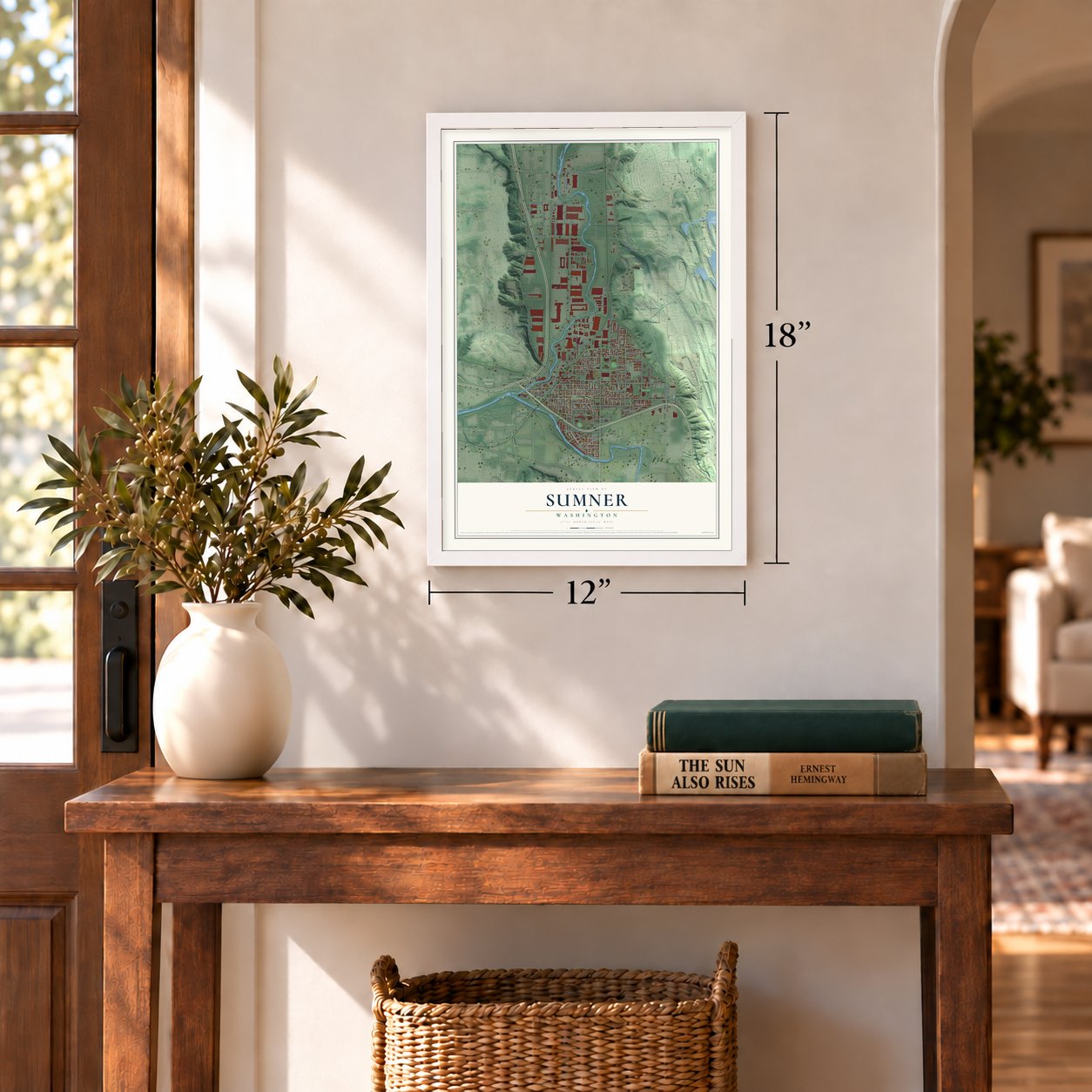
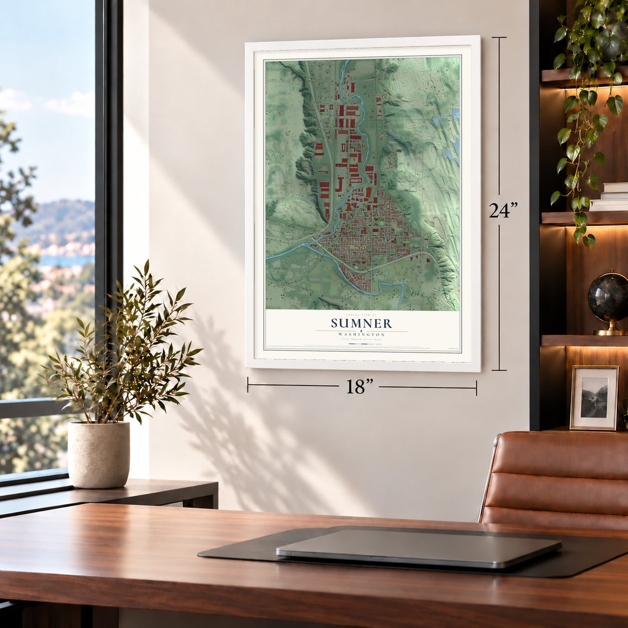
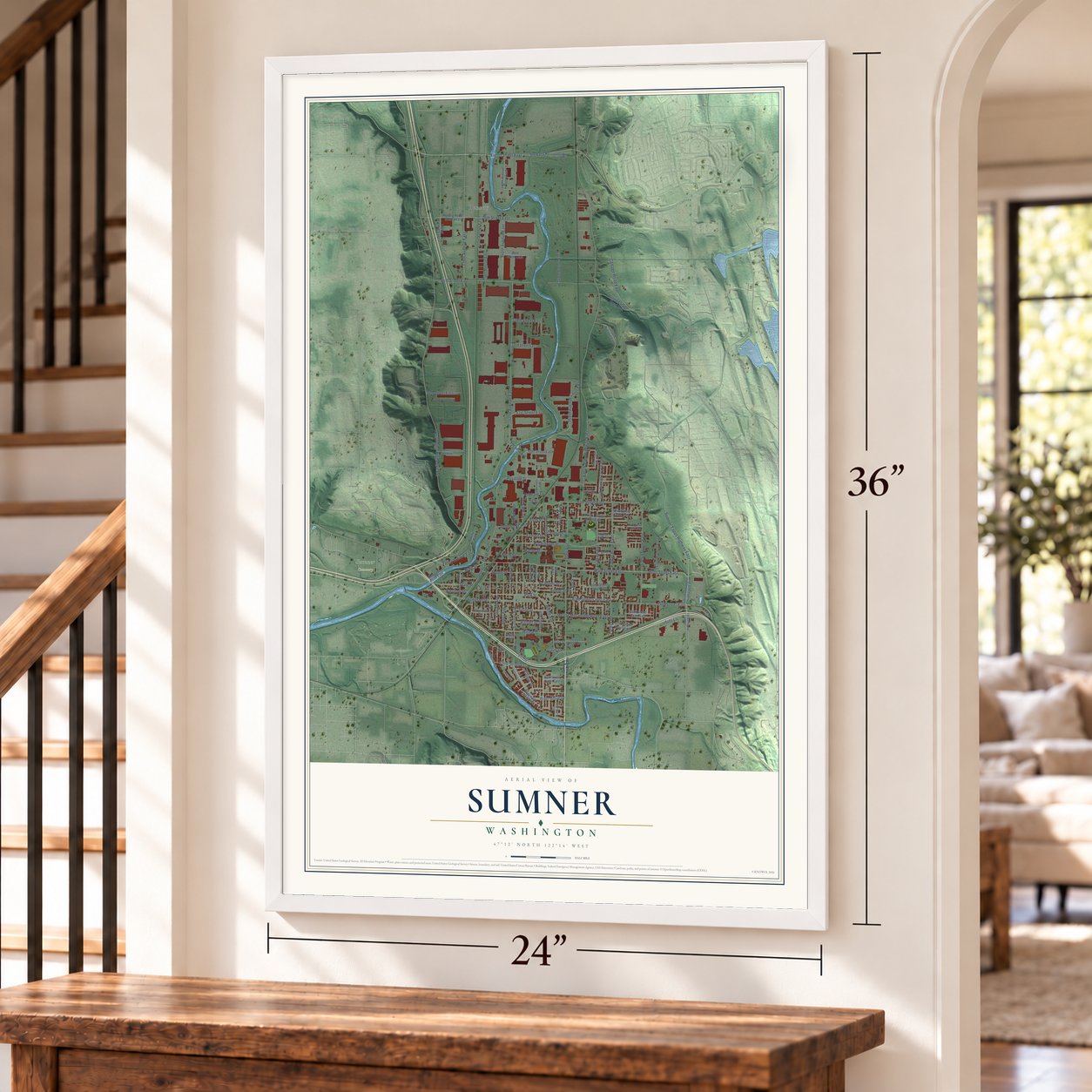
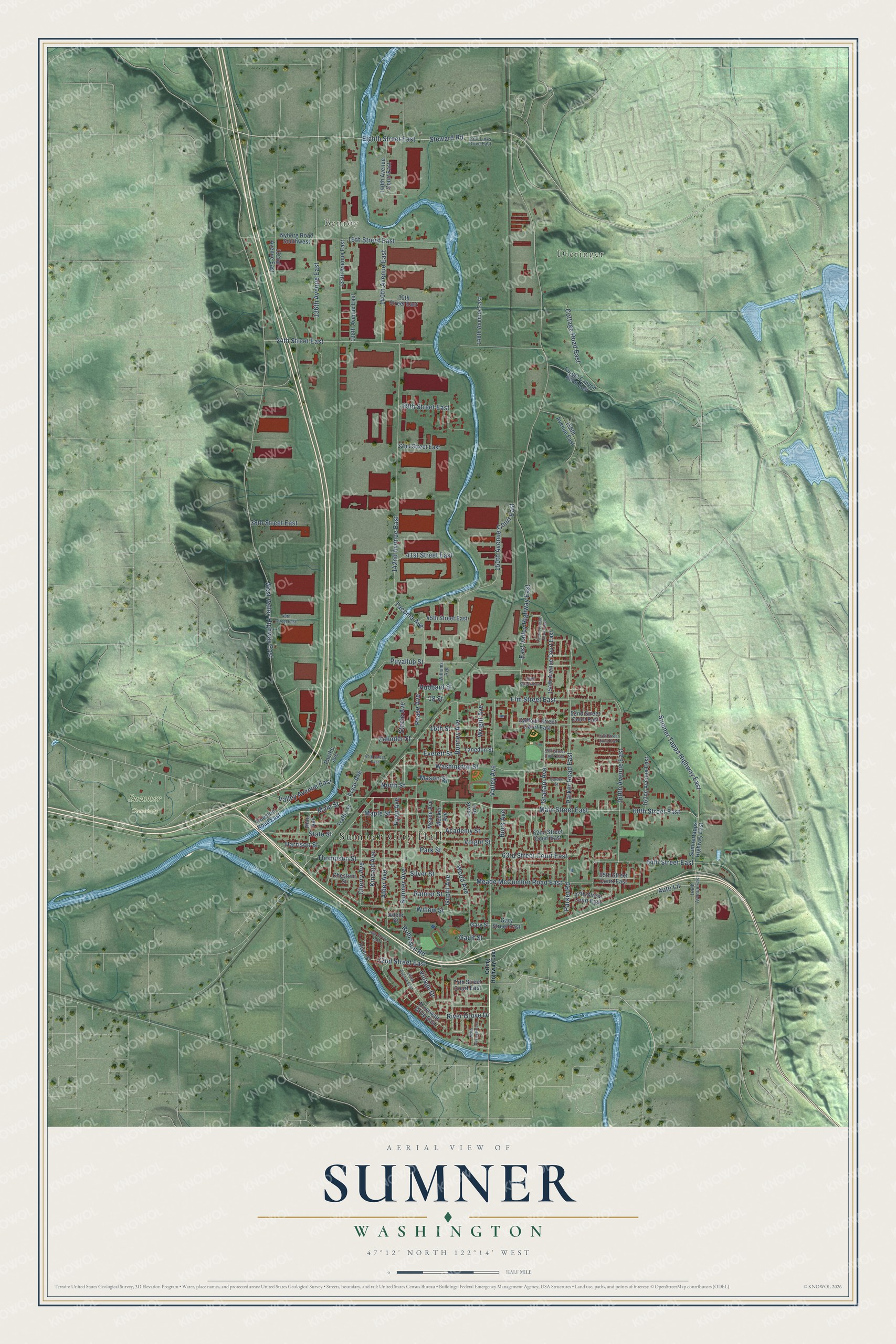
A new map of Sumner, Washington, made in 2026 and printed to order on thick archival matte paper.
12" x 18" Archival Matte Print
A Map of Home. A Work of Art.
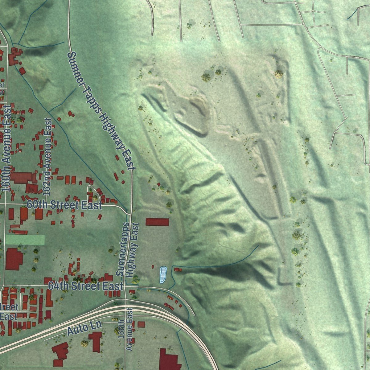
Explore Sumner, Washington from a whole new perspective. Created using aerial imagery and detailed geographic data, this map captures Sumner building by building, with labeled streets, familiar landmarks, and shaded topographical relief that highlights the natural contours of the landscape.
Combining modern data with the timeless character of a vintage atlas, this map is just as interesting up close as it is beautiful on the wall. Whether you grew up in Sumner, spent memorable years there, or call it home today, this unique map is a great way to celebrate a place that means something to you. Zoom in on the preview to look for your street, and then order a print to put your memories on the wall.
Three ways to hang it
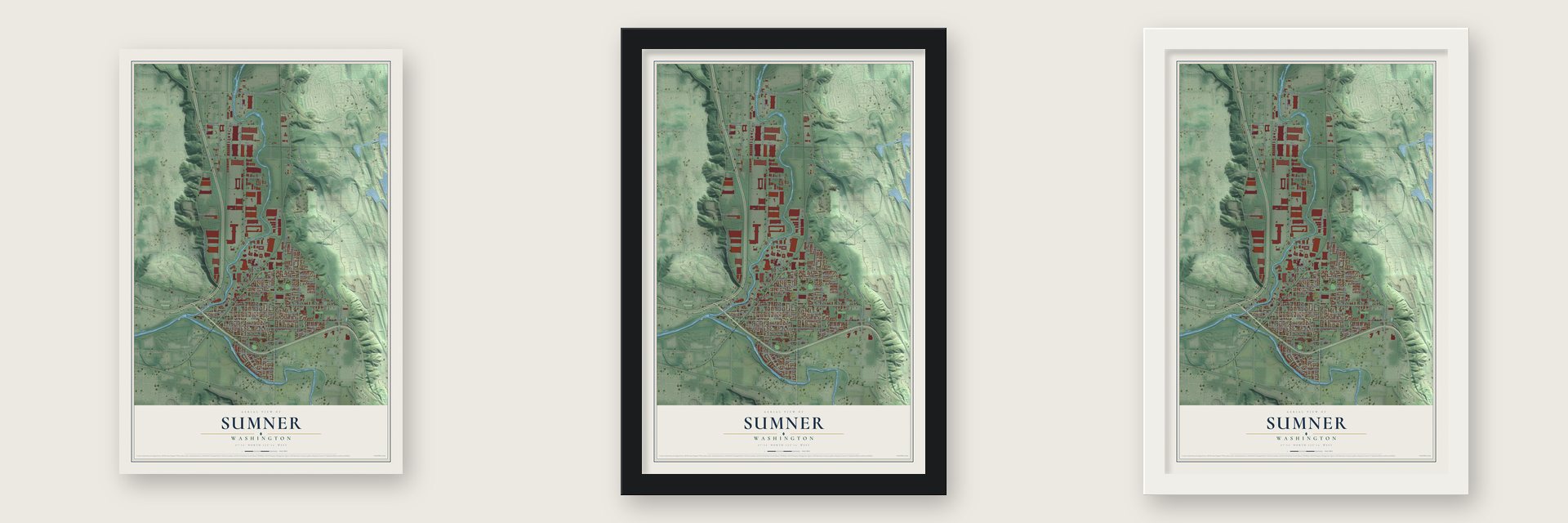
Unframed archival matte, a black wood frame or a white wood frame.
Up close
Geography Worth Displaying
This map was created using accurate cartographic data and authoritative geographic sources, including the U.S. Geological Survey and the Census Bureau. The map brings together terrain, waterways, roads, and building detail. The majority of the streets are labeled, houses are accurately depicted, and the topography is derived from government sources. Combining local data with carefully composed color and shading leads to this beautifully detailed Sumner artwork for your wall.
Rather than simply showing street outlines, we’ve included as many of the street names as we could reasonably fit on the map while keeping their names legible. Zoom in on the high resolution preview to see exactly what’s on the map. We truly set out to create a statement piece for anyone who loves Sumner. So whether it’s for you, or a gift for someone you love, we hope this map of Sumner brings back fond memories.
Read the story behind this map of Sumner, Washington from 2026.

About Sumner, Washington
Sumner is a city of 10,621 people in northern Pierce County, with Puyallup to its west, Auburn to its north and Bonney Lake to its east. Settlement began here in 1853, when the place was known as Stuck Junction. Thirty years later, in 1883, George H. Ryan platted a town on the site because he expected the Northern Pacific Railway to put a stop there.
Trains still serve the town, since Sounder commuter trains stop at a downtown station and link Sumner directly with Seattle and Tacoma. REI runs corporate offices and a large distribution center in the city, and Dillanos Coffee Roasters is based here as well.
“Sumner was first settled in 1853 by William Kincaid, a widower with seven children who entered the Puget Sound region through Naches Pass as part of the James Longmire wagon party.”
- Named Sumner in 1891The town was called Franklin until 1891. That year the Post Office Department asked for a new name, because other towns with similar names were causing confusion. A lottery settled the question, and the town took the name of Charles Sumner, the abolitionist senator.
- George H. Ryan's townRyan laid out the townsite in 1883, betting that the railroad would come through. A Pierce County history from the same period printed photographs of his logging camp, his sawmill and his hop field at Sumner, along with pictures of Whitworth College at Sumner and the town's early school.
- Rhubarb Pie Capital of the WorldSumner gives itself that title and celebrates it every year with a festival called Rhubarb Days. Each April the town also hosts one of the four parts of the Daffodil Parade, which moves through Tacoma, Puyallup, Sumner and Orting.
- Built on a mudflowAbout 5,600 years ago the Osceola Mudflow poured off Mount Rainier and left a deposit 300 feet deep over part of the ground where Sumner now stands. The city, along with Orting and Puyallup, still lies in the lahar hazard zone for the mountain.
Find your street
Names on the Sumner map
Every name below is printed on this map. Look for your street, your school, the park where you played, or the pond down the road.
Places and landmarks4
- Sumner City Hall
- Benroy
- Dieringer
- Sumner Cemetery
Streets and roads115
- Sumner Tapps Highway East
- Main Street
- Main Street East
- Eighth Street East
- 60th Street East
- West Valley Highway East
- East Valley Highway East
- 142nd Avenue East
- Wood Avenue
- 24th Street East
- Valley Avenue
- Parker Road East
- Washington Street
- 160th Avenue East
- 64th Street East
- Valley Avenue East
- Sumner Avenue
- Elm Street East
- Puyallup Street
- 16th Street East
- 150th Avenue Court East
- Academy Street
- Meade McCumber Road East
- Alder Avenue
- Fryar Avenue
- 63rd Street Court East
- Cherry Avenue
- Willow Street
- 140th Avenue East
- Maple Street
Show all 115 streets
- Tacoma Avenue
- 136th Avenue East
- 72nd Street East
- Graham Avenue
- Steward Road
- Cottage Road East
- Kincaid Avenue
- Bonney Avenue
- Thompson Street
- River Grove Drive
- Ryan Avenue
- State Street
- Park Street
- Rainier Street
- 29th Street East
- Harrison Street
- 38th Street East
- 41st Street East
- Silver Street
- Guptil Avenue
- Everett Street
- 16th Street
- Pease Avenue
- Auto Lane
- Robinson Road
- Wright Avenue
- Voight Street
- Zehnder Street
- Bock Avenue
- Mason Street
- Village Drive
- Parker Road
- Steele Avenue
- North Street
- Hubbard Street
- Gault Street
- 18 Street
- Sumnertapps Highway East
- 140th Avenue Court East
- 67th Street Court East
- 154th Avenue Court East
- 148th Avenue East
- Forest Canyon Road East
- 45th Street East
- Daffodil Street Court East
- Traffic Street
- 162nd Avenue East
- 20th Street East
- Meade Avenue
- 156th Avenue East
- 137th Avenue East
- 62nd Street Court East
- 32nd Street East
- 138th Avenue East
- Nyberg Road Southwest
- Meeker Avenue
- Riverwalk Drive East
- Houston Road East
- 74th Street Court East
- Hunt Avenue
- 65th Street Court East
- Lewis Avenue
- 132nd Avenue East
- Langdon Street
- Gary Street East
- Chestnut Street
- 52nd Street Court East
- Pacific Avenue
- Gary Street
- River Street
- Adele Street
- Williams Avenue
- Golf Links Drive East
- 166th Avenue East
- Orting Highway East
- 54th Street Court East
- 153rd Avenue Court East
- 143rd Avenue East
- 48th Street East
- 149th Avenue East
- Garden Street
- 55th Street Court East
- 57th Street East
- 70th Street East
- 50th Street East
Names are listed as they appear on the printed map. Zoom into the product photos to find them.
The art of mapping a place
How This Map Was Made
Real places. Remarkable detail. Discover the layers that turn geographic data into a map of home.

The view from above
Aerial imagery reveals the character of the land: woodland, open fields, and the patterns of a place.

The shape of the land
Elevation data brings hills, valleys, and subtle changes in the landscape into view.

The details of home
Roads, waterways, and building footprints come together to make the map feel unmistakably local.

Geography becomes art
Considered color, shading, and typography bring the layers together in a map made for your wall.


Process illustrated with Mendon, Massachusetts. Aerial imagery: USDA NAIP. Terrain: USGS 3D Elevation Program. Map details and finished artwork: KNOWOL.
The Details
About This Print
Choose an archival matte print, or a black or white Ayous wood frame. The archival matte print is unframed.
Select your size and finish above to see the matching product image and price.
Materials & Craftsmanship
A contemporary map with the character of a classic atlas, printed on archival matte paper. Optional frames are made from Ayous wood.
Your printed map does not include the watermark shown in the full-map preview.
Shipping & Delivery
Free shipping within the United States. Every print is made to order in the USA.
Buying a gift? Add a note in your cart and we'll include it. We never put prices in the package.
Prints ship within 2 to 3 business days. Allow 7 to 10 days total from ordering for delivery. Timing may vary during holidays or periods of high order volume.
Read our shipping policy.
Returns and damaged prints
Each print is made to order. Change-of-mind refunds are not available after production.
If your print arrives damaged, misprinted or incorrect, contact support@knowol.com within 30 days of receiving it. Include your order number, photos and a description of the issue.
Read our full refund and replacement policy. For questions about your order, email support@knowol.com.
Find your town
Looking for another city?
Find a map of home in our Washington collection, or any town in the country.
Nearby
Maps of towns near Sumner
Know someone from one of these towns? Their map makes a great gift.
 Edgewood
, Washington
From $39.99See the map
 Pacific
, Washington
From $39.99See the map
 North Puyallup
, Washington
From $39.99See the map
More maps nearby: Lake Tapps, Alderton, Algona, Bonney Lake and Lakeland South.