
Search for another town




Free U.S. delivery 7 to 10 days after you order
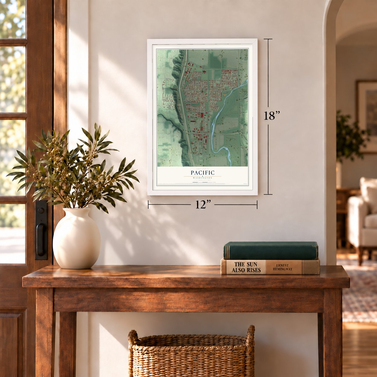
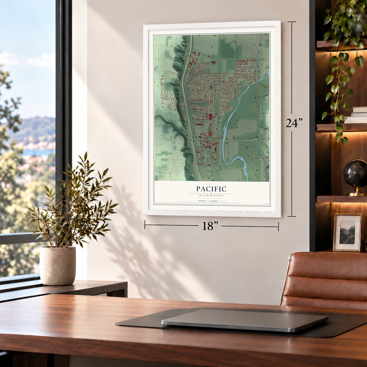
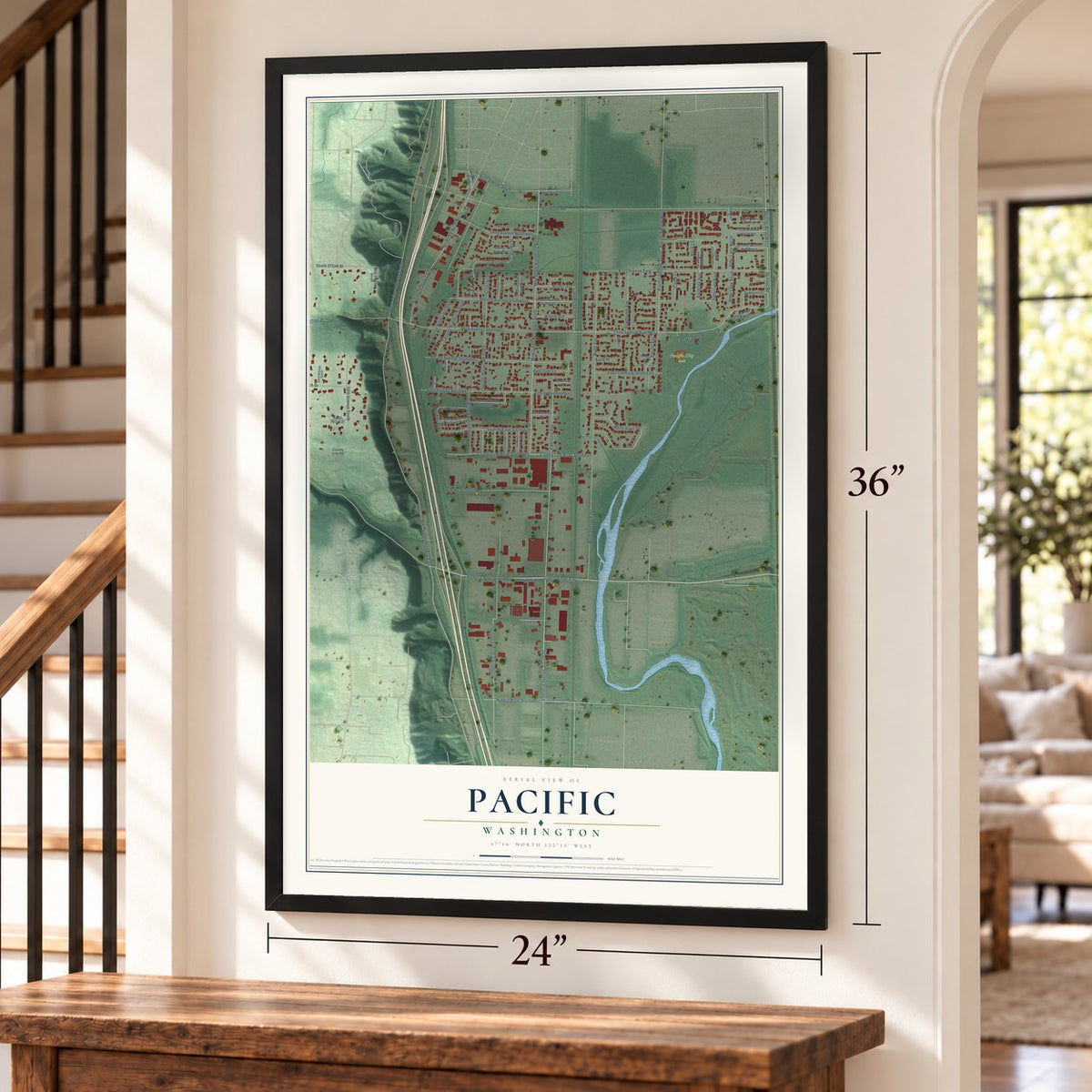
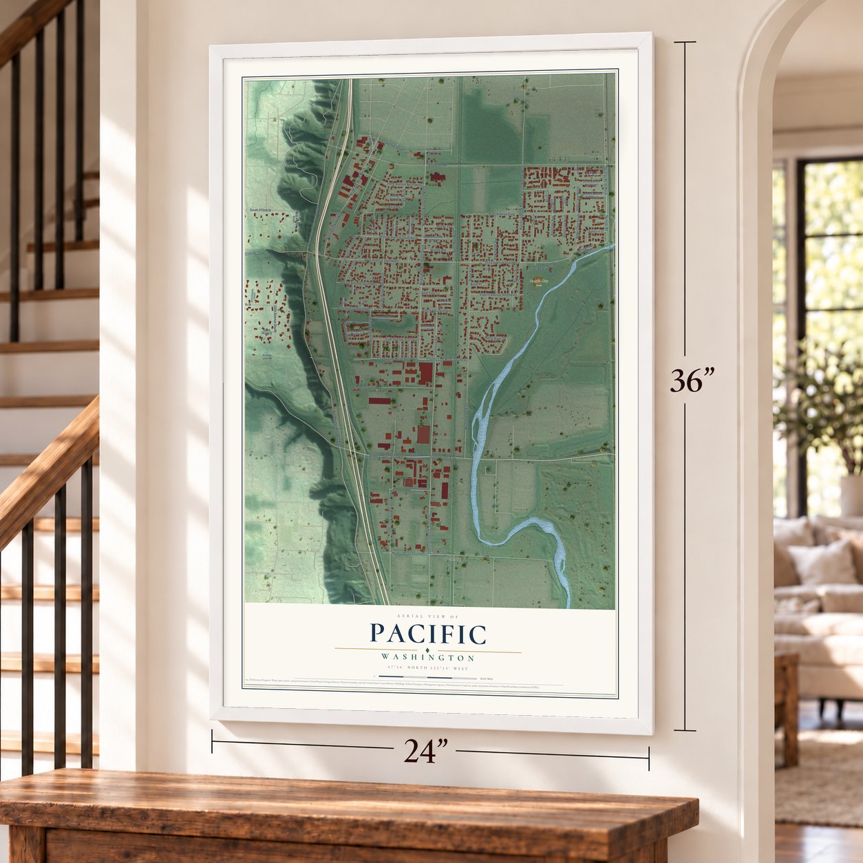
Pacific, Washington Map Art
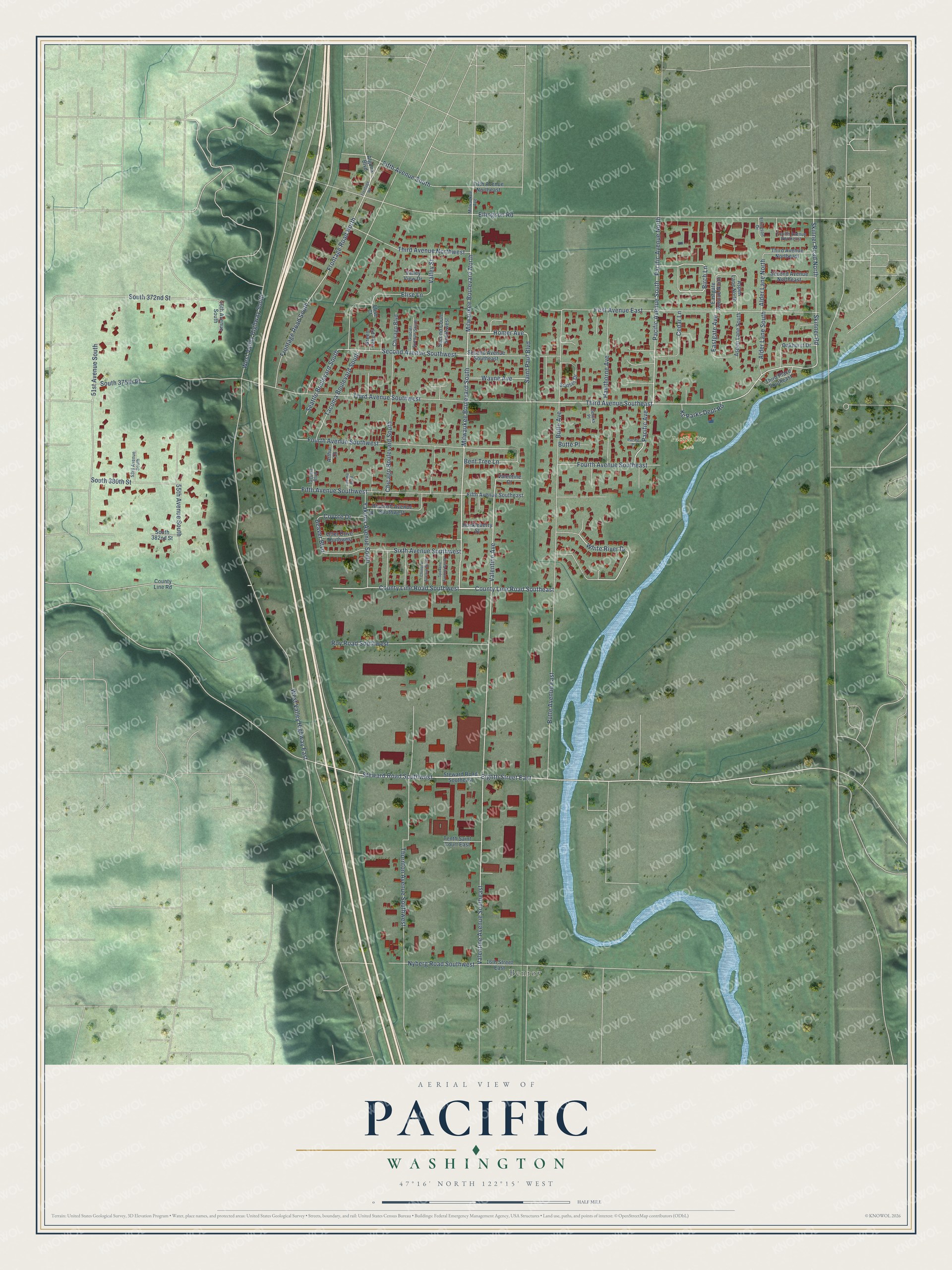
A new map of Pacific, Washington, made in 2026 and printed to order on thick archival matte paper.
12" x 18" Archival Matte Print
A Map of Home. A Work of Art.
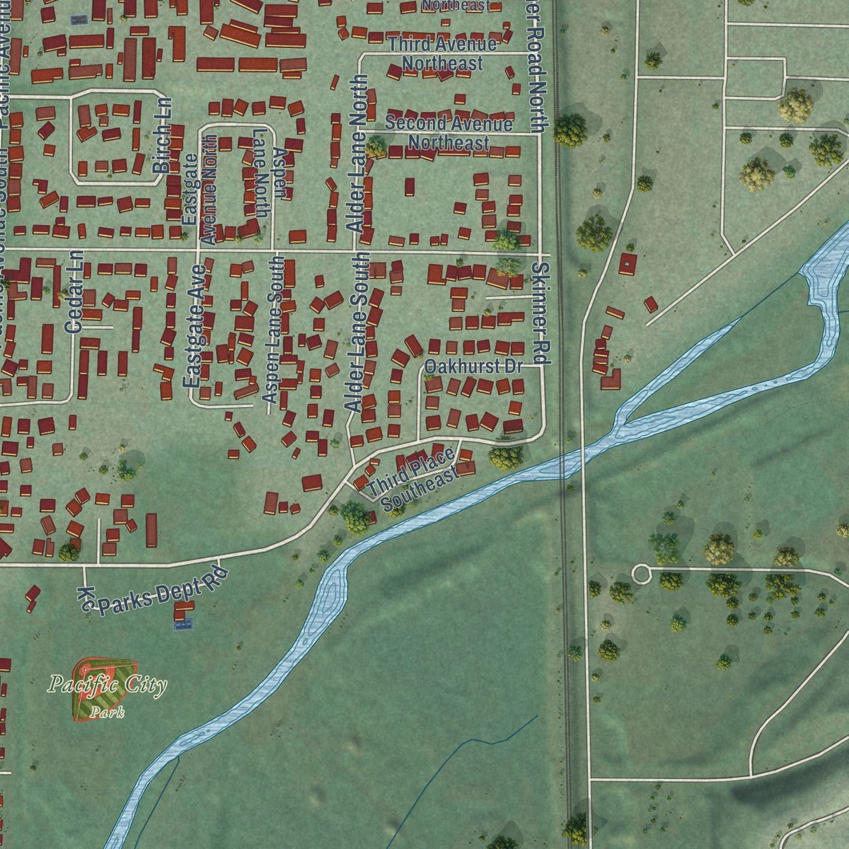
Explore Pacific, Washington from a whole new perspective. Created using aerial imagery and detailed geographic data, this map captures Pacific building by building, with labeled streets, familiar landmarks, and shaded topographical relief that highlights the natural contours of the landscape.
Combining modern data with the timeless character of a vintage atlas, this map is just as interesting up close as it is beautiful on the wall. Whether you grew up in Pacific, spent memorable years there, or call it home today, this unique map is a great way to celebrate a place that means something to you. Zoom in on the preview to look for your street, and then order a print to put your memories on the wall.
Three ways to hang it
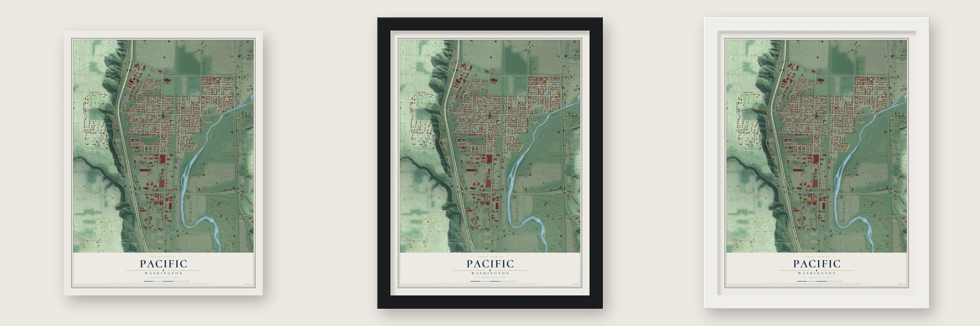
Unframed archival matte, a black wood frame or a white wood frame.
Up close
Geography Worth Displaying
This map was created using accurate cartographic data and authoritative geographic sources, including the U.S. Geological Survey and the Census Bureau. The map brings together terrain, waterways, roads, and building detail. The majority of the streets are labeled, houses are accurately depicted, and the topography is derived from government sources. Combining local data with carefully composed color and shading leads to this beautifully detailed Pacific artwork for your wall.
Rather than simply showing street outlines, we’ve included as many of the street names as we could reasonably fit on the map while keeping their names legible. Zoom in on the high resolution preview to see exactly what’s on the map. We truly set out to create a statement piece for anyone who loves Pacific. So whether it’s for you, or a gift for someone you love, we hope this map of Pacific brings back fond memories.
Read the story behind this map of Pacific, Washington from 2026.

About Pacific, Washington
Pacific is a city of 7,235 people on the line between King and Pierce counties, about 28 miles south of Seattle. Hop farms brought good times to the White River Valley in the 1880s and 1890s, but in 1891 an outbreak of aphids wiped out the crop within a year, and local farmers switched to potatoes, vegetables and fruit. On September 25, 1902, the Puget Sound Electric Railway opened its line between Seattle and Tacoma through the valley.
Real estate developer Clarence Dayton Hillman and his wife, Bessie Olive Hillman, quietly bought more than 3,000 acres near the line from some 20 sellers, and in 1906 he platted the town he called Pacific City. It incorporated on August 10, 1909, with James F. Lemar as its first mayor, and by 1910 it had 413 residents. The Interurban carried passengers for 26 years, until its last train ran on December 30, 1928.
- Mail from a moving trainAlfred R. Weaver, a saloon owner, bought Mr. Lantz's grocery and feed store by the tracks and turned it into a grocery and post office. President Theodore Roosevelt named him postmaster on April 17, 1908. As trains of the Milwaukee, Chicago, and St. Paul line rolled slowly past the store, railroad workers tossed the mail bags off while Weaver threw Pacific's outgoing bags aboard.
- Gius' Market since 1934Richard Gius took over the post office in 1933 and the next spring opened a market in a building leased from the Junkins family. When the owners wouldn't renew the lease, he bought the corner lot opposite, and his father, Amadio Gius, put up a new store there in less than a month. In 1936 Richard and Angie, his wife, moved the business and the post office into it. Four generations of Giuses have served the town since.
- School above a land officePacific's first teacher, a Mr. Bagley, held classes upstairs in Hillman's real estate building. By 1907 children crossed the tracks to a school run by John and Etta Whistler, and after the Methodist Church went up in 1908, classes met there. The three-story Pacific School opened in 1916 on the ground where City Hall was later built.
- The flood of 1906On November 14, 1906, heavy rain and melting snow drove the White River into the small Stuck River and on toward the Puyallup near Tacoma. The flood struck Pacific along with Kent, Auburn, Sumner and Puyallup, and it permanently changed the course of the valley's rivers. To control the floods, Mud Mountain Dam was finished on the White River in 1950.
- Water released in 2009On January 8, 2009, with its reservoir full after heavy rain, the Army Corps of Engineers let water out of Mud Mountain Dam so fast that it flooded Pacific almost without warning. Jerry Miller, one of Moby Grape's founding members, had only recently moved to Pacific from Tacoma, and the water took nearly all he owned, including more than forty years of keepsakes from his music career. FEMA helped the families hit by the flood.
Find your street
Names on the Pacific map
Every name below is printed on this map. Look for your street, your school, the park where you played, or the pond down the road.
Places and landmarks2
- Pacific City Park
- Benroy
Streets and roads99
- Milwaukee Boulevard South
- Milwaukee Boulevard North
- County Line Road Southeast
- Homer Avenue
- Birch Lane
- Steward Road Southwest
- Eighth Street East
- White River Drive
- Pacific Avenue South
- Third Avenue Southeast
- Skinner Road North
- Skinner Road
- Valentine Avenue Southeast
- Valentine Avenue
- Eastgate Avenue
- Second Avenue Southwest
- Frontage Road North
- 51st Avenue South
- Fourth Avenue Southeast
- South 372nd Street
- Beaver Boulevard
- West Valley Highway South
- Ellingson Road
- Third Avenue Southwest
- Butte Avenue
- First Avenue East
- Thornton Avenue Southwest
- Butte Avenue East
- West Valley Highway East
- Chicago Boulevard South
Show all 99 streets
- Fifth Avenue Southwest
- Fourth Avenue Southwest
- Roy Road Southwest
- Tacoma Boulevard South
- Sixth Avenue Southwest
- Fifth Avenue South
- 55th Avenue South
- County Line Road Southwest
- Third Avenue Northwest
- Hawthorne Avenue
- Yakima Avenue South
- Frontage Road South
- Pacific Avenue North
- Nyberg Road Southwest
- Wayne Avenue
- Pacific Avenue
- South 380th Street
- Seattle Boulevard South
- Cedar Lane
- Saint Paul Boulevard
- Elise Lane
- Alder Lane South
- Alder Lane North
- Kc Parks Dept Road
- Bent Tree Lane
- South 375th Place
- Coyote Drive
- Valley Street
- Butte Place
- Steward Road Southeast
- Algona Boulevard
- Third Avenue Northeast
- Second Avenue Northeast
- Eastgate Avenue North
- County Line Road
- Second Avenue Southeast
- Fifth Avenue Southeast
- 16th Street East
- Oakhurst Drive
- Rhubarb Avenue Southwest
- South 382nd Street
- Fifth Avenue Northeast
- Aspen Lane South
- Sunset Drive
- Otter Drive Southwest
- Aspen Lane North
- Third Place Southeast
- Second Court Southwest
- Chicago Boulevard
- Tenth Saint Court East
- Valley View Drive
- 56th Avenue South
- Huckleberry Street
- Valentine Court
- Green Lake Place
- Arthur Court
- Elise Court
- Glacier Avenue South
- Fourth Avenue Northeast
- 53rd Avenue South
- Milwaukee Avenue
- Tacoma Boulevard
- Dereks Place
- Ellingson Drive
- Frontage Road
- Chinook Avenue South
- Spokane Avenue South
- Yakima Boulevard
- Pacific Place
Names are listed as they appear on the printed map. Zoom into the product photos to find them.
The art of mapping a place
How This Map Was Made
Real places. Remarkable detail. Discover the layers that turn geographic data into a map of home.

The view from above
Aerial imagery reveals the character of the land: woodland, open fields, and the patterns of a place.

The shape of the land
Elevation data brings hills, valleys, and subtle changes in the landscape into view.

The details of home
Roads, waterways, and building footprints come together to make the map feel unmistakably local.

Geography becomes art
Considered color, shading, and typography bring the layers together in a map made for your wall.


Process illustrated with Mendon, Massachusetts. Aerial imagery: USDA NAIP. Terrain: USGS 3D Elevation Program. Map details and finished artwork: KNOWOL.
The Details
About This Print
Choose an archival matte print, or a black or white Ayous wood frame. The archival matte print is unframed.
Select your size and finish above to see the matching product image and price.
Materials & Craftsmanship
A contemporary map with the character of a classic atlas, printed on archival matte paper. Optional frames are made from Ayous wood.
Your printed map does not include the watermark shown in the full-map preview.
Shipping & Delivery
Free shipping within the United States. Every print is made to order in the USA.
Buying a gift? Add a note in your cart and we'll include it. We never put prices in the package.
Prints ship within 2 to 3 business days. Allow 7 to 10 days total from ordering for delivery. Timing may vary during holidays or periods of high order volume.
Read our shipping policy.
Returns and damaged prints
Each print is made to order. Change-of-mind refunds are not available after production.
If your print arrives damaged, misprinted or incorrect, contact support@knowol.com within 30 days of receiving it. Include your order number, photos and a description of the issue.
Read our full refund and replacement policy. For questions about your order, email support@knowol.com.
Find your town
Looking for another city?
Find a map of home in our Washington collection, or any town in the country.
Nearby
Maps of towns near Pacific
Know someone from one of these towns? Their map makes a great gift.
 Algona
, Washington
From $39.99See the map
 Lakeland South
, Washington
From $39.99See the map
 Sumner
, Washington
From $39.99See the map
More maps nearby: Edgewood, Milton, Auburn, Lake Tapps and Fife Heights.