


Search for another town


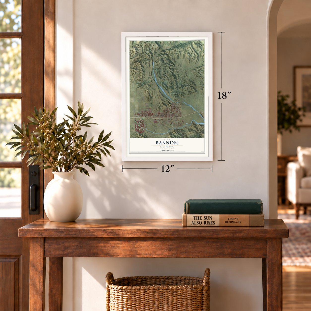

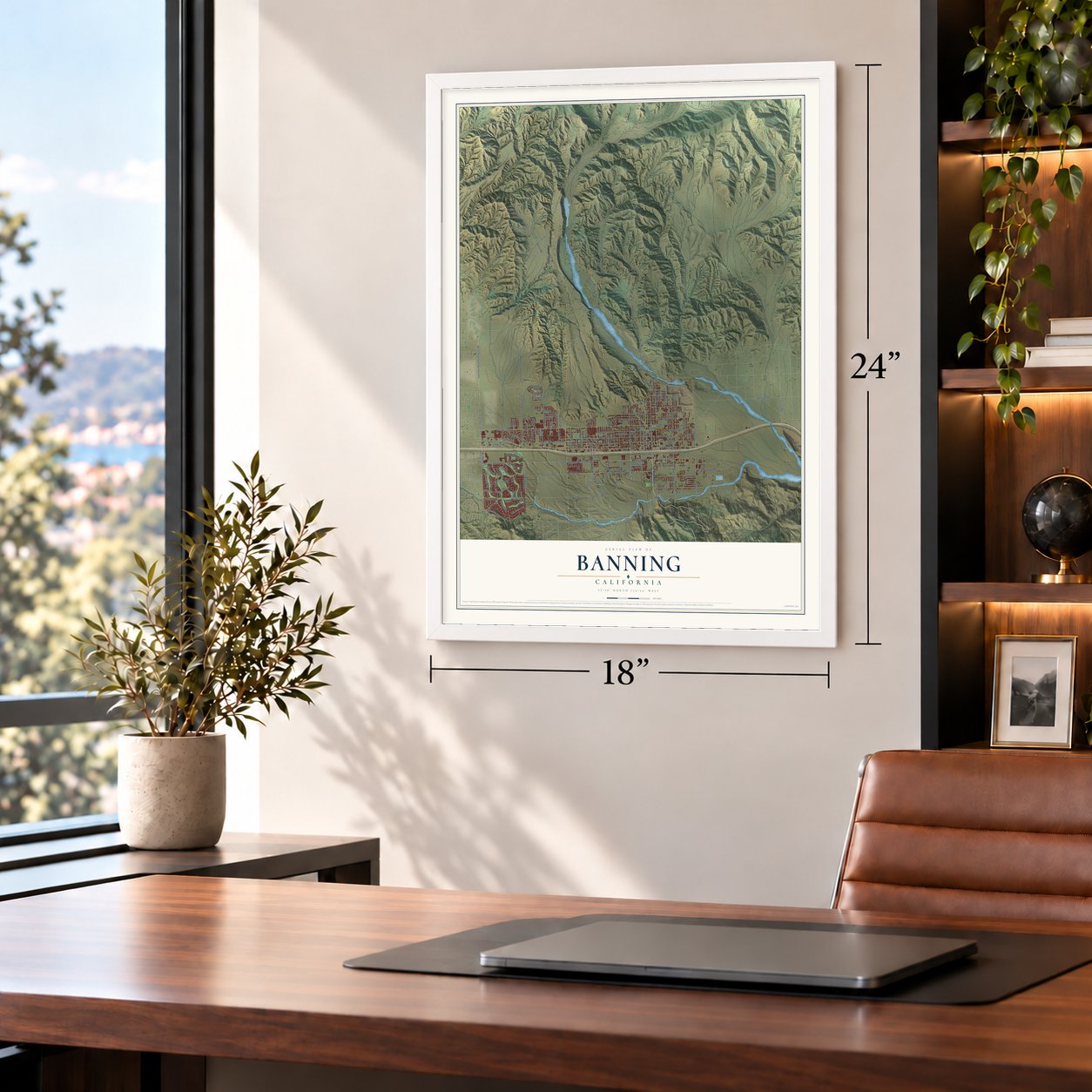

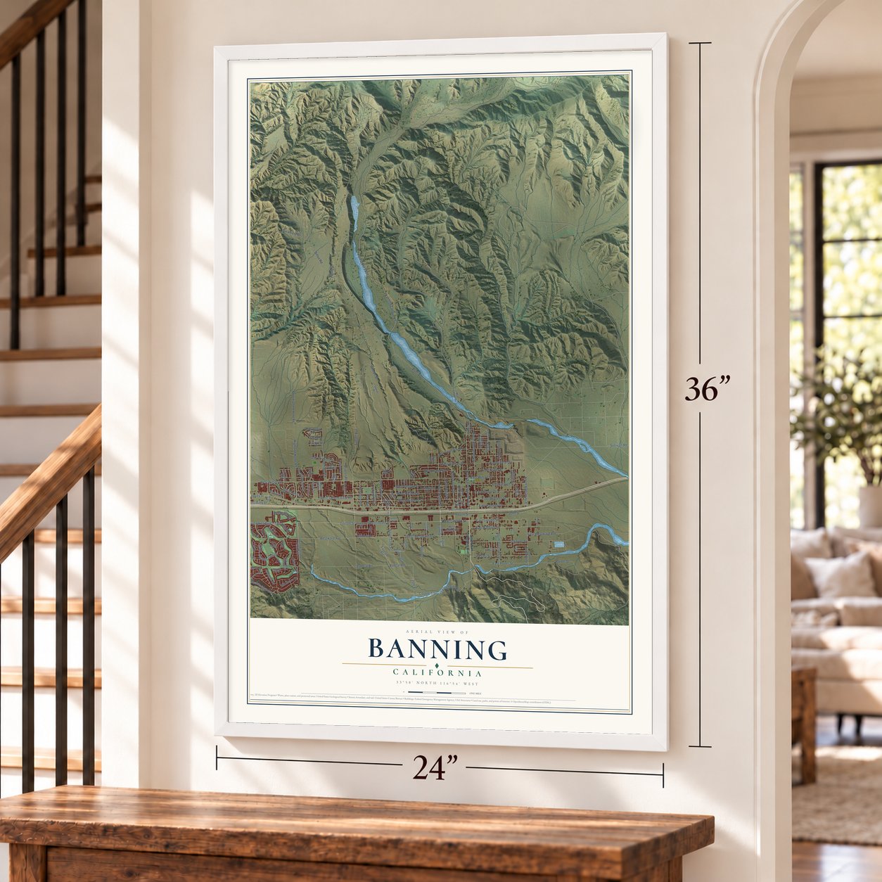

Free U.S. delivery 7 to 10 days after you order
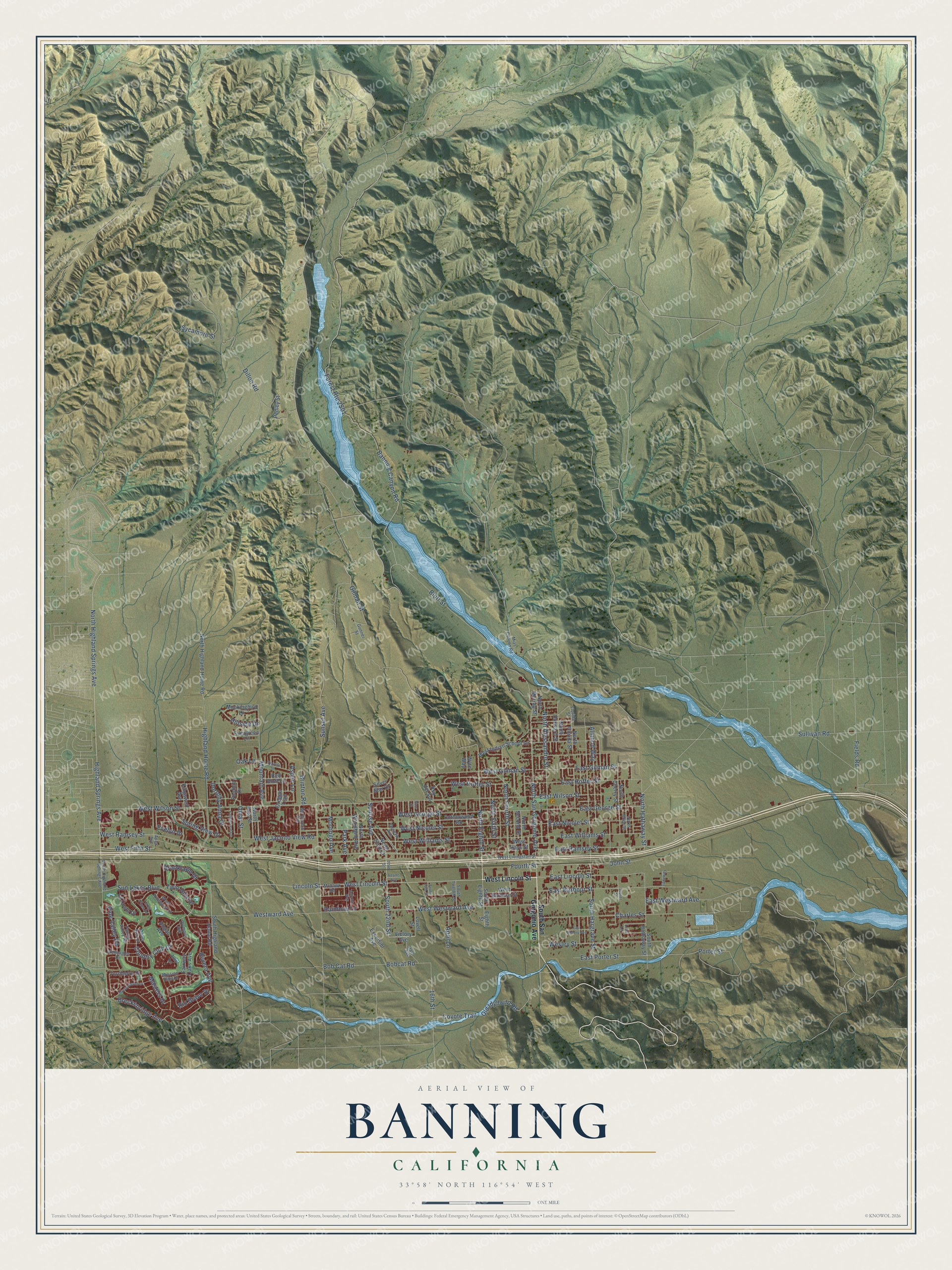
Banning, California Map Art
Building by building, with labeled streets and shaded relief.
12" x 18" Archival Matte Print
A Map of Home. A Work of Art.
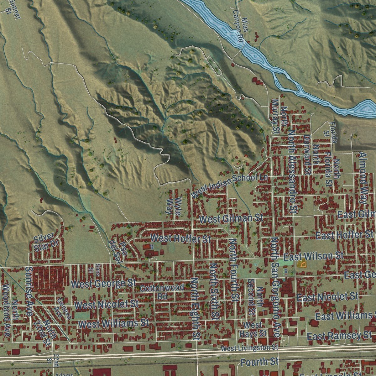
Explore Banning, California from a whole new perspective. Created using aerial imagery and detailed geographic data, this map captures Banning building by building, with labeled streets, familiar landmarks, and shaded topographical relief that highlights the natural contours of the landscape.
Combining modern data with the timeless character of a vintage atlas, this map is just as interesting up close as it is beautiful on the wall. Whether you grew up in Banning, spent memorable years there, or call it home today, this unique map is a great way to celebrate a place that means something to you. Zoom in on the preview to look for your street, and then order a print to put your memories on the wall.
Three ways to hang it
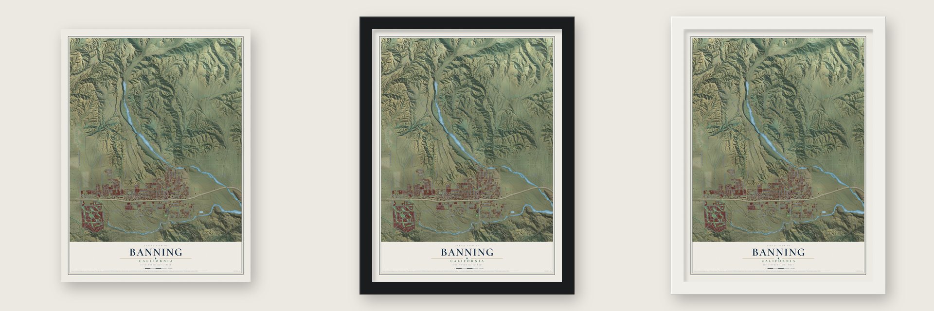
Unframed archival matte, a black wood frame or a white wood frame.
Up close
Geography Worth Displaying
This map was created using accurate cartographic data and authoritative geographic sources, including the U.S. Geological Survey and the Census Bureau. The map brings together terrain, waterways, roads, and building detail. The majority of the streets are labeled, houses are accurately depicted, and the topography is derived from government sources. Combining local data with carefully composed color and shading leads to this beautifully detailed Banning artwork for your wall.
Rather than simply showing street outlines, we’ve included as many of the street names as we could reasonably fit on the map while keeping their names legible. Zoom in on the high resolution preview to see exactly what’s on the map. We truly set out to create a statement piece for anyone who loves Banning. So whether it’s for you, or a gift for someone you love, we hope this map of Banning brings back fond memories.
Read the story behind this map of Banning, California from 2026.

Find your street
Names on the Banning map
Every name below is printed on this map. Look for your street, your school, the park where you played, or the pond down the road.
Streets and roads144
- Highland Home Road
- West Lincoln Street
- Lincoln Street
- South 22nd Street
- East Gilman Street
- Old Idyllwild Road
- Sunrise Avenue
- North San Gorgonio Avenue
- Sun Lakes Boulevard
- Gilman Street
- Coyote Trail
- Bluff Street
- West Ramsey Street
- Highland Springs Avenue
- North Highland Springs Avenue
- East Lincoln Street
- North Eighth Street
- North Fourth Street
- North Hathaway Street
- Rainbow Lane
- West Wilson Street
- East Hoffer Street
- Fourth Street
- Masters Drive
- Evelyn Drive
- Banning Canyon Road
- Sunset Avenue
- West Nicolet Street
- Charles Street
- West Williams Street
Show all 144 streets
- West Westward Avenue
- West George Street
- Riviera Avenue
- East Barbour Street
- West Gilman Street
- Porter Street
- North Alessandro Street
- Country Club Drive
- East Ramsey Street
- West Hoffer Street
- Wesley Street
- East Westward Avenue
- Dillon Road
- West Jacinto View Road
- Westward Avenue
- East Nicolet Street
- East Williams Street
- Breckenridge Avenue
- John Street
- Mountain Avenue
- Almond Way
- East George Street
- South Hargrave Street
- Pine Valley Road
- East Porter Street
- East Wilson Street
- Sycamore Street
- Sullivan Road
- Dorothy Anna Drive
- Fields Road
- Brooklawn Drive
- Bobcat Road
- West Fifth Street
- North Sixth Street
- 16th Street
- Bob Cat Road
- Omar Street
- Morongo Avenue
- Spring View Drive
- Rio Bravo Drive
- Twin Hills Drive
- Park Avenue
- Hillside Drive
- April Lane
- Brinton Road
- Aspen Lane
- Oak Lane
- South San Gorgonio Avenue
- North 22nd Street
- Victory Avenue
- West Hays Street
- South Eighth Street
- North Second Street
- South Highland Home Road
- North Murray Street
- Fairway Oaks Avenue
- South Hathaway Street
- North Florida Street
- North Highland Home Road
- Cottonwood Road
- West Barbour Street
- North Cherry Street
- West Indian School Lane
- North Durward Street
- North Woodland Avenue
- Kingswell Avenue
- Mockingbird Lane
- La Costa Drive
- Pedley Street
- Foothill Drive
- Turnberry Drive
- North 41st Street
- Hogan Avenue
- Red Bluff Lane
- Oregon Trail
- Evergreen Lane
- Excelsior Avenue
- Lovell Street
- Silver Star Drive
- Wyte Way
- Eighth Street
- Pso del Sol
- South Highland Springs Avenue
- Florida Street
- Lisa Lane
- North Allen Street
- Mias Canyon Road
- South Twelfth Street
- West Livingston Street
- Mission Hills Drive
- Pauma Valley Road
- West Pinehurst Drive
- Gleneagles Drive
- Mc Govern Avenue
- Hale Avenue
- Taxiway
- Allin Lane
- Geneva Avenue
- Mohawk Road
- Gunner Street
- Olympic Avenue
- Apex Avenue
- 22nd Street
- Myrtle Beach Drive
- Sims Street
- Laguna Seca Court
- Cypress Street
- Falling Leaf Lane
- East Victory Avenue
- Autumn Way
- Torrey Pines Road
- Adams Avenue
- Juarez Street
- South 16th Street
Names are listed as they appear on the printed map. Zoom into the product photos to find them.
About Banning, California
Banning is a city of 29,505 people in Riverside County, set in the San Gorgonio Pass at about 2,300 feet. The Serrano and later the Cahuilla lived in the pass, and in 1824 Mission San Gabriel Arcángel founded Rancho San Gorgonio here. Dr. Isaac Smith became the first Anglo settler in 1853.
In 1862 the Bradshaw Trail began carrying wagons through the pass to the gold camps of Arizona, and Gilman's Ranch, north of today's downtown, became a stop for the stagecoaches. Cattle rancher Ransom B. Moore first called the settlement Moore City. Within months it took the name of Phineas Banning, a stagecoach owner who had grazed sheep in the pass. The Southern Pacific reached town in 1876, and Banning was incorporated on February 6, 1913.
- St. Boniface Indian SchoolThe school opened in 1890 to teach trades to Cahuilla, Serrano, Luiseño, Kumeyaay and other Native students. Bishop Francisco Mora y Borrell approved it, and Mother Katharine Drexel paid for the land, the buildings and the running costs through the Bureau of Catholic Indian Missions. About 8,000 students went there before it was torn down in 1974, and a small abandoned cemetery remains.
- A wartime hospital and a tankDuring World War II the 1,000-bed Banning General Hospital served troops at the Desert Training Center and later cared for recovering Navy patients until it was taken apart in 1948. In 1942 residents raised the money for an M3 Stuart tank. After the war it went to the South African Defence Force, and as the "City of Johannesburg" it survives in a museum in Richmond, Natal.
- Stagecoach Days since 1957Every year since 1957, Banning has held Stagecoach Days to honor the old stage line through the pass and its namesake, who ran stagecoaches himself. The nonprofit Stagecoach Days Association puts it on at the AC Dysart Equestrian Park.
- The oldest almond districtIn the early 20th century the land around Banning was thought ideal for growing almonds, and the area was known as the oldest almond district in southern California.
- The Saturday Afternoon ClubBanning's first women's club was founded in 1904 and joined the C. F. W. C. in 1905. In 1909 the club incorporated under state law so it could better manage the real estate it owned.
Keep exploring California
Banning is one of 1,990 California towns we've mapped. Every dot on the map is a print of its own.
The search covers every state, California first.
Near Banning
Order 2 or more town maps and save 10%. Shown in the size and finish you picked above, so they hang as a set.
- Cherry Valley 12" x 18" / Archival Matte Print $39.99
- Beaumont 12" x 18" / Archival Matte Print $39.99
- Cabazon 12" x 18" / Archival Matte Print $39.99

More maps nearby: Oak Glen, Calimesa, Yucaipa, San Jacinto and Whitewater.
The art of mapping a place
How This Map Was Made
Real places. Remarkable detail. Discover the layers that turn geographic data into a map of home.

The view from above
Aerial imagery reveals the character of the land: woodland, open fields, and the patterns of a place.

The shape of the land
Elevation data brings hills, valleys, and subtle changes in the landscape into view.

The details of home
Roads, waterways, and building footprints come together to make the map feel unmistakably local.

Geography becomes art
Considered color, shading, and typography bring the layers together in a map made for your wall.


Process illustrated with Mendon, Massachusetts. Aerial imagery: USDA NAIP. Terrain: USGS 3D Elevation Program. Map details and finished artwork: KNOWOL.
The Details
About This Print
Choose an archival matte print, or a black or white Ayous wood frame. The archival matte print is unframed.
Select your size and finish above to see the matching product image and price.
Materials & Craftsmanship
A contemporary map with the character of a classic atlas, printed on archival matte paper. Optional frames are made from Ayous wood.
Your printed map does not include the watermark shown in the full-map preview.
Shipping & Delivery
Free shipping within the United States. Every print is made to order in the USA.
Buying a gift? Add a note in your cart and we'll include it. We never put prices in the package.
Prints ship within 2 to 3 business days. Allow 7 to 10 days total from ordering for delivery. Timing may vary during holidays or periods of high order volume.
Read our shipping policy.
Returns and damaged prints
Each print is made to order. Change-of-mind refunds are not available after production.
If your print arrives damaged, misprinted or incorrect, contact support@knowol.com within 30 days of receiving it. Include your order number, photos and a description of the issue.
Read our full refund and replacement policy. For questions about your order, email support@knowol.com.