
Search for another town





Free U.S. delivery 7 to 10 days after you order
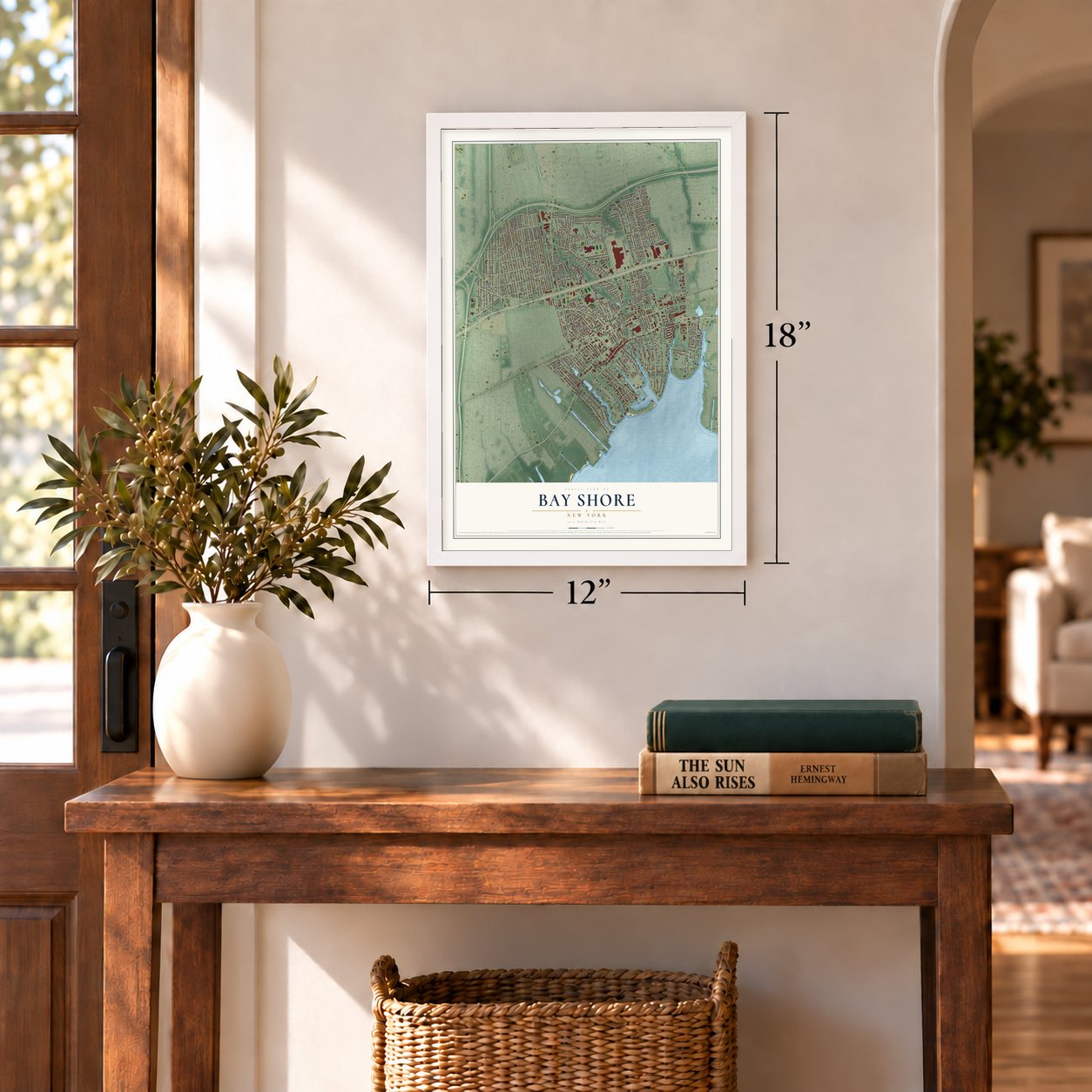
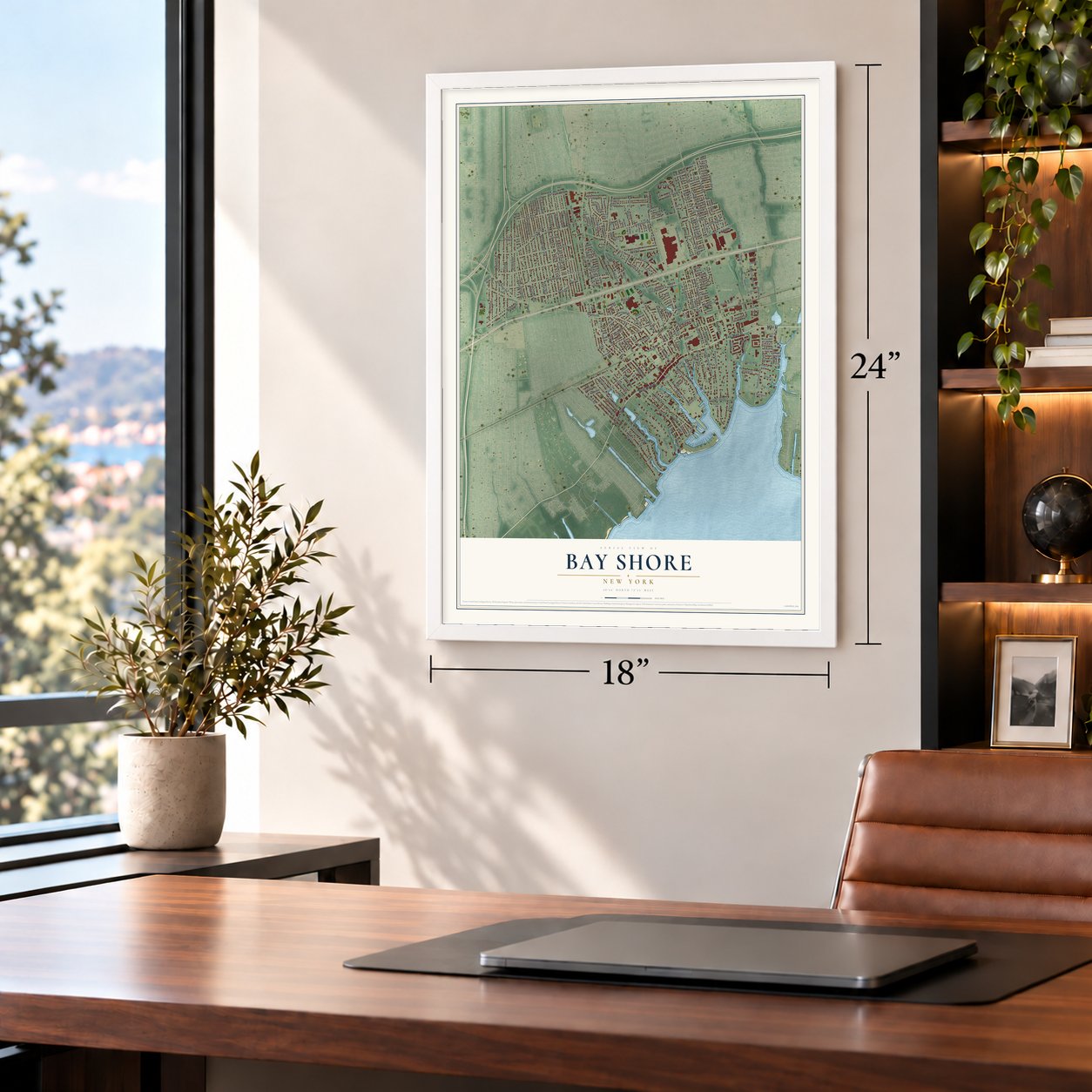
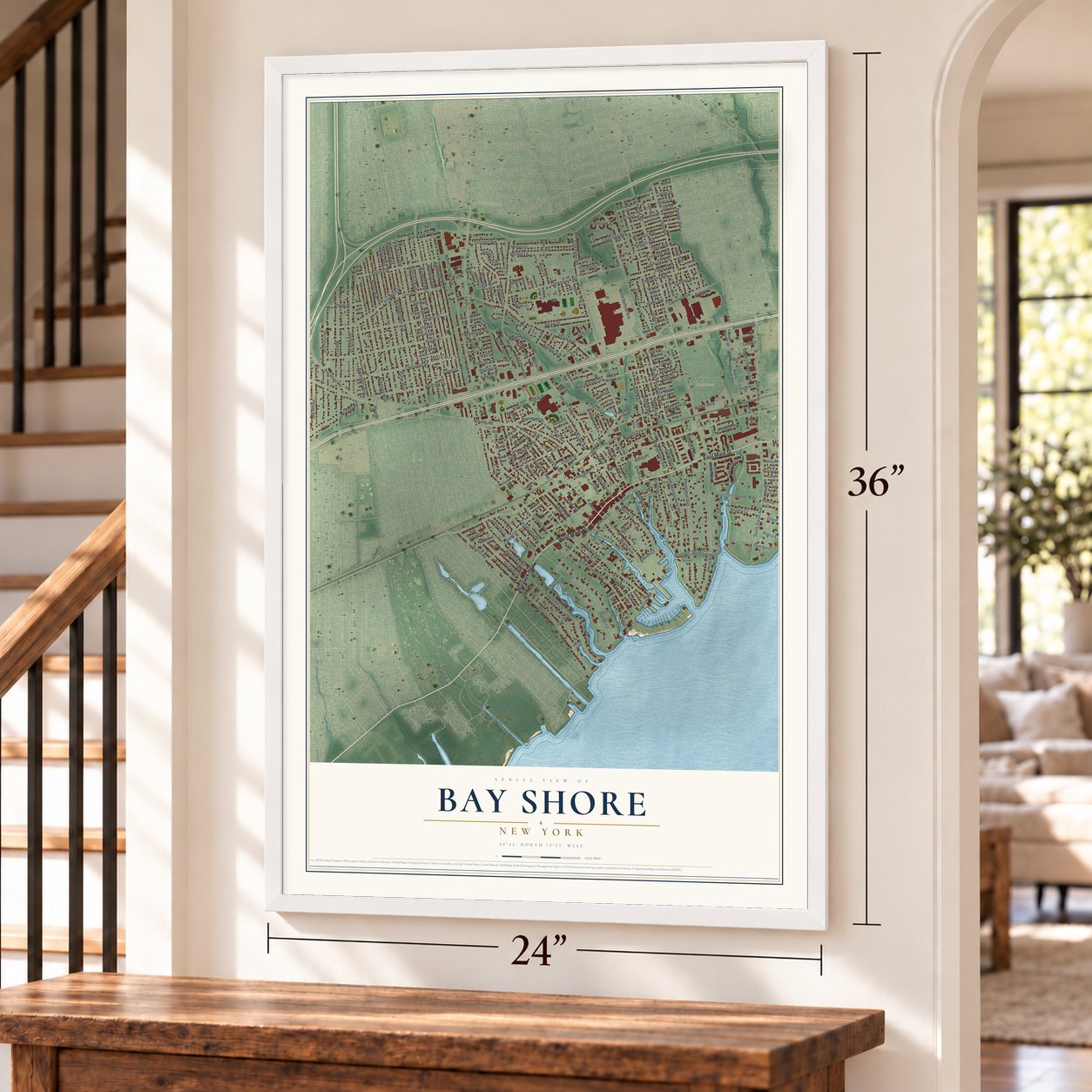
Bay Shore, New York Map Art
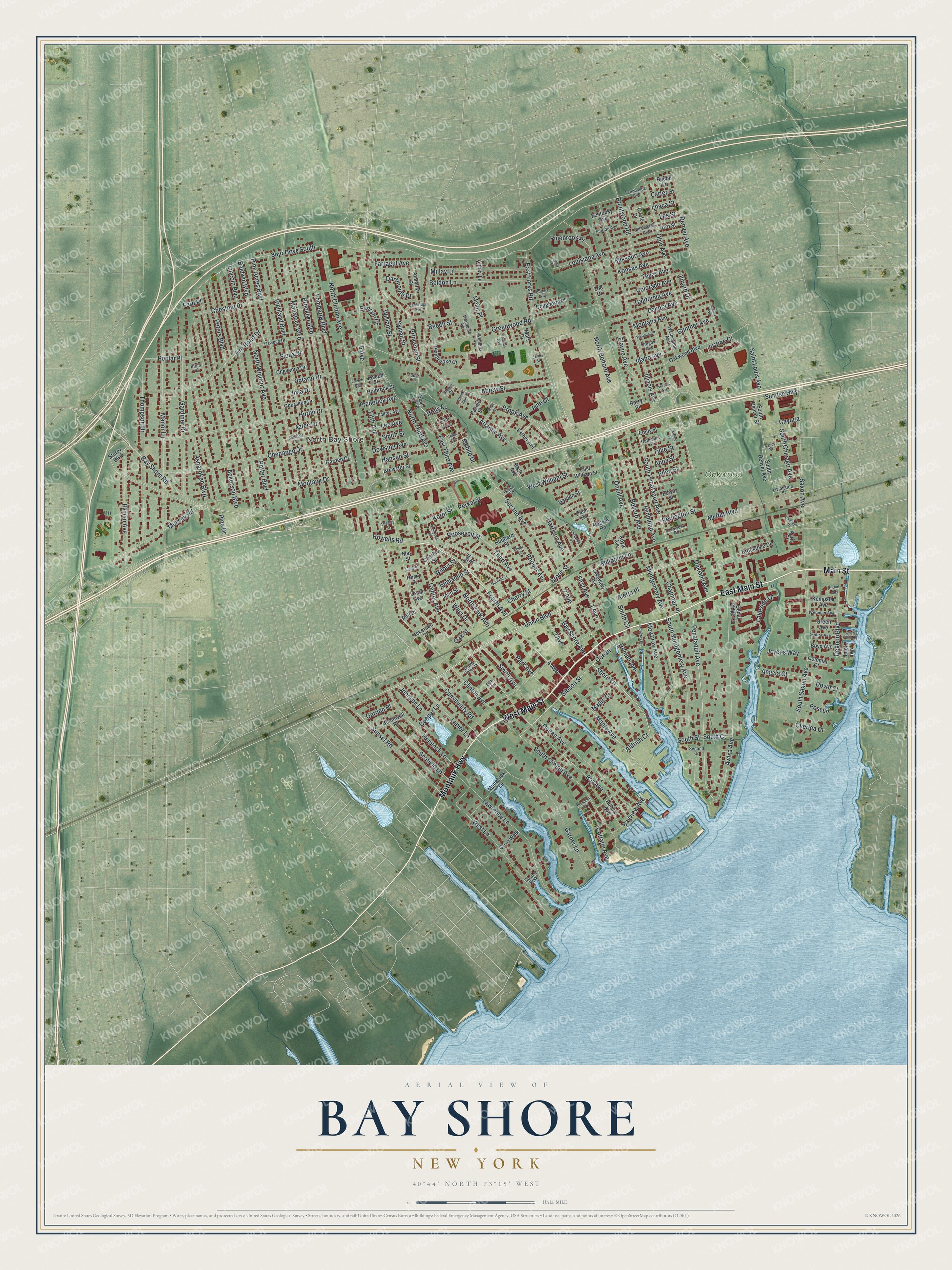
A new map of Bay Shore, New York, made in 2026 and printed to order on thick archival matte paper.
12" x 18" Archival Matte Print
A Map of Home. A Work of Art.
Bring a piece of Bay Shore home. Whether it’s where you grew up, your current home, or simply a moment in your life, this Bay Shore, New York map print brings those memories to your wall. Antique-inspired styling and modern geographic detail combine to create artwork that’s beautiful from across the room, with plenty to study and explore when you get up close.
Three ways to hang it
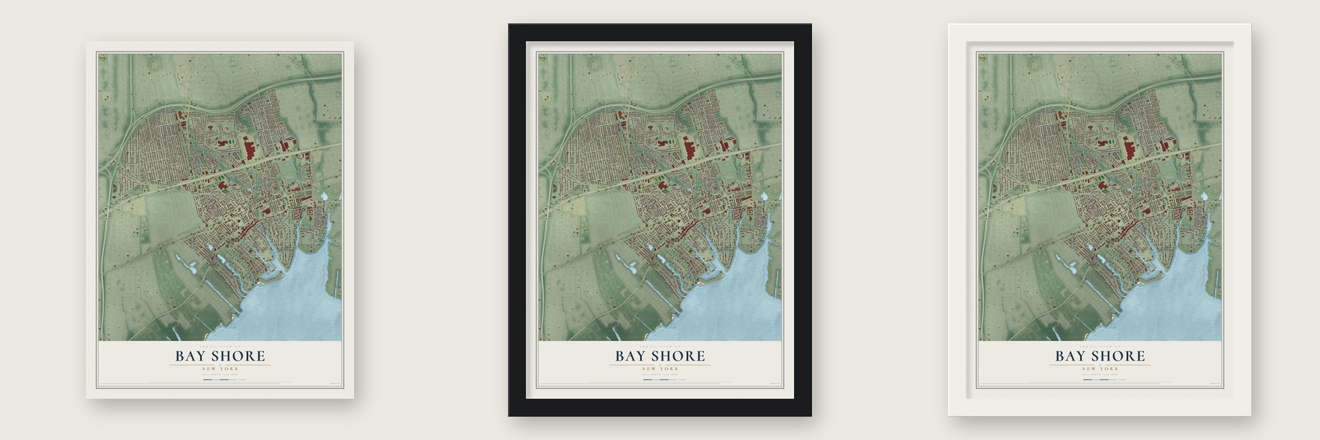
Unframed archival matte, a black wood frame or a white wood frame.
Up close
Real geography. Art worth displaying.
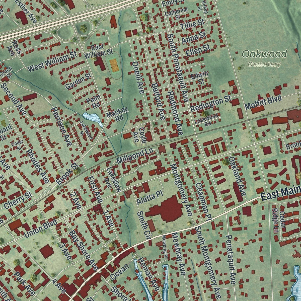
This map was created using accurate cartographic data and authoritative geographic sources, including the U.S. Geological Survey (USGS) and FEMA. The map brings together terrain, waterways, roads, and building detail. The majority of the streets are labeled, houses are accurately depicted, and the topography is derived from government sources. Combining local data with carefully composed color and shading leads to this beautifully detailed Bay Shore artwork for your wall.
Rather than simply showing street outlines, we’ve included as many of the street names as we could reasonably fit on the map while keeping their names legible. Zoom in on the high resolution preview to see exactly what’s on the map. We truly set out to create a statement piece for anyone who loves Bay Shore. So whether it’s for you, or a gift for someone you love, we hope this map of Bay Shore brings back fond memories.
Explore the full map of Bay Shore, New York and read about the local places it shows.

About Bay Shore, New York
Bay Shore is a hamlet and census-designated place (CDP) in the Town of Islip, New York, United States. Its documented story includes this detail: Sagtikos Manor, located in West Bay Shore, was built around 1697. The record also notes that it was used as a British armed forces headquarters, at the time of the Battle of Long Island during the Revolutionary War. Together, these points give a concise view of the community.
- Part of local historySagtikos Manor, located in West Bay Shore, was built around 1697.
- Island geographyIt was used as a British armed forces headquarters, at the time of the Battle of Long Island during the Revolutionary War.
- Part of local historyThis was a methodist church built in 1828.
- Island geographyIt was a tourist spot on weekends and during the summer, in large part because the newly built Long Island Rail Road enabled easy access from New York City.
- Part of local historyDuring World War I it became the headquarters of the First Yale Unit, a United States Naval Air Reserve unit.
Find your street
Names on the Bay Shore map
Every name below is printed on this map. Look for your street, your school, the park where you played, or the pond down the road.
Places and landmarks2
- North Bay Shore
- Oakwood Cemetery
Streets and roads273
- East Main Street
- Montauk Highway
- Main Street
- West Main Street
- Union Boulevard
- Fourth Avenue
- Roosevelt Street
- Bay Shore Avenue
- Shore Lane
- Brook Avenue
- East Forks Road
- Maple Avenue
- Awixa Avenue
- Penataquit Avenue
- Brentwood Road
- Howells Road
- Garner Lane
- Brook Street
- 2 Avenue
- Fifth Avenue
- 4 Avenue
- Bay Shore Road
- Denver Avenue
- North Park Avenue
- 5 Avenue
- Harrison Avenue
- 1 Avenue
- Sunrise Highway
- Spur Drive South
- South Penataquit Avenue
Show all 273 streets
- North Clinton Avenue
- Manatuck Boulevard
- Clinton Avenue
- Third Avenue
- South Clinton Avenue
- Lombardy Boulevard
- Richland Boulevard
- Brooklyn Boulevard
- Pine Acres Boulevard
- Potter Boulevard
- Peters Boulevard
- East Third Avenue
- Ackerson Boulevard
- Manor Lane
- Pine Drive
- Second Avenue
- Illinois Avenue
- Huron Drive
- Gardiner Drive
- Chenango Drive
- South Saxon Avenue
- Saxon Avenue
- Greenwood Road
- North Windsor Avenue
- West Lane
- Thompson Drive
- Lawrence Lane
- Justine Court
- Ocean Avenue
- Dakota Avenue
- North Third Avenue
- Ontario Drive
- Gibson Street
- Ohio Avenue
- Fire Road Drive
- Muncey Road
- Ocean
- Montauk Drive
- Redington Street
- Bay Avenue
- Sunset Road
- Chestnut Drive
- South Montgomery Avenue
- Center Avenue
- Hyman Avenue
- Redmond Avenue
- Belford Avenue
- Princeton Street
- Louisiana Avenue
- Perkal Street
- Hemlock Lane
- Beldon Lane
- Moffitt Boulevard
- Community Road
- Cooper Lane
- Millay Lane
- Millpond Lane
- Rhodes Avenue
- Asharoken Boulevard
- Park Avenue
- Oneill Avenue
- North Belford Avenue
- Lanier Lane
- Degnon Boulevard
- Tillie Street
- Seafield Lane
- Abrew Street
- Lincoln Boulevard
- Elayne Avenue
- Mowbray Avenue
- California Avenue
- Montana Avenue
- First Avenue
- Smith Avenue
- Baldwin Boulevard
- Missouri Avenue
- South Chicago Avenue
- Bayview Avenue
- Chapman Place
- Montgomery Avenue
- Saint Louis Avenue
- Oakland Avenue
- Ellen Street
- William Street
- Junard Drive
- Mobile Drive
- Gunther Avenue
- Colorado Avenue
- Poplar Place
- South Court
- South Street
- Pinebrook Place
- Sylvan Street
- Atlantic Avenue
- Farragut Avenue
- Meier Place
- Lakeside Lane
- Aletta Place
- Kansas Avenue
- Texas Avenue
- West William Street
- Homan Avenue
- Angela Court
- Dartmouth Drive
- Idaho Avenue
- Garden Place
- Benjamin Street
- Johnson Lane
- Joyces Way
- Dowsing Avenue
- Lee Avenue
- Frederick Avenue
- Anna Street
- Cayuga
- June Court
- Dover Court
- Oak Street
- Korol Street
- Post Lane
- Cherry Street
- Cottage Avenue
- Smith Circle
- Wilbur Street
- Aztec Drive
- Inca Drive
- Overlea Court
- Sioux Drive
- Santam Court
- Aldrich Court
- Carter Street
- West Drive
- Ithaca Street
- Hansen Street
- Smith Street
- Les Street
- Beech Street
- Holly Drive
- Maple Court
- 3 Avenue
- Fern Place
- South Denver Avenue
- Storey Boulevard
- Oakwood Boulevard
- Manatuck Lane
- Lakeview Avenue
- Edwin Street
- Brookdale Drive
- East 3 Avenue
- Joseph Street
- Circle Drive
- Amherst Street
- Mackay Road
- Pembrooke Court
- Dougherty Place
- May Street
- Bonniwell Place
- Kentucky Avenue
- Elm Avenue
- Garden Court
- East William Street
- Cherokee Drive
- Cheyenne Drive
- Auburn Avenue
- Kempster Avenue
- Karis Court
- Cedar Ridge Lane
- Green Avenue
- Holbrook Street
- Brewster Street
- Ross Avenue
- South Denver Street
- Bacon Lane
- Boyd Avenue
- Pacific Street
- John Street
- Esther Avenue
- Ard Street
- Hubbard Street
- Colonial Court
- Garden Street
- Cove Walk
- Ackerson Street
- Mars Drive
- Abbey Lane
- Charles Street
- Emily Street
- Barry Place
- Palm Road
- Coyle Avenue
- Reil Place
- Inlet Vw
- Oscar Avenue
- Henry Place
- Gail Street
- Zoe Court
- Oswego Drive
- Mississippi Avenue
- Washington Avenue
- Essex Street
- Florida Avenue
- Wenman Avenue
- Livingston Street
- Tennessee Avenue
- Palfrey Avenue
- Mallar Avenue
- Lockwood Road
- South Union Street
- Second Court
- Woodbine Avenue
- Oregon Avenue
- Catherine Street
- Woodlea Avenue
- Oconee Walk
- Brandt Court
- Grace Street
- Tudor Lane
- Birch Place
- Deb Court
- Garfield Street
- Monroe Avenue
- Seminole Drive
- Lakewood Street
- Cedar Street
- Cambridge Avenue
- Arctic Street
- Mowbray Place
- Thomas Avenue
- Sampson Place
- Wyoming Street
- Allen Point Road
- Nevada Avenue
- Cortina Way
- Brook Spur Drive
- West Street
- Charley's Place
- Kirkup Street
- Cedar Avenue
- Prospect Avenue
- Juliet Street
- Anchor Way
- Sheeley Street
- Joseph Avenue
- James Street
Names are listed as they appear on the printed map. Zoom into the product photos to find them.
The art of mapping a place
How This Map Was Made
Real places. Remarkable detail. Discover the layers that turn geographic data into a map of home.

The view from above
Aerial imagery reveals the character of the land: woodland, open fields, and the patterns of a place.

The shape of the land
Elevation data brings hills, valleys, and subtle changes in the landscape into view.

The details of home
Roads, waterways, and building footprints come together to make the map feel unmistakably local.

Geography becomes art
Considered color, shading, and typography bring the layers together in a map made for your wall.


Process illustrated with Mendon, Massachusetts. Aerial imagery: USDA NAIP. Terrain: USGS 3D Elevation Program. Map details and finished artwork: KNOWOL.
The Details
About This Print
Choose an archival matte print, or a black or white Ayous wood frame. The archival matte print is unframed.
Select your size and finish above to see the matching product image and price.
Materials & Craftsmanship
A contemporary map with the character of a classic atlas, printed on archival matte paper. Optional frames are made from Ayous wood.
Your printed map does not include the watermark shown in the full-map preview.
Shipping & Delivery
Free shipping within the United States. Every print is made to order in the USA.
Buying a gift? Add a note in your cart and we'll include it. We never put prices in the package.
Prints ship within 2 to 3 business days. Allow 7 to 10 days total from ordering for delivery. Timing may vary during holidays or periods of high order volume.
Read our shipping policy.
Returns and damaged prints
Each print is made to order. Change-of-mind refunds are not available after production.
If your print arrives damaged, misprinted or incorrect, contact support@knowol.com within 30 days of receiving it. Include your order number, photos and a description of the issue.
Read our full refund and replacement policy. For questions about your order, email support@knowol.com.
Find your town
Looking for another city?
Find a map of home in our New York collection.
Nearby
Maps of towns near Bay Shore
Know someone from one of these towns? Their map makes a great gift.


