
Search for another town


Free U.S. delivery 7 to 10 days after you order
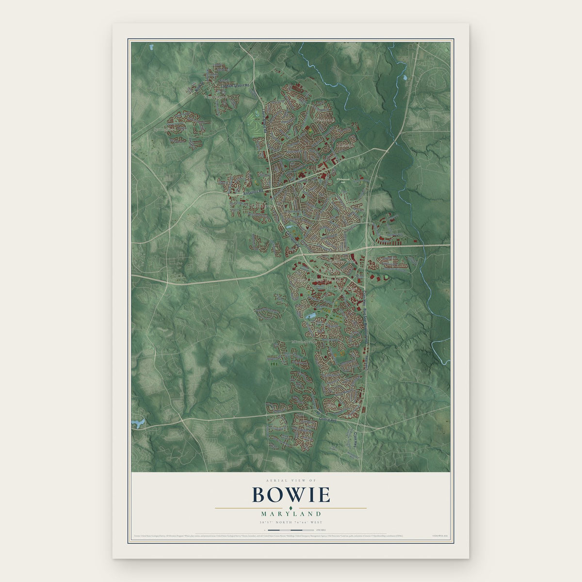
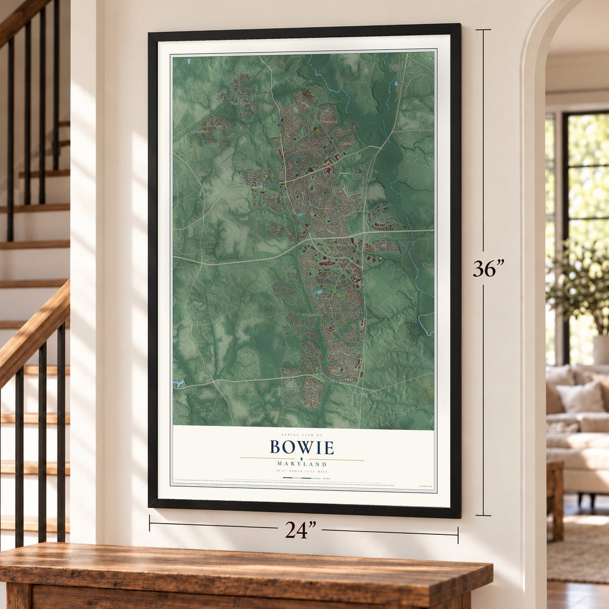
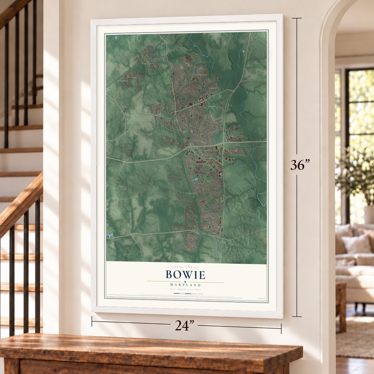
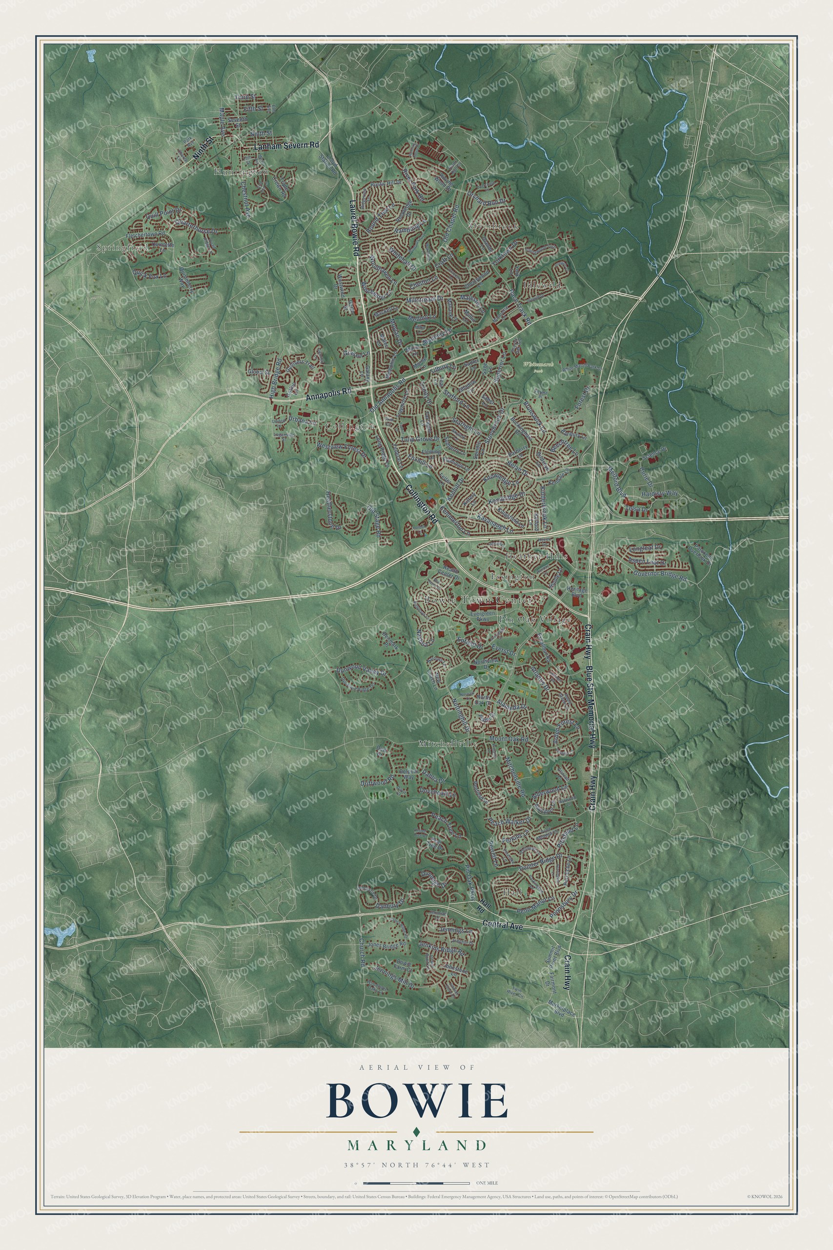
Bowie, Maryland Map Art
Building by building, with labeled streets and shaded relief.
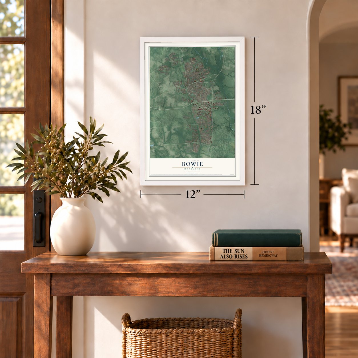
12" x 18" Archival Matte Print
A Map of Home. A Work of Art.
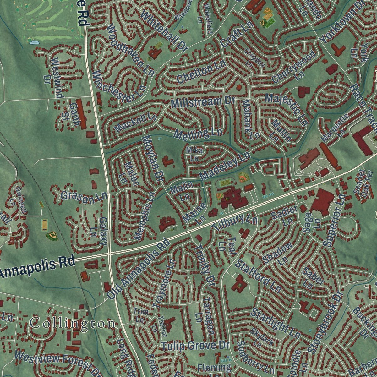
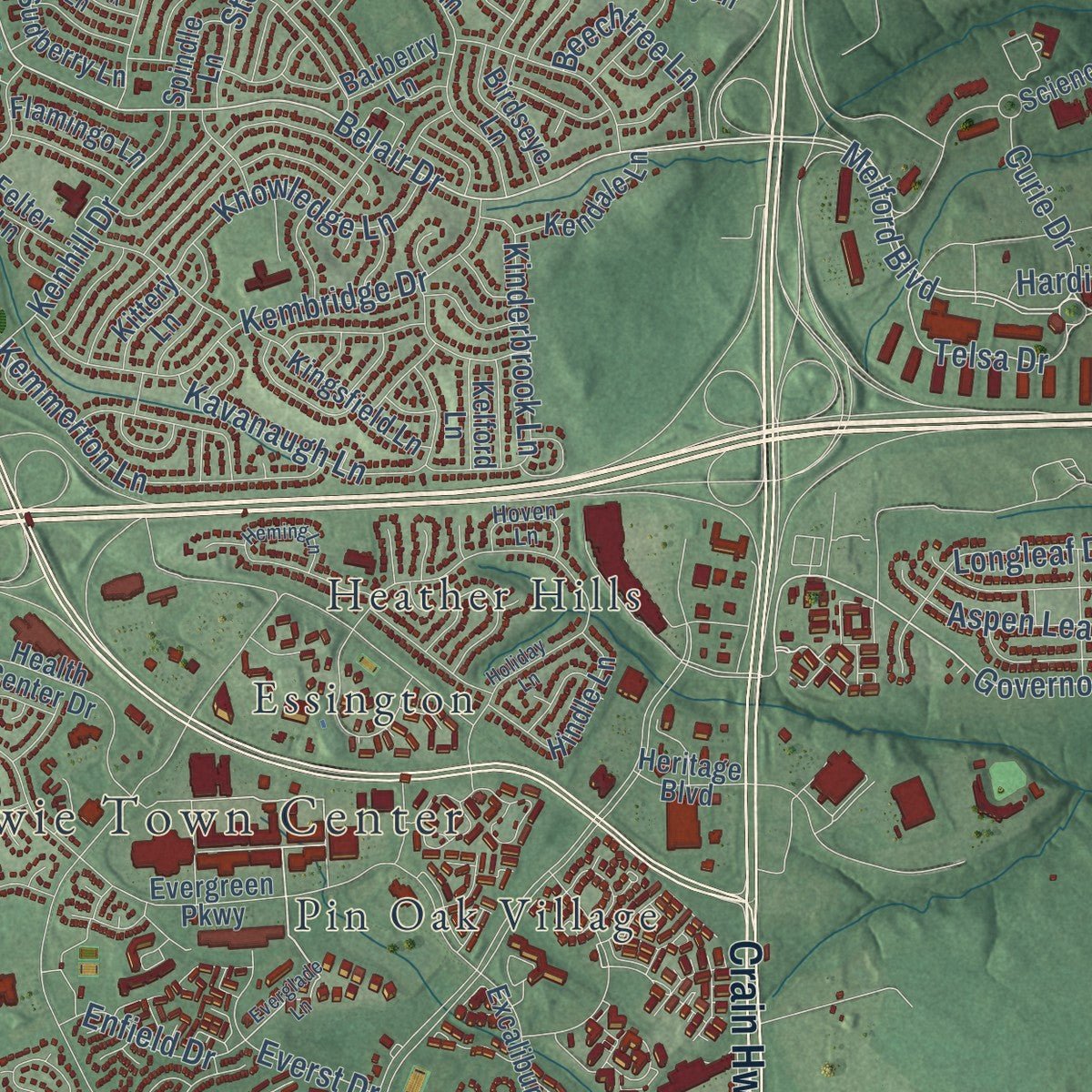
Explore Bowie, Maryland from a whole new perspective. Created using aerial imagery and detailed geographic data, this map captures Bowie building by building, with labeled streets, familiar landmarks, and shaded topographical relief that highlights the natural contours of the landscape.
Combining modern data with the timeless character of a vintage atlas, this map is just as interesting up close as it is beautiful on the wall. Whether you grew up in Bowie, spent memorable years there, or call it home today, this unique map is a great way to celebrate a place that means something to you. Zoom in on the preview to look for your street, and then order a print to put your memories on the wall.
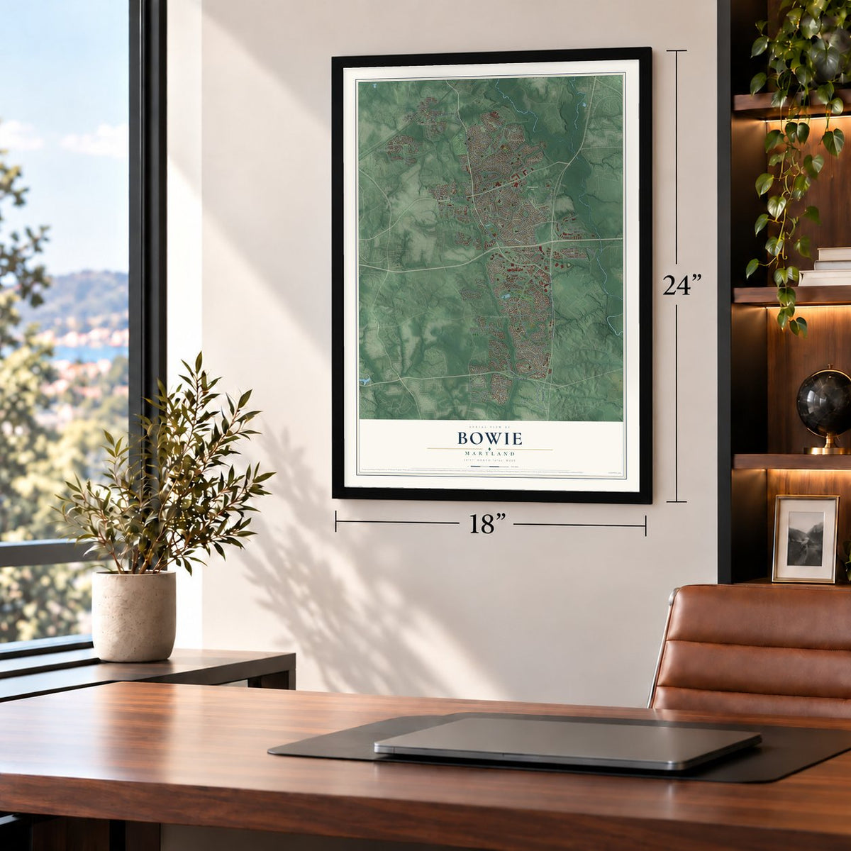
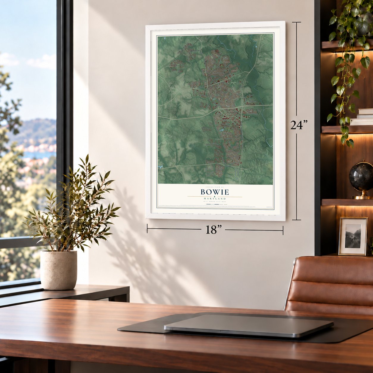
Three ways to hang it
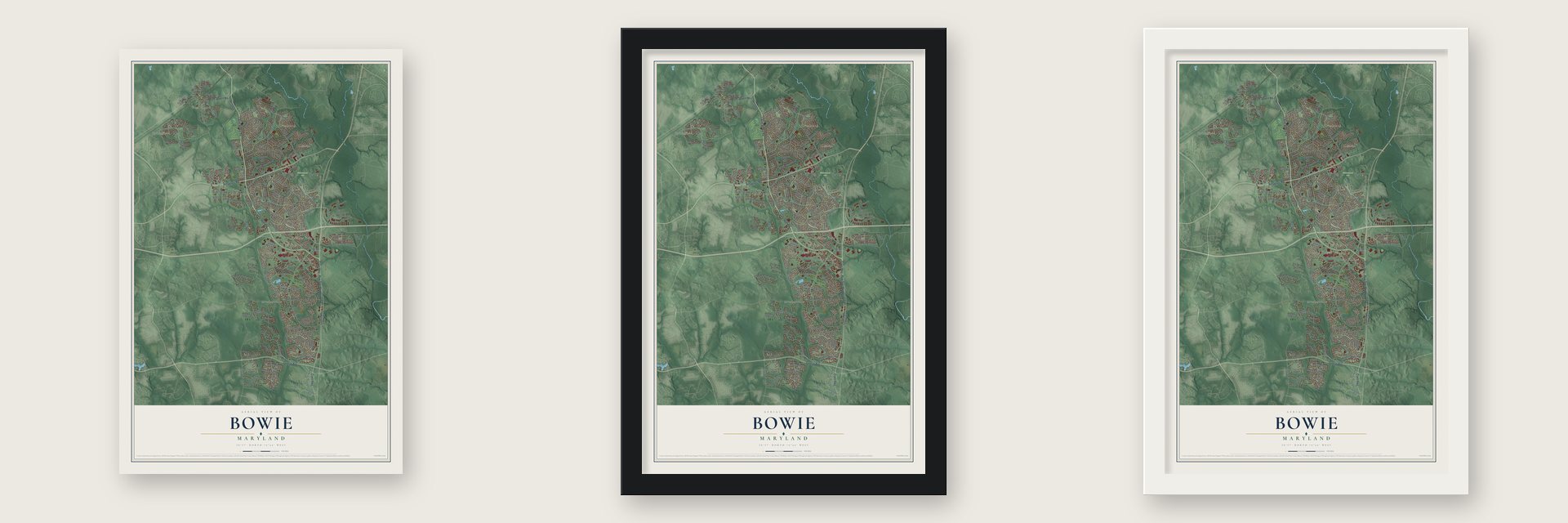
Unframed archival matte, a black wood frame or a white wood frame.
Up close
Geography Worth Displaying
This map was created using accurate cartographic data and authoritative geographic sources, including the U.S. Geological Survey and the Census Bureau. The map brings together terrain, waterways, roads, and building detail. The majority of the streets are labeled, houses are accurately depicted, and the topography is derived from government sources. Combining local data with carefully composed color and shading leads to this beautifully detailed Bowie artwork for your wall.
Rather than simply showing street outlines, we’ve included as many of the street names as we could reasonably fit on the map while keeping their names legible. Zoom in on the high resolution preview to see exactly what’s on the map. We truly set out to create a statement piece for anyone who loves Bowie. So whether it’s for you, or a gift for someone you love, we hope this map of Bowie brings back fond memories.
Read the story behind this map of Bowie, Maryland from 2026.

Find your street
Names on the Bowie map
Every name below is printed on this map. Look for your street, your school, the park where you played, or the pond down the road.
Places and landmarks12
- Bowie Town Center
- Springfield
- Whitemarsh Park
- Collington
- Essington
- Hall
- Heather Hills
- Huntington
- Idlewild
- Mitchellville
- Overbrook
- Pin Oak Village
Streets and roads224
- Annapolis Road
- Collington Road
- Laurel Bowie Road
- Crain Highway
- Central Avenue
- Blue Star Memorial Highway
- Lanham Severn Road
- Ninth Street
- Belair Drive
- Governor Bridge Road
- Melford Boulevard
- Telsa Drive
- Chestnut Avenue
- High Bridge Road
- Mitchellville Road
- Church Road
- Race Track Road
- Mount Oak Road
- Old Chapel Road
- Jennings Mill Drive
- Millstream Drive
- Peach Walker Drive
- Pin Oak Parkway
- Old Annapolis Road
- Pointer Ridge Drive
- River Park Road
- Quill Point Drive
- Stonybrook Drive
- Kembridge Drive
- Yorktown Drive
Show all 224 streets
- Jenkins Ridge Road
- Atlantis Drive
- Nottinghill Drive
- Forest Drive
- Dunwood Valley Drive
- Nashua Lane
- Peach Tree Lane
- Alameda Drive
- Brunswick Lane
- Whitehall Drive
- Kemmerton Lane
- Kavanaugh Lane
- Pennsbury Drive
- Kinderbrook Lane
- Perrell Lane
- Kenhill Drive
- Driftwood Road
- Winchester Lane
- Tulip Grove Drive
- Madeley Lane
- Quarterhorse Drive
- Penn Manor Lane
- Knowledge Lane
- Moylan Drive
- Old Stage Road
- Doveheart Lane
- Majestic Lane
- Alderwood Lane
- Melling Lane
- Jennings Lane
- Westview Forest Drive
- Heatherstone Drive
- Orchard Run Drive
- Starlight Lane
- Rambling Lane
- Arden Forest Lane
- Round Tree Lane
- Dahlia Drive
- Foxhill Lane
- Perkins Lane
- Aspen Leaf Drive
- Beechtree Lane
- Everst Drive
- Dunleigh Drive
- Pittsfield Lane
- Longleaf Drive
- Hardisty Way
- Fifth Street
- Superior Lane
- Stafford Lane
- Woodhaven Lane
- Tilbury Lane
- Enfield Drive
- Maple Avenue
- Trinity Drive
- Chelton Lane
- Curie Drive
- Quick Fox Lane
- Danbury Drive
- Grason Lane
- Urbana Lane
- Third Street
- Craft Lane
- Hall Road
- Fletchertown Road
- Marketplace Boulevard
- Fairmont Drive
- Summit Point Boulevard
- Northview Drive
- Excalibur Road
- Health Center Drive
- Long Ridge Lane
- Gullivers Trail
- Evergreen Parkway
- Rockledge Drive
- Buckingham Drive
- Triple Crown Road
- Memphis Lane
- Science Drive
- Traymore Lane
- Port Echo Lane
- Cherrywood Lane
- Rustic Hill Drive
- Felter Lane
- Galaxy Lane
- Westwind Drive
- Kingsfield Lane
- Jones Bridge Road
- Lloyd Station Road
- Hindle Lane
- New Coach Lane
- Penfield Lane
- Audubon Lane
- Shadow Lane
- Dolphin Way
- Roving Wood Drive
- Tarragon Lane
- Seventh Street
- Sudberry Lane
- Kendale Lane
- Quisinberry Way
- Birdseye Lane
- Mackell Lane
- Federal Lane
- Flamingo Lane
- Global Street
- Patuxent Overlook Drive
- Fleming Lane
- Banbury Lane
- Sadler Lane
- Mabank Lane
- Pear Tree Drive
- Marne Lane
- Johnstone Lane
- North Oak Court
- Malin Lane
- Denmark Place
- Quintette Lane
- Barberry Lane
- Bowie Farm Court
- Spindle Lane
- Teal Lane
- Saber Lane
- Gothic Lane
- Kelford Lane
- Platte Drive
- Heritage Boulevard
- Malec Lane
- Kittery Lane
- Olando Lane
- Mullin Lane
- York Lane
- Garth Street
- Dew Drive
- Sage Lane
- Pond Meadow Lane
- Youngwood Turn
- Dunwood Ridge Terrace
- Apple Green Lane
- Delcastle Drive
- White Marsh Park Drive
- Philmont Lane
- Narrows Lane
- Parkington Lane
- Marquette Lane
- Jordon Pond Lane
- Twin River Circle
- Loganville Street
- Skylark Lane
- United Lane
- Pinelake Lane
- Elm Avenue
- Jodphur Drive
- Hoven Lane
- Woodmore Oaks Court
- Ridgeview Lane
- Quail Ridge Lane
- Scarlet Oak Terrace
- Alstead Lane
- Davit Court
- Park Avenue
- Jerimiah Lane
- Forest Place
- River Run Drive
- Ayrwood Lane
- Church Lane
- Mika Lane
- 13th Street
- Trim Lane
- London Lane
- Everglade Lane
- Holiday Lane
- Idlewild Drive
- Myrtle Avenue
- Nighthawk Lane
- Irongate Lane
- Windover Turn
- Heming Lane
- Wakefield Lane
- James Ridge Road
- New Haven Drive
- Pennington Lane
- Overchase Lane
- Gwinnett Lane
- Croydon Lane
- Pittland Lane
- Artesian Lane
- Norwalk Court
- Gold Cup Lane
- Eddinger Road
- Trainor Lane
- Running Horse Place
- Johnson Grove Lane
- Pepper Tree Drive
Names are listed as they appear on the printed map. Zoom into the product photos to find them.
About Bowie, Maryland
Bowie is a city of 58,329 people in Prince George's County, and it grew up around a railroad junction. In 1853 Colonel William Duckett Bowie won a charter from the Maryland legislature for a rail line into Southern Maryland. The Baltimore & Potomac Railroad began building it in 1869, through country of small farms and big tobacco plantations that ran on slave labor. In 1870 Ben Plumb, a land speculator, sold lots around the junction and named the settlement Huntington City.
The branch to Washington, D.C., was done by 1872, and trains ran the whole way through Southern Maryland to Pope's Creek in 1873. Huntington City received a new charter under the name Bowie in 1880. The new name honored Oden Bowie, the colonel's son and business partner, who had been governor of Maryland and was then president of the railroad. Developers split the land into more than 500 house lots.
- Belair at Bowie, 1957In 1957 the builders Levitt and Sons bought the Belair Estate and laid out the community of Belair at Bowie, its street names grouped in alliterative sections. The town annexed the Levitt land two years later and became a city in 1963. Levitt would not sell its houses to African Americans, and that policy drew civil rights protests in Bowie in 1963. Most people in Bowie still live in this neighborhood.
- Belair Mansion, about 1745The five-part Georgian house was the plantation home of Samuel Ogle, colonial governor of Maryland, and later of his son, Governor Benjamin Ogle. The banker James T. Woodward bought it in 1898, and when he died in 1910 he left it to his nephew, William Woodward Sr.
- Home of the Belair StudWilliam Woodward Sr. (1876 to 1953) ran the Belair Stud, one of the top racing stables of the 1930s, '40s and '50s, from the stables on the estate. No horse farm in the country had raced longer without a break. It shut down in 1957, after the death of his son, Billy Woodward.
Keep exploring Maryland
Bowie is one of 874 Maryland towns we've mapped. Every dot on the map is a print of its own.
The search covers every state, Maryland first.
Near Bowie
Order 2 or more town maps and save 10%. Shown in the size and finish you picked above, so they hang as a set.
- Fairwood 12" x 18" / Archival Matte Print $39.99
- Woodmore 12" x 18" / Archival Matte Print $39.99
- Glenn Dale 12" x 18" / Archival Matte Print $39.99


More maps nearby: Mitchellville, Crofton, Kettering, Lanham and Davidsonville.
The art of mapping a place
How This Map Was Made
Real places. Remarkable detail. Discover the layers that turn geographic data into a map of home.

The view from above
Aerial imagery reveals the character of the land: woodland, open fields, and the patterns of a place.

The shape of the land
Elevation data brings hills, valleys, and subtle changes in the landscape into view.

The details of home
Roads, waterways, and building footprints come together to make the map feel unmistakably local.

Geography becomes art
Considered color, shading, and typography bring the layers together in a map made for your wall.


Process illustrated with Mendon, Massachusetts. Aerial imagery: USDA NAIP. Terrain: USGS 3D Elevation Program. Map details and finished artwork: KNOWOL.
The Details
About This Print
Choose an archival matte print, or a black or white Ayous wood frame. The archival matte print is unframed.
Select your size and finish above to see the matching product image and price.
Materials & Craftsmanship
A contemporary map with the character of a classic atlas, printed on archival matte paper. Optional frames are made from Ayous wood.
Your printed map does not include the watermark shown in the full-map preview.
Shipping & Delivery
Free shipping within the United States. Every print is made to order in the USA.
Buying a gift? Add a note in your cart and we'll include it. We never put prices in the package.
Prints ship within 2 to 3 business days. Allow 7 to 10 days total from ordering for delivery. Timing may vary during holidays or periods of high order volume.
Read our shipping policy.
Returns and damaged prints
Each print is made to order. Change-of-mind refunds are not available after production.
If your print arrives damaged, misprinted or incorrect, contact support@knowol.com within 30 days of receiving it. Include your order number, photos and a description of the issue.
Read our full refund and replacement policy. For questions about your order, email support@knowol.com.