
Search for another town





Free U.S. delivery 7 to 10 days after you order
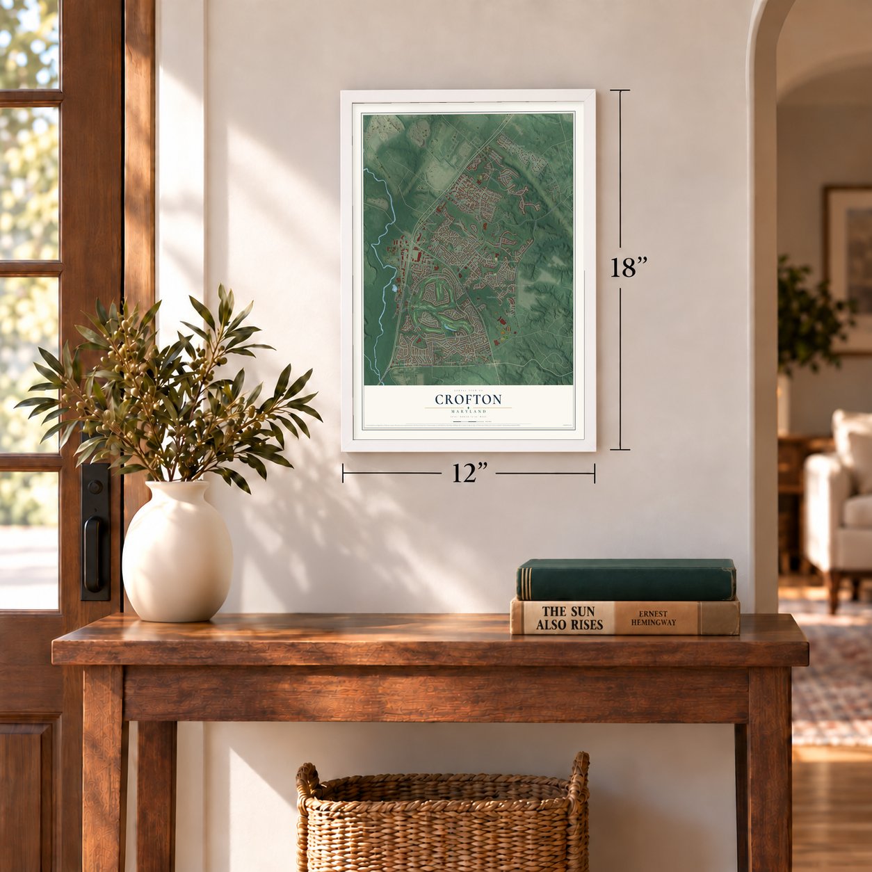
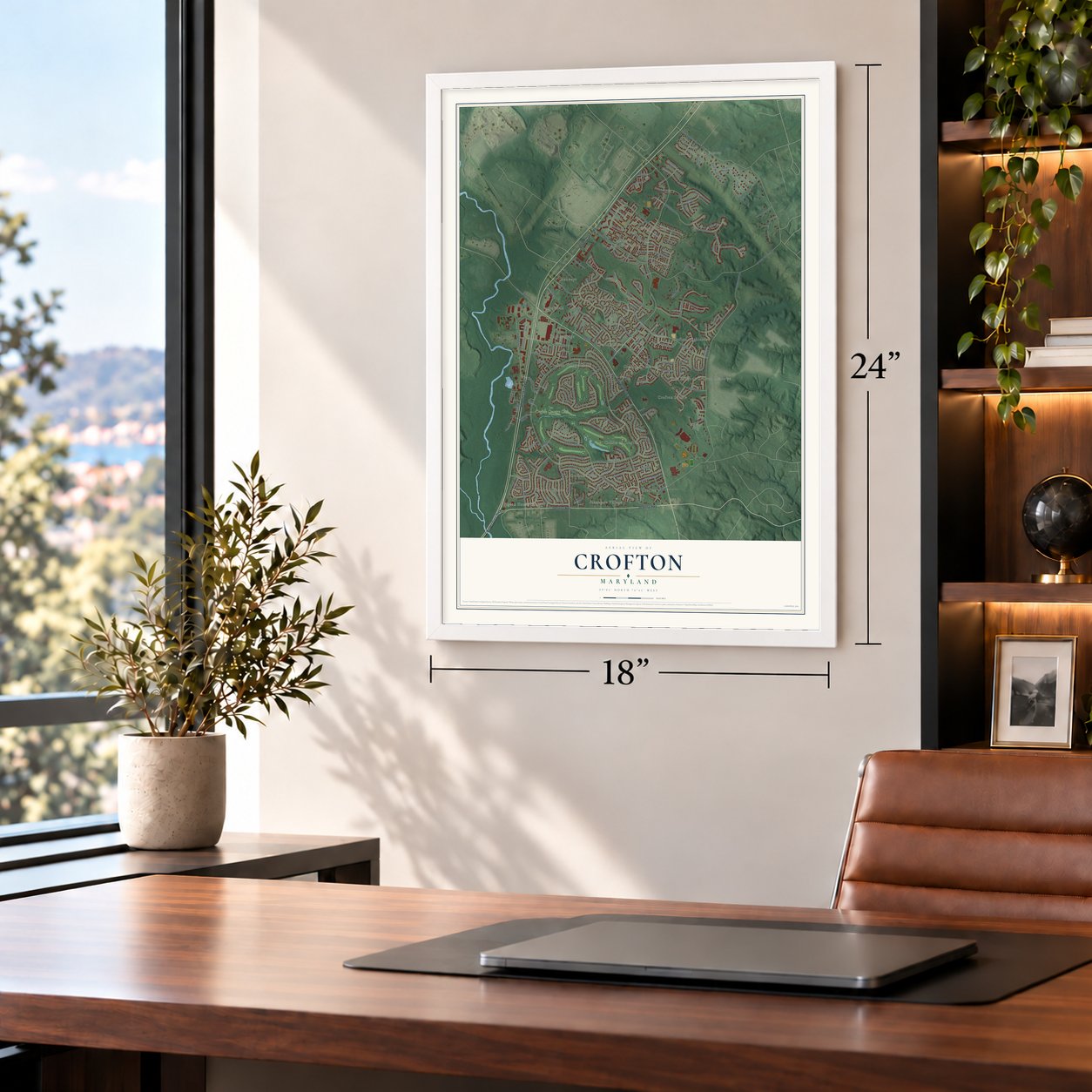
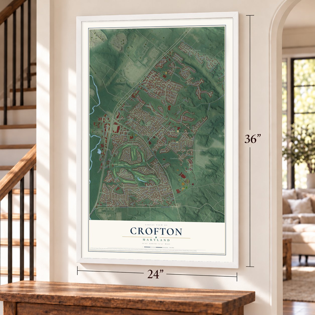
Crofton, Maryland Map Art
Building by building, with labeled streets and shaded relief.
12" x 18" Archival Matte Print
A Map of Home. A Work of Art.
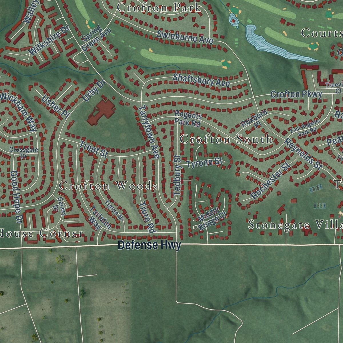
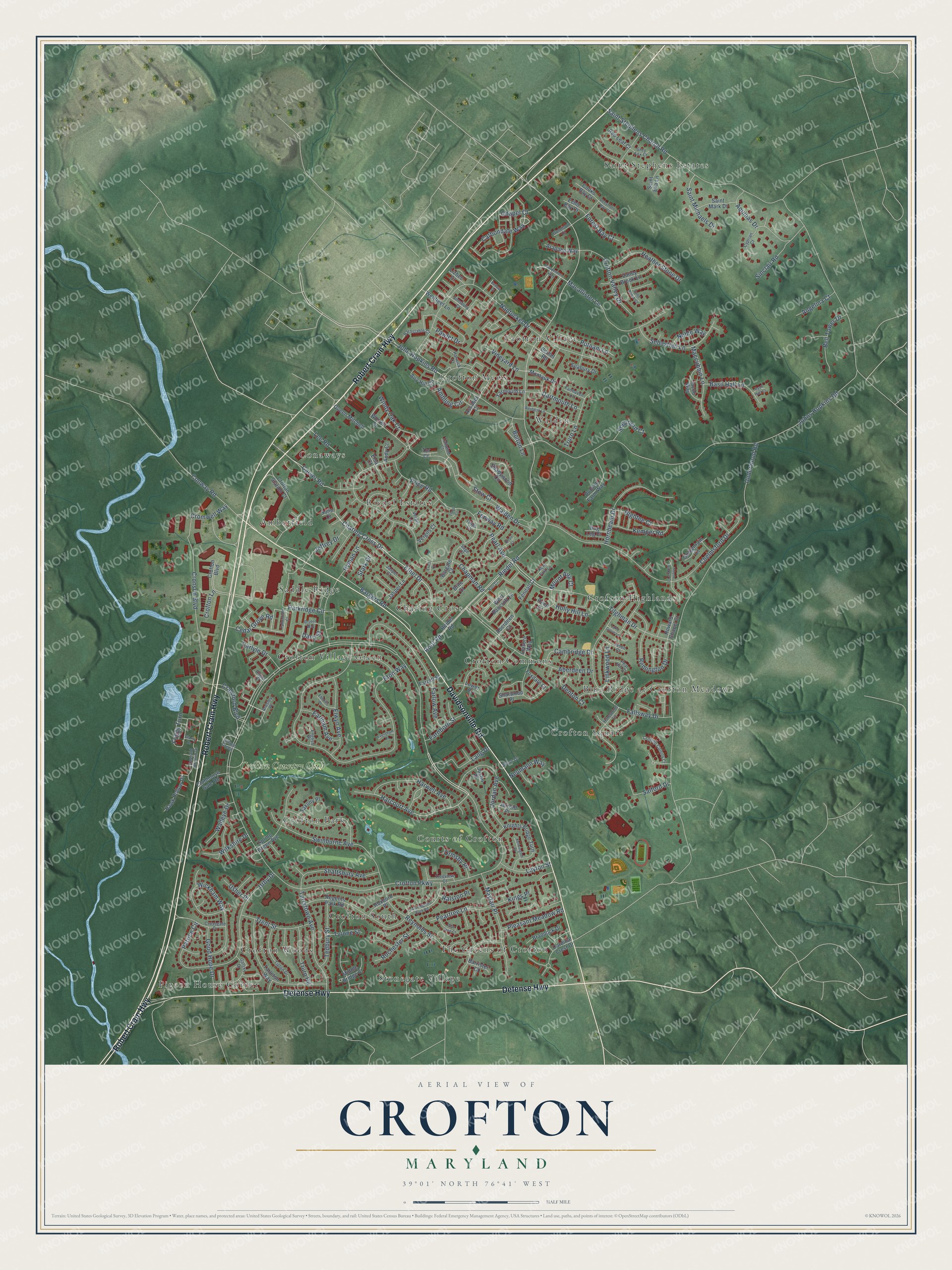
Explore Crofton, Maryland from a whole new perspective. Created using aerial imagery and detailed geographic data, this map captures Crofton building by building, with labeled streets, familiar landmarks, and shaded topographical relief that highlights the natural contours of the landscape.
Combining modern data with the timeless character of a vintage atlas, this map is just as interesting up close as it is beautiful on the wall. Whether you grew up in Crofton, spent memorable years there, or call it home today, this unique map is a great way to celebrate a place that means something to you. Zoom in on the preview to look for your street, and then order a print to put your memories on the wall.
Three ways to hang it
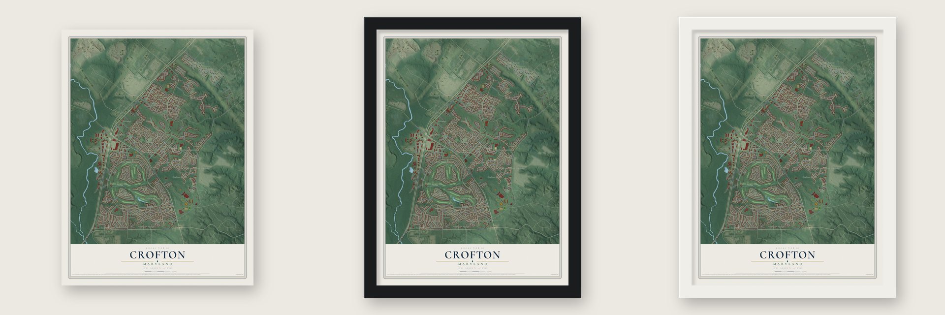
Unframed archival matte, a black wood frame or a white wood frame.
Up close
Geography Worth Displaying
This map was created using accurate cartographic data and authoritative geographic sources, including the U.S. Geological Survey and the Census Bureau. The map brings together terrain, waterways, roads, and building detail. The majority of the streets are labeled, houses are accurately depicted, and the topography is derived from government sources. Combining local data with carefully composed color and shading leads to this beautifully detailed Crofton artwork for your wall.
Rather than simply showing street outlines, we’ve included as many of the street names as we could reasonably fit on the map while keeping their names legible. Zoom in on the high resolution preview to see exactly what’s on the map. We truly set out to create a statement piece for anyone who loves Crofton. So whether it’s for you, or a gift for someone you love, we hope this map of Crofton brings back fond memories.
Read the story behind this map of Crofton, Maryland from 2026.

Find your street
Names on the Crofton map
Every name below is printed on this map. Look for your street, your school, the park where you played, or the pond down the road.
Places and landmarks22
- Charing Cross
- Saint Stephens Estates
- Pigeon House Corner
- The Greens of Crofton
- Walden
- Crofton Village Green
- Crofton Highlands
- Crofton Woods
- Courts of Crofton
- Conaways
- Crofton Park
- Crofton Square
Show all 22 places
- Saddle Ridge
- Blue Ridge at Crofton Meadows
- Stonegate Village
- Crofton Village
- Riedel Estates
- Amberfield
- Crofton Commons
- Crofton South
- Crofton Mews
- Crofton Country Club
Streets and roads210
- Robert Crain Highway
- Davidsonville Road
- Defense Highway
- Tilghman Drive
- Ethel Drive
- Carbondale Way
- Pearl Avenue
- Crofton Parkway
- John Hopkins Road
- Harcourt Avenue
- Vineyard Lane
- Riedel Road
- Underwood Road
- Johns Hopkins Road
- Saint Stephens Church Road
- Eton Way
- Chapman Road
- Nantucket Drive
- Chelmsford Drive
- Aberdeen Drive
- Charing Cross Drive
- Fallsway Drive
- Root Road
- Price Road
- Farlow Avenue
- Cronson Boulevard
- Walden Drive
- Wickham Way
- Swinburne Avenue
- Tarrytown Avenue
Show all 210 streets
- Parkridge Circle
- Urby Drive
- Macallister Lane
- Reynolds Street
- Crawford Boulevard
- Jordan Avenue
- Hornbeam Drive
- Bargers Road
- Conway Road
- Mayfair Place
- Sebastian Lane
- Harwell Avenue
- Crofton Valley Drive
- Remington Drive
- Aquinas Drive
- Heather Stone Drive
- Elwyn Avenue
- Carver Road
- Shaftsbury Avenue
- Pawlet Drive
- Patrice Circle
- Linkwood Lane
- Ambling Circle
- Trent Street
- Windy Oak Court
- Maccubbin Lane
- Sinclair Road
- Tedbury Street
- Holly Hill Lane
- Foggy Turn
- Lang Drive
- Good Hope Drive
- Bell Tower Drive
- Hightee Court
- Pleasant Meadow Road
- Basil Hall Lane
- Saint Michaels Drive
- Kemper Road
- Cromwell Way
- Putnam Lane
- Truro Lane
- Dartmouth Lane
- Truro Road
- Peartree Lane
- Jeffrey Drive
- Earlham Avenue
- Cambridge Drive
- Rochester Street
- Layton Street
- Chapel Court
- Walleye Drive
- Wilkshire Drive
- Cedar Grove Road
- Hyman Lane
- Farnborn Street
- Salford Drive
- Carlyle Drive
- Shepherd Court
- Denton Court
- Angelina Court
- Kings Place
- Stow Court
- Forest Bay Court
- Noble Way
- Neumann Way
- Bolton Lane
- Mount Airy Court
- Ormsby Place
- Tyrone Street
- Fenway Road
- Lee Road
- Ralston Place
- Usher Place
- Crofton Lane
- Dana Street
- Stark Drive
- Montauk Drive
- Regents Park Road
- Tarleton Way
- Shadywood Circle
- Crofton Boulevard
- Knights Bridge Turn
- Reidel Road
- Spring Green Avenue
- West Bancroft Lane
- Crofton Station Court
- Worrell Court
- Sharwood Place
- Duckett Farm Way
- Foxdale Court
- Valley Brook Lane
- Cardinal Crest Drive
- Roxboro Place
- Jacob Way
- Wellfleet Lane
- Middle Bridge Court
- Airy Hill Circle
- Hawk Hollow Drive
- Saint Eva Lane
- Queen Mitchell
- Brite Court
- Saint Mark Drive
- Braddock Drive
- Jasper Lane
- Arapaho Way
- Clubhouse Gate Road
- Yarmouth Lane
- Goldenrain Court
- Aberdeen Court
- Seabury Drive
- Cooks Bay Court
- Jerrold Place
- Saxony Place
- Red Leaf Court
- Echo Bay Court
- Leisure Way
- Howard Chapel Court
- Vergils Court
- Fendall Court
- Dog Leg Court
- Barrister Court
- Bethel Road
- Bargate Court
- Farrell Street
- Lizbec Court
- Reed Drive
- Assabet Court
- Andy Court
- Tor Court
- Justin Place
- Lower Court
- Soho Court
- Elsa Court
- Tallwind Court
- Ardsley Place
- Simsbury Court
- Harewood Lane
- Crossgate Drive
- Tipton Drive
- Emerald Branch Drive
- Galaxy Drive
- Village Green
- Crofton Colony Court
- Cyprian Court
- Barnstable Court
- Treeview Court
- Jason Court
- Pear Hill Court
- Jasper Court
- Fairhaven Lane
- Kent Fort Lane
- Verdis Lane
- Harwick Court
- Grey Fox Court
- Gunnison Court
- English Place
- Seton Drive
- Angus Court
- Twigs Court
- Sage Court
- Powderhorn Way
- Fallowfield Court
- Dryden Way
- Westport Lane
- East Regents Park Road
- Hart Court
- Lake Grove Lane
- Sand Brook Court
- Pear Tree Court
- Ebbotts Place
- Bellow Court
- Kensington Place
- Thistle Brooke Court
- Elton Court
- Densmore Bay Court
- Eversham Place
- Basil Hall Court
- Clarity Drive
- Troys Court
- Erics Court
Names are listed as they appear on the printed map. Zoom into the product photos to find them.
About Crofton, Maryland
Crofton is a planned community in Anne Arundel County, about 9.8 miles west of Annapolis. In 1963 the Crawford Corporation had gathered more than 1,600 acres and announced that it would build a new town there. The land had been the Duvall family farm, a triangle bounded by Crain Highway, Davidsonville Road and Defense Highway. A golf course was planned at its heart, and it later became the Crofton Country Club.
The company took the name from a little township in England's Cumberland County, once called Croft-town. The new town's official start came that autumn, in 1964, the same year Reston, Virginia, was founded. Its first residents arrived three years before families moved into Columbia, often called Maryland's first planned community. Crofton Parkway, a 3.5-mile loop, still circles the center of the original town, and Crofton marked its 50th anniversary in October 2014.
- Linthicum WalksEvan Davis received this land in 1672, and Thomas Linthicum, a Welsh immigrant, acquired it in 1699 for a tobacco farm. In 1701 his son Thomas Linthicum II resurveyed the family's 631 acres and gave the whole tract the name Linthicum Walks. George Washington stayed in the house on trips between Mount Vernon, Annapolis and Philadelphia.
- Saving the Linthicum houseThe school board took the old Linthicum land for schools in 1972. Seven years later, in 1979, the group Anne Arundel Heritage secured a deal that protected the house and the family cemetery, and the house was added to the National Register in 1984.
- The snakehead summer of 2002In late June and early July 2002, a northern snakehead turned up in the pond behind the Crofton post office, and the town made national news. In September crews treated that pond and two others with rotenone and then potassium permanganate, killing six adults and more than one thousand young fish. The scare inspired the films Snakehead Terror and Frankenfish in 2004 and a National Geographic documentary in 2007.
- A sales office turned Town HallThe original section of Crofton runs much of its own affairs through the Crofton Civic Association. Its Town Hall, at Crofton Parkway and Duke of Kent Drive, first served as the Crawford Corporation's sales center, and the building was given to the community in 1973. The town's own police department dates from 1969.
Keep exploring Maryland
Crofton is one of 874 Maryland towns we've mapped. Every dot on the map is a print of its own.
The search covers every state, Maryland first.
Near Crofton
Order 2 or more town maps and save 10%. Shown in the size and finish you picked above, so they hang as a set.
- Odenton 12" x 18" / Archival Matte Print $39.99
- Crownsville 12" x 18" / Archival Matte Print $39.99
- Bowie 12" x 18" / Archival Matte Print $39.99


More maps nearby: Davidsonville, Gambrills, Arden on the Severn, Millersville and Herald Harbor.
The art of mapping a place
How This Map Was Made
Real places. Remarkable detail. Discover the layers that turn geographic data into a map of home.

The view from above
Aerial imagery reveals the character of the land: woodland, open fields, and the patterns of a place.

The shape of the land
Elevation data brings hills, valleys, and subtle changes in the landscape into view.

The details of home
Roads, waterways, and building footprints come together to make the map feel unmistakably local.

Geography becomes art
Considered color, shading, and typography bring the layers together in a map made for your wall.


Process illustrated with Mendon, Massachusetts. Aerial imagery: USDA NAIP. Terrain: USGS 3D Elevation Program. Map details and finished artwork: KNOWOL.
The Details
About This Print
Choose an archival matte print, or a black or white Ayous wood frame. The archival matte print is unframed.
Select your size and finish above to see the matching product image and price.
Materials & Craftsmanship
A contemporary map with the character of a classic atlas, printed on archival matte paper. Optional frames are made from Ayous wood.
Your printed map does not include the watermark shown in the full-map preview.
Shipping & Delivery
Free shipping within the United States. Every print is made to order in the USA.
Buying a gift? Add a note in your cart and we'll include it. We never put prices in the package.
Prints ship within 2 to 3 business days. Allow 7 to 10 days total from ordering for delivery. Timing may vary during holidays or periods of high order volume.
Read our shipping policy.
Returns and damaged prints
Each print is made to order. Change-of-mind refunds are not available after production.
If your print arrives damaged, misprinted or incorrect, contact support@knowol.com within 30 days of receiving it. Include your order number, photos and a description of the issue.
Read our full refund and replacement policy. For questions about your order, email support@knowol.com.