
Search for another town





Free U.S. delivery 7 to 10 days after you order
Brentsville, Virginia Map Art
Building by building, with labeled streets and shaded relief.
12" x 18" Archival Matte Print
A Map of Home. A Work of Art.
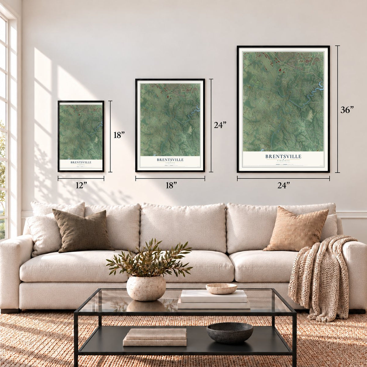
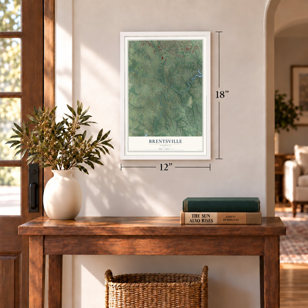
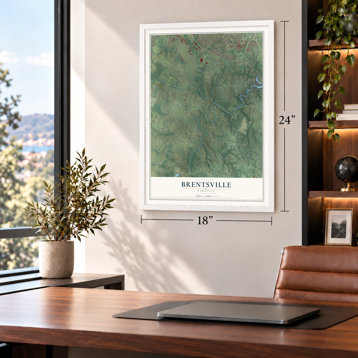
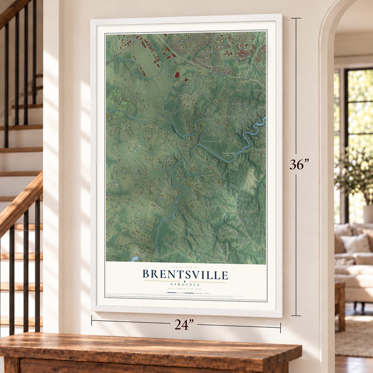
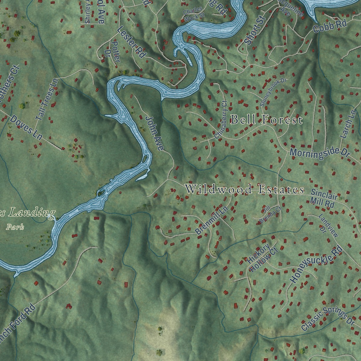
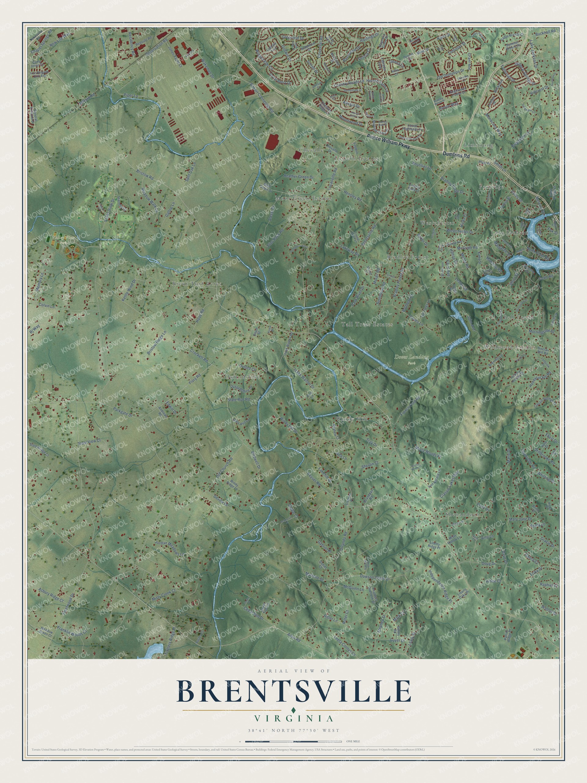
Explore Brentsville, Virginia from a whole new perspective. Created using aerial imagery and detailed geographic data, this map captures Brentsville building by building, with labeled streets, familiar landmarks, and shaded topographical relief that highlights the natural contours of the landscape.
Combining modern data with the timeless character of a vintage atlas, this map is just as interesting up close as it is beautiful on the wall. Whether you grew up in Brentsville, spent memorable years there, or call it home today, this unique map is a great way to celebrate a place that means something to you. Zoom in on the preview to look for your street, and then order a print to put your memories on the wall.
Three ways to hang it
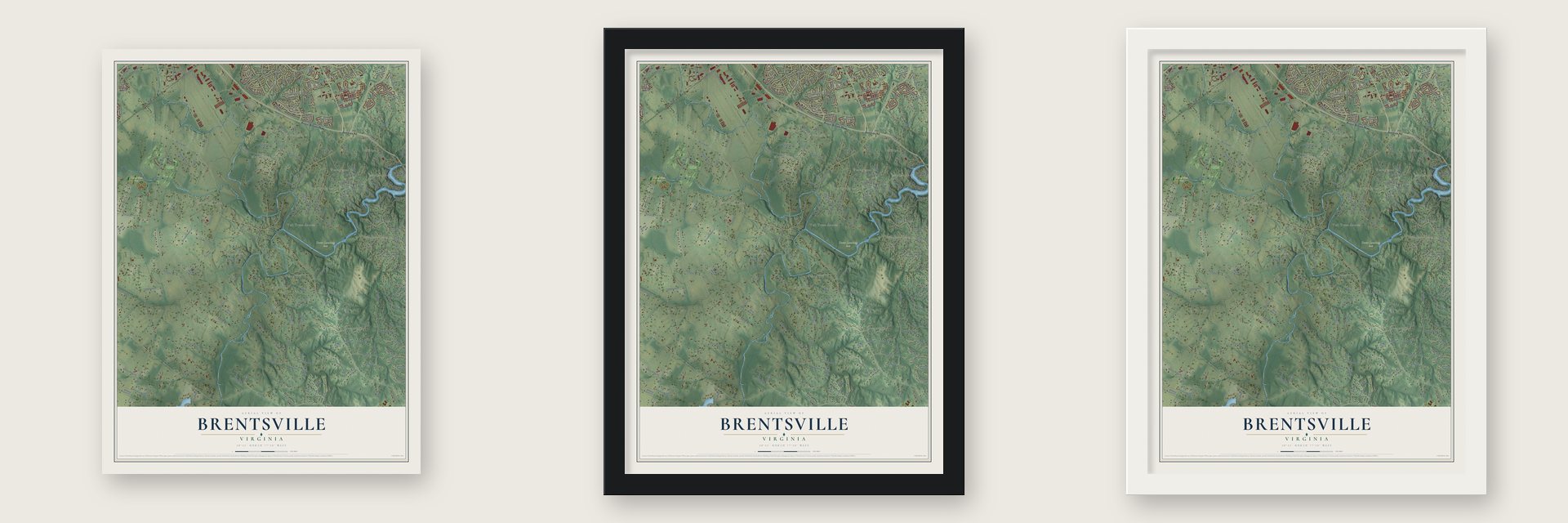
Unframed archival matte, a black wood frame or a white wood frame.
Up close
Geography Worth Displaying
This map was created using accurate cartographic data and authoritative geographic sources, including the U.S. Geological Survey and the Census Bureau. The map brings together terrain, waterways, roads, and building detail. The majority of the streets are labeled, houses are accurately depicted, and the topography is derived from government sources. Combining local data with carefully composed color and shading leads to this beautifully detailed Brentsville artwork for your wall.
Rather than simply showing street outlines, we’ve included as many of the street names as we could reasonably fit on the map while keeping their names legible. Zoom in on the high resolution preview to see exactly what’s on the map. We truly set out to create a statement piece for anyone who loves Brentsville. So whether it’s for you, or a gift for someone you love, we hope this map of Brentsville brings back fond memories.
Read the story behind this map: Detailed Map of Brentsville, Virginia.

Find your street
Names on the Brentsville map
Every name below is printed on this map. Look for your street, your school, the park where you played, or the pond down the road.
Places and landmarks17
- Doves Landing Park
- Valley View Park
- Limstrong
- Moor Green Estates
- Shenandoah
- Oxfordshire
- Bell Forest
- Brent Turf Acres
- Westchester
- Windy Hill
- Fostern Estates
- Bradley Forest
Show all 17 places
- Lake Jackson
- Wildwood Estates
- Foxridge
- Tall Trees Estates
- Chevalle
Streets and roads256
- Prince William Parkway
- Dumfries Road
- Hastings Drive
- Lucasville Road
- Godwin Drive
- Grant Avenue
- Park River Drive
- Bristow Road
- Aden Road
- Parkgate Drive
- Fleetwood Drive
- Valley View Drive
- Brentsville Road
- Old Church Road
- Orlando Road
- Lake Jackson Drive
- Crockett Road
- Keyser Road
- Observation Road
- Smithfield Road
- Windy Hill Drive
- McGrath Road
- Bradley Forest Road
- Cloverhill Road
- Westchester Drive
- Flory Road
- Counselor Road
- Cobb Road
- Wakemen Drive
- Morningside Drive
Show all 256 streets
- Hillcrest Drive
- Stillbrooke Road
- Memory Lane
- Dawson Creek Drive
- Lester Road
- French Ford Road
- Marie Drive
- Whitting Drive
- Airport Connector Road
- Winged Elm Circle
- Mente Road
- Colvin Lane
- Coles Drive
- Izaak Walton Drive
- Monocacy Way
- Flint Rock Road
- Independence Ridge Place
- Misty Creek Court
- Doves Lane
- Jordan Meadows Lane
- Lakehill Drive
- Alessi Drive
- Piper Lane
- Hooe Road
- Ritter Lane
- Hinton Way
- Gallop Lane
- Heather Green Drive
- North Point Road
- Smith Lane
- Amy Lane
- Stephen Street
- Morla Woods Place
- Boutilier Lane
- Mary Jane Drive
- Briarmont Lane
- Lakeway Drive
- Meadow Walk Lane
- Coral Berry Drive
- Bridwell Drive
- Marlette Drive
- Alydar Court
- Old Dominion Drive
- Rj Way
- Leary Street
- Mineral Springs Drive
- Asbury Ridge Court
- Dave Drive
- Doug Drive
- Residency Road
- Hensley Road
- Split Oak Lane
- Gracie Drive
- Leeta Cornus Lane
- Shevlin Court
- Hersch Farm Lane
- John Avenue
- Bradley Forge Drive
- Honeysuckle Road
- Oxfordshire Drive
- Tattersall Drive
- Classic Lakes Way
- Cedar Run Drive
- Allegro Drive
- Chapel Springs Road
- Walton Drive
- Bristow Ridge Lane
- Guyer Drive
- Deville Drive
- Slate View Court
- Greenleaf Drive
- Erika Drive
- Manning Road
- Trotters Ridge Place
- New Life Way
- Country Roads Lane
- Sorrell Drive
- Troy Drive
- Franklin Woods Court
- Hilltop Drive
- Kettle Wind Drive
- Buckhall Road
- Oxford Court
- Gabriel Place
- Mountwood Drive
- Karlo Street
- Frost Drive
- Short Street
- Basilwood Drive
- Edwin Drive
- Ebert Drive
- McGuinn Lane
- Ada Lane
- Mercury Drive
- Slate Run Road
- Calico Court
- Ritter Court
- Margarite Street
- Fox Street
- Tomislav Street
- Penny Lane
- Brothers Court
- Genna Lane
- Molair Road
- Milic Street
- Milford Road
- Baber Drive
- Raphiel Court
- Hicks Court
- Arbee Court
- Carol Avenue
- Felicia Court
- Mark Court
- Sinclair Mill Road
- Izaak Walton Road
- Moor Green Drive
- Chevalle Drive
- Englewood Farms Drive
- Waterford Drive
- Tall Trees Lane
- Brenmill Lane
- Liberty Oaks Place
- Fostern Lane
- General Kirkland Drive
- Hickory Hollow Court
- Labrador Loop
- Mayfield Trace Place
- Tico Lane
- Plant Place
- Cheshire Ridge Cl
- Sentry Road
- James Payne Court
- Classic Springs Drive
- Heathers Overlook Court
- Meadow Green Court
- Patriot Ridge Place
- Laurel Highlands Place
- Daniel Court
- Cabin Branch Court
- Slate Bridge Court
- Iron Brigade Unit Avenue
- Windy Ridge Lane
- Larch Lane
- Ann Natalie Lane
- Redoubt Road
- Magnolia Grove Drive
- Sand Bridge Court
- Stainsby Court
- Brickshire Lane
- Slate Run Lane
- Loblolly Trail
- Summer Breeze Place
- Liberty Ridge Place
- Harton Street
- Hillis Court
- Lismore Place
- Hyla Drive
- Grandpas Road
- Kathy Street
- Lenfant Place
- Mayhew Court
- Elaine Avenue
- Donner Drive
- Navarone Place
- Aspen Tree Lane
- Andrews Road
- Misty Hollow Lane
- Ausley Court
- Camp Jones Court
- Tito Court
- Estates Pond Court
- Potter Drive
- Union Street
- Brinn Court
- Sinclair Lane
- Clinton Drive
- Inspiration Point Place
- Jacqueline Avenue
- Chinaberry Court
- Landview Drive
- Sunnyslope Drive
- Cabin Ridge Court
- Crystal Creek Lane
- Jansen Street
- Tullamore Court
- Caton Place
- Janja Court
- Shirley Avenue
- Bradley Manor Place
- Haire Street
- Manor View Place
- Stoney Run Place
- Johnson Drive
- Sheridan Lane
- Furr Court
- Aviation Lane
- Smith Pond Lane
- Robert Place
- Richie Court
- Duet Court
- Sara Court
- Nokesville Road
- Huntsman Drive
- Barrington Park Circle
- Cedar Ridge Drive
- Arrington Court
- Seabiscuit Lane
- Stoneybrook Drive
- Goldenberry Hill Lane
- Monterosa Place
- Knollwood Drive
- Temple Loop
- Charles Wack Street
- Kristi May Way
- Trenton Court
- Round Top Road
- Haggle Court
- Coopers Lane
- Jill Brenda Court
- Bristow Woods Court
- Luther Drive
- Conifer Court
- Barbee Road
- Hogan Place
- Shady Creek Court
- Heaven Scent Lane
Names are listed as they appear on the printed map. Zoom into the product photos to find them.
About Brentsville, Virginia
Brentsville was first called Brent Town, after its colonial founder George Brent. Settlers were living here by the summer of 1688. Because it sat in the middle of the county, it became the Prince William County seat around 1820. It held that role until 1894.
Brentsville was a key spot in the Civil War and took heavy damage. Union soldiers pulled apart parts of the courthouse to build other things. The town rebuilt, and in 1871 it raised a shared Union Church and a one-room schoolhouse.
Keep exploring Virginia
Brentsville is one of 862 Virginia towns we've mapped. Every dot on the map is a print of its own.
The search covers every state, Virginia first.
Near Brentsville
Order 2 or more town maps and save 10%. Shown in the size and finish you picked above, so they hang as a set.
- Bristow 12" x 18" / Archival Matte Print $39.99
- Woodbine 12" x 18" / Archival Matte Print $39.99
- Buckhall 12" x 18" / Archival Matte Print $39.99


More maps nearby: Manassas, Nokesville, Innovation, Independent Hill and Linton Hall.
The art of mapping a place
How This Map Was Made
Real places. Remarkable detail. Discover the layers that turn geographic data into a map of home.

The view from above
Aerial imagery reveals the character of the land: woodland, open fields, and the patterns of a place.

The shape of the land
Elevation data brings hills, valleys, and subtle changes in the landscape into view.

The details of home
Roads, waterways, and building footprints come together to make the map feel unmistakably local.

Geography becomes art
Considered color, shading, and typography bring the layers together in a map made for your wall.


Process illustrated with Mendon, Massachusetts. Aerial imagery: USDA NAIP. Terrain: USGS 3D Elevation Program. Map details and finished artwork: KNOWOL.
The Details
About This Print
Choose an archival matte print, or a black or white Ayous wood frame. The archival matte print is unframed.
Select your size and finish above to see the matching product image and price.
Materials & Craftsmanship
A contemporary map with the character of a classic atlas, printed on archival matte paper. Optional frames are made from Ayous wood.
Your printed map does not include the watermark shown in the full-map preview.
Shipping & Delivery
Free shipping within the United States. Every print is made to order in the USA.
Buying a gift? Add a note in your cart and we'll include it. We never put prices in the package.
Prints ship within 2 to 3 business days. Allow 7 to 10 days total from ordering for delivery. Timing may vary during holidays or periods of high order volume.
Read our shipping policy.
Returns and damaged prints
Each print is made to order. Change-of-mind refunds are not available after production.
If your print arrives damaged, misprinted or incorrect, contact support@knowol.com within 30 days of receiving it. Include your order number, photos and a description of the issue.
Read our full refund and replacement policy. For questions about your order, email support@knowol.com.