


Search for another town



Free U.S. delivery 7 to 10 days after you order
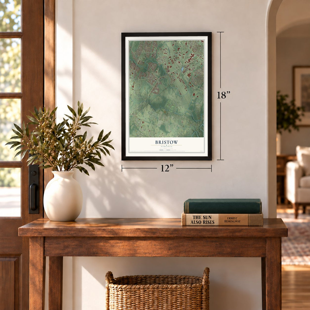
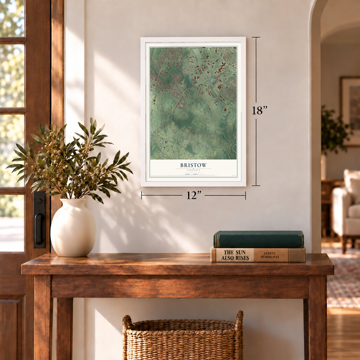
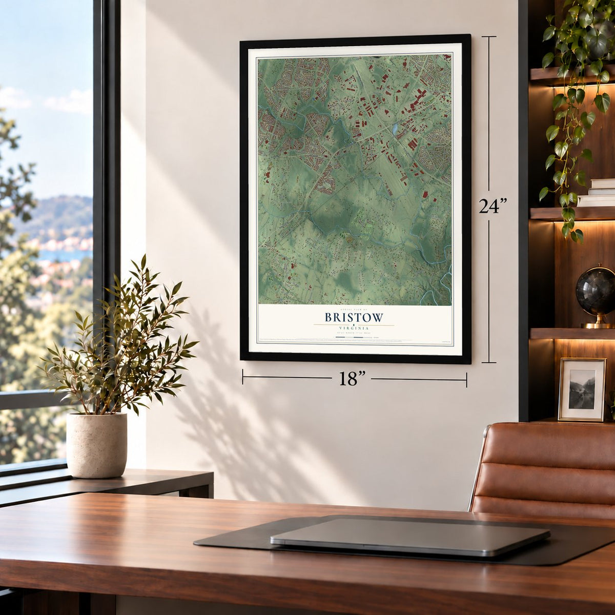
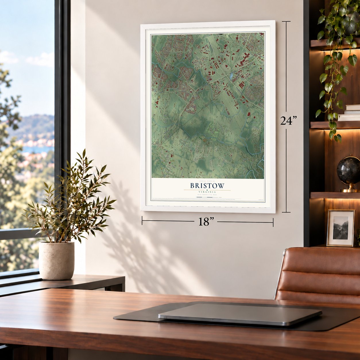
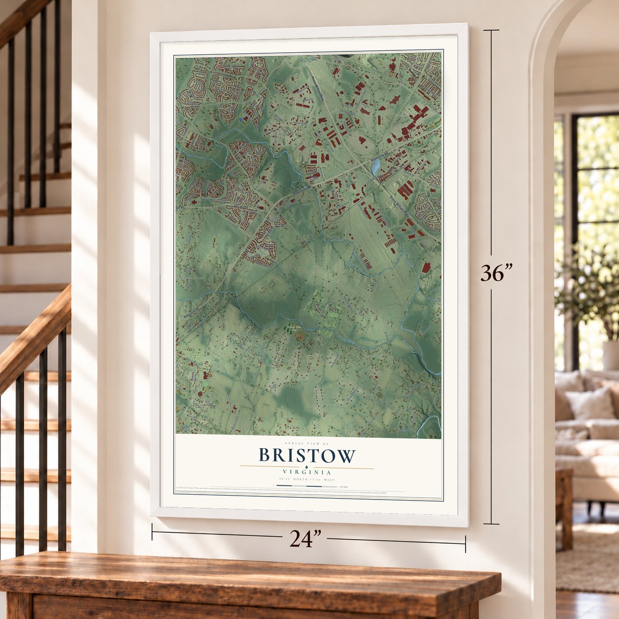
Bristow, Virginia Map Art
Building by building, with labeled streets and shaded relief.
12" x 18" Archival Matte Print
A Map of Home. A Work of Art.
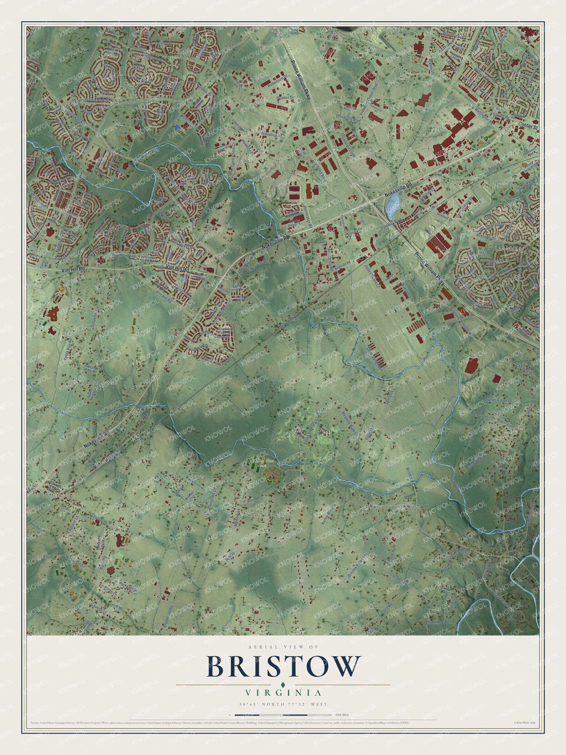
Explore Bristow, Virginia from a whole new perspective. Created using aerial imagery and detailed geographic data, this map captures Bristow building by building, with labeled streets, familiar landmarks, and shaded topographical relief that highlights the natural contours of the landscape.
Combining modern data with the timeless character of a vintage atlas, this map is just as interesting up close as it is beautiful on the wall. Whether you grew up in Bristow, spent memorable years there, or call it home today, this unique map is a great way to celebrate a place that means something to you. Zoom in on the preview to look for your street, and then order a print to put your memories on the wall.
Three ways to hang it
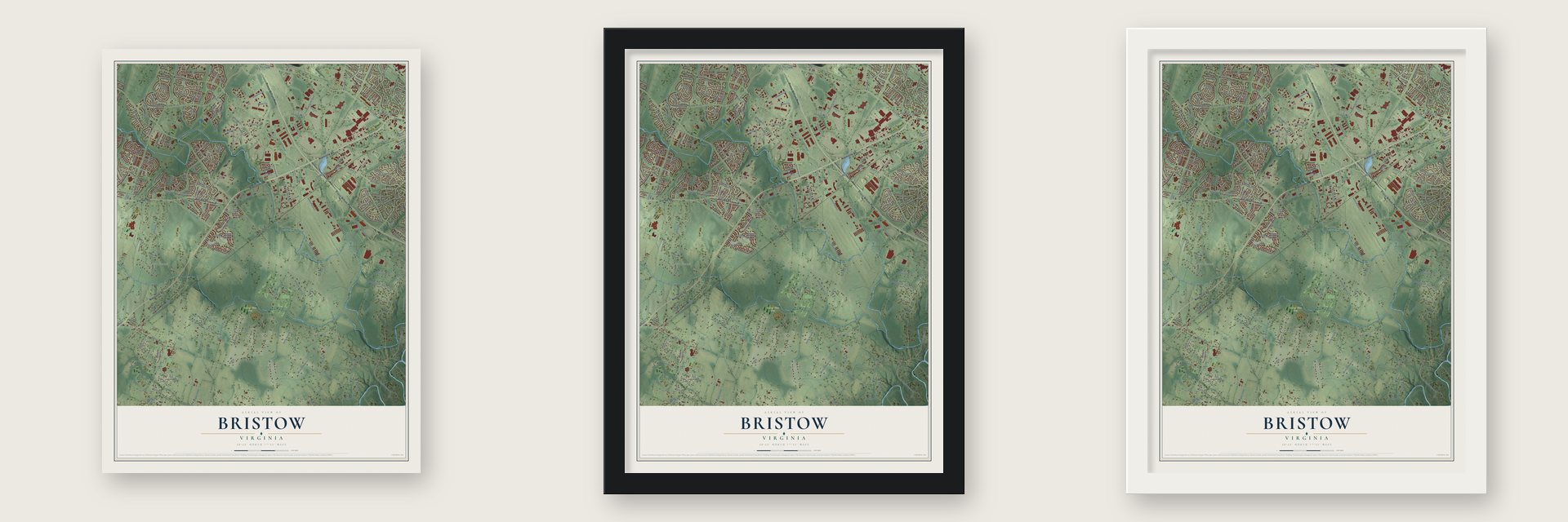
Unframed archival matte, a black wood frame or a white wood frame.
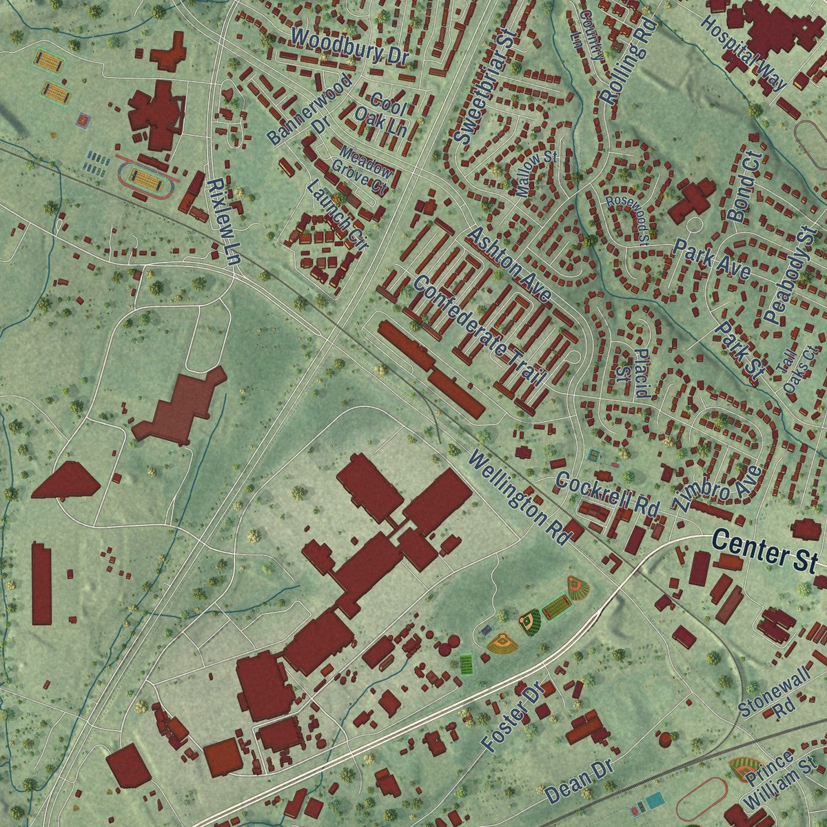
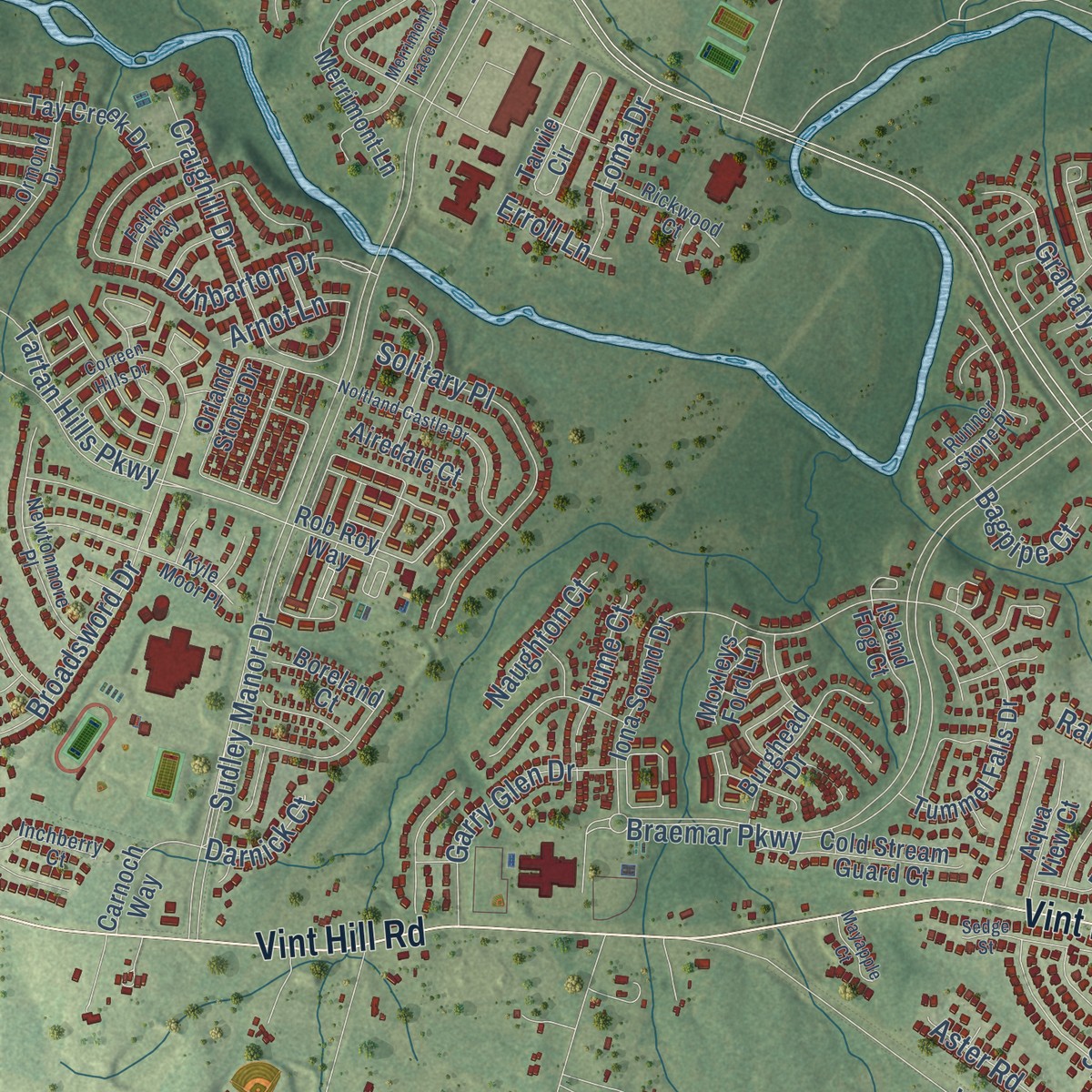
Up close
Geography Worth Displaying
This map was created using accurate cartographic data and authoritative geographic sources, including the U.S. Geological Survey and the Census Bureau. The map brings together terrain, waterways, roads, and building detail. The majority of the streets are labeled, houses are accurately depicted, and the topography is derived from government sources. Combining local data with carefully composed color and shading leads to this beautifully detailed Bristow artwork for your wall.
Rather than simply showing street outlines, we’ve included as many of the street names as we could reasonably fit on the map while keeping their names legible. Zoom in on the high resolution preview to see exactly what’s on the map. We truly set out to create a statement piece for anyone who loves Bristow. So whether it’s for you, or a gift for someone you love, we hope this map of Bristow brings back fond memories.
Read the story behind this map: Detailed Map of Bristow, Virginia.

Find your street
Names on the Bristow map
Every name below is printed on this map. Look for your street, your school, the park where you played, or the pond down the road.
Places and landmarks8
- Nokesville
- Lee Manor
- Valley View Park
- Woodlawn Farms
- Brent Turf Acres
- Colonial Acres
- Colvin Farms
- Clover Hill
Streets and roads268
- Nokesville Road
- Prince William Parkway
- Vint Hill Road
- Center Street
- Wellington Road
- Rixlew Lane
- Godwin Drive
- Carolina Drive
- Tartan Hills Parkway
- Piper Lane
- Aden Road
- Upper Mill Loop
- Edmonston Drive
- Sudley Manor Drive
- Linton Hall Road
- Bristow Road
- University Boulevard
- Ashton Avenue
- Valley View Drive
- Parkgate Drive
- Kettle Run Road
- Hornbaker Road
- Braemar Parkway
- Colvin Lane
- Lucasville Road
- Crockett Road
- Observation Road
- Hastings Drive
- Cloverhill Road
- Victory Lakes Loop
Show all 268 streets
- Schaeffer Lane
- Fitzwater Drive
- Marsteller Drive
- Old Church Road
- Devlin Road
- Wakemen Drive
- Memory Lane
- General Kirkland Drive
- Winged Elm Circle
- Gateway Boulevard
- Airport Connector Road
- Flory Road
- Confederate Trail
- Residency Road
- Brentsville Road
- Discovery Boulevard
- Park Avenue
- Izaak Walton Drive
- Moor Green Drive
- Flint Rock Road
- Freedom Center Boulevard
- Dunbarton Drive
- Park Street
- Shannon Lane
- General Cooke Drive
- Bristow Station Drive
- Foster Drive
- Alessi Drive
- Dean Drive
- Acadia Park Drive
- Lake Baldwin Drive
- Chevalle Drive
- Battlefield Drive
- Hooe Road
- Rolling Road
- Gallop Lane
- Heather Green Drive
- Industrial Road
- Solitary Place
- Hickerson Lane
- Craighill Drive
- Sweetbriar Street
- Meadow Walk Lane
- Coral Berry Drive
- Rj Way
- Zimbro Avenue
- Robertson Drive
- Woodbury Drive
- Innovation Loop
- Garman Drive
- Hawkins Drive
- Sherborne Street
- Split Oak Lane
- Devlins Grove Place
- Hooker Lane
- Broadsword Drive
- Chapel Springs Road
- Oxfordshire Drive
- Spring Iris Drive
- Airlea Drive
- Hazel Circle Drive
- Tygart Lake Drive
- Clara Barton Drive
- Garry Glen Drive
- Granary Place
- Bluegrass Court
- Bristow Ridge Lane
- Greenleaf Drive
- Industrial Court
- Formby Street
- Brookfield Road
- Central Park Drive
- Cockrell Road
- New Life Way
- Sorrell Drive
- Contractors Court
- Dean Park Lane
- Rain Slicker Place
- James Payne Court
- Kettle Wind Drive
- Aster Road
- Bens Way
- Hackney Drive
- Great Falls Drive
- Slate Run Road
- Loma Drive
- Foremost Court
- Peabody Street
- Naughton Court
- Colonel Court
- Nokes Street
- Rothbury Drive
- Rilda Place
- Bagpipe Court
- Milford Road
- Braden Drive
- Darnick Court
- Arnot Lane
- Erroll Lane
- Hume Court
- Bond Court
- Rob Roy Way
- Tarvie Circle
- Ratcliffe Trail
- Cool Oak Lane
- Izaak Walton Road
- Moore Green Drive
- Falling Water Drive
- Iona Sound Drive
- Orland Stone Drive
- Launch Circle
- Shallow Creek Loop
- Sowder Village Square
- Big Springs Loop
- Waterford Drive
- Tummel Falls Drive
- Merrimont Lane
- Lexington Valley Drive
- Tico Lane
- Bannerwood Drive
- Twin Leaf Drive
- Glen Meadow Lane
- Cheshire Ridge Cl
- Prince William Street
- Rayborn Creek Drive
- Raging Water Drive
- Crossman Creek Way
- Country Mill Drive
- Oxford Court
- Round Hill Drive
- Cold Stream Guard Court
- Cascade Falls Drive
- Hospital Way
- Tay Creek Drive
- Assett Loop
- Redoubt Road
- Puddle Place
- Patriot Hill
- Stainsby Court
- Alexander Hays Road
- Blue Violet Way
- Aqua View Court
- Loblolly Trail
- Hanson Grove Court
- Carnoch Way
- Angel Falls Street
- Balaton Lake Lane
- Island Fog Court
- Edwin Drive
- Vulcan Lane
- Vantage Point Court
- Dawkins Crest Circle
- Carriage Ford Road
- Infantry Lane
- Burghead Drive
- Stonewall Road
- Airedale Court
- Allegro Drive
- Thong Pan Road
- Navarone Place
- Battalion Square
- Moxleys Ford Lane
- Boreland Court
- Skylark Drive
- Pleasant View Court
- Hayden Road
- Camp Jones Court
- Placid Street
- Bourne Place
- Minute Lane
- Johnson Drive
- Edmund Saul Court
- Fiore Court
- Runner Stone Place
- Cedar Ridge Drive
- Brewer Creek Place
- George Mason Circle
- Poagues Battery Drive
- Roaring Spring Loop
- Newtonmore Place
- Crabtree Falls Drive
- Lakeway Drive
- Pennsylvania Avenue
- Benton Lake Road
- Iron Brigade Unit Avenue
- Magic Springs Way
- Pump Staion Way
- Ormond Drive
- Falcon Glen Court
- Casey Lane
- Rickwood Court
- Country Lane
- Pyramid Place
- Chippenham Court
- Hunting Cove Place
- Kyle Moor Place
- Sandy Court
- Fetlar Way
- Inchberry Court
- Mallow Street
- Manor View Place
- Trailside Turn
- Rainleaf Court
- Meadow Grove Court
- Crecy Lane
- Free Street
- Capitol Court
- Union Street
- Aviation Lane
- Tall Oaks Court
- Coffee Tree Court
- Faber Lane
- Bristow Center Drive
- Merrimont Trace Circle
- Correen Hills Drive
- Noltland Castle Drive
- Dunstable Loop
- Goldenberry Hill Lane
- Sedge Street
- Tulane Falls Drive
- Ashleys Park Lane
- Snapshot Court
- Whitchurch Court
- Hawkeye Run Court
- Underwood Court
- Serenity Place
- Trenton Court
- Rosewood Street
- Pouring Rain Place
- Vinnia Court
- Haltwhistle Court
- Hawthorn Hill Court
- Mayapple Court
- Camden Park Court
- Bus Center Court
- Candy Court
- Harvest Place
- Carmel Way
Names are listed as they appear on the printed map. Zoom into the product photos to find them.
About Bristow, Virginia
Most of Bristow was once Linton's Ford plantation, held by the Linton family since the 1700s. In 1894 Sarah Linton became a Catholic nun. She gave the land to the church for schools for poor children. Linton Hall Military School opened there in 1922, and Linton Hall Road is named for it.
- Civil War eventOn August 26, 1862, Jackson's troops cut the communications of Pope's army here at Bristow.
Keep exploring Virginia
Bristow is one of 862 Virginia towns we've mapped. Every dot on the map is a print of its own.
The search covers every state, Virginia first.
Near Bristow
Order 2 or more town maps and save 10%. Shown in the size and finish you picked above, so they hang as a set.
- Innovation 12" x 18" / Archival Matte Print $39.99
- Linton Hall 12" x 18" / Archival Matte Print $39.99
- Nokesville 12" x 18" / Archival Matte Print $39.99


More maps nearby: Brentsville, Manassas, Bull Run, Sudley and Buckhall.
The art of mapping a place
How This Map Was Made
Real places. Remarkable detail. Discover the layers that turn geographic data into a map of home.

The view from above
Aerial imagery reveals the character of the land: woodland, open fields, and the patterns of a place.

The shape of the land
Elevation data brings hills, valleys, and subtle changes in the landscape into view.

The details of home
Roads, waterways, and building footprints come together to make the map feel unmistakably local.

Geography becomes art
Considered color, shading, and typography bring the layers together in a map made for your wall.


Process illustrated with Mendon, Massachusetts. Aerial imagery: USDA NAIP. Terrain: USGS 3D Elevation Program. Map details and finished artwork: KNOWOL.
The Details
About This Print
Choose an archival matte print, or a black or white Ayous wood frame. The archival matte print is unframed.
Select your size and finish above to see the matching product image and price.
Materials & Craftsmanship
A contemporary map with the character of a classic atlas, printed on archival matte paper. Optional frames are made from Ayous wood.
Your printed map does not include the watermark shown in the full-map preview.
Shipping & Delivery
Free shipping within the United States. Every print is made to order in the USA.
Buying a gift? Add a note in your cart and we'll include it. We never put prices in the package.
Prints ship within 2 to 3 business days. Allow 7 to 10 days total from ordering for delivery. Timing may vary during holidays or periods of high order volume.
Read our shipping policy.
Returns and damaged prints
Each print is made to order. Change-of-mind refunds are not available after production.
If your print arrives damaged, misprinted or incorrect, contact support@knowol.com within 30 days of receiving it. Include your order number, photos and a description of the issue.
Read our full refund and replacement policy. For questions about your order, email support@knowol.com.