
Search for another town


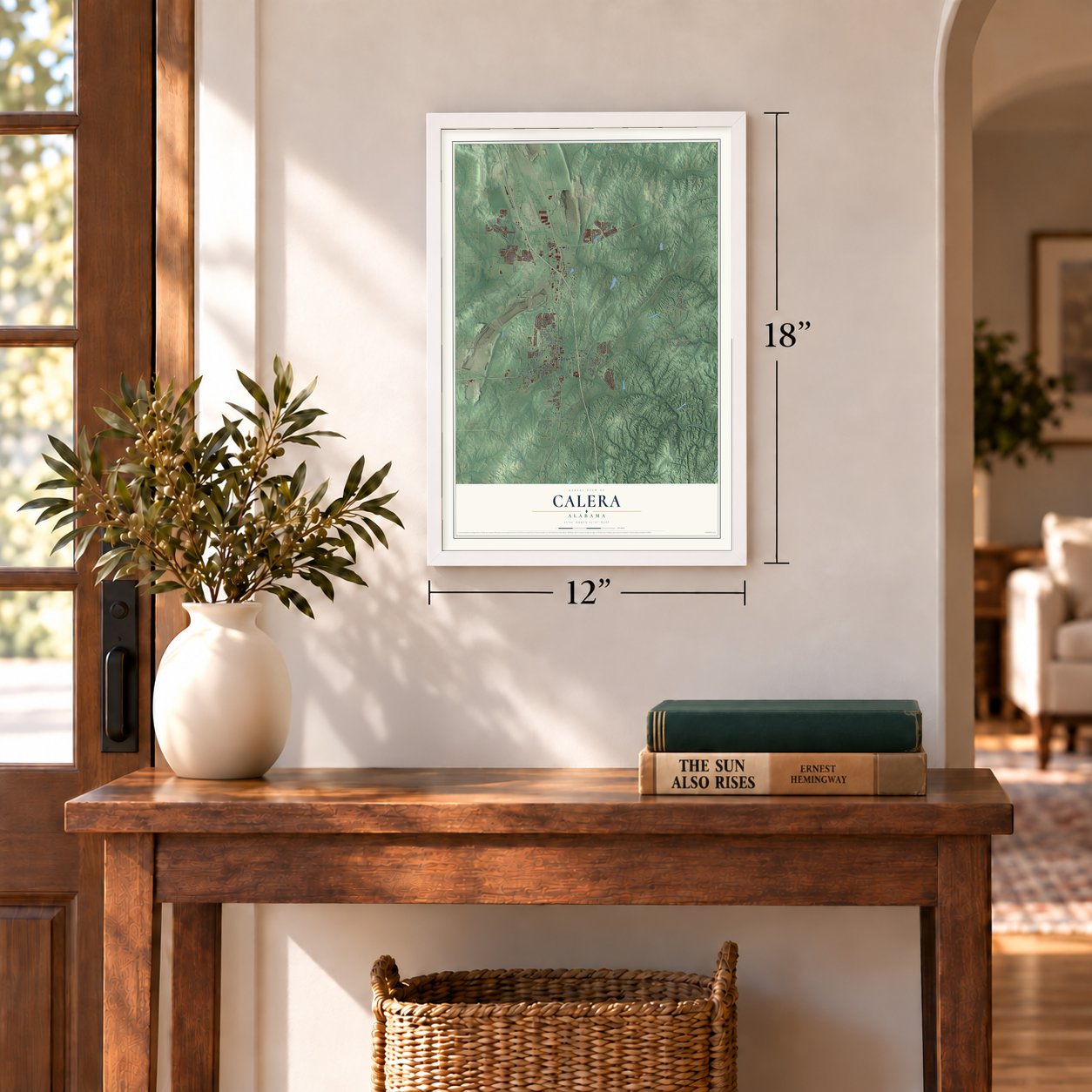
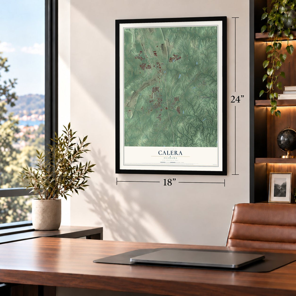
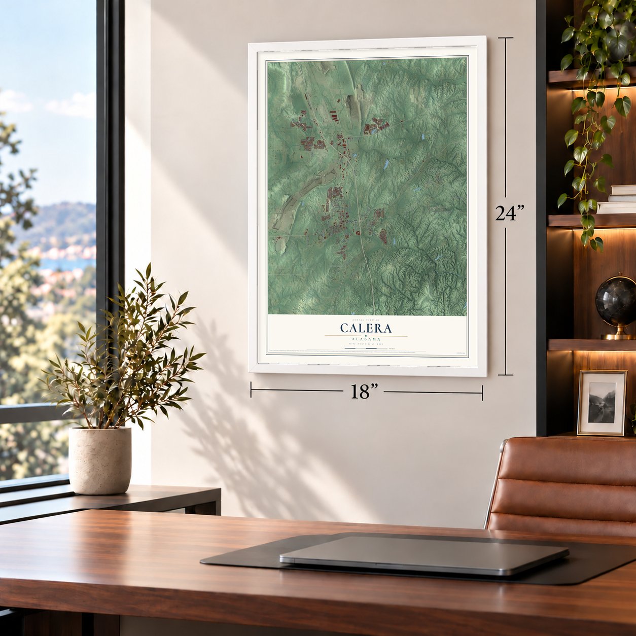

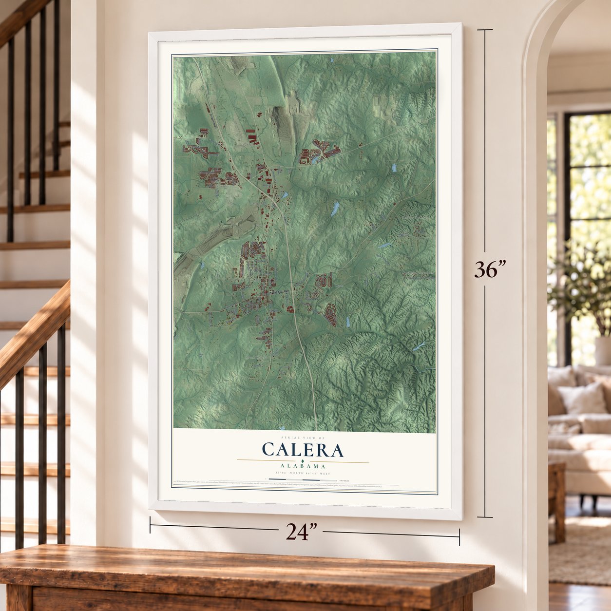

Free U.S. delivery 7 to 10 days after you order
Calera, Alabama Map Art
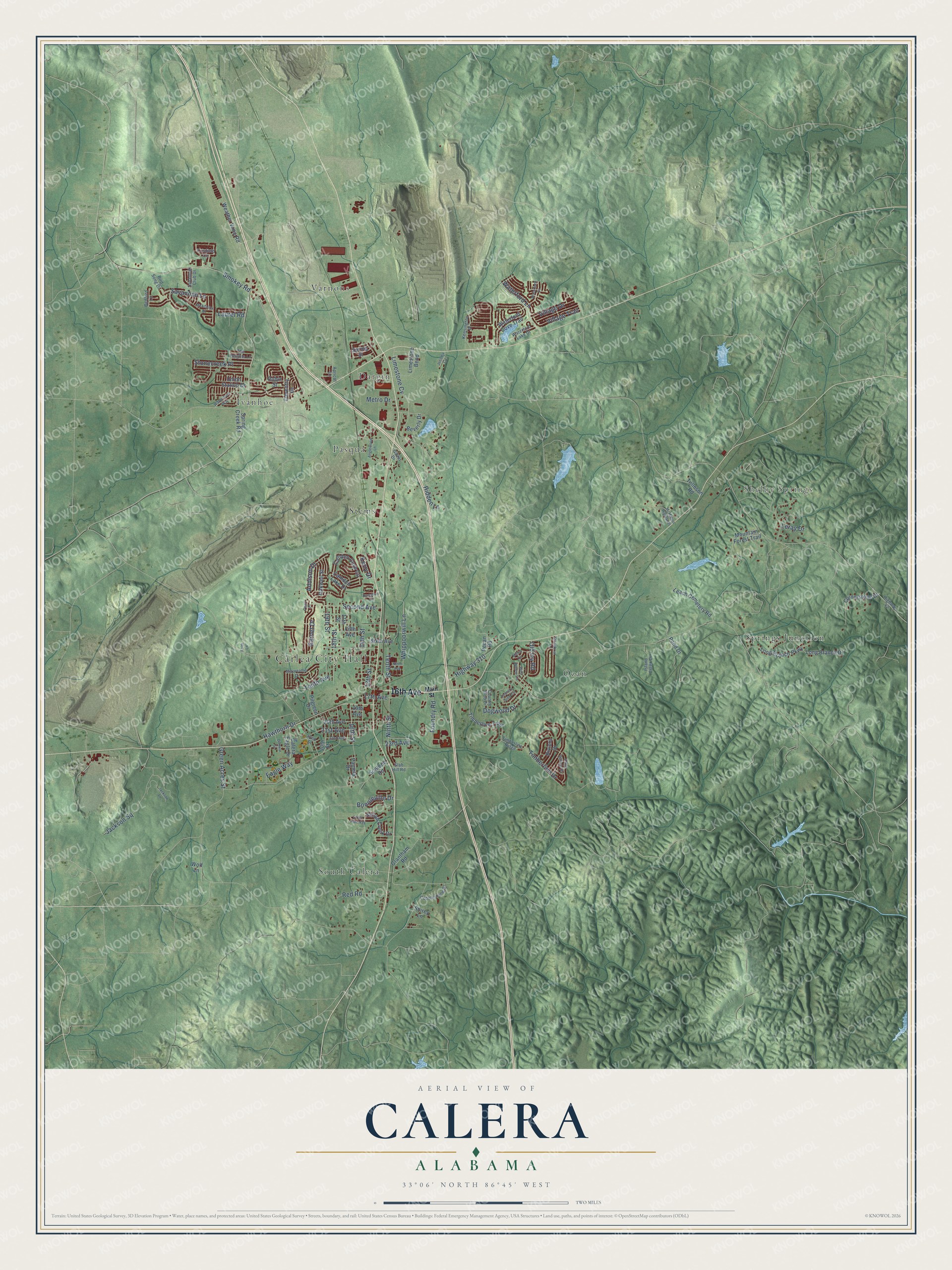
A new map of Calera, Alabama, made in 2026 and printed to order on thick archival matte paper.
12" x 18" Archival Matte Print
A Map of Home. A Work of Art.
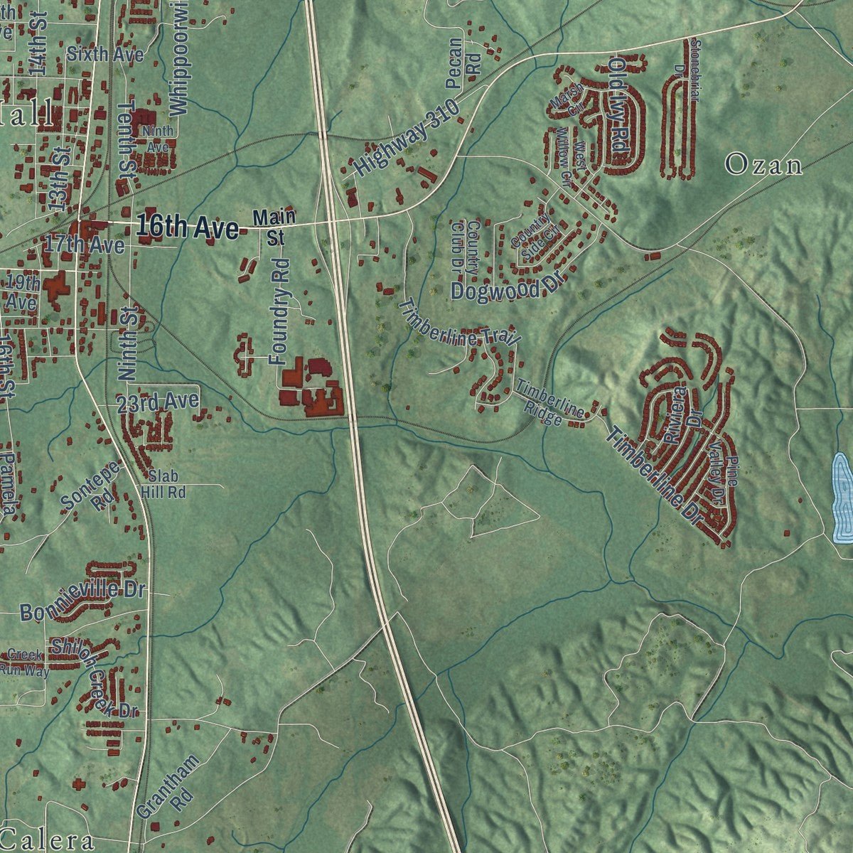
Explore Calera, Alabama from a whole new perspective. Created using aerial imagery and detailed geographic data, this map captures Calera building by building, with labeled streets, familiar landmarks, and shaded topographical relief that highlights the natural contours of the landscape.
Combining modern data with the timeless character of a vintage atlas, this map is just as interesting up close as it is beautiful on the wall. Whether you grew up in Calera, spent memorable years there, or call it home today, this unique map is a great way to celebrate a place that means something to you. Zoom in on the preview to look for your street, and then order a print to put your memories on the wall.
Three ways to hang it
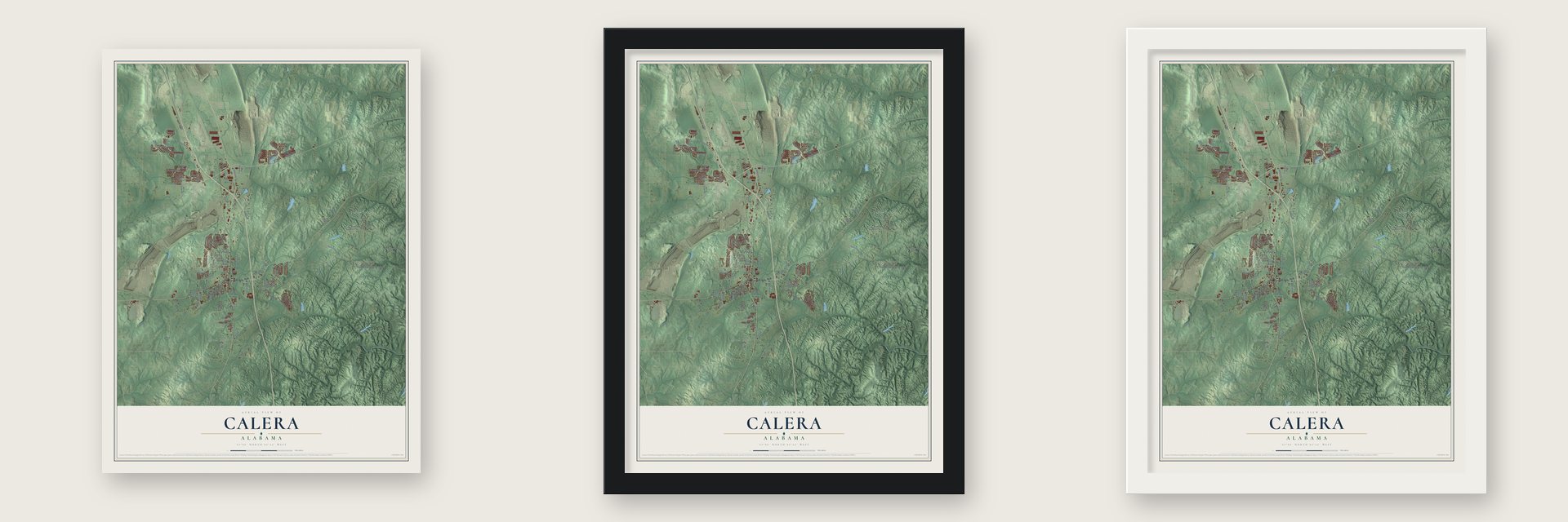
Unframed archival matte, a black wood frame or a white wood frame.
Up close
Geography Worth Displaying
This map was created using accurate cartographic data and authoritative geographic sources, including the U.S. Geological Survey and the Census Bureau. The map brings together terrain, waterways, roads, and building detail. The majority of the streets are labeled, houses are accurately depicted, and the topography is derived from government sources. Combining local data with carefully composed color and shading leads to this beautifully detailed Calera artwork for your wall.
Rather than simply showing street outlines, we’ve included as many of the street names as we could reasonably fit on the map while keeping their names legible. Zoom in on the high resolution preview to see exactly what’s on the map. We truly set out to create a statement piece for anyone who loves Calera. So whether it’s for you, or a gift for someone you love, we hope this map of Calera brings back fond memories.
Read the story behind this map of Calera, Alabama from 2026.

About Calera, Alabama
Calera is a city of 16,494 people in Shelby County, and its southern edge reaches into Chilton County. Settlers first came in the early 1820s, but the place stayed quiet until the Alabama and Tennessee River Railroad laid its tracks through between 1854 and 1855. The settlement was then called Buxahatchie. During the Civil War it became a center for making lime, and people began calling it Limeville, Lime Kilns, Lime City or Lime Station.
The war did little harm to the town itself, so once the damaged rail lines were fixed, its lime was shipping across the country again. In 1869 the town took the name Calera, Spanish for "lime." During the mid-1880s, investors from Montgomery organized the Calera Land Company and bought up large tracts, hoping to build another Birmingham. Calera never grew that big, but new businesses came, and by 1885 more than 200 people lived here, with a first public school and several hotels. The town asked to incorporate that year and held its first municipal elections in 1887.
- Still a lime townLime stayed Calera's main industry after the Civil War, and the city is still a major producer, shipping mostly to the southeastern states. In the 1870s the town tried to attract a colony of Scandinavian or German immigrants, the way Cullman had drawn German settlers, but the plan largely failed.
- Heart of Dixie Railroad MuseumThe railroad made Calera, and the Heart of Dixie Railroad Museum keeps that story alive. Its grounds hold two restored depots, trains on both standard and narrow gauge track, and a collection of old locomotives, cars and railroad artifacts.
- Strawberry Festival since 2011Calera held its first annual Strawberry Festival in April 2011 as an outreach of the Calera Farmers Market. That first year drew about 35 vendors and 1,500 to 2,000 visitors. The market itself sells fresh local produce on Tuesday afternoons from June through August.
- A marker for a surgical pioneerA historical marker at 7444 Highway 25 South in Calera honors Dr. James Daniel Hardy. In 1963 he and his team performed the first human lung transplant, and in 1964 they became the first to remove a living human heart and to place a chimpanzee heart in a human patient. That operation pushed doctors to agree on rules for brain death. Hardy trained more than 200 surgeons and published over 500 journal articles.
Find your street
Names on the Calera map
Every name below is printed on this map. Look for your street, your school, the park where you played, or the pond down the road.
Places and landmarks10
- Carlea City Hall
- Shelby Springs
- Dargin
- Ivanhoe
- Ozan
- Pasqua
- South Calera
- Springs Junction
- Stems
- Varnons
Streets and roads112
- 16th Avenue
- Whippoorwill Lane
- Highway 310
- Smokey Road
- 16th Street
- 18th Street
- Savannah Lane
- 14th Street
- Second Avenue
- Bonnieville Drive
- 19th Street
- 21st Avenue
- Addison Drive
- Foundry Road
- Stonecreek Place
- 13th Street
- Limestone Cv
- Dogwood Drive
- Village Trail
- Timberline Drive
- Red Road
- Tenth Street
- Tenth Avenue
- Village Drive
- Jackson Square
- Ninth Street
- 17th Avenue
- Green Acres Street
- Hawthorn Drive
- Waterford Lane
Show all 112 streets
- Eagle Way
- Hidden Lane
- 23rd Avenue
- Garnet Drive
- Laurel Road
- Metro Drive
- Old Ivy Road
- Kerry Drive
- Leray Drive
- Pecan Road
- Mountain Forest Trail
- Weather Vane Road
- Timberline Trail
- Waterford Cove Trail
- Sixth Avenue
- 17th Street
- Long Branch Parkway
- 20th Avenue
- Cornerstone Drive
- Camden Cove Circle
- Leach Cemetery Road
- Union Station Drive
- Long Branch Drive
- Limestone Bend
- 20th Street
- Fifth Avenue
- Shiloh Creek Drive
- Camden Lake Drive
- Pond Drive
- Oakwell Street
- Calera Eagle Drive
- Grantham Road
- Daventry Drive
- Riviera Drive
- Sontepe Road
- Pilgreen Drive
- Beverly Drive
- Tolleson Road
- Pamela Drive
- Spring Creek Road
- Spring Street
- Robin Street
- Shirey Lane
- 19th Avenue
- Wolf Lane
- Main Street
- Kensington Place
- Crisfield Circle
- Pine Valley Drive
- Savannah Club Drive
- Apricot Lane
- Cobblestone Drive
- Timberline Ridge
- Waterford Lake Drive
- Highway 42
- The Heights Lane
- Country Club Drive
- Island Creek Drive
- Gaiter Drive
- Bedford Lane
- Slab Hill Road
- Bird Song Drive
- 22nd Street
- Meriweather Drive
- 22nd Avenue
- Country Side Circle
- Anglewood Lane
- Jackson Lane
- McAllister Drive
- McMahon Highlands
- Ninth Avenue
- Creek Run Way
- Waterford Drive
- Waterstone Way
- Stonebriar Drive
- West Willow Circle
- Dunwar Street
- Hampton Lane
- Jecoma Circle
- Marsh Circle
- Pearl Place
- Faith Lane
Names are listed as they appear on the printed map. Zoom into the product photos to find them.
The art of mapping a place
How This Map Was Made
Real places. Remarkable detail. Discover the layers that turn geographic data into a map of home.

The view from above
Aerial imagery reveals the character of the land: woodland, open fields, and the patterns of a place.

The shape of the land
Elevation data brings hills, valleys, and subtle changes in the landscape into view.

The details of home
Roads, waterways, and building footprints come together to make the map feel unmistakably local.

Geography becomes art
Considered color, shading, and typography bring the layers together in a map made for your wall.


Process illustrated with Mendon, Massachusetts. Aerial imagery: USDA NAIP. Terrain: USGS 3D Elevation Program. Map details and finished artwork: KNOWOL.
The Details
About This Print
Choose an archival matte print, or a black or white Ayous wood frame. The archival matte print is unframed.
Select your size and finish above to see the matching product image and price.
Materials & Craftsmanship
A contemporary map with the character of a classic atlas, printed on archival matte paper. Optional frames are made from Ayous wood.
Your printed map does not include the watermark shown in the full-map preview.
Shipping & Delivery
Free shipping within the United States. Every print is made to order in the USA.
Buying a gift? Add a note in your cart and we'll include it. We never put prices in the package.
Prints ship within 2 to 3 business days. Allow 7 to 10 days total from ordering for delivery. Timing may vary during holidays or periods of high order volume.
Read our shipping policy.
Returns and damaged prints
Each print is made to order. Change-of-mind refunds are not available after production.
If your print arrives damaged, misprinted or incorrect, contact support@knowol.com within 30 days of receiving it. Include your order number, photos and a description of the issue.
Read our full refund and replacement policy. For questions about your order, email support@knowol.com.
Find your town
Looking for another city?
Find a map of home in our Alabama collection, or any town in the country.
Nearby
Maps of towns near Calera
Know someone from one of these towns? Their map makes a great gift.
 Montevallo
, Alabama
From $39.99See the map
 Alabaster
, Alabama
From $39.99See the map
 Wilton
, Alabama
From $39.99See the map
More maps nearby: Columbiana, Shelby, Brantleyville, Jemison and Pea Ridge.