
Search for another town


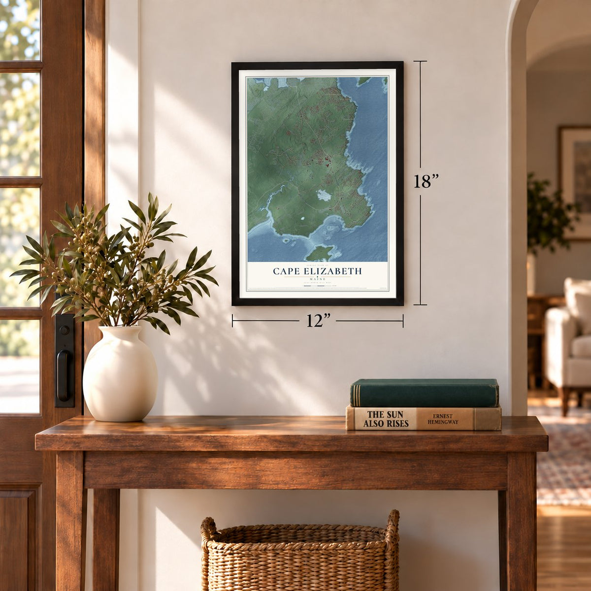
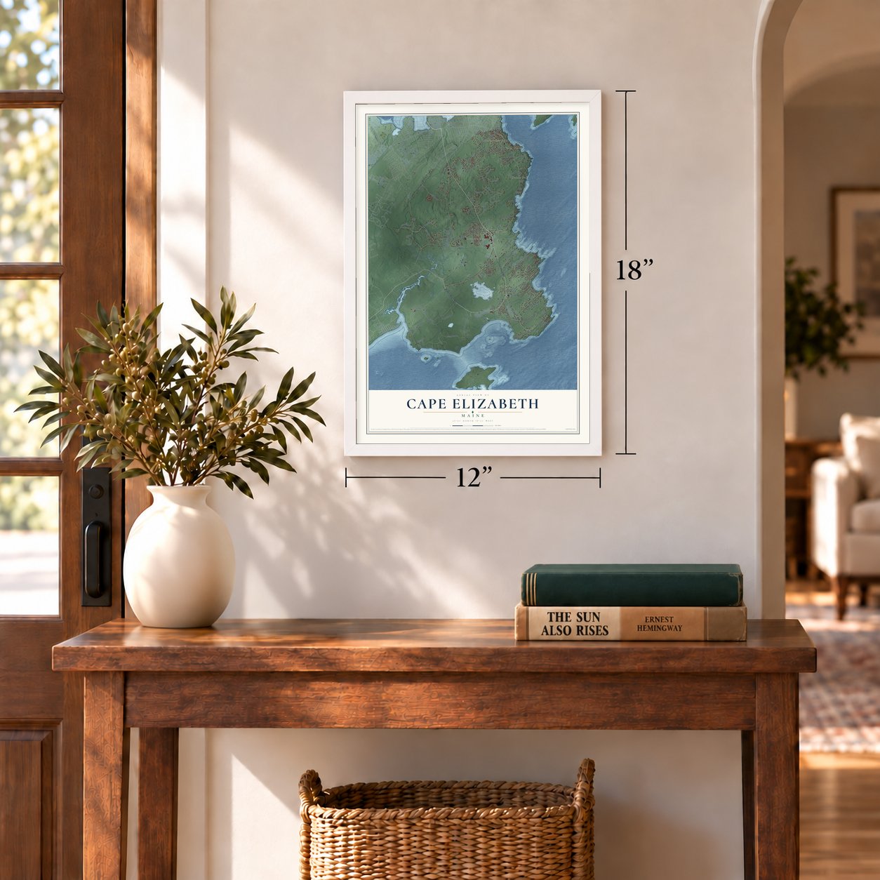
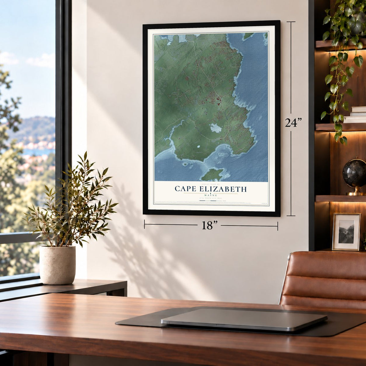
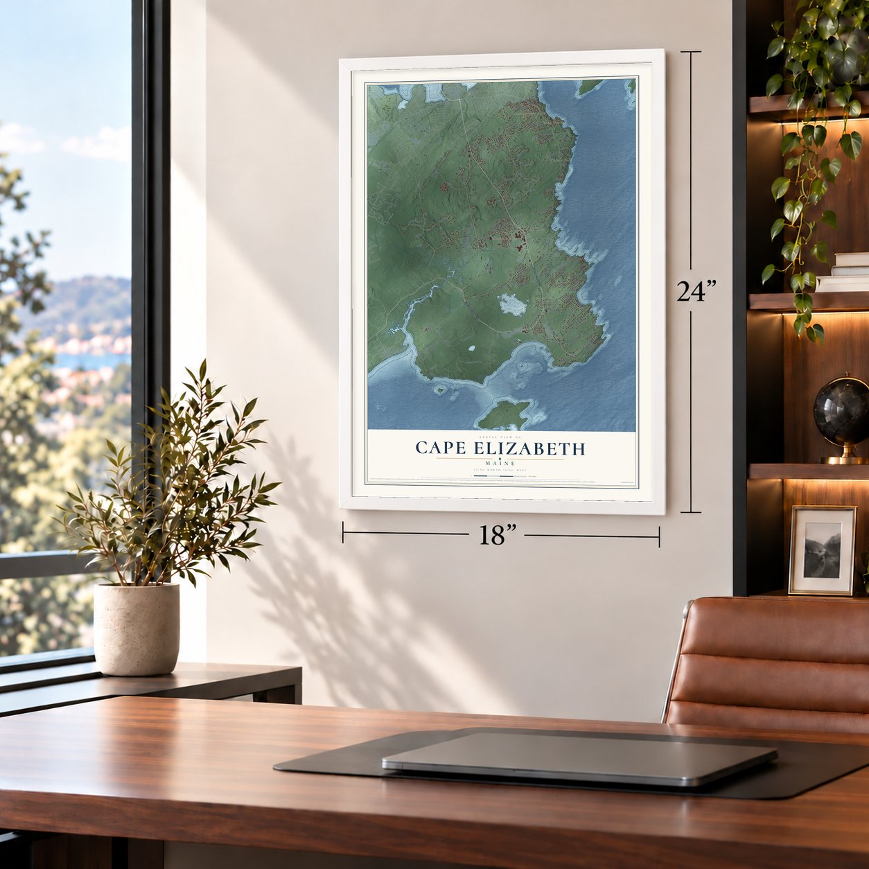
Free U.S. delivery 7 to 10 days after you order
Cape Elizabeth, Maine Map Art
Building by building, with labeled streets and shaded relief.
12" x 18" Archival Matte Print
A Map of Home. A Work of Art.
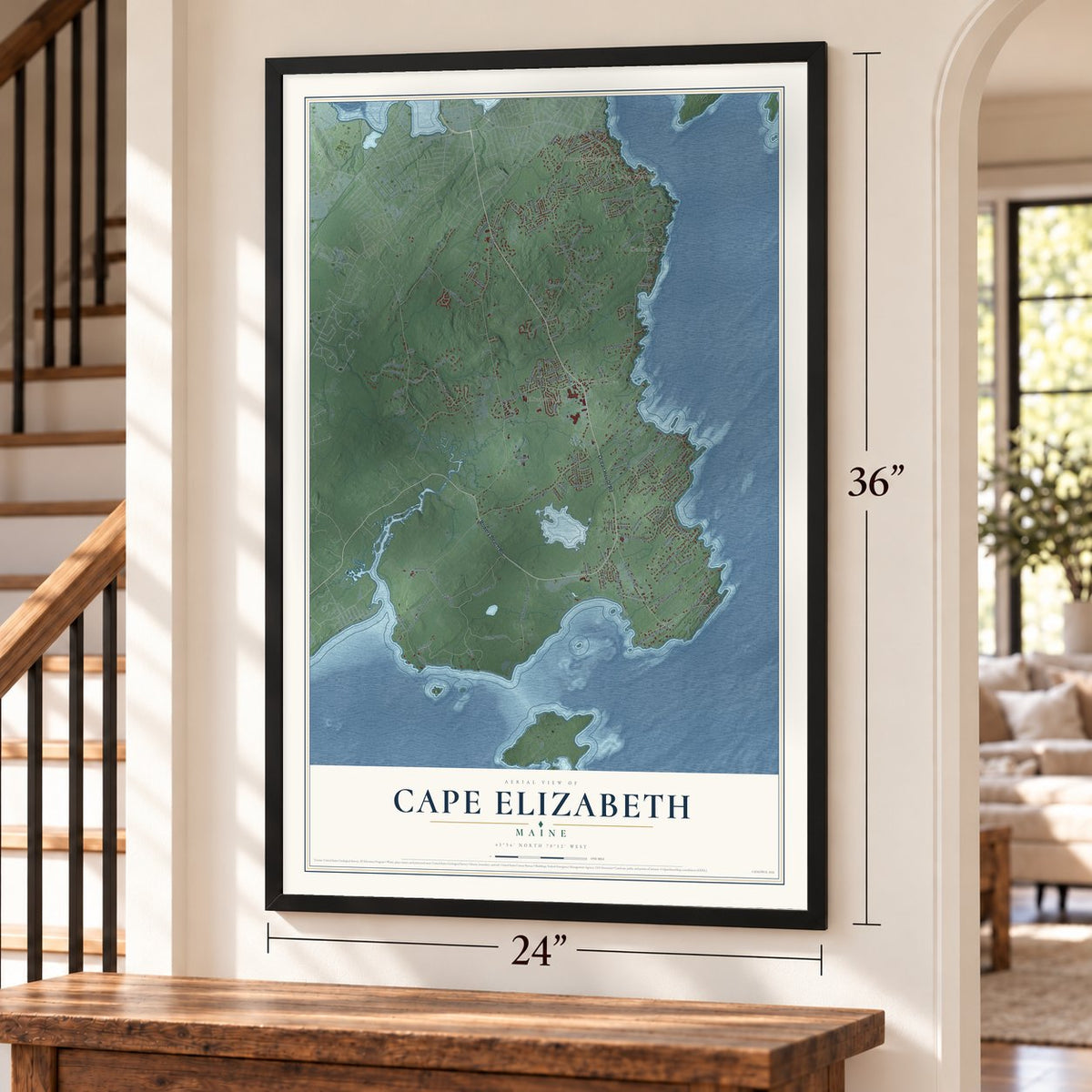
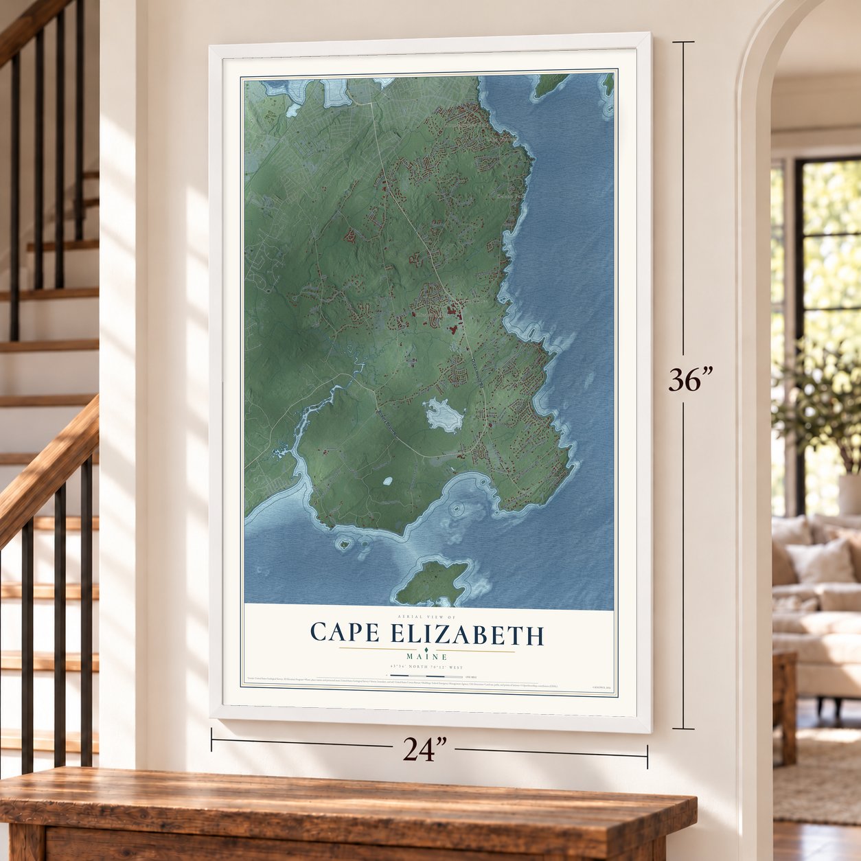
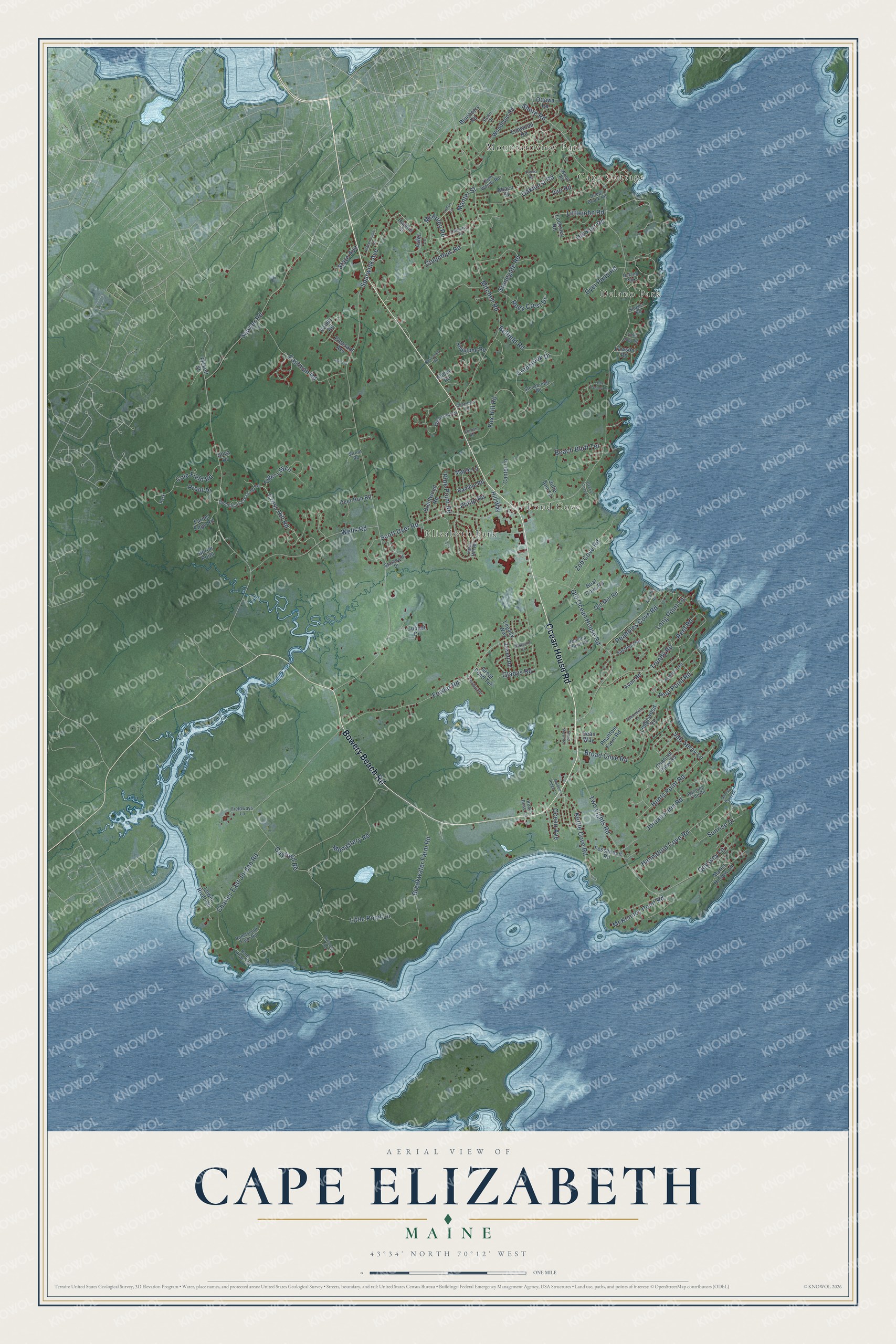
Explore Cape Elizabeth, Maine from a whole new perspective. Created using aerial imagery and detailed geographic data, this map captures Cape Elizabeth building by building, with labeled streets, familiar landmarks, and shaded topographical relief that highlights the natural contours of the landscape.
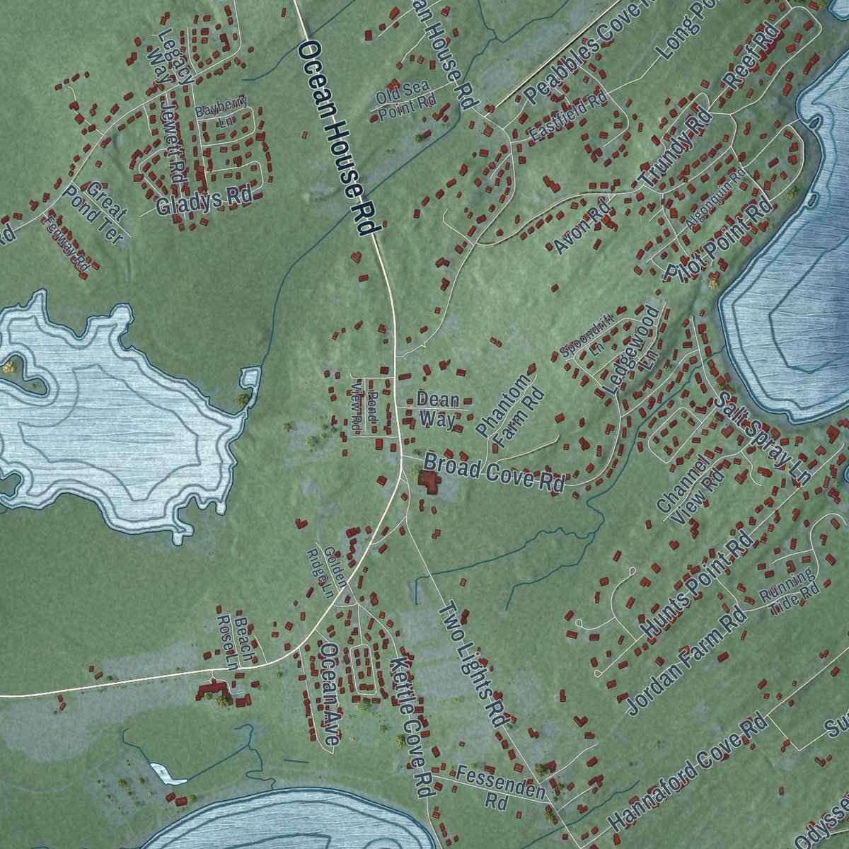
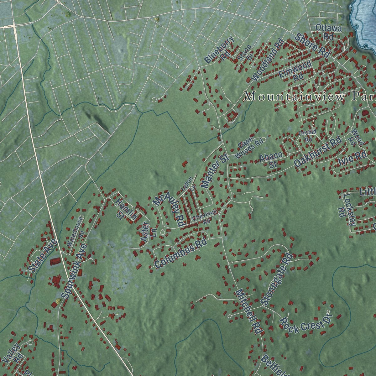
Combining modern data with the timeless character of a vintage atlas, this map is just as interesting up close as it is beautiful on the wall. Whether you grew up in Cape Elizabeth, spent memorable years there, or call it home today, this unique map is a great way to celebrate a place that means something to you. Zoom in on the preview to look for your street, and then order a print to put your memories on the wall.
Three ways to hang it
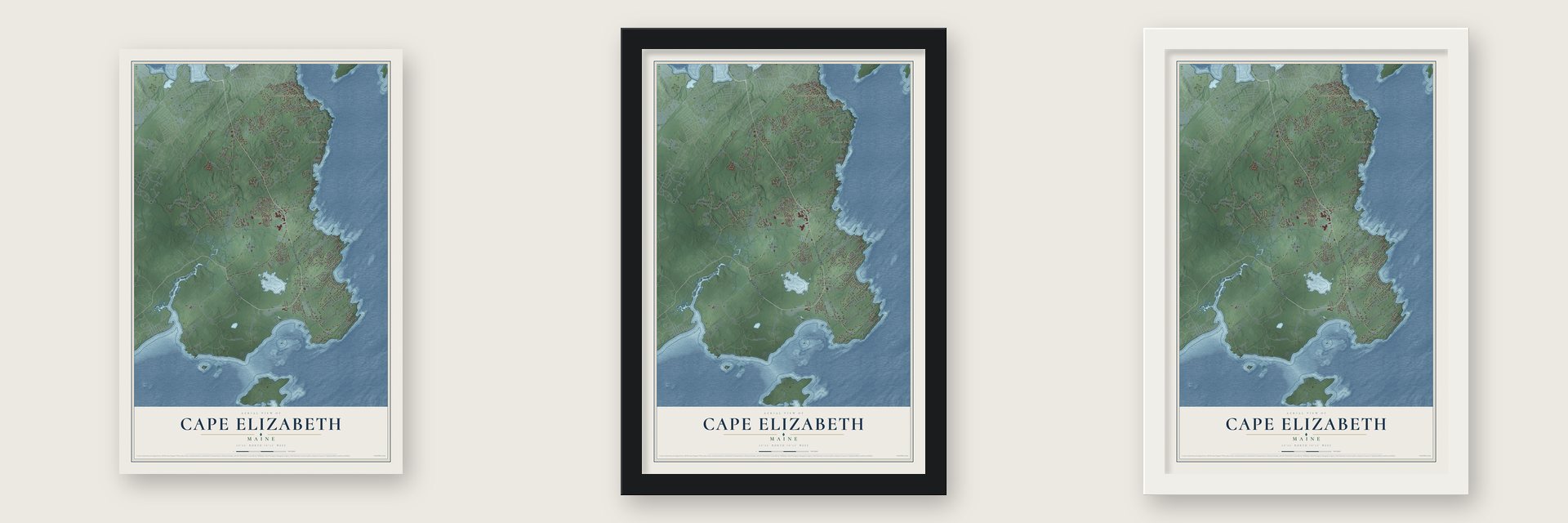
Unframed archival matte, a black wood frame or a white wood frame.
Up close
Geography Worth Displaying
This map was created using accurate cartographic data and authoritative geographic sources, including the U.S. Geological Survey (USGS) and FEMA. The map brings together terrain, waterways, roads, and building detail. The majority of the streets are labeled, houses are accurately depicted, and the topography is derived from government sources. Combining local data with carefully composed color and shading leads to this beautifully detailed Cape Elizabeth artwork for your wall.
Rather than simply showing street outlines, we’ve included as many of the street names as we could reasonably fit on the map while keeping their names legible. Zoom in on the high resolution preview to see exactly what’s on the map. We truly set out to create a statement piece for anyone who loves Cape Elizabeth. So whether it’s for you, or a gift for someone you love, we hope this map of Cape Elizabeth brings back fond memories.
Explore the full map of Cape Elizabeth, Maine and read about the local places it shows.

Find your street
Names on the Cape Elizabeth map
Every name below is printed on this map. Look for your street, your school, the park where you played, or the pond down the road.
Places and landmarks6
- Delano Park
- Elizabeth Park
- Mountainview Park
- Pond Cove
- Cape Cottage
- Park
Streets and roads131
- Ocean House Road
- Bowery Beach Road
- Manter Street
- Sawyer Road
- Spurwink Avenue
- Shore Road
- Monastery Road
- Mitchell Road
- Charles East Jordan Road
- Fowler Road
- Two Lights Road
- Little Pond Lane
- Old Ocean House Road
- Cross Hill Road
- Wells Road
- Scott Dyer Road
- Breakwater Farm Road
- Eastman Road
- Oakhurst Road
- Hannaford Cove Road
- Broad Cove Road
- Kettle Cove Road
- Hunts Point Road
- Stonegate Road
- Reef Road
- Peabbles Cove Road
- Fox Hill Road
- Cranbrook Drive
- Trundy Road
- Zeb Cove Road
Show all 131 streets
- Belfield Road
- Jordan Farm Road
- Salt Spray Lane
- McKenney Point Road
- Long Point Lane
- Cole Field Road
- Gayfield Road
- Tiger Lily Lane
- Rock Crest Drive
- Columbus Road
- Old Fort Road
- Littlejohn Road
- Prout Place
- Dyer Pond Road
- Beach Bluff Terrace
- Odyssey Lane
- McAuley Road
- Pilot Point Road
- Pine Point Road
- Gladys Road
- Sunrise Drive
- Ocean Avenue
- Philip Road
- State Avenue
- Ivie Road
- Locksley Road
- Old Mill Road
- Woodland Road
- Brentwood Road
- Aster Lane
- Heron Point
- Hamlin Street
- Ledgewood Lane
- Fessenden Road
- Jewett Road
- Channel View Road
- Canter Lane
- Phantom Farm Road
- Hobstone Road
- Deer Run Road
- Lower River Road
- Valley Road
- Blueberry Road
- Mares Hollow Lane
- Lawson Road
- Hill Way
- Ramble Road
- Boat Cove Road
- Farms Edge Road
- Pleasant Avenue
- Avon Road
- Maple Lane
- Julie Ann Lane
- Great Pond Terrace
- Elmwood Road
- Cooper Drive
- Ottawa Road
- Abaco Street
- Fickett Street
- Dean Way
- Legacy Way
- Albion Road
- Silva Drive
- Wildwood Drive
- Dominicus Crossing Road
- Running Tide Road
- Wood Road
- Starboard Drive
- Farm Hill Road
- Ram Island Farm Road
- Fieldways Lane
- Eastfield Road
- Stonebridge Road
- Old Sea Point Road
- Cape Woods Road
- Rams Head Road
- Deep Brook Road
- Singles Road
- Strout Road
- Beach Rose Lane
- Stone Drive
- Waterhouse Road
- Alewife Road
- Olde Colony Lane
- Algonquin Road
- Lydon Lane
- Bayberry Lane
- Cheverus Road
- Spoondrift Lane
- Fenway Road
- Davcarley Road
- Chambers Road
- Golden Ridge Lane
- Beckys Cove Lane
- Orchid Road
- Pond View Road
- Tides Edge Road
- Bacchus Road
- Rocky Point Lane
- Tote Road
- Clinton Road
Names are listed as they appear on the printed map. Zoom into the product photos to find them.
About Cape Elizabeth, Maine
Cape Elizabeth is a town of 9,535 people in Cumberland County, on the cape at the southern entrance to Portland Harbor. Spanish explorers charted this coast in 1525 and called it Cabo de Arrecife, and the Englishman Bartholomew Gosnold reached it on May 14, 1602. When John Smith brought his 1615 map to King Charles I for approval, the king named the cape for his sister, Elizabeth of Bohemia.
Walter Bagnall opened a trading post on Richmond Island in 1628, trading rum for beaver pelts. He cheated the Wabanaki, who killed him and burned the post in October 1631, and new owners built the island into a fishing and trading station with 60 men by 1638. Attacks during the colonial wars destroyed the settlement in 1703, and people did not return until about 1719. On November 1, 1765, Cape Elizabeth broke away from Falmouth as Maine's 23rd incorporated town. In 1895 its busy northern half left to become South Portland, while the rural south kept the old name.
- First lit in 1791George Washington set Portland Head Light in motion in 1787. Falmouth masons Jonathan Bryant and John Nichols raised its rubblestone tower from stone gathered in nearby fields and along the shore, as Washington had told them to. The lamp was lit on January 10, 1791, and no lighthouse in Maine is older. In 1927 Edward Hopper made it the subject of a painting.
- A rescue in the riggingThe Cape Elizabeth Light station opened in 1828 with two stone towers 300 yards apart, which is why the area is called Two Lights. During a snowstorm in January 1885, the schooner Australia ran aground on the ledge with two sailors stuck in its frozen rigging. Keeper Marcus A. Hanna kept throwing them a line, and with his assistant and two neighbors he pulled both men to safety. Only the eastern tower still shines.
- From fort to parkIn 1872 the Army started construction of a coast artillery post at Portland Head Light to guard the southern entrance to the harbor. It was named Fort Williams in 1899 for Major General Seth Williams of the Civil War, and it stayed active until 1962. The town then bought the grounds for about $200,000, and today Fort Williams Park contains the lighthouse and its museum, plus the remains of the fort and the Goddard Mansion.
- The oldest public buildingThe Spurwink Congregational Church went up in 1802 on a rise above the Spurwink River, where Spurwink Avenue meets Bowery Beach Road, and it was renovated in 1830. The town has owned it since 1957 and uses it for community gatherings.
- Beach to Beacon since 1998Joan Benoit Samuelson, born in Cape Elizabeth, took the first women's Olympic marathon in 1984. In 1998 she started the Beach to Beacon 10K, an August race that starts at Crescent Beach State Park and finishes at Portland Head Light, bringing some of the world's top distance runners to her hometown.
Keep exploring Maine
Cape Elizabeth is one of 536 Maine towns we've mapped. Every dot on the map is a print of its own.
The search covers every state, Maine first.
Near Cape Elizabeth
Order 2 or more town maps and save 10%. Shown in the size and finish you picked above, so they hang as a set.
- Pond Cove 12" x 18" / Archival Matte Print $39.99
- Portland 12" x 18" / Archival Matte Print $39.99
- Pleasant Hill 12" x 18" / Archival Matte Print $39.99


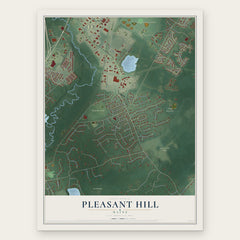
More maps nearby: South Portland, Scarborough, Oak Hill, Blue Point and Eight Corners.
The art of mapping a place
How This Map Was Made
Real places. Remarkable detail. Discover the layers that turn geographic data into a map of home.

The view from above
Aerial imagery reveals the character of the land: woodland, open fields, and the patterns of a place.

The shape of the land
Elevation data brings hills, valleys, and subtle changes in the landscape into view.

The details of home
Roads, waterways, and building footprints come together to make the map feel unmistakably local.

Geography becomes art
Considered color, shading, and typography bring the layers together in a map made for your wall.


Process illustrated with Mendon, Massachusetts. Aerial imagery: USDA NAIP. Terrain: USGS 3D Elevation Program. Map details and finished artwork: KNOWOL.
The Details
About This Print
Choose an archival matte print, or a black or white Ayous wood frame. The archival matte print is unframed.
Select your size and finish above to see the matching product image and price.
Materials & Craftsmanship
A contemporary map with the character of a classic atlas, printed on archival matte paper. Optional frames are made from Ayous wood.
Your printed map does not include the watermark shown in the full-map preview.
Shipping & Delivery
Free shipping within the United States. Every print is made to order in the USA.
Buying a gift? Add a note in your cart and we'll include it. We never put prices in the package.
Prints ship within 2 to 3 business days. Allow 7 to 10 days total from ordering for delivery. Timing may vary during holidays or periods of high order volume.
Read our shipping policy.
Returns and damaged prints
Each print is made to order. Change-of-mind refunds are not available after production.
If your print arrives damaged, misprinted or incorrect, contact support@knowol.com within 30 days of receiving it. Include your order number, photos and a description of the issue.
Read our full refund and replacement policy. For questions about your order, email support@knowol.com.