
Search for another town




Free U.S. delivery 7 to 10 days after you order
Portland, Maine Map Art
Building by building, with labeled streets and shaded relief.
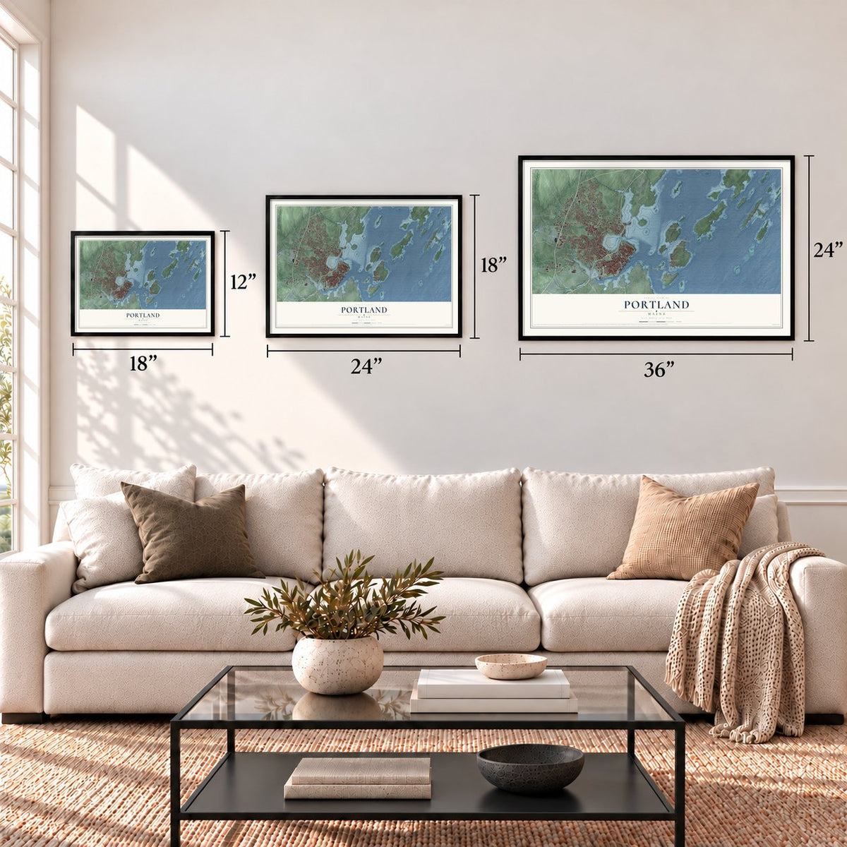
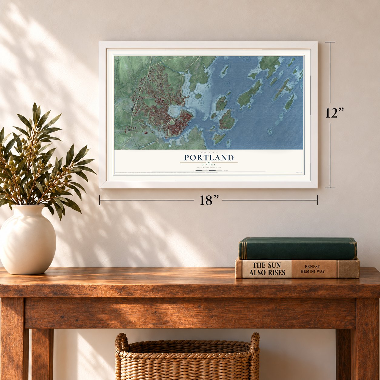
12" x 18" Archival Matte Print
A Map of Home. A Work of Art.
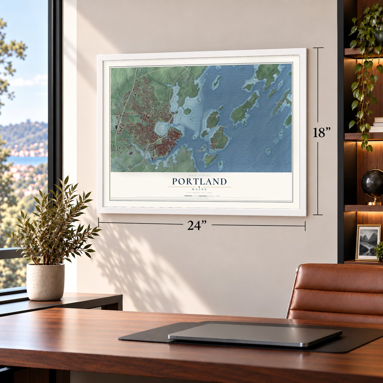
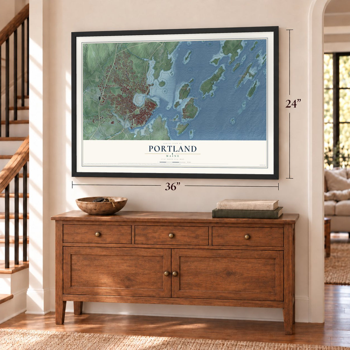
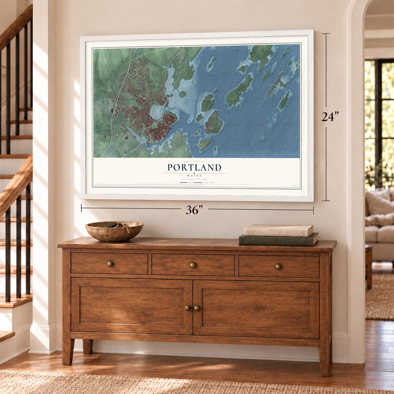
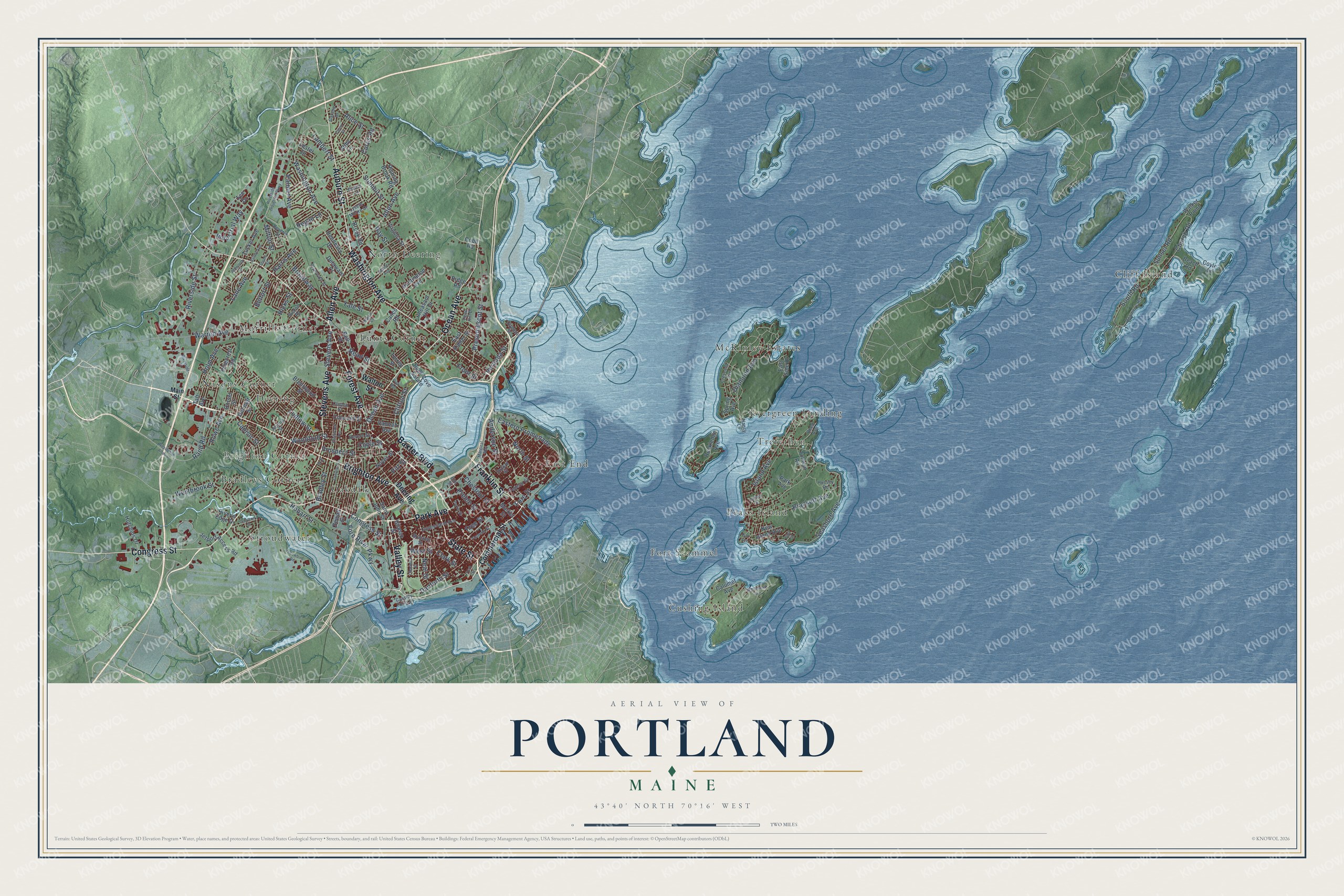
Explore Portland, Maine from a whole new perspective. Created using aerial imagery and detailed geographic data, this map captures Portland building by building, with labeled streets, familiar landmarks, and shaded topographical relief that highlights the natural contours of the landscape.
Combining modern data with the timeless character of a vintage atlas, this map is just as interesting up close as it is beautiful on the wall. Whether you grew up in Portland, spent memorable years there, or call it home today, this unique map is a great way to celebrate a place that means something to you. Zoom in on the preview to look for your street, and then order a print to put your memories on the wall.
Three ways to hang it
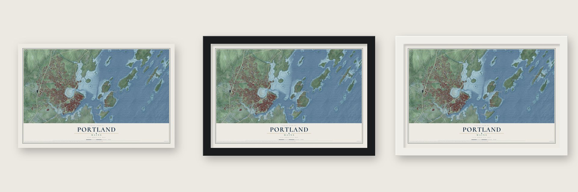
Unframed archival matte, a black wood frame or a white wood frame.
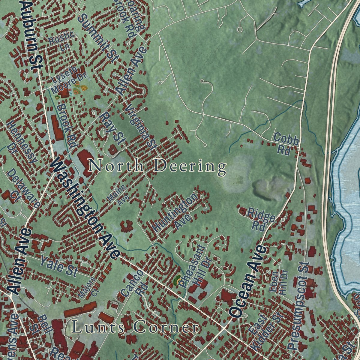
Up close
Geography Worth Displaying
This map was created using accurate cartographic data and authoritative geographic sources, including the U.S. Geological Survey (USGS) and FEMA. The map brings together terrain, waterways, roads, and building detail. The majority of the streets are labeled, houses are accurately depicted, and the topography is derived from government sources. Combining local data with carefully composed color and shading leads to this beautifully detailed Portland artwork for your wall.
Rather than simply showing street outlines, we’ve included as many of the street names as we could reasonably fit on the map while keeping their names legible. Zoom in on the high resolution preview to see exactly what’s on the map. We truly set out to create a statement piece for anyone who loves Portland. So whether it’s for you, or a gift for someone you love, we hope this map of Portland brings back fond memories.
Explore the full map of Portland, Maine and read about the local places it shows.

Find your street
Names on the Portland map
Every name below is printed on this map. Look for your street, your school, the park where you played, or the pond down the road.
Places and landmarks17
- Cliff Island
- McKinley Estates
- North Deering
- Stroudwater
- Nasons Corner
- Cushing Island
- Bradleys Corner
- Evergreen Landing
- Fort Scammel
- Deering
- Oakdale
- Lunts Corner
Show all 17 places
- Brighton Corner
- Trefethen
- Peaks Island
- East End
- Morrills Corner
Streets and roads158
- Forest Avenue
- Brighton Avenue
- Park Avenue
- State Street
- Congress Street
- Auburn Street
- Baxter Boulevard
- Valley Street
- Ocean Avenue
- Franklin Street
- Washington Avenue
- Allen Avenue
- Stevens Avenue
- Clark Street
- West Street
- Danforth Street
- Veranda Street
- Fore River Parkway
- Rand Road
- Fore Street
- Free Street
- Riverside Street
- Sunset Road
- Preble Street
- Milton Street
- Seashore Avenue
- Westbrook Street
- Warren Avenue
- Island Avenue
- Summit Street
Show all 158 streets
- Capisic Street
- Presumpscot Street
- Eastern Promenade
- Woodford Street
- Ludlow Street
- Ray Street
- Church Road
- Brackett Avenue
- Diamond Avenue
- Read Street
- Holm Avenue
- Anderson Street
- Clifton Street
- Lane Avenue
- South Road
- Palmer Avenue
- Bradley Street
- Prospect Street
- North Street
- Hicks Street
- Industrial Way
- Neal Street
- Curtis Road
- Coyle Street
- Lambert Street
- Regan Lane
- Chestnut Street
- Rowe Avenue
- Yale Street
- Alice Street
- Belfort Street
- Broadway
- Harris Avenue
- Hobart Street
- Pitt Street
- Front Street
- Deering Avenue
- Commercial Street
- Walton Street
- Saint John Street
- Canco Road
- Beach Road
- Taft Avenue
- Jetport Access Road
- Concord Street
- Pinecrest Road
- Virginia Street
- Pheasant Hill Drive
- Brentwood Street
- Lester Drive
- Rockledge Avenue
- Tucker Avenue
- Delaware Court
- Hutchins Drive
- Bell Street
- Noyes Street
- New Island Avenue
- Hennessy Drive
- Ridge Road
- Vannah Avenue
- Abby Lane
- Roaring Brook Road
- River's Edge Drive
- Huntington Avenue
- Calumet Avenue
- Back Cove Estate
- Dennett Street
- Gilman Street
- Market Street
- East Kidder Street
- Coyle's Lane
- Tolman Road
- Brook Road
- Dorset Street
- East Side Drive
- Walker Point
- Torrey Street
- Spring Avenue
- Sewall Street
- Tee Drive
- Cobb Road
- Main Street
- Cassidy Point Drive
- Federal Street
- Cumberland Avenue
- Brackett Street
- Oxford Street
- Hussey Road
- Elm Street
- Eben Hill Drive
- Reamer's Road
- Clinton Street
- Plymouth Street
- Crescent Avenue
- Nancy Lane
- Reed Avenue
- Lyseth Moore Drive
- Jeanne Street
- Revere Street
- Beverly Street
- Rustic Lane
- Garsoe Drive
- Avalon Road
- Luther Street
- Olympia Street
- Pya Road
- York Street
- Marginal Way
- Westbrook Arterial
- Riverside Industrial Parkway
- Yellowbird Road
- Maine Avenue
- Whitehead Avenue
- Craigie Street
- Glenwood Avenue
- Chadwick Street
- Pleasant Street
- Garrison Street
- Bailey Avenue
- Riverside Court
- Parris Street
- Caron Street
- Aldworth Street
- Stuart Street
- Oak Avenue
- Majors Court
- First Street
- Ivy Street
Names are listed as they appear on the printed map. Zoom into the product photos to find them.
About Portland, Maine
Portland is a city of 68,408 people and the county seat of Cumberland County, set on a peninsula in Casco Bay. The Eastern Abenaki called the peninsula Machigonne, or "great neck." Settlers started a fishing and trading village named Casco there in 1632, and it became Falmouth after the Massachusetts Bay Colony took control of Casco Bay in 1658. The Abenaki destroyed the village in 1676, during King Philip's War, and after it was rebuilt, French troops and their native allies wrecked it again at the Battle of Fort Loyal in 1690.
Disaster came once more on October 18, 1775, when a Royal Navy force under Captain Henry Mowat set Falmouth on fire. After the Revolution, the part of town called The Neck grew quickly as a shipping port, and in 1786 its citizens split off and formed their own town. They named it Portland, for the Isle of Portland off Dorset, England. Portland served as the capital of the new state of Maine from 1820 until 1832, when the capital moved to Augusta.
- Canada's winter seaportThe Grand Trunk Railway to Montreal was finished in 1853, and Portland's harbor, which stayed free of ice, became the main winter outlet for Canadian exports. The Portland Company on Fore Street built more than six hundred steam locomotives and was for a time the city's biggest employer, hiring many immigrants from Canada, Ireland and Italy. After the Grand Trunk was nationalized in 1923, Canadian shipments went to Halifax instead, and Portland's economy fell into a sharp decline.
- The Great Fire of 1866On July 4, 1866, a fire broke out in the middle of the Independence Day celebration. It burned most of the city's commercial buildings, half of its churches and hundreds of homes, and more than 10,000 people lost their homes. Portland rebuilt, and its city seal shows a phoenix rising from the ashes, a nod to the city's comeback from four ruinous fires.
- Deering joins the cityOn March 8, 1899, an act of the Maine Legislature made the neighboring city of Deering part of Portland, even though Deering's own voters had turned the idea down. The merger made Portland far larger and opened land off the peninsula for building. Deering High School, once that city's public high school, now belongs to Portland.
- The Old Port comes backThe Maine Mall, an indoor shopping center, opened in South Portland in 1971 and drew business away from downtown Portland. The slump turned around when tourists and new businesses moved into the old seaport, where one section, known locally as the Old Port, kept its cobblestone streets and old warehouses.
Keep exploring Maine
Portland is one of 520 Maine towns we've mapped. Every dot on the map is a print of its own.
The search covers every state, Maine first.
Near Portland
Order 2 or more town maps and save 10%. Shown in the size and finish you picked above, so they hang as a set.
- Pond Cove 12" x 18" / Archival Matte Print $39.99
- Long Island 12" x 18" / Archival Matte Print $39.99
- Cape Elizabeth 12" x 18" / Archival Matte Print $39.99


More maps nearby: South Portland, Pleasant Hill, Falmouth Foreside, Eight Corners and Oak Hill.
The art of mapping a place
How This Map Was Made
Real places. Remarkable detail. Discover the layers that turn geographic data into a map of home.

The view from above
Aerial imagery reveals the character of the land: woodland, open fields, and the patterns of a place.

The shape of the land
Elevation data brings hills, valleys, and subtle changes in the landscape into view.

The details of home
Roads, waterways, and building footprints come together to make the map feel unmistakably local.

Geography becomes art
Considered color, shading, and typography bring the layers together in a map made for your wall.


Process illustrated with Mendon, Massachusetts. Aerial imagery: USDA NAIP. Terrain: USGS 3D Elevation Program. Map details and finished artwork: KNOWOL.
The Details
About This Print
Choose an archival matte print, or a black or white Ayous wood frame. The archival matte print is unframed.
Select your size and finish above to see the matching product image and price.
Materials & Craftsmanship
A contemporary map with the character of a classic atlas, printed on archival matte paper. Optional frames are made from Ayous wood.
Your printed map does not include the watermark shown in the full-map preview.
Shipping & Delivery
Free shipping within the United States. Every print is made to order in the USA.
Buying a gift? Add a note in your cart and we'll include it. We never put prices in the package.
Prints ship within 2 to 3 business days. Allow 7 to 10 days total from ordering for delivery. Timing may vary during holidays or periods of high order volume.
Read our shipping policy.
Returns and damaged prints
Each print is made to order. Change-of-mind refunds are not available after production.
If your print arrives damaged, misprinted or incorrect, contact support@knowol.com within 30 days of receiving it. Include your order number, photos and a description of the issue.
Read our full refund and replacement policy. For questions about your order, email support@knowol.com.