
Search for another town


Free U.S. delivery 7 to 10 days after you order
Scarborough, Maine Map Art
Building by building, with labeled streets and shaded relief.
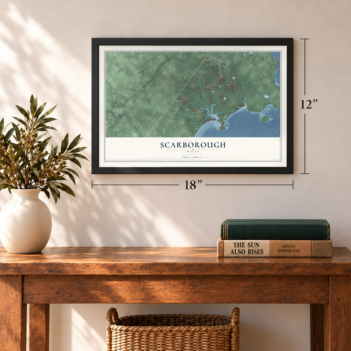
12" x 18" Archival Matte Print
A Map of Home. A Work of Art.
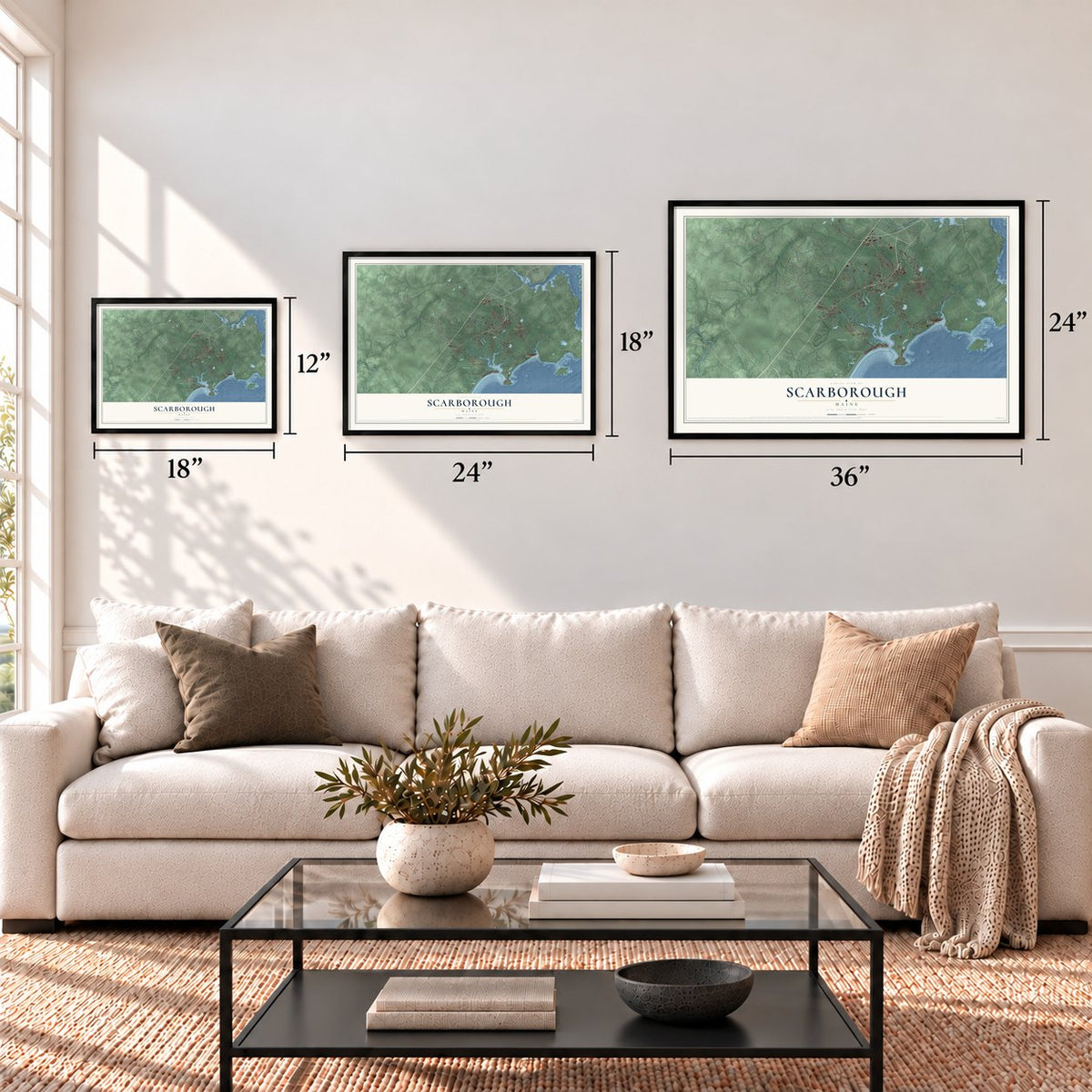
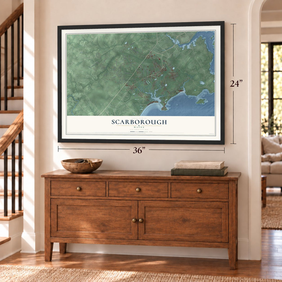
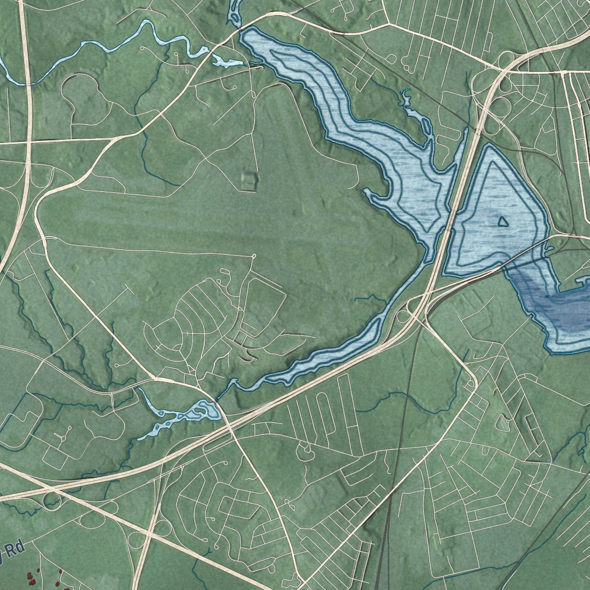
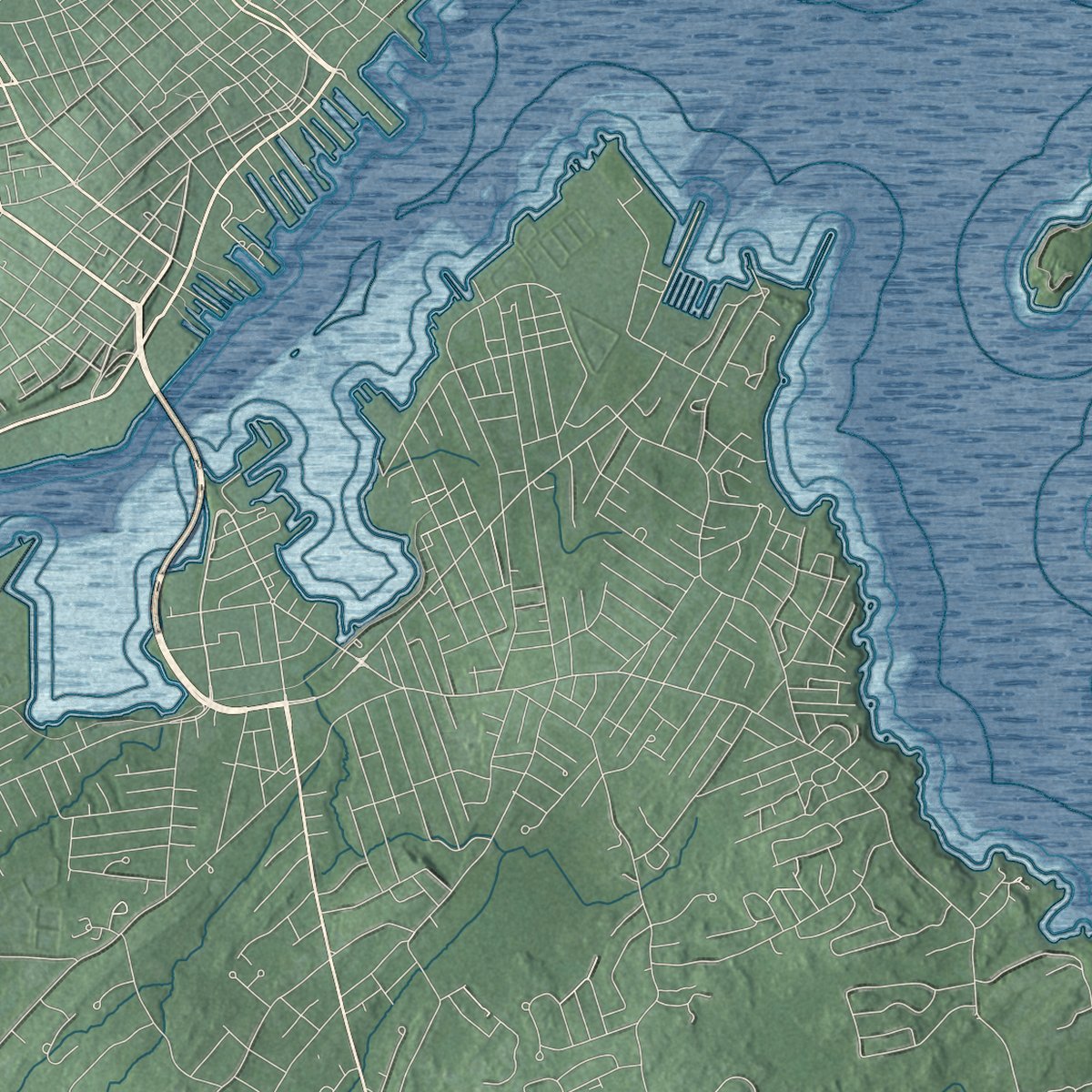
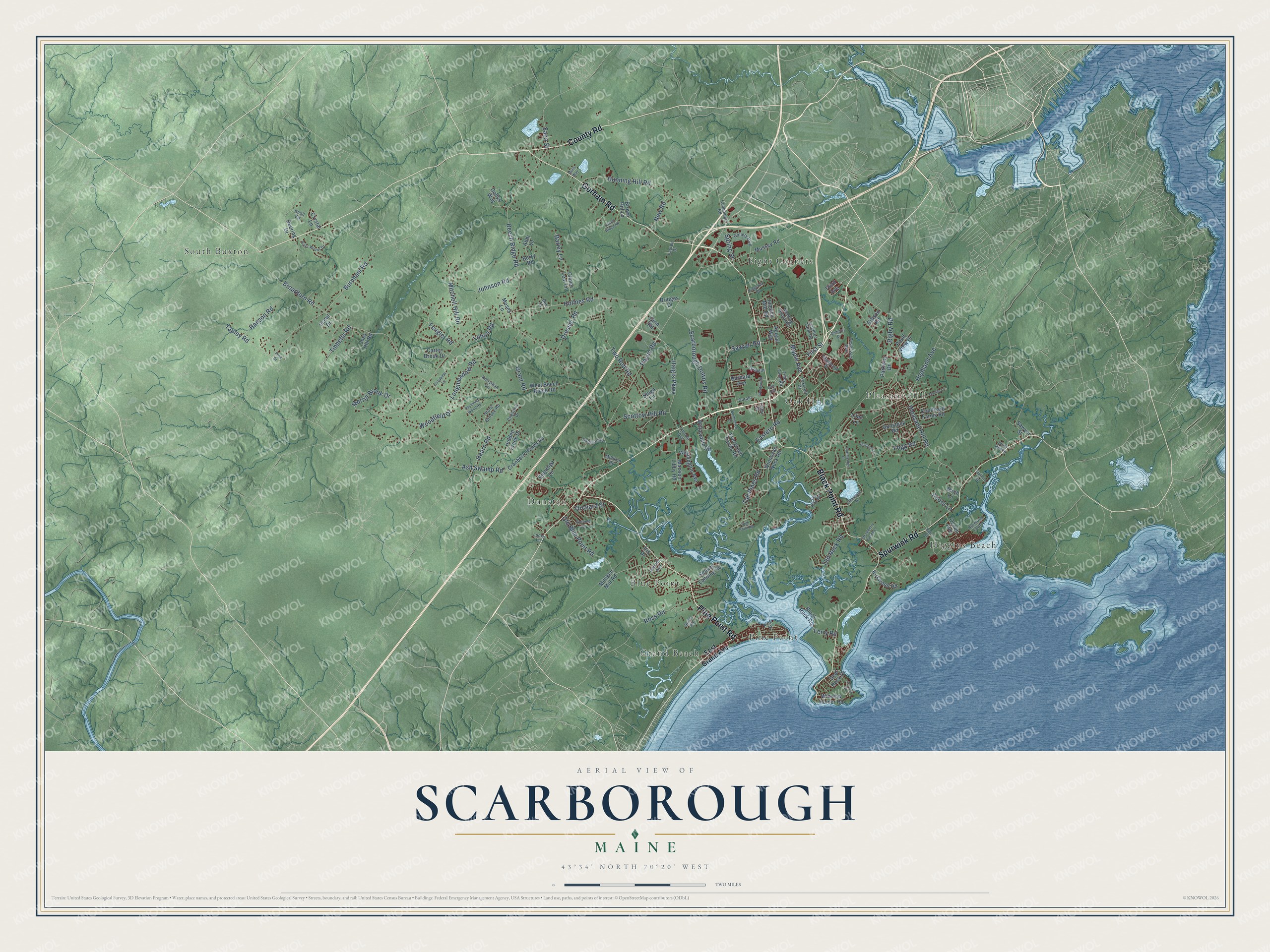
Explore Scarborough, Maine from a whole new perspective. Created using aerial imagery and detailed geographic data, this map captures Scarborough building by building, with labeled streets, familiar landmarks, and shaded topographical relief that highlights the natural contours of the landscape.
Combining modern data with the timeless character of a vintage atlas, this map is just as interesting up close as it is beautiful on the wall. Whether you grew up in Scarborough, spent memorable years there, or call it home today, this unique map is a great way to celebrate a place that means something to you. Zoom in on the preview to look for your street, and then order a print to put your memories on the wall.
Three ways to hang it
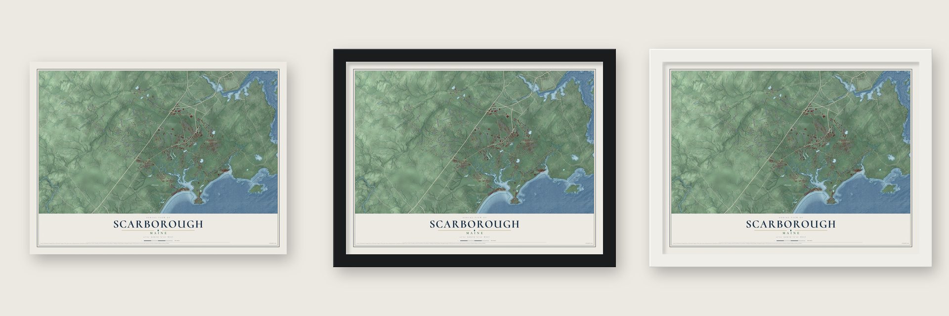
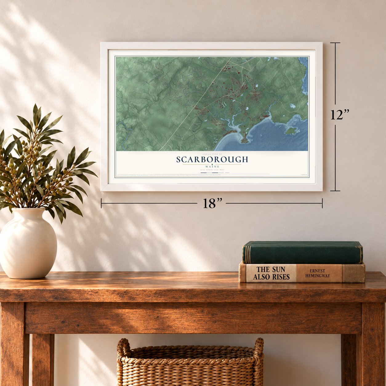
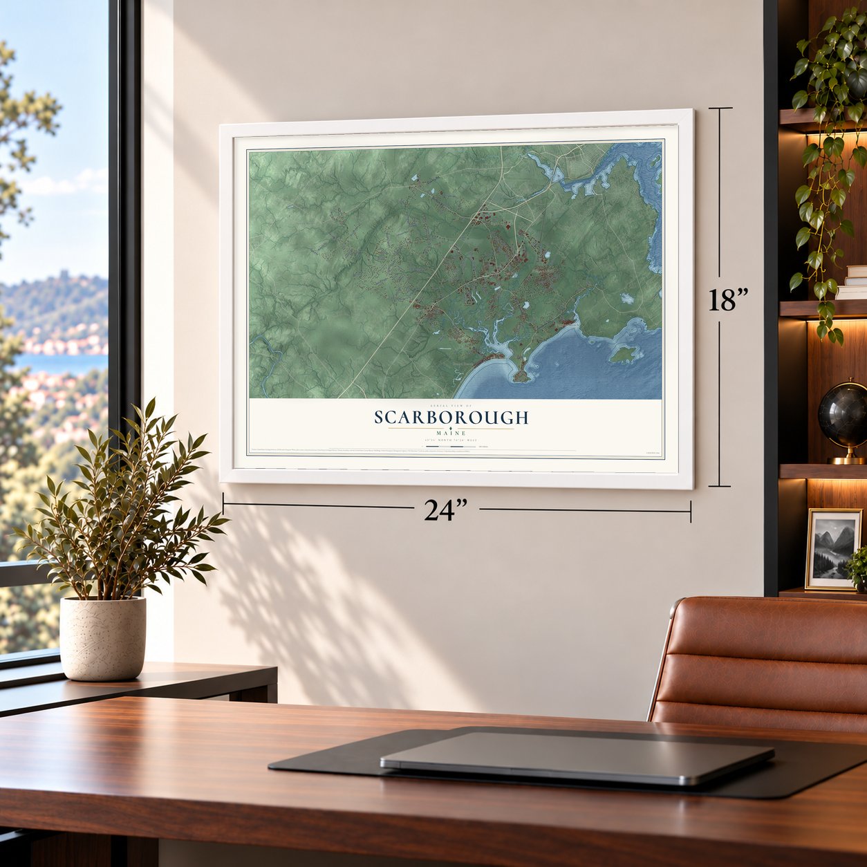
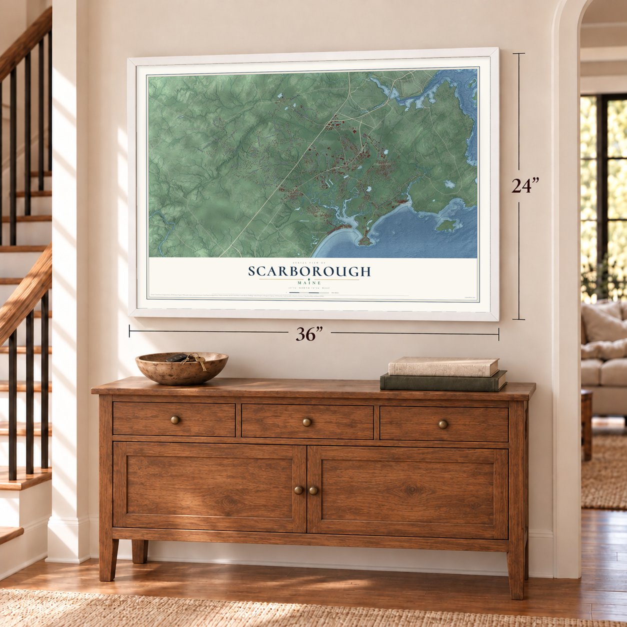
Unframed archival matte, a black wood frame or a white wood frame.
Up close
Geography Worth Displaying
This map was created using accurate cartographic data and authoritative geographic sources, including the U.S. Geological Survey (USGS) and FEMA. The map brings together terrain, waterways, roads, and building detail. The majority of the streets are labeled, houses are accurately depicted, and the topography is derived from government sources. Combining local data with carefully composed color and shading leads to this beautifully detailed Scarborough artwork for your wall.
Rather than simply showing street outlines, we’ve included as many of the street names as we could reasonably fit on the map while keeping their names legible. Zoom in on the high resolution preview to see exactly what’s on the map. We truly set out to create a statement piece for anyone who loves Scarborough. So whether it’s for you, or a gift for someone you love, we hope this map of Scarborough brings back fond memories.
Explore the full map of Scarborough, Maine and read about the local places it shows.

Find your street
Names on the Scarborough map
Every name below is printed on this map. Look for your street, your school, the park where you played, or the pond down the road.
Places and landmarks9
- Oak Hill
- South Buxton
- Grand Beach
- Higgins Beach
- Eight Corners
- Pleasant Hill
- Blue Point
- Pine Point
- Dunstan
Streets and roads140
- Pine Point Road
- County Road
- Gorham Road
- Black Point Road
- Spurwink Road
- Broadturn Road
- Payne Road
- Burnham Road
- Tapley Road
- Spring Street
- Holmes Road
- Beech Ridge Road
- Pleasant Hill Road
- Highland Avenue
- Ash Swamp Road
- Running Hill Road
- Two Rod Road
- Old Blue Point Road
- Fogg Road
- Haigis Parkway
- Scarborough Downs Road
- Eastern Road
- Merrill Brook Drive
- Sawyer Road
- Mitchell Hill Road
- Longmeadow Road
- Maple Avenue
- Fengler Road
- Woodfield Drive
- Hanson Road
Show all 140 streets
- Hearn Road
- Scottow Hill Road
- Dresser Road
- Ross Road
- Saco Street
- Tall Pines Road
- Old Neck Road
- Tibbetts Road
- Johnson Road
- Barley Lane
- New Road
- Orchard Street
- First Street
- Lobos Road
- Grant Road
- Rigby Road
- Acorn Lane
- Ferry Road
- East Grand Avenue
- Winnocks Neck Road
- Mussey Road
- Washington Avenue
- Cranberry Pines Road
- Winslow Homer Road
- Manson Libby Road
- West Beech Ridge Road
- Gunstock Road
- Parkway Drive
- Coulthard Farms Road
- Hidden Creek Drive
- Willowdale Road
- Ocean Avenue
- Seavey Landing Road
- Sawyer Street
- Evergreen Farms Road
- Berry Road
- Joss Hill Road
- Kirkwood Road
- Clover Leaf Lane
- Jameco Mill Road
- Black Rock Road
- Saratoga Lane
- Milliken Mill Road
- Carter Brook Drive
- Seal Rock Drive
- Bridges Drive
- Pond View Drive
- Abigail Way
- Third Avenue
- Deering Drive
- Moses Lane
- Crystal Lane
- Barbara Avenue
- Dollys Way
- Gibson Road
- Stuga Lane
- Ginn Road
- Abbi Lane
- Brown Hill Lane
- Birch Lane
- Scout Drive
- Lilac Lane
- Iris Drive
- Clay Pits Road
- Stone Brooke Road
- King Street
- Lincoln Avenue
- Gallery Boulevard
- Meeting House Road
- Vagabond Street
- Kerryman Circle
- Cummings Road
- Sargent Road
- Snow Road
- Foley Farm Road
- Foxcroft Drive
- Desfosses Avenue
- Harmons Island
- Chestnut Drive
- Ivory Hill Lane
- Knoll Vw
- Quentin
- Milliken Road
- Leighton Farm Road
- Hillside Avenue
- Durant
- Lauren Drive
- Den Drive
- Lucky Lane
- Libby Street
- River Woods Drive
- Clearwater Drive
- Piper Road
- Campus Drive
- Commerce Drive
- Tenney Lane
- Raymond Wood Road
- High Point Road
- Bornheimer Place
- Wentworth
- Jocelyn Road
- Laurel Ridge Road
- Wildrose Lane
- Strawberry Fields Lane
- Ridgeway Road
- Elizabeth Lane
- Starbird Road
- Ryefield Drive
- Mulls Way
- Foss Drive
Names are listed as they appear on the printed map. Zoom into the product photos to find them.
About Scarborough, Maine
Scarborough is a town of 22,135 people in Cumberland County, about 7 miles south of Portland. From about 1630, John V. Stratton traded from Stratton Island, out in Saco Bay. The next year the Plymouth Council for New England gave Captain Thomas Cammock the Black Point Patent, and in 1635 he built a house and settled on its 1,500 acres. Good fishing and farmland drew families to Black Point, Blue Point, Dunstan and Stratton Island, which held fifty homes by 1650. On July 14, 1658, the Massachusetts General Court joined them as one town and named it for Scarborough in Yorkshire, England.
When King Philip's War broke out in 1675, Scarborough had more than one hundred houses and a thousand head of cattle. By 1676 the fighting had ruined it, and settlers had been killed or carried off as captives. Survivors tried again and again to rebuild during King William's War, then abandoned the town in 1690 for Portsmouth and Boston. After a truce in 1699, seven settlers from Lynn, Massachusetts, came back in 1702 and began a fort on Prouts Neck under Captain John Larrabee. This time the town held on, and by 1749 it was thriving, shipping cattle and timber and running a dozen sawmills on its streams.
- Ambush at Moore's BrookMassachusetts sent soldiers and Indian allies in 1677 to make the town safe for settlers again. On June 29, 1677, they chased a few Indians who turned out to be a decoy and ran into warriors led by Chief Squandro. Of nearly one hundred militiamen, fifty to sixty were killed or mortally wounded, Captain Benjamin Swett among them. A large fort went up at Black Point in 1681.
- Rain saved the fort in 1703In August 1703, five hundred French and Indian fighters under the Sieur de Beaubassin struck the settlements from Casco Bay to Wells. At Prouts Neck the fort stood on a bluff, and the attackers, sheltered under the overhang, started digging a tunnel to come up beneath it. Two days of heavy rain collapsed the loosened bank and exposed the diggers to the marksmen inside. Beaubassin gave up and moved on, and the eight people in the fort survived.
- Warning fires on Scottow HillIn the early years of settlement, people lit bonfires on Scottow Hill, 144 feet high, to warn the countryside that danger was coming. The highest ground in town is Beech Ridge, at 215 feet.
- Maine's largest townWith 22,135 people in 2020, Scarborough was the sixth most populous municipality in Maine and the biggest in the state still called a town. It has had a council-manager government since October 7, 1969, and Hannaford supermarkets keep their headquarters here.
Keep exploring Maine
Scarborough is one of 536 Maine towns we've mapped. Every dot on the map is a print of its own.
The search covers every state, Maine first.
Near Scarborough
Order 2 or more town maps and save 10%. Shown in the size and finish you picked above, so they hang as a set.
- Blue Point 12" x 18" / Archival Matte Print $39.99
- Oak Hill 12" x 18" / Archival Matte Print $39.99
- Pleasant Hill 12" x 18" / Archival Matte Print $39.99


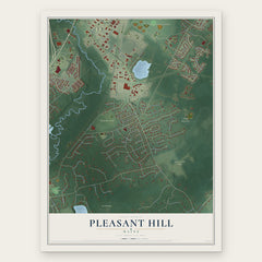
More maps nearby: Dunstan, Old Orchard Beach, Eight Corners, South Portland and Saco.
The art of mapping a place
How This Map Was Made
Real places. Remarkable detail. Discover the layers that turn geographic data into a map of home.

The view from above
Aerial imagery reveals the character of the land: woodland, open fields, and the patterns of a place.

The shape of the land
Elevation data brings hills, valleys, and subtle changes in the landscape into view.

The details of home
Roads, waterways, and building footprints come together to make the map feel unmistakably local.

Geography becomes art
Considered color, shading, and typography bring the layers together in a map made for your wall.


Process illustrated with Mendon, Massachusetts. Aerial imagery: USDA NAIP. Terrain: USGS 3D Elevation Program. Map details and finished artwork: KNOWOL.
The Details
About This Print
Choose an archival matte print, or a black or white Ayous wood frame. The archival matte print is unframed.
Select your size and finish above to see the matching product image and price.
Materials & Craftsmanship
A contemporary map with the character of a classic atlas, printed on archival matte paper. Optional frames are made from Ayous wood.
Your printed map does not include the watermark shown in the full-map preview.
Shipping & Delivery
Free shipping within the United States. Every print is made to order in the USA.
Buying a gift? Add a note in your cart and we'll include it. We never put prices in the package.
Prints ship within 2 to 3 business days. Allow 7 to 10 days total from ordering for delivery. Timing may vary during holidays or periods of high order volume.
Read our shipping policy.
Returns and damaged prints
Each print is made to order. Change-of-mind refunds are not available after production.
If your print arrives damaged, misprinted or incorrect, contact support@knowol.com within 30 days of receiving it. Include your order number, photos and a description of the issue.
Read our full refund and replacement policy. For questions about your order, email support@knowol.com.