
Search for another town



Free U.S. delivery 7 to 10 days after you order
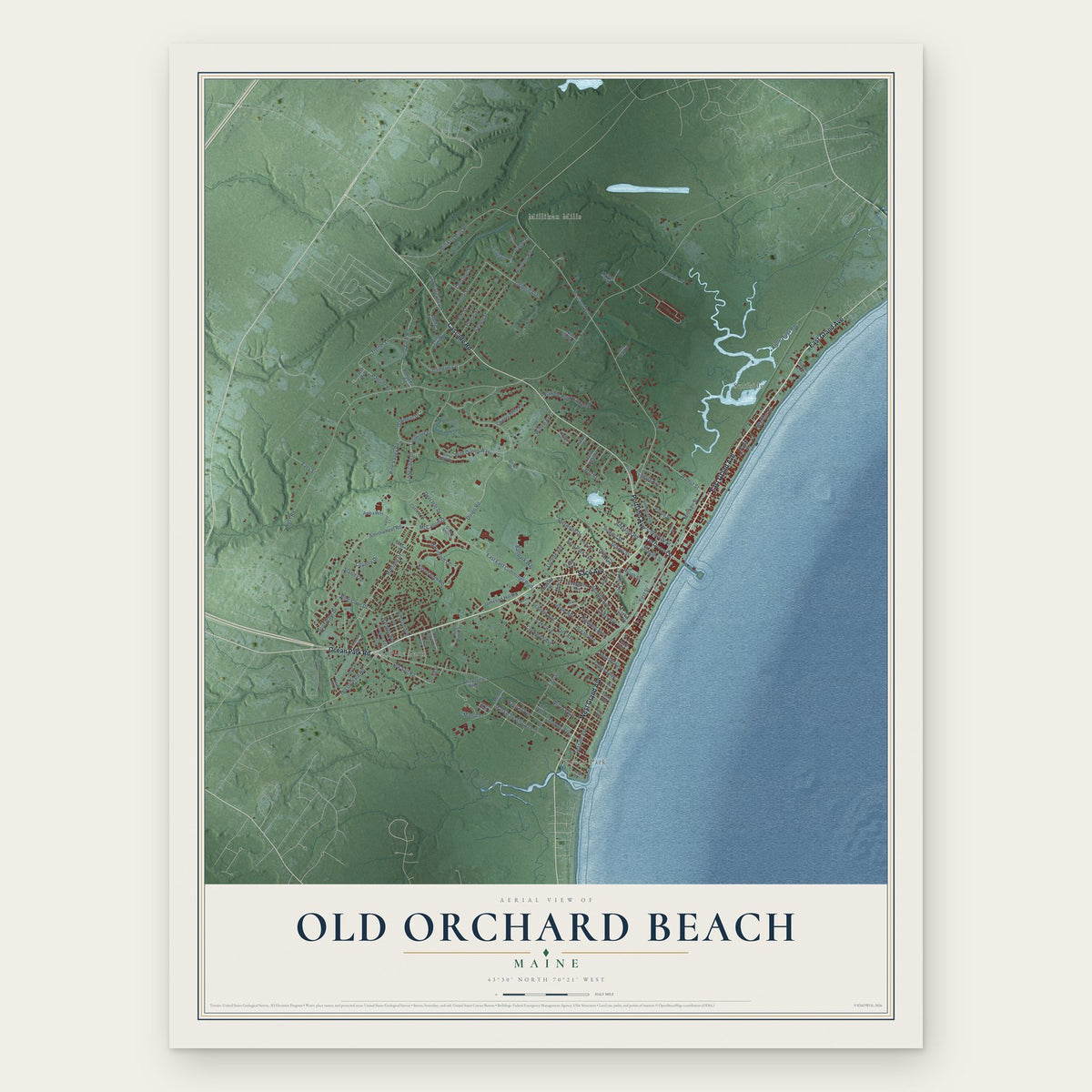
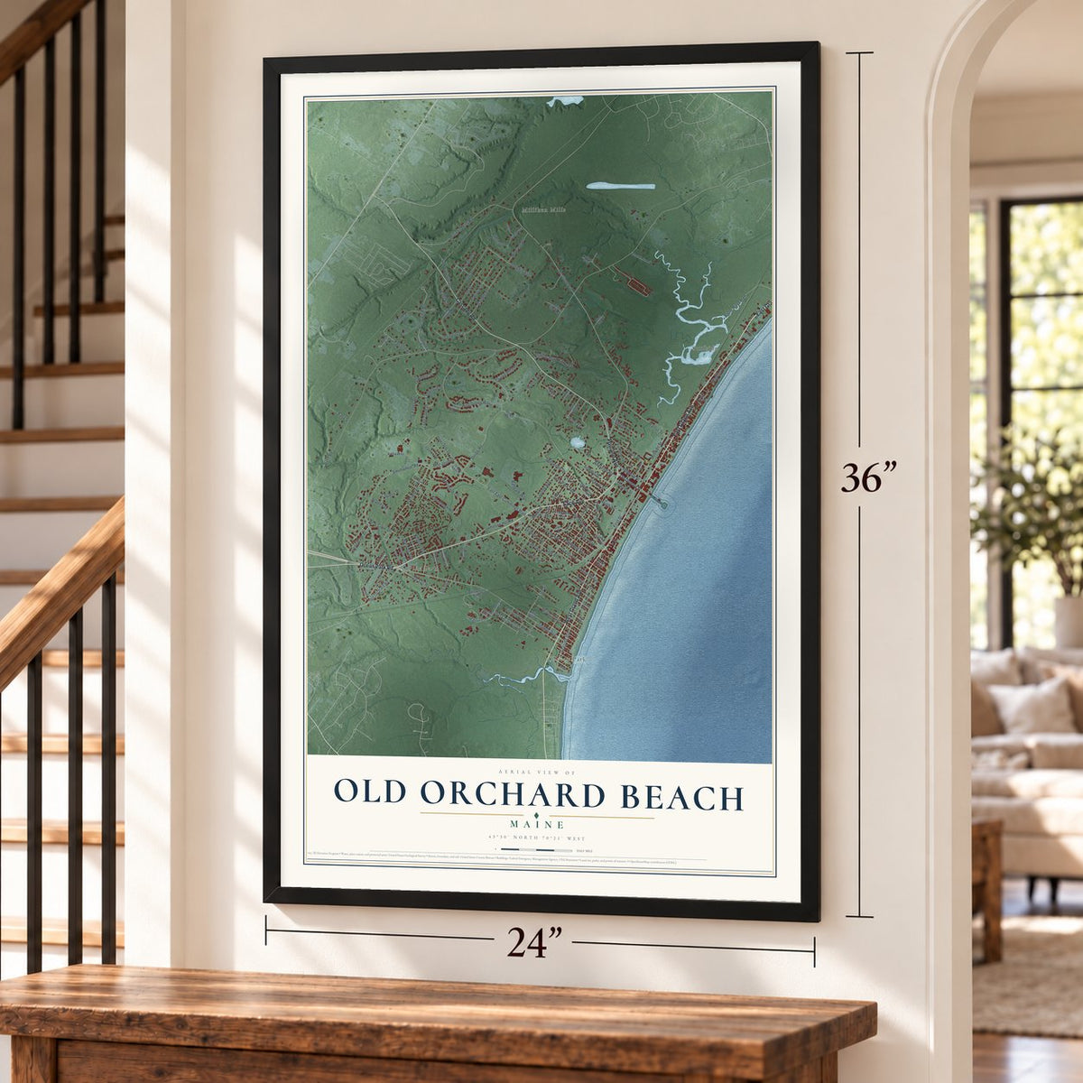
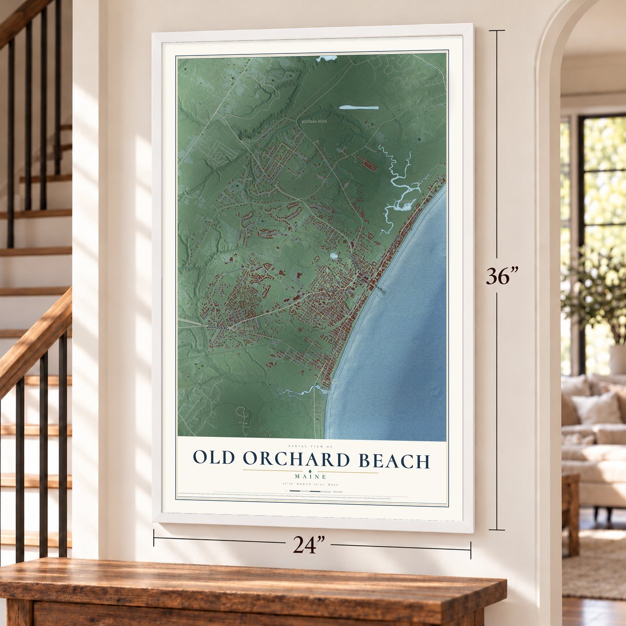
Old Orchard Beach, Maine Map Art
Building by building, with labeled streets and shaded relief.
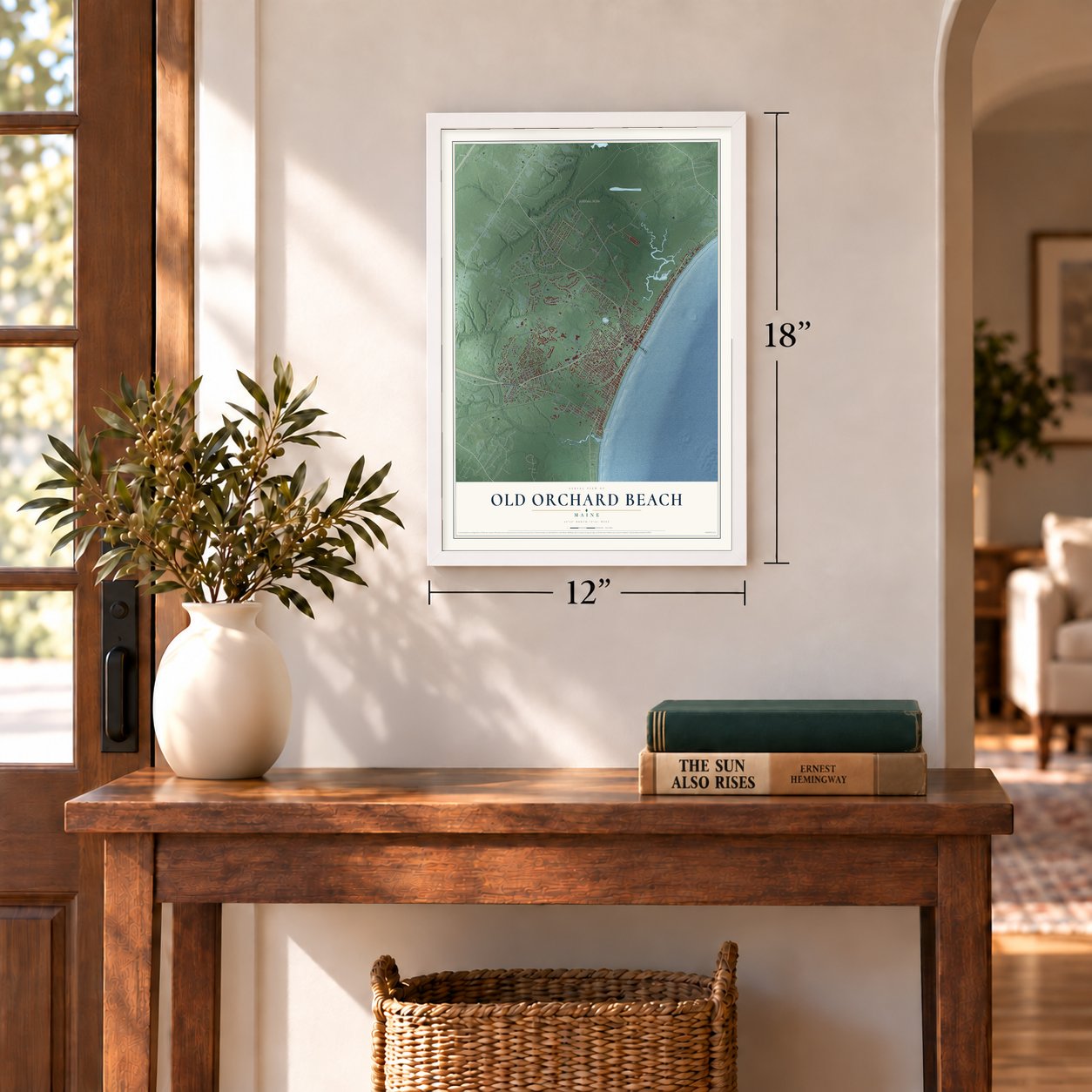
12" x 18" Archival Matte Print
A Map of Home. A Work of Art.
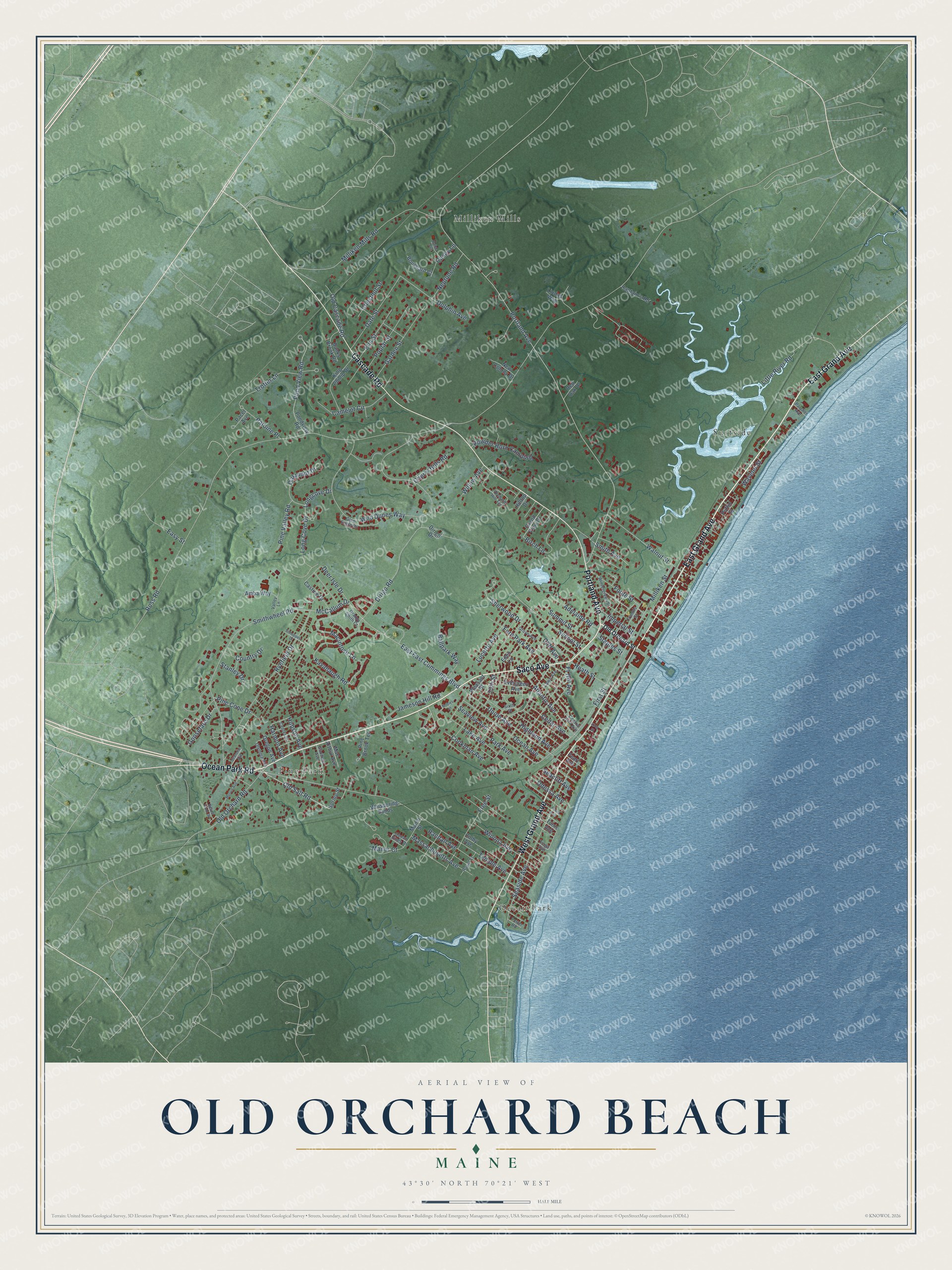
Explore Old Orchard Beach, Maine from a whole new perspective. Created using aerial imagery and detailed geographic data, this map captures Old Orchard Beach building by building, with labeled streets, familiar landmarks, and shaded topographical relief that highlights the natural contours of the landscape.
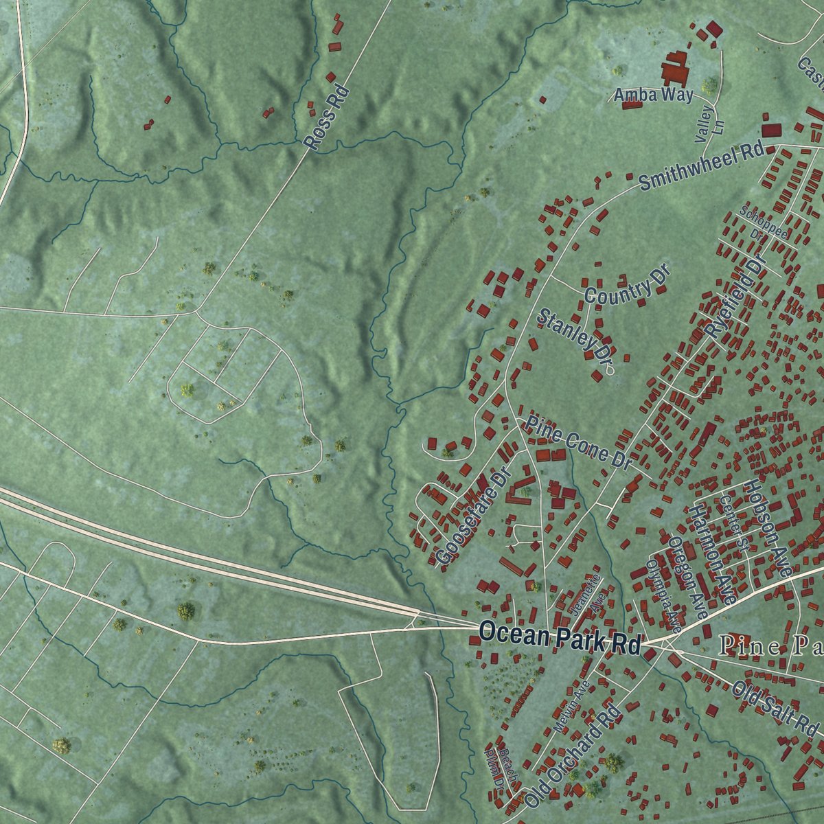
Combining modern data with the timeless character of a vintage atlas, this map is just as interesting up close as it is beautiful on the wall. Whether you grew up in Old Orchard Beach, spent memorable years there, or call it home today, this unique map is a great way to celebrate a place that means something to you. Zoom in on the preview to look for your street, and then order a print to put your memories on the wall.
Three ways to hang it
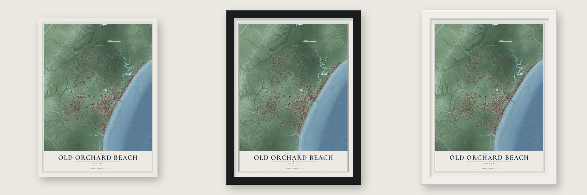
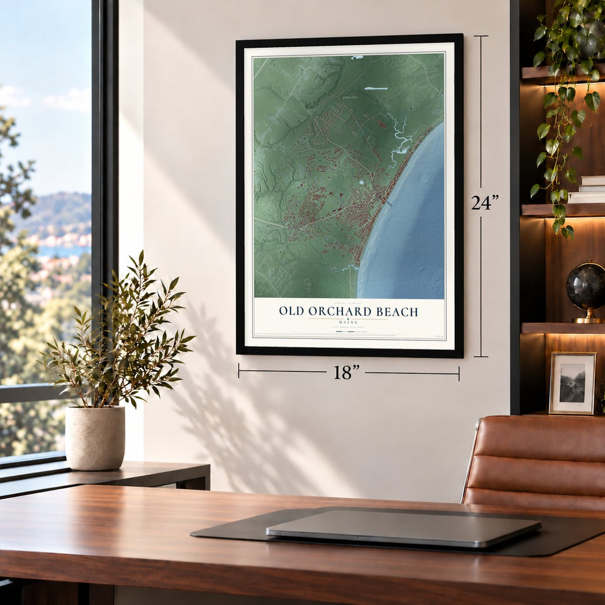
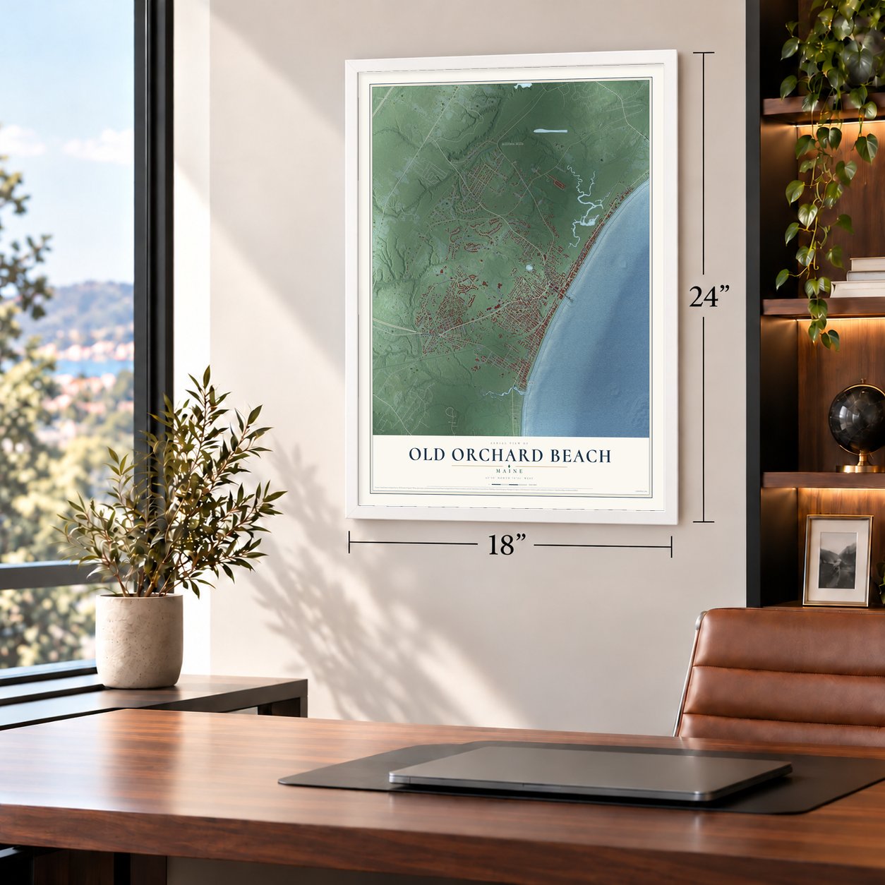
Unframed archival matte, a black wood frame or a white wood frame.
Up close
Geography Worth Displaying
This map was created using accurate cartographic data and authoritative geographic sources, including the U.S. Geological Survey (USGS) and FEMA. The map brings together terrain, waterways, roads, and building detail. The majority of the streets are labeled, houses are accurately depicted, and the topography is derived from government sources. Combining local data with carefully composed color and shading leads to this beautifully detailed Old Orchard Beach artwork for your wall.
Rather than simply showing street outlines, we’ve included as many of the street names as we could reasonably fit on the map while keeping their names legible. Zoom in on the high resolution preview to see exactly what’s on the map. We truly set out to create a statement piece for anyone who loves Old Orchard Beach. So whether it’s for you, or a gift for someone you love, we hope this map of Old Orchard Beach brings back fond memories.
Explore the full map of Old Orchard Beach, Maine and read about the local places it shows.

Find your street
Names on the Old Orchard Beach map
Every name below is printed on this map. Look for your street, your school, the park where you played, or the pond down the road.
Places and landmarks4
- Surfside
- Pine Park
- Milliken Mills
- Ocean Park
Streets and roads140
- Saco Avenue
- East Grand Avenue
- Portland Avenue
- West Grand Avenue
- Cascade Road
- Ocean Park Road
- Temple Avenue
- Old Salt Road
- Cliff Avenue
- Longcove Drive
- Hobson Avenue
- East East Cummings Boulevard
- Ross Road
- Wild Dunes Way
- Smithwheel Road
- Seaside Avenue
- Ryefield Drive
- Union Avenue
- First Street
- Dirigo Road
- Ocean Avenue
- Kavanaugh Road
- Milliken Mills Road
- Pond View Road
- Randall Avenue
- Walnut Street
- Little River Road
- Atlantic Avenue
- Seaview Avenue
- Long Cove Drive
Show all 140 streets
- Old Orchard Road
- Macintosh Lane
- Birch Lane
- Milliken Street
- Date Street
- Free Street
- Garden Street
- Trotter Lane
- Powder Horn Camping
- Fern Park Avenue
- Winona Avenue
- Camelot Circle
- Dolphin Avenue
- Oakmont Drive
- Poplar Street
- Massachusetts Avenue
- Smith Avenue
- Jameson Hill Road
- Park Avenue
- Ballpark Way
- School Street
- Foote Street
- Sherwood Drive
- Adelaide Road
- Elm Street
- Lake Avenue
- Highland Avenue
- Summit Street
- Old Cascade Road
- Neptune Road
- Cedar Avenue
- McCallum Drive
- Pine Valley Road
- Pine Cone Drive
- Goosefare Drive
- Patoine Place
- Manor Court
- Cookman Avenue
- Cherry Hills Road
- Deer Isle Drive
- Seacliff Avenue
- Heath Street
- Odessa Avenue
- Wavelet Street
- Lucette Avenue
- Country Drive
- Imperial Street
- Chestnut Street
- Casey Lane
- Willow Avenue
- Stanley Drive
- Easy Street
- Harmon Avenue
- Ft Hill Avenue
- 15th Street
- Staples Street
- Pondview Road
- Colby Avenue
- King Phillip Drive
- Whispering Sands
- Evergreen Avenue
- Pine Brook Terrace
- Castine Drive
- Grand View Drive
- Banks Brook Road
- Captain's Road
- Manor Street
- Bouchard Court
- Dirigo Drive
- Pacer Avenue
- Oregon Avenue
- New Colony Drive
- Amba Way
- Mac Arthur Avenue
- Pleasant Street
- Eden Lane
- Tunis Avenue
- Red Oak Drive
- Spring Street
- Puffin Street
- Pearl Avenue
- Hilltop Drive
- Lindas Way
- Old Orchard Street
- Central Park Avenue
- Orchard Hill Terrace
- Wintergreen Street
- Grove Avenue
- Glen Eagle Drive
- Goodwin Avenue
- Granny Smith Court
- Center Street
- Royal Street
- Valley Lane
- Olympia Avenue
- Francis Street
- Sixth Street
- Tioga Avenue
- Lawn Avenue
- Ocean Pines Drive
- Parcher Avenue
- Porter Road
- Melvin Avenue
- Nobles Lane
- Schoppee Drive
- Beach Plum Drive
- Jeanette Avenue
- Pavia Avenue
- Paige Avenue
- King Street
Names are listed as they appear on the printed map. Zoom into the product photos to find them.
About Old Orchard Beach, Maine
Old Orchard Beach is a resort town of 8,960 people in York County, on Saco Bay. Abenaki people lived here before Europeans came, and the British explorer Martin Pring reached the mouth of the Saco and Goosefare rivers in 1603. Thomas Rogers came to the Goosefare Brook area in 1636, settled the land officially in 1657 and called it "The Garden By The Sea." After an Indian attack wrecked his homestead, his family moved to Kittery. The apple orchard they left behind lasted about 150 years as a landmark for sailors, and it gave the town its name.
Visitors came early. A public house opened in 1829, and by 1837 tourists were paying to board at a local farm. Over the following decades Old Orchard grew into a major resort, where planes took off from the beach and cars raced on the sand. The fire of 1907 destroyed most of the big hotels, so the Ocean House, built around 1895 at 71 West Grand Avenue, is now the oldest hotel still standing on the beachfront.
- World's longest steel pierOn July 2, 1898, a steel pier built by the Berlin Iron Bridge Co. for $38,000 opened at Old Orchard. At 1,825 feet it was the world's longest steel pier. A storm soon took 150 feet off its length, and another one ten years later left it at 700 feet. A blizzard destroyed the pier in 1978, and the wooden pier built in 1980 reaches 500 feet into the Atlantic.
- Dancing at the Pier CasinoA ballroom called the Pier Casino stood at the end of the 1898 pier, with room for 5,000 dancers. After the second storm shortened the pier, the Casino was moved. Between the two world wars it booked Frank Sinatra, Benny Goodman, Louis Armstrong, Guy Lombardo and Xavier Cugat. It was torn down in 1970.
- Cummings' Guest House, 1923In 1923, when Black musicians were turned away from other local hotels, Rose and Edward Cummings Jr. opened the Cummings' Guest House at 110 Portland Avenue for Black visitors. Lionel Hampton, Count Basie, Cab Calloway and Duke Ellington all stayed there. The guest house kept its doors open until 1993 and is now on the National Register.
- A revival camp at Ocean ParkBates College president Oren B. Cheney built a Free Will Baptist revival camp at Ocean Park, down the beach from the center of town, in 1881. On January 24 of that year, its association told the State of Maine that it planned a summer resort for religious, educational and other meetings. The community is still going, and its Ocean Park Historic Buildings are on the National Register.
- Palace Playland since 1902Palace Playland opened in 1902 on four acres of beachfront and is one of New England's last old-style seaside amusement parks. Its rides once included Noah's Ark, a rocking boat-shaped funhouse meant to thrill a 5-year-old without scaring one, and the Jack and Jill slide, which hauled riders on a hemp mat up a 50-foot tower. A fire in 1969 burned both, along with the Mine Ride, the Whale's Mouth and two carousels.
Keep exploring Maine
Old Orchard Beach is one of 536 Maine towns we've mapped. Every dot on the map is a print of its own.
The search covers every state, Maine first.
Near Old Orchard Beach
Order 2 or more town maps and save 10%. Shown in the size and finish you picked above, so they hang as a set.
- Blue Point 12" x 18" / Archival Matte Print $39.99
- Scarborough 12" x 18" / Archival Matte Print $39.99
- Dunstan 12" x 18" / Archival Matte Print $39.99


More maps nearby: Saco, Oak Hill, Pleasant Hill, Eight Corners and Biddeford.
The art of mapping a place
How This Map Was Made
Real places. Remarkable detail. Discover the layers that turn geographic data into a map of home.

The view from above
Aerial imagery reveals the character of the land: woodland, open fields, and the patterns of a place.

The shape of the land
Elevation data brings hills, valleys, and subtle changes in the landscape into view.

The details of home
Roads, waterways, and building footprints come together to make the map feel unmistakably local.

Geography becomes art
Considered color, shading, and typography bring the layers together in a map made for your wall.


Process illustrated with Mendon, Massachusetts. Aerial imagery: USDA NAIP. Terrain: USGS 3D Elevation Program. Map details and finished artwork: KNOWOL.
The Details
About This Print
Choose an archival matte print, or a black or white Ayous wood frame. The archival matte print is unframed.
Select your size and finish above to see the matching product image and price.
Materials & Craftsmanship
A contemporary map with the character of a classic atlas, printed on archival matte paper. Optional frames are made from Ayous wood.
Your printed map does not include the watermark shown in the full-map preview.
Shipping & Delivery
Free shipping within the United States. Every print is made to order in the USA.
Buying a gift? Add a note in your cart and we'll include it. We never put prices in the package.
Prints ship within 2 to 3 business days. Allow 7 to 10 days total from ordering for delivery. Timing may vary during holidays or periods of high order volume.
Read our shipping policy.
Returns and damaged prints
Each print is made to order. Change-of-mind refunds are not available after production.
If your print arrives damaged, misprinted or incorrect, contact support@knowol.com within 30 days of receiving it. Include your order number, photos and a description of the issue.
Read our full refund and replacement policy. For questions about your order, email support@knowol.com.