
Search for another town





Free U.S. delivery 7 to 10 days after you order
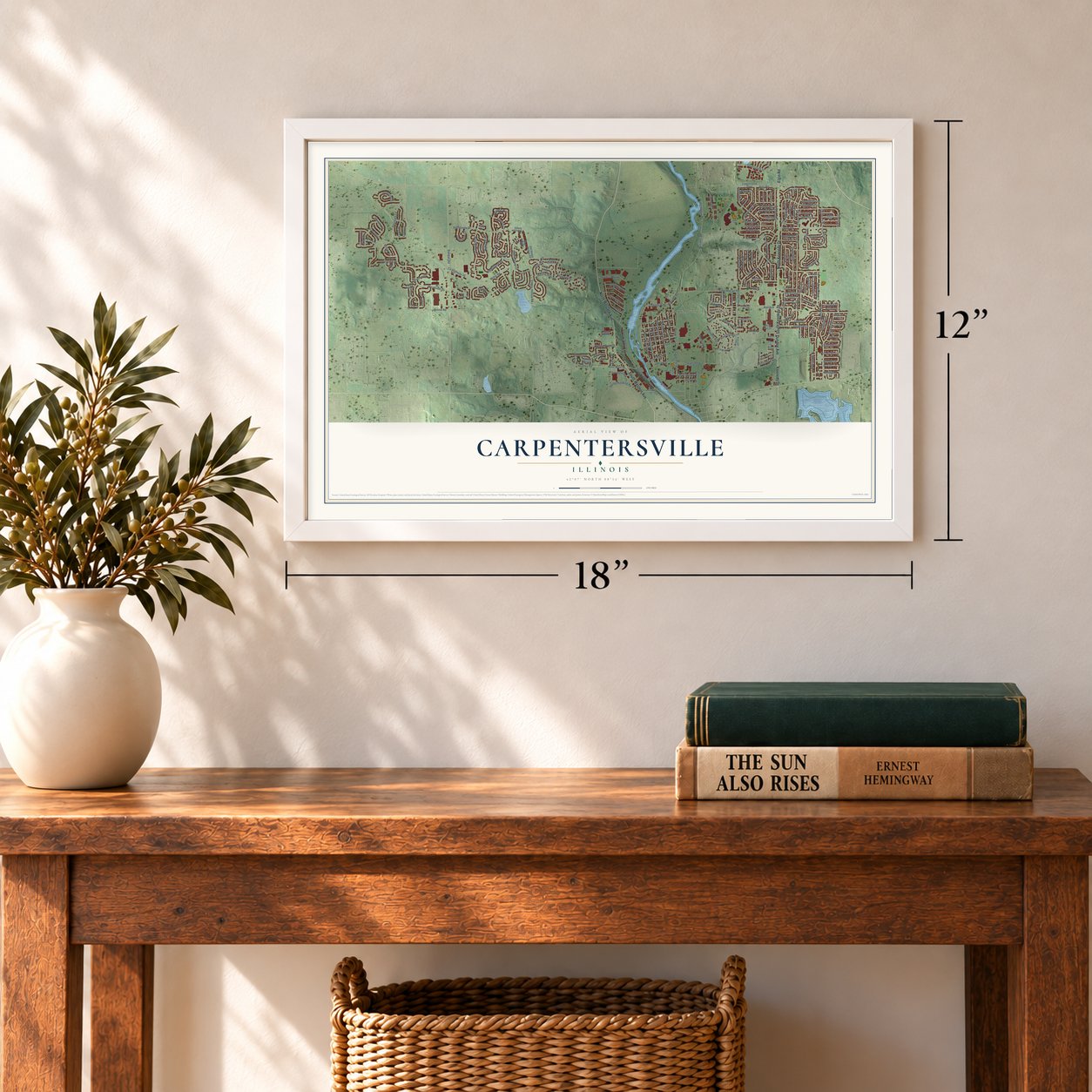
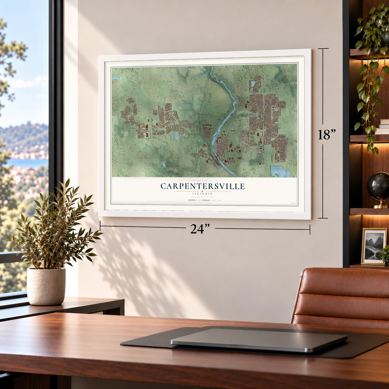
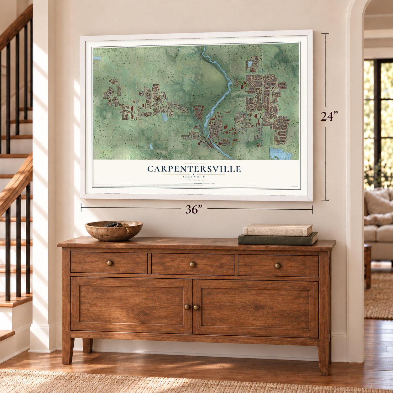
Carpentersville, Illinois Map Art
A new map of Carpentersville, Illinois, made in 2026 and printed to order on thick archival matte paper.
12" x 18" Archival Matte Print
A Map of Home. A Work of Art.
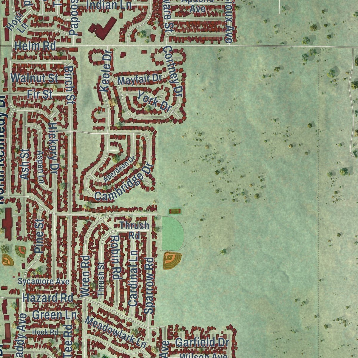
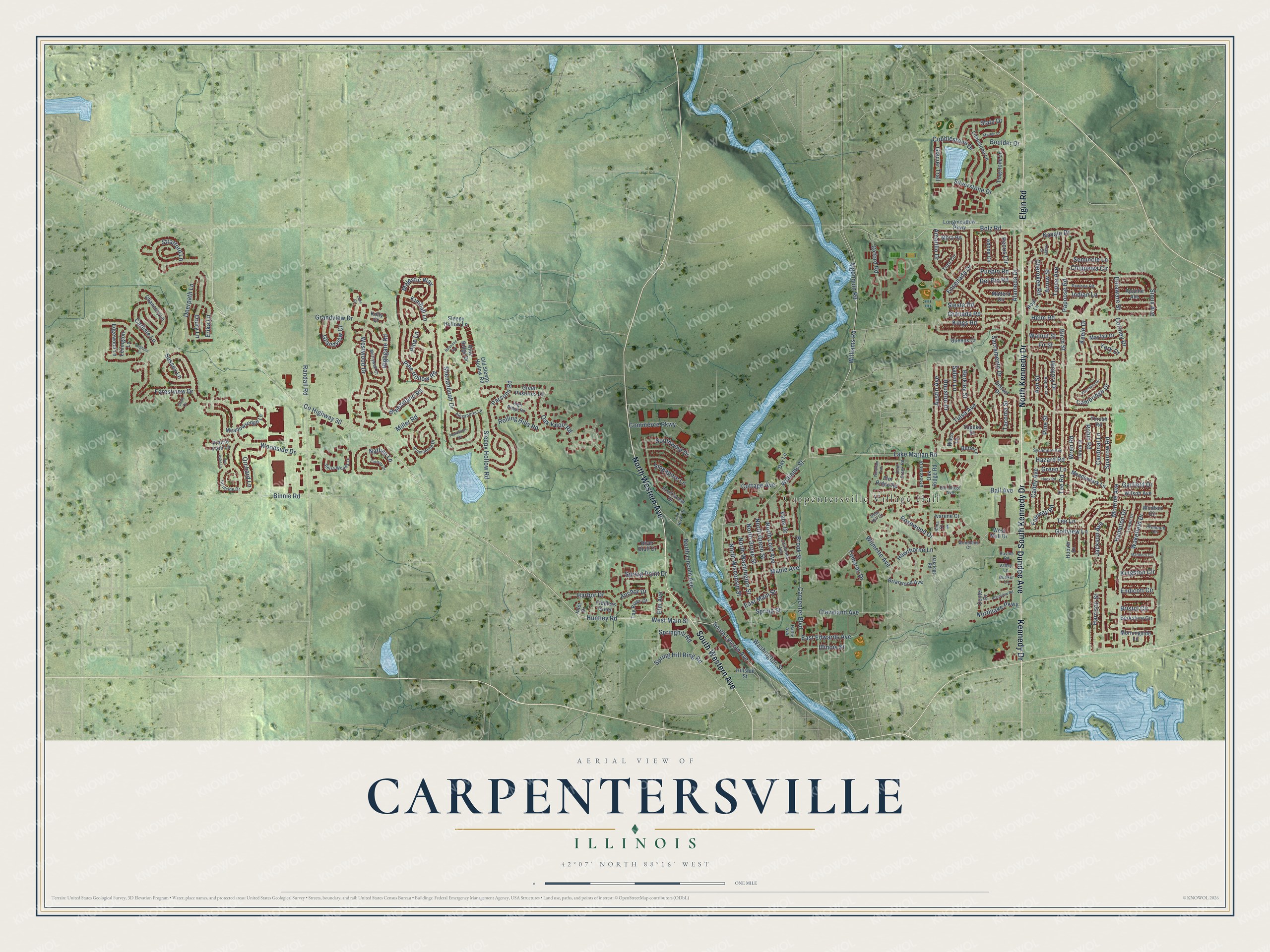
Explore Carpentersville, Illinois from a whole new perspective. Created using aerial imagery and detailed geographic data, this map captures Carpentersville building by building, with labeled streets, familiar landmarks, and shaded topographical relief that highlights the natural contours of the landscape.
Combining modern data with the timeless character of a vintage atlas, this map is just as interesting up close as it is beautiful on the wall. Whether you grew up in Carpentersville, spent memorable years there, or call it home today, this unique map is a great way to celebrate a place that means something to you. Zoom in on the preview to look for your street, and then order a print to put your memories on the wall.
Three ways to hang it
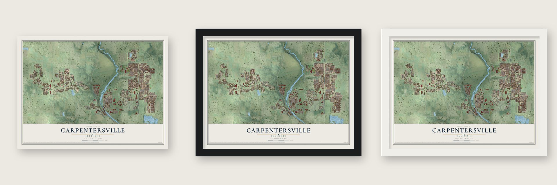
Unframed archival matte, a black wood frame or a white wood frame.
Up close
Geography Worth Displaying
This map was created using accurate cartographic data and authoritative geographic sources, including the U.S. Geological Survey and the Census Bureau. The map brings together terrain, waterways, roads, and building detail. The majority of the streets are labeled, houses are accurately depicted, and the topography is derived from government sources. Combining local data with carefully composed color and shading leads to this beautifully detailed Carpentersville artwork for your wall.
Rather than simply showing street outlines, we’ve included as many of the street names as we could reasonably fit on the map while keeping their names legible. Zoom in on the high resolution preview to see exactly what’s on the map. We truly set out to create a statement piece for anyone who loves Carpentersville. So whether it’s for you, or a gift for someone you love, we hope this map of Carpentersville brings back fond memories.
Read the story behind this map of Carpentersville, Illinois from 2026.

About Carpentersville, Illinois
Carpentersville is a village of 37,983 people in Kane County, on the Fox River in the Chicago metropolitan area. Charles V. Carpenter and his brother Daniel left Uxbridge, Massachusetts, by oxcart, headed for the Rock River. Spring floods stopped them on the east bank of the Fox, so they camped to wait for the water to drop, and they stayed for good in a place first called Carpenters' Grove. A 1939 state guide dates the settlement to 1834, while Wikipedia puts the camp in 1837. Charles's first home there was a log cabin.
Charles's son, Julius Angelo Carpenter, born in 1827, became the settlement's leading citizen. He built its first store, its first bridge and its first factory, and he served two terms in the Illinois House of Representatives before his death in 1880. Without a direct rail line to Chicago, the village grew slowly, and until the 1950s it was mostly a grid of streets along the river around Main Street, whose bridge was the only highway crossing of the Fox between Algonquin and Dundee.
“In the decades that followed, Carpenter all but built the settlement singlehanded.”
- Streetcars to Elgin in 1896In 1896 the Carpentersville, Elgin and Aurora Railway opened an electric interurban running four miles from Elgin's streetcars to Main Street, ending at the foundry of Illinois Iron and Bolt. Factory workers rode it both ways, and families took the open summer cars to Elgin's Trout Park. The Great Depression and the paved Illinois Route 31 pulled riders to cars and buses, and a 1933 tornado wrecked the line's bridge over the Fox south of West Dundee, ending service.
- Meadowdale opens in 1957Leonard W. Besinger broke ground in December 1955 on a $10,000,000 shopping center, one of the biggest in the country at the time. Its first 14 stores opened on May 18, 1957, and by 1958 it held as many as 53. That November the Winter Garden Annex opened around an indoor ice rink of 6,000 square feet, celebrated with fashion shows on the ice and pony rides for children.
- Kennedy campaigns, 1960On October 25, 1960, John F. Kennedy came to the Meadowdale Shopping Center during his presidential campaign and spoke about fair schooling for young children and about housing.
- The fire of 1963On November 19, 1963, fire swept Meadowdale, destroying 25 stores and the Winter Garden ice rink and causing $3,000,000 in damage. Rebuilding started at once, and the mall reopened on November 5, 1964, though the rink never came back. Business faded after Spring Hill Mall opened to the west in October 1980, much of Meadowdale was torn down in 1989, and a Walmart opened at its east end in 2016.
- Meadowdale Raceway, 1958 to 1969Besinger also started the Meadowdale International Raceway, a road course 3.27 miles long west of Illinois Route 31, where cars raced from 1958 to 1969. The old track grounds are now a township park and the Raceway Woods Forest Preserve.
Find your street
Names on the Carpentersville map
Every name below is printed on this map. Look for your street, your school, the park where you played, or the pond down the road.
Places and landmarks1
- Carpentersville Village Hall
Streets and roads222
- Elgin Road
- North Kennedy Drive
- South Kennedy Drive
- Dundee Avenue
- Kennedy Drive
- North Western Avenue
- South Western Avenue
- County Highway 30
- Lake Marian Road
- Williams Road
- Bolz Road
- Huntley Road
- South Lincoln Avenue
- West Main Street
- Williams Street
- East Main Street
- Algonquin Road
- Hazard Road
- North Wisconsin Street
- Pine Hollow Road
- Spring Hill Ring Road
- Miller Road
- Maple Avenue
- Woodside Drive
- Sleepy Hollow Road
- Golfview Lane
- Deerpath Lane
- Austin Avenue
- Amarillo Drive
- Binnie Road
Show all 222 streets
- Randall Road
- Birch Street
- Chippewa Circle
- Navajo Drive
- Tulsa Avenue
- Westwood Drive
- Wakefield Drive
- Hickory Drive
- Shenandoah Drive
- Cottage Avenue
- Oak Knoll Road
- Grandview Drive
- Rosewood Drive
- North Lincoln Avenue
- Parsons Road
- Kings Road
- Tee Lane
- Sioux Avenue
- Cambridge Drive
- Robin Road
- Wren Road
- Sacramento Drive
- Sparrow Road
- Berkley Street
- Helm Road
- Alameda Drive
- Stratford Lane
- Majestic Way
- Ensenada Drive
- Oxford Road
- Ball Avenue
- Breezeland Road
- Silverstone Drive
- Cortney Drive
- Cherokee Road
- Nathan Lane
- Papoose Road
- North Lord Avenue
- Cleveland Avenue
- Cobblestone Drive
- North Green Street
- North Washington Street
- North Grove Street
- Endicott Circle
- Tee Road
- Illinois Street
- Bristol Circle
- Ash Street
- Kingston Circle
- Carpenter Boulevard
- Wilmette Avenue
- Orchard Lane
- Tepee Avenue
- East Edwards Avenue
- Drury Lane
- Delaware Street
- Hampton Drive
- Harrison Street
- Highgate Road
- Carlisle Lane
- Tamarac Drive
- Granada Road
- Harbor Drive
- Grandview Court
- Monroe Avenue
- Fairway Road
- Forestview Drive
- Spring Point Drive
- Pueblo Road
- Houston Drive
- Caddy Avenue
- Elm Avenue
- Rolling Hills Road
- Pecos Circle
- Commerce Parkway
- Slate Drive
- Pine Street
- Spring Street
- Boulder Drive
- Salem Lane
- Del Rio Road
- Hawthorne Lane
- Cardinal Lane
- Keele Drive
- Erika Lane
- Southwind Drive
- Jackson Avenue
- Washington Street
- Northlake Parkway
- Springhill Road
- Indian Lane
- Arrow Street
- Glacier Trail
- Singapore Lane
- Fir Street
- Seminole Lane
- Kimball Lane
- Tacoma Street
- Garfield Drive
- Sussex Lane
- Anchor Drive
- Walnut Street
- Siesta Road
- Vana Drive
- York Drive
- Brook Street
- Green Lane
- Pine Lane
- West Mall Drive
- Center Drive
- Meadowsedge Lane
- Oak Ridge Road
- Longmeadow Parkway
- Riversview Drive
- Elm Ridge Road
- Tay River Drive
- Limestone Lane
- Berkshire Circle
- Madera Circle
- Mora Road
- Denver Drive
- Thrush Road
- Edgewood Lane
- Flagstone Lane
- Windsor Circle
- Adobe Circle
- Waco Lane
- Chancery Lane
- Toro Circle
- Morningside Lane
- Queens Court
- Briarwood Avenue
- Lexington Lane
- Blue Ridge Drive
- Butte Lane
- Meadowlark Lane
- Green Pastures Lane
- Hillside Street
- Wilson Avenue
- Apache Avenue
- Old Sleepy Hollow Road
- Fiddlers Green
- Mayfair Drive
- Sleepy Hollow Lane
- Day Lane
- River Bluff Drive
- Prairie Path Lane
- Ivarene Court
- Hoover Drive
- Hopi Lane
- Topeka Drive
- Inlet Drive
- Kelly Court
- Oakridge Road
- Providence Drive
- Thrush Street
- Plymouth Circle
- Lowell Drive
- Brookdale Drive
- Sierra Woods Lane
- High Ridge Road
- Aspen Lane
- Farmside Drive
- Merrywell Court
- Pawnee Road
- Alexandria Lane
- California Avenue
- Sycamore Avenue
- Deer Creek Road
- Elm Ridge Avenue
- Woodland Court
- Alma Court
- Fox River Drive
- Deer Hill Court
- Ravine Road
- Bunker Lane
- Valley Lane
- Hattie Avenue
- Windham Trail
- Marlboro Circle
- Aberdeen Drive
- Marble Lane
- Zachary Drive
- Plantation Drive
- Plainview Road
- Van Dyke Lane
- Brighton Lane
- Hook Road
- Roanoke Avenue
- Quail Cv
- Osage Court
- Liam Court
Names are listed as they appear on the printed map. Zoom into the product photos to find them.
The art of mapping a place
How This Map Was Made
Real places. Remarkable detail. Discover the layers that turn geographic data into a map of home.

The view from above
Aerial imagery reveals the character of the land: woodland, open fields, and the patterns of a place.

The shape of the land
Elevation data brings hills, valleys, and subtle changes in the landscape into view.

The details of home
Roads, waterways, and building footprints come together to make the map feel unmistakably local.

Geography becomes art
Considered color, shading, and typography bring the layers together in a map made for your wall.


Process illustrated with Mendon, Massachusetts. Aerial imagery: USDA NAIP. Terrain: USGS 3D Elevation Program. Map details and finished artwork: KNOWOL.
The Details
About This Print
Choose an archival matte print, or a black or white Ayous wood frame. The archival matte print is unframed.
Select your size and finish above to see the matching product image and price.
Materials & Craftsmanship
A contemporary map with the character of a classic atlas, printed on archival matte paper. Optional frames are made from Ayous wood.
Your printed map does not include the watermark shown in the full-map preview.
Shipping & Delivery
Free shipping within the United States. Every print is made to order in the USA.
Buying a gift? Add a note in your cart and we'll include it. We never put prices in the package.
Prints ship within 2 to 3 business days. Allow 7 to 10 days total from ordering for delivery. Timing may vary during holidays or periods of high order volume.
Read our shipping policy.
Returns and damaged prints
Each print is made to order. Change-of-mind refunds are not available after production.
If your print arrives damaged, misprinted or incorrect, contact support@knowol.com within 30 days of receiving it. Include your order number, photos and a description of the issue.
Read our full refund and replacement policy. For questions about your order, email support@knowol.com.
Find your town
Looking for another city?
Find a map of home in our Illinois collection, or any town in the country.
Nearby
Maps of towns near Carpentersville
Know someone from one of these towns? Their map makes a great gift.
 West Dundee
, Illinois
From $39.99See the map
 Sleepy Hollow
, Illinois
From $39.99See the map
 Algonquin
, Illinois
From $39.99See the map
More maps nearby: East Dundee, Lake in the Hills, Gilberts, Barrington Hills and Trout Valley.